 E-PICS - ETHBIB.Bildarchiv


The images presented on this page are part of E-Pics, a service provided by the ETH-Bibliothek of ETH Zurich. You find here static medium resolution images published under the creative commons
CC-BY-SA license or with the Public Domain Mark. This means that you are free to share, copy and redistribute the material in any medium or format; that you are free to remix, transform, and build upon the material for any purpose, even commercially, under the following conditions: You must give appropriate credit, provide a link to the license, and indicate if changes were made.
- More information about E-Pics is available at https://www.e-pics.ethz.ch
- This catalog can also be accessed at https://ba.e-pics.ethz.ch/ . There you can download the image in a higher resolution.

Title (German)
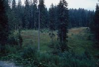
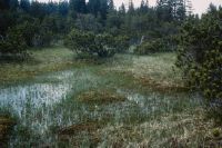
HM 290, Gerschni
Caption
Coordinates: 672'900, 184'600
Caption (German)
Koordinaten: 672'900, 184'600
Record Name
Dia_358-2788
Title (German)
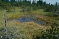
HM 290, Gerschni
Caption
Coordinates: 672'900, 184'600
Caption (German)
Koordinaten: 672'900, 184'600
Record Name
Dia_358-2789

Title (German)
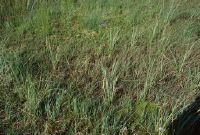
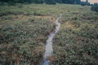
HM 290, Gerschni, Torf geackert
Caption
Coordinates: 672'900, 184'600
Caption (German)
Koordinaten: 672'900, 184'600
Record Name
Dia_358-2790

Title (German)
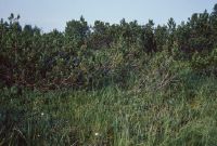
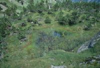
HM 290, Gerschni
Caption
Coordinates: 672'900, 184'600
Caption (German)
Koordinaten: 672'900, 184'600
Record Name
Dia_358-2791

Title (German)
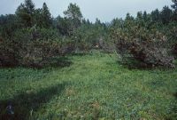
HM 290, Gerschni
Caption
Coordinates: 672'900, 184'600
Caption (German)
Koordinaten: 672'900, 184'600
Record Name
Dia_358-2792

Title (German)
HM 290, Gerschni
Caption
Coordinates: 672'900, 184'600
Caption (German)
Koordinaten: 672'900, 184'600
Record Name
Dia_358-2793

Title (German)
HM 290, Gerschni
Caption
Coordinates: 672'900, 184'600
Caption (German)
Koordinaten: 672'900, 184'600
Record Name
Dia_358-2794

Title (German)
HM 290, Gerschni
Caption
Coordinates: 672'900, 184'600
Caption (German)
Koordinaten: 672'900, 184'600
Record Name
Dia_358-2795

Title (German)
HM 290, Gerschni
Caption
Coordinates: 672'900, 184'600
Caption (German)
Koordinaten: 672'900, 184'600
Record Name
Dia_358-2796

Title (German)
HM 290, Gerschni
Caption
Coordinates: 672'900, 184'600
Caption (German)
Koordinaten: 672'900, 184'600
Record Name
Dia_358-2797

Title (German)
HM 290, Gerschni
Caption
Coordinates: 672'900, 184'600
Caption (German)
Koordinaten: 672'900, 184'600
Record Name
Dia_358-2798

Title (German)
HM 290, Gerschni
Caption
Coordinates: 672'900, 184'600
Caption (German)
Koordinaten: 672'900, 184'600
Record Name
Dia_358-2799

Title (German)
HM 291, Feldmoos
Caption
Coordinates: 673'700, 184'700
Caption (German)
Koordinaten: 673'700, 184'700
Record Name
Dia_358-2800

Title (German)
HM 293, Nollen, Einh 6E
Caption
Coordinates: 650'800, 191'400
Caption (German)
Koordinaten: 650'800, 191'400
Record Name
Dia_358-2801

Title (German)
HM 293, Nollen, Einh 18
Caption
Coordinates: 650'800, 191'400
Caption (German)
Koordinaten: 650'800, 191'400
Record Name
Dia_358-2802

Title (German)
HM 293, Nollen, Einh 6E
Caption
Coordinates: 650'800, 191'400
Caption (German)
Koordinaten: 650'800, 191'400
Record Name
Dia_358-2803

Title (German)
HM 293, Nollen, Einh 6E
Caption
Coordinates: 650'800, 191'400
Caption (German)
Koordinaten: 650'800, 191'400
Record Name
Dia_358-2804

Title (German)
HM 931, Obermattboden, Bergkante südlich (S) Schattenberg
Caption
Coordinates: 654'600, 194'300
Caption (German)
Koordinaten: 654'600, 194'300
Record Name
Dia_358-2805

Title (German)
HM 931, Obermattboden
Caption
Coordinates: 654'600, 194'300
Caption (German)
Koordinaten: 654'600, 194'300
Record Name
Dia_358-2806

Title (German)
HM 931, Obermattboden, Moorfläche
Caption
Coordinates: 654'000,194'170
Caption (German)
Koordinaten: 654'000,194'170
Record Name
Dia_358-2807

Title (German)
HM 931, Obermattboden, Moorflächen auf Bergkante zw. Schatten und Matt
Caption
Coordinates: 654'600, 194'400
Caption (German)
Koordinaten: 654'600, 194'400
Record Name
Dia_358-2808

Title (German)
HM 931, Obermattboden
Caption
Coordinates: 654'600, 194'300
Caption (German)
Koordinaten: 654'600, 194'300
Record Name
Dia_358-2809

Title (German)
HM 936, Rormettlen
Caption
Coordinates: 648'700, 187'600
Caption (German)
Koordinaten: 648'700, 187'600
Record Name
Dia_358-2810

Title (German)
HM 936, Rormettlen
Caption
Coordinates: 648'700, 187'600
Caption (German)
Koordinaten: 648'700, 187'600
Record Name
Dia_358-2811

Title (German)
HM 936, Rormettlen
Caption
Coordinates: 648'700, 187'600
Caption (German)
Koordinaten: 648'700, 187'600
Record Name
Dia_358-2812

Title (German)
HM 135, Hudelmoos, Andwiler Moos
Caption
Coordinates: 739'300, 265'100
Caption (German)
Koordinaten: 739'300, 265'100
Record Name
Dia_358-2813

Title (German)
HM 135, Hudelmoos, Huebermoos
Caption
Coordinates: 739'300, 265'100
Caption (German)
Koordinaten: 739'300, 265'100
Record Name
Dia_358-2814

Title (German)
HM 135, Hudelmoos, Andwiler Moos
Caption
Coordinates: 739'300, 265'100
Caption (German)
Koordinaten: 739'300, 265'100
Record Name
Dia_358-2815

Title (German)
HM 135, Hudelmoos, Huebermoos
Caption
Coordinates: 739'300, 265'100
Caption (German)
Koordinaten: 739'300, 265'100
Record Name
Dia_358-2816

Title (German)
HM 135, Hudelmoos, Huebermoos
Caption
Coordinates: 739'300, 265'100
Caption (German)
Koordinaten: 739'300, 265'100
Record Name
Dia_358-2817

Title (German)
HM 137, Unter Hüttenbüel
Caption
Coordinates: 724'600, 235'500
Caption (German)
Koordinaten: 724'600, 235'500
Record Name
Dia_358-2818

Title (German)
HM 137, Unter Hüttenbüel, ehemalige mächtige Torfstichkante
Caption
Coordinates: 724'600, 235'500
Caption (German)
Koordinaten: 724'600, 235'500
Record Name
Dia_358-2819

Title (German)
HM 137, Unter Hüttenbüel, Regeneration eines ehemaligen Torfstichweihers
Caption
Coordinates: 724'600, 235'500
Caption (German)
Koordinaten: 724'600, 235'500
Record Name
Dia_358-2820

Title (German)
HM 137, Unter Hüttenbüel, drainiertes, abgetrocknetes HM und Torfstichwände
Caption
Coordinates: 724'600, 235'500
Caption (German)
Koordinaten: 724'600, 235'500
Record Name
Dia_358-2821

Title (German)
HM 137, Unter Hüttenbüel, Massenvorkommen Andromeda
Caption
Coordinates: 724'600, 235'500
Caption (German)
Koordinaten: 724'600, 235'500
Record Name
Dia_358-2822

Title (German)
HM 137, Unter Hüttenbüel, Massenvorkommen Andromeda
Caption
Coordinates: 724'600, 235'500
Caption (German)
Koordinaten: 724'600, 235'500
Record Name
Dia_358-2823

Title (German)
HM 137, Unter Hüttenbüel
Caption
Coordinates: 724'600, 235'500
Caption (German)
Koordinaten: 724'600, 235'500
Record Name
Dia_358-2824

Title (German)
HM 137, Unter Hüttenbüel
Caption
Coordinates: 724'600, 235'500
Caption (German)
Koordinaten: 724'600, 235'500
Record Name
Dia_358-2825

Title (German)
HM 138, Moore auf dem Chräzerenpass (Schwarzegg, Lauchriet, Witiriet), in Torfboden eingelegte Entwässerungsleitung/Drainage
Caption
Coordinates: 741'000, 235'400
Caption (German)
Koordinaten: 741'000, 235'400
Record Name
Dia_358-2826

Title (German)
HM 138, Moore auf dem Chräzerenpass (Schwarzegg, Lauchriet, Witiriet), eingelegte Rohrleitung in Drainagegraben mit Erosionserscheinungen. Im Umfeld des Hydranten (links): Torfboden mit Mineralerde überschüttet/Entwässerung
Caption
Coordinates: 741'000, 235'400
Caption (German)
Koordinaten: 741'000, 235'400
Record Name
Dia_358-2827

Title (German)
HM 138, Moore auf dem Chräzerenpass (Schwarzegg, Lauchriet, Witiriet)
Caption
Coordinates: 741'000, 235'400
Caption (German)
Koordinaten: 741'000, 235'400
Record Name
Dia_358-2828

Title (German)
HM 138, Moore auf dem Chräzerenpass (Schwarzegg, Lauchriet, Witiriet), Blick Richtung Osten (E)
Caption
Coordinates: 741'000, 235'400
Caption (German)
Koordinaten: 741'000, 235'400
Record Name
Dia_358-2829

Title (German)
HM 138, Moore auf dem Chräzerenpass (Schwarzegg, Lauchriet, Witiriet), flächenhafte Zerstörung von Flach- und Hochmoorvegetation. Erosionsrinne
Caption
Coordinates: 741'000, 235'400
Caption (German)
Koordinaten: 741'000, 235'400
Record Name
Dia_358-2830

Title (German)
HM 141, Bilchenriet, Unterwald, Schiltmoos, Hochmoor Pinetum
Caption
Coordinates: 740'100, 234'700
Caption (German)
Koordinaten: 740'100, 234'700
Record Name
Dia_358-2831

Title (German)
HM 141, Bilchenriet, Unterwald, Schiltmoos, Erosionserscheinung, Verheidung wegen Ausschnitt des Torfkörpers durch Bach
Caption
Coordinates: 740'100, 234'700
Caption (German)
Koordinaten: 740'100, 234'700
Record Name
Dia_358-2832

Title (German)
HM 141, Bilchenriet, Unterwald, Schiltmoos, Rülle
Caption
Coordinates: 740'100, 234'700
Caption (German)
Koordinaten: 740'100, 234'700
Record Name
Dia_358-2833

Title (German)
HM 141, Bilchenriet, Unterwald, Schiltmoos, HM-Aufwölbung, Fichten-Krüppel
Caption
Coordinates: 740'100, 234'700
Caption (German)
Koordinaten: 740'100, 234'700
Record Name
Dia_358-2834

Title (German)
HM 141, Bilchenriet, Unterwald, Schiltmoos
Caption
Coordinates: 740'100, 234'700
Caption (German)
Koordinaten: 740'100, 234'700
Record Name
Dia_358-2835

Title (German)
HM 141, Bilchenriet, Unterwald, Schiltmoos, Moorerosion
Caption
Coordinates: 740'100, 234'700
Caption (German)
Koordinaten: 740'100, 234'700
Record Name
Dia_358-2836

Title (German)
HM 147, Chellen
Caption
Coordinates: 730'900, 237'300
Caption (German)
Koordinaten: 730'900, 237'300
Record Name
Dia_358-2837

Title (German)
HM 147, Chellen, Allmeindswald, Bendelried
Caption
Coordinates: 730'900, 237'300
Caption (German)
Koordinaten: 730'900, 237'300
Record Name
Dia_358-2838

Title (German)
HM 147, Chellen, Allmeindswald, Bendelried
Caption
Coordinates: 730'900, 237'300
Caption (German)
Koordinaten: 730'900, 237'300
Record Name
Dia_358-2839

Title (German)
HM 147, Allmeindswald, Teilobjekt 14.2
Caption
Coordinates: 730'900, 237'300
Caption (German)
Koordinaten: 730'900, 237'300
Record Name
Dia_358-2840

Title (German)
HM 148, Salomonstempel
Caption
Coordinates: 729'700, 238'000
Caption (German)
Koordinaten: 729'700, 238'000
Record Name
Dia_358-2841

Title (German)
HM 148, Salomonstempel
Caption
Coordinates: 729'700, 238'000
Caption (German)
Koordinaten: 729'700, 238'000
Record Name
Dia_358-2842

Title (German)
HM 148, Salomonstempel
Caption
Coordinates: 729'700, 238'000
Caption (German)
Koordinaten: 729'700, 238'000
Record Name
Dia_358-2843

Title (German)
HM 148, Salomonstempel
Caption
Coordinates: 729'700, 238'000
Caption (German)
Koordinaten: 729'700, 238'000
Record Name
Dia_358-2844

Title (German)
HM 148, Salomonstempel
Caption
Coordinates: 729'700, 238'000
Caption (German)
Koordinaten: 729'700, 238'000
Record Name
Dia_358-2845

Title (German)
HM 148, Salomonstempel
Caption
Coordinates: 729'700, 238'000
Caption (German)
Koordinaten: 729'700, 238'000
Record Name
Dia_358-2846

Title (German)
HM 148, Salomonstempel
Caption
Coordinates: 729'700, 238'000
Caption (German)
Koordinaten: 729'700, 238'000
Record Name
Dia_358-2847

Title (German)
HM 148, Salomonstempel, Bodenprofil, Überschüttungsflächen randlich
Caption
Coordinates: 729'700, 238'000
Caption (German)
Koordinaten: 729'700, 238'000
Record Name
Dia_358-2848
![HM 148, Solomon's Temple, soil profile, +/- intact transition bog [blurred photo].](thumbnails/thumb_ETHBIB.Bildarchiv_1148965.jpg)
Title (German)
HM 148, Salomonstempel, Bodenprofil, +/- intaktes Übergangsmoor [unscharfe Aufnahme]
Caption
Coordinates: 729'700, 238'000
Caption (German)
Koordinaten: 729'700, 238'000
Record Name
Dia_358-2849

Title (German)
HM 149, Moore auf der Wolzenalp, Hännis, Skilift durch Pinetum
Caption
Coordinates: 729'700, 231'800
Caption (German)
Koordinaten: 729'700, 231'800
Record Name
Dia_358-2850

Title (German)
HM 149, Moore auf der Wolzenalp, Hännis, Hangriet, abgetorftes Hochmoor
Caption
Coordinates: 729'700, 231'800
Caption (German)
Koordinaten: 729'700, 231'800
Record Name
Dia_358-2851

Title (German)
HM 149, Moore auf der Wolzenalp, Hännis, Skilift durch Pinetum
Caption
Coordinates: 729'700, 231'800
Caption (German)
Koordinaten: 729'700, 231'800
Record Name
Dia_358-2852

Title (German)
HM 149, Moore auf der Wolzenalp, Allmen, verheideter Randwald
Caption
Coordinates: 729'700, 231'800
Caption (German)
Koordinaten: 729'700, 231'800
Record Name
Dia_358-2853

Title (German)
HM 149, Moore auf der Wolzenalp, Allmen, Torfstichgraben verlandet
Caption
Coordinates: 729'700, 231'800
Caption (German)
Koordinaten: 729'700, 231'800
Record Name
Dia_358-2854

Title (German)
HM 149, Moore auf der Wolzenalp, Allmen, Torfstichkante, Zentrum
Caption
Coordinates: 729'700, 231'800
Caption (German)
Koordinaten: 729'700, 231'800
Record Name
Dia_358-2855

Title (German)
HM 149, Moore auf der Wolzenalp, Allmen, Holzlager, Skilifttalstation
Caption
Coordinates: 729'700, 231'800
Caption (German)
Koordinaten: 729'700, 231'800
Record Name
Dia_358-2856

Title (German)
HM 149, Moore auf der Wolzenalp, Allmen, Holzstämme im zentralen, offenen Hochmoor
Caption
Coordinates: 729'700, 231'800
Caption (German)
Koordinaten: 729'700, 231'800
Record Name
Dia_358-2857

Title (German)
HM 149, Moore auf der Wolzenalp, Allmen, Holzstämme im ehemals besten Teil
Caption
Coordinates: 729'700, 231'800
Caption (German)
Koordinaten: 729'700, 231'800
Record Name
Dia_358-2858

Title (German)
HM 149, Moore auf der Wolzenalp, Allmen, Kiesplatz, Strasse und Holzlager im Moor
Caption
Coordinates: 729'700, 231'800
Caption (German)
Koordinaten: 729'700, 231'800
Record Name
Dia_358-2859

Title (German)
HM 149, Moore auf der Wolzenalp, Rietbach, Regeneration am Steilhang
Caption
Coordinates: 729'700, 231'800
Caption (German)
Koordinaten: 729'700, 231'800
Record Name
Dia_358-2860

Title (German)
HM 149, Moore auf der Wolzenalp, Rietbach, Regeneration
Caption
Coordinates: 729'700, 231'800
Caption (German)
Koordinaten: 729'700, 231'800
Record Name
Dia_358-2861

Title (German)
HM 149, Moore auf der Wolzenalp, Rietbach, Regeneration im Torfstich
Caption
Coordinates: 729'700, 231'800
Caption (German)
Koordinaten: 729'700, 231'800
Record Name
Dia_358-2862

Title (German)
HM 149, Moore auf der Wolzenalp, Rietbach, Regeneration am Hang, regelmässig gemäht
Caption
Coordinates: 729'700, 231'800
Caption (German)
Koordinaten: 729'700, 231'800
Record Name
Dia_358-2863

Title (German)
HM 149, Moore auf der Wolzenalp, Rietbach, sek. Schlenke mit Carex rostrata
Caption
Coordinates: 729'700, 231'800
Caption (German)
Koordinaten: 729'700, 231'800
Record Name
Dia_358-2864
Title (German)
HM 149, Moore auf der Wolzenalp, Rietbach, sek. Schlenke mit Carex magellanicum
Caption
Coordinates: 729'700, 231'800
Caption (German)
Koordinaten: 729'700, 231'800
Record Name
Dia_358-2865

Title (German)
HM 150, Gamperfin, Turbenriet, Tischenriet, Gapels,Hochmoorweite, Graben, Bewaldung
Caption
Coordinates: 747'200, 226'500
Caption (German)
Koordinaten: 747'200, 226'500
Record Name
Dia_358-2866
Title (German)
HM 150, Gamperfin, Turbenriet, Tischenriet, Gapels,Turbenriet, Tischenriet, Gapels, Moorzentrum
Caption
Coordinates: 747'200, 226'500
Caption (German)
Koordinaten: 747'200, 226'500
Record Name
Dia_358-2867

Title (German)
HM 150, Gamperfin, Turbenriet, Tischenriet, Gapels,Turbenriet, Tischenriet, Gapels
Caption
Coordinates: 747'200, 226'500
Caption (German)
Koordinaten: 747'200, 226'500
Record Name
Dia_358-2868

Title (German)
HM 150, Gamperfin, Turbenriet, Tischenriet, Gapels,Hochmoorweite, Bewaldung
Caption
Coordinates: 747'200, 226'500
Caption (German)
Koordinaten: 747'200, 226'500
Record Name
Dia_358-2869

Title (German)
HM 150, Gamperfin, Turbenriet, Tischenriet, Gapels, verheidete Hochmoorfläche
Caption
Coordinates: 747'200, 226'500
Caption (German)
Koordinaten: 747'200, 226'500
Record Name
Dia_358-2870

Title (German)
HM 150, Gamperfin, Turbenriet, Tischenriet, Gapels,Torfstichwand
Caption
Coordinates: 747'200, 226'500
Caption (German)
Koordinaten: 747'200, 226'500
Record Name
Dia_358-2871

Title (German)
HM 150, Gamperfin, alter Torfstich, Drainagegraben/Entwässerung
Caption
Coordinates: 747'200, 226'500
Caption (German)
Koordinaten: 747'200, 226'500
Record Name
Dia_358-2872

Title (German)
HM 150, Gamperfin, Turbenriet, Tischenriet, Gapels, Torfstichwand
Caption
Coordinates: 747'200, 226'500
Caption (German)
Koordinaten: 747'200, 226'500
Record Name
Dia_358-2873

Title (German)
HM 150, Gamperfin, Turbenriet, Tischenriet, Gapels, Entwässerungsgraben, Bewaldung/Drainage
Caption
Coordinates: 747'200, 226'500
Caption (German)
Koordinaten: 747'200, 226'500
Record Name
Dia_358-2874

Title (German)
HM 150, Gamperfin, Turbenriet, Tischenriet, Gapels
Caption
Coordinates: 747'200, 226'500
Caption (German)
Koordinaten: 747'200, 226'500
Record Name
Dia_358-2875

Title (German)
HM 150, Gamperfin, Turbenriet, Tischenriet, Gapels, Sackung
Caption
Coordinates: 747'200, 226'500
Caption (German)
Koordinaten: 747'200, 226'500
Record Name
Dia_358-2876

Title (German)
HM 150, Gamperfin, Turbenriet, Tischenriet, Gapels
Caption
Coordinates: 747'200, 226'500
Caption (German)
Koordinaten: 747'200, 226'500
Record Name
Dia_358-2877

Title (German)
HM 150, Gamperfin, Turbenriet, Tischenriet, Gapels, Damm
Caption
Coordinates: 747'200, 226'500
Caption (German)
Koordinaten: 747'200, 226'500
Record Name
Dia_358-2878

Title (German)
HM 150, Gamperfin, Turbenriet, Tischenriet, Gapels, Austrocknen, Fichten
Caption
Coordinates: 747'200, 226'500
Caption (German)
Koordinaten: 747'200, 226'500
Record Name
Dia_358-2879

Title (German)
HM 150, Gamperfin, Turbenriet, Tischenriet, Gapels, Turbenriet
Caption
Coordinates: 747'200, 226'500
Caption (German)
Koordinaten: 747'200, 226'500
Record Name
Dia_358-2880

Title (German)
HM 150, Gamperfin, Turbenriet, Tischenriet, Gapels
Caption
Coordinates: 747'200, 226'500
Caption (German)
Koordinaten: 747'200, 226'500
Record Name
Dia_358-2881

Title (German)
HM 150, Gamperfin, Turbenriet, Tischenriet, Gapels
Caption
Coordinates: 747'200, 226'500
Caption (German)
Koordinaten: 747'200, 226'500
Record Name
Dia_358-2882

Title (German)
HM 150, Gamperfin, Turbenriet, Tischenriet, Gapels, Übergang FM-HM
Caption
Coordinates: 747'200, 226'500
Caption (German)
Koordinaten: 747'200, 226'500
Record Name
Dia_358-2883

Title (German)
HM 150, Gamperfin, Turbenriet, Tischenriet, Gapels, Mooroberrand
Caption
Coordinates: 747'200, 226'500
Caption (German)
Koordinaten: 747'200, 226'500
Record Name
Dia_358-2884

Title (German)
HM 150, Gamperfin, Turbenriet, Tischenriet, Gapels, Mooroberrand
Caption
Coordinates: 747'200, 226'500
Caption (German)
Koordinaten: 747'200, 226'500
Record Name
Dia_358-2885

Title (German)
HM 150, Gamperfin, Turbenriet, Tischenriet, Gapels, Randlagg
Caption
Coordinates: 747'200, 226'500
Caption (German)
Koordinaten: 747'200, 226'500
Record Name
Dia_358-2886

Title (German)
HM 150, Gamperfin, Turbenriet, Tischenriet, Gapels, Randlagg
Caption
Coordinates: 747'200, 226'500
Caption (German)
Koordinaten: 747'200, 226'500
Record Name
Dia_358-2887

Title (German)
HM 150, Gamperfin, Turbenriet, Tischenriet, Gapels, Randlagg
Caption
Coordinates: 747'200, 226'500
Caption (German)
Koordinaten: 747'200, 226'500
Record Name
Dia_358-2888

Title (German)
HM 150, Gamperfin, Turbenriet, Tischenriet, Gapels, Mooroberrand
Caption
Coordinates: 747'200, 226'500
Caption (German)
Koordinaten: 747'200, 226'500
Record Name
Dia_358-2889

Title (German)
HM 150, Gamperfin, Turbenriet, Tischenriet, Gapels, Turbenriet
Caption
Coordinates: 747'200, 226'500
Caption (German)
Koordinaten: 747'200, 226'500
Record Name
Dia_358-2890

Title (German)
HM 150, Gamperfin, Turbenriet, Tischenriet, Gapels, Randlagg
Caption
Coordinates: 747'200, 226'500
Caption (German)
Koordinaten: 747'200, 226'500
Record Name
Dia_358-2891

Title (German)
HM 150, Gamperfin, Turbenriet, Tischenriet, Gapels, Randwaldzone, Spirken wachsen hoch
Caption
Coordinates: 747'200, 226'500
Caption (German)
Koordinaten: 747'200, 226'500
Record Name
Dia_358-2892

Title (German)
HM 150, Gamperfin, Turbenriet, Tischenriet, Gapels
Caption
Coordinates: 747'200, 226'500
Caption (German)
Koordinaten: 747'200, 226'500
Record Name
Dia_358-2893

Title (German)
HM 150, Gamperfin, Turbenriet, Tischenriet, Gapels, Randlagg
Caption
Coordinates: 747'200, 226'500
Caption (German)
Koordinaten: 747'200, 226'500
Record Name
Dia_358-2894

Title (German)
HM 150, Gamperfin, Turbenriet, Tischenriet, Gapels
Caption
Coordinates: 747'200, 226'500
Caption (German)
Koordinaten: 747'200, 226'500
Record Name
Dia_358-2895

Title (German)
HM 150, Gamperfin, Turbenriet, Tischenriet, Gapels
Caption
Coordinates: 747'200, 226'500
Caption (German)
Koordinaten: 747'200, 226'500
Record Name
Dia_358-2896
![HM 150, Gamperfin, Turbenriet, Tischenriet, Gapels, Ausrockne[?]:, spruces](thumbnails/thumb_ETHBIB.Bildarchiv_1149013.jpg)
Title (German)
HM 150, Gamperfin, Turbenriet, Tischenriet, Gapels, Austrockne[?]:, Fichten
Caption
Coordinates: 747'200, 226'500
Caption (German)
Koordinaten: 747'200, 226'500
Record Name
Dia_358-2897

Title (German)
HM 150, Gamperfin, Turbenriet, Tischenriet, Gapels
Caption
Coordinates: 747'200, 226'500
Caption (German)
Koordinaten: 747'200, 226'500
Record Name
Dia_358-2898

Title (German)
HM 150, Gamperfin, Turbenriet, Tischenriet, Gapels, Schlenke
Caption
Coordinates: 747'200, 226'500
Caption (German)
Koordinaten: 747'200, 226'500
Record Name
Dia_358-2899

Title (German)
HM 150, Gamperfin, abgetrocknete Fläche
Caption
Coordinates: 747'200, 226'500
Caption (German)
Koordinaten: 747'200, 226'500
Record Name
Dia_358-2900

Title (German)
HM 150, Gamperfin, Turbenriet, Tischenriet, Gapels, Verheidung
Caption
Coordinates: 747'200, 226'500
Caption (German)
Koordinaten: 747'200, 226'500
Record Name
Dia_358-2901
Title (German)
HM 150, Gamperfin, Turbenriet, Tischenriet, Gapels, Verheidung
Caption
Coordinates: 747'200, 226'500
Caption (German)
Koordinaten: 747'200, 226'500
Record Name
Dia_358-2902
![HM 150, Gamperfin, Turbenriet, Tischenriet, Gapels [blurred image].](thumbnails/thumb_ETHBIB.Bildarchiv_1149019.jpg)
Title (German)
HM 150, Gamperfin, Turbenriet, Tischenriet, Gapels [unscharfe Aufnahme]
Caption
Coordinates: 747'200, 226'500
Caption (German)
Koordinaten: 747'200, 226'500
Record Name
Dia_358-2903

Title (German)
HM 150, Gamperfin, Turbenriet, Tischenriet, Gapels, Eriophorum vaginatum, 1330müM
Caption
Coordinates: 747'200, 226'500
Caption (German)
Koordinaten: 747'200, 226'500
Record Name
Dia_358-2904

Title (German)
HM 150, Gamperfin, Turbenriet, Tischenriet, Gapels
Caption
Coordinates: 747'200, 226'500
Caption (German)
Koordinaten: 747'200, 226'500
Record Name
Dia_358-2905

Title (German)
HM 150, Gamperfin, Turbenriet, Tischenriet, Gapels, Versuch Grabenfüllung im Juni 1985
Caption
Coordinates: 747'200, 226'500
Caption (German)
Koordinaten: 747'200, 226'500
Record Name
Dia_358-2906
![HM 150, Gamperfin, Turbenriet, Tischenriet, Gapels, trial trench filling in June 1985 [blurred photo].](thumbnails/thumb_ETHBIB.Bildarchiv_1149023.jpg)
Title (German)
HM 150, Gamperfin, Turbenriet, Tischenriet, Gapels, Versuch Grabenfüllung im Juni 1985 [unscharfe Aufnahme]
Caption
Coordinates: 747'200, 226'500
Caption (German)
Koordinaten: 747'200, 226'500
Record Name
Dia_358-2907

Title (German)
HM 150, Gamperfin, Turbenriet, Tischenriet, Gapels, Versuch Grabenfüllung im Juni 1985
Caption
Coordinates: 747'200, 226'500
Caption (German)
Koordinaten: 747'200, 226'500
Record Name
Dia_358-2908

Title (German)
HM 150, Gamperfin, Turbenriet, Tischenriet, Gapels, Versuch Grabenfüllung im Juni 1985
Caption
Coordinates: 747'200, 226'500
Caption (German)
Koordinaten: 747'200, 226'500
Record Name
Dia_358-2909

Title (German)
HM 150, Gamperfin, Turbenriet, Tischenriet, Gapels, Versuch Grabenfüllung im Juni 1985
Caption
Coordinates: 747'200, 226'500
Caption (German)
Koordinaten: 747'200, 226'500
Record Name
Dia_358-2910

Title (German)
HM 150, Gamperfin, Turbenriet, Tischenriet, Gapels, Versuch Grabenfüllung im Juni 1985
Caption
Coordinates: 747'200, 226'500
Caption (German)
Koordinaten: 747'200, 226'500
Record Name
Dia_358-2911

Title (German)
HM 150, Gamperfin, Turbenriet, Tischenriet, Gapels, Transsekt 42, Vegetationsaufnahmen, 0-40
Caption
Coordinates: 747'200, 226'500
Caption (German)
Koordinaten: 747'200, 226'500
Record Name
Dia_358-2912

Title (German)
HM 150, Gamperfin, Turbenriet, Tischenriet, Gapels, Transsekt 42, Vegetationsaufnahmen
Caption
Coordinates: 747'200, 226'500
Caption (German)
Koordinaten: 747'200, 226'500
Record Name
Dia_358-2913

Title (German)
HM 150, Gamperfin, Turbenriet, Tischenriet, Gapels, Transsekt 42, Vegetationsaufnahmen, 600-640
Caption
Coordinates: 747'200, 226'500
Caption (German)
Koordinaten: 747'200, 226'500
Record Name
Dia_358-2914

Title (German)
HM 150, Gamperfin, Turbenriet, Tischenriet, Gapels, Transsekt 42, Vegetationsaufnahmen, 910-950
Caption
Coordinates: 747'200, 226'500
Caption (German)
Koordinaten: 747'200, 226'500
Record Name
Dia_358-2915

Title (German)
HM 150, Gamperfin, Turbenriet, Tischenriet, Gapels, Transsekt 42, Vegetationsaufnahmen
Caption
Coordinates: 747'200, 226'500
Caption (German)
Koordinaten: 747'200, 226'500
Record Name
Dia_358-2916

Title (German)
HM 150, Gamperfin, Turbenriet, Tischenriet, Gapels, Transsekt 42, Vegetationsaufnahmen, 1200-1240
Caption
Coordinates: 747'200, 226'500
Caption (German)
Koordinaten: 747'200, 226'500
Record Name
Dia_358-2917

Title (German)
HM 150, Gamperfin, Turbenriet, Tischenriet, Gapels, Transsekt 42, Vegetationsaufnahmen, 1500-1540
Caption
Coordinates: 747'200, 226'500
Caption (German)
Koordinaten: 747'200, 226'500
Record Name
Dia_358-2918

Title (German)
HM 150, Gamperfin, Turbenriet, Tischenriet, Gapels, Transsekt 42, Vegetationsaufnahmen, 1800-1840
Caption
Coordinates: 747'200, 226'500
Caption (German)
Koordinaten: 747'200, 226'500
Record Name
Dia_358-2919

Title (German)
HM 150, Gamperfin, Turbenriet, Tischenriet, Gapels, Transsekt 42, Vegetationsaufnahmen, Blick nach Süden (S)
Caption
Coordinates: 747'200, 226'500
Caption (German)
Koordinaten: 747'200, 226'500
Record Name
Dia_358-2920

Title (German)
HM 150, Gamperfin, Turbenriet, Tischenriet, Gapels, Transsekt 42, Vegetationsaufnahmen, Blick nach Norden (N)
Caption
Coordinates: 747'200, 226'500
Caption (German)
Koordinaten: 747'200, 226'500
Record Name
Dia_358-2921

Title (German)
HM 150, Gamperfin, Turbenriet, Tischenriet, Gapels, Transsekt 42, Vegetationsaufnahmen
Caption
Coordinates: 747'200, 226'500
Caption (German)
Koordinaten: 747'200, 226'500
Record Name
Dia_358-2922

Title (German)
HM 150, Gamperfin, Turbenriet, Tischenriet, Gapels, Transsekt 42, Vegetationsaufnahmen
Caption
Coordinates: 747'200, 226'500
Caption (German)
Koordinaten: 747'200, 226'500
Record Name
Dia_358-2923

Title (German)
HM 150, Gamperfin, Turbenriet, Tischenriet, Gapels, Transsekt 42, Vegetationsaufnahmen, 300-340
Caption
Coordinates: 747'200, 226'500
Caption (German)
Koordinaten: 747'200, 226'500
Record Name
Dia_358-2924

Title (German)
HM 150, Gamperfin, Turbenriet, Tischenriet, Gapels, Transsekt 42, Vegetationsaufnahmen
Caption
Coordinates: 747'200, 226'500
Caption (German)
Koordinaten: 747'200, 226'500
Record Name
Dia_358-2925

Title (German)
HM 150, Gamperfin, Turbenriet, Tischenriet, Gapels
Caption
Coordinates: 747'200, 226'500
Caption (German)
Koordinaten: 747'200, 226'500
Record Name
Dia_358-2926

Title (German)
HM 150, Gamperfin, Turbenriet, Tischenriet, Gapels
Caption
Coordinates: 747'200, 226'500
Caption (German)
Koordinaten: 747'200, 226'500
Record Name
Dia_358-2927

Title (German)
HM 150, Gamperfin, Turbenriet, Tischenriet, Gapels
Caption
Coordinates: 747'200, 226'500
Caption (German)
Koordinaten: 747'200, 226'500
Record Name
Dia_358-2928

Title (German)
HM 150, Gamperfin, Turbenriet, Tischenriet, Gapels
Caption
Coordinates: 747'200, 226'500
Caption (German)
Koordinaten: 747'200, 226'500
Record Name
Dia_358-2929

Title (German)
HM 150, Gamperfin, Turbenriet, Tischenriet, Gapels
Caption
Coordinates: 747'200, 226'500
Caption (German)
Koordinaten: 747'200, 226'500
Record Name
Dia_358-2930

Title (German)
HM 150, Gamperfin, Turbenriet, Tischenriet, Gapels
Caption
Coordinates: 747'200, 226'500
Caption (German)
Koordinaten: 747'200, 226'500
Record Name
Dia_358-2932

Title (German)
HM 150, Gamperfin, Turbenriet, Tischenriet, Gapels
Caption
Coordinates: 747'200, 226'500
Caption (German)
Koordinaten: 747'200, 226'500
Record Name
Dia_358-2933

Title (German)
HM 150, Gamperfin, Turbenriet, Tischenriet, Gapels
Caption
Coordinates: 747'200, 226'500
Caption (German)
Koordinaten: 747'200, 226'500
Record Name
Dia_358-2934

Title (German)
HM 150, Gamperfin, Turbenriet, Tischenriet, Gapels
Caption
Coordinates: 747'200, 226'500
Caption (German)
Koordinaten: 747'200, 226'500
Record Name
Dia_358-2935

Title (German)
HM 150, Gamperfin, Turbenriet, Tischenriet, Gapels
Caption
Coordinates: 747'200, 226'500
Caption (German)
Koordinaten: 747'200, 226'500
Record Name
Dia_358-2936

Title (German)
HM 150, Gamperfin, Turbenriet, Tischenriet, Gapels
Caption
Coordinates: 747'200, 226'500
Caption (German)
Koordinaten: 747'200, 226'500
Record Name
Dia_358-2937

Title (German)
HM 150, Gamperfin, Turbenriet, Tischenriet, Gapels
Caption
Coordinates: 747'200, 226'500
Caption (German)
Koordinaten: 747'200, 226'500
Record Name
Dia_358-2938

Title (German)
HM 150, Gamperfin, Turbenriet, Tischenriet, Gapels
Caption
Coordinates: 747'200, 226'500
Caption (German)
Koordinaten: 747'200, 226'500
Record Name
Dia_358-2939

Title (German)
HM 150, Gamperfin, Turbenriet, Tischenriet, Gapels
Caption
Coordinates: 747'200, 226'500
Caption (German)
Koordinaten: 747'200, 226'500
Record Name
Dia_358-2940
![HM 150, Gamperfin, Turbenriet, Tischenriet, Gapels, autumn atmosphere in drained high moorland/drainage [blurred photo].](thumbnails/thumb_ETHBIB.Bildarchiv_1149057.jpg)
Title (German)
HM 150, Gamperfin, Turbenriet, Tischenriet, Gapels, Herbststimmung im entwässerten Hochmoor/Drainage [unscharfe Aufnahme]
Caption
Coordinates: 747'200, 226'500
Caption (German)
Koordinaten: 747'200, 226'500
Record Name
Dia_358-2941

Title (German)
HM 150, Gamperfin, Turbenriet, Tischenriet, Gapels
Caption
Coordinates: 747'200, 226'500
Caption (German)
Koordinaten: 747'200, 226'500
Record Name
Dia_358-2942

Title (German)
HM 150, Gamperfin, Turbenriet, Tischenriet, Gapels, Torfprofil im grossen Graben
Caption
Coordinates: 747'200, 226'500
Caption (German)
Koordinaten: 747'200, 226'500
Record Name
Dia_358-2943

Title (German)
HM 150, Gamperfin, Turbenriet, Tischenriet, Gapels
Caption
Coordinates: 747'200, 226'500
Caption (German)
Koordinaten: 747'200, 226'500
Record Name
Dia_358-2944

Title (German)
HM 150, Gamperfin, Turbenriet, Tischenriet, Gapels
Caption
Coordinates: 747'200, 226'500
Caption (German)
Koordinaten: 747'200, 226'500
Record Name
Dia_358-2945

Title (German)
HM 150, Gamperfin, Turbenriet, Tischenriet, Gapels, Moor
Caption
Coordinates: 747'200, 226'500
Caption (German)
Koordinaten: 747'200, 226'500
Record Name
Dia_358-2946

Title (German)
HM 150, Gamperfin, Turbenriet, Tischenriet, Gapels, Moor
Caption
Coordinates: 747'200, 226'500
Caption (German)
Koordinaten: 747'200, 226'500
Record Name
Dia_358-2947

Title (German)
HM 150, Gamperfin, Turbenriet, Tischenriet, Gapels, Winter
Caption
Coordinates: 747'200, 226'500
Caption (German)
Koordinaten: 747'200, 226'500
Record Name
Dia_358-2948

Title (German)
HM 150, Gamperfin, Turbenriet, Tischenriet, Gapels, Winter
Caption
Coordinates: 747'200, 226'500
Caption (German)
Koordinaten: 747'200, 226'500
Record Name
Dia_358-2949
Title (German)
HM 150, Gamperfin, Turbenriet, Tischenriet, Gapels, Schlenken
Caption
Coordinates: 747'200, 226'500
Caption (German)
Koordinaten: 747'200, 226'500
Record Name
Dia_358-2950

Title (German)
HM 150, Gamperfin, Turbenriet, Tischenriet, Gapels, gereinigter Graben zum Auffüllen mit Torf bereit
Caption
Coordinates: 747'200, 226'500
Caption (German)
Koordinaten: 747'200, 226'500
Record Name
Dia_358-2951

Title (German)
HM 150, Gamperfin, Turbenriet, Tischenriet, Gapels, Graben vorn mit Torf aufgefüllt, hinten mit Rasenziegel gedeckt
Caption
Coordinates: 747'200, 226'500
Caption (German)
Koordinaten: 747'200, 226'500
Record Name
Dia_358-2952

Title (German)
HM 150, Gamperfin, Turbenriet, Tischenriet, Gapels, Graben mit Torf aufgefüllt und mit Rasenziegel gegen Erosion geschützt
Caption
Coordinates: 747'200, 226'500
Caption (German)
Koordinaten: 747'200, 226'500
Record Name
Dia_358-2953

Title (German)
HM 150, Gamperfin, Turbenriet, Tischenriet, Gapels, Graben mit Torf aufgefüllt und mit Rasenziegel gedeckt
Caption
Coordinates: 747'200, 226'500
Caption (German)
Koordinaten: 747'200, 226'500
Record Name
Dia_358-2954

Title (German)
HM 150, Gamperfin, Turbenriet, Tischenriet, Gapels, Hirschsuhle
Caption
Coordinates: 747'200, 226'500
Caption (German)
Koordinaten: 747'200, 226'500
Record Name
Dia_358-2955

Title (German)
HM 150, Gamperfin, Turbenriet, Tischenriet, Gapels, gereinigter Graben zum Auffüllen bereit
Caption
Coordinates: 747'200, 226'500
Caption (German)
Koordinaten: 747'200, 226'500
Record Name
Dia_358-2956

Title (German)
HM 150, Gamperfin, Turbenriet, Tischenriet, Gapels, Grabenfüllung
Caption
Coordinates: 747'200, 226'500
Caption (German)
Koordinaten: 747'200, 226'500
Record Name
Dia_358-2957

Title (German)
HM 150, Gamperfin, Turbenriet, Tischenriet, Gapels, Torfentnahme zur Grabenfüllung
Caption
Coordinates: 747'200, 226'500
Caption (German)
Koordinaten: 747'200, 226'500
Record Name
Dia_358-2958

Title (German)
HM 150, Gamperfin, Turbenriet, Tischenriet, Gapels, Tensiometer zur Kontrolle
Caption
Coordinates: 747'200, 226'500
Caption (German)
Koordinaten: 747'200, 226'500
Record Name
Dia_358-2959

Title (German)
HM 150, Gamperfin, Turbenriet, Tischenriet, Gapels,
Caption
Coordinates: 747'200, 226'500
Caption (German)
Koordinaten: 747'200, 226'500
Record Name
Dia_358-2960
Title (German)
HM 150, Gamperfin, Turbenriet, Tischenriet, Gapels, Trampelpfad bei Hochwasser, Erosion
Caption
Coordinates: 747'200, 226'500
Caption (German)
Koordinaten: 747'200, 226'500
Record Name
Dia_358-2961

Title (German)
HM 150, Gamperfin, Turbenriet, Tischenriet, Gapels, grosser Graben im Herbst
Caption
Coordinates: 747'200, 226'500
Caption (German)
Koordinaten: 747'200, 226'500
Record Name
Dia_358-2962
Title (German)
HM 150, Gamperfin, Turbenriet, Tischenriet, Gapels, Hirschsuhle
Caption
Coordinates: 747'200, 226'500
Caption (German)
Koordinaten: 747'200, 226'500
Record Name
Dia_358-2963

Title (German)
HM 150, Gamperfin, Turbenriet, Tischenriet, Gapels, Hirschsuhle
Caption
Coordinates: 747'200, 226'500
Caption (German)
Koordinaten: 747'200, 226'500
Record Name
Dia_358-2964

Title (German)
HM 150, Gamperfin, Turbenriet, Tischenriet, Gapels, Hirschsuhle
Caption
Coordinates: 747'200, 226'500
Caption (German)
Koordinaten: 747'200, 226'500
Record Name
Dia_358-2965

Title (German)
HM 150, Gamperfin, Turbenriet, Tischenriet, Gapels
Caption
Coordinates: 747'200, 226'500
Caption (German)
Koordinaten: 747'200, 226'500
Record Name
Dia_358-2966

Title (German)
HM 150, Gamperfin, Turbenriet, Tischenriet, Gapels, gemäht, nicht gemäht
Caption
Coordinates: 747'200, 226'500
Caption (German)
Koordinaten: 747'200, 226'500
Record Name
Dia_358-2967

Title (German)
HM 150, Gamperfin, Turbenriet, Tischenriet, Gapels, gemäht, nicht gemäht
Caption
Coordinates: 747'200, 226'500
Caption (German)
Koordinaten: 747'200, 226'500
Record Name
Dia_358-2968

Title (German)
HM 150, Gamperfin, Turbenriet, Tischenriet, Gapels, gemäht, nicht gemäht
Caption
Coordinates: 747'200, 226'500
Caption (German)
Koordinaten: 747'200, 226'500
Record Name
Dia_358-2969

Title (German)
HM 150, Gamperfin ob Nähe Torfprofil Moor
Caption
Coordinates: 747'200, 226'500
Caption (German)
Koordinaten: 747'200, 226'500
Record Name
Dia_358-2970

Title (German)
HM 151, Hirzenbäder, Sommerweid
Caption
Coordinates: 747'800, 227'300
Caption (German)
Koordinaten: 747'800, 227'300
Record Name
Dia_358-2971

Title (German)
HM 151, Hirzenbäder, Sommerweid
Caption
Coordinates: 747'800, 227'300
Caption (German)
Koordinaten: 747'800, 227'300
Record Name
Dia_358-2972

Title (German)
HM 151, Hirzenbäder, Sommerweid
Caption
Coordinates: 747'800, 227'300
Caption (German)
Koordinaten: 747'800, 227'300
Record Name
Dia_358-2973

Title (German)
HM 152, Schönenboden
Caption
Coordinates: 748'600, 230'800
Caption (German)
Koordinaten: 748'600, 230'800
Record Name
Dia_358-2974

Title (German)
HM 152, Schönenboden
Caption
Coordinates: 748'600, 230'800
Caption (German)
Koordinaten: 748'600, 230'800
Record Name
Dia_358-2975

Title (German)
HM 152, Schönenboden, Sommerigchopf, grösstes Caricetum davallianae der Schweiz
Caption
Coordinates: 748'600, 230'800
Caption (German)
Koordinaten: 748'600, 230'800
Record Name
Dia_358-2976

Title (German)
HM 152, Schönenboden, Sommerigchopf, Blick ins Rheintal
Caption
Coordinates: 748'600, 230'800
Caption (German)
Koordinaten: 748'600, 230'800
Record Name
Dia_358-2977

Title (German)
HM 152, Schönenboden, Sommerigchopf
Caption
Coordinates: 748'600, 230'800
Caption (German)
Koordinaten: 748'600, 230'800
Record Name
Dia_358-2978

Title (German)
HM 152, Schönenboden, Sommerigchopf
Caption
Coordinates: 748'600, 230'800
Caption (German)
Koordinaten: 748'600, 230'800
Record Name
Dia_358-2979

Title (German)
HM 152, Schönenboden, Sommerigchopf
Caption
Coordinates: 748'600, 230'800
Caption (German)
Koordinaten: 748'600, 230'800
Record Name
Dia_358-2980

Title (German)
HM 152, Schönenboden, Sommerigchopf
Caption
Coordinates: 748'600, 230'800
Caption (German)
Koordinaten: 748'600, 230'800
Record Name
Dia_358-2981

Title (German)
HM 152, Schönenboden, Sommerigchopf
Caption
Coordinates: 748'600, 230'800
Caption (German)
Koordinaten: 748'600, 230'800
Record Name
Dia_358-2982

Title (German)
HM 152, Schönenboden, Sommerigchopf
Caption
Coordinates: 748'600, 230'800
Caption (German)
Koordinaten: 748'600, 230'800
Record Name
Dia_358-2983

Title (German)
HM 152, Schönenboden, Sommerigchopf
Caption
Coordinates: 748'600, 230'800
Caption (German)
Koordinaten: 748'600, 230'800
Record Name
Dia_358-2984

Title (German)
HM 152, Schönenboden, Sommerigchopf, Caricetum davallianae
Caption
Coordinates: 748'600, 230'800
Caption (German)
Koordinaten: 748'600, 230'800
Record Name
Dia_358-2985

Title (German)
HM 152, Schönenboden, Sommerigchopf
Caption
Coordinates: 748'600, 230'800
Caption (German)
Koordinaten: 748'600, 230'800
Record Name
Dia_358-2986

Title (German)
HM 152, Schönenboden, Sommerigchopf
Caption
Coordinates: 748'600, 230'800
Caption (German)
Koordinaten: 748'600, 230'800
Record Name
Dia_358-2987

Title (German)
HM 152, Schönenboden, Sommerigchopf
Caption
Coordinates: 748'600, 230'800
Caption (German)
Koordinaten: 748'600, 230'800
Record Name
Dia_358-2988

Title (German)
HM 153, Aelpli, Eggenriet, Übergangsmoor
Caption
Coordinates: 745'100, 227'700
Caption (German)
Koordinaten: 745'100, 227'700
Record Name
Dia_358-2989

Title (German)
HM 153, Aelpli, Eggenriet
Caption
Coordinates: 745'100, 227'700
Caption (German)
Koordinaten: 745'100, 227'700
Record Name
Dia_358-2990

Title (German)
HM 153, Aelpli, Eggenriet
Caption
Coordinates: 745'100, 227'700
Caption (German)
Koordinaten: 745'100, 227'700
Record Name
Dia_358-2991

Title (German)
HM 153, Aelpli, Eggenriet, Rülle
Caption
Coordinates: 745'100, 227'700
Caption (German)
Koordinaten: 745'100, 227'700
Record Name
Dia_358-2992

Title (German)
HM 153, Aelpli, Eggenriet, Bult, Schlenke, Bergföhrenhochmoor
Caption
Coordinates: 745'100, 227'700
Caption (German)
Koordinaten: 745'100, 227'700
Record Name
Dia_358-2993

Title (German)
HM 153, Aelpli, Eggenriet, Übergangsmoor
Caption
Coordinates: 745'100, 227'700
Caption (German)
Koordinaten: 745'100, 227'700
Record Name
Dia_358-2994

Title (German)
HM 153, Aelpli, Eggenriet, Übergangsmoor, Fichtenrandwald
Caption
Coordinates: 745'100, 227'700
Caption (German)
Koordinaten: 745'100, 227'700
Record Name
Dia_358-2995

Title (German)
HM 153, Aelpli, Eggenriet
Caption
Coordinates: 745'100, 227'700
Caption (German)
Koordinaten: 745'100, 227'700
Record Name
Dia_358-2996

Title (German)
HM 154, Schwendiseen, Schwingrasen und Verlandungszone durch Tourismus gestört
Caption
Coordinates: 743'300, 227'800
Caption (German)
Koordinaten: 743'300, 227'800
Record Name
Dia_358-2997

Title (German)
HM 154, Schwendiseen, Schwingrasen, Fischerei, Tourismus
Caption
Coordinates: 743'300, 227'800
Caption (German)
Koordinaten: 743'300, 227'800
Record Name
Dia_358-2998

Title (German)
HM 154, Schwendiseen, Schwingrasen, Fischerei, Tourismus
Caption
Coordinates: 743'300, 227'800
Caption (German)
Koordinaten: 743'300, 227'800
Record Name
Dia_358-2999

Title (German)
HM 154, Schwendiseen
Caption
Coordinates: 743'300, 227'800
Caption (German)
Koordinaten: 743'300, 227'800
Record Name
Dia_358-3000

Title (German)
HM 154, Schwendiseen
Caption
Coordinates: 743'300, 227'800
Caption (German)
Koordinaten: 743'300, 227'800
Record Name
Dia_358-3001

Title (German)
HM 157, Dreihütten, Gamplüt
Caption
Coordinates: 744'100, 231'000
Caption (German)
Koordinaten: 744'100, 231'000
Record Name
Dia_358-3002

Title (German)
HM 157, Dreihütten, Gamplüt
Caption
Coordinates: 744'100, 231'000
Caption (German)
Koordinaten: 744'100, 231'000
Record Name
Dia_358-3003

Title (German)
HM 159, Hinter Höhi, Bönisriet, Stöcklerriet, Auslaufen des Bergföhrenhochmoores in Randlagg resp. Flachmoor
Caption
Coordinates: 731'200, 226'100
Caption (German)
Koordinaten: 731'200, 226'100
Record Name
Dia_358-3004

Title (German)
HM 159, Hinter Höhi, Bönisriet, Stöcklerriet, Amdenerhöhi, Kuppenmoor, Blick auf Berghföhrenhochmoor, im Vordergrund Flachmoor, resp. Randlagg
Caption
Coordinates: 731'200, 226'100
Caption (German)
Koordinaten: 731'200, 226'100
Record Name
Dia_358-3005

Title (German)
HM 159, Hinter Höhi, Bönisriet, Stöcklerriet, Hangmoor mit grossem Anteil an Hochmoorarten, z.B. Eriophorum vaginatum
Caption
Coordinates: 731'200, 226'100
Caption (German)
Koordinaten: 731'200, 226'100
Record Name
Dia_358-3006

Title (German)
HM 159, Hinter Höhi, Bönisriet, Stöcklerriet, Hangmoor
Caption
Coordinates: 731'200, 226'100
Caption (German)
Koordinaten: 731'200, 226'100
Record Name
Dia_358-3007

Title (German)
HM 159, Hinter Höhi, Bönisriet, Stöcklerriet, Flachmoor - Übergangsmoor am stark geneigten Hang
Caption
Coordinates: 731'200, 226'100
Caption (German)
Koordinaten: 731'200, 226'100
Record Name
Dia_358-3008

Title (German)
HM 159, Hinter Höhi, Bönisriet, Stöcklerriet, mehr oder weniger abgetrocknete Schlenke
Caption
Coordinates: 731'200, 226'100
Caption (German)
Koordinaten: 731'200, 226'100
Record Name
Dia_358-3009

Title (German)
HM 159, Hinter Höhi, Bönisriet, Stöcklerriet, Übergang vom Bergföhrenhochmoor zum Flachmoor
Caption
Coordinates: 731'200, 226'100
Caption (German)
Koordinaten: 731'200, 226'100
Record Name
Dia_358-3010

Title (German)
HM 159, Hinter Höhi, Bönisriet, Stöcklerriet, Moorauge - Blänke
Caption
Coordinates: 731'200, 226'100
Caption (German)
Koordinaten: 731'200, 226'100
Record Name
Dia_358-3011

Title (German)
HM 159, Hinter Höhi, Bönisriet, Stöcklerriet, Moorauge - Blänke
Caption
Coordinates: 731'200, 226'100
Caption (German)
Koordinaten: 731'200, 226'100
Record Name
Dia_358-3012

Title (German)
HM 159, Hinter Höhi, Bönisriet, Stöcklerriet, Schlenke, natürlicherweise erodiert
Caption
Coordinates: 731'200, 226'100
Caption (German)
Koordinaten: 731'200, 226'100
Record Name
Dia_358-3013

Title (German)
HM 159, Hinter Höhi, Bönisriet, Stöcklerriet, Erosionsschlenke in naütrlich gealtertem Moor
Caption
Coordinates: 731'200, 226'100
Caption (German)
Koordinaten: 731'200, 226'100
Record Name
Dia_358-3014

Title (German)
HM 159, Hinter Höhi, Bönisriet, Stöcklerriet, abgetrocknete Schlenke mit Randwaldzone im Hintergrund
Caption
Coordinates: 731'200, 226'100
Caption (German)
Koordinaten: 731'200, 226'100
Record Name
Dia_358-3015

Title (German)
HM 159, Hinter Höhi, Bönisriet, Stöcklerriet, Schlenke
Caption
Coordinates: 731'200, 226'100
Caption (German)
Koordinaten: 731'200, 226'100
Record Name
Dia_358-3016

Title (German)
HM 159, Hinter Höhi, Bönisriet, Stöcklerriet, Randlagg
Caption
Coordinates: 731'200, 226'100
Caption (German)
Koordinaten: 731'200, 226'100
Record Name
Dia_358-3017

Title (German)
HM 159, Hinter Höhi
Caption
Coordinates: 731'200, 226'100
Caption (German)
Koordinaten: 731'200, 226'100
Record Name
Dia_358-3018

Title (German)
HM 159, Hinter Höhi, Bönisriet, Stöcklerriet
Caption
Coordinates: 731'200, 226'100
Caption (German)
Koordinaten: 731'200, 226'100
Record Name
Dia_358-3019

Title (German)
HM 159, Hinter Höhi, Bönisriet, Stöcklerriet
Caption
Coordinates: 731'200, 226'100
Caption (German)
Koordinaten: 731'200, 226'100
Record Name
Dia_358-3020

Title (German)
HM 159, Hinter Höhi, Bönisriet, Stöcklerriet
Caption
Coordinates: 731'200, 226'100
Caption (German)
Koordinaten: 731'200, 226'100
Record Name
Dia_358-3021

Title (German)
HM 159, Hinter Höhi, Bönisriet, Stöcklerriet
Caption
Coordinates: 731'200, 226'100
Caption (German)
Koordinaten: 731'200, 226'100
Record Name
Dia_358-3022

Title (German)
HM 159, Hinter Höhi, Bönisriet, Stöcklerriet
Caption
Coordinates: 731'200, 226'100
Caption (German)
Koordinaten: 731'200, 226'100
Record Name
Dia_358-3023

Title (German)
HM 159, Hinter Höhi, Bönisriet, Stöcklerriet
Caption
Coordinates: 731'200, 226'100
Caption (German)
Koordinaten: 731'200, 226'100
Record Name
Dia_358-3024

Title (German)
HM 159, Hinter Höhi, Bönisriet, Stöcklerriet
Caption
Coordinates: 731'200, 226'100
Caption (German)
Koordinaten: 731'200, 226'100
Record Name
Dia_358-3025

Title (German)
HM 159, Hinter Höhi
Caption
Coordinates: 731'200, 226'100
Caption (German)
Koordinaten: 731'200, 226'100
Record Name
Dia_358-3026

Title (German)
HM 159, Hinter Höhi
Caption
Coordinates: 731'200, 226'100
Caption (German)
Koordinaten: 731'200, 226'100
Record Name
Dia_358-3027

Title (German)
HM 159, Hinter Höhi, Bönisriet, Stöcklerriet
Caption
Coordinates: 731'200, 226'100
Caption (German)
Koordinaten: 731'200, 226'100
Record Name
Dia_358-3028

Title (German)
HM 159, Hinter Höhi, Bönisriet, Stöcklerriet
Caption
Coordinates: 731'200, 226'100
Caption (German)
Koordinaten: 731'200, 226'100
Record Name
Dia_358-3029

Title (German)
HM 159, Hinter Höhi, Bönisriet, Stöcklerriet
Caption
Coordinates: 731'200, 226'100
Caption (German)
Koordinaten: 731'200, 226'100
Record Name
Dia_358-3030

Title (German)
HM 159, Hinter Höhi, Bönisriet, Stöcklerriet
Caption
Coordinates: 731'200, 226'100
Caption (German)
Koordinaten: 731'200, 226'100
Record Name
Dia_358-3031

Title (German)
HM 159, Hinter Höhi, Bönisriet, Stöcklerriet
Caption
Coordinates: 731'200, 226'100
Caption (German)
Koordinaten: 731'200, 226'100
Record Name
Dia_358-3032

Title (German)
HM 159, Hinter Höhi
Caption
Coordinates: 731'200, 226'100
Caption (German)
Koordinaten: 731'200, 226'100
Record Name
Dia_358-3033
![HM 159, Hinter Höhi, Bönisriet, Stöcklerriet [finger of the photographer in the picture].](thumbnails/thumb_ETHBIB.Bildarchiv_1149150.jpg)
Title (German)
HM 159, Hinter Höhi, Bönisriet, Stöcklerriet [Finger des Fotografierenden im Bild]
Caption
Coordinates: 731'200, 226'100
Caption (German)
Koordinaten: 731'200, 226'100
Record Name
Dia_358-3034

Title (German)
HM 159, Hinter Höhi, Bönisriet, Stöcklerriet
Caption
Coordinates: 731'200, 226'100
Caption (German)
Koordinaten: 731'200, 226'100
Record Name
Dia_358-3035

Title (German)
HM 159, Hinter Höhi, Bönisriet, Stöcklerriet
Caption
Coordinates: 731'200, 226'100
Caption (German)
Koordinaten: 731'200, 226'100
Record Name
Dia_358-3036

Title (German)
HM 159, Hinter Höhi, Bönisriet, Stöcklerriet
Caption
Coordinates: 731'200, 226'100
Caption (German)
Koordinaten: 731'200, 226'100
Record Name
Dia_358-3037

Title (German)
HM 159, Hinter Höhi, Bönisriet, Stöcklerriet
Caption
Coordinates: 731'200, 226'100
Caption (German)
Koordinaten: 731'200, 226'100
Record Name
Dia_358-3038

Title (German)
HM 159, Hinter Höhi, Bönisriet, Stöcklerriet
Caption
Coordinates: 731'200, 226'100
Caption (German)
Koordinaten: 731'200, 226'100
Record Name
Dia_358-3039

Title (German)
HM 159, Hinter Höhi, Bönisriet, Stöcklerriet
Caption
Coordinates: 731'200, 226'100
Caption (German)
Koordinaten: 731'200, 226'100
Record Name
Dia_358-3040

Title (German)
HM 159, Hinter Höhi, Bönisriet, Stöcklerriet
Caption
Coordinates: 731'200, 226'100
Caption (German)
Koordinaten: 731'200, 226'100
Record Name
Dia_358-3041

Title (German)
HM 159, Hinter Höhi, Bönisriet, Stöcklerriet
Caption
Coordinates: 731'200, 226'100
Caption (German)
Koordinaten: 731'200, 226'100
Record Name
Dia_358-3042

Title (German)
HM 159, Hinter Höhi, Hochmoorstrasse
Caption
Coordinates: 731'200, 226'100
Caption (German)
Koordinaten: 731'200, 226'100
Record Name
Dia_358-3043

Title (German)
HM 159, Hinter Höhi, neu geschüttete Strasse, alter Weg, Drainage, Aushub/Entwässerung
Caption
Coordinates: 731'200, 226'100
Caption (German)
Koordinaten: 731'200, 226'100
Record Name
Dia_358-3044

Title (German)
HM 159, Hinter Höhi, Bönisriet, Stöcklerriet
Caption
Coordinates: 731'200, 226'100
Caption (German)
Koordinaten: 731'200, 226'100
Record Name
Dia_358-3045

Title (German)
HM 159, Hinter Höhi
Caption
Coordinates: 731'200, 226'100
Caption (German)
Koordinaten: 731'200, 226'100
Record Name
Dia_358-3046

Title (German)
HM 159, Hinter Höhi, seitlich Drainage, längs Weg, Aushub ins Moor/Entwässerung
Caption
Coordinates: 731'200, 226'100
Caption (German)
Koordinaten: 731'200, 226'100
Record Name
Dia_358-3047

Title (German)
HM 159, Hinter Höhi, Bönisriet, Stöcklerriet
Caption
Coordinates: 731'200, 226'100
Caption (German)
Koordinaten: 731'200, 226'100
Record Name
Dia_358-3048

Title (German)
HM 159, Hinter Höhi, Militär im Schlenkengebiet
Caption
Coordinates: 731'200, 226'100
Caption (German)
Koordinaten: 731'200, 226'100
Record Name
Dia_358-3049

Title (German)
HM 159, Hinter Höhi, neue geschüttete, verbreiterte Strasse, alter Bohlenweg, Drainagegraben, Aushub/Entwässerung
Caption
Coordinates: 731'200, 226'100
Caption (German)
Koordinaten: 731'200, 226'100
Record Name
Dia_358-3050

Title (German)
HM 159, Hinter Höhi, Bönisriet, Stöcklerriet, Eingriff, Güllewirtschaft
Caption
Coordinates: 731'200, 226'100
Caption (German)
Koordinaten: 731'200, 226'100
Record Name
Dia_358-3051

Title (German)
HM 160, Altstofel, Initialphase des Hochmoores, Sattel-Hangmoor
Caption
Coordinates: 734'400, 226'600
Caption (German)
Koordinaten: 734'400, 226'600
Record Name
Dia_358-3052

Title (German)
HM 160, Altstofel, Hirschsuhle in Moor
Caption
Coordinates: 734'400, 226'600
Caption (German)
Koordinaten: 734'400, 226'600
Record Name
Dia_358-3053

Title (German)
HM 160, Altstofel, vollständig degratiertes Hochmoor, u.a. durch Beweidung
Caption
Coordinates: 734'400, 226'600
Caption (German)
Koordinaten: 734'400, 226'600
Record Name
Dia_358-3054

Title (German)
HM 160, Altstofel, Unter Erlenloch
Caption
Coordinates: 734'400, 226'600
Caption (German)
Koordinaten: 734'400, 226'600
Record Name
Dia_358-3055

Title (German)
HM 160, Altstofel, Vorder Höhi, ehemaliges Hochmoor, Beweidung
Caption
Coordinates: 734'400, 226'600
Caption (German)
Koordinaten: 734'400, 226'600
Record Name
Dia_358-3056

Title (German)
HM 160, Altstofel, durch Beweidung degradiertes Hochmoor
Caption
Coordinates: 734'400, 226'600
Caption (German)
Koordinaten: 734'400, 226'600
Record Name
Dia_358-3057

Title (German)
HM 161, Arvenbüel, Blick von Südost (SE) auf neues und geplante Ferienhäuser
Caption
Coordinates: 731'700, 223'000
Caption (German)
Koordinaten: 731'700, 223'000
Record Name
Dia_358-3058

Title (German)
HM 161, Grossriet, Arvenbüel, Blick auf neues und geplante Ferienhäuser
Caption
Coordinates: 731'700, 223'000
Caption (German)
Koordinaten: 731'700, 223'000
Record Name
Dia_358-3059

Title (German)
HM 161, Grossriet, Arvenbüel, Blick auf neues und geplante Ferienhäuser
Caption
Coordinates: 731'700, 223'000
Caption (German)
Koordinaten: 731'700, 223'000
Record Name
Dia_358-3060

Title (German)
HM 161, Grossriet, Arvenbüel, Blick auf neues und geplante Ferienhäuser
Caption
Coordinates: 731'700, 223'000
Caption (German)
Koordinaten: 731'700, 223'000
Record Name
Dia_358-3061

Title (German)
HM 161, Grossriet, Arvenbüel, Blick auf neues und geplante Ferienhäuser
Caption
Coordinates: 731'700, 223'000
Caption (German)
Koordinaten: 731'700, 223'000
Record Name
Dia_358-3062

Title (German)
HM 161, Grossriet, Arvenbüel, Blick auf neues und geplante Ferienhäuser
Caption
Coordinates: 731'700, 223'000
Caption (German)
Koordinaten: 731'700, 223'000
Record Name
Dia_358-3063

Title (German)
HM 161, Grossriet, Arvenbüel, Blick auf neues und geplante Ferienhäuser
Caption
Coordinates: 731'700, 223'000
Caption (German)
Koordinaten: 731'700, 223'000
Record Name
Dia_358-3064

Title (German)
HM 161, Grossriet, Arvenbüel, Blick auf neues und geplante Ferienhäuser
Caption
Coordinates: 731'700, 223'000
Caption (German)
Koordinaten: 731'700, 223'000
Record Name
Dia_358-3065

Title (German)
HM 161, Grossriet, Arvenbüel, Blick auf neues und geplante Ferienhäuser
Caption
Coordinates: 731'700, 223'000
Caption (German)
Koordinaten: 731'700, 223'000
Record Name
Dia_358-3067

Title (German)
HM 161, Grossriet, Arvenbüel, Bauzone nach Zonenplan 1973
Caption
Coordinates: 731'700, 223'000
Caption (German)
Koordinaten: 731'700, 223'000
Record Name
Dia_358-3069

Title (German)
HM 161, Arvenbüel, Blick von Südost (SE) auf neues und geplante Ferienhäuser
Caption
Coordinates: 731'700, 223'000
Caption (German)
Koordinaten: 731'700, 223'000
Record Name
Dia_358-3070

Title (German)
HM 161, Arvenbüel, nach Zonenplan bebaubare Parzelle (Vegetationseinheit 6)
Caption
Coordinates: 731'700, 223'000
Caption (German)
Koordinaten: 731'700, 223'000
Record Name
Dia_358-3071

Title (German)
HM 161, Arvenbüel, Bauzone, Parzelle
Caption
Coordinates: 731'700, 223'000
Caption (German)
Koordinaten: 731'700, 223'000
Record Name
Dia_358-3072

Title (German)
HM 161, Arvenbüel, Blick nach Nordosten (NE) auf neu erstelltes Ferienhaus
Caption
Coordinates: 731'700, 223'000
Caption (German)
Koordinaten: 731'700, 223'000
Record Name
Dia_358-3073

Title (German)
HM 161, Arvenbüel, Blick auf Haus H.-P. Hediger von Einheit 5 nach Norden (N)
Caption
Coordinates: 731'700, 223'000
Caption (German)
Koordinaten: 731'700, 223'000
Record Name
Dia_358-3074

Title (German)
HM 161, Arvenbüel, Blick auf Haus H.-P. Hediger von Einheit 5 nach Norden (N)
Caption
Coordinates: 731'700, 223'000
Caption (German)
Koordinaten: 731'700, 223'000
Record Name
Dia_358-3075

Title (German)
HM 161, Grossriet, Arvenbüel, Güllewirtschaft
Caption
Coordinates: 731'700, 223'000
Caption (German)
Koordinaten: 731'700, 223'000
Record Name
Dia_358-3076

Title (German)
HM 161, Grossriet, Arvenbüel, Aufstieg zur Vorderhöhi, Güllerei
Caption
Coordinates: 731'700, 223'000
Caption (German)
Koordinaten: 731'700, 223'000
Record Name
Dia_358-3077

Title (German)
HM 161, Grossriet, Arvenbüel, Gülle
Caption
Coordinates: 731'700, 223'000
Caption (German)
Koordinaten: 731'700, 223'000
Record Name
Dia_358-3078

Title (German)
HM 161, Grossriet, Arvenbüel
Caption
Coordinates: 731'700, 223'000
Caption (German)
Koordinaten: 731'700, 223'000
Record Name
Dia_358-3079

Title (German)
HM 161, Grossriet, Arvenbüel
Caption
Coordinates: 731'700, 223'000
Caption (German)
Koordinaten: 731'700, 223'000
Record Name
Dia_358-3080
![HM 161, Grossriet, Arvenbüel [lens shod].](thumbnails/thumb_ETHBIB.Bildarchiv_1149197.jpg)
Title (German)
HM 161, Grossriet, Arvenbüel [Objektiv beschlagen]
Caption
Coordinates: 731'700, 223'000
Caption (German)
Koordinaten: 731'700, 223'000
Record Name
Dia_358-3081

Title (German)
HM 161, Grossriet, Arvenbüel
Caption
Coordinates: 731'700, 223'000
Caption (German)
Koordinaten: 731'700, 223'000
Record Name
Dia_358-3082

Title (German)
HM 161, Grossriet, Arvenbüel
Caption
Coordinates: 731'700, 223'000
Caption (German)
Koordinaten: 731'700, 223'000
Record Name
Dia_358-3083

Title (German)
HM 161, Grossriet, Arvenbüel, Beerenbach
Caption
Coordinates: 731'700, 223'000
Caption (German)
Koordinaten: 731'700, 223'000
Record Name
Dia_358-3084

Title (German)
HM 161, Grossriet, Arvenbüel, Beerenbach
Caption
Coordinates: 731'700, 223'000
Caption (German)
Koordinaten: 731'700, 223'000
Record Name
Dia_358-3085

Title (German)
HM 169, Rotmoos
Caption
Coordinates: 730'900, 250'600
Caption (German)
Koordinaten: 730'900, 250'600
Record Name
Dia_358-3086

Title (German)
HM 169, Rotmoos
Caption
Coordinates: 730'900, 250'600
Caption (German)
Koordinaten: 730'900, 250'600
Record Name
Dia_358-3087

Title (German)
HM 169, Rotmoos
Caption
Coordinates: 730'900, 250'600
Caption (German)
Koordinaten: 730'900, 250'600
Record Name
Dia_358-3088

Title (German)
HM 169, Rotmoos
Caption
Coordinates: 730'900, 250'600
Caption (German)
Koordinaten: 730'900, 250'600
Record Name
Dia_358-3089

Title (German)
HM 244, Prodriet
Caption
Coordinates: 740'600, 215'700
Caption (German)
Koordinaten: 740'600, 215'700
Record Name
Dia_358-3090

Title (German)
HM 423, Chapfensee, Sanierungsmassnahmen Waldstrasse, siehe auch Gutachten L. Vetterli
Caption
Coordinates: 747'400, 212'300
Caption (German)
Koordinaten: 747'400, 212'300
Record Name
Dia_358-3091

Title (German)
HM 423, Chapfensee, Sanierungsmassnahmen Waldstrasse, siehe auch Gutachten L. Vetterli
Caption
Coordinates: 747'400, 212'300
Caption (German)
Koordinaten: 747'400, 212'300
Record Name
Dia_358-3092

Title (German)
HM 423, Chapfensee, Sanierungsmassnahmen Waldstrasse, siehe auch Gutachten L. Vetterli
Caption
Coordinates: 747'400, 212'300
Caption (German)
Koordinaten: 747'400, 212'300
Record Name
Dia_358-3093
![HM 423, Chapfensee, rehabilitation measures Waldstrasse, see also expert opinion L. Vetterli [blurred image].](thumbnails/thumb_ETHBIB.Bildarchiv_1149210.jpg)
Title (German)
HM 423, Chapfensee, Sanierungsmassnahmen Waldstrasse, siehe auch Gutachten L. Vetterli [unscharfe Aufnahme]
Caption
Coordinates: 747'400, 212'300
Caption (German)
Koordinaten: 747'400, 212'300
Record Name
Dia_358-3094

Title (German)
HM 423, Chapfensee, Sanierungsmassnahmen Waldstrasse, siehe auch Gutachten L. Vetterli
Caption
Coordinates: 747'400, 212'300
Caption (German)
Koordinaten: 747'400, 212'300
Record Name
Dia_358-3095

Title (German)
HM 423, Chapfensee, Sanierungsmassnahmen Waldstrasse, siehe auch Gutachten L. Vetterli
Caption
Coordinates: 747'400, 212'300
Caption (German)
Koordinaten: 747'400, 212'300
Record Name
Dia_358-3096

Title (German)
HM 423, Chapfensee, Sanierungsmassnahmen Waldstrasse, siehe auch Gutachten L. Vetterli
Caption
Coordinates: 747'400, 212'300
Caption (German)
Koordinaten: 747'400, 212'300
Record Name
Dia_358-3097

Title (German)
HM 423, Chapfensee, Sanierungsmassnahmen Waldstrasse, siehe auch Gutachten L. Vetterli
Caption
Coordinates: 747'400, 212'300
Caption (German)
Koordinaten: 747'400, 212'300
Record Name
Dia_358-3098

Title (German)
HM 423, Chapfensee, Sanierungsmassnahmen Waldstrasse, siehe auch Gutachten L. Vetterli
Caption
Coordinates: 747'400, 212'300
Caption (German)
Koordinaten: 747'400, 212'300
Record Name
Dia_358-3099

Title (German)
HM 423, Chapfensee, Sanierungsmassnahmen Waldstrasse, siehe auch Gutachten L. Vetterli
Caption
Coordinates: 747'400, 212'300
Caption (German)
Koordinaten: 747'400, 212'300
Record Name
Dia_358-3100

Title (German)
HM 423, Chapfensee, Sanierungsmassnahmen Waldstrasse, siehe auch Gutachten L. Vetterli
Caption
Coordinates: 747'400, 212'300
Caption (German)
Koordinaten: 747'400, 212'300
Record Name
Dia_358-3101

Title (German)
HM 423, Chapfensee, Sanierungsmassnahmen Waldstrasse, siehe auch Gutachten L. Vetterli
Caption
Coordinates: 747'400, 212'300
Caption (German)
Koordinaten: 747'400, 212'300
Record Name
Dia_358-3102

Title (German)
HM 423, Chapfensee, Sanierungsmassnahmen Waldstrasse, siehe auch Gutachten L. Vetterli
Caption
Coordinates: 747'400, 212'300
Caption (German)
Koordinaten: 747'400, 212'300
Record Name
Dia_358-3103

Title (German)
HM 423, Chapfensee, Sanierungsmassnahmen Waldstrasse, siehe auch Gutachten L. Vetterli
Caption
Coordinates: 747'400, 212'300
Caption (German)
Koordinaten: 747'400, 212'300
Record Name
Dia_358-3104

Title (German)
HM 423, Chapfensee, Sanierungsmassnahmen Waldstrasse, siehe auch Gutachten L. Vetterli
Caption
Coordinates: 747'400, 212'300
Caption (German)
Koordinaten: 747'400, 212'300
Record Name
Dia_358-3105

Title (German)
HM 423, Chapfensee, Sanierungsmassnahmen Waldstrasse, siehe auch Gutachten L. Vetterli
Caption
Coordinates: 747'400, 212'300
Caption (German)
Koordinaten: 747'400, 212'300
Record Name
Dia_358-3106

Title (German)
HM 426, Rietlichopf im Murgtal, Moorsee
Caption
Coordinates: 732'200, 211'800
Caption (German)
Koordinaten: 732'200, 211'800
Record Name
Dia_358-3107

Title (German)
HM 426, Rietlichopf im Murgtal, Moorsee
Caption
Coordinates: 732'200, 211'800
Caption (German)
Koordinaten: 732'200, 211'800
Record Name
Dia_358-3108

Title (German)
HM 426, Rietlichopf im Murgtal, Moorsee
Caption
Coordinates: 732'200, 211'800
Caption (German)
Koordinaten: 732'200, 211'800
Record Name
Dia_358-3109

Title (German)
HM 426, Rietlichopf im Murgtal
Caption
Coordinates: 732'200, 211'800
Caption (German)
Koordinaten: 732'200, 211'800
Record Name
Dia_358-3110

Title (German)
HM 426, Rietlichopf im Murgtal
Caption
Coordinates: 732'200, 211'800
Caption (German)
Koordinaten: 732'200, 211'800
Record Name
Dia_358-3111

Title (German)
HM 426, Rietlichopf im Murgtal
Caption
Coordinates: 732'200, 211'800
Caption (German)
Koordinaten: 732'200, 211'800
Record Name
Dia_358-3112

Title (German)
HM 426, Rietlichopf im Murgtal
Caption
Coordinates: 732'200, 211'800
Caption (German)
Koordinaten: 732'200, 211'800
Record Name
Dia_358-3113

Title (German)
HM 426, Rietlichopf im Murgtal
Caption
Coordinates: 732'200, 211'800
Caption (German)
Koordinaten: 732'200, 211'800
Record Name
Dia_358-3114

Title (German)
HM 426, Rietlichopf im Murgtal
Caption
Coordinates: 732'200, 211'800
Caption (German)
Koordinaten: 732'200, 211'800
Record Name
Dia_358-3115

Title (German)
HM 426, Rietlichopf im Murgtal
Caption
Coordinates: 732'200, 211'800
Caption (German)
Koordinaten: 732'200, 211'800
Record Name
Dia_358-3116

Title (German)
HM 426, Rietlichopf im Murgtal
Caption
Coordinates: 732'200, 211'800
Caption (German)
Koordinaten: 732'200, 211'800
Record Name
Dia_358-3117

Title (German)
HM 426, Rietlichopf im Murgtal, Moorsee
Caption
Coordinates: 732'200, 211'800
Caption (German)
Koordinaten: 732'200, 211'800
Record Name
Dia_358-3118

Title (German)
HM 426, Rietlichopf im Murgtal
Caption
Coordinates: 732'200, 211'800
Caption (German)
Koordinaten: 732'200, 211'800
Record Name
Dia_358-3119
Title (German)
HM 426, Rietlichopf im Murgtal
Caption
Coordinates: 732'200, 211'800
Caption (German)
Koordinaten: 732'200, 211'800
Record Name
Dia_358-3120

Title (German)
HM 426, Rietlichopf im Murgtal
Caption
Coordinates: 732'200, 211'800
Caption (German)
Koordinaten: 732'200, 211'800
Record Name
Dia_358-3121

Title (German)
HM 426, Rietlichopf im Murgtal
Caption
Coordinates: 732'200, 211'800
Caption (German)
Koordinaten: 732'200, 211'800
Record Name
Dia_358-3122

Title (German)
HM 428, Unter Murgsee
Caption
Coordinates: 731'300, 211'400
Caption (German)
Koordinaten: 731'300, 211'400
Record Name
Dia_358-3123

Title (German)
HM 459, Obersäss
Caption
Coordinates: 752'400, 207'000
Caption (German)
Koordinaten: 752'400, 207'000
Record Name
Dia_358-3124

Title (German)
HM 459, Obersäss
Caption
Coordinates: 752'400, 207'000
Caption (German)
Koordinaten: 752'400, 207'000
Record Name
Dia_358-3125

Title (German)
HM 459, Obersäss
Caption
Coordinates: 752'400, 207'000
Caption (German)
Koordinaten: 752'400, 207'000
Record Name
Dia_358-3126

Title (German)
HM 459, Obersäss
Caption
Coordinates: 752'400, 207'000
Caption (German)
Koordinaten: 752'400, 207'000
Record Name
Dia_358-3127

Title (German)
HM 536, Vorderwängi
Caption
Coordinates: 725'700, 228'600
Caption (German)
Koordinaten: 725'700, 228'600
Record Name
Dia_358-3128

Title (German)
HM 536, Vorderwängi
Caption
Coordinates: 725'700, 228'600
Caption (German)
Koordinaten: 725'700, 228'600
Record Name
Dia_358-3129
![HM 538, Friessen, influence of nutrients [blurred recording].](thumbnails/thumb_ETHBIB.Bildarchiv_1149246.jpg)
Title (German)
HM 538, Friessen, Einfluss der Nährstoffe [unscharfe Aufnahme]
Caption
Coordinates: 735'800, 232'900
Caption (German)
Koordinaten: 735'800, 232'900
Record Name
Dia_358-3130

Title (German)
HM 538, Friessen, Viehtritt
Caption
Coordinates: 735'800, 232'900
Caption (German)
Koordinaten: 735'800, 232'900
Record Name
Dia_358-3131

Title (German)
HM 539, Hinter Engi
Caption
Coordinates: 728'000, 229'600
Caption (German)
Koordinaten: 728'000, 229'600
Record Name
Dia_358-3132

Title (German)
HM 539, Hinter Engi, entwässertes und mit Fichten aufgeforstetes Hochmoor, Balzplatz des Auerhahnes/Drainage
Caption
Coordinates: 728'000, 229'600
Caption (German)
Koordinaten: 728'000, 229'600
Record Name
Dia_358-3133

Title (German)
HM 578, Altschenchopf
Caption
Coordinates: 733'200, 224'300
Caption (German)
Koordinaten: 733'200, 224'300
Record Name
Dia_358-3134

Title (German)
HM 578, Altschenchopf
Caption
Coordinates: 733'200, 224'300
Caption (German)
Koordinaten: 733'200, 224'300
Record Name
Dia_358-3135

Title (German)
HM 578, Altschenchopf
Caption
Coordinates: 733'200, 224'300
Caption (German)
Koordinaten: 733'200, 224'300
Record Name
Dia_358-3136

Title (German)
HM 578, Altschenchopf
Caption
Coordinates: 733'200, 224'300
Caption (German)
Koordinaten: 733'200, 224'300
Record Name
Dia_358-3137

Title (German)
HM 579, Schärsboden-Moor
Caption
Coordinates: 733'100, 226'600
Caption (German)
Koordinaten: 733'100, 226'600
Record Name
Dia_358-3138

Title (German)
HM 579, Schärsboden-Moor
Caption
Coordinates: 733'100, 226'600
Caption (German)
Koordinaten: 733'100, 226'600
Record Name
Dia_358-3139

Title (German)
HM 579, Schärsboden-Moor
Caption
Coordinates: 733'100, 226'600
Caption (German)
Koordinaten: 733'100, 226'600
Record Name
Dia_358-3140

Title (German)
HM 586, Chlosterwald-Moore, Ampferenbödeli
Caption
Coordinates: 735'300, 235'900
Caption (German)
Koordinaten: 735'300, 235'900
Record Name
Dia_358-3141

Title (German)
HM 586, Chlosterwald-Moore, Ampferenbödeli
Caption
Coordinates: 735'300, 235'900
Caption (German)
Koordinaten: 735'300, 235'900
Record Name
Dia_358-3142

Title (German)
HM 586, Chlosterwald-Moore, Ampferenbödeli
Caption
Coordinates: 735'300, 235'900
Caption (German)
Koordinaten: 735'300, 235'900
Record Name
Dia_358-3143

Title (German)
HM 586, Chlosterwald-Moore, Ampferenbödeli
Caption
Coordinates: 735'300, 235'900
Caption (German)
Koordinaten: 735'300, 235'900
Record Name
Dia_358-3144

Title (German)
HM 586, Chlosterwald-Moore, Ampferenbödeli
Caption
Coordinates: 735'300, 235'900
Caption (German)
Koordinaten: 735'300, 235'900
Record Name
Dia_358-3145
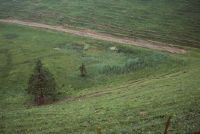
Title (German)
HM 586, Chlosterwald-Moore, Ampferenbödeli
Caption
Coordinates: 735'300, 235'900
Caption (German)
Koordinaten: 735'300, 235'900
Record Name
Dia_358-3146

Title (German)
HM 586, Chlosterwald-Moore, Ampferenbödeli
Caption
Coordinates: 735'300, 235'900
Caption (German)
Koordinaten: 735'300, 235'900
Record Name
Dia_358-3147

Title (German)
HM 586, Chlosterwald-Moore, Ampferenbödeli
Caption
Coordinates: 735'300, 235'900
Caption (German)
Koordinaten: 735'300, 235'900
Record Name
Dia_358-3148

Title (German)
HM 588, Moore bei Steig und Schartegg
Caption
Coordinates: 732'800, 235'900
Caption (German)
Koordinaten: 732'800, 235'900
Record Name
Dia_358-3149

Title (German)
HM 588, Moore bei Steig und Schartegg
Caption
Coordinates: 732'800, 235'900
Caption (German)
Koordinaten: 732'800, 235'900
Record Name
Dia_358-3150

Title (German)
HM 588, Moore bei Steig und Schartegg, Lycopodium inundatum Schlenke
Caption
Coordinates: 732'800, 235'900
Caption (German)
Koordinaten: 732'800, 235'900
Record Name
Dia_358-3151

Title (German)
HM 588, Moore bei Steig und Schartegg
Caption
Coordinates: 732'800, 235'900
Caption (German)
Koordinaten: 732'800, 235'900
Record Name
Dia_358-3152

Title (German)
HM 588, Moore bei Steig und Schartegg
Caption
Coordinates: 732'800, 235'900
Caption (German)
Koordinaten: 732'800, 235'900
Record Name
Dia_358-3153

Title (German)
HM 588, Moore bei Steig und Schartegg
Caption
Coordinates: 732'800, 235'900
Caption (German)
Koordinaten: 732'800, 235'900
Record Name
Dia_358-3154

Title (German)
HM 588, Moore bei Steig und Schartegg
Caption
Coordinates: 732'800, 235'900
Caption (German)
Koordinaten: 732'800, 235'900
Record Name
Dia_358-3155

Title (German)
HM 588, Moore bei Steig und Schartegg
Caption
Coordinates: 732'800, 235'900
Caption (German)
Koordinaten: 732'800, 235'900
Record Name
Dia_358-3156

Title (German)
HM 589, Au, Hinterlaad
Caption
Coordinates: 733'000, 228'700
Caption (German)
Koordinaten: 733'000, 228'700
Record Name
Dia_358-3157

Title (German)
HM 589, Au, Hinterlaad
Caption
Coordinates: 733'000, 228'700
Caption (German)
Koordinaten: 733'000, 228'700
Record Name
Dia_358-3158

Title (German)
HM 591, Moor nördlich Heeg
Caption
Coordinates: 749'200, 230'300
Caption (German)
Koordinaten: 749'200, 230'300
Record Name
Dia_358-3159

Title (German)
HM 591, Moor nördlich Heeg
Caption
Coordinates: 749'200, 230'300
Caption (German)
Koordinaten: 749'200, 230'300
Record Name
Dia_358-3160

Title (German)
HM 591, Moor nördlich Heeg
Caption
Coordinates: 749'200, 230'300
Caption (German)
Koordinaten: 749'200, 230'300
Record Name
Dia_358-3161

Title (German)
HM 594, Moore nördlich Guggeien, Waldsterben
Caption
Coordinates: 730'100, 239'000
Caption (German)
Koordinaten: 730'100, 239'000
Record Name
Dia_358-3162

Title (German)
HM 594, Moore nördlich Guggeien, Waldsterben auf Extremstandort Streuewiese
Caption
Coordinates: 730'100, 239'000
Caption (German)
Koordinaten: 730'100, 239'000
Record Name
Dia_358-3163

Title (German)
HM 594, Moore nördlich Guggeien, Waldsterben auf Extremstandort Streuewiese
Caption
Coordinates: 730'100, 239'000
Caption (German)
Koordinaten: 730'100, 239'000
Record Name
Dia_358-3164

Title (German)
FM 0058, Oberhöflerriet, Eingriff, Drainage/Entwässerung
Caption
Coordinates: 703'800, 239'800
Caption (German)
Koordinaten: 703'800, 239'800
Record Name
Dia_358-3165

Title (German)
FM 0058, Oberhöflerriet, Eingriff, Drainage/Entwässerung
Caption
Coordinates: 703'800, 239'800
Caption (German)
Koordinaten: 703'800, 239'800
Record Name
Dia_358-3166

Title (German)
HM 102, Torfriet
Caption
Coordinates: 700'100, 247'000
Caption (German)
Koordinaten: 700'100, 247'000
Record Name
Dia_358-3168

Title (German)
HM 102, Torfriet
Caption
Coordinates: 700'100, 247'000
Caption (German)
Koordinaten: 700'100, 247'000
Record Name
Dia_358-3169

Title (German)
HM 102, Torfriet
Caption
Coordinates: 700'100, 247'000
Caption (German)
Koordinaten: 700'100, 247'000
Record Name
Dia_358-3170

Title (German)
HM 102, Torfriet
Caption
Coordinates: 700'100, 247'000
Caption (German)
Koordinaten: 700'100, 247'000
Record Name
Dia_358-3171

Title (German)
HM 102, Torfriet
Caption
Coordinates: 700'100, 247'000
Caption (German)
Koordinaten: 700'100, 247'000
Record Name
Dia_358-3172

Title (German)
HM 102, Torfriet
Caption
Coordinates: 700'100, 247'000
Caption (German)
Koordinaten: 700'100, 247'000
Record Name
Dia_358-3173

Title (German)
HM 102, Torfriet
Caption
Coordinates: 700'100, 247'000
Caption (German)
Koordinaten: 700'100, 247'000
Record Name
Dia_358-3174

Title (German)
HM 102, Torfriet
Caption
Coordinates: 700'100, 247'000
Caption (German)
Koordinaten: 700'100, 247'000
Record Name
Dia_358-3175
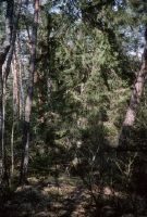
Title (German)
HM 102, Torfriet
Caption
Coordinates: 700'100, 247'000
Caption (German)
Koordinaten: 700'100, 247'000
Record Name
Dia_358-3176

Title (German)
HM 102, Torfriet
Caption
Coordinates: 700'100, 247'000
Caption (German)
Koordinaten: 700'100, 247'000
Record Name
Dia_358-3177

Title (German)
HM 103, Robenhauserriet, Pfäffikersee
Caption
Coordinates: 702'000, 244'000
Caption (German)
Koordinaten: 702'000, 244'000
Record Name
Dia_358-3178

Title (German)
HM 103, Robenhauserriet, Pfäffikersee, Cladium mariscus
Caption
Coordinates: 702'000, 244'000
Caption (German)
Koordinaten: 702'000, 244'000
Record Name
Dia_358-3179

Title (German)
HM 103, Robenhauserriet, Pfäffikersee, Maggiriet
Caption
Coordinates: 702'000, 244'000
Caption (German)
Koordinaten: 702'000, 244'000
Record Name
Dia_358-3181

Title (German)
HM 103, Robenhauserriet, Pfäffikersee
Caption
Coordinates: 702'000, 244'000
Caption (German)
Koordinaten: 702'000, 244'000
Record Name
Dia_358-3182

Title (German)
HM 103, Robenhauserriet, Pfäffikersee
Caption
Coordinates: 702'000, 244'000
Caption (German)
Koordinaten: 702'000, 244'000
Record Name
Dia_358-3183

Title (German)
HM 103, Robenhauserriet, Pfäffikersee
Caption
Coordinates: 702'000, 244'000
Caption (German)
Koordinaten: 702'000, 244'000
Record Name
Dia_358-3184

Title (German)
HM 103, Robenhauserriet, Pfäffikersee
Caption
Coordinates: 702'000, 244'000
Caption (German)
Koordinaten: 702'000, 244'000
Record Name
Dia_358-3185

Title (German)
HM 103, Robenhauserriet, Pfäffikersee
Caption
Coordinates: 702'000, 244'000
Caption (German)
Koordinaten: 702'000, 244'000
Record Name
Dia_358-3186

Title (German)
HM 103, Robenhauserriet, Pfäffikersee
Caption
Coordinates: 702'000, 244'000
Caption (German)
Koordinaten: 702'000, 244'000
Record Name
Dia_358-3187

Title (German)
HM 103, Robenhauserriet, Pfäffikersee, Zerstörung einer Riedwiese, N. Areal Mercedes-Benz
Caption
Coordinates: 702'000, 244'000
Caption (German)
Koordinaten: 702'000, 244'000
Record Name
Dia_358-3188

Title (German)
HM 103, Robenhauserriet, Pfäffikersee, Vorbereitung für Aufschüttung im Robenhauser Riet, abends
Caption
Coordinates: 702'000, 244'000
Caption (German)
Koordinaten: 702'000, 244'000
Record Name
Dia_358-3189

Title (German)
HM 103, Robenhauserriet, Pfäffikersee, Projekt Heidacker
Caption
Coordinates: 702'000, 244'000
Caption (German)
Koordinaten: 702'000, 244'000
Record Name
Dia_358-3190

Title (German)
HM 103, Robenhauserriet, Pfäffikersee
Caption
Coordinates: 702'000, 244'000
Caption (German)
Koordinaten: 702'000, 244'000
Record Name
Dia_358-3192

Title (German)
HM 103, Robenhauserriet, Pfäffikersee, neue Grenzziehung: versetzte Baumhecke am Rande, Torfböden
Caption
Coordinates: 702'000, 244'000
Caption (German)
Koordinaten: 702'000, 244'000
Record Name
Dia_358-3193

Title (German)
HM 103, Robenhauserriet, Pfäffikersee, Profile für Überbauung "Im Heidacker"
Caption
Coordinates: 702'000, 244'000
Caption (German)
Koordinaten: 702'000, 244'000
Record Name
Dia_358-3194

Title (German)
HM 103, Robenhauserriet, Pfäffikersee, Zerstörung für Aufschüttung Parkplatz Mercedes
Caption
Coordinates: 702'000, 244'000
Caption (German)
Koordinaten: 702'000, 244'000
Record Name
Dia_358-3195

Title (German)
HM 103, Robenhauserriet, Pfäffikersee, Zerstörung für Aufschüttung Parkplatz Mercedes
Caption
Coordinates: 702'000, 244'000
Caption (German)
Koordinaten: 702'000, 244'000
Record Name
Dia_358-3196

Title (German)
HM 103, Robenhauserriet, Pfäffikersee, Zerstörung für Aufschüttung Parkplatz Mercedes
Caption
Coordinates: 702'000, 244'000
Caption (German)
Koordinaten: 702'000, 244'000
Record Name
Dia_358-3197

Title (German)
HM 103, Robenhauserriet, Pfäffikersee, Zerstörung für Aufschüttung Parkplatz Mercedes
Caption
Coordinates: 702'000, 244'000
Caption (German)
Koordinaten: 702'000, 244'000
Record Name
Dia_358-3198

Title (German)
HM 103, Robenhauserriet, Pfäffikersee, Zerstörung für Aufschüttung Parkplatz Mercedes
Caption
Coordinates: 702'000, 244'000
Caption (German)
Koordinaten: 702'000, 244'000
Record Name
Dia_358-3199
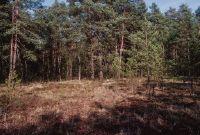
Title (German)
HM 106, Hiwiler Riet
Caption
Coordinates: 704'100, 239'600
Caption (German)
Koordinaten: 704'100, 239'600
Record Name
Dia_358-3200

Title (German)
HM 106, Hiwiler Riet
Caption
Coordinates: 704'100, 239'600
Caption (German)
Koordinaten: 704'100, 239'600
Record Name
Dia_358-3201

Title (German)
HM 115, Unterrifferswilermoos, Chrutzelen, Oberrifferswilermoos, Seleger Moor
Caption
Coordinates: 681'200, 233'500
Caption (German)
Koordinaten: 681'200, 233'500
Record Name
Dia_358-3202

Title (German)
HM 115, Unterrifferswilermoos, Chrutzelen, Oberrifferswilermoos, Seleger Moor
Caption
Coordinates: 681'200, 233'500
Caption (German)
Koordinaten: 681'200, 233'500
Record Name
Dia_358-3203

Title (German)
HM 115, Unterrifferswilermoos, Chrutzelen, Oberrifferswilermoos, Seleger Moor
Caption
Coordinates: 681'200, 233'500
Caption (German)
Koordinaten: 681'200, 233'500
Record Name
Dia_358-3204

Title (German)
HM 115, Unterrifferswilermoos, Chrutzelen, Oberrifferswilermoos, Seleger Moor
Caption
Coordinates: 681'200, 233'500
Caption (German)
Koordinaten: 681'200, 233'500
Record Name
Dia_358-3205

Title (German)
HM 115, Unterrifferswilermoos, Chrutzelen, Oberrifferswilermoos, Seleger Moor
Caption
Coordinates: 681'200, 233'500
Caption (German)
Koordinaten: 681'200, 233'500
Record Name
Dia_358-3206

Title (German)
HM 115, Unterrifferswilermoos, Chrutzelen, Oberrifferswilermoos, Seleger Moor
Caption
Coordinates: 681'200, 233'500
Caption (German)
Koordinaten: 681'200, 233'500
Record Name
Dia_358-3207

Title (German)
HM 115, Unterrifferswilermoos, Chrutzelen, Oberrifferswilermoos, Seleger Moor
Caption
Coordinates: 681'200, 233'500
Caption (German)
Koordinaten: 681'200, 233'500
Record Name
Dia_358-3208

Title (German)
HM 115, Unterrifferswilermoos, Chrutzelen, Oberrifferswilermoos, Seleger Moor
Caption
Coordinates: 681'200, 233'500
Caption (German)
Koordinaten: 681'200, 233'500
Record Name
Dia_358-3209

Title (German)
HM 115, Unterrifferswilermoos, Chrutzelen, Oberrifferswilermoos, Seleger Moor
Caption
Coordinates: 681'200, 233'500
Caption (German)
Koordinaten: 681'200, 233'500
Record Name
Dia_358-3210

Title (German)
HM 115, Unterrifferswilermoos, Chrutzelen, Oberrifferswilermoos, Seleger Moor
Caption
Coordinates: 681'200, 233'500
Caption (German)
Koordinaten: 681'200, 233'500
Record Name
Dia_358-3211

Title (German)
HM 115, Unterrifferswilermoos, Chrutzelen, Oberrifferswilermoos, Seleger Moor
Caption
Coordinates: 681'200, 233'500
Caption (German)
Koordinaten: 681'200, 233'500
Record Name
Dia_358-3212

Title (German)
HM 115, Unterrifferswilermoos, Chrutzelen, Oberrifferswilermoos, Seleger Moor
Caption
Coordinates: 681'200, 233'500
Caption (German)
Koordinaten: 681'200, 233'500
Record Name
Dia_358-3213

Title (German)
HM 115, Unterrifferswilermoos, Chrutzelen, Oberrifferswilermoos, Seleger Moor, Plakat
Caption
Coordinates: 681'200, 233'500
Caption (German)
Koordinaten: 681'200, 233'500
Record Name
Dia_358-3214

Title (German)
HM 115, Unterrifferswilermoos, Chrutzelen, Oberrifferswilermoos, Seleger Moor, Regenerationsflächen
Caption
Coordinates: 681'200, 233'500
Caption (German)
Koordinaten: 681'200, 233'500
Record Name
Dia_358-3215

Title (German)
HM 117, Hagenmoos, Regenerationskomplex
Caption
Coordinates: 682'000, 232'100
Caption (German)
Koordinaten: 682'000, 232'100
Record Name
Dia_358-3216

Title (German)
HM 117, Hagenmoos, Regenerationskomplex
Caption
Coordinates: 682'000, 232'100
Caption (German)
Koordinaten: 682'000, 232'100
Record Name
Dia_358-3217

Title (German)
HM 117, Hagenmoos, Pinetum
Caption
Coordinates: 682'000, 232'100
Caption (German)
Koordinaten: 682'000, 232'100
Record Name
Dia_358-3218

Title (German)
HM 117, Hagenmoos
Caption
Coordinates: 682'000, 232'100
Caption (German)
Koordinaten: 682'000, 232'100
Record Name
Dia_358-3219

Title (German)
HM 117, Hagenmoos, Regenerationskomplex
Caption
Coordinates: 682'000, 232'100
Caption (German)
Koordinaten: 682'000, 232'100
Record Name
Dia_358-3220

Title (German)
HM 117, Hagenmoos, Regenerationskomplex
Caption
Coordinates: 682'000, 232'100
Caption (German)
Koordinaten: 682'000, 232'100
Record Name
Dia_358-3221

Title (German)
HM 117, Hagenmoos, Durchstich der Moräne
Caption
Coordinates: 682'000, 232'100
Caption (German)
Koordinaten: 682'000, 232'100
Record Name
Dia_358-3222

Title (German)
HM 117, Hagenmoos, Regenerationskomplex
Caption
Coordinates: 682'000, 232'100
Caption (German)
Koordinaten: 682'000, 232'100
Record Name
Dia_358-3223

Title (German)
HM 117, Hagenmoos
Caption
Coordinates: 682'000, 232'100
Caption (German)
Koordinaten: 682'000, 232'100
Record Name
Dia_358-3224

Title (German)
HM 117, Hagenmoos
Caption
Coordinates: 682'000, 232'100
Caption (German)
Koordinaten: 682'000, 232'100
Record Name
Dia_358-3225

Title (German)
HM 117, Hagenholz, Torfstichgrube in Regeneration
Caption
Coordinates: 682'000, 232'100
Caption (German)
Koordinaten: 682'000, 232'100
Record Name
Dia_358-3226

Title (German)
HM 117, Hagenholz, Torfstichgrube in Regeneration
Caption
Coordinates: 682'000, 232'100
Caption (German)
Koordinaten: 682'000, 232'100
Record Name
Dia_358-3227

Title (German)
HM 117, Hagenholz, Entbuschung
Caption
Coordinates: 682'000, 232'100
Caption (German)
Koordinaten: 682'000, 232'100
Record Name
Dia_358-3228

Title (German)
HM 117, Hagenholz, Entbuschung
Caption
Coordinates: 682'000, 232'100
Caption (German)
Koordinaten: 682'000, 232'100
Record Name
Dia_358-3229

Title (German)
HM 117, Hagenholz, Entbuschung
Caption
Coordinates: 682'000, 232'100
Caption (German)
Koordinaten: 682'000, 232'100
Record Name
Dia_358-3230

Title (German)
HM 117, Hagenholz, Entbuschung
Caption
Coordinates: 682'000, 232'100
Caption (German)
Koordinaten: 682'000, 232'100
Record Name
Dia_358-3231

Title (German)
HM 117, Hagenholz, Entbuschung
Caption
Coordinates: 682'000, 232'100
Caption (German)
Koordinaten: 682'000, 232'100
Record Name
Dia_358-3232

Title (German)
HM 117, Hagenholz, Entbuschung der grossen Torfstichgrube
Caption
Coordinates: 682'000, 232'100
Caption (German)
Koordinaten: 682'000, 232'100
Record Name
Dia_358-3233

Title (German)
HM 117, Hagenholz, Entbuschung der grossen Torfstichgrube
Caption
Coordinates: 682'000, 232'100
Caption (German)
Koordinaten: 682'000, 232'100
Record Name
Dia_358-3234

Title (German)
HM 117, Hagenmoos, Sphagnadecke zwischen zwei Torfstichgruben
Caption
Coordinates: 682'000, 232'100
Caption (German)
Koordinaten: 682'000, 232'100
Record Name
Dia_358-3235

Title (German)
HM 117, Hagenmoos
Caption
Coordinates: 682'000, 232'100
Caption (German)
Koordinaten: 682'000, 232'100
Record Name
Dia_358-3236

Title (German)
HM 117, Hagenmoos, Stereoaufnahme Dauerfläche
Caption
Coordinates: 682'000, 232'100
Caption (German)
Koordinaten: 682'000, 232'100
Record Name
Dia_358-3237

Title (German)
HM 117, Hagenmoos, Stereoaufnahme Dauerfläche
Caption
Coordinates: 682'000, 232'100
Caption (German)
Koordinaten: 682'000, 232'100
Record Name
Dia_358-3238

Title (German)
HM 117, Hagenmoos, nach starkem Regen
Caption
Coordinates: 682'000, 232'100
Caption (German)
Koordinaten: 682'000, 232'100
Record Name
Dia_358-3239

Title (German)
HM 117, Hagenmoos, nach starkem Regen
Caption
Coordinates: 682'000, 232'100
Caption (German)
Koordinaten: 682'000, 232'100
Record Name
Dia_358-3240

Title (German)
HM 117, Hagenmoos, nach starkem Regen
Caption
Coordinates: 682'000, 232'100
Caption (German)
Koordinaten: 682'000, 232'100
Record Name
Dia_358-3241

Title (German)
HM 117, Hagenmoos, Brennesselflur
Caption
Coordinates: 682'000, 232'100
Caption (German)
Koordinaten: 682'000, 232'100
Record Name
Dia_358-3242

Title (German)
HM 117, Hagenmoos, nach starkem Regen
Caption
Coordinates: 682'000, 232'100
Caption (German)
Koordinaten: 682'000, 232'100
Record Name
Dia_358-3243

Title (German)
HM 117, Hagenmoos, nach starkem Regen
Caption
Coordinates: 682'000, 232'100
Caption (German)
Koordinaten: 682'000, 232'100
Record Name
Dia_358-3244

Title (German)
HM 117, Hagenmoos, nach starkem Regen
Caption
Coordinates: 682'000, 232'100
Caption (German)
Koordinaten: 682'000, 232'100
Record Name
Dia_358-3245

Title (German)
HM 117, Hagenmoos, Wasser quillt hervor, vom Hauptkanal zum Stichkanal
Caption
Coordinates: 682'000, 232'100
Caption (German)
Koordinaten: 682'000, 232'100
Record Name
Dia_358-3246

Title (German)
HM 117, Hagenmoos, wegen starkem Regen befluteter und erodierter Damm
Caption
Coordinates: 682'000, 232'100
Caption (German)
Koordinaten: 682'000, 232'100
Record Name
Dia_358-3247

Title (German)
HM 117, Hagenmoos, vom Rehbock gefegte Bergföhre
Caption
Coordinates: 682'000, 232'100
Caption (German)
Koordinaten: 682'000, 232'100
Record Name
Dia_358-3248

Title (German)
HM 117, Hagenmoos, Lehmentnahmestelle
Caption
Coordinates: 682'000, 232'100
Caption (German)
Koordinaten: 682'000, 232'100
Record Name
Dia_358-3249

Title (German)
HM 117, Hagenmoos, nach starkem Regen
Caption
Coordinates: 682'000, 232'100
Caption (German)
Koordinaten: 682'000, 232'100
Record Name
Dia_358-3250

Title (German)
HM 117, Hagenmoos, nach starkem Regen
Caption
Coordinates: 682'000, 232'100
Caption (German)
Koordinaten: 682'000, 232'100
Record Name
Dia_358-3251

Title (German)
HM 117, Hagenmoos, Ausschlagen der Weiden, grosser Torfstich
Caption
Coordinates: 682'000, 232'100
Caption (German)
Koordinaten: 682'000, 232'100
Record Name
Dia_358-3252

Title (German)
HM 117, Hagenmoos, freigestellte Flächen am Ostrand (E)
Caption
Coordinates: 682'000, 232'100
Caption (German)
Koordinaten: 682'000, 232'100
Record Name
Dia_358-3253

Title (German)
HM 117, Hagenmoos, Sphagnen mit Sonnenbrand
Caption
Coordinates: 682'000, 232'100
Caption (German)
Koordinaten: 682'000, 232'100
Record Name
Dia_358-3254

Title (German)
HM 117, Hagenmoos, Einstau
Caption
Coordinates: 682'000, 232'100
Caption (German)
Koordinaten: 682'000, 232'100
Record Name
Dia_358-3255

Title (German)
HM 117, Hagenmoos, Hinterfüllen des Dammes
Caption
Coordinates: 682'000, 232'100
Caption (German)
Koordinaten: 682'000, 232'100
Record Name
Dia_358-3256

Title (German)
HM 117, Hagenmoos, Hinterfüllen des Dammes
Caption
Coordinates: 682'000, 232'100
Caption (German)
Koordinaten: 682'000, 232'100
Record Name
Dia_358-3257

Title (German)
HM 117, Hagenmoos, Verdichten des Lehmes, Stiefel bleibt stecken
Caption
Coordinates: 682'000, 232'100
Caption (German)
Koordinaten: 682'000, 232'100
Record Name
Dia_358-3258

Title (German)
HM 117, Hagenmoos
Caption
Coordinates: 682'000, 232'100
Caption (German)
Koordinaten: 682'000, 232'100
Record Name
Dia_358-3259

Title (German)
HM 117, Hagenmoos, Dammbau
Caption
Coordinates: 682'000, 232'100
Caption (German)
Koordinaten: 682'000, 232'100
Record Name
Dia_358-3260

Title (German)
HM 117, Hagenmoos, Dammbau
Caption
Coordinates: 682'000, 232'100
Caption (German)
Koordinaten: 682'000, 232'100
Record Name
Dia_358-3261

Title (German)
HM 117, Hagenholz, Hagenmoos, Dammbau
Caption
Coordinates: 682'000, 232'100
Caption (German)
Koordinaten: 682'000, 232'100
Record Name
Dia_358-3262

Title (German)
HM 117, Hagenholz, Hagenmoos, Dammbau
Caption
Coordinates: 682'000, 232'100
Caption (German)
Koordinaten: 682'000, 232'100
Record Name
Dia_358-3263

Title (German)
HM 117, Hagenholz, Hagenmoos, Dammbau
Caption
Coordinates: 682'000, 232'100
Caption (German)
Koordinaten: 682'000, 232'100
Record Name
Dia_358-3264
![HM 117, Hagenholz, Hagenmoos, dam construction [unshot image].](thumbnails/thumb_ETHBIB.Bildarchiv_1149381.jpg)
Title (German)
HM 117, Hagenholz, Hagenmoos, Dammbau [unschafe Aufnahme]
Caption
Coordinates: 682'000, 232'100
Caption (German)
Koordinaten: 682'000, 232'100
Record Name
Dia_358-3265

Title (German)
HM 117, Hagenholz, Hagenmoos, Dammbau
Caption
Coordinates: 682'000, 232'100
Caption (German)
Koordinaten: 682'000, 232'100
Record Name
Dia_358-3266

Title (German)
HM 117, Hagenholz, Hagenmoos, Dammbau
Caption
Coordinates: 682'000, 232'100
Caption (German)
Koordinaten: 682'000, 232'100
Record Name
Dia_358-3267

Title (German)
HM 117, Hagenholz, Hagenmoos, Dammbau
Caption
Coordinates: 682'000, 232'100
Caption (German)
Koordinaten: 682'000, 232'100
Record Name
Dia_358-3268

Title (German)
HM 117, Hagenholz, Hagenmoos, Dammbau
Caption
Coordinates: 682'000, 232'100
Caption (German)
Koordinaten: 682'000, 232'100
Record Name
Dia_358-3269

Title (German)
HM 117, Hagenholz, Hagenmoos, Dammbau
Caption
Coordinates: 682'000, 232'100
Caption (German)
Koordinaten: 682'000, 232'100
Record Name
Dia_358-3270

Title (German)
HM 117, Hagenholz, Hagenmoos, Dammbau
Caption
Coordinates: 682'000, 232'100
Caption (German)
Koordinaten: 682'000, 232'100
Record Name
Dia_358-3271
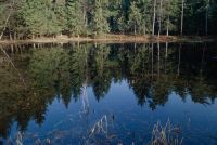
Title (German)
HM 117, Hagenholz, Hagenmoos
Caption
Coordinates: 682'000, 232'100
Caption (German)
Koordinaten: 682'000, 232'100
Record Name
Dia_358-3272

Title (German)
HM 117, Hagenholz, Hagenmoos
Caption
Coordinates: 682'000, 232'100
Caption (German)
Koordinaten: 682'000, 232'100
Record Name
Dia_358-3273

Title (German)
HM 117, Hagenholz, Hagenmoos
Caption
Coordinates: 682'000, 232'100
Caption (German)
Koordinaten: 682'000, 232'100
Record Name
Dia_358-3274

Title (German)
HM 117, Hagenholz, Hagenmoos
Caption
Coordinates: 682'000, 232'100
Caption (German)
Koordinaten: 682'000, 232'100
Record Name
Dia_358-3275

Title (German)
HM 117, Hagenholz, Hagenmoos, Dammbau
Caption
Coordinates: 682'000, 232'100
Caption (German)
Koordinaten: 682'000, 232'100
Record Name
Dia_358-3276

Title (German)
HM 117, Hagenholz, Hagenmoos, Dammbau
Caption
Coordinates: 682'000, 232'100
Caption (German)
Koordinaten: 682'000, 232'100
Record Name
Dia_358-3277

Title (German)
HM 117, Hagenholz, Hagenmoos, Dammbau
Caption
Coordinates: 682'000, 232'100
Caption (German)
Koordinaten: 682'000, 232'100
Record Name
Dia_358-3278

Title (German)
HM 117, Hagenholz, Hagenmoos, Dammbau
Caption
Coordinates: 682'000, 232'100
Caption (German)
Koordinaten: 682'000, 232'100
Record Name
Dia_358-3279
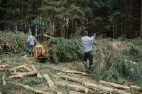
Title (German)
HM 117, Hagenholz, Hagenmoos, Dammbau
Caption
Coordinates: 682'000, 232'100
Caption (German)
Koordinaten: 682'000, 232'100
Record Name
Dia_358-3280

Title (German)
HM 117, Hagenholz, Hagenmoos, Dammbau
Caption
Coordinates: 682'000, 232'100
Caption (German)
Koordinaten: 682'000, 232'100
Record Name
Dia_358-3281

Title (German)
HM 117, Hagenholz, Hagenmoos, Dammbau
Caption
Coordinates: 682'000, 232'100
Caption (German)
Koordinaten: 682'000, 232'100
Record Name
Dia_358-3282

Title (German)
HM 117, Hagenholz, Hagenmoos, Dammbau
Caption
Coordinates: 682'000, 232'100
Caption (German)
Koordinaten: 682'000, 232'100
Record Name
Dia_358-3283

Title (German)
HM 117, Hagenholz, Hagenmoos, Dammbau
Caption
Coordinates: 682'000, 232'100
Caption (German)
Koordinaten: 682'000, 232'100
Record Name
Dia_358-3284

Title (German)
HM 117, Hagenholz, Hagenmoos, Dammbau
Caption
Coordinates: 682'000, 232'100
Caption (German)
Koordinaten: 682'000, 232'100
Record Name
Dia_358-3285

Title (German)
HM 117, Hagenholz, Hagenmoos, Dammbau
Caption
Coordinates: 682'000, 232'100
Caption (German)
Koordinaten: 682'000, 232'100
Record Name
Dia_358-3286

Title (German)
HM 117, Hagenholz, Hagenmoos, Dammbau
Caption
Coordinates: 682'000, 232'100
Caption (German)
Koordinaten: 682'000, 232'100
Record Name
Dia_358-3287

Title (German)
HM 117, Hagenholz, Hagenmoos, Dammbau
Caption
Coordinates: 682'000, 232'100
Caption (German)
Koordinaten: 682'000, 232'100
Record Name
Dia_358-3288

Title (German)
HM 117, Hagenholz, Hagenmoos, Dammbau
Caption
Coordinates: 682'000, 232'100
Caption (German)
Koordinaten: 682'000, 232'100
Record Name
Dia_358-3289

Title (German)
HM 117, Hagenholz, Hagenmoos, Dammbau
Caption
Coordinates: 682'000, 232'100
Caption (German)
Koordinaten: 682'000, 232'100
Record Name
Dia_358-3290

Title (German)
HM 117, Hagenholz, Hagenmoos, Dammbau
Caption
Coordinates: 682'000, 232'100
Caption (German)
Koordinaten: 682'000, 232'100
Record Name
Dia_358-3291

Title (German)
HM 117, Hagenholz, Hagenmoos, Dammbau
Caption
Coordinates: 682'000, 232'100
Caption (German)
Koordinaten: 682'000, 232'100
Record Name
Dia_358-3292

Title (German)
HM 117, Hagenholz, Hagenmoos, Dammbau
Caption
Coordinates: 682'000, 232'100
Caption (German)
Koordinaten: 682'000, 232'100
Record Name
Dia_358-3293