 E-PICS - ETHBIB.Bildarchiv


The images presented on this page are part of E-Pics, a service provided by the ETH-Bibliothek of ETH Zurich. You find here static medium resolution images published under the creative commons
CC-BY-SA license or with the Public Domain Mark. This means that you are free to share, copy and redistribute the material in any medium or format; that you are free to remix, transform, and build upon the material for any purpose, even commercially, under the following conditions: You must give appropriate credit, provide a link to the license, and indicate if changes were made.
- More information about E-Pics is available at https://www.e-pics.ethz.ch
- This catalog can also be accessed at https://ba.e-pics.ethz.ch/ . There you can download the image in a higher resolution.

Title (German)
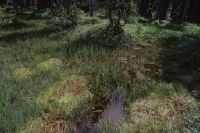
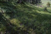
Flühli LU, Auf Salwiden, Hochmoorföhrenwald südöstlich des Weilers Turnschwand
Caption
Semi-open high moor mountain pine forest Türnliwald, habitat type Ledo-Pinion, photograph taken during the vegetation phase, UNESCO Entlebuch Biosphere Reserve, partial view; keywords Documenta Natura: wetland.
Caption (German)
Halboffener Hochmoor-Bergföhrenwald Türnliwald, Lebensraumtyp Ledo-Pinion, Aufnahme während der Vegetationsphase, UNESCO-Biosphärenreservat Entlebuch, Teilansicht; Schlagworte Documenta Natura: Feuchtgebiet
Record Name
Dia_303-36306

Title (German)
Flühli LU, Auf Salwiden, Hochmoorföhrenwald südöstlich des Weilers Turnschwand
Caption
Semi-open high moor mountain pine forest Türnliwald, habitat type Ledo-Pinion, photograph taken during the vegetation phase, UNESCO Entlebuch Biosphere Reserve, partial view; keywords Documenta Natura: wetland.
Caption (German)
Halboffener Hochmoor-Bergföhrenwald Türnliwald, Lebensraumtyp Ledo-Pinion, Aufnahme während der Vegetationsphase, UNESCO-Biosphärenreservat Entlebuch, Teilansicht; Schlagworte Documenta Natura: Feuchtgebiet
Record Name
Dia_303-36311

Title (German)
Flühli LU, Auf Salwiden, Hochmoorföhrenwald südöstlich des Weilers Turnschwand
Caption
Semi-open high moor mountain pine forest Türnliwald, habitat type Ledo-Pinion, photograph taken during the vegetation phase, UNESCO Entlebuch Biosphere Reserve, partial view; keywords Documenta Natura: wetland.
Caption (German)
Halboffener Hochmoor-Bergföhrenwald Türnliwald, Lebensraumtyp Ledo-Pinion, Aufnahme während der Vegetationsphase, UNESCO-Biosphärenreservat Entlebuch, Teilansicht; Schlagworte Documenta Natura: Feuchtgebiet
Record Name
Dia_303-36321

Title (German)
Flühli LU, Auf Salwiden, Hochmoorföhrenwald südöstlich des Weilers Turnschwand
Caption
Semi-open high moor mountain pine forest Türnliwald, habitat type Ledo-Pinion, photograph taken during the vegetation phase, UNESCO Entlebuch Biosphere Reserve, partial view; keywords Documenta Natura: wetland.
Caption (German)
Halboffener Hochmoor-Bergföhrenwald Türnliwald, Lebensraumtyp Ledo-Pinion, Aufnahme während der Vegetationsphase, UNESCO-Biosphärenreservat Entlebuch, Teilansicht; Schlagworte Documenta Natura: Feuchtgebiet
Record Name
Dia_303-36326

Title (German)
Flühli LU, Auf Salwiden, Hochmoorföhrenwald südöstlich des Weilers Turnschwand
Caption
Semi-open high moor mountain pine forest Türnliwald, habitat type Ledo-Pinion, photograph taken during the vegetation phase, UNESCO Entlebuch Biosphere Reserve, partial view; keywords Documenta Natura: wetland.
Caption (German)
Halboffener Hochmoor-Bergföhrenwald Türnliwald, Lebensraumtyp Ledo-Pinion, Aufnahme während der Vegetationsphase, UNESCO-Biosphärenreservat Entlebuch, Teilansicht; Schlagworte Documenta Natura: Feuchtgebiet
Record Name
Dia_303-36331

Title (German)
Flühli LU, Auf Salwiden, Hochmoorföhrenwald südöstlich des Weilers Turnschwand
Caption
Semi-open high moor mountain pine forest Türnliwald, habitat type Ledo-Pinion, photograph taken during the vegetation phase, UNESCO Entlebuch Biosphere Reserve, partial view; keywords Documenta Natura: wetland.
Caption (German)
Halboffener Hochmoor-Bergföhrenwald Türnliwald, Lebensraumtyp Ledo-Pinion, Aufnahme während der Vegetationsphase, UNESCO-Biosphärenreservat Entlebuch, Teilansicht; Schlagworte Documenta Natura: Feuchtgebiet
Record Name
Dia_303-36336

Title (German)
Flühli LU, Auf Salwiden, Hochmoorföhrenwald südöstlich des Weilers Turnschwand
Caption
Ground vegetation of ericaceous dwarf shrubs, mosses and grasses in the semi-open high moor mountain pine forest Türnliwald, habitat type Ledo-Pinion, open waterhole (moor eye), photograph taken during the vegetation phase, UNESCO Entlebuch Biosphere Reserve, detail view; keywords Documenta Natura: wetland.
Caption (German)
Bodenvegetation aus Erika-Zwergsträucher, Moose und Gräser im halboffenen Hochmoor-Bergföhrenwald Türnliwald, Lebensraumtyp Ledo-Pinion, offenen Wasserstelle (Moorauge), Aufnahme während der Vegetationsphase, UNESCO-Biosphärenreservat Entlebuch, Detailansicht; Schlagworte Documenta Natura: Feuchtgebiet
Record Name
Dia_303-36341
Title (German)
Flühli LU, Auf Salwiden, Hochmoorföhrenwald südöstlich des Weilers Turnschwand
Caption
Ground vegetation of ericaceous dwarf shrubs, mosses and grasses in the semi-open high moor mountain pine forest Türnliwald, habitat type Ledo-Pinion, open waterhole (moor eye), photograph taken during the vegetation phase, UNESCO Entlebuch Biosphere Reserve, detail view; keywords Documenta Natura: wetland.
Caption (German)
Bodenvegetation aus Erika-Zwergsträucher, Moose und Gräser im halboffenen Hochmoor-Bergföhrenwald Türnliwald, Lebensraumtyp Ledo-Pinion, offenen Wasserstelle (Moorauge), Aufnahme während der Vegetationsphase, UNESCO-Biosphärenreservat Entlebuch, Detailansicht; Schlagworte Documenta Natura: Feuchtgebiet
Record Name
Dia_303-36346
Title (German)
Flühli LU, Auf Salwiden, Hochmoorföhrenwald südöstlich des Weilers Turnschwand
Caption
Ground vegetation of ericaceous dwarf shrubs, mosses and grasses in the semi-open high moor mountain pine forest Türnliwald, habitat type Ledo-Pinion, open waterhole (moor eye), photograph taken during the vegetation phase, UNESCO Entlebuch Biosphere Reserve, detail view; keywords Documenta Natura: wetland.
Caption (German)
Bodenvegetation aus Erika-Zwergsträucher, Moose und Gräser im halboffenen Hochmoor-Bergföhrenwald Türnliwald, Lebensraumtyp Ledo-Pinion, offenen Wasserstelle (Moorauge), Aufnahme während der Vegetationsphase, UNESCO-Biosphärenreservat Entlebuch, Detailansicht; Schlagworte Documenta Natura: Feuchtgebiet
Record Name
Dia_303-36351
Title (German)
Flühli LU, Auf Salwiden, Hochmoorföhrenwald südöstlich des Weilers Turnschwand
Caption
Ground vegetation of mosses and grasses (peat moss bulrushes) in the semi-open high moor mountain pine forest Türnliwald, habitat type Ledo-Pinion, open waterhole (moor eye), photograph taken during the vegetation phase, UNESCO Entlebuch Biosphere Reserve, detail view; keywords Documenta Natura: wetland.
Caption (German)
Bodenvegetation aus Moose und Gräser (Torfmoos-Bulten) im halboffenen Hochmoor-Bergföhrenwald Türnliwald, Lebensraumtyp Ledo-Pinion, offenen Wasserstelle (Moorauge), Aufnahme während der Vegetationsphase, UNESCO-Biosphärenreservat Entlebuch, Detailansicht; Schlagworte Documenta Natura: Feuchtgebiet
Record Name
Dia_303-36356

Title (German)
Flühli LU, Auf Salwiden, Hochmoorföhrenwald südöstlich des Weilers Turnschwand
Caption
Ground vegetation of mosses and grasses (peat moss bulrushes) in the semi-open high moor mountain pine forest Türnliwald, habitat type Ledo-Pinion, open waterhole (moor eye), photograph taken during the vegetation phase, UNESCO Entlebuch Biosphere Reserve, partial view; keywords Documenta Natura: wetland.
Caption (German)
Bodenvegetation aus Moose und Gräser (Torfmoos-Bulten) im halboffenen Hochmoor-Bergföhrenwald Türnliwald, Lebensraumtyp Ledo-Pinion, offenen Wasserstelle (Moorauge), Aufnahme während der Vegetationsphase, UNESCO-Biosphärenreservat Entlebuch, Teilansicht; Schlagworte Documenta Natura: Feuchtgebiet
Record Name
Dia_303-36366

Title (German)
Flühli LU, Auf Salwiden, Hochmoorföhrenwald südöstlich des Weilers Turnschwand
Caption
Ground vegetation of mosses and grasses (peat moss bulrushes) in the semi-open high moor mountain pine forest Türnliwald, habitat type Ledo-Pinion, open waterhole (moor eye), photograph taken during the vegetation phase, UNESCO Entlebuch Biosphere Reserve, partial view; keywords Documenta Natura: wetland.
Caption (German)
Bodenvegetation aus Moose und Gräser (Torfmoos-Bulten) im halboffenen Hochmoor-Bergföhrenwald Türnliwald, Lebensraumtyp Ledo-Pinion, offenen Wasserstelle (Moorauge), Aufnahme während der Vegetationsphase, UNESCO-Biosphärenreservat Entlebuch, Teilansicht; Schlagworte Documenta Natura: Feuchtgebiet
Record Name
Dia_303-36371

Title (German)
Flühli LU, Auf Salwiden, Hochmoorföhrenwald südöstlich des Weilers Turnschwand
Caption
Ground vegetation of mosses and grasses (peat moss bulrushes) in the semi-open high moor mountain pine forest Türnliwald, habitat type Ledo-Pinion, open waterhole (moor eye), photograph taken during the vegetation phase, UNESCO Entlebuch Biosphere Reserve, partial view; keywords Documenta Natura: wetland.
Caption (German)
Bodenvegetation aus Moose und Gräser (Torfmoos-Bulten) im halboffenen Hochmoor-Bergföhrenwald Türnliwald, Lebensraumtyp Ledo-Pinion, offenen Wasserstelle (Moorauge), Aufnahme während der Vegetationsphase, UNESCO-Biosphärenreservat Entlebuch, Teilansicht; Schlagworte Documenta Natura: Feuchtgebiet
Record Name
Dia_303-36376

Title (German)
Flühli LU, Auf Salwiden, Hochmoorföhrenwald südöstlich des Weilers Turnschwand
Caption
Open waterhole (bog eye) in the high moor mountain pine forest Türnliwald, habitat type Ledo-Pinion, photograph taken during the vegetation phase, UNESCO biosphere reserve Entlebuch, detail view; keywords Documenta Natura: meadowland
Caption (German)
Offene Wasserstelle (Moorauge) im Hochmoor-Bergföhrenwald Türnliwald, Lebensraumtyp Ledo-Pinion, Aufnahme während der Vegetationsphase, UNESCO-Biosphärenreservat Entlebuch, Detailansicht; Schlagworte Documenta Natura: Wiesland
Record Name
Dia_303-36381

Title (German)
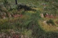
Flühli LU, Auf Salwiden, Weide südlich des Weilers Turnschwand
Caption
Grazed fen with hummocky rush grass tussocks, drainage ditch, in the background the edge of the forest, partial view; Keywords Documenta Natura: meadowland.
Caption (German)
Beweidetes Flachmoor mit höckerartigen Binsengräserbüschel, Entwässerungsgraben, im Hintergrund der Waldrand, Teilansicht; Schlagworte Documenta Natura: Wiesland
Record Name
Dia_303-36386

Title (German)
Flühli LU, Auf Salwiden, Flachmoor südlich von Gross Gfäl
Caption
Fens along a stream, photograph taken during vegetation phase, partial view; coordinates (LV03) of camera location: 643623/184195; keywords Documenta Natura: wetland.
Caption (German)
Flachmoor entlang eines Bachlaufes, Aufnahme während der Vegetationsphase, Teilansicht; Koordinaten (LV03) des Kamerastandorts: 643623/184195; Schlagworte Documenta Natura: Feuchtgebiet
Record Name
Dia_303-36397
Title (German)
Flühli LU, Auf Salwiden, Flachmoor südlich von Gross Gfäl
Caption
Ground vegetation (rush grasses) in a fen along a stream, photograph taken during the vegetation phase, partial view; coordinates (LV03) of camera location: 643623/184195; keywords Documenta Natura: wetland.
Caption (German)
Bodenvegetation (Binsengräser) im Flachmoor entlang eines Bachlaufes, Aufnahme während der Vegetationsphase, Teilansicht; Koordinaten (LV03) des Kamerastandorts: 643623/184195; Schlagworte Documenta Natura: Feuchtgebiet
Record Name
Dia_303-36402

Title (German)
Flühli LU, Auf Salwiden, Flachmoor südlich von Gross Gfäl
Caption
Ground vegetation in fen along a stream, photograph taken during vegetation phase, partial view; coordinates (LV03) of camera location: 643623/184195; keywords Documenta Natura: wetland.
Caption (German)
Bodenvegetation im Flachmoor entlang eines Bachlaufes, Aufnahme während der Vegetationsphase, Teilansicht; Koordinaten (LV03) des Kamerastandorts: 643623/184195; Schlagworte Documenta Natura: Feuchtgebiet
Record Name
Dia_303-36407

Title (German)
Flühli LU, Auf Salwiden, Flachmoor südlich von Gross Gfäl
Caption
Narrow-leaved cotton grass (eriophorum angustifolium) in a fen along a stream, photograph taken during the vegetation phase, partial view; coordinates (LV03) of camera location: 643623/184195; keywords Documenta Natura: wetland.
Caption (German)
Schmalblättriges Wollgras (eriophorum angustifolium) im Flachmoor entlang eines Bachlaufes, Aufnahme während der Vegetationsphase, Teilansicht; Koordinaten (LV03) des Kamerastandorts: 643623/184195; Schlagworte Documenta Natura: Feuchtgebiet
Record Name
Dia_303-36422

Title (German)
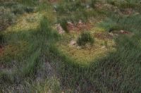
Flühli LU, Auf Salwiden, Flachmoor unterhalb Husegg
Caption
Ground vegetation with various rush grasses and sedge grasses in the fen, photograph taken during the vegetation phase, partial view; Keywords Documenta Natura: wetland.
Caption (German)
Bodenvegetation mit verschiedenen Binsengräser und Seggengräser im Flachmoor, Aufnahme während der Vegetationsphase, Teilansicht; Schlagworte Documenta Natura: Feuchtgebiet
Record Name
Dia_303-36427

Title (German)
Flühli LU, Auf Salwiden, Flachmoor unterhalb Husegg
Caption
Ground vegetation with various rush grasses and sedge grasses in the fen, photograph taken during the vegetation phase, partial view; Keywords Documenta Natura: wetland.
Caption (German)
Bodenvegetation mit verschiedenen Binsengräser und Seggengräser im Flachmoor, Aufnahme während der Vegetationsphase, Teilansicht; Schlagworte Documenta Natura: Feuchtgebiet
Record Name
Dia_303-36432

Title (German)
Flühli LU, Auf Salwiden, Flachmoor unterhalb Husegg
Caption
Narrow-leaved cotton grass (eriophorum angustifolium) in fen, photograph taken during vegetation phase, detail; Keywords Documenta Natura: wetland.
Caption (German)
Schmalblättriges Wollgras (eriophorum angustifolium) im Flachmoor, Aufnahme während der Vegetationsphase, Detailansicht; Schlagworte Documenta Natura: Feuchtgebiet
Record Name
Dia_303-36437

Title (German)
Flühli LU, Auf Salwiden, Flachmoor unterhalb Husegg
Caption
Narrow-leaved cotton grass (eriophorum angustifolium) in fen, photograph taken during vegetation phase, detail; Keywords Documenta Natura: wetland.
Caption (German)
Schmalblättriges Wollgras (eriophorum angustifolium) im Flachmoor, Aufnahme während der Vegetationsphase, Detailansicht; Schlagworte Documenta Natura: Feuchtgebiet
Record Name
Dia_303-36442

Title (German)
Zürich ZH, Blick (Südwestansicht) über das Bahnhofgelände Stadelhofen
Caption
Southwest view from the restaurant Bahnhof (Goethestrasse) to the station area Stadelhofen with pedestrian bridge, station building, passers-by, partial bird's eye view; keywords Documenta Natura: station
Caption (German)
Südwestansicht vom Restaurant Bahnhof (Goethestrasse) auf das Bahnhofgelände Stadelhofen mit Fussgängerbrücke, Bahnhofgebäude, Passanten, Teilansicht aus Vogelperspektive; Schlagworte Documenta Natura: Bahnhof
Record Name
Dia_303-36457

Title (German)
Zürich ZH, Blick (Südwestansicht) über das Bahnhofgelände Stadelhofen
Caption
Southwest view from the restaurant Bahnhof (Goethestrasse) to the station area Stadelhofen with pedestrian bridge, station building, passers-by, partial bird's eye view; keywords Documenta Natura: station
Caption (German)
Südwestansicht vom Restaurant Bahnhof (Goethestrasse) auf das Bahnhofgelände Stadelhofen mit Fussgängerbrücke, Bahnhofgebäude, Passanten, Teilansicht aus Vogelperspektive; Schlagworte Documenta Natura: Bahnhof
Record Name
Dia_303-36460

Title (German)
Zürich ZH, Blick (Südwestansicht) über das Bahnhofgelände Stadelhofen
Caption
Southwest view from the restaurant Bahnhof (Goethestrasse) to the station area Stadelhofen with pedestrian bridge, station building, passers-by, partial bird's eye view; keywords Documenta Natura: station
Caption (German)
Südwestansicht vom Restaurant Bahnhof (Goethestrasse) auf das Bahnhofgelände Stadelhofen mit Fussgängerbrücke, Bahnhofgebäude, Passanten, Teilansicht aus Vogelperspektive; Schlagworte Documenta Natura: Bahnhof
Record Name
Dia_303-36464

Title (German)
Zürich ZH, Blick (Südwestansicht) über das Bahnhofgelände Stadelhofen
Caption
Southwest view from the restaurant Bahnhof (Goethestrasse) to the station area Stadelhofen with pedestrian bridge, station building, passers-by, partial bird's eye view; keywords Documenta Natura: station
Caption (German)
Südwestansicht vom Restaurant Bahnhof (Goethestrasse) auf das Bahnhofgelände Stadelhofen mit Fussgängerbrücke, Bahnhofgebäude, Passanten, Teilansicht aus Vogelperspektive; Schlagworte Documenta Natura: Bahnhof
Record Name
Dia_303-36466

Title (German)
Zürich ZH, Blick (Südwestansicht) über das Bahnhofgelände Stadelhofen
Caption
Southwest view of Stadelhofen station area with pedestrian bridge, station building, passers-by, partial view; keywords Documenta Natura: station
Caption (German)
Südwestansicht auf das Bahnhofgelände Stadelhofen mit Fussgängerbrücke, Bahnhofgebäude, Passanten, Teilansicht; Schlagworte Documenta Natura: Bahnhof
Record Name
Dia_303-36470

Title (German)
Zürich ZH, Blick (Südwestansicht) über das Bahnhofgelände Stadelhofen
Caption
Southwest view from the restaurant Bahnhof (Goethestrasse) to the station area Stadelhofen with pedestrian bridge, station building, passers-by, partial bird's eye view; keywords Documenta Natura: station
Caption (German)
Südwestansicht vom Restaurant Bahnhof (Goethestrasse) auf das Bahnhofgelände Stadelhofen mit Fussgängerbrücke, Bahnhofgebäude, Passanten, Teilansicht aus Vogelperspektive; Schlagworte Documenta Natura: Bahnhof
Record Name
Dia_303-36473

Title (German)
Zürich ZH, Blick (Südwestansicht) über das Bahnhofgelände Stadelhofen
Caption
Southwest view from the restaurant Bahnhof (Goethestrasse) to the station area Stadelhofen with pedestrian bridge, station building, passers-by, partial bird's eye view; keywords Documenta Natura: station
Caption (German)
Südwestansicht vom Restaurant Bahnhof (Goethestrasse) auf das Bahnhofgelände Stadelhofen mit Fussgängerbrücke, Bahnhofgebäude, Passanten, Teilansicht aus Vogelperspektive; Schlagworte Documenta Natura: Bahnhof
Record Name
Dia_303-36482

Title (German)
Zürich ZH, Blick (Südwestansicht) über das Bahnhofgelände Stadelhofen
Caption
Southwest view from the restaurant Bahnhof (Goethestrasse) to the station area Stadelhofen with pedestrian bridge, station building, passers-by, partial bird's eye view; keywords Documenta Natura: station
Caption (German)
Südwestansicht vom Restaurant Bahnhof (Goethestrasse) auf das Bahnhofgelände Stadelhofen mit Fussgängerbrücke, Bahnhofgebäude, Passanten, Teilansicht aus Vogelperspektive; Schlagworte Documenta Natura: Bahnhof
Record Name
Dia_303-36487

Title (German)
Zürich ZH, Blick (Südwestansicht) über das Bahnhofgelände Stadelhofen
Caption
Southwest view from the restaurant Bahnhof (Goethestrasse) to the station area Stadelhofen with pedestrian bridge, station building, passers-by, partial bird's eye view; keywords Documenta Natura: recreation area
Caption (German)
Südwestansicht vom Restaurant Bahnhof (Goethestrasse) auf das Bahnhofgelände Stadelhofen mit Fussgängerbrücke, Bahnhofgebäude, Passanten, Teilansicht aus Vogelperspektive; Schlagworte Documenta Natura: Erholungsgebiet
Record Name
Dia_303-36493

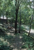
Title (German)
Carona TI, Wanderweg bei der Madonna d'Ongero
Caption
Pedestrian walking on footpath in shady deciduous forest, general view; keywords Documenta Natura: exhibition
Caption (German)
Fussgänger beim Spazieren auf Wanderweg im schattigen Laubwald, Gesamtansicht; Schlagworte Documenta Natura: Ausstellung
Record Name
Dia_303-36497

Title (German)
Carona TI, Wanderweg bei der Madonna d'Ongero
Caption
Pedestrian walking on footpath in shady deciduous forest, general view; keywords Documenta Natura: exhibition
Caption (German)
Fussgänger beim Spazieren auf Wanderweg im schattigen Laubwald, Gesamtansicht; Schlagworte Documenta Natura: Ausstellung
Record Name
Dia_303-36499

Title (German)
Carona TI, Wanderweg bei der Madonna d'Ongero
Caption
Hiking trail in shady deciduous forest, general view; keywords Documenta Natura: exhibition
Caption (German)
Wanderweg im schattigen Laubwald, Gesamtansicht; Schlagworte Documenta Natura: Ausstellung
Record Name
Dia_303-36502

Title (German)
Ittigen BE, Cafeteria, 4. Stock im Wahli-Gebäude, Worblentalstrasse 32, Ittigen-Papiermühle
Caption
Views of the SAEFL traveling exhibition "Man and his Environment" in the cafeteria of the Wahli building, partial view; keywords Documenta Natura: exhibition.
Caption (German)
Ansichten der BUWAL-Wanderausstellung "Der Mensch und seine Umwelt" in der Cafeteria des Wahli-Gebäudes, Teilansicht; Schlagworte Documenta Natura: Ausstellung
Record Name
Dia_303-36505

Title (German)
Ittigen BE, Cafeteria, 4. Stock im Wahli-Gebäude, Worblentalstrasse 32, Ittigen-Papiermühle
Caption
Views of the SAEFL traveling exhibition "Man and his Environment" in the cafeteria of the Wahli building, partial view; keywords Documenta Natura: exhibition.
Caption (German)
Ansichten der BUWAL-Wanderausstellung "Der Mensch und seine Umwelt" in der Cafeteria des Wahli-Gebäudes, Teilansicht; Schlagworte Documenta Natura: Ausstellung
Record Name
Dia_303-36509
Title (German)
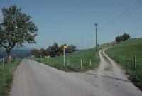
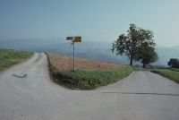
Fahrni b. Thun BE, Bei Lueg
Caption
Road junction outside town with asphalted road and gravel path, with hiking sign, in cultural landscape (with fields, meadows, hedges and trees), partial views; keywords Documenta Natura: road
Caption (German)
Strassengabelung ausserorts mit asphaltierter Strasse und Kiesweg, mit Wanderwegweiser, in Kulturlandschaft (mit Äcker, Wiesen, Hecken und Bäumen), Teilansichten; Schlagworte Documenta Natura: Strasse
Record Name
Dia_303-36545

Title (German)
Fahrni b. Thun BE, Bei Lueg
Caption
Road junction outside town with asphalted road and gravel path, with hiking sign, in cultural landscape (with fields, meadows, hedges and trees), partial views; keywords Documenta Natura: road
Caption (German)
Strassengabelung ausserorts mit asphaltierter Strasse und Kiesweg, mit Wanderwegweiser, in Kulturlandschaft (mit Äcker, Wiesen, Hecken und Bäumen), Teilansichten; Schlagworte Documenta Natura: Strasse
Record Name
Dia_303-36550

Title (German)
Fahrni b. Thun BE, Bei Lueg
Caption
Road junction outside town with asphalted road and gravel path, with hiking sign, in cultural landscape (with fields, meadows and trees), partial views; keywords Documenta Natura: road
Caption (German)
Strassengabelung ausserorts mit asphaltierter Strasse und Kiesweg, mit Wanderwegweiser, in Kulturlandschaft (mit Äcker, Wiesen und Bäumen), Teilansichten; Schlagworte Documenta Natura: Strasse
Record Name
Dia_303-36555
Title (German)
Fahrni b. Thun BE, Bei Lueg
Caption
Road junction outside town with asphalted road and gravel path, with hiking sign, in cultural landscape (with fields, meadows and trees), partial views; keywords Documenta Natura: road
Caption (German)
Strassengabelung ausserorts mit asphaltierter Strasse und Kiesweg, mit Wanderwegweiser, in Kulturlandschaft (mit Äcker, Wiesen und Bäumen), Teilansichten; Schlagworte Documenta Natura: Strasse
Record Name
Dia_303-36560

Title (German)
Rüeggisberg BE, Nordansicht der Weiler Cheer und Bodmatt bei Brügglen
Caption
North view of the hamlets Cheer and Hofmatt with farm development, farm roads in between pasture land and arable land, general view; keywords Documenta Natura: Weiler
Caption (German)
Nordansicht der Weiler Cheer und Hofmatt mit Hoferschliessung, Bewirtschaftungsstrassen dazwischen Weidland und Ackerland, Gesamtansicht; Schlagworte Documenta Natura: Weiler
Record Name
Dia_303-36565

Title (German)
Rüeggisberg BE, Nordansicht der Weiler Cheer und Bodmatt bei Brügglen
Caption
North view of the hamlets Cheer and Hofmatt with farm development, farm roads in between pasture land and arable land, general view; keywords Documenta Natura: Weiler
Caption (German)
Nordansicht der Weiler Cheer und Hofmatt mit Hoferschliessung, Bewirtschaftungsstrassen dazwischen Weidland und Ackerland, Gesamtansicht; Schlagworte Documenta Natura: Weiler
Record Name
Dia_303-36570

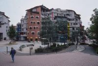
Title (German)
Genève GE, In der Überbauung Les Schtroumpfs im Quartier Les Grottes
Caption
Park-like environmental design in the Les Schtroumpfs development with residential blocks, footpaths, small forest with (old) trees and meadows, partial view; keywords Documenta Natura: City
Caption (German)
Parkähnliche Umgebungsgestaltung in der Überbauung Les Schtroumpfs mit Wohnblöcken, Fusswegen, kleinem Wald mit (alten) Bäumen und Wiesen, Teilansicht; Schlagworte Documenta Natura: Stadt
Record Name
Dia_303-36592

Title (German)
Genève GE, In der Überbauung Les Schtroumpfs im Quartier Les Grottes
Caption
Park-like environmental design in the Les Schtroumpfs development with residential blocks, footpaths, small forest with (old) trees and meadows, partial view; keywords Documenta Natura: City
Caption (German)
Parkähnliche Umgebungsgestaltung in der Überbauung Les Schtroumpfs mit Wohnblöcken, Fusswegen, kleinem Wald mit (alten) Bäumen und Wiesen, Teilansicht; Schlagworte Documenta Natura: Stadt
Record Name
Dia_303-36597

Title (German)
Genève GE, In der Überbauung Les Schtroumpfs im Quartier Les Grottes
Caption
Park-like landscaping in the Les Schtroumpfs development with apartment blocks, playground, trees and meadows, partial view; keywords Documenta Natura: City.
Caption (German)
Parkähnliche Umgebungsgestaltung in der Überbauung Les Schtroumpfs mit Wohnblöcken, Spielplatz, Bäumen und Wiesen, Teilansicht; Schlagworte Documenta Natura: Stadt
Record Name
Dia_303-36600

Title (German)
Genève GE, In der Überbauung Les Schtroumpfs im Quartier Les Grottes
Caption
Park-like landscaping in the Les Schtroumpfs development with apartment blocks, playground, trees and meadows, partial view; keywords Documenta Natura: City.
Caption (German)
Parkähnliche Umgebungsgestaltung in der Überbauung Les Schtroumpfs mit Wohnblöcken, Spielplatz, Bäumen und Wiesen, Teilansicht; Schlagworte Documenta Natura: Stadt
Record Name
Dia_303-36605

Title (German)
Genève GE, In der Überbauung Les Schtroumpfs im Quartier Les Grottes
Caption
Park-like landscaping in the Les Schtroumpfs development with apartment blocks, playground, trees and meadows, partial view; keywords Documenta Natura: City.
Caption (German)
Parkähnliche Umgebungsgestaltung in der Überbauung Les Schtroumpfs mit Wohnblöcken, Spielplatz, Bäumen und Wiesen, Teilansicht; Schlagworte Documenta Natura: Stadt
Record Name
Dia_303-36607

Title (German)
Genève GE, In der Überbauung Les Schtroumpfs im Quartier Les Grottes
Caption
Park-like landscaping in the Les Schtroumpfs development with apartment blocks, school building with playground with playing children, partial view; keywords Documenta Natura: city
Caption (German)
Parkähnliche Umgebungsgestaltung in der Überbauung Les Schtroumpfs mit Wohnblöcken, Schulhaus mit Pausenplatz mit spielenden Kindern, Teilansicht; Schlagworte Documenta Natura: Stadt
Record Name
Dia_303-36609

Title (German)
Genève GE, In der Überbauung Les Schtroumpfs im Quartier Les Grottes
Caption
Park-like landscaping in the Les Schtroumpfs development, partial view; keywords Documenta Natura: city
Caption (German)
Parkähnliche Umgebungsgestaltung in der Überbauung Les Schtroumpfs, Teilansicht; Schlagworte Documenta Natura: Stadt
Record Name
Dia_303-36614
Title (German)
Genève GE, In der Überbauung Les Schtroumpfs im Quartier Les Grottes
Caption
Park-like landscaping in the Les Schtroumpfs development, partial view; keywords Documenta Natura: city
Caption (German)
Parkähnliche Umgebungsgestaltung in der Überbauung Les Schtroumpfs, Teilansicht; Schlagworte Documenta Natura: Stadt
Record Name
Dia_303-36617

Title (German)
Genève GE, In der Überbauung Les Schtroumpfs im Quartier Les Grottes
Caption
Park-like landscaping in the Les Schtroumpfs development with apartment blocks, footpaths, (old) trees and meadows, partial view; keywords Documenta Natura: City
Caption (German)
Parkähnliche Umgebungsgestaltung in der Überbauung Les Schtroumpfs mit Wohnblöcken, Fusswegen, (alten) Bäumen und Wiesen, Teilansicht; Schlagworte Documenta Natura: Stadt
Record Name
Dia_303-36619

Title (German)
Genève GE, In der Überbauung Les Schtroumpfs im Quartier Les Grottes
Caption
Superstructure Les Schtroumpfs with residential blocks, partial view; keywords Documenta Natura: recreation area.
Caption (German)
Überbauung Les Schtroumpfs mit Wohnblöcken, Teilansicht; Schlagworte Documenta Natura: Erholungsgebiet
Record Name
Dia_303-36623
Title (German)
Lugano TI, Auf dem Monte Brè sopra Lugano
Caption
Pedestrians resting in shady deciduous forest, partial view ; keywords Documenta Natura: recreation area
Caption (German)
Fussgänger beim Ausruhen im schattigen Laubwald, Teilansicht ; Schlagworte Documenta Natura: Erholungsgebiet
Record Name
Dia_303-36625

Title (German)
Lugano TI, Auf dem Monte Brè sopra Lugano
Caption
Pedestrian resting in deciduous forest with clearing, partial view ; keywords Documenta Natura: recreation area
Caption (German)
Fussgänger beim Ausruhen im Laubwald mit Lichtung, Teilansicht ; Schlagworte Documenta Natura: Erholungsgebiet
Record Name
Dia_303-36631

Title (German)
Lugano TI, Auf dem Monte Brè sopra Lugano
Caption
Pedestrian walking in shady deciduous forest with clearing, partial view ; keywords Documenta Natura: recreation area
Caption (German)
Fussgänger beim Spazieren im schattigen Laubwald mit Lichtung, Teilansicht ; Schlagworte Documenta Natura: Erholungsgebiet
Record Name
Dia_303-36642

Title (German)
Lugano TI, Auf dem Monte Brè sopra Lugano
Caption
Pedestrian walking in shady deciduous forest with clearing, partial view ; keywords Documenta Natura: recreation area
Caption (German)
Fussgänger beim Spazieren im schattigen Laubwald mit Lichtung, Teilansicht ; Schlagworte Documenta Natura: Erholungsgebiet
Record Name
Dia_303-36647

Title (German)
Lugano TI, Auf dem Monte Brè sopra Lugano
Caption
Pedestrian walking in shady deciduous forest with clearing, partial view ; keywords Documenta Natura: recreation area
Caption (German)
Fussgänger beim Spazieren im schattigen Laubwald mit Lichtung, Teilansicht ; Schlagworte Documenta Natura: Erholungsgebiet
Record Name
Dia_303-36654

Title (German)
Lugano TI, Auf dem Monte Brè sopra Lugano
Caption
Pedestrian resting in deciduous forest with clearing, partial view; keywords Documenta Natura: recreation area
Caption (German)
Fussgänger beim Ausruhen im Laubwald mit Lichtung, Teilansicht; Schlagworte Documenta Natura: Erholungsgebiet
Record Name
Dia_303-36655

Title (German)
Lugano TI, Auf dem Monte Brè sopra Lugano
Caption
Pedestrian resting in deciduous forest with clearing, partial view; keywords Documenta Natura: recreation area
Caption (German)
Fussgänger beim Ausruhen im Laubwald mit Lichtung, Teilansicht; Schlagworte Documenta Natura: Erholungsgebiet
Record Name
Dia_303-36658

Title (German)
Lugano TI, Auf dem Monte Brè sopra Lugano
Caption
Pedestrians picnicking and resting in deciduous forest with clearing, partial view; keywords Documenta Natura: recreation area
Caption (German)
Fussgänger beim Picknicken und Ausruhen im Laubwald mit Lichtung, Teilansicht; Schlagworte Documenta Natura: Erholungsgebiet
Record Name
Dia_303-36677

Title (German)
Lugano TI, Auf dem Monte Brè sopra Lugano
Caption
Pedestrian walking in deciduous forest with clearing, partial view ; keywords Documenta Natura: recreation area
Caption (German)
Fussgänger beim Spazieren im Laubwald mit Lichtung, Teilansicht ; Schlagworte Documenta Natura: Erholungsgebiet
Record Name
Dia_303-36684

Title (German)
Lugano TI, Auf dem Monte Brè sopra Lugano
Caption
Pedestrian walking in deciduous forest with clearing, partial view ; keywords Documenta Natura: recreation area
Caption (German)
Fussgänger beim Spazieren im Laubwald mit Lichtung, Teilansicht ; Schlagworte Documenta Natura: Erholungsgebiet
Record Name
Dia_303-36689

Title (German)
Lugano TI, Auf dem Monte Brè sopra Lugano
Caption
Pedestrian walking in deciduous forest with clearing, partial view ; keywords Documenta Natura: city
Caption (German)
Fussgänger beim Spazieren im Laubwald mit Lichtung, Teilansicht ; Schlagworte Documenta Natura: Stadt
Record Name
Dia_303-36692

Title (German)
Genève GE, Wohnstrassen Rue du Midi und Rue des Grottes im Quartier Les Grottes
Caption
Residential streets Rue du Midi and Rue des Grottes with flower pots and bollards at the roadside, elevated and narrowed street sections, offset street layout and angled parking spaces, partial view; keywords Documenta Natura: city
Caption (German)
Wohnstrassen Rue du Midi und Rue des Grottes mit Blumentöpfen und Poller am Strassenrand, erhöhten und verengten Strassenabschnitten, versetztem Strassenverlauf und Schrägparkplätzen, Teilansicht; Schlagworte Documenta Natura: Stadt
Record Name
Dia_303-36695

Title (German)
Genève GE, Wohnstrassen Rue du Midi und Rue des Grottes im Quartier Les Grottes
Caption
Residential streets Rue du Midi and Rue des Grottes with flower pots and bollards at the roadside, elevated and narrowed street sections, offset street layout and angled parking spaces, partial view; keywords Documenta Natura: city
Caption (German)
Wohnstrassen Rue du Midi und Rue des Grottes mit Blumentöpfen und Poller am Strassenrand, erhöhten und verengten Strassenabschnitten, versetztem Strassenverlauf und Schrägparkplätzen, Teilansicht; Schlagworte Documenta Natura: Stadt
Record Name
Dia_303-36700

Title (German)
Genève GE, Wohnstrassen Rue du Midi und Rue des Grottes im Quartier Les Grottes
Caption
Residential streets Rue du Midi and Rue des Grottes with flower pots and bollards at the roadside, elevated and narrowed street sections, staggered road course and angled parking spaces, intersection with planted tree (lime tree), partial view; keywords Documenta Natura: city
Caption (German)
Wohnstrassen Rue du Midi und Rue des Grottes mit Blumentöpfen und Poller am Strassenrand, erhöhten und verengten Strassenabschnitten, versetztem Strassenverlauf und Schrägparkplätzen, Kreuzung mit gepflanztem Baum (Linde), Teilansicht; Schlagworte Documenta Natura: Stadt
Record Name
Dia_303-36703

Title (German)
Genève GE, Wohnstrassen Rue du Midi und Rue des Grottes im Quartier Les Grottes
Caption
Residential streets Rue du Midi and Rue des Grottes with flower pots and bollards at the roadside, elevated and narrowed street sections, staggered road course and angled parking spaces, intersection with planted tree (lime tree), partial view; keywords Documenta Natura: windthrow
Caption (German)
Wohnstrassen Rue du Midi und Rue des Grottes mit Blumentöpfen und Poller am Strassenrand, erhöhten und verengten Strassenabschnitten, versetztem Strassenverlauf und Schrägparkplätzen, Kreuzung mit gepflanztem Baum (Linde), Teilansicht; Schlagworte Documenta Natura: Windwurf
Record Name
Dia_303-36708
Title (German)
Mels SG, Vilters SG, Nordostansicht des Nordosthanges oberhalb Mels mit Neuenbergwald und z. T. Gamidaurspitz, im Vordergrund Grossfeld und Vorderberg
Caption
Northeast view of the northeast slope above Mels with windthrow damage in the Neuenberg forest, partial view; coordinates (LV03) of camera location: 751840/212953; keywords Documenta Natura: castle
Caption (German)
Nordostansicht des Nordosthanges oberhalb Mels mit Windwurfflächenschaden im Neuenbergwald, Teilansicht; Koordinaten (LV03) des Kamerastandorts: 751840/212953; Schlagworte Documenta Natura: Schloss
Record Name
Dia_303-36715

Title (German)
Mels SG, Vilters SG, Nordostansicht des Nordosthanges oberhalb Mels mit Neuenbergwald und z. T. Gamidaurspitz, im Vordergrund Grossfeld und Vorderberg
Caption
Northeast view of the northeast slope above Mels with windthrow damage in the Neuenberg forest, in the foreground scattered settlement Grossfeld and Vorderberg, general view; coordinates (LV03) of the camera location: 751840/212953; keywords Documenta Natura: Castle
Caption (German)
Nordostansicht des Nordosthanges oberhalb Mels mit Windwurfflächenschaden im Neuenbergwald, im Vordergrund Streusiedlung Grossfeld und Vorderberg, Gesamtansicht; Koordinaten (LV03) des Kamerastandorts: 751840/212953; Schlagworte Documenta Natura: Schloss
Record Name
Dia_303-36732

Title (German)
Pfäfers SG, Westansicht von Bläs, Vadura und Böden mit Westhang, Bläser Berg und Chemi
Caption
West view of Bläs, Vadura and soils with the windthrow damage in Brenntwald and Bläser Berg, counter slope view, partial view; coordinates (LV03) of the camera location: 754663/202765; keywords Documenta Natura: castle
Caption (German)
Westansicht von Bläs, Vadura und Böden mit dem Windwurfflächenschaden im Brenntwald und Bläser Berg, Gegenhangaufnahme, Teilansicht; Koordinaten (LV03) des Kamerastandorts: 754663/202765; Schlagworte Documenta Natura: Schloss
Record Name
Dia_303-36743

Title (German)
Pfäfers SG, Westansicht von Bläs, Vadura und Böden mit Westhang, Bläser Berg und Chemi
Caption
West view of Bläs, Vadura and soils with the windthrow damage in Brenntwald and Bläser Berg, opposite slope view, partial view; coordinates (LV03) of the camera location: 754825/202463; keywords Documenta Natura: street
Caption (German)
Westansicht von Bläs, Vadura und Böden mit dem Windwurfflächenschaden im Brenntwald und Bläser Berg, Gegenhangaufnahme, Teilansicht; Koordinaten (LV03) des Kamerastandorts: 754825/202463; Schlagworte Documenta Natura: Strasse
Record Name
Dia_303-36753

Title (German)
Pfäfers SG, Westansicht von Bläs, Vadura und Böden mit Westhang, Bläser Berg und Chemi
Caption
West view of Bläs, Vadura and Böden with the windthrow damage in Brenntwald and Bläser Berg, counter slope view, partial view; coordinates (LV03) of the camera location: 754825/202463; keywords Documenta Natura: Weiler
Caption (German)
Westansicht von Bläs, Vadura und Böden mit dem Windwurfflächenschaden im Brenntwald und Bläser Berg, Gegenhangaufnahme, Teilansicht; Koordinaten (LV03) des Kamerastandorts: 754825/202463; Schlagworte Documenta Natura: Weiler
Record Name
Dia_303-36759

Title (German)
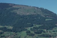
Entlebuch LU, Ostansicht der Aufforstung im Osthang mit den Weilern Folleneggli und Alpili, im Hintergrund Wissenegg und Alpiliegg
Caption
East view of the eastern slope with the afforestation and the hamlets of Folleneggli and Alpili, in the background Wissenegg and Alpiliegg, reverse slope view, partial view; coordinates (LV03) of the camera location: 653125/203620; keywords Documenta Natura: hamlets
Caption (German)
Ostansicht des Osthanges mit der Aufforstung und den Weilern Folleneggli und Alpili, im Hintergrund Wissenegg und Alpiliegg, Gegenhangaufnahme, Teilansicht; Koordinaten (LV03) des Kamerastandorts: 653125/203620; Schlagworte Documenta Natura: Weiler
Record Name
Dia_303-36765

Title (German)
Entlebuch LU, Nordwestansicht der Aufforstung im Nordwesthang des Risetenstock mit Risetenflüe, im Vordergrund die Alp Unterriseten
Caption
Northwest view of the reforestation in the northwest slope of Risetenstock with Risetenflüe, in the foreground the alpine settlement Unterriseten, partial view; coordinates (LV03) of the camera location: 653625/201920; keywords Documenta Natura: road
Caption (German)
Nordwestansicht der Aufforstung im Nordwesthang des Risetenstock mit Risetenflüe, im Vordergrund die Alpsiedlung Unterriseten, Teilansicht; Koordinaten (LV03) des Kamerastandorts: 653625/201920; Schlagworte Documenta Natura: Strasse
Record Name
Dia_303-36775

Title (German)
Alpnach OW, Südostansicht der Aufforstung im Südosthang des Risetenstock mit Bruderalpeli, Alpeli, im Vordergrund Tossenschwand
Caption
Southeast view of the afforestation in the southeast slope of the Risetenstock with Bruderalpeli, Alpeli, in the foreground the alpine settlement Tossenschwand, partial view; coordinates (LV03) of the camera location: 654640/200290; keywords Documenta Natura: exhibition
Caption (German)
Südostansicht der Aufforstung im Südosthang des Risetenstock mit Bruderalpeli, Alpeli, im Vordergrund die Alpsiedlung Tossenschwand, Teilansicht; Koordinaten (LV03) des Kamerastandorts: 654640/200290; Schlagworte Documenta Natura: Ausstellung
Record Name
Dia_303-36782

Title (German)
Escholzmatt LU, Nordostansicht der Aufforstung Häxenschwand mit Hürnliegg und Hürnli, im Vordergrund das Hilferntal mit den Torbachhöfen
Caption
Northeast view of the reforestation Häxenschwand with Hürnliegg and Hürnli, in the foreground the Hilferental with the Torbachhöfe, general view; coordinates (LV03) of the camera location: 639080/191520; keywords Documenta Natura: exhibition
Caption (German)
Nordostansicht der Aufforstung Häxenschwand mit Hürnliegg und Hürnli, im Vordergrund das Hilferental mit den Torbachhöfen, Gesamtansicht; Koordinaten (LV03) des Kamerastandorts: 639080/191520; Schlagworte Documenta Natura: Ausstellung
Record Name
Dia_303-36787

Title (German)
Escholzmatt LU, Ostansicht der Aufforstung am Hürnli mit Hürnliegg und Hürnlihütten
Caption
East view of the reforestation at Hürnli with Hürnliegg and Hürnlihütten, partial view; coordinates (LV03) of the camera location: 638560/189210; keywords Documenta Natura: exhibition
Caption (German)
Ostansicht der Aufforstung am Hürnli mit Hürnliegg und Hürnlihütten, Teilansicht; Koordinaten (LV03) des Kamerastandorts: 638560/189210; Schlagworte Documenta Natura: Ausstellung
Record Name
Dia_303-36792

Title (German)
Escholzmatt LU, Ostansicht der Aufforstung am Hürnli mit Hürnliegg und Hürnlihütten
Caption
East view of the reforestation at Hürnli with Hürnliegg and Hürnlihütten, partial view; coordinates (LV03) of the camera location: 638560/189210; keywords Documenta Natura: exhibition
Caption (German)
Ostansicht der Aufforstung am Hürnli mit Hürnliegg und Hürnlihütten, Teilansicht; Koordinaten (LV03) des Kamerastandorts: 638560/189210; Schlagworte Documenta Natura: Ausstellung
Record Name
Dia_303-36796

Title (German)
Escholzmatt LU, Ostansicht der Aufforstung am Hürnli mit Hürnliegg und Hürnlihütten
Caption
East view of the reforestation at Hürnli with Hürnliegg and Hürnlihütten, partial view; coordinates (LV03) of the camera location: 638500/189050; keywords Documenta Natura: exhibition
Caption (German)
Ostansicht der Aufforstung am Hürnli mit Hürnliegg und Hürnlihütten, Teilansicht; Koordinaten (LV03) des Kamerastandorts: 638500/189050; Schlagworte Documenta Natura: Ausstellung
Record Name
Dia_303-36800

Title (German)
Escholzmatt LU, Ostansicht der Aufforstung am Hürnli mit Hürnliegg und Hürnlihütten
Caption
East view of the afforestation at Hürnli with Hürnliegg and Hürnlihütten, partial view; coordinates (LV03) of the camera location: 638500/189050; keywords Documenta Natura: road
Caption (German)
Ostansicht der Aufforstung am Hürnli mit Hürnliegg und Hürnlihütten, Teilansicht; Koordinaten (LV03) des Kamerastandorts: 638500/189050; Schlagworte Documenta Natura: Strasse
Record Name
Dia_303-36804

Title (German)
Hasle LU, Schüpfheim LU, Südostansicht der Farneren und des First von der Schafmatt aus gesehen
Caption
Southeast view of Farneren and Ridge, seen from Schafmatt, general view; coordinates (LV03) of camera location: 6476ff/1958ff; keywords Documenta Natura: mountain area.
Caption (German)
Südostansicht der Farneren und des First, von der Schafmatt aus gesehen, Gesamtansicht; Koordinaten (LV03) des Kamerastandorts: 6476ff/1958ff; Schlagworte Documenta Natura: Berggebiet
Record Name
Dia_303-36811

Title (German)
Giswil OW, Nordwestansicht der Aufforstungen Teufimatt mit Rotbachgraben, im Vordergrund der Hof Vorder Rüchi, im Hintergrund die Gebirgskette mit dem Bärenturm, Haldimattstock und Bleikenchopf und Bleikenchopf
Caption
Northwest view of the Teufimatt afforestation with Rotbachgraben, in the foreground the Vorder Rüchi farm, in the background the mountain range with the Bärenturm, Haldimattstock and Bleikenchopf, partial view; coordinates (LV03) of the camera location: 646160/191730; keywords Documenta Natura: afforestation, mountain forest, landscape change
Caption (German)
Nordwestansicht der Aufforstungen Teufimatt mit Rotbachgraben, im Vordergrund der Hof Vorder Rüchi, im Hintergrund die Gebirgskette mit dem Bärenturm, Haldimattstock und Bleikenchopf, Teilansicht; Koordinaten (LV03) des Kamerastandorts: 646160/191730; Schlagworte Documenta Natura: Aufforstung, Gebirgswald, Landschaftswandel
Record Name
Dia_303-36815

Title (German)
Hasle LU, Westansicht der Rutschung im Nordwesthang unterhalb des Schimbrig mit den Weilern Aeschitannen, Schluck und Rossloch
Caption
West view of the landslide on the northwest slope of Schimbrig with forest, meadows and the hamlets of Aeschitannen, Schluck and Rossloch, general view; coordinates (LV03) of the camera location: 649300/199360; keywords Documenta Natura: landslide, mountain forest, mountain area
Caption (German)
Westansicht der Rutschung im Nordwesthang des Schimbrig mit Wald, Wiesen und den Weilern Aeschitannen, Schluck und Rossloch, Gesamtansicht; Koordinaten (LV03) des Kamerastandorts: 649300/199360; Schlagworte Documenta Natura: Rutschung, Gebirgswald, Berggebiet
Record Name
Dia_303-36821

Title (German)
Hasle LU, Nordwestansicht der Rutschung im Nordwesthang unterhalb des Schimbrig mit den Weilern Schluck und Rossloch, im Vordergrund das Rosslochmoos
Caption
Northwest view of the landslide in the northwest slope of Schimbrig with meadows, forest, road and the hamlets Schluck and Rossloch, in the foreground the Rosslochmoos, general view; coordinates (LV03) of the camera location: 649710/199790; keywords Documenta Natura: landslide, mountain forest, mountain area
Caption (German)
Nordwestansicht der Rutschung im Nordwesthang des Schimbrig mit Wiesen, Wald, Strasse und den Weilern Schluck und Rossloch, im Vordergrund das Rosslochmoos, Gesamtansicht; Koordinaten (LV03) des Kamerastandorts: 649710/199790; Schlagworte Documenta Natura: Rutschung, Gebirgswald, Berggebiet
Record Name
Dia_303-36829

Title (German)
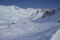
Hasliberg BE, Südwestansicht der Mägisalp mit Undere Stafel, z. T. mit neuer 4er-Sesselumlaufbahn, Talstation Glogghüs 1 und Gebirgskette mit Fulenberg, Glogghüs und Rothorn
Caption
Southwest view of Mägisalp, in the foreground alpine settlement Undere Stafel, in the background the mountain range with Fulenberg, Glogghüs, Rothorn, first photo (1991) snow-free, partial view; coordinates (LV03) of the camera location: 661113/177925; keywords Documenta Natura: mountain railroad, high mountains, winter sportsmen, leveling, erosion
Caption (German)
Südwestansicht der Mägisalp, im Vordergrund Alpsiedlung Undere Stafel, im Hintergrund die Gebirgskette mit Fulenberg, Glogghüs, Rothorn, Erstaufnahme (1991) schneefrei, Teilansicht; Koordinaten (LV03) des Kamerastandorts: 661113/177925; Schlagworte Documenta Natura: Bergbahn, Hochgebirge, Wintersportler, Planierung, Erosion
Record Name
Dia_303-36839
Title (German)
Hasliberg BE, Südwestansicht der Mägisalp mit Undere Stafel, z. T. mit neuer 4er-Sesselumlaufbahn, Talstation Glogghüs 1 und Gebirgskette mit Fulenberg, Glogghüs und Rothorn
Caption
Southwest view of Mägisalp, in the foreground alpine settlement Undere Stafel, in the background the mountain range with Fulenberg, Glogghüs, Rothorn, alternative photo (1992) snow-covered, partial view; coordinates (LV03) of camera location: 661113/177925; keywords Documenta Natura: mountain railroad, high mountains, winter sportsmen, leveling, erosion
Caption (German)
Südwestansicht der Mägisalp, im Vordergrund Alpsiedlung Undere Stafel, im Hintergrund die Gebirgskette mit Fulenberg, Glogghüs, Rothorn, Alternativaufnahme (1992) schneebedeckt, Teilansicht; Koordinaten (LV03) des Kamerastandorts: 661113/177925; Schlagworte Documenta Natura: Bergbahn, Hochgebirge, Wintersportler, Planierung, Erosion
Record Name
Dia_303-36856

Title (German)
Hasliberg BE, Südwestansicht der Mägisalp mit Undere Stafel, z. T. mit neuer 4er-Sesselumlaufbahn, Talstation Glogghüs 1 und Gebirgskette mit Fulenberg, Glogghüs und Rothorn
Caption
Southwest view of Mägisalp, in the foreground alpine settlement Undere Stafel, in the background the mountain range with Fulenberg, Glogghüs, Rothorn, 2nd photo. Follow-up photo with the new 4-seater chair lift and new construction or extension of the alpine huts, in the foreground grading with the valley station Glogghüs 1, snow-covered (1993), partial view; coordinates (LV03) of the camera location: 661113/177925; keywords Documenta Natura: mountain railroad, high mountains, winter sportsmen, grading, erosion
Caption (German)
Südwestansicht der Mägisalp, im Vordergrund Alpsiedlung Undere Stafel, im Hintergrund die Gebirgskette mit Fulenberg, Glogghüs, Rothorn, 2. Folgeaufnahme mit der neuen 4er-Sesselumlaufbahn und Neubau oder Ausbau der Alphütten, im Vordergrund Planierung mit der Talstation Glogghüs 1, schneebedeckt (1993), Teilansicht; Koordinaten (LV03) des Kamerastandorts: 661113/177925; Schlagworte Documenta Natura: Bergbahn, Hochgebirge, Wintersportler, Planierung, Erosion
Record Name
Dia_303-36872

Title (German)
Hasliberg BE, Südwestansicht der Mägisalp mit Undere Stafel, z. T. mit neuer 4er-Sesselumlaufbahn, Talstation Glogghüs 1 und Gebirgskette mit Fulenberg, Glogghüs und Rothorn
Caption
Southwest view of Mägisalp, in the foreground alpine settlement Undere Stafel, in the background the mountain range with Fulenberg, Glogghüs, Rothorn, 3rd photo. Follow-up photo with the new 4-seater chair lift and new construction or expansion of the alpine huts, in the foreground grading with the valley station Glogghüs 1, snow-free (1993), partial view; coordinates (LV03) of the camera location: 661111/177923; keywords Documenta Natura: mountain railroad, high mountains, winter sportsmen, grading, erosion
Caption (German)
Südwestansicht der Mägisalp, im Vordergrund Alpsiedlung Undere Stafel, im Hintergrund die Gebirgskette mit Fulenberg, Glogghüs, Rothorn, 3. Folgeaufnahme mit der neuen 4er-Sesselumlaufbahn und Neubau oder Ausbau der Alphütten, im Vordergrund Planierung mit der Talstation Glogghüs 1, schneefrei (1993), Teilansicht; Koordinaten (LV03) des Kamerastandorts: 661111/177923; Schlagworte Documenta Natura: Bergbahn, Hochgebirge, Wintersportler, Planierung, Erosion
Record Name
Dia_303-36885

Title (German)
Hasliberg BE, Südwestansicht der Mägisalp mit Undere Stafel, z. T. mit neuer 4er-Sesselumlaufbahn, Talstation Glogghüs 1 und Gebirgskette mit Fulenberg, Glogghüs und Rothorn
Caption
Southwest view of Mägisalp, in the foreground alpine settlement Undere Stafel, in the background the mountain range with Fulenberg, Glogghüs, Rothorn, 4th follow-up image after 4 years, snow-free (1997), partial view; coordinates (LV03) of camera location: 661113/177925; keywords Documenta Natura: mountain railroad, high mountains, winter sportsmen, leveling, erosion
Caption (German)
Südwestansicht der Mägisalp, im Vordergrund Alpsiedlung Undere Stafel, im Hintergrund die Gebirgskette mit Fulenberg, Glogghüs, Rothorn, 4. Folgeaufnahme nach 4 Jahren, schneefrei (1997), Teilansicht; Koordinaten (LV03) des Kamerastandorts: 661113/177925; Schlagworte Documenta Natura: Bergbahn, Hochgebirge, Wintersportler, Planierung, Erosion
Record Name
Dia_303-36893

Title (German)
Hasliberg BE, Südwestansicht der Mägisalp mit Undere Stafel, z. T. mit neuer 4er-Sesselumlaufbahn, Talstation Glogghüs 1 und Gebirgskette mit Fulenberg, Glogghüs und Rothorn
Caption
Southwest view of Mägisalp, in the foreground alpine settlement Undere Stafel, in the background the mountain range with Fulenberg, Glogghüs, Rothorn, 5th follow-up image after 12 years, snow-free (2005), partial view; coordinates (LV03) of the camera location: 661113/177925; keywords Documenta Natura: mountain railroad, high mountains, winter sportsmen, leveling, erosion
Caption (German)
Südwestansicht der Mägisalp, im Vordergrund Alpsiedlung Undere Stafel, im Hintergrund die Gebirgskette mit Fulenberg, Glogghüs, Rothorn, 5.Folgeaufnahme nach 12 Jahren, schneefrei (2005), Teilansicht; Koordinaten (LV03) des Kamerastandorts: 661113/177925; Schlagworte Documenta Natura: Bergbahn, Hochgebirge, Wintersportler, Planierung, Erosion
Record Name
Dia_303-36901
Title (German)
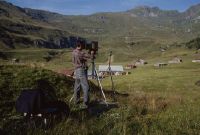
Hasliberg BE, Auf Mägisalp bei Undere Stafel
Caption
Documenta Natura photographer Hans Kobi taking pictures with a view camera, on tripod, in the middle of an alpine meadow, general view; keywords Documenta Natura: mountain railroad, high mountains, winter sportsmen, leveling, erosion
Caption (German)
Documenta Natura-Fotograf Hans Kobi beim Fotografieren mit der Fachkamera, auf Stativ, inmitten einer Alpwiese, Gesamtansicht; Schlagworte Documenta Natura: Bergbahn, Hochgebirge, Wintersportler, Planierung, Erosion
Record Name
Dia_303-36912

Title (German)
Hasliberg BE, Südansicht der Mägisalp mit Undere Stafel, Leitistöck, Hohsträss, Fulenberg und z. T. Glogghüs, im Vordergrund die 4er-Sesselumlaufbahn
Caption
South view of Mägisalp with alpine settlement Undere Stafel, mountain range with Leitistöck, Hohsträss, Fulenberg and partly Glogghüs, first photo (1991), partial view; coordinates (LV03) of camera location: 661870/178030; keywords Documenta Natura: mountain railroad, high mountains, winter sportsmen, leveling, erosion
Caption (German)
Südansicht der Mägisalp mit Alpsiedlung Undere Stafel, Gebirgskette mit Leitistöck, Hohsträss, Fulenberg und teilweise Glogghüs, Erstaufnahme (1991), Teilansicht; Koordinaten (LV03) des Kamerastandorts: 661870/178030; Schlagworte Documenta Natura: Bergbahn, Hochgebirge, Wintersportler, Planierung, Erosion
Record Name
Dia_303-36915

Title (German)
Hasliberg BE, Südansicht der Mägisalp mit Undere Stafel, Leitistöck, Hohsträss, Fulenberg und z. T. Glogghüs, im Vordergrund die 4er-Sesselumlaufbahn
Caption
South view of Mägisalp with alpine settlement Undere Stafel, mountain range with Leitistöck, Hohsträss, Fulenberg and partly Glogghüs, first photo (1991), partial view; coordinates (LV03) of camera location: 661870/178030; keywords Documenta Natura: mountain railroad, high mountains, winter sportsmen, leveling, erosion
Caption (German)
Südansicht der Mägisalp mit Alpsiedlung Undere Stafel, Gebirgskette mit Leitistöck, Hohsträss, Fulenberg und teilweise Glogghüs, Erstaufnahme (1991), Teilansicht; Koordinaten (LV03) des Kamerastandorts: 661870/178030; Schlagworte Documenta Natura: Bergbahn, Hochgebirge, Wintersportler, Planierung, Erosion
Record Name
Dia_303-36923

Title (German)
Hasliberg BE, Südansicht der Mägisalp mit Undere Stafel, Leitistöck, Hohsträss, Fulenberg und z. T. Glogghüs, im Vordergrund die 4er-Sesselumlaufbahn
Caption
South view of Mägisalp with alpine settlement Undere Stafel, mountain range with Leitistöck, Hohsträss, Fulenberg and partly Glogghüs, 1st follow-up photograph after the construction of the 4-seater chair lift (1993), partial view; coordinates (LV03) of the camera location: 661870/178030; keywords Documenta Natura: mountain railroad, high mountains, winter sportsmen, grading, erosion
Caption (German)
Südansicht der Mägisalp mit Alpsiedlung Undere Stafel, Gebirgskette mit Leitistöck, Hohsträss, Fulenberg und teilweise Glogghüs, 1. Folgeaufnahme nach dem Bau der 4er-Sesselumlaufbahn (1993), Teilansicht; Koordinaten (LV03) des Kamerastandorts: 661870/178030; Schlagworte Documenta Natura: Bergbahn, Hochgebirge, Wintersportler, Planierung, Erosion
Record Name
Dia_303-36935

Title (German)
Hasliberg BE, Südansicht der Mägisalp mit Undere Stafel, Leitistöck, Hohsträss, Fulenberg und z. T. Glogghüs, im Vordergrund die 4er-Sesselumlaufbahn
Caption
South view of Mägisalp with alpine settlement Undere Stafel, mountain range with Leitistöck, Hohsträss, Fulenberg and partly Glogghüs, 1st follow-up photo after the construction of the 4-seater chair lift (1993), partial view; coordinates (LV03) of the camera location: 661870/178030; keywords Documenta Natura: mountain railroad, high mountains, winter sportsmen, grading, erosion
Caption (German)
Südansicht der Mägisalp mit Alpsiedlung Undere Stafel, Gebirgskette mit Leitistöck, Hohsträss, Fulenberg und teilweise Glogghüs, 1. Folgeaufnahme nach dem Bau der 4er-Sesselumlaufbahn (1993), Teilansicht; Koordinaten (LV03) des Kamerastandorts: 661870/178030; Schlagworte Documenta Natura: Bergbahn, Hochgebirge, Wintersportler, Planierung, Erosion
Record Name
Dia_303-36944

Title (German)
Hasliberg BE, Südansicht von Hirsnollen und Hääggen mit Fulenberg und Glogghüs
Caption
South view of Hirsnollen and Hääggen with Fulenberg and Glogghüs, first photograph (1991) general view; coordinates (LV03) of camera location: 662045/177978; keywords Documenta Natura: mountain railroad, high mountains, winter sportsmen, leveling, erosion
Caption (German)
Südansicht von Hirsnollen und Hääggen mit Fulenberg und Glogghüs, Erstaufnahme (1991) Gesamtansicht; Koordinaten (LV03) des Kamerastandorts: 662045/177978; Schlagworte Documenta Natura: Bergbahn, Hochgebirge, Wintersportler, Planierung, Erosion
Record Name
Dia_303-36956

Title (German)
Hasliberg BE, Südansicht von Hirsnollen und Hääggen mit Fulenberg und Glogghüs
Caption
South view of Hirsnollen with Fulenberg, 1st subsequent photograph (1993) after the construction of the chairlift with the middle stations on Hääggen and the top station below Glogghüs, general view; coordinates (LV03) of the camera location: 662045/177978; keywords Documenta Natura: mountain railroad, high mountains, winter sportsmen, leveling, erosion
Caption (German)
Südansicht von Hirsnollen mit Fulenberg, 1. Folgeaufnahme (1993) nach dem Bau der Sesselbahn mit den Mittelstationen auf Hääggen und der Bergstation unterhalb Glogghüs, Gesamtansicht; Koordinaten (LV03) des Kamerastandorts: 662045/177978; Schlagworte Documenta Natura: Bergbahn, Hochgebirge, Wintersportler, Planierung, Erosion
Record Name
Dia_303-36966

Title (German)
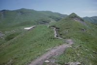
Hasliberg BE, Auf der Mägisalp, verschiedene Ansichten des Wanderweges bzw. Skipiste zwischen Hohsträss und Fulenberg
Caption
Views of the alpine pasture near Hohsträss and Fulenberg before the creation of the ski slope, with existing hiking trail, first photo taken in 1992, partial view; coordinates (LV03) of the camera location: 661100/179395; keywords Documenta Natura: mountain railroad, high mountains, winter sportsmen, grading, erosion
Caption (German)
Ansichten der Alpweide bei Hohsträss und Fulenberg vor dem Anlegen der Skipiste, mit bestehendem Wanderweg, Erstaufnahme 1992, Teilansicht; Koordinaten (LV03) des Kamerastandorts: 661100/179395; Schlagworte Documenta Natura: Bergbahn, Hochgebirge, Wintersportler, Planierung, Erosion
Record Name
Dia_303-36975

Title (German)
Hasliberg BE, Auf der Mägisalp, verschiedene Ansichten des Wanderweges bzw. Skipiste zwischen Hohsträss und Fulenberg
Caption
Views of the alpine pasture near Hohsträss and Fulenberg before the creation of the ski slope, with existing hiking trail, first photo taken in 1992, partial view; coordinates (LV03) of the camera location: 661100/179395; keywords Documenta Natura: mountain railroad, high mountains, winter sportsmen, grading, erosion
Caption (German)
Ansichten der Alpweide bei Hohsträss und Fulenberg vor dem Anlegen der Skipiste, mit bestehendem Wanderweg, Erstaufnahme 1992, Teilansicht; Koordinaten (LV03) des Kamerastandorts: 661100/179395; Schlagworte Documenta Natura: Bergbahn, Hochgebirge, Wintersportler, Planierung, Erosion
Record Name
Dia_303-36985

Title (German)
Hasliberg BE, Auf der Mägisalp, verschiedene Ansichten des Wanderweges bzw. Skipiste zwischen Hohsträss und Fulenberg
Caption
Views of the alpine pasture near Hohsträss and Fulenberg before the creation of the ski slope, with existing hiking trail, first photograph taken in 1992, partial view; coordinates (LV03) of the camera location: 661240/179520; keywords Documenta Natura: mountain railroad, high mountains, winter sportsmen, grading, erosion
Caption (German)
Ansichten der Alpweide bei Hohsträss und Fulenberg vor dem Anlegen der Skipiste, mit bestehendem Wanderweg, Erstaufnahme 1992, Teilansicht; Koordinaten (LV03) des Kamerastandorts: 661240/179520; Schlagworte Documenta Natura: Bergbahn, Hochgebirge, Wintersportler, Planierung, Erosion
Record Name
Dia_303-36995

Title (German)
Hasliberg BE, Auf der Mägisalp, verschiedene Ansichten des Wanderweges bzw. Skipiste zwischen Hohsträss und Fulenberg
Caption
Views of the alpine pasture near Hohsträss and Fulenberg before the creation of the ski slope, with existing hiking trail, first photograph taken in 1992, partial view; coordinates (LV03) of the camera location: 661418/179638; keywords Documenta Natura: mountain railroad, high mountains, winter sportsmen, grading, erosion
Caption (German)
Ansichten der Alpweide bei Hohsträss und Fulenberg vor dem Anlegen der Skipiste, mit bestehendem Wanderweg, Erstaufnahme 1992, Teilansicht; Koordinaten (LV03) des Kamerastandorts: 661418/179638; Schlagworte Documenta Natura: Bergbahn, Hochgebirge, Wintersportler, Planierung, Erosion
Record Name
Dia_303-37005

Title (German)
Hasliberg BE, Auf der Mägisalp, verschiedene Ansichten des Wanderweges bzw. Skipiste zwischen Hohsträss und Fulenberg
Caption
Views of the alpine pasture near Hohsträss and Fulenberg before the creation of the ski slope, with existing hiking trail, first photograph taken in 1992, partial view; coordinates (LV03) of the camera location: 661900/179810; keywords Documenta Natura: mountain railroad, high mountains, winter sportsmen, grading, erosion
Caption (German)
Ansichten der Alpweide bei Hohsträss und Fulenberg vor dem Anlegen der Skipiste, mit bestehendem Wanderweg, Erstaufnahme 1992, Teilansicht; Koordinaten (LV03) des Kamerastandorts: 661900/179810; Schlagworte Documenta Natura: Bergbahn, Hochgebirge, Wintersportler, Planierung, Erosion
Record Name
Dia_303-37015

Title (German)
Hasliberg BE, Auf der Mägisalp, verschiedene Ansichten des Wanderweges bzw. Skipiste zwischen Hohsträss und Fulenberg
Caption
Views of the alpine pasture near Hohsträss and Fulenberg before the creation of the ski slope, first photograph taken in 1992, partial view; coordinates (LV03) of the camera location: 661845/179803; keywords Documenta Natura: mountain railroad, high mountains, winter sportsmen, grading, erosion
Caption (German)
Ansichten der Alpweide bei Hohsträss und Fulenberg vor dem Anlegen der Skipiste, Erstaufnahme 1992, Teilansicht; Koordinaten (LV03) des Kamerastandorts: 661845/179803; Schlagworte Documenta Natura: Bergbahn, Hochgebirge, Wintersportler, Planierung, Erosion
Record Name
Dia_303-37025

Title (German)
Hasliberg BE, Auf der Mägisalp, verschiedene Ansichten des Wanderweges bzw. Skipiste zwischen Hohsträss und Fulenberg
Caption
Views of the alpine pasture near Hohsträss and Fulenberg before the creation of the ski slope, with existing hiking trail, first photograph taken in 1992, partial view; coordinates (LV03) of the camera location: 661695/179808; keywords Documenta Natura: mountain railroad, high mountains, winter sportsmen, grading, erosion
Caption (German)
Ansichten der Alpweide bei Hohsträss und Fulenberg vor dem Anlegen der Skipiste, mit bestehendem Wanderweg, Erstaufnahme 1992, Teilansicht; Koordinaten (LV03) des Kamerastandorts: 661695/179808; Schlagworte Documenta Natura: Bergbahn, Hochgebirge, Wintersportler, Planierung, Erosion
Record Name
Dia_303-37035

Title (German)
Hasliberg BE, Auf der Mägisalp, verschiedene Ansichten des Wanderweges bzw. Skipiste zwischen Hohsträss und Fulenberg
Caption
Views of the alpine pasture near Hohsträss and Fulenberg after the construction of the ski slope, with hiking trail, 1st follow-up photograph 1994, partial view; coordinates (LV03) of the camera location: 661100/179395; keywords Documenta Natura: mountain railroad, high mountains, winter sportsmen, leveling, erosion
Caption (German)
Ansichten der Alpweide bei Hohsträss und Fulenberg nach dem Anlegen der Skipiste, mit Wanderweg, 1. Folgeaufnahme 1994, Teilansicht; Koordinaten (LV03) des Kamerastandorts: 661100/179395; Schlagworte Documenta Natura: Bergbahn, Hochgebirge, Wintersportler, Planierung, Erosion
Record Name
Dia_303-37045
Title (German)
Hasliberg BE, Auf der Mägisalp, verschiedene Ansichten des Wanderweges bzw. Skipiste zwischen Hohsträss und Fulenberg
Caption
Views of the alpine pasture near Hohsträss and Fulenberg after the construction of the ski slope, with hiking trail, 1st follow-up photograph 1994, partial view; coordinates (LV03) of the camera location: 661100/179395; keywords Documenta Natura: mountain railroad, high mountains, winter sportsmen, leveling, erosion
Caption (German)
Ansichten der Alpweide bei Hohsträss und Fulenberg nach dem Anlegen der Skipiste, mit Wanderweg, 1. Folgeaufnahme 1994, Teilansicht; Koordinaten (LV03) des Kamerastandorts: 661100/179395; Schlagworte Documenta Natura: Bergbahn, Hochgebirge, Wintersportler, Planierung, Erosion
Record Name
Dia_303-37055

Title (German)
Hasliberg BE, Auf der Mägisalp, verschiedene Ansichten des Wanderweges bzw. Skipiste zwischen Hohsträss und Fulenberg
Caption
Views of the alpine pasture near Hohsträss and Fulenberg after the construction of the ski slope, with hiking trail, 1st follow-up photograph 1994, partial view; coordinates (LV03) of the camera location: 661240/179520; keywords Documenta Natura: mountain railroad, high mountains, winter sportsmen, leveling, erosion
Caption (German)
Ansichten der Alpweide bei Hohsträss und Fulenberg nach dem Anlegen der Skipiste, mit Wanderweg, 1. Folgeaufnahme 1994, Teilansicht; Koordinaten (LV03) des Kamerastandorts: 661240/179520; Schlagworte Documenta Natura: Bergbahn, Hochgebirge, Wintersportler, Planierung, Erosion
Record Name
Dia_303-37065

Title (German)
Hasliberg BE, Auf der Mägisalp, verschiedene Ansichten des Wanderweges bzw. Skipiste zwischen Hohsträss und Fulenberg
Caption
Views of the alpine pasture near Hohsträss and Fulenberg after the construction of the ski slope, with hiking trail, 1st follow-up photograph 1994, partial view; coordinates (LV03) of the camera location: 661418/179638; keywords Documenta Natura: mountain railroad, high mountains, winter sportsmen, leveling, erosion
Caption (German)
Ansichten der Alpweide bei Hohsträss und Fulenberg nach dem Anlegen der Skipiste, mit Wanderweg, 1. Folgeaufnahme 1994, Teilansicht; Koordinaten (LV03) des Kamerastandorts: 661418/179638; Schlagworte Documenta Natura: Bergbahn, Hochgebirge, Wintersportler, Planierung, Erosion
Record Name
Dia_303-37075
Title (German)
Hasliberg BE, Auf der Mägisalp, verschiedene Ansichten des Wanderweges bzw. Skipiste zwischen Hohsträss und Fulenberg
Caption
Views of the alpine pasture near Hohsträss and Fulenberg after the construction of the ski slope, with hiking trail, 1st follow-up photograph 1994, partial view; coordinates (LV03) of the camera location: 661900/179810; keywords Documenta Natura: mountain railroad, high mountains, winter sportsmen, leveling, erosion
Caption (German)
Ansichten der Alpweide bei Hohsträss und Fulenberg nach dem Anlegen der Skipiste, mit Wanderweg, 1. Folgeaufnahme 1994, Teilansicht; Koordinaten (LV03) des Kamerastandorts: 661900/179810; Schlagworte Documenta Natura: Bergbahn, Hochgebirge, Wintersportler, Planierung, Erosion
Record Name
Dia_303-37085

Title (German)
Hasliberg BE, Auf der Mägisalp, verschiedene Ansichten des Wanderweges bzw. Skipiste zwischen Hohsträss und Fulenberg
Caption
Views of the alpine pasture near Hohsträss and Fulenberg after the creation of the ski slope, 1st follow-up photograph 1994, partial view; coordinates (LV03) of the camera location: 661845/179803; keywords Documenta Natura: mountain railroad, high mountains, winter sportsmen, grading, erosion
Caption (German)
Ansichten der Alpweide bei Hohsträss und Fulenberg nach dem Anlegen der Skipiste, 1. Folgeaufnahme 1994, Teilansicht; Koordinaten (LV03) des Kamerastandorts: 661845/179803; Schlagworte Documenta Natura: Bergbahn, Hochgebirge, Wintersportler, Planierung, Erosion
Record Name
Dia_303-37095

Title (German)
Hasliberg BE, Auf der Mägisalp
Caption
Various views of the alpine pasture Mägisalp before the construction of ski slopes, hiking trails, partial view; coordinates (LV03) of the camera location: 661883/178363; keywords Documenta Natura: mountain railroad, high mountains, winter sportsmen, grading, erosion
Caption (German)
Verschiedene Ansichten der Alpweide Mägisalp vor dem Anlegen von Skipisten, Wanderwegen, Teilansicht; Koordinaten (LV03) des Kamerastandorts: 661883/178363; Schlagworte Documenta Natura: Bergbahn, Hochgebirge, Wintersportler, Planierung, Erosion
Record Name
Dia_303-37123

Title (German)
Hasliberg BE, Auf der Mägisalp
Caption
Various views of the alpine pasture Mägisalp before the construction of ski slopes, hiking trails, partial view; coordinates (LV03) of the camera location: 661938/178600; keywords Documenta Natura: mountain railroad, high mountains, winter sportsmen, grading, erosion
Caption (German)
Verschiedene Ansichten der Alpweide Mägisalp vor dem Anlegen von Skipisten, Wanderwegen, Teilansicht; Koordinaten (LV03) des Kamerastandorts: 661938/178600; Schlagworte Documenta Natura: Bergbahn, Hochgebirge, Wintersportler, Planierung, Erosion
Record Name
Dia_303-37135

Title (German)
Hasliberg BE, Auf der Mägisalp
Caption
Various views of the alpine pasture Mägisalp after the construction of ski slopes, partly with newly laid water pipe, hiking trails, general view; coordinates (LV03) of the camera location: 661950/178588; keywords Documenta Natura: mountain railroad, high mountains, winter sportsmen, leveling, erosion
Caption (German)
Verschiedene Ansichten der Alpweide Mägisalp nach dem Anlegen von Skipisten, teilweise mit neu verlegter Wasserleitung, Wanderwege, Gesamtansicht; Koordinaten (LV03) des Kamerastandorts: 661950/178588; Schlagworte Documenta Natura: Bergbahn, Hochgebirge, Wintersportler, Planierung, Erosion
Record Name
Dia_303-37143
Title (German)
Hasliberg BE, Talstation Glogghus 1 bei Undere Stafel auf der Mägisalp
Caption
Valley station of the new 4-seater chair lift Glogghus 1 with arriving skiers, in the background the Mägisalp, photo taken in winter (snow-covered), general view; keywords Documenta Natura: mountain railroad, high mountains, winter sportsmen, leveling, erosion
Caption (German)
Talstation der neuen 4er Sesselumlaufbahn Glogghus 1 mit ankommenden Skifahrern, im Hintergrund die Mägisalp, Aufnahme im Winter (schneebedeckt), Gesamtansicht; Schlagworte Documenta Natura: Bergbahn, Hochgebirge, Wintersportler, Planierung, Erosion
Record Name
Dia_303-37154
Title (German)
Hasliberg BE, Auf der Mägisalp
Caption
Paraglider in flight over Mägisalp, photo taken in winter (snow-covered), pilot with skis; keywords Documenta Natura: mountain railroad, high mountains, winter sportsmen, leveling, erosion
Caption (German)
Gleitschirmflieger im Flug über der Mägisalp, Aufnahme im Winter (schneebedeckt), Pilot mit Skis; Schlagworte Documenta Natura: Bergbahn, Hochgebirge, Wintersportler, Planierung, Erosion
Record Name
Dia_303-37165

Title (German)
Hasliberg BE, Auf der Mägisalp
Caption
Paraglider in flight over Mägisalp, photo taken in winter (snow-covered), pilot with skis; keywords Documenta Natura: mountain railroad, high mountains, winter sportsmen, leveling, erosion
Caption (German)
Gleitschirmflieger im Flug über der Mägisalp, Aufnahme im Winter (schneebedeckt), Pilot mit Skis; Schlagworte Documenta Natura: Bergbahn, Hochgebirge, Wintersportler, Planierung, Erosion
Record Name
Dia_303-37169

Title (German)
Hasliberg BE, Auf der Mägisalp
Caption
Paraglider in flight over Mägisalp, photo taken in winter (snow-covered), pilot with skis; keywords Documenta Natura: mountain railroad, high mountains, winter sportsmen, leveling, erosion
Caption (German)
Gleitschirmflieger im Flug über der Mägisalp, Aufnahme im Winter (schneebedeckt), Pilot mit Skis; Schlagworte Documenta Natura: Bergbahn, Hochgebirge, Wintersportler, Planierung, Erosion
Record Name
Dia_303-37171

Title (German)
Hasliberg BE, Auf der Mägisalp
Caption
Paraglider in flight over Mägisalp, photo taken in winter (snow-covered), pilot with skis; keywords Documenta Natura: mountain railroad, high mountains, winter sportsmen, leveling, erosion
Caption (German)
Gleitschirmflieger im Flug über der Mägisalp, Aufnahme im Winter (schneebedeckt), Pilot mit Skis; Schlagworte Documenta Natura: Bergbahn, Hochgebirge, Wintersportler, Planierung, Erosion
Record Name
Dia_303-37173

Title (German)
Wolfenschiessen NW, Auf dem Jochpass, Nordwestansicht mit Jochpasshütte, Jochseeli, im Hintergrund Bergbahnstationen
Caption
Northwest view of Jochpass with mountain restaurant Jochpasshütte, Jochseeli and various mountain railway stations, reconstruction photo (1993), general view; coordinates (LV03) of camera location: 672500/181285; keywords Documenta Natura: mountain railroad, high mountains, grading, erosion, landscape change
Caption (German)
Nordwestansicht des Jochpasses mit Bergrestaurant Jochpasshütte, Jochseeli und diversen Bergbahnstationen, Rekonstruktionsaufnahme (1993), Gesamtansicht; Koordinaten (LV03) des Kamerastandorts: 672500/181285; Schlagworte Documenta Natura: Bergbahn, Hochgebirge, Planierung, Erosion, Landschaftswandel
Record Name
Dia_303-37177

Title (German)
Wolfenschiessen NW, Auf dem Jochpass, Nordwestansicht mit Jochpasshütte, Jochseeli, im Hintergrund Bergbahnstationen
Caption
Northwest view of Jochpass with mountain restaurant Jochpasshütte, Jochseeli and various mountain railway stations, reconstruction photo (1996), general view; coordinates (LV03) of camera location: 672515/181320; keywords Documenta Natura: mountain railroad, high mountains, grading, erosion, landscape change
Caption (German)
Nordwestansicht des Jochpasses mit Bergrestaurant Jochpasshütte, Jochseeli und diversen Bergbahnstationen, Rekonstruktionsaufnahme (1996), Gesamtansicht; Koordinaten (LV03) des Kamerastandorts: 672515/181320; Schlagworte Documenta Natura: Bergbahn, Hochgebirge, Planierung, Erosion, Landschaftswandel
Record Name
Dia_303-37187

Title (German)
Wolfenschiessen NW, Auf dem Jochpass, Südwestansicht mit Jochpasshütte, Jochseeli, Bergbahnstationen und Graustock
Caption
Southwest view of Jochpass with Graustock, Jochpasshütte mountain restaurant, Jochseeli and various mountain railway stations, reconstruction photograph (1996), general view; coordinates (LV03) of camera location: 672645/181145; keywords Documenta Natura: mountain railroad, high mountains, grading, erosion, landscape change
Caption (German)
Südwestansicht des Jochpasses mit Graustock, Bergrestaurant Jochpasshütte, Jochseeli und diversen Bergbahnstationen, Rekonstruktionsaufnahme (1996), Gesamtansicht; Koordinaten (LV03) des Kamerastandorts: 672645/181145; Schlagworte Documenta Natura: Bergbahn, Hochgebirge, Planierung, Erosion, Landschaftswandel
Record Name
Dia_303-37199

Title (German)
Boppelsen ZH, Otelfingen ZH, Kulturlandschaft zwischen Otelfingen und Boppelsen, Witschgenbüel Hulligen, Loch, Lägeren, Isenbüel, Bingert
Caption
Cultural landscape with viticulture, cereal cultivation, vegetable cultivation, fruit cultivation, hedges, forest (Lägeren slope), cultivation roads, photograph taken on behalf of the Swiss Commission for Environmental Observation (SKUB), general view; coordinates (LV03) of camera location: 672698/257765; keywords Documenta Natura: landscape change, lowland, agriculture_general, hedge, village
Caption (German)
Kulturlandschaft mit Weinbau, Getreidebau, Gemüsebau, Obstbau, Hecken, Wald (Lägerenhang), Bewirtschaftungsstrassen, Aufnahme im Auftrag der Schweizerischen Kommission für Umweltbeobachtung (SKUB), Gesamtansicht; Koordinaten (LV03) des Kamerastandorts: 672698/257765; Schlagworte Documenta Natura: Landschaftswandel, Flachland, Landwirtschaft_Allgemein, Hecke, Dorf
Record Name
Dia_303-37210

Title (German)
Boppelsen ZH, Otelfingen ZH, Kulturlandschaft zwischen Otelfingen und Boppelsen, Witschgenbüel Hulligen, Loch, Lägeren, Isenbüel, Bingert
Caption
Cultural landscape with cereal cultivation, hedges, cultivation roads, photograph taken on behalf of the Swiss Commission for Environmental Observation (SKUB), partial view; coordinates (LV03) of camera location: 671425/258180; keywords Documenta Natura: landscape change, lowland, agriculture_general, hedge, village
Caption (German)
Kulturlandschaft mit Getreidebau, Hecken, Bewirtschaftungsstrassen, Aufnahme im Auftrag der Schweizerischen Kommission für Umweltbeobachtung (SKUB), Teilansicht; Koordinaten (LV03) des Kamerastandorts: 671425/258180; Schlagworte Documenta Natura: Landschaftswandel, Flachland, Landwirtschaft_Allgemein, Hecke, Dorf
Record Name
Dia_303-37221

Title (German)
Boppelsen ZH, Otelfingen ZH, Kulturlandschaft zwischen Otelfingen und Boppelsen, Witschgenbüel Hulligen, Loch, Lägeren, Isenbüel, Bingert
Caption
Cultivated landscape with cereal cultivation, vegetable cultivation, fruit cultivation, forest (Lägerenhang), cultivation roads, disc stand, photograph taken on behalf of the Swiss Commission for Environmental Observation (SKUB), partial view; coordinates (LV03) of the camera location: 671253/258275; keywords Documenta Natura: landscape change, lowland, agriculture_general, hedge, village
Caption (German)
Kulturlandschaft mit Getreidebau, Gemüsebau, Obstbau, Wald (Lägerenhang), Bewirtschaftungsstrassen, Scheibenstand, Aufnahme fotografiert im Auftrag der Schweizerischen Kommission für Umweltbeobachtung (SKUB), Teilansicht; Koordinaten (LV03) des Kamerastandorts: 671253/258275; Schlagworte Documenta Natura: Landschaftswandel, Flachland, Landwirtschaft_Allgemein, Hecke, Dorf
Record Name
Dia_303-37234

Title (German)
Boppelsen ZH, Otelfingen ZH, Kulturlandschaft zwischen Otelfingen und Boppelsen, Witschgenbüel Hulligen, Loch, Lägeren, Isenbüel, Bingert
Caption
Cultivated landscape with cereal growing, vegetable growing, fruit growing, hedges, forest (Lägerenhang), farm roads, photograph taken on behalf of the Swiss Commission for Environmental Observation (SKUB), partial view; coordinates (LV03) of the camera location: 672685/258655; keywords Documenta Natura: landscape change, lowland, agriculture_general, hedge, village
Caption (German)
Kulturlandschaft mit Getreidebau, Gemüsebau, Obstbau, Hecken, Wald (Lägerenhang), Bewirtschaftungsstrassen, Aufnahme fotografiert im Auftrag der Schweizerischen Kommission für Umweltbeobachtung (SKUB), Teilansicht; Koordinaten (LV03) des Kamerastandorts: 672685/258655; Schlagworte Documenta Natura: Landschaftswandel, Flachland, Landwirtschaft_Allgemein, Hecke, Dorf
Record Name
Dia_303-37246

Title (German)
Boppelsen ZH, Otelfingen ZH, Kulturlandschaft zwischen Otelfingen und Boppelsen, Witschgenbüel Hulligen, Loch, Lägeren, Isenbüel, Bingert
Caption
Cultural landscape with cereal cultivation, vines, hedges, forest (Lägeren slope), farm roads, photograph taken on behalf of the Swiss Commission for Environmental Observation (SKUB), partial view; coordinates (LV03) of camera location: 672148/258030; keywords Documenta Natura: landscape change, lowlands, agriculture_general, hedge, village
Caption (German)
Kulturlandschaft mit Getreidebau, Reben, Hecken, Wald (Lägerenhang), Bewirtschaftungsstrassen, Aufnahme fotografiert im Auftrag der Schweizerischen Kommission für Umwelbeobachtung (SKUB), Teilansicht; Koordinaten (LV03) des Kamerastandorts: 672148/258030; Schlagworte Documenta Natura: Landschaftswandel, Flachland, Landwirtschaft_Allgemein, Hecke, Dorf
Record Name
Dia_303-37257
Title (German)
Boppelsen ZH, Otelfingen ZH, Kulturlandschaft zwischen Otelfingen und Boppelsen, Witschgenbüel Hulligen, Loch, Lägeren, Isenbüel, Bingert
Caption
Cultural landscape with cereal cultivation, vines, hedges, forest (Lägeren slope), farm roads, photograph taken on behalf of the Swiss Commission for Environmental Observation (SKUB), partial view; coordinates (LV03) of the camera location: 672148/258030; keywords Documenta Natura: landscape change, lowland, agriculture_general, hedge, village
Caption (German)
Kulturlandschaft mit Getreidebau, Reben, Hecken, Wald (Lägerenhang), Bewirtschaftungsstrassen, Aufnahme fotografiert im Auftrag der Schweizerischen Kommission für Umwelbeobachtung (SKUB), Teilansicht; Koordinaten (LV03) des Kamerastandorts: 672148/258030; Schlagworte Documenta Natura: Landschaftswandel, Flachland, Landwirtschaft_Allgemein, Hecke, Dorf
Record Name
Dia_303-37269

Title (German)
Boppelsen ZH, Ostansicht des Ortsteil Bingert, Südostansicht des Dorfplatzes
Caption
East view of the village Bingert with single-family houses, market garden with greenhouses, in the background vineyards, partial view; coordinates (LV03) of the camera location: 672475/258353; keywords Documenta Natura: landscape change, lowland, agriculture_general, hedge, village
Caption (German)
Ostansicht des Ortsteiles Bingert mit Einfamilienhäusern, Gärtnerei mit Gewächshäusern, im Hintergrund Rebberge, Teilansicht; Koordinaten (LV03) des Kamerastandorts: 672475/258353; Schlagworte Documenta Natura: Landschaftswandel, Flachland, Landwirtschaft_Allgemein, Hecke, Dorf
Record Name
Dia_303-37280

Title (German)
Boppelsen ZH, Otelfingen ZH, Kulturlandschaft zwischen Otelfingen und Boppelsen, Witschgenbüel Hulligen, Bingert
Caption
Cultural landscape with farmland, hedges, forest edge, partial view; Keywords Documenta Natura: landscape change, lowland, agriculture_general, hedge, village
Caption (German)
Kulturlandschaft mit Ackerland, Hecken, Waldrand, Teilansicht; Schlagworte Documenta Natura: Landschaftswandel, Flachland, Landwirtschaft_Allgemein, Hecke, Dorf
Record Name
Dia_303-37297

Title (German)
Boppelsen ZH, Otelfingen ZH, Kulturlandschaft zwischen Otelfingen und Boppelsen, Witschgenbüel Hulligen, Bingert
Caption
Cultural landscape with farmland, hedges, forest edge, partial view; Keywords Documenta Natura: landscape change, lowland, agriculture_general, hedge, village
Caption (German)
Kulturlandschaft mit Ackerland, Hecken, Waldrand, Teilansicht; Schlagworte Documenta Natura: Landschaftswandel, Flachland, Landwirtschaft_Allgemein, Hecke, Dorf
Record Name
Dia_303-37299
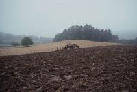
Title (German)
Boppelsen ZH, Otelfingen ZH, Kulturlandschaft zwischen Otelfingen und Boppelsen, Witschgenbüel Hulligen, Bingert
Caption
Cultural landscape with farmland, hedges, forest edge, tractor plowing, partial view; Keywords Documenta Natura: landscape change, lowland, agriculture_general, hedge, village
Caption (German)
Kulturlandschaft mit Ackerland, Hecken, Waldrand, Traktor am Pflügen, Teilansicht; Schlagworte Documenta Natura: Landschaftswandel, Flachland, Landwirtschaft_Allgemein, Hecke, Dorf
Record Name
Dia_303-37303

Title (German)
Boppelsen ZH, Otelfingen ZH, Kulturlandschaft zwischen Otelfingen und Boppelsen, Witschgenbüel Hulligen, Bingert
Caption
Cultural landscape with farmland, hedges, partial view; Keywords Documenta Natura: landscape change, lowland, agriculture_general, hedge, village
Caption (German)
Kulturlandschaft mit Ackerland, Hecken, Teilansicht; Schlagworte Documenta Natura: Landschaftswandel, Flachland, Landwirtschaft_Allgemein, Hecke, Dorf
Record Name
Dia_303-37313

Title (German)
Boppelsen ZH, Otelfingen ZH, Kulturlandschaft zwischen Otelfingen und Boppelsen, Witschgenbüel Hulligen, Bingert
Caption
Cultural landscape with farmland, hedges, vegetable gardening, forest in the background, farm road, partial view, general view; Keywords Documenta Natura: landscape change, lowland, agriculture_general, hedge, village
Caption (German)
Kulturlandschaft mit Ackerland, Hecken, Gemüsebau, Wald im Hintergrund, Bewirtschaftungsstrasse, Teilansicht, Gesamtansicht; Schlagworte Documenta Natura: Landschaftswandel, Flachland, Landwirtschaft_Allgemein, Hecke, Dorf
Record Name
Dia_303-37318

Title (German)
Boppelsen ZH, Otelfingen ZH, Kulturlandschaft zwischen Otelfingen und Boppelsen, Witschgenbüel Hulligen, Bingert
Caption
Cultural landscape with farmland, hedges, vegetable gardening, forest in the background, partial view; Keywords Documenta Natura: landscape change, lowland, agriculture_general, hedge, village
Caption (German)
Kulturlandschaft mit Ackerland, Hecken, Gemüsebau, Wald im Hintergrund, Teilansicht; Schlagworte Documenta Natura: Landschaftswandel, Flachland, Landwirtschaft_Allgemein, Hecke, Dorf
Record Name
Dia_303-37323

Title (German)
Boppelsen ZH, Otelfingen ZH, Kulturlandschaft zwischen Otelfingen und Boppelsen, Witschgenbüel Hulligen, Bingert
Caption
Cultural landscape with vineyard, edge of settlement, partial view; Keywords Documenta Natura: landscape change, lowland, agriculture_general, hedge, village
Caption (German)
Kulturlandschaft mit Rebberg, Siedlungsrand, Teilansicht; Schlagworte Documenta Natura: Landschaftswandel, Flachland, Landwirtschaft_Allgemein, Hecke, Dorf
Record Name
Dia_303-37326
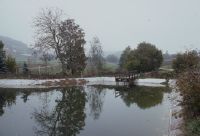
Title (German)
Boppelsen ZH, Otelfingen ZH, Kulturlandschaft zwischen Otelfingen und Boppelsen, Witschgenbüel Hulligen, Bingert
Caption
Cultural landscape with farmland, hedges, irrigation pond, partial view; Keywords Documenta Natura: landscape change, lowland, agriculture_general, hedge, village
Caption (German)
Kulturlandschaft mit Ackerland, Hecken, Bewässerungsteich, Teilansicht; Schlagworte Documenta Natura: Landschaftswandel, Flachland, Landwirtschaft_Allgemein, Hecke, Dorf
Record Name
Dia_303-37329

Title (German)
Boppelsen ZH, Otelfingen ZH, Kulturlandschaft zwischen Otelfingen und Boppelsen, Witschgenbüel Hulligen, Bingert
Caption
Cultural landscape with farmland, hedges, irrigation pond, Christmas tree plantation, partial view; Keywords Documenta Natura: landscape change, lowland, agriculture_general, hedge, village
Caption (German)
Kulturlandschaft mit Ackerland, Hecken, Bewässerungsteich, Weihnachtsbaumplantage, Teilansicht; Schlagworte Documenta Natura: Landschaftswandel, Flachland, Landwirtschaft_Allgemein, Hecke, Dorf
Record Name
Dia_303-37333

Title (German)
Boppelsen ZH, Otelfingen ZH, Kulturlandschaft zwischen Otelfingen und Boppelsen, Witschgenbüel Hulligen, Bingert
Caption
Cultural landscape with farmland, hedges, forest edge, partial view; Keywords Documenta Natura: landscape change, lowland, agriculture_general, hedge, village
Caption (German)
Kulturlandschaft mit Ackerland, Hecken, Waldrand, Teilansicht; Schlagworte Documenta Natura: Landschaftswandel, Flachland, Landwirtschaft_Allgemein, Hecke, Dorf
Record Name
Dia_303-37336

Title (German)
Boppelsen ZH, Otelfingen ZH, Kulturlandschaft zwischen Otelfingen und Boppelsen, Witschgenbüel Hulligen, Bingert
Caption
Cultural landscape with farmland, hedges, forest edge, partial view; Keywords Documenta Natura: landscape change, lowland, agriculture_general, hedge, village
Caption (German)
Kulturlandschaft mit Ackerland, Hecken, Waldrand, Teilansicht; Schlagworte Documenta Natura: Landschaftswandel, Flachland, Landwirtschaft_Allgemein, Hecke, Dorf
Record Name
Dia_303-37338

Title (German)
Boppelsen ZH, Otelfingen ZH, Kulturlandschaft zwischen Otelfingen und Boppelsen, Witschgenbüel Hulligen, Bingert
Caption
Cultural landscape with farmland, hedges, forest edge, cultivation road, partial view; Keywords Documenta Natura: landscape change, lowland, agriculture_general, hedge, village
Caption (German)
Kulturlandschaft mit Ackerland, Hecken, Waldrand, Bewirtschaftungsstrasse, Teilansicht; Schlagworte Documenta Natura: Landschaftswandel, Flachland, Landwirtschaft_Allgemein, Hecke, Dorf
Record Name
Dia_303-37351

Title (German)
Boppelsen ZH, Otelfingen ZH, Kulturlandschaft zwischen Otelfingen und Boppelsen, Witschgenbüel Hulligen, Bingert
Caption
Cultural landscape with fruit trees and arable land, cultivation road, partial view; Keywords Documenta Natura: landscape change, lowland, agriculture_general, hedge, village
Caption (German)
Kulturlandschaft mit Obstbäumen und Ackerland, Bewirtschaftungsstrasse, Teilansicht; Schlagworte Documenta Natura: Landschaftswandel, Flachland, Landwirtschaft_Allgemein, Hecke, Dorf
Record Name
Dia_303-37352
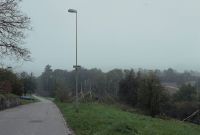
Title (German)
Boppelsen ZH, Otelfingen ZH, Kulturlandschaft zwischen Otelfingen und Boppelsen, Witschgenbüel Hulligen, Bingert
Caption
Cultural landscape with arable land, hedges, fruit trees, farm roads, settlement edge with building profiles, partial view; Keywords Documenta Natura: landscape change, lowland, agriculture_general, hedge, village
Caption (German)
Kulturlandschaft mit Ackerland, Hecken, Obstbäume, Bewirtschaftungsstrassen, Siedlungsrand mit Bauprofilen, Teilansicht; Schlagworte Documenta Natura: Landschaftswandel, Flachland, Landwirtschaft_Allgemein, Hecke, Dorf
Record Name
Dia_303-37364

Title (German)
Boppelsen ZH, Otelfingen ZH, Kulturlandschaft zwischen Otelfingen und Boppelsen, Witschgenbüel Hulligen, Bingert
Caption
Cultural landscape with vegetable gardening on the outskirts of Boppelsen, greenhouses, single-family houses, partial view; Keywords Documenta Natura: landscape change, lowland, agriculture_general, hedge, village
Caption (German)
Kulturlandschaft mit Gemüsebau am Siedlungsrand von Boppelsen, Gewächshäusern, Einfamilienhäusern, Teilansicht; Schlagworte Documenta Natura: Landschaftswandel, Flachland, Landwirtschaft_Allgemein, Hecke, Dorf
Record Name
Dia_303-37375

Title (German)
Boppelsen ZH, Otelfingen ZH, Kulturlandschaft zwischen Otelfingen und Boppelsen, Witschgenbüel Hulligen, Bingert
Caption
Cultural landscape with vegetable cultivation, settlement edge of Boppelsen, single-family houses and timber-framed house, partial view; Keywords Documenta Natura: landscape change, lowland, agriculture_general, hedge, village
Caption (German)
Kulturlandschaft mit Gemüsebau, Siedlungsrand von Boppelsen, Einfamilienhäusern und Riegelhaus, Teilansicht; Schlagworte Documenta Natura: Landschaftswandel, Flachland, Landwirtschaft_Allgemein, Hecke, Dorf
Record Name
Dia_303-37380

Title (German)
Boppelsen ZH, Otelfingen ZH, Kulturlandschaft zwischen Otelfingen und Boppelsen, Witschgenbüel Hulligen, Bingert
Caption
Settlement area with farmhouses and single-family houses, front gardens, partial view; Keywords Documenta Natura: landscape change, lowland, agriculture_general, hedge, village
Caption (German)
Siedlungsgebiet mit Bauernhäuser und Einfamilienhäusern, Vorgärten, Teilansicht; Schlagworte Documenta Natura: Landschaftswandel, Flachland, Landwirtschaft_Allgemein, Hecke, Dorf
Record Name
Dia_303-37383

Title (German)
Boppelsen ZH, Otelfingen ZH, Kulturlandschaft zwischen Otelfingen und Boppelsen, Witschgenbüel Hulligen, Bingert
Caption
Settlement area with farmhouses and single-family houses, front gardens, partial view; Keywords Documenta Natura: landscape change, lowland, agriculture_general, hedge, village
Caption (German)
Siedlungsgebiet mit Bauernhäuser und Einfamilienhäusern, Vorgärten, Teilansicht; Schlagworte Documenta Natura: Landschaftswandel, Flachland, Landwirtschaft_Allgemein, Hecke, Dorf
Record Name
Dia_303-37386
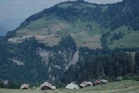
Title (German)
Valendas GR, Westansicht von Brün mit Westhang, z. T. im Vordergrund Unter Dutjen
Caption
Western views of the hamlet Brün (near Flims) with western slope shortly after completion of the access road (1st construction stage), partly in the foreground the hamlet Unter Dutjen, first photograph (1992), reverse slope photograph, general view; coordinates (LV03) of the camera location: 740975/182063; keywords Documenta Natura: hamlet, road construction, mountain area, melioration, landscape change
Caption (German)
Westansichten des Weilers Brün (bei Flims) mit Westhang kurz nach Fertigstellung der Erschliessungsstrasse (1. Bauetappe), zum Teil im Vordergrund der Weiler Unter Dutjen, Erstaufnahme (1992), Gegenhangaufnahme, Gesamtansicht; Koordinaten (LV03) des Kamerastandorts: 740975/182063; Schlagworte Documenta Natura: Weiler, Strassenbau, Berggebiet, Melioration, Landschaftswandel
Record Name
Dia_303-37404

Title (German)
Valendas GR, Westansicht von Brün mit Westhang, z. T. im Vordergrund Unter Dutjen
Caption
Western views of the hamlet Brün (near Flims) with western slope shortly after completion of the access road (1st construction stage), partly in the foreground the hamlet Unter Dutjen, first photograph (1992), reverse slope photograph, general view; coordinates (LV03) of the camera location: 740975/182063; keywords Documenta Natura: hamlet, road construction, mountain area, melioration, landscape change
Caption (German)
Westansichten des Weilers Brün (bei Flims) mit Westhang kurz nach Fertigstellung der Erschliessungsstrasse (1. Bauetappe), zum Teil im Vordergrund der Weiler Unter Dutjen, Erstaufnahme (1992), Gegenhangaufnahme, Gesamtansicht; Koordinaten (LV03) des Kamerastandorts: 740975/182063; Schlagworte Documenta Natura: Weiler, Strassenbau, Berggebiet, Melioration, Landschaftswandel
Record Name
Dia_303-37414

Title (German)
Valendas GR, Westansicht von Brün mit Westhang, z. T. im Vordergrund Unter Dutjen
Caption
West views of the hamlet Brün (near Flims) with western slope, partly in the foreground the hamlet Unter Dutjen, 1st subsequent photograph (1997) during the construction of the access road (2nd construction stage), with two new communal barns, opposite slope photograph, general view; coordinates (LV03) of the camera location: 740975/182063; keywords Documenta Natura: hamlet, road construction, mountain area, melioration, landscape change
Caption (German)
Westansichten des Weilers Brün (bei Flims) mit Westhang, zum Teil im Vordergrund der Weiler Unter Dutjen, 1. Folgeaufnahme (1997) während dem Bau der Erschliessungsstrasse (2. Bauetappe), mit zwei neuen Gemeinschaftsscheunen, Gegenhangaufnahme, Gesamtansicht; Koordinaten (LV03) des Kamerastandorts: 740975/182063; Schlagworte Documenta Natura: Weiler, Strassenbau, Berggebiet, Melioration, Landschaftswandel
Record Name
Dia_303-37423

Title (German)
Valendas GR, Südwestansicht des Weilers Brün
Caption
Southwest view of the hamlet of Brün (near Flims), first photograph (1992), general view; coordinates (LV03) of camera location: 742500/182505; keywords Documenta Natura: hamlet, road construction, mountain area, melioration, landscape change
Caption (German)
Südwestansicht des Weilers Brün (bei Flims), Erstaufnahme (1992), Gesamtansicht; Koordinaten (LV03) des Kamerastandorts: 742500/182505; Schlagworte Documenta Natura: Weiler, Strassenbau, Berggebiet, Melioration, Landschaftswandel
Record Name
Dia_303-37433

Title (German)
Valendas GR, Südwestansicht des Weilers Brün
Caption
Southwest view of the hamlet of Brün, 1st follow-up photograph (1997) during the construction of the access road (2nd construction phase) and a new communal barn above the hamlet, general view; coordinates (LV03) of the camera location: 742500/182505; keywords Documenta Natura: hamlet, road construction, mountain area, melioration, landscape change
Caption (German)
Südwestansicht des Weilers Brün, 1. Folgeaufnahme (1997) während dem Bau der Erschliessungsstrasse (2. Bauetappe) und einer neuen Gemeinschaftsscheune oberhalb des Weilers, Gesamtansicht; Koordinaten (LV03) des Kamerastandorts: 742500/182505; Schlagworte Documenta Natura: Weiler, Strassenbau, Berggebiet, Melioration, Landschaftswandel
Record Name
Dia_303-37444

Title (German)
Valendas GR, Dorfplatz von Brün
Caption
Village square of Brün after the widening of the road, reconstruction photo 1997, partial view 1; coordinates (LV03) of the camera location: 742525/182620; keywords Documenta Natura: hamlet, road construction, mountain area, melioration, landscape change
Caption (German)
Dorfplatz von Brün nach der Verbreiterung der Strasse, Rekonstruktionsaufnahme 1997, Teilansicht 1; Koordinaten (LV03) des Kamerastandorts: 742525/182620; Schlagworte Documenta Natura: Weiler, Strassenbau, Berggebiet, Melioration, Landschaftswandel
Record Name
Dia_303-37455

Title (German)
Valendas GR, Dorfplatz von Brün
Caption
Village square of Brün after the widening of the road, reconstruction photo 1997, partial view 2; coordinates (LV03) of the camera location: 742530/182605; keywords Documenta Natura: hamlet, road construction, mountain area, melioration, landscape change
Caption (German)
Dorfplatz von Brün nach der Verbreiterung der Strasse, Rekonstruktionsaufnahme 1997, Teilansicht 2; Koordinaten (LV03) des Kamerastandorts: 742530/182605; Schlagworte Documenta Natura: Weiler, Strassenbau, Berggebiet, Melioration, Landschaftswandel
Record Name
Dia_303-37461

Title (German)
Adelboden BE, Ostansicht des Osthanges Gilbachegge mit Gilbach
Caption
East view of the eastern slope Gilbachegge with reforestation area at the lower forest edge, Ogiböcken (protective structure for young plants), in the foreground the hamlet Gilbach, first photograph end of vegetation phase (1992), counter slope photograph, general view; coordinates (LV03) of the camera location: 607880/147285; keywords Documenta Natura: protective forest, avalanche control, landslide.
Caption (German)
Ostansicht des Osthanges Gilbachegge mit Aufforstungsfläche am unteren Waldrand, Ogiböcken (Schutzbau für Jungpflanzen), im Vordergrund der Weiler Gilbach, Erstaufnahme Ende der Vegetationsphase (1992), Gegenhangaufnahme, Gesamtansicht; Koordinaten (LV03) des Kamerastandorts: 607880/147285; Schlagworte Documenta Natura: Schutzwald, Lawinenverbauung, Rutschung
Record Name
Dia_303-37470

Title (German)
Adelboden BE, Ostansicht des Osthanges Gilbachegge mit Gilbach
Caption
East view of the eastern slope Gilbachegge with reforestation area at the lower forest edge, Ogiböcken (protective structure for young plants), in the foreground the hamlet Gilbach, 1st follow-up photograph, snow-covered (1995), counter-slope photograph, general view; coordinates (LV03) of the camera location: 607880/147285; keywords Documenta Natura: protective forest, avalanche control, landslide.
Caption (German)
Ostansicht des Osthanges Gilbachegge mit Aufforstungsfläche am unteren Waldrand, Ogiböcken (Schutzbau für Jungpflanzen), im Vordergrund der Weiler Gilbach, 1. Folgeaufnahme, schneebedeckt (1995), Gegenhangaufnahme, Gesamtansicht; Koordinaten (LV03) des Kamerastandorts: 607880/147285; Schlagworte Documenta Natura: Schutzwald, Lawinenverbauung, Rutschung
Record Name
Dia_303-37481

Title (German)
Adelboden BE, Ostansicht des Osthanges Gilbachegge mit Gilbach
Caption
East view of the eastern slope Gilbachegge with reforestation area at the lower forest edge, Ogiböcken (protective structure for young plants), in the foreground the hamlet of Gilbach, 2nd follow-up photograph, snow-covered (1999), counter-slope photograph, general view; coordinates (LV03) of the camera location: 607880/147285; keywords Documenta Natura: protective forest, avalanche control, landslide.
Caption (German)
Ostansicht des Osthanges Gilbachegge mit Aufforstungsfläche am unteren Waldrand, Ogiböcken (Schutzbau für Jungpflanzen), im Vordergrund der Weiler Gilbach, 2. Folgeaufnahme, schneebedeckt (1999), Gegenhangaufnahme, Gesamtansicht; Koordinaten (LV03) des Kamerastandorts: 607880/147285; Schlagworte Documenta Natura: Schutzwald, Lawinenverbauung, Rutschung
Record Name
Dia_303-37491

Title (German)
Adelboden BE, Ostansicht des Osthanges Gilbachegge mit Gilbach
Caption
East view of the eastern slope Gilbachegge with reforestation area at the lower forest edge, Ogiböcken (protective structure for young plants), in the foreground the hamlet Gilbach, 3rd follow-up photograph end of vegetation phase (1999), counter slope photograph, general view; coordinates (LV03) of the camera location: 607880/147285; keywords Documenta Natura: protective forest, avalanche defense, landslide.
Caption (German)
Ostansicht des Osthanges Gilbachegge mit Aufforstungsfläche am unteren Waldrand, Ogiböcken (Schutzbau für Jungpflanzen), im Vordergrund der Weiler Gilbach, 3. Folgeaufnahme Ende der Vegetationsphase (1999), Gegenhangaufnahme, Gesamtansicht; Koordinaten (LV03) des Kamerastandorts: 607880/147285; Schlagworte Documenta Natura: Schutzwald, Lawinenverbauung, Rutschung
Record Name
Dia_303-37501

Title (German)
Adelboden BE, Südansicht des Südhanges mit dem Röschttal, Stigelschwand und Wannegg, im Hintergrund Schwandfäl und Schwandfälspitz
Caption
South view of the Röscht valley with the hamlets of Stigelschwand and Wannegg, in the background Schwandfäl and Schwandfälspitz, first photograph taken at the end of the vegetation phase (1992), general view; coordinates (LV03) of the camera location: 607813/147800; keywords Documenta Natura: protection forest, avalanche control, landslide
Caption (German)
Südansicht des Röschttales mit den Weilern Stigelschwand und Wannegg, im Hintergrund Schwandfäl und Schwandfälspitz, Erstaufnahme Ende der Vegetationsphase (1992), Gesamtansicht; Koordinaten (LV03) des Kamerastandorts: 607813/147800; Schlagworte Documenta Natura: Schutzwald, Lawinenverbauung, Rutschung
Record Name
Dia_303-37513

Title (German)
Adelboden BE, Südansicht des Südhanges mit dem Röschttal, Stigelschwand und Wannegg, im Hintergrund Schwandfäl und Schwandfälspitz
Caption
South view of the Röscht valley with the hamlets of Stigelschwand and Wannegg, in the background Schwandfäl and Schwandfälspitz, 1st follow-up photograph, snow-covered (1995), general view; coordinates (LV03) of the camera location: 607813/147800; keywords Documenta Natura: protection forest, avalanche control, landslide
Caption (German)
Südansicht des Röschttales mit den Weilern Stigelschwand und Wannegg, im Hintergrund Schwandfäl und Schwandfälspitz, 1. Folgeaufnahme, schneebedeckt (1995), Gesamtansicht; Koordinaten (LV03) des Kamerastandorts: 607813/147800; Schlagworte Documenta Natura: Schutzwald, Lawinenverbauung, Rutschung
Record Name
Dia_303-37522

Title (German)
Adelboden BE, Südansicht des Südhanges mit dem Röschttal, Stigelschwand und Wannegg, im Hintergrund Schwandfäl und Schwandfälspitz
Caption
South view of the Röscht valley with the hamlets of Stigelschwand and Wannegg, in the background Schwandfäl and Schwandfälspitz, 2nd follow-up photo, snow-covered (1999), general view; coordinates (LV03) of the camera location: 607813/147800; keywords Documenta Natura: protection forest, avalanche control, landslide
Caption (German)
Südansicht des Röschttales mit den Weilern Stigelschwand und Wannegg, im Hintergrund Schwandfäl und Schwandfälspitz, 2. Folgeaufnahme, schneebedeckt (1999), Gesamtansicht; Koordinaten (LV03) des Kamerastandorts: 607813/147800; Schlagworte Documenta Natura: Schutzwald, Lawinenverbauung, Rutschung
Record Name
Dia_303-37535

Title (German)
Adelboden BE, Südansicht des Südhanges mit dem Röschttal, Stigelschwand und Wannegg, im Hintergrund Schwandfäl und Schwandfälspitz
Caption
South view of the Röscht valley with the hamlets of Stigelschwand and Wannegg, in the background Schwandfäl and Schwandfälspitz, 3rd follow-up photo after 7 years, snow-free (1999), general view; coordinates (LV03) of the camera location: 607813/147800; keywords Documenta Natura: protection forest, avalanche control, landslide
Caption (German)
Südansicht des Röschttales mit den Weilern Stigelschwand und Wannegg, im Hintergrund Schwandfäl und Schwandfälspitz, 3. Folgeaufnahme nach 7 Jahren, schneefrei (1999), Gesamtansicht; Koordinaten (LV03) des Kamerastandorts: 607813/147800; Schlagworte Documenta Natura: Schutzwald, Lawinenverbauung, Rutschung
Record Name
Dia_303-37543

Title (German)
Adelboden BE, Südostansicht von Adelboden mit Südosthang, Gebirgskette mit Hempliger, Schwandfälspitz und Landvogtehore
Caption
Southeast view of Adelboden with the Bawald (Bannwald), in the background the mountain range with Hempliger, Schwandfälspitz and Landvogtehore, first photograph during the vegetation phase (1994), reverse slope photograph, general view; coordinates (LV03) of the camera location: 610685/148275; keywords Documenta Natura: protection forest, avalanche control, landslide
Caption (German)
Südostansicht von Adelboden mit dem Bawald (Bannwald), im Hintergrund die Gebirgskette mit Hempliger, Schwandfälspitz und Landvogtehore, Erstaufnahme während der Vegetationsphase (1994), Gegenhangaufnahme, Gesamtansicht; Koordinaten (LV03) des Kamerastandorts: 610685/148275; Schlagworte Documenta Natura: Schutzwald, Lawinenverbauung, Rutschung
Record Name
Dia_303-37555

Title (German)
Adelboden BE, Südostansicht von Adelboden mit Südosthang, Gebirgskette mit Hempliger, Schwandfälspitz und Landvogtehore
Caption
Southeast view of Adelboden with the Bawald (Bannwald), first image during the vegetation phase (1994), counter-slope image, general view; coordinates (LV03) of the camera location: 610685/148275; keywords Documenta Natura: protection forest, avalanche protection, landslide
Caption (German)
Südostansicht von Adelboden mit dem Bawald (Bannwald), Erstaufnahme während der Vegetationsphase (1994), Gegenhangaufnahme, Gesamtansicht; Koordinaten (LV03) des Kamerastandorts: 610685/148275; Schlagworte Documenta Natura: Schutzwald, Lawinenverbauung, Rutschung
Record Name
Dia_303-37567

Title (German)
Adelboden BE, Südostansicht von Adelboden mit Südosthang, Gebirgskette mit Hempliger, Schwandfälspitz und Landvogtehore
Caption
Southeast view of Adelboden with the Bawald (Bannwald), in the background the mountain range with Hempliger, Schwandfälspitz and Landvogtehore, 1st follow-up image, snow-covered (1995), counter-slope image, general view; coordinates (LV03) of the camera location: 610373/148348; keywords Documenta Natura: protective forest, avalanche control, landslide
Caption (German)
Südostansicht von Adelboden mit dem Bawald (Bannwald), im Hintergrund die Gebirgskette mit Hempliger, Schwandfälspitz und Landvogtehore, 1. Folgeaufnahme, schneebedeckt (1995), Gegenhangaufnahme, Gesamtansicht; Koordinaten (LV03) des Kamerastandorts: 610373/148348; Schlagworte Documenta Natura: Schutzwald, Lawinenverbauung, Rutschung
Record Name
Dia_303-37575

Title (German)
Adelboden BE, Südostansicht von Adelboden mit Südosthang, Gebirgskette mit Hempliger, Schwandfälspitz und Landvogtehore
Caption
Southeast view of Adelboden with the Bawald (Bannwald), in the background the mountain range with Hempliger, Schwandfälspitz and Landvogtehore, 2nd follow-up image, snow-covered, (1999), reverse slope image, general view; coordinates (LV03) of the camera location: 610373/148348; keywords Documenta Natura: protective forest, avalanche control, landslide
Caption (German)
Südostansicht von Adelboden mit dem Bawald (Bannwald), im Hintergrund die Gebirgskette mit Hempliger, Schwandfälspitz und Landvogtehore, 2. Folgeaufnahme, schneebedeckt, (1999), Gegenhangaufnahme, Gesamtansicht; Koordinaten (LV03) des Kamerastandorts: 610373/148348; Schlagworte Documenta Natura: Schutzwald, Lawinenverbauung, Rutschung
Record Name
Dia_303-37585

Title (German)
Adelboden BE, Südostansicht von Adelboden mit Südosthang, Gebirgskette mit Hempliger, Schwandfälspitz und Landvogtehore
Caption
Southeast view of Adelboden with the Bawald (Bannwald), in the background the mountain range with Hempliger, Schwandfälspitz and Landvogtehore, 3rd follow-up image during the vegetation phase (1999), counter-slope image, general view; coordinates (LV03) of the camera location: 610685/148275; keywords Documenta Natura: protection forest, avalanche control, landslide
Caption (German)
Südostansicht von Adelboden mit dem Bawald (Bannwald), im Hintergrund die Gebirgskette mit Hempliger, Schwandfälspitz und Landvogtehore, 3. Folgeaufnahme während der Vegetationsphase (1999), Gegenhangaufnahme, Gesamtansicht; Koordinaten (LV03) des Kamerastandorts: 610685/148275; Schlagworte Documenta Natura: Schutzwald, Lawinenverbauung, Rutschung
Record Name
Dia_303-37595

Title (German)
Adelboden BE, Südostansicht von Adelboden mit Südosthang, Gebirgskette mit Hempliger, Schwandfälspitz und Landvogtehore
Caption
Southeast view of Adelboden with the Bawald (Bannwald), 3rd follow-up image during the vegetation phase (1999), counter-slope image, general view; coordinates (LV03) of the camera location: 610685/148275; keywords Documenta Natura: protection forest, avalanche control, landslide
Caption (German)
Südostansicht von Adelboden mit dem Bawald (Bannwald), 3. Folgeaufnahme während der Vegetationsphase (1999), Gegenhangaufnahme, Gesamtansicht; Koordinaten (LV03) des Kamerastandorts: 610685/148275; Schlagworte Documenta Natura: Schutzwald, Lawinenverbauung, Rutschung
Record Name
Dia_303-37606

Title (German)
Brienz, Brienzwiler, Hofstetten b. Brienz, Schwanden b. Brienz BE, Blick von der Axalp auf die Brienzer Wildbäche mit Brienzersee und Gebirgskette
Caption
South view from Axalp on the Brienz torrents: Trachtbach, Glyssibach, Schwanderbach, Lammbach and Eistlenbach, in the foreground right shore of Lake Brienz with Brienz, in the background the mountain range with Briefenhorn, Brienzer Rothorn, Arnihaaggen, Höch Gumme and Wilerhorn, first shot, snow covered (1995), opposite slope shot, general view; coordinates (LV03) of camera location: 647052/174313; keywords Documenta Natura: creek, riverine obstruction, mountain area, avalanche obstruction, landslide, village, lake, avalanche zone.
Caption (German)
Südansicht von der Axalp auf die Brienzer Wildbäche: Trachtbach, Glyssibach, Schwanderbach, Lammbach und Eistlenbach, im Vordergrund rechtes Ufer des Brienzersee mit Brienz, im Hintergrund die Gebirgskette mit Briefenhorn, Brienzer Rothorn, Arnihaaggen, Höch Gumme und Wilerhorn, Erstaufnahme, schneebedeckt (1995), Gegenhangaufnahme, Gesamtansicht; Koordinaten (LV03) des Kamerastandorts: 647052/174313; Schlagworte Documenta Natura: Bach, Flussverbauung, Berggebiet, Lawinenverbauung, Rutschung, Dorf, See, Lawinenzone
Record Name
Dia_303-37617

Title (German)
Brienz, Brienzwiler, Hofstetten b. Brienz, Schwanden b. Brienz BE, Blick von der Axalp auf die Brienzer Wildbäche mit Brienzersee und Gebirgskette
Caption
South view from Axalp on the Brienz torrents, in the background partly the mountain range, first shot, snow-covered (1995), opposite slope shot, partial view; coordinates (LV03) of the camera location: 647052/174313; keywords Documenta Natura: stream, river obstruction, mountain area, avalanche obstruction, landslide, village, lake, avalanche zone
Caption (German)
Südansicht von der Axalp auf die Brienzer Wildbäche, im Hintergrund teilweise die Gebirgskette, Erstaufnahme, schneebedeckt (1995), Gegenhangaufnahme, Teilansicht; Koordinaten (LV03) des Kamerastandorts: 647052/174313; Schlagworte Documenta Natura: Bach, Flussverbauung, Berggebiet, Lawinenverbauung, Rutschung, Dorf, See, Lawinenzone
Record Name
Dia_303-37627

Title (German)
Brienz, Brienzwiler, Hofstetten b. Brienz, Schwanden b. Brienz BE, Blick von der Axalp auf die Brienzer Wildbäche mit Brienzersee und Gebirgskette
Caption
South view from Axalp on the Brienz torrents, in the background partly the mountain range, first shot, snow-covered (1995), opposite slope shot, partial view; coordinates (LV03) of the camera location: 647052/174313; keywords Documenta Natura: stream, river obstruction, mountain area, avalanche obstruction, landslide, village, lake, avalanche zone
Caption (German)
Südansicht von der Axalp auf die Brienzer Wildbäche, im Hintergrund teilweise die Gebirgskette, Erstaufnahme, schneebedeckt (1995), Gegenhangaufnahme, Teilansicht; Koordinaten (LV03) des Kamerastandorts: 647052/174313; Schlagworte Documenta Natura: Bach, Flussverbauung, Berggebiet, Lawinenverbauung, Rutschung, Dorf, See, Lawinenzone
Record Name
Dia_303-37638
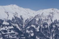
Title (German)
Brienz, Brienzwiler, Hofstetten b. Brienz, Schwanden b. Brienz BE, Blick von der Axalp auf die Brienzer Wildbäche mit Brienzersee und Gebirgskette
Caption
South view from Axalp on the Brienz torrents, in the background partly the mountain range, first shot, snow-covered (1995), opposite slope shot, partial view; coordinates (LV03) of the camera location: 647052/174313; keywords Documenta Natura: stream, river obstruction, mountain area, avalanche obstruction, landslide, village, lake, avalanche zone
Caption (German)
Südansicht von der Axalp auf die Brienzer Wildbäche, im Hintergrund teilweise die Gebirgskette, Erstaufnahme, schneebedeckt (1995), Gegenhangaufnahme, Teilansicht; Koordinaten (LV03) des Kamerastandorts: 647052/174313; Schlagworte Documenta Natura: Bach, Flussverbauung, Berggebiet, Lawinenverbauung, Rutschung, Dorf, See, Lawinenzone
Record Name
Dia_303-37648

Title (German)
Brienz, Brienzwiler, Hofstetten b. Brienz, Schwanden b. Brienz BE, Blick von der Axalp auf die Brienzer Wildbäche mit Brienzersee und Gebirgskette
Caption
South view from Axalp on the Brienz torrents: Trachtbach, Glyssibach, Schwanderbach, Lammbach and Eistlenbach, in the foreground right shore of Lake Brienz with Brienz, in the background the mountain range with Briefenhorn, Brienzer Rothorn, Arnihaaggen, Höch Gumme and Wilerhorn, alternative shot during vegetation phase (1995), reverse slope shot, general view; coordinates (LV03) of camera location: 647052/174313; keywords Documenta Natura: creek, river obstruction, mountain area, avalanche obstruction, landslide, village, lake, avalanche zone.
Caption (German)
Südansicht von der Axalp auf die Brienzer Wildbäche: Trachtbach, Glyssibach, Schwanderbach, Lammbach und Eistlenbach, im Vordergrund rechtes Ufer des Brienzersee mit Brienz, im Hintergrund die Gebirgskette mit Briefenhorn, Brienzer Rothorn, Arnihaaggen, Höch Gumme und Wilerhorn, Alternativaufnahme während der Vegetationsphase (1995), Gegenhangaufnahme, Gesamtansicht; Koordinaten (LV03) des Kamerastandorts: 647052/174313; Schlagworte Documenta Natura: Bach, Flussverbauung, Berggebiet, Lawinenverbauung, Rutschung, Dorf, See, Lawinenzone
Record Name
Dia_303-37657

Title (German)
Brienz, Brienzwiler, Hofstetten b. Brienz, Schwanden b. Brienz BE, Blick von der Axalp auf die Brienzer Wildbäche mit Brienzersee und Gebirgskette
Caption
South view from Axalp on the Brienz torrents, in the background the mountain range, alternative shot during the vegetation phase (1995), counter slope shot, partial view; coordinates (LV03) of the camera location: 647052/174313; keywords Documenta Natura: stream, river obstruction, mountain area, avalanche obstruction, landslide, village, lake, avalanche zone
Caption (German)
Südansicht von der Axalp auf die Brienzer Wildbäche, im Hintergrund die Gebirgskette, Alternativaufnahme während der Vegetationsphase (1995), Gegenhangaufnahme, Teilansicht; Koordinaten (LV03) des Kamerastandorts: 647052/174313; Schlagworte Documenta Natura: Bach, Flussverbauung, Berggebiet, Lawinenverbauung, Rutschung, Dorf, See, Lawinenzone
Record Name
Dia_303-37667

Title (German)
Brienz, Brienzwiler, Hofstetten b. Brienz, Schwanden b. Brienz BE, Blick von der Axalp auf die Brienzer Wildbäche mit Brienzersee und Gebirgskette
Caption
South view from Axalp on the Brienz torrents, in the background the mountain range, alternative shot during the vegetation phase (1995), counter slope shot, partial view; coordinates (LV03) of the camera location: 647052/174313; keywords Documenta Natura: stream, river obstruction, mountain area, avalanche obstruction, landslide, village, lake, avalanche zone
Caption (German)
Südansicht von der Axalp auf die Brienzer Wildbäche, im Hintergrund die Gebirgskette, Alternativaufnahme während der Vegetationsphase (1995), Gegenhangaufnahme, Teilansicht; Koordinaten (LV03) des Kamerastandorts: 647052/174313; Schlagworte Documenta Natura: Bach, Flussverbauung, Berggebiet, Lawinenverbauung, Rutschung, Dorf, See, Lawinenzone
Record Name
Dia_303-37677
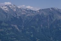
Title (German)
Brienz, Brienzwiler, Hofstetten b. Brienz, Schwanden b. Brienz BE, Blick von der Axalp auf die Brienzer Wildbäche mit Brienzersee und Gebirgskette
Caption
South view from Axalp on the Brienz torrents, in the background the mountain range, alternative shot during the vegetation phase (1995), counter slope shot, partial view; coordinates (LV03) of the camera location: 647052/174313; keywords Documenta Natura: stream, river obstruction, mountain area, avalanche obstruction, landslide, village, lake, avalanche zone
Caption (German)
Südansicht von der Axalp auf die Brienzer Wildbäche, im Hintergrund die Gebirgskette, Alternativaufnahme während der Vegetationsphase (1995), Gegenhangaufnahme, Teilansicht; Koordinaten (LV03) des Kamerastandorts: 647052/174313; Schlagworte Documenta Natura: Bach, Flussverbauung, Berggebiet, Lawinenverbauung, Rutschung, Dorf, See, Lawinenzone
Record Name
Dia_303-37688

Title (German)
Kandersteg BE, Ostansicht des Osthanges der Bire mit dem Wätterbach
Caption
East view of the eastern slope of the Bire with the ski jump Röstiweid, the hamlets Port, Spissli and Raagegg, the Wätterbach in the forest, in the foreground the Kander and railroad line, partial view, reverse slope view; coordinates (LV03) of the camera location: 617725/150000; keywords Documenta Natura: stream, reforestation, mountain forest, mountain area, landscape change
Caption (German)
Ostansicht des Osthanges der Bire mit der Skisprunganlage Röstiweid, den Weilern Port, Spissli und Raagegg, dem Wätterbach im Wald, im Vordergrund die Kander und Eisenbahnlinie, Teilansicht, Gegenhangaufnahme; Koordinaten (LV03) des Kamerastandorts: 617725/150000; Schlagworte Documenta Natura: Bach, Aufforstung, Gebirgswald, Berggebiet, Landschaftswandel
Record Name
Dia_303-37698

Title (German)
Kandersteg BE, Ostansicht des Osthanges der Bire mit dem Wätterbach
Caption
East view of the eastern slope of the Bire, ski jump Röstiweid, the hamlets Port, Spissli and Raagegg, the Wätterbach in the forest, in the foreground the Kander and railroad line, reconstruction shot (1994), general view, reverse slope shot; coordinates (LV03) of the camera location: 617985/150150; keywords Documenta Natura: stream, reforestation, mountain forest, mountain area, landscape change
Caption (German)
Ostansicht des Osthanges der Bire, Skisprunganlage Röstiweid, den Weilern Port, Spissli und Raagegg, dem Wätterbach im Wald, im Vordergrund die Kander und Eisenbahnlinie, Rekonstruktionsaufnahme (1994), Gesamtansicht, Gegenhangaufnahme; Koordinaten (LV03) des Kamerastandorts: 617985/150150; Schlagworte Documenta Natura: Bach, Aufforstung, Gebirgswald, Berggebiet, Landschaftswandel
Record Name
Dia_303-37708
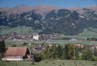
Title (German)
Frutigen BE, Südwestansicht von Frutigen mit dem Leimbach im Südwesthang und Gebirgskette
Caption
Southwest view of Frutigen with the Leimbach stream in the southwest slope, in the foreground the valley floor with Frutigen, in the background the mountain range with Mäggisserehore, Tschipparällehore and Steischlaghore, reconstruction photo (1994), reverse slope photo, general view; coordinates (LV03) of the camera location: 617120/159438; keywords Documenta Natura: stream, afforestation, mountain forest, mountain area, landscape change
Caption (German)
Südwestansicht von Frutigen mit dem Leimbach im Südwesthang, im Vordergrund der Talboden mit Frutigen, im Hintergrund die Gebirgskette mit Mäggisserehore, Tschipparällehore und Steischlaghore, Rekonstruktionsaufnahme (1994), Gegenhangaufnahme, Gesamtansicht; Koordinaten (LV03) des Kamerastandorts: 617120/159438; Schlagworte Documenta Natura: Bach, Aufforstung, Gebirgswald, Berggebiet, Landschaftswandel
Record Name
Dia_303-37715

Title (German)
Frutigen BE, Westansicht von Frutigen mit dem Talboden, Südwesthang und Gebirgskette
Caption
West view of Frutigen with the valley floor and southwest slope, in the foreground the valley floor with Tellenfeld, Oberfeld and Frutigen, in the background the mountain range with Hohniesen, Bündihore, Mäggisserehore, Tschipparällehore and Steischlaghore, new base shot, counter slope shot, general view; coordinates (LV03) of camera location: 617163/159520; keywords Documenta Natura: stream, afforestation, mountain forest, mountain area, landscape change
Caption (German)
Westansicht von Frutigen mit dem Talboden und Südwesthang, im Vordergrund der Talboden mit Tellenfeld, Oberfeld und Frutigen, im Hintergrund die Gebirgskette mit Hohniesen, Bündihore, Mäggisserehore, Tschipparällehore und Steischlaghore, neue Basisaufnahme, Gegenhangaufnahme, Gesamtansicht; Koordinaten (LV03) des Kamerastandorts: 617163/159520; Schlagworte Documenta Natura: Bach, Aufforstung, Gebirgswald, Berggebiet, Landschaftswandel
Record Name
Dia_303-37722

Title (German)
Frutigen BE, Westansicht von Frutigen mit dem Talboden, Südwesthang und Gebirgskette
Caption
West view of Frutigen with the valley floor and southwest slope, in the foreground the valley floor with Tellenfeld, Oberfeld and Frutigen, in the background the mountain range with Hohniesen, Bündihore, Mäggisserehore, Tschipparällehore and Steischlaghore, new base shot, counter slope shot, general view; coordinates (LV03) of camera location: 617163/159520; keywords Documenta Natura: stream, afforestation, mountain forest, mountain area, landscape change
Caption (German)
Westansicht von Frutigen mit dem Talboden und Südwesthang, im Vordergrund der Talboden mit Tellenfeld, Oberfeld und Frutigen, im Hintergrund die Gebirgskette mit Hohniesen, Bündihore, Mäggisserehore, Tschipparällehore und Steischlaghore, neue Basisaufnahme, Gegenhangaufnahme, Gesamtansicht; Koordinaten (LV03) des Kamerastandorts: 617163/159520; Schlagworte Documenta Natura: Bach, Aufforstung, Gebirgswald, Berggebiet, Landschaftswandel
Record Name
Dia_303-37731

Title (German)
Lommiswil SO, Südostansicht des Südhanges mit Hasenmatt und Vorberg, im Vordergrund die Ackerlandschaft Allmend
Caption
Southeast view of the southern slope (southern foot of the Jura) with aisles from thinning (bare areas) with Hasenmatt and Vorberg, in the foreground the farmland Allmend, first photograph before the vegetation phase (1996), partial view; coordinates (LV03) of the camera location: 602180/230573; keywords Documenta Natura: thinning, mountain forest, Jura
Caption (German)
Südostansicht des Südhanges (Jurasüdfuss) mit Schneisen von der Durchforstung (Kahlflächen) mit Hasenmatt und Vorberg, im Vordergrund das Ackerland Allmend, Erstaufnahme vor der Vegetationsphase (1996), Teilansicht; Koordinaten (LV03) des Kamerastandorts: 602180/230573; Schlagworte Documenta Natura: Durchforstung, Gebirgswald, Jura
Record Name
Dia_303-37742

Title (German)
Lommiswil SO, Südostansicht des Südhanges mit Hasenmatt und Vorberg, im Vordergrund die Ackerlandschaft Allmend
Caption
Southeast view of the south slope (Jura south foot) with aisles from thinning (bare areas) with Hasenmatt and Vorberg, in the foreground the farmland Allmend, first photograph before vegetation phase (1996), partial view; coordinates (LV03) of the camera location: 602180/230573; keywords Documenta Natura: thinning, mountain forest, Jura Mountains
Caption (German)
Südostansicht des Südhanges (Jurasüdfuss) mit Schneisen von der Durchforstung (Kahlflächen) mit Hasenmatt und Vorberg, im Vordergrund das Ackerland Allmend, Erstaufnahme vor der Vegetationsphase (1996), Teilansicht; Koordinaten (LV03) des Kamerastandorts: 602180/230573; Schlagworte Documenta Natura: Durchforstung, Gebirgswald, Jura
Record Name
Dia_303-37752

Title (German)
Lommiswil SO, Südostansicht des Südhanges mit Hasenmatt und Vorberg, im Vordergrund die Ackerlandschaft Allmend
Caption
Southeast view of the southern slope (southern foot of the Jura) with aisles from thinning (bare areas) with Hasenmatt and Vorberg, in the foreground the farmland Allmend, 1st follow-up photograph during the vegetation phase (1996), partial view; coordinates (LV03) of the camera location: 602180/230573; keywords Documenta Natura: thinning, mountain forest, Jura
Caption (German)
Südostansicht des Südhanges (Jurasüdfuss) mit Schneisen von der Durchforstung (Kahlflächen) mit Hasenmatt und Vorberg, im Vordergrund das Ackerland Allmend, 1. Folgeaufnahme während der Vegetationsphase (1996), Teilansicht; Koordinaten (LV03) des Kamerastandorts: 602180/230573; Schlagworte Documenta Natura: Durchforstung, Gebirgswald, Jura
Record Name
Dia_303-37762

Title (German)
Lommiswil SO, Südostansicht des Südhanges mit Hasenmatt und Vorberg, im Vordergrund die Ackerlandschaft Allmend
Caption
Southeast view of the southern slope (southern foot of the Jura) with aisles from thinning (bare areas) with Hasenmatt and Vorberg, in the foreground the farmland Allmend, 1st follow-up photograph during the vegetation phase (1996), partial view; coordinates (LV03) of the camera location: 602180/230573; keywords Documenta Natura: thinning, mountain forest, Jura
Caption (German)
Südostansicht des Südhanges (Jurasüdfuss) mit Schneisen von der Durchforstung (Kahlflächen) mit Hasenmatt und Vorberg, im Vordergrund das Ackerland Allmend, 1. Folgeaufnahme während der Vegetationsphase (1996), Teilansicht; Koordinaten (LV03) des Kamerastandorts: 602180/230573; Schlagworte Documenta Natura: Durchforstung, Gebirgswald, Jura
Record Name
Dia_303-37772

Title (German)
Lommiswil SO, Im Südhang Vorberg ostsüdöstlich der Hasenmatt
Caption
Thinned (clearing cut) stand (bare area), habitat type toothroot beech forest (Lonico-Fagenion), single biotope tree, partial view downslope; coordinates (LV03) of camera location: 6021ff/2321ff; keywords Documenta Natura: thinning, mountain forest, Jurassic Mountains
Caption (German)
Durchforsteter (Lichtungshieb) Bestand (Kahlfläche), Lebensraumtyp Zahnwurz-Buchenwald (Lonico-Fagenion), einzelner Biotopbaum, Teilansicht hangabwärts; Koordinaten (LV03) des Kamerastandorts: 6021ff/2321ff; Schlagworte Documenta Natura: Durchforstung, Gebirgswald, Jura
Record Name
Dia_303-37782

Title (German)
Lommiswil SO, Im Südhang Vorberg ostsüdöstlich der Hasenmatt
Caption
Thinned (clearing cut) stand (bare area), habitat type toothroot beech forest (Lonicero-Fagenion), single biotope tree, partial view upslope; coordinates (LV03) of camera location: 6021ff/2321ff; keywords Documenta Natura: thinning, mountain forest, Jura Mountains
Caption (German)
Durchforsteter (Lichtungshieb) Bestand (Kahlfläche), Lebensraumty Zahnwurz-Buchenwald (Lonicero-Fagenion), einzelner Biotopbaum, Teilansicht hangaufwärts; Koordinaten (LV03) des Kamerastandorts: 6021ff/2321ff; Schlagworte Documenta Natura: Durchforstung, Gebirgswald, Jura
Record Name
Dia_303-37792

Title (German)
Aesch BL, Arlesheim BL, Dornach SO, Westansicht von Dornach mit Goetheanum, Scharten und Schartenflue, Schloss Dorneck, im Vordergrund Dornachbrugg und Bruggfeld
Caption
West view of Dornach with Goetheanum, Scharten and Schartenflue, Dorneck Castle, in the foreground residential and industrial area Dornachbrugg Bruggfeld, reconstruction photograph (1996), general view; coordinates (LV03) of the camera location: 612480/259590; keywords Documenta Natura: landscape change, forest edge, thinning, town, village forest clearing, lowlands
Caption (German)
Westansicht von Dornach mit Goetheanum, Scharten und Schartenflue, Schloss Dorneck, im Vordergrund Wohn- und Industrieareal Dornachbrugg Bruggfeld, Rekonstruktionsaufnahme (1996), Gesamtansicht; Koordinaten (LV03) des Kamerastandorts: 612480/259590; Schlagworte Documenta Natura: Landschaftswandel, Waldrand, Durchforstung, Stadt, Dorf Waldlichtung, Flachland
Record Name
Dia_303-37804

Title (German)
Aesch BL, Arlesheim BL, Dornach SO, Westansicht von Dornach mit Goetheanum, Scharten und Schartenflue, Schloss Dorneck, im Vordergrund Dornachbrugg und Bruggfeld
Caption
West view of Dornach with Goetheanum, Scharten and Schartenflue, Dorneck Castle, in the foreground industry and residential quarter Dornachbrugg Bruggfeld, general view; coordinates (LV03) of the camera location: 612550/259470; keywords Documenta Natura: landscape change, forest edge, thinning, town, village forest clearing, lowlands
Caption (German)
Westansicht von Dornach mit Goetheanum, Scharten und Schartenflue, Schloss Dorneck, im Vordergrund Industrie und Wohnquartier Dornachbrugg Bruggfeld, Gesamtansicht; Koordinaten (LV03) des Kamerastandorts: 612550/259470; Schlagworte Documenta Natura: Landschaftswandel, Waldrand, Durchforstung, Stadt, Dorf Waldlichtung, Flachland
Record Name
Dia_303-37814

Title (German)
Aesch BL, Arlesheim BL, Dornach SO, Westansicht von Dornach mit Goetheanum, Scharten und Schartenflue, Schloss Dorneck, im Vordergrund Dornachbrugg und Bruggfeld
Caption
West view of Dornach with Goetheanum, Scharten and Schartenflue, Dorneck Castle, in the foreground industry and residential quarters, general view; coordinates (LV03) of the camera location: 612550/259470; keywords Documenta Natura: landscape change, forest edge, thinning, town, village forest clearing, lowlands
Caption (German)
Westansicht von Dornach mit Goetheanum, Scharten und Schartenflue, Schloss Dorneck, im Vordergrund Industrie und Wohnquartiere, Gesamtansicht; Koordinaten (LV03) des Kamerastandorts: 612550/259470; Schlagworte Documenta Natura: Landschaftswandel, Waldrand, Durchforstung, Stadt, Dorf Waldlichtung, Flachland
Record Name
Dia_303-37824

Title (German)
Metzerlen-Mariastein SO, Westsüdwestansicht des Bättentals, im Hintergrund das Schloss Rotberg
Caption
West-southwest view of the Bättental with edge cut at the edge of the forest for a stepped structure, pasture land, farmland, in the background the castle Rotberg, first shot at the end of the vegetation phase (1996), partial view; coordinates (LV03) of the camera location: 602500/256620; keywords Documenta Natura: landscape change, edge of the forest, thinning, town, village forest clearing, lowlands
Caption (German)
Westsüdwestansicht des Bättentals mit Randhieb am Waldrand für eine stufige Struktur, Weidland, Ackerland, im Hintergrund das Schloss Rotberg, Erstaufnahme am Ende der Vegetationsphase (1996), Teilansicht; Koordinaten (LV03) des Kamerastandorts: 602500/256620; Schlagworte Documenta Natura: Landschaftswandel, Waldrand, Durchforstung, Stadt, Dorf Waldlichtung, Flachland
Record Name
Dia_303-37835

Title (German)
Metzerlen-Mariastein SO, Westsüdwestansicht des Bättentals, im Hintergrund das Schloss Rotberg
Caption
West-southwest view of the Bättental with edge cut at the edge of the forest for a stepped structure, pasture land, farmland, in the background the castle Rotberg, first shot at the end of the vegetation phase (1996), partial view; coordinates (LV03) of the camera location: 602500/256620; keywords Documenta Natura: landscape change, edge of the forest, thinning, town, village forest clearing, lowlands
Caption (German)
Westsüdwestansicht des Bättentals mit Randhieb am Waldrand für eine stufige Struktur, Weidland, Ackerland, im Hintergrund das Schloss Rotberg, Erstaufnahme am Ende der Vegetationsphase (1996), Teilansicht; Koordinaten (LV03) des Kamerastandorts: 602500/256620; Schlagworte Documenta Natura: Landschaftswandel, Waldrand, Durchforstung, Stadt, Dorf Waldlichtung, Flachland
Record Name
Dia_303-37845

Title (German)
Metzerlen-Mariastein SO, Westsüdwestansicht des Bättentals, im Hintergrund das Schloss Rotberg
Caption
West-southwest view of the Bättental with edge cuts at the edge of the forest for a stepped structure, pastureland, farmland, in the background the Rotberg castle, 1st follow-up photograph during the vegetation phase (1997), partial view; coordinates (LV03) of the camera location: 602500/256620; keywords Documenta Natura: landscape change, edge of the forest, thinning, town, village forest clearing, lowlands
Caption (German)
Westsüdwestansicht des Bättentals mit Randhieben am Waldrand für eine stufige Struktur, Weidland, Ackerland, im Hintergrund das Schloss Rotberg, 1. Folgeaufnahme während der Vegetationsphase (1997), Teilansicht; Koordinaten (LV03) des Kamerastandorts: 602500/256620; Schlagworte Documenta Natura: Landschaftswandel, Waldrand, Durchforstung, Stadt, Dorf Waldlichtung, Flachland
Record Name
Dia_303-37855

Title (German)
Metzerlen-Mariastein SO, Westsüdwestansicht des Bättentals, im Hintergrund das Schloss Rotberg
Caption
West-southwest view of the Bättental with edge cuts at the edge of the forest for a stepped structure, pastureland, farmland, in the background the Rotberg castle, 1st follow-up photograph during the vegetation phase (1997), partial view; coordinates (LV03) of the camera location: 602500/256620; keywords Documenta Natura: landscape change, edge of the forest, thinning, town, village forest clearing, lowlands
Caption (German)
Westsüdwestansicht des Bättentals mit Randhieben am Waldrand für eine stufige Struktur, Weidland, Ackerland, im Hintergrund das Schloss Rotberg, 1. Folgeaufnahme während der Vegetationsphase (1997), Teilansicht; Koordinaten (LV03) des Kamerastandorts: 602500/256620; Schlagworte Documenta Natura: Landschaftswandel, Waldrand, Durchforstung, Stadt, Dorf Waldlichtung, Flachland
Record Name
Dia_303-37863

Title (German)
Metzerlen-Mariastein SO, Im Bättental, Südostansicht des Waldrandes im Südhang
Caption
Forest edge with visible edge cut (left) for a stepped structure, in the foreground pasture and heap pile, first photograph taken at the beginning of the vegetation phase (1996), partial view; coordinates (LV03) of the camera location: 602963/256850; keywords Documenta Natura: landscape change, forest edge, thinning, city, village forest clearing, lowland.
Caption (German)
Waldrand mit sichtbarem Randhieb (links) für eine stufige Struktur, im Vordergrund Weide und Haufenpolter, Erstaufnahme bei Beginn der Vegetationsphase (1996), Teilansicht; Koordinaten (LV03) des Kamerastandorts: 602963/256850; Schlagworte Documenta Natura: Landschaftswandel, Waldrand, Durchforstung, Stadt, Dorf Waldlichtung, Flachland
Record Name
Dia_303-37871

Title (German)
Metzerlen-Mariastein SO, Im Bättental, Südostansicht des Waldrandes im Südhang
Caption
Forest edge with visible edge cut (left) for a stepped structure, in the foreground willow and heap pile, 1st follow-up photograph at the end of the vegetation phase (1996), partial view; coordinates (LV03) of the camera location: 602963/256850; keywords Documenta Natura: landscape change, forest edge, thinning, city, village forest clearing, lowland.
Caption (German)
Waldrand mit sichtbarem Randhieb (links) für eine stufige Struktur, im Vordergrund Weide und Haufenpolter, 1. Folgeaufnahme bei Ende der Vegetationsphase (1996), Teilansicht; Koordinaten (LV03) des Kamerastandorts: 602963/256850; Schlagworte Documenta Natura: Landschaftswandel, Waldrand, Durchforstung, Stadt, Dorf Waldlichtung, Flachland
Record Name
Dia_303-37881

Title (German)
Metzerlen-Mariastein SO, Im Bättental, Südostansicht des Waldrandes im Südhang
Caption
Forest edge with visible edge cut (left) for a stepped structure, in the foreground pasture and heap pile, 2nd follow-up photograph during the vegetation phase (1997), partial view; coordinates (LV03) of the camera location: 602963/256850; keywords Documenta Natura: landscape change, forest edge, thinning, city, village forest clearing, lowland.
Caption (German)
Waldrand mit sichtbarem Randhieb (links) für eine stufige Struktur, im Vordergrund Weide und Haufenpolter, 2. Folgeaufnahme während der Vegetationsphase (1997), Teilansicht; Koordinaten (LV03) des Kamerastandorts: 602963/256850; Schlagworte Documenta Natura: Landschaftswandel, Waldrand, Durchforstung, Stadt, Dorf Waldlichtung, Flachland
Record Name
Dia_303-37891

Title (German)
Metzerlen-Mariastein SO, Südansicht von Metzerlen (z. T.), im Hintergrund das Niderfeld und der Niderberg
Caption
North view of the village of Metzerlen, in the background the Niderfeld with fruit trees and farmland as well as the Niderberg with managed forest aisles (farmland, pastureland), reverse slope view, general view; coordinates (LV03) of the camera location: 601850/256600; keywords Documenta Natura: landscape change, forest edge, thinning, town, village forest clearing, lowlands
Caption (German)
Nordansicht des Dorfes Metzerlen, im Hintergrund das Niderfeld mit Obstbäumen und Ackerland sowie der Niderberg mit bewirtschafteten Waldschneisen (Acker-, Weidland), Gegenhangaufnahme, Gesamtansicht; Koordinaten (LV03) des Kamerastandorts: 601850/256600; Schlagworte Documenta Natura: Landschaftswandel, Waldrand, Durchforstung, Stadt, Dorf Waldlichtung, Flachland
Record Name
Dia_303-37900

Title (German)
Metzerlen-Mariastein SO, Südostansicht des Niderberges, im Vordergrund das Niderfeld
Caption
Southeast view of the Niderberg with managed forest aisles (pastureland), in the foreground the Niderfeld with farmland, end of vegetation phase, partial view; coordinates (LV03) of the camera location: 601955/257745; keywords Documenta Natura: landscape change, forest edge, thinning, town, village forest clearing, lowland
Caption (German)
Südostansicht des Niderberges mit bewirtschafteten Waldschneisen (Weidland), im Vordergrund das Niderfeld mit Ackerland, Ende Vegetationsphase, Teilansicht; Koordinaten (LV03) des Kamerastandorts: 601955/257745; Schlagworte Documenta Natura: Landschaftswandel, Waldrand, Durchforstung, Stadt, Dorf Waldlichtung, Flachland
Record Name
Dia_303-37911

Title (German)
Metzerlen-Mariastein SO, Südostansicht des Niderberges, im Vordergrund das Niderfeld
Caption
Southeast view of the Niderberg with managed forest aisles (pastureland), in the foreground the Niderfeld with farmland, end of vegetation phase, partial view; coordinates (LV03) of the camera location: 601955/257745; keywords Documenta Natura: landscape change, forest edge, thinning, town, village forest clearing, lowland
Caption (German)
Südostansicht des Niderberges mit bewirtschafteten Waldschneisen (Weidland), im Vordergrund das Niderfeld mit Ackerland, Ende Vegetationsphase, Teilansicht; Koordinaten (LV03) des Kamerastandorts: 601955/257745; Schlagworte Documenta Natura: Landschaftswandel, Waldrand, Durchforstung, Stadt, Dorf Waldlichtung, Flachland
Record Name
Dia_303-37921

Title (German)
Bättwil, Witterswil SO, Nordansicht des Nordhanges Witterswiler und Bättwiler Berg, im Vordergrund das Eggfeld
Caption
North view of the northern slope with the forest in the Witterswil mountain, in the foreground the farmland Eggfeld, the road and the village Bättwil, photograph taken during the vegetation phase, partial view; coordinates (LV03) of the camera location: 606125/260650; keywords Documenta Natura: landscape change, forest edge, thinning, town, village forest clearing, lowland
Caption (German)
Nordansicht des Nordhanges mit dem Wald im Witterswiler Berg, im Vordergrund das Ackerland Eggfeld, die Strasse und das Dorf Bättwil, Aufnahme während der Vegetationsphase, Teilansicht; Koordinaten (LV03) des Kamerastandorts: 606125/260650; Schlagworte Documenta Natura: Landschaftswandel, Waldrand, Durchforstung, Stadt, Dorf Waldlichtung, Flachland
Record Name
Dia_303-37933

Title (German)
Bättwil, Witterswil SO, Nordansicht des Nordhanges Witterswiler und Bättwiler Berg, im Vordergrund das Eggfeld
Caption
North view of the northern slope with the forest in the Witterswil mountain, in the foreground the farmland Eggfeld, the road and the village Bättwil, photograph taken during the vegetation phase, partial view; coordinates (LV03) of the camera location: 606125/260650; keywords Documenta Natura: landscape change, forest edge, thinning, town, village forest clearing, lowland
Caption (German)
Nordansicht des Nordhanges mit dem Wald im Witterswiler Berg, im Vordergrund das Ackerland Eggfeld, die Strasse und das Dorf Bättwil, Aufnahme während der Vegetationsphase, Teilansicht; Koordinaten (LV03) des Kamerastandorts: 606125/260650; Schlagworte Documenta Natura: Landschaftswandel, Waldrand, Durchforstung, Stadt, Dorf Waldlichtung, Flachland
Record Name
Dia_303-37938

Title (German)
Bättwil, Witterswil SO, Nordansicht des Nordhanges Witterswiler und Bättwiler Berg, im Vordergrund das Eggfeld
Caption
North view of the northern slope with the forest between the Witterswil and Bättwil mountains, in the foreground the farmland Eggfeld, the road and the village Bättwil, photograph taken during the vegetation phase, partial view; coordinates (LV03) of the camera location: 606125/260650; keywords Documenta Natura: landscape change, forest edge, thinning, town, village forest clearing, lowlands
Caption (German)
Nordansicht des Nordhanges mit dem Wald zwischen dem Witterswiler und Bättwiler Berg, im Vordergrund das Ackerland Eggfeld, die Strasse und das Dorf Bättwil, Aufnahme während der Vegetationsphase, Teilansicht; Koordinaten (LV03) des Kamerastandorts: 606125/260650; Schlagworte Documenta Natura: Landschaftswandel, Waldrand, Durchforstung, Stadt, Dorf Waldlichtung, Flachland
Record Name
Dia_303-37943

Title (German)
Bättwil, Witterswil SO, Nordansicht des Nordhanges Witterswiler und Bättwiler Berg, im Vordergrund das Eggfeld
Caption
North view of the northern slope with the forest in the Bättwiler Berg, in the foreground the farmland Eggfeld, the road and the village Bättwil, photograph taken during the vegetation phase, partial view; coordinates (LV03) of the camera location: 606125/260650; keywords Documenta Natura: landscape change, forest edge, thinning, town, village forest clearing, lowland
Caption (German)
Nordansicht des Nordhanges mit dem Wald im Bättwiler Berg, im Vordergrund das Ackerland Eggfeld, die Strasse und das Dorf Bättwil, Aufnahme während der Vegetationsphase, Teilansicht; Koordinaten (LV03) des Kamerastandorts: 606125/260650; Schlagworte Documenta Natura: Landschaftswandel, Waldrand, Durchforstung, Stadt, Dorf Waldlichtung, Flachland
Record Name
Dia_303-37948

Title (German)
Welschenrohr SO, Im Solmattwald östlich des Solmattboden
Caption
North view of the southern slope Solmattwald with bare area, pioneer forest with shrubs, natural regeneration, general view; coordinates (LV03) of the camera location: 607695/235740; keywords Documenta Natura: bare area, mixed forest, high forest, forest regeneration, forest reserve.
Caption (German)
Nordansicht des Südhanges Solmattwald mit Kahlfläche, Pionierwald mit Sträuchern, Naturverjüngung, Gesamtansicht; Koordinaten (LV03) des Kamerastandorts: 607695/235740; Schlagworte Documenta Natura: Kahlflaeche, Mischwald, Hochwald, Waldverjuengung, Waldreservat
Record Name
Dia_303-37953

Title (German)
Welschenrohr SO, Im Schofbachtobel südwestlich des Solmattboden
Caption
Stand in the Schofbach forest reserve in Schofbachtobel, during vegetation, partial view across the slope; coordinates (LV03) of camera location: 60683f/23543f; keywords Documenta Natura: clearcut, mixed forest, upland forest, forest regeneration, forest reserve.
Caption (German)
Bestand im Waldreservat Schofbach im Schofbachtobel, während der Vegetation, Teilansicht quer zum Hang; Koordinaten (LV03) des Kamerastandorts: 60683f/23543f; Schlagworte Documenta Natura: Kahlflaeche, Mischwald, Hochwald, Waldverjuengung, Waldreservat
Record Name
Dia_303-37964

Title (German)
Welschenrohr SO, Im Schofbachtobel südwestlich des Solmattboden
Caption
Stand in the forest reserve Schofbach in the Schofbachtobel, during vegetation, partial view downslope; coordinates (LV03) of the camera location: 60688f/23540f; keywords Documenta Natura: clearcut, mixed forest, high forest, forest regeneration, forest reserve.
Caption (German)
Bestand im Waldreservat Schofbach im Schofbachtobel, während der Vegetation, Teilansicht hangabwärts; Koordinaten (LV03) des Kamerastandorts: 60688f/23540f; Schlagworte Documenta Natura: Kahlflaeche, Mischwald, Hochwald, Waldverjuengung, Waldreservat
Record Name
Dia_303-37974

Title (German)
Messen SO, Nordwestansicht der Windwurfschadenfläche im südöstlichen Teil der Versuchsfläche Messen
Caption
Northwest view over uncleared windthrow damaged area, first photograph taken before vegetation phase (2001), storm wood (conifers, spruce) broken and under tension, measuring device (yellow funnel), beginning of secondary succession, partial view; coordinates (LV03) of camera location: 601905/215050; keywords Documenta Natura: windthrow, lowland, landscape change.
Caption (German)
Nordwestansicht über die ungeräumte Windwurfschadenfläche, Erstaufnahme vor der Vegetationsphase (2001), Sturmholz (Nadelbäume, Fichte) gebrochen und unter Spannung, Messeinrichtung (gelber Trichter), Beginn sekundäre Sukzession, Teilansicht; Koordinaten (LV03) des Kamerastandorts: 601905/215050; Schlagworte Documenta Natura: Windwurf, Flachland, Landschaftswandel
Record Name
Dia_303-37986

Title (German)
Messen SO, Nordwestansicht der Windwurfschadenfläche im südöstlichen Teil der Versuchsfläche Messen
Caption
Northwest view over uncleared windthrow damaged area, first photograph taken before vegetation phase (2001), storm wood (conifers, spruce) broken and under tension, measuring device (yellow funnel), beginning of secondary succession, partial view; coordinates (LV03) of camera location: 601905/215050; keywords Documenta Natura: windthrow, lowland, landscape change.
Caption (German)
Nordwestansicht über die ungeräumte Windwurfschadenfläche, Erstaufnahme vor der Vegetationsphase (2001), Sturmholz (Nadelbäume, Fichte) gebrochen und unter Spannung, Messeinrichtung (gelber Trichter), Beginn sekundäre Sukzession, Teilansicht; Koordinaten (LV03) des Kamerastandorts: 601905/215050; Schlagworte Documenta Natura: Windwurf, Flachland, Landschaftswandel
Record Name
Dia_303-37996

Title (German)
Messen SO, Nordwestansicht der Windwurfschadenfläche im südöstlichen Teil der Versuchsfläche Messen
Caption
Northwest view over uncleared windthrow damaged area, 1st follow-up image during vegetation phase (2001), storm wood (conifers, spruce) broken and under tension, measuring equipment (yellow funnels), beginning of secondary succession (growth herbaceous and shrub layer), partial view; coordinates (LV03) of camera location: 601905/215050; keywords Documenta Natura: windthrow, lowland, landscape change.
Caption (German)
Nordwestansicht über die ungeräumte Windwurfschadenfläche, 1. Folgeaufnahme während der Vegetationsphase (2001), Sturmholz (Nadelbäume, Fichte) gebrochen und unter Spannung, Messeinrichtungen (gelbe Trichter), Beginn sekundäre Sukzession (Wachstum Kraut- und Strauchschicht), Teilansicht; Koordinaten (LV03) des Kamerastandorts: 601905/215050; Schlagworte Documenta Natura: Windwurf, Flachland, Landschaftswandel
Record Name
Dia_303-38006

Title (German)
Messen SO, Nordwestansicht der Windwurfschadenfläche im südöstlichen Teil der Versuchsfläche Messen
Caption
Northwest view over uncleared windthrow damaged area, 1st follow-up image during vegetation phase (2001), storm wood (conifers, spruce) broken and under tension, measuring equipment (yellow funnels), beginning of secondary succession (growth herbaceous and shrub layer), partial view; coordinates (LV03) of camera location: 601905/215050; keywords Documenta Natura: windthrow, lowland, landscape change.
Caption (German)
Nordwestansicht über die ungeräumte Windwurfschadenfläche, 1. Folgeaufnahme während der Vegetationsphase (2001), Sturmholz (Nadelbäume, Fichte) gebrochen und unter Spannung, Messeinrichtungen (gelbe Trichter), Beginn sekundäre Sukzession (Wachstum Kraut- und Strauchschicht), Teilansicht; Koordinaten (LV03) des Kamerastandorts: 601905/215050; Schlagworte Documenta Natura: Windwurf, Flachland, Landschaftswandel
Record Name
Dia_303-38016

Title (German)
Messen SO, Nordwestansicht der Windwurfschadenfläche im südöstlichen Teil der Versuchsfläche Messen
Caption
Northwest view over uncleared windthrow damaged area (conifers, spruce), 2nd follow-up image during vegetation phase (2003), secondary succession (shrub layer, first pioneer trees), partial view; coordinates (LV03) of camera location: 601905/215050; keywords Documenta Natura: windthrow, lowland, landscape change.
Caption (German)
Nordwestansicht über die ungeräumte Windwurfschadenfläche (Nadelbäume, Fichte), 2. Folgeaufnahme während der Vegetationsphase (2003), sekundäre Sukzession (Strauchschicht, erste Pionierbäume), Teilansicht; Koordinaten (LV03) des Kamerastandorts: 601905/215050; Schlagworte Documenta Natura: Windwurf, Flachland, Landschaftswandel
Record Name
Dia_303-38026

Title (German)
Messen SO, Nordwestansicht der Windwurfschadenfläche im südöstlichen Teil der Versuchsfläche Messen
Caption
Northwest view over uncleared windthrow damaged area (conifers, spruce), 2nd follow-up image during vegetation phase (2003), secondary succession (shrub layer, first pioneer trees), partial view; coordinates (LV03) of camera location: 601905/215050; keywords Documenta Natura: windthrow, lowland, landscape change.
Caption (German)
Nordwestansicht über die ungeräumte Windwurfschadenfläche (Nadelbäume, Fichte), 2. Folgeaufnahme während der Vegetationsphase (2003), sekundäre Sukzession (Strauchschicht, erste Pionierbäume), Teilansicht; Koordinaten (LV03) des Kamerastandorts: 601905/215050; Schlagworte Documenta Natura: Windwurf, Flachland, Landschaftswandel
Record Name
Dia_303-38036

Title (German)
Messen SO, Nordwestansicht der Windwurfschadenfläche im südöstlichen Teil der Versuchsfläche Messen
Caption
Northwest view over uncleared windthrow damaged area (conifers, spruce), 3rd follow-up image during vegetation phase (2005), secondary succession (pioneer trees, stepped young growth), partial view; coordinates (LV03) of camera location: 601905/215050; keywords Documenta Natura: windthrow, lowland, landscape change.
Caption (German)
Nordwestansicht über die ungeräumte Windwurfschadenfläche (Nadelbäume, Fichte), 3. Folgeaufnahme während der Vegetationsphase (2005), sekundäre Sukzession (Pionierbäume, stufiger Jungwuchs), Teilansicht; Koordinaten (LV03) des Kamerastandorts: 601905/215050; Schlagworte Documenta Natura: Windwurf, Flachland, Landschaftswandel
Record Name
Dia_303-38046

Title (German)
Messen SO, Nordwestansicht der Windwurfschadenfläche im südöstlichen Teil der Versuchsfläche Messen
Caption
Northwest view over uncleared windthrow damaged area (conifers, spruce), 3rd follow-up image during vegetation phase (2005), secondary succession (pioneer trees, stepped young growth), partial view; coordinates (LV03) of camera location: 601905/215050; keywords Documenta Natura: windthrow, lowland, landscape change.
Caption (German)
Nordwestansicht über die ungeräumte Windwurfschadenfläche (Nadelbäume, Fichte), 3. Folgeaufnahme während der Vegetationsphase (2005), sekundäre Sukzession (Pionierbäume, stufiger Jungwuchs), Teilansicht; Koordinaten (LV03) des Kamerastandorts: 601905/215050; Schlagworte Documenta Natura: Windwurf, Flachland, Landschaftswandel
Record Name
Dia_303-38056

Title (German)
Messen SO, Südwestansicht und Nordwestansicht der Windwurfschadenfläche im nordwestlichen Teil der Versuchsfläche Messen
Caption
Southwest view across uncleared windthrow damaged area, first photograph, beginning of vegetation phase (2001), storm wood, with broken and still standing spruce trees, beginning of secondary succession, partial view; coordinates (LV03) of camera location: 601755/215052; keywords Documenta Natura: windthrow, lowland, landscape change.
Caption (German)
Südwestansicht über die ungeräumte Windwurfschadenfläche, Erstaufnahme, Beginn der Vegetationsphase (2001), Sturmholz, mit gebrochenen und noch stehenden Fichten, Beginn sekundäre Sukzession, Teilansicht; Koordinaten (LV03) des Kamerastandorts: 601755/215052; Schlagworte Documenta Natura: Windwurf, Flachland, Landschaftswandel
Record Name
Dia_303-38068

Title (German)
Messen SO, Südwestansicht und Nordwestansicht der Windwurfschadenfläche im nordwestlichen Teil der Versuchsfläche Messen
Caption
Northwest view across uncleared windthrow damaged area, first photograph, beginning of vegetation phase (2001), storm wood, with broken and still standing spruce trees, beginning of secondary succession, partial view; coordinates (LV03) of camera location: 601755/215052; keywords Documenta Natura: windthrow, lowland, landscape change.
Caption (German)
Nordwestansicht über die ungeräumte Windwurfschadenfläche, Erstaufnahme, Beginn der Vegetationsphase (2001), Sturmholz, mit gebrochenen und noch stehenden Fichten, Beginn sekundäre Sukzession, Teilansicht; Koordinaten (LV03) des Kamerastandorts: 601755/215052; Schlagworte Documenta Natura: Windwurf, Flachland, Landschaftswandel
Record Name
Dia_303-38078
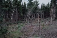
Title (German)
Messen SO, Südwestansicht und Nordwestansicht der Windwurfschadenfläche im nordwestlichen Teil der Versuchsfläche Messen
Caption
Southwest view over uncleared windthrow damaged area, 1st follow-up photograph during vegetation phase (2001), storm wood, with broken and still standing spruce trees, beginning of secondary succession, partial view; coordinates (LV03) of camera location: 601755/215052; keywords Documenta Natura: windthrow, lowland, landscape change.
Caption (German)
Südwestansicht über die ungeräumte Windwurfschadenfläche, 1. Folgeaufnahme während der Vegetationsphase (2001), Sturmholz, mit gebrochenen und noch stehenden Fichten, Beginn sekundäre Sukzession, Teilansicht; Koordinaten (LV03) des Kamerastandorts: 601755/215052; Schlagworte Documenta Natura: Windwurf, Flachland, Landschaftswandel
Record Name
Dia_303-38088

Title (German)
Messen SO, Südwestansicht und Nordwestansicht der Windwurfschadenfläche im nordwestlichen Teil der Versuchsfläche Messen
Caption
Northwest view across uncleared windthrow damaged area, 1st follow-up photograph during vegetation phase (2001), storm wood, with broken and still standing spruce trees, beginning of secondary succession, partial view; coordinates (LV03) of camera location: 601755/215052; keywords Documenta Natura: windthrow, lowland, landscape change.
Caption (German)
Nordwestansicht über die ungeräumte Windwurfschadenfläche, 1. Folgeaufnahme während der Vegetationsphase (2001), Sturmholz, mit gebrochenen und noch stehenden Fichten, Beginn sekundäre Sukzession, Teilansicht; Koordinaten (LV03) des Kamerastandorts: 601755/215052; Schlagworte Documenta Natura: Windwurf, Flachland, Landschaftswandel
Record Name
Dia_303-38098

Title (German)
Messen SO, Südwestansicht und Nordwestansicht der Windwurfschadenfläche im nordwestlichen Teil der Versuchsfläche Messen
Caption
Southwest view over uncleared windthrow damaged area, 2nd follow-up image during vegetation phase (2003), storm wood, with broken and still standing spruce trees, secondary succession (growing herb and shrub layer), partial view; coordinates (LV03) of camera location: 601755/215052; keywords Documenta Natura: windthrow, lowland, landscape change.
Caption (German)
Südwestansicht über die ungeräumte Windwurfschadenfläche, 2. Folgeaufnahme während der Vegetationsphase (2003), Sturmholz, mit gebrochenen und noch stehenden Fichten, sekundäre Sukzession (wachsende Kraut- und Strauchschicht), Teilansicht; Koordinaten (LV03) des Kamerastandorts: 601755/215052; Schlagworte Documenta Natura: Windwurf, Flachland, Landschaftswandel
Record Name
Dia_303-38108

Title (German)
Messen SO, Südwestansicht und Nordwestansicht der Windwurfschadenfläche im nordwestlichen Teil der Versuchsfläche Messen
Caption
Northwest view across uncleared windthrow damaged area, 2nd follow-up image during vegetation phase (2003), storm wood, with broken and still standing spruce trees, secondary succession (growing herb and shrub layer), partial view; coordinates (LV03) of camera location: 601755/215052; keywords Documenta Natura: windthrow, lowland, landscape change.
Caption (German)
Nordwestansicht über die ungeräumte Windwurfschadenfläche, 2. Folgeaufnahme während der Vegetationsphase (2003), Sturmholz, mit gebrochenen und noch stehenden Fichten, sekundäre Sukzession (wachsende Kraut- und Strauchschicht), Teilansicht; Koordinaten (LV03) des Kamerastandorts: 601755/215052; Schlagworte Documenta Natura: Windwurf, Flachland, Landschaftswandel
Record Name
Dia_303-38118

Title (German)
Messen SO, Südwestansicht und Nordwestansicht der Windwurfschadenfläche im nordwestlichen Teil der Versuchsfläche Messen
Caption
Southwestern view over uncleared windthrow damaged area, 3rd follow-up image during vegetation phase (2005), storm wood, with broken and still standing spruce trees, secondary succession (shrub layer, pioneer trees), partial view; coordinates (LV03) of camera location: 601755/215052; keywords Documenta Natura: windthrow, lowland, landscape change.
Caption (German)
Südwestansicht über die ungeräumte Windwurfschadenfläche, 3. Folgeaufnahme während der Vegetationsphase (2005), Sturmholz, mit gebrochenen und noch stehenden Fichten, sekundäre Sukzession (Strauchschicht, Pionierbäume), Teilansicht; Koordinaten (LV03) des Kamerastandorts: 601755/215052; Schlagworte Documenta Natura: Windwurf, Flachland, Landschaftswandel
Record Name
Dia_303-38128
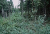
Title (German)
Messen SO, Südwestansicht und Nordwestansicht der Windwurfschadenfläche im nordwestlichen Teil der Versuchsfläche Messen
Caption
Northwest view across uncleared windthrow damaged area, 3rd follow-up image during vegetation phase (2005), storm wood, with broken and still standing spruce trees, secondary succession (shrub layer, pioneer trees), partial view; coordinates (LV03) of camera location: 601755/215052; keywords Documenta Natura: windthrow, lowland, landscape change.
Caption (German)
Nordwestansicht über die ungeräumte Windwurfschadenfläche, 3. Folgeaufnahme während der Vegetationsphase (2005), Sturmholz, mit gebrochenen und noch stehenden Fichten, sekundäre Sukzession (Strauchschicht, Pionierbäume), Teilansicht; Koordinaten (LV03) des Kamerastandorts: 601755/215052; Schlagworte Documenta Natura: Windwurf, Flachland, Landschaftswandel
Record Name
Dia_303-38138

Title (German)
Messen SO, Nordwestansicht der Windwurfschadenfläche im mittleren Teil der Versuchsfläche Messen
Caption
Northwest view over uncleared windthrow damaged area, initial photograph, beginning of vegetation phase (2001), lying and broken storm wood (spruce), beginning of secondary succession, partial view; coordinates (LV03) of camera location: 601850/215128; keywords Documenta Natura: windthrow, lowland, landscape change.
Caption (German)
Nordwestansicht über die ungeräumte Windwurfschadenfläche, Erstaufnahme, Beginn der Vegetationsphase (2001), liegendes und gebrochenes Sturmholz (Fichte), Beginn sekundäre Sukzession, Teilansicht; Koordinaten (LV03) des Kamerastandorts: 601850/215128; Schlagworte Documenta Natura: Windwurf, Flachland, Landschaftswandel
Record Name
Dia_303-38149

Title (German)
Messen SO, Nordwestansicht der Windwurfschadenfläche im mittleren Teil der Versuchsfläche Messen
Caption
Northwest view across uncleared windthrow damaged area, 1st follow-up image during vegetation phase (2001), lying and broken storm wood (spruce), secondary succession (growth herbaceous and shrub layer), partial view; coordinates (LV03) of camera location: 601850/215128; keywords Documenta Natura: windthrow, lowland, landscape change.
Caption (German)
Nordwestansicht über die ungeräumte Windwurfschadenfläche, 1. Folgeaufnahme während der Vegetationsphase (2001), liegendes und gebrochenes Sturmholz (Fichte), sekundäre Sukzession (Wachstum Kraut- und Strauchschicht), Teilansicht; Koordinaten (LV03) des Kamerastandorts: 601850/215128; Schlagworte Documenta Natura: Windwurf, Flachland, Landschaftswandel
Record Name
Dia_303-38159

Title (German)
Messen SO, Nordwestansicht der Windwurfschadenfläche im mittleren Teil der Versuchsfläche Messen
Caption
Northwest view across uncleared windthrow damaged area, 2nd follow-up image during vegetation phase (2003), lying and broken storm wood (spruce), secondary succession (shrub layer and pioneer trees), partial view; coordinates (LV03) of camera location: 601850/215128; keywords Documenta Natura: windthrow, lowland, landscape change.
Caption (German)
Nordwestansicht über die ungeräumte Windwurfschadenfläche, 2. Folgeaufnahme während der Vegetationsphase (2003), liegendes und gebrochenes Sturmholz (Fichte), sekundäre Sukzession (Strauchschicht und Pionierbäume), Teilansicht; Koordinaten (LV03) des Kamerastandorts: 601850/215128; Schlagworte Documenta Natura: Windwurf, Flachland, Landschaftswandel
Record Name
Dia_303-38169
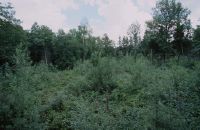
Title (German)
Messen SO, Nordwestansicht der Windwurfschadenfläche im mittleren Teil der Versuchsfläche Messen
Caption
Northwest view across uncleared windthrow damaged area, 3rd follow-up image during vegetation phase (2005), secondary succession (pioneer trees, young growth), partial view; coordinates (LV03) of camera location: 601850/215128; keywords Documenta Natura: windthrow, lowland, landscape change.
Caption (German)
Nordwestansicht über die ungeräumte Windwurfschadenfläche, 3. Folgeaufnahme während der Vegetationsphase (2005), sekundäre Sukzession (Pionierbäume, Jungwuchs), Teilansicht; Koordinaten (LV03) des Kamerastandorts: 601850/215128; Schlagworte Documenta Natura: Windwurf, Flachland, Landschaftswandel
Record Name
Dia_303-38179

Title (German)
Messen SO, Nordwestansicht der Windwurfschadenfläche im nördlichen Teil der Versuchsfläche Messen
Caption
Northwest view over cleared windthrow damaged area, initial photograph, beginning of vegetation phase (2001), with forest road and measuring equipment, secondary succession, partial view; coordinates (LV03) of camera location: 601730/215345; keywords Documenta Natura: windthrow, lowland, landscape change.
Caption (German)
Nordwestansicht über die geräumte Windwurfschadenfläche, Erstaufnahme, Beginn der Vegetationsphase (2001), mit Waldstrasse und Messeinrichtungen, sekundäre Sukzession, Teilansicht; Koordinaten (LV03) des Kamerastandorts: 601730/215345; Schlagworte Documenta Natura: Windwurf, Flachland, Landschaftswandel
Record Name
Dia_303-38190

Title (German)
Messen SO, Nordwestansicht der Windwurfschadenfläche im nördlichen Teil der Versuchsfläche Messen
Caption
Northwest view over cleared windthrow damaged area, initial photograph, beginning of vegetation phase (2001), with forest road and measuring equipment, secondary succession, partial view; coordinates (LV03) of camera location: 601730/215345; keywords Documenta Natura: windthrow, lowland, landscape change.
Caption (German)
Nordwestansicht über die geräumte Windwurfschadenfläche, Erstaufnahme, Beginn der Vegetationsphase (2001), mit Waldstrasse und Messeinrichtungen, sekundäre Sukzession, Teilansicht; Koordinaten (LV03) des Kamerastandorts: 601730/215345; Schlagworte Documenta Natura: Windwurf, Flachland, Landschaftswandel
Record Name
Dia_303-38200

Title (German)
Messen SO, Nordwestansicht der Windwurfschadenfläche im nördlichen Teil der Versuchsfläche Messen
Caption
Northwest view over cleared windthrow damaged area, 1st follow-up image during vegetation (2001), with forest road and measuring equipment, secondary succession (growth of herbaceous and shrub layer), partial view; coordinates (LV03) of camera location: 601730/215345; keywords Documenta Natura: windthrow, lowland, landscape change.
Caption (German)
Nordwestansicht über die geräumte Windwurfschadenfläche, 1. Folgeaufnahme während der Vegetation (2001), mit Waldstrasse und Messeinrichtungen, sekundäre Sukzession (Wachstum Kraut- und Strauchschicht), Teilansicht; Koordinaten (LV03) des Kamerastandorts: 601730/215345; Schlagworte Documenta Natura: Windwurf, Flachland, Landschaftswandel
Record Name
Dia_303-38210

Title (German)
Messen SO, Nordwestansicht der Windwurfschadenfläche im nördlichen Teil der Versuchsfläche Messen
Caption
Northwest view over cleared windthrow damaged area, 1st follow-up image during vegetation (2001), with forest road and measuring equipment, secondary succession (growth of herbaceous and shrub layer), partial view; coordinates (LV03) of camera location: 601730/215345; keywords Documenta Natura: windthrow, lowland, landscape change.
Caption (German)
Nordwestansicht über die geräumte Windwurfschadenfläche, 1. Folgeaufnahme während der Vegetation (2001), mit Waldstrasse und Messeinrichtungen, sekundäre Sukzession (Wachstum Kraut- und Strauchschicht), Teilansicht; Koordinaten (LV03) des Kamerastandorts: 601730/215345; Schlagworte Documenta Natura: Windwurf, Flachland, Landschaftswandel
Record Name
Dia_303-38220

Title (German)
Messen SO, Nordwestansicht der Windwurfschadenfläche im nördlichen Teil der Versuchsfläche Messen
Caption
Northwest view over cleared windthrow damaged area, 2nd follow-up image during vegetation (2003), secondary succession (growth of shrub layer and pioneer trees), partial view; coordinates (LV03) of camera location: 601730/215345; keywords Documenta Natura: windthrow, lowland, landscape change.
Caption (German)
Nordwestansicht über die geräumte Windwurfschadenfläche, 2. Folgeaufnahme während der Vegetation (2003), sekundäre Sukzession (Wachstum Strauchschicht und Pionierbäume), Teilansicht; Koordinaten (LV03) des Kamerastandorts: 601730/215345; Schlagworte Documenta Natura: Windwurf, Flachland, Landschaftswandel
Record Name
Dia_303-38230

Title (German)
Messen SO, Nordwestansicht der Windwurfschadenfläche im nördlichen Teil der Versuchsfläche Messen
Caption
Northwest view over cleared windthrow damaged area, 2nd follow-up image during vegetation (2003), secondary succession (growth of shrub layer and pioneer trees), partial view; coordinates (LV03) of camera location: 601730/215345; keywords Documenta Natura: windthrow, lowland, landscape change.
Caption (German)
Nordwestansicht über die geräumte Windwurfschadenfläche, 2. Folgeaufnahme während der Vegetation (2003), sekundäre Sukzession (Wachstum Strauchschicht und Pionierbäume), Teilansicht; Koordinaten (LV03) des Kamerastandorts: 601730/215345; Schlagworte Documenta Natura: Windwurf, Flachland, Landschaftswandel
Record Name
Dia_303-38240

Title (German)
Messen SO, Nordwestansicht der Windwurfschadenfläche im nördlichen Teil der Versuchsfläche Messen
Caption
Northwest view over cleared windthrow damaged area, 3rd follow-up image during vegetation (2005), secondary succession (young growth with pioneer trees), partial view; coordinates (LV03) of camera location: 601730/215345; keywords Documenta Natura: windthrow, lowland, landscape change.
Caption (German)
Nordwestansicht über die geräumte Windwurfschadenfläche, 3. Folgeaufnahme während der Vegetation (2005), sekundäre Sukzession (Jungwuchs mit Pionierbäume), Teilansicht; Koordinaten (LV03) des Kamerastandorts: 601730/215345; Schlagworte Documenta Natura: Windwurf, Flachland, Landschaftswandel
Record Name
Dia_303-38250

Title (German)
Messen SO, Nordwestansicht der Windwurfschadenfläche im nördlichen Teil der Versuchsfläche Messen
Caption
Northwest view over cleared windthrow damaged area, 3rd follow-up image during vegetation (2005), secondary succession (young growth with pioneer trees), partial view; coordinates (LV03) of camera location: 601730/215345; keywords Documenta Natura: windthrow, lowland, landscape change.
Caption (German)
Nordwestansicht über die geräumte Windwurfschadenfläche, 3. Folgeaufnahme während der Vegetation (2005), sekundäre Sukzession (Jungwuchs mit Pionierbäume), Teilansicht; Koordinaten (LV03) des Kamerastandorts: 601730/215345; Schlagworte Documenta Natura: Windwurf, Flachland, Landschaftswandel
Record Name
Dia_303-38260

Title (German)
Wohlen b. Bern BE, Südostansicht der Kulturlandschaft bei Falkwil westlich von Üttligen, im Hintergrund der Weiler Möriswilmoos
Caption
Southeast view of meadow and arable land (unplowed) Falkwil, in the background the hamlet Möriswilmoos, first photograph (1994), general view; coordinates (LV03) of camera location: 594648/204693; keywords Documenta Natura: hedge, agriculture_general, landscape change, lowlands
Caption (German)
Südostansicht des Wies- und Ackerlandes (ungepflügt) Falkwil, im Hintergrund der Weiler Möriswilmoos, Erstaufnahme (1994), Gesamtansicht; Koordinaten (LV03) des Kamerastandorts: 594648/204693; Schlagworte Documenta Natura: Hecke, Landwirtschaft_Allgemein, Landschaftswandel, Flachland
Record Name
Dia_303-38271

Title (German)
Wohlen b. Bern BE, Südostansicht der Kulturlandschaft bei Falkwil westlich von Üttligen, im Hintergrund der Weiler Möriswilmoos
Caption
Southeast view of the meadow and arable land Falkwil after conversion into an ecological compensation area, in the background the hamlet Möriswilmoos, 1st follow-up photograph after planting low hedges and conversion of the arable land into extensive meadowland (2006), general view; coordinates (LV03) of the camera location: 594648/204693; keywords Documenta Natura: hedge, agriculture_general, landscape change, lowlands
Caption (German)
Südostansicht des Wies- und Ackerlandes Falkwil nach Umwandlung in eine ökologische Ausgleichsfläche, im Hintergrund der Weiler Möriswilmoos, 1. Folgeaufnahme nach dem Anpflanzen von Niederhecken und Umwandlung des Ackerlandes in extensives Wiesland (2006), Gesamtansicht; Koordinaten (LV03) des Kamerastandorts: 594648/204693; Schlagworte Documenta Natura: Hecke, Landwirtschaft_Allgemein, Landschaftswandel, Flachland
Record Name
Dia_303-38281

Title (German)
Wohlen b. Bern BE, Nordostansicht der Ackerlandes bei Schürmatt südlich von Üttligen
Caption
Northeast view of farmland near Schürmatt with ditch and field road, forest in the background, first photograph (1994), general view; coordinates (LV03) of camera location: 595855/203115; keywords Documenta Natura: hedge, agriculture_general, landscape change, lowlands
Caption (German)
Nordostansicht des Ackerlandes bei Schürmatt mit Wassergraben und Flurstrasse, im Hintergrund Wald, Erstaufnahme (1994), Gesamtansicht; Koordinaten (LV03) des Kamerastandorts: 595855/203115; Schlagworte Documenta Natura: Hecke, Landwirtschaft_Allgemein, Landschaftswandel, Flachland
Record Name
Dia_303-38293
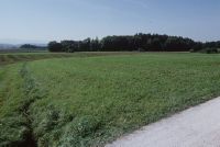
Title (German)
Wohlen b. Bern BE, Nordostansicht der Ackerlandes bei Schürmatt südlich von Üttligen
Caption
Northeast view of farmland near Schürmatt with water ditch and field road, forest in the background, 1st subsequent photograph (2006) without the planting of shrubs, general view; coordinates (LV03) of the camera location: 595855/203115; keywords Documenta Natura: hedge, agriculture_general, landscape change, flatland
Caption (German)
Nordostansicht des Ackerlandes bei Schürmatt mit Wassergraben und Flurstrasse, im Hintergrund Wald, 1. Folgeaufnahme (2006) ohne die Anpflanzung von Sträuchern, Gesamtansicht; Koordinaten (LV03) des Kamerastandorts: 595855/203115; Schlagworte Documenta Natura: Hecke, Landwirtschaft_Allgemein, Landschaftswandel, Flachland
Record Name
Dia_303-38302

Title (German)
Wohlen b. Bern BE, Südostansicht des Wieslandes, Ackerlandes Schürmatt südlich von Üttligen, im Hintergrund die Weiler Schürmatt, Obere Schürmatt und Üttligen
Caption
Southeast view of the meadow and farmland Schürmatt, in the background the village Uettligen, first photo (1994), general view; coordinates (LV03) of the camera location: 595855/203115; keywords Documenta Natura: hedge, agriculture_general, landscape change, lowlands
Caption (German)
Südostansicht des Wies- und Ackerlandes Schürmatt, im Hintergrund das Dorf Uettligen, Erstaufnahme (1994), Gesamtansicht; Koordinaten (LV03) des Kamerastandorts: 595855/203115; Schlagworte Documenta Natura: Hecke, Landwirtschaft_Allgemein, Landschaftswandel, Flachland
Record Name
Dia_303-38314

Title (German)
Wohlen b. Bern BE, Südostansicht des Wieslandes, Ackerlandes Schürmatt südlich von Üttligen, im Hintergrund die Weiler Schürmatt, Obere Schürmatt und Üttligen
Caption
Southeast view of the meadow and farmland Schürmatt, in the background the village Uettligen, first photo (1994), general view; coordinates (LV03) of the camera location: 595830/203195; keywords Documenta Natura: hedge, agriculture_general, landscape change, lowlands
Caption (German)
Südostansicht des Wies- und Ackerlandes Schürmatt, im Hintergrund das Dorf Uettligen, Erstaufnahme (1994), Gesamtansicht; Koordinaten (LV03) des Kamerastandorts: 595830/203195; Schlagworte Documenta Natura: Hecke, Landwirtschaft_Allgemein, Landschaftswandel, Flachland
Record Name
Dia_303-38323

Title (German)
Wohlen b. Bern BE, Südostansicht des Wieslandes, Ackerlandes Schürmatt südlich von Üttligen, im Hintergrund die Weiler Schürmatt, Obere Schürmatt und Üttligen
Caption
Southeast view of the meadow and arable land Schürmatt, in the background the village Üttligen, 1st follow-up photograph after planting low hedges and converting wet arable land into extensive meadow as well as widening the channel and planting tall herbaceous vegetation (2006), general view; coordinates (LV03) of the camera location: 595830/203195; keywords Documenta Natura: hedge, agriculture_general, landscape change, lowlands
Caption (German)
Südostansicht des Wies- und Ackerlandes Schürmatt, im Hintergrund das Dorf Üttligen, 1. Folgeaufnahme nach dem Anpflanzen von Niederhecken und Umwandeln von vernässtem Ackerland in eine extensive Wiese sowie Aufweiten des Gerinnes und Anpflanzen von Hochstaudenflur (2006), Gesamtansicht; Koordinaten (LV03) des Kamerastandorts: 595830/203195; Schlagworte Documenta Natura: Hecke, Landwirtschaft_Allgemein, Landschaftswandel, Flachland
Record Name
Dia_303-38333

Title (German)
Wohlen b. Bern BE, Nordwestansicht der Möriswilstrasse östlich von Möriswil
Caption
Northwest view of Möriswilstrasse with meadowland, single tree, embankment, shrubs as well as meadowland and arable land, general view; coordinates (LV03) of camera location: 593565/204465; keywords Documenta Natura: hedge, agriculture_general, landscape change, lowlands
Caption (German)
Nordwestansicht der Möriswilstrasse mit Wiesland, Einzelbaum, Böschung, Sträucher sowie Wiesland und Ackerland, Gesamtansicht; Koordinaten (LV03) des Kamerastandorts: 593565/204465; Schlagworte Documenta Natura: Hecke, Landwirtschaft_Allgemein, Landschaftswandel, Flachland
Record Name
Dia_303-38356
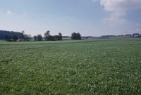
Title (German)
Wohlen b. Bern BE, Ostansicht des Wieslandes, Ackerlandes Längmatt südlich von Üttligen
Caption
East view of meadowland and farmland Längmatt with forest, Glasbach with trees, first photograph (1994), general view; coordinates (LV03) of camera location: 596720/203650; keywords Documenta Natura: hedge, agriculture_general, landscape change, lowlands
Caption (German)
Ostansicht des Wieslandes und Ackerlandes Längmatt mit Wald, Glasbach mit Bäumen, Erstaufnahme (1994), Gesamtansicht; Koordinaten (LV03) des Kamerastandorts: 596720/203650; Schlagworte Documenta Natura: Hecke, Landwirtschaft_Allgemein, Landschaftswandel, Flachland
Record Name
Dia_303-38366

Title (German)
Wohlen b. Bern BE, Ostansicht des Wieslandes, Ackerlandes Längmatt südlich von Üttligen
Caption
East view of meadowland and arable land Längmatt with forest, Glasbach with trees, 1st subsequent photograph (2006), general view; coordinates (LV03) of camera location: 596720/203650; keywords Documenta Natura: hedge, agriculture_general, landscape change, lowlands
Caption (German)
Ostansicht des Wieslandes und Ackerlandes Längmatt mit Wald, Glasbach mit Bäumen, 1. Folgeaufnahme (2006), Gesamtansicht; Koordinaten (LV03) des Kamerastandorts: 596720/203650; Schlagworte Documenta Natura: Hecke, Landwirtschaft_Allgemein, Landschaftswandel, Flachland
Record Name
Dia_303-38376

Title (German)
Wohlen b. Bern BE, Südwestansicht des Wieslandes, Ackerlandes Längmatt südlich von Üttligen
Caption
Southwest view of Längmatt meadow and farmland, Uettligen in the background, 1st follow-up image after planting low hedges, deciduous trees/single tree and variegated fallow (2006), partial view; coordinates (LV03) of camera location: 596190/203488; keywords Documenta Natura: hedge, agriculture_general, landscape change, lowland.
Caption (German)
Südwestansicht des Wies- und Ackerlandes Längmatt, im Hintergrund Uettligen, 1. Folgeaufnahme nach dem Anpflanzen von Niederhecken, Laubbäumen/Einzelbaum und Buntbrachestreifen (2006), Teilansicht; Koordinaten (LV03) des Kamerastandorts: 596190/203488; Schlagworte Documenta Natura: Hecke, Landwirtschaft_Allgemein, Landschaftswandel, Flachland
Record Name
Dia_303-38397

Title (German)
Wohlen b. Bern BE, Südansicht des Wieslandes Säget südöstlich von Üttligen
Caption
South view of meadow Säget with group of trees of pollarded willows (moat), first photograph (1994), general view; coordinates (LV03) of camera location: 596753/203695; keywords Documenta Natura: hedge, agriculture_general, landscape change, lowlands
Caption (German)
Südansicht des Wieslandes Säget mit Baumgruppe von Kopfweiden (Wassergraben), Erstaufnahme (1994), Gesamtansicht; Koordinaten (LV03) des Kamerastandorts: 596753/203695; Schlagworte Documenta Natura: Hecke, Landwirtschaft_Allgemein, Landschaftswandel, Flachland
Record Name
Dia_303-38409

Title (German)
Wohlen b. Bern BE, Südansicht des Wieslandes Säget südöstlich von Üttligen
Caption
South view of Säget meadow with group of pollarded willows (moat), 1st follow-up image after planting more pollarded willows along the moat (2006), general view; coordinates (LV03) of camera location: 596753/203695; keywords Documenta Natura: hedge, agriculture_general, landscape change, lowlands
Caption (German)
Südansicht des Wieslandes Säget mit Baumgruppe von Kopfweiden (Wassergraben), 1. Folgeaufnahme nach dem Anpflanzen von weiteren Kopfweiden entlang des Wassergraben (2006), Gesamtansicht; Koordinaten (LV03) des Kamerastandorts: 596753/203695; Schlagworte Documenta Natura: Hecke, Landwirtschaft_Allgemein, Landschaftswandel, Flachland
Record Name
Dia_303-38420

Title (German)
Wohlen b. Bern BE, Nordwestansicht des Ackerlandes, Wieslandes Hintermatt und Bützenmatt südlich von Möriswil
Caption
Northwest view of the farmland and meadow Hintermatt and Bützenmatt, at the right edge of the picture the hamlet Bützenmatt, first photograph (1994), partial view; coordinates (LV03) of the camera location: 593505/204000; keywords Documenta Natura: hedge, agriculture_general, landscape change, lowlands
Caption (German)
Nordwestansicht des Ackerlandes und Wieslandes Hintermatt und Bützenmatt, am rechten Bildrand der Weiler Bützenmatt, Erstaufnahme (1994), Teilansicht; Koordinaten (LV03) des Kamerastandorts: 593505/204000; Schlagworte Documenta Natura: Hecke, Landwirtschaft_Allgemein, Landschaftswandel, Flachland
Record Name
Dia_303-38429

Title (German)
Wohlen b. Bern BE, Nordwestansicht des Ackerlandes, Wieslandes Hintermatt und Bützenmatt südlich von Möriswil
Caption
Northwestern view of the farmland and meadow Hintermatt and Bützenmatt, at the right edge of the picture the hamlet Bützenmatt, 1st subsequent photograph after planting low hedges (2006), partial view; coordinates (LV03) of the camera location: 593505/204000; keywords Documenta Natura: hedge, agriculture_general, landscape change, lowlands
Caption (German)
Nordwestansicht des Ackerlandes und Wieslandes Hintermatt und Bützenmatt, am rechten Bildrand der Weiler Bützenmatt, 1. Folgeaufnahme nach dem Anpflanzen von Niederhecken (2006), Teilansicht; Koordinaten (LV03) des Kamerastandorts: 593505/204000; Schlagworte Documenta Natura: Hecke, Landwirtschaft_Allgemein, Landschaftswandel, Flachland
Record Name
Dia_303-38439

Title (German)
Wohlen b. Bern BE, Nordwestansicht der Weide am südlichen Dorfrand von Üttligen
Caption
Northwest view of meadowland (pasture) at the southern edge of the village, with cows grazing, Längmatt in the background, first photograph (1994), partial view; coordinates (LV03) of camera location: 596053/204035; keywords Documenta Natura: hedge, agriculture_general, landscape change, lowlands
Caption (German)
Nordwestansicht des Wieslandes (Weide) am südlichen Dorfrand, mit Kühen beim Weiden, im Hintergrund die Längmatt, Erstaufnahme (1994), Teilansicht; Koordinaten (LV03) des Kamerastandorts: 596053/204035; Schlagworte Documenta Natura: Hecke, Landwirtschaft_Allgemein, Landschaftswandel, Flachland
Record Name
Dia_303-38450

Title (German)
Wohlen b. Bern BE, Nordwestansicht der Weide am südlichen Dorfrand von Üttligen
Caption
Northwest view of the meadowland (pasture) at the southern edge of the village, with horses grazing, Längmatt in the background, 1st subsequent photograph after planting low hedges and fruit trees (2006), partial view; coordinates (LV03) of the camera location: 596053/204035; keywords Documenta Natura: hedge, agriculture_general, landscape change, lowlands
Caption (German)
Nordwestansicht des Wieslandes (Weide) am südlichen Dorfrand, mit Pferden beim Weiden, im Hintergrund die Längmatt, 1. Folgeaufnahme nach dem Anpflanzen von Niederhecken und Obstbäumen (2006), Teilansicht; Koordinaten (LV03) des Kamerastandorts: 596053/204035; Schlagworte Documenta Natura: Hecke, Landwirtschaft_Allgemein, Landschaftswandel, Flachland
Record Name
Dia_303-38460

Title (German)
Wohlen b. Bern BE, Südwestansicht des Ackerlandes, Wieslandes Bützenmatt südlich von Möriswil
Caption
Southwest view of the farmland and meadow Bützenmatt, at the right edge of the picture the hamlet Bützenmatt, asphalted connecting road, first photograph (1995), general view; coordinates (LV03) of the camera location: 593410/203720; keywords Documenta Natura: hedge, agriculture_general, landscape change, lowlands
Caption (German)
Südwestansicht des Acker- und Wieslandes Bützenmatt, am rechten Bildrand der Weiler Bützenmatt, asphaltierte Verbindungsstrasse, Erstaufnahme (1995), Gesamtansicht; Koordinaten (LV03) des Kamerastandorts: 593410/203720; Schlagworte Documenta Natura: Hecke, Landwirtschaft_Allgemein, Landschaftswandel, Flachland
Record Name
Dia_303-38471
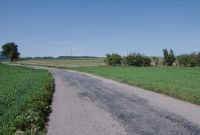
Title (German)
Wohlen b. Bern BE, Südwestansicht des Ackerlandes, Wieslandes Bützenmatt südlich von Möriswil
Caption
Southwest view of the farmland and meadow Bützenmatt, at the right edge of the picture the hamlet Bützenmatt, asphalted connecting road, 1st subsequent photograph after planting low hedges (2006), general view; coordinates (LV03) of the camera location: 593410/203720; keywords Documenta Natura: hedge, agriculture_general, landscape change, lowlands
Caption (German)
Südwestansicht des Acker- und Wieslandes Bützenmatt, am rechten Bildrand der Weiler Bützenmatt, asphaltierte Verbindungsstrasse, 1. Folgeaufnahme nach dem Anpflanzen von Niederhecken (2006), Gesamtansicht; Koordinaten (LV03) des Kamerastandorts: 593410/203720; Schlagworte Documenta Natura: Hecke, Landwirtschaft_Allgemein, Landschaftswandel, Flachland
Record Name
Dia_303-38481

Title (German)
Wohlen b. Bern BE, Südansicht des Wieslandes, Ackerlandes Bergmatt, Steimatte südlich von Üttligen
Caption
South view of the meadow and farmland Bergmatt and Steimatte, in the background the village Üttligen, first photograph (1995), partial view; coordinates (LV03) of the camera location: 596112/203267; keywords Documenta Natura: hedge, agriculture_general, landscape change, lowlands
Caption (German)
Südansicht des Wies- und Ackerlandes Bergmatt und Steimatte, im Hintergrund das Dorf Üttligen, Erstaufnahme (1995), Teilansicht; Koordinaten (LV03) des Kamerastandorts: 596112/203267; Schlagworte Documenta Natura: Hecke, Landwirtschaft_Allgemein, Landschaftswandel, Flachland
Record Name
Dia_303-38493

Title (German)
Wohlen b. Bern BE, Südansicht des Wieslandes, Ackerlandes Bergmatt, Steimatte südlich von Üttligen
Caption
South view of the meadow and arable land Bergmatt and Steimatte, in the background the village Üttligen, first photograph (1995), partial view; coordinates (LV03) of the camera location: 596112/203267; keywords Documenta Natura: hedge, agriculture_general, landscape change, lowlands
Caption (German)
Südansicht des Wies- und Ackerlandes Bergmatt und Steimatte, im Hintergrund das Dorf Üttligen, Erstaufnahme (1995), Teilansicht; Koordinaten (LV03) des Kamerastandorts: 596112/203267; Schlagworte Documenta Natura: Hecke, Landwirtschaft_Allgemein, Landschaftswandel, Flachland
Record Name
Dia_303-38503

Title (German)
Wohlen b. Bern BE, Südansicht des Wieslandes, Ackerlandes Bergmatt, Steimatte südlich von Üttligen
Caption
South view of the meadow and arable land Bergmatt and Steimatte, in the background the village Uettligen, 1st follow-up photograph after planting low hedges (2005), partial view; coordinates (LV03) of the camera location: 596112/203267; keywords Documenta Natura: hedge, agriculture_general, landscape change, lowlands
Caption (German)
Südansicht des Wies- und Ackerlandes Bergmatt und Steimatte, im Hintergrund das Dorf Uettligen, 1. Folgeaufnahme nach dem Anpflanzen von Niederhecken (2005), Teilansicht; Koordinaten (LV03) des Kamerastandorts: 596112/203267; Schlagworte Documenta Natura: Hecke, Landwirtschaft_Allgemein, Landschaftswandel, Flachland
Record Name
Dia_303-38512

Title (German)
Wohlen b. Bern BE, Südansicht des Wieslandes, Ackerlandes Bergmatt, Steimatte südlich von Üttligen
Caption
South view of the meadow and arable land Bergmatt and Steimatte, in the background the village Uettligen, 1st follow-up photograph after planting low hedges (2005), partial view; coordinates (LV03) of the camera location: 596112/203267; keywords Documenta Natura: hedge, agriculture_general, landscape change, lowlands
Caption (German)
Südansicht des Wies- und Ackerlandes Bergmatt und Steimatte, im Hintergrund das Dorf Uettligen, 1. Folgeaufnahme nach dem Anpflanzen von Niederhecken (2005), Teilansicht; Koordinaten (LV03) des Kamerastandorts: 596112/203267; Schlagworte Documenta Natura: Hecke, Landwirtschaft_Allgemein, Landschaftswandel, Flachland
Record Name
Dia_303-38522

Title (German)
Diemtigen BE, Grimmialp, Weide südlich des Kurheimes
Caption
Pasture at the beginning of the vegetation phase, area with stones and single trees (spruce), in the background the Grimmialp health resort, long-term observation on behalf of Pro Natura Bern (easement agreement between Pro Natura/SNB and owner), partial view; coordinates (LV03) of the camera location: 603815/157815; keywords Documenta Natura: Landwirtschaft_General, Landschaftswandel, Berggebiet, Laubbaum Wiese
Caption (German)
Weide bei Beginn der Vegetationsphase, Fläche mit Steinen und Einzelbäumen (Fichte), im Hintergrund das Kurheim Grimmialp, Langzeitbeobachtung im Auftrag der Pro Natura Bern (Dienstbarkeitsvertrag zwischen Pro Natura/SNB und Eigentümer), Teilansicht; Koordinaten (LV03) des Kamerastandorts: 603815/157815; Schlagworte Documenta Natura: Landwirtschaft_Allgemein, Landschaftswandel, Berggebiet, Laubbaum Wiese
Record Name
Dia_303-38533

Title (German)
Diemtigen BE, Grimmialp, Weide im Osthang östlich des Kurheimes
Caption
Pasture with steep eastern slope, beginning of vegetation phase, with conifers (spruce)/single trees (sycamore maple), long-term observation on behalf of Pro Natura Bern (easement agreement between Pro Natura/SNB and owner), partial view; coordinates (LV03) of camera location: 603925/157960; keywords Documenta Natura: Landwirtschaft_General, Landschaftswandel, Berggebiet, Laubbaum Wiese
Caption (German)
Weide mit steilem Osthang, Beginn der Vegetationsphase, mit Nadelbäumen (Fichte)/Einzelbäumen (Bergahorn), Langzeitbeobachtung im Auftrag der Pro Natura Bern (Dienstbarkeitsvertrag zwischen Pro Natura/SNB und Eigentümer), Teilansicht; Koordinaten (LV03) des Kamerastandorts: 603925/157960; Schlagworte Documenta Natura: Landwirtschaft_Allgemein, Landschaftswandel, Berggebiet, Laubbaum Wiese
Record Name
Dia_303-38544

Title (German)
Diemtigen BE, Grimmialp, Weide im Osthang östlich des Kurheimes
Caption
Pasture with steep eastern slope, beginning of vegetation phase, with conifers (spruce)/single trees (sycamore maple), new stable, long-term observation on behalf of Pro Natura Bern (easement agreement between Pro Natura/SNB and owner), partial view; coordinates (LV03) of camera location: 603925/157960; keywords Documenta Natura: Landwirtschaft_General, Landschaftswandel, Berggebiet, Laubbaum Wiese
Caption (German)
Weide mit steilem Osthang, Beginn der Vegetationsphase, mit Nadelbäumen (Fichte)/Einzelbäumen (Bergahorn), neuem Stall, Langzeitbeobachtung im Auftrag der Pro Natura Bern (Dienstbarkeitsvertrag zwischen Pro Natura/SNB und Eigentümer), Teilansicht; Koordinaten (LV03) des Kamerastandorts: 603925/157960; Schlagworte Documenta Natura: Landwirtschaft_Allgemein, Landschaftswandel, Berggebiet, Laubbaum Wiese
Record Name
Dia_303-38552

Title (German)
Diemtigen BE, Grimmialp, Weide im Osthang östlich des Kurheimes
Caption
Pasture with steep eastern slope, beginning of vegetation phase, with conifers (spruce)/single trees (sycamore maple), brook Fildrich with riparian woodland, long-term observation on behalf of Pro Natura Bern (easement agreement between Pro Natura/SNB and owner), partial view; coordinates (LV03) of camera location: 603888/158025; keywords Documenta Natura: Landwirtschaft_General, Landschaftswandel, Berggebiet, Laubbaum Wiese
Caption (German)
Weide mit steilem Osthang, Beginn der Vegetationsphase, mit Nadelbäumen (Fichte)/Einzelbäumen (Bergahorn), Bach Fildrich mit Ufergehölz, Langzeitbeobachtung im Auftrag der Pro Natura Bern (Dienstbarkeitsvertrag zwischen Pro Natura/SNB und Eigentümer), Teilansicht; Koordinaten (LV03) des Kamerastandorts: 603888/158025; Schlagworte Documenta Natura: Landwirtschaft_Allgemein, Landschaftswandel, Berggebiet, Laubbaum Wiese
Record Name
Dia_303-38561

Title (German)
Diemtigen BE, Grimmialp, Weide südlich von Geissboden
Caption
Mountain pasture in spring vegetation, freshly fertilized, with three sycamores (acer pseudoplatanus), in the foreground the stream Senggibach, partial view; coordinates (LV03) of the camera location: 603650/158285; keywords Documenta Natura: agriculture_general, landscape change, mountain area, deciduous tree meadow
Caption (German)
Bergweide in Frühlingsvegetation, frisch gedüngt, mit drei Bergahornen (acer pseudoplatanus), im Vordergrund der Bach Senggibach, Teilansicht; Koordinaten (LV03) des Kamerastandorts: 603650/158285; Schlagworte Documenta Natura: Landwirtschaft_Allgemein, Landschaftswandel, Berggebiet, Laubbaum Wiese
Record Name
Dia_303-38574

Title (German)
Diemtigen BE, Grimmialp, Weide und Waldrand im Westhang oberhalb des Baches Senggibach
Caption
Northeast view of pasture with steep slope, power pole and single tree, young growth spruce, in the background the edge of the forest and the brook Senggibach with riparian woodland, partial view; coordinates (LV03) of the camera location: 603510/158050; keywords Documenta Natura: agriculture_general, landscape change, mountain area, deciduous tree meadow
Caption (German)
Nordostansicht der Weide mit Steilhang, Strommast und Einzelbaum, Jungwuchs Fichte, im Hintergrund der Waldrand und der Bach Senggibach mit Ufergehölz, Teilansicht; Koordinaten (LV03) des Kamerastandorts: 603510/158050; Schlagworte Documenta Natura: Landwirtschaft_Allgemein, Landschaftswandel, Berggebiet, Laubbaum Wiese
Record Name
Dia_303-38584

Title (German)
Diemtigen BE, Grimmialp, Weide im Westhang westlich des Kurheimes
Caption
View of pasture in slope, in spring vegetation with deciduous trees and conifers/group of trees and single tree, with asphalted road, edge of forest, stables and chapel, partial view; coordinates (LV03) of camera location: 603510/158010; keywords Documenta Natura: agriculture_general, landscape change, mountain area, deciduous tree meadow
Caption (German)
Ansicht der Weide im Hang, in Frühlingsvegetation mit Laubbäumen und Nadelbäumen/Baumgruppe und Einzelbaum, mit asphaltierter Strasse, Waldrand, Ställen und Kapelle, Teilansicht; Koordinaten (LV03) des Kamerastandorts: 603510/158010; Schlagworte Documenta Natura: Landwirtschaft_Allgemein, Landschaftswandel, Berggebiet, Laubbaum Wiese
Record Name
Dia_303-38596

Title (German)
Diemtigen BE, Grimmialp, Weide im Westhang westlich des Kurheimes
Caption
View of pasture in slope, in spring vegetation with deciduous trees and conifers, parking lot, footpath, chapel, partial view; coordinates (LV03) of camera location: 603625/158153; keywords Documenta Natura: agriculture_general, landscape change, mountain area, deciduous tree meadow
Caption (German)
Ansicht der Weide im Hang, in Frühlingsvegetation mit Laubbäumen und Nadelbäumen, Parkplatz, Fussweg, Kapelle, Teilansicht; Koordinaten (LV03) des Kamerastandorts: 603625/158153; Schlagworte Documenta Natura: Landwirtschaft_Allgemein, Landschaftswandel, Berggebiet, Laubbaum Wiese
Record Name
Dia_303-38605
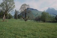
Title (German)
Diemtigen BE, Grimmialp, Weide südwestlich des Kurheimes
Caption
North view of the pasture at the beginning of the vegetation phase, with 13 solitary old trees (sycamore maple), in the background the hamlet of Egg, the Stiereberg and the mountain range, long-term observation on behalf of Pro Natura Bern (easement agreement between Pro Natura/SNB and owner) partial view; coordinates (LV03) of the camera location: 603615/157928; keywords Documenta Natura: Landwirtschaft_General, Landschaftswandel, Berggebiet, Laubbaum Wiese
Caption (German)
Nordansicht der Weide bei Beginn der Vegetationsphase, mit 13 einzelstehenden alten Bäumen (Bergahorn), im Hintergrund der Weiler Egg, den Stiereberg und die Gebirgskette, Langzeitbeobachtung im Auftrag der Pro Natura Bern (Dienstbarkeitsvertrag zwischen Pro Natura/SNB und Eigentümer) Teilansicht; Koordinaten (LV03) des Kamerastandorts: 603615/157928; Schlagworte Documenta Natura: Landwirtschaft_Allgemein, Landschaftswandel, Berggebiet, Laubbaum Wiese
Record Name
Dia_303-38614

Title (German)
Luzern LU, Reuss zwischen Nadelwehr und Spreuerbrücke
Caption
Closed needle weir on the Reuss River, photograph taken downstream, camera location 1; keywords Documenta Natura: power plant, river, city, dam, bridge
Caption (German)
Geschlossenes Nadelwehr an der Reuss, Aufnahme flussabwärts, Kamerastandort 1; Schlagworte Documenta Natura: Kraftwerk, Fluss, Stadt, Talsperre, Bruecke
Record Name
Dia_303-38625

Title (German)
Luzern LU, Reuss zwischen Nadelwehr und Spreuerbrücke
Caption
Open needle weir on the Reuss River, photograph taken downstream, camera location 1; keywords Documenta Natura: power plant, river, city, dam, bridge
Caption (German)
Offenes Nadelwehr an der Reuss, Aufnahme flussabwärts, Kamerastandort 1; Schlagworte Documenta Natura: Kraftwerk, Fluss, Stadt, Talsperre, Bruecke
Record Name
Dia_303-38627

Title (German)
Luzern LU, Reuss zwischen Nadelwehr und Spreuerbrücke
Caption
Construction worker opening the needle weir on the Reuss, shot downstream, camera location 1; keywords Documenta Natura: power plant, river, city, dam, bridge
Caption (German)
Bauarbeiter beim Öffnen des Nadelwehrs an der Reuss, Aufnahme flussabwärts, Kamerastandort 1; Schlagworte Documenta Natura: Kraftwerk, Fluss, Stadt, Talsperre, Bruecke
Record Name
Dia_303-38632

Title (German)
Luzern LU, Reuss zwischen Nadelwehr und Spreuerbrücke
Caption
View downstream towards the Spreuer bridge with the needle weir closed; keywords Documenta Natura: power plant, river, city, dam, bridge
Caption (German)
Blick flussabwärts Richtung Spreuerbrücke bei geschlossenem Nadelwehr; Schlagworte Documenta Natura: Kraftwerk, Fluss, Stadt, Talsperre, Bruecke
Record Name
Dia_303-38635

Title (German)
Luzern LU, Reuss zwischen Nadelwehr und Spreuerbrücke
Caption
View downstream towards Spreuer bridge with open needle weir; keywords Documenta Natura: power plant, river, city, dam, bridge
Caption (German)
Blick flussabwärts Richtung Spreuerbrücke bei offenem Nadelwehr; Schlagworte Documenta Natura: Kraftwerk, Fluss, Stadt, Talsperre, Bruecke
Record Name
Dia_303-38637

Title (German)
Luzern LU, Reuss zwischen Nadelwehr und Spreuerbrücke
Caption
Lower side of closed needle weir, camera location 2; keywords Documenta Natura: power plant, river, city, dam, bridge
Caption (German)
Untere Seite des geschlossenen Nadelwehr, Kamerastandort 2; Schlagworte Documenta Natura: Kraftwerk, Fluss, Stadt, Talsperre, Bruecke
Record Name
Dia_303-38645

Title (German)
Luzern LU, Reuss zwischen Nadelwehr und Spreuerbrücke
Caption
Lower side of open needle weir, camera location 2; keywords Documenta Natura: power plant, river, city, dam, bridge
Caption (German)
Untere Seite des offenen Nadelwehr, Kamerastandort 2; Schlagworte Documenta Natura: Kraftwerk, Fluss, Stadt, Talsperre, Bruecke
Record Name
Dia_303-38651

Title (German)
Luzern LU, Reuss zwischen Nadelwehr und Spreuerbrücke
Caption
Needle weir on the Reuss closed, camera location 3; keywords Documenta Natura: power plant, river, city, dam, bridge
Caption (German)
Nadelwehr an der Reuss geschlossen, Kamerstandort 3; Schlagworte Documenta Natura: Kraftwerk, Fluss, Stadt, Talsperre, Bruecke
Record Name
Dia_303-38655

Title (German)
Luzern LU, Reuss zwischen Nadelwehr und Spreuerbrücke
Caption
Needle weir on the Reuss open, camera location 3; keywords Documenta Natura: power plant, river, city, dam, bridge
Caption (German)
Nadelwehr an der Reuss offen, Kamerstandort 3; Schlagworte Documenta Natura: Kraftwerk, Fluss, Stadt, Talsperre, Bruecke
Record Name
Dia_303-38660

Title (German)
Luzern LU, Reuss zwischen Nadelwehr und Spreuerbrücke
Caption
View downstream towards Spreuer bridge with closed needle weir, camera location 4; keywords Documenta Natura: power plant, river, city, dam, bridge
Caption (German)
Blick flussabwärts Richtung Spreuerbrücke bei geschlossenem Nadelwehr, Kamerastandort 4; Schlagworte Documenta Natura: Kraftwerk, Fluss, Stadt, Talsperre, Bruecke
Record Name
Dia_303-38665
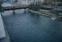
Title (German)
Luzern LU, Reuss zwischen Nadelwehr und Spreuerbrücke
Caption
View downstream towards Spreuer bridge at open needle weir, camera location 4; keywords Documenta Natura: power plant, river, city, dam, bridge
Caption (German)
Blick flussabwärts Richtung Spreuerbrücke bei offenem Nadelwehr, Kamerastandort 4; Schlagworte Documenta Natura: Kraftwerk, Fluss, Stadt, Talsperre, Bruecke
Record Name
Dia_303-38671

Title (German)
Luzern LU, Reuss zwischen Nadelwehr und Spreuerbrücke
Caption
Bank area and bridge pier of the Spreuer bridge with closed needle weir, camera location 5; keywords Documenta Natura: power plant, river, city, dam, bridge
Caption (German)
Uferbereich und Brückenpfeiler der Spreuerbrücke bei geschlossenem Nadelwehr, Kamerstandort 5; Schlagworte Documenta Natura: Kraftwerk, Fluss, Stadt, Talsperre, Bruecke
Record Name
Dia_303-38675

Title (German)
Luzern LU, Reuss zwischen Nadelwehr und Spreuerbrücke
Caption
Bank area and bridge pier of the Spreuer bridge at open needle weir, camera location 5; keywords Documenta Natura: power plant, river, city, dam, bridge
Caption (German)
Uferbereich und Brückenpfeiler der Spreuerbrücke bei offenem Nadelwehr, Kamerstandort 5; Schlagworte Documenta Natura: Kraftwerk, Fluss, Stadt, Talsperre, Bruecke
Record Name
Dia_303-38681

Title (German)
Luzern LU, Reuss zwischen Nadelwehr und Spreuerbrücke
Caption
View upstream with closed needle weir, camera location 6; keywords Documenta Natura: power plant, river, city, dam, bridge
Caption (German)
Blick flussaufwärts mit geschlossenem Nadelwehr, Kamerastandort 6; Schlagworte Documenta Natura: Kraftwerk, Fluss, Stadt, Talsperre, Bruecke
Record Name
Dia_303-38685

Title (German)
Luzern LU, Reuss zwischen Nadelwehr und Spreuerbrücke
Caption
View upstream with open needle weir, camera location 6; keywords Documenta Natura: power plant, river, city, dam, bridge
Caption (German)
Blick flussaufwärts mit offenem Nadelwehr, Kamerastandort 6; Schlagworte Documenta Natura: Kraftwerk, Fluss, Stadt, Talsperre, Bruecke
Record Name
Dia_303-38687

Title (German)
Luzern LU, Reuss zwischen Nadelwehr und Spreuerbrücke
Caption
Water level of the Reuss river below the closed Nadelwehr, camera location 7; keywords Documenta Natura: power plant, river, city, dam, bridge
Caption (German)
Wasserspiegel der Reuss unterhalb des geschlossenen Nadelwehr, Kamerastandort 7; Schlagworte Documenta Natura: Kraftwerk, Fluss, Stadt, Talsperre, Bruecke
Record Name
Dia_303-38695

Title (German)
Luzern LU, Reuss zwischen Nadelwehr und Spreuerbrücke
Caption
Water level of the Reuss river below the open needle weir, camera location 7; keywords Documenta Natura: power plant, river, city, dam, bridge
Caption (German)
Wasserspiegel der Reuss unterhalb des offenen Nadelwehr, Kamerastandort 7; Schlagworte Documenta Natura: Kraftwerk, Fluss, Stadt, Talsperre, Bruecke
Record Name
Dia_303-38700

Title (German)
Luzern LU, Reuss zwischen Nadelwehr und Spreuerbrücke
Caption
Reuss river with Spreuer bridge with closed needle weir, camera location 8; keywords Documenta Natura: power plant, river, city, dam, bridge
Caption (German)
Reuss mit Spreuerbrücke bei geschlossenem Nadelwehr, Kamerstandort 8; Schlagworte Documenta Natura: Kraftwerk, Fluss, Stadt, Talsperre, Bruecke
Record Name
Dia_303-38705

Title (German)
Luzern LU, Reuss zwischen Nadelwehr und Spreuerbrücke
Caption
Reuss river with Spreuer bridge at open needle weir, camera location 8; keywords Documenta Natura: power plant, river, city, dam, bridge
Caption (German)
Reuss mit Spreuerbrücke bei offenem Nadelwehr, Kamerstandort 8; Schlagworte Documenta Natura: Kraftwerk, Fluss, Stadt, Talsperre, Bruecke
Record Name
Dia_303-38707

Title (German)
Luzern LU, Reuss zwischen Nadelwehr und Spreuerbrücke
Caption
Bank of the river Reuss with Spreuer bridge with closed needle weir, camera location 9; keywords Documenta Natura: power plant, river, city, dam, bridge
Caption (German)
Ufer der Reuss mit Spreuerbrücke bei geschlossenem Nadelwehr, Kamerstandort 9; Schlagworte Documenta Natura: Kraftwerk, Fluss, Stadt, Talsperre, Bruecke
Record Name
Dia_303-38715

Title (German)
Luzern LU, Reuss zwischen Nadelwehr und Spreuerbrücke
Caption
Bank of the river Reuss with Spreuer bridge at open needle weir, camera location 9; keywords Documenta Natura: power plant, river, city, dam, bridge
Caption (German)
Ufer der Reuss mit Spreuerbrücke bei offenem Nadelwehr, Kamerstandort 9; Schlagworte Documenta Natura: Kraftwerk, Fluss, Stadt, Talsperre, Bruecke
Record Name
Dia_303-38721

Title (German)
Luzern LU, Reuss zwischen Nadelwehr und Spreuerbrücke
Caption
Water level of the Reuss river at the Spreuer bridge, with closed needle weir, camera location 10; keywords Documenta Natura: power plant, river, city, dam, bridge
Caption (German)
Wasserspiegel der Reuss bei der Spreuerbrücke, mit geschlossenem Nadelwehr, Kamerstandort 10; Schlagworte Documenta Natura: Kraftwerk, Fluss, Stadt, Talsperre, Bruecke
Record Name
Dia_303-38725

Title (German)
Luzern LU, Reuss zwischen Nadelwehr und Spreuerbrücke
Caption
Water level of the Reuss river at the Spreuer bridge, with open needle weir, camera location 10; keywords Documenta Natura: power plant, river, city, dam, bridge
Caption (German)
Wasserspiegel der Reuss bei der Spreuerbrücke, mit offenem Nadelwehr, Kamerstandort 10; Schlagworte Documenta Natura: Kraftwerk, Fluss, Stadt, Talsperre, Bruecke
Record Name
Dia_303-38727
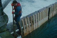
Title (German)
Luzern LU, Nadelwehr in der Reuss unterhalb der Reussbrücke
Caption
Construction worker levering out the wooden pillars at the needle weir with a Zappi; keywords Documenta Natura: power plant, river, city, dam, bridge
Caption (German)
Bauarbeiter beim Aushebeln der Holzpfeiler am Nadelwehr mit einem Zappi; Schlagworte Documenta Natura: Kraftwerk, Fluss, Stadt, Talsperre, Bruecke
Record Name
Dia_303-38736

Title (German)
Luzern LU, Nadelwehr in der Reuss unterhalb der Reussbrücke
Caption
Construction workers removing wooden pillars at the needle weir ; keywords Documenta Natura: power plant, river, city, dam, bridge
Caption (German)
Bauarbeiter beim Wegräumen der Holzpfeiler am Nadelwehr ; Schlagworte Documenta Natura: Kraftwerk, Fluss, Stadt, Talsperre, Bruecke
Record Name
Dia_303-38738

Title (German)
Luzern LU, Nadelwehr in der Reuss unterhalb der Reussbrücke
Caption
Construction workers at the same time levering out and securing the wooden pillars at the needle weir; keywords Documenta Natura: power plant, river, city, dam, bridge
Caption (German)
Bauarbeiter gleichzeitig beim Aushebeln und Sichern der Holzpfeiler am Nadelwehr; Schlagworte Documenta Natura: Kraftwerk, Fluss, Stadt, Talsperre, Bruecke
Record Name
Dia_303-38740

Title (German)
Luzern LU, Nadelwehr in der Reuss unterhalb der Reussbrücke
Caption
Construction workers at the same time levering out and securing the wooden pillars at the needle weir; keywords Documenta Natura: power plant, river, city, dam, bridge
Caption (German)
Bauarbeiter gleichzeitig beim Aushebeln und Sichern der Holzpfeiler am Nadelwehr; Schlagworte Documenta Natura: Kraftwerk, Fluss, Stadt, Talsperre, Bruecke
Record Name
Dia_303-38744

Title (German)
Luzern LU, Nadelwehr in der Reuss unterhalb der Reussbrücke
Caption
Construction workers at the same time levering out and securing the wooden pillars at the needle weir; keywords Documenta Natura: power plant, river, city, dam, bridge
Caption (German)
Bauarbeiter gleichzeitig beim Aushebeln und Sichern der Holzpfeiler am Nadelwehr; Schlagworte Documenta Natura: Kraftwerk, Fluss, Stadt, Talsperre, Bruecke
Record Name
Dia_303-38748

Title (German)
Luzern LU, Nadelwehr in der Reuss unterhalb der Reussbrücke
Caption
Construction worker secured with rope on the footbridge of the needle weir levering out the wooden pillars; keywords Documenta Natura: power plant, river, city, dam, bridge
Caption (German)
Bauarbeiter mit Seil gesichert auf dem Steg des Nadelwehr beim Aushebeln der Holzpfeiler; Schlagworte Documenta Natura: Kraftwerk, Fluss, Stadt, Talsperre, Bruecke
Record Name
Dia_303-38760
Title (German)
Luzern LU, Nadelwehr in der Reuss unterhalb der Reussbrücke
Caption
Construction worker secured with rope on the footbridge of the needle weir levering out the wooden piers; keywords Documenta Natura: power plant, river, city, dam, bridge
Caption (German)
Bauarbeiter mit Seil gesichert auf dem Steg des Nadelwehr beim Aushebeln der Holzpfeiler; Schlagworte Documenta Natura: Kraftwerk, Fluss, Stadt, Talsperre, Bruecke
Record Name
Dia_303-38763

Title (German)
Luzern LU, Nadelwehr in der Reuss unterhalb der Reussbrücke
Caption
Construction worker secured with rope on the footbridge of the needle weir levering out the wooden piers; keywords Documenta Natura: power plant, river, city, dam, bridge
Caption (German)
Bauarbeiter mit Seil gesichert auf dem Steg des Nadelwehr beim Aushebeln der Holzpfeiler; Schlagworte Documenta Natura: Kraftwerk, Fluss, Stadt, Talsperre, Bruecke
Record Name
Dia_303-38766

Title (German)
Grindelwald, Lütschental BE, Bach Schwarze Lütschine unterhalb Burglauenen im Lütschental
Caption
Schwarze Lütschine stream with closed weir and residual water inlet, general view camera site 1; coordinates (LV03) of camera site: 641075/165075; keywords Documenta Natura: power plant, stream, valley, mountain area.
Caption (German)
Bach Schwarze Lütschine mit geschlossenem Wehr und Restwassereinlauf, Gesamtansicht Kamerastandort 1; Koordinaten (LV03) des Kamerastandorts: 641075/165075; Schlagworte Documenta Natura: Kraftwerk, Bach, Tal, Berggebiet
Record Name
Dia_303-38769

Title (German)
Grindelwald, Lütschental BE, Bach Schwarze Lütschine unterhalb Burglauenen im Lütschental
Caption
Schwarze Lütschine stream with closed weir and residual water inlet, follow-up image, general view camera location 1; coordinates (LV03) of camera location: 641075/165075; keywords Documenta Natura: power plant, stream, valley, mountain area
Caption (German)
Bach Schwarze Lütschine mit geschlossenem Wehr und Restwassereinlauf, Folgeaufnahme, Gesamtansicht Kamerastandort 1; Koordinaten (LV03) des Kamerastandorts: 641075/165075; Schlagworte Documenta Natura: Kraftwerk, Bach, Tal, Berggebiet
Record Name
Dia_303-38773

Title (German)
Grindelwald, Lütschental BE, Bach Schwarze Lütschine unterhalb Burglauenen im Lütschental
Caption
Fall (sill) at the Schwarze Lütschine stream with varying water discharge (residual flow), general view camera location 2; coordinates (LV03) of camera location: 640080/165170; keywords Documenta Natura: power plant, stream, valley, mountain area
Caption (German)
Absturz (Schwelle) am Bach Schwarze Lütschine mit unterschiedlichem Wasserabfluss (Restwassermenge), Gesamtansicht Kamerastandort 2; Koordinaten (LV03) des Kamerastandorts: 640080/165170; Schlagworte Documenta Natura: Kraftwerk, Bach, Tal, Berggebiet
Record Name
Dia_303-38776

Title (German)
Grindelwald, Lütschental BE, Bach Schwarze Lütschine unterhalb Burglauenen im Lütschental
Caption
Fall (sill) at the Schwarze Lütschine stream with varying water discharge (residual flow), general view camera location 2; coordinates (LV03) of camera location: 640080/165170; keywords Documenta Natura: power plant, stream, valley, mountain area
Caption (German)
Absturz (Schwelle) am Bach Schwarze Lütschine mit unterschiedlichem Wasserabfluss (Restwassermenge), Gesamtansicht Kamerastandort 2; Koordinaten (LV03) des Kamerastandorts: 640080/165170; Schlagworte Documenta Natura: Kraftwerk, Bach, Tal, Berggebiet
Record Name
Dia_303-38784

Title (German)
Grindelwald, Lütschental BE, Bach Schwarze Lütschine unterhalb Burglauenen im Lütschental
Caption
Schwarze Lütschine stream with varying water discharge (residual flow), general view camera location 3; coordinates (LV03) of camera location: 639695/165190; keywords Documenta Natura: power plant, stream, valley, mountain area.
Caption (German)
Bach Schwarze Lütschine mit unterschiedlichem Wasserabfluss (Restwassermenge), Gesamtansicht Kamerastandort 3; Koordinaten (LV03) des Kamerastandorts: 639695/165190; Schlagworte Documenta Natura: Kraftwerk, Bach, Tal, Berggebiet
Record Name
Dia_303-38786
Title (German)
Grindelwald, Lütschental BE, Bach Schwarze Lütschine unterhalb Burglauenen im Lütschental
Caption
Schwarze Lütschine stream with varying water discharge (residual flow), follow-up image, general view camera location 3; coordinates (LV03) of camera location: 639695/165190; keywords Documenta Natura: power plant, stream, valley, mountain area
Caption (German)
Bach Schwarze Lütschine mit unterschiedlichem Wasserabfluss (Restwassermenge), Folgeaufnahme, Gesamtansicht Kamerastandort 3; Koordinaten (LV03) des Kamerastandorts: 639695/165190; Schlagworte Documenta Natura: Kraftwerk, Bach, Tal, Berggebiet
Record Name
Dia_303-38791

Title (German)
Grindelwald, Lütschental BE, Bach Schwarze Lütschine unterhalb Burglauenen im Lütschental
Caption
Schwarze Lütschine stream with varying water discharge (residual flow), wooden bridge, general view camera location 4; coordinates (LV03) of camera location: 639505/165270; keywords Documenta Natura: power plant, stream, valley, mountain area.
Caption (German)
Bach Schwarze Lütschine mit unterschiedlichem Wasserabfluss (Restwassermenge), Holzbrücke, Gesamtansicht Kamerastandort 4; Koordinaten (LV03) des Kamerastandorts: 639505/165270; Schlagworte Documenta Natura: Kraftwerk, Bach, Tal, Berggebiet
Record Name
Dia_303-38795

Title (German)
Grindelwald, Lütschental BE, Bach Schwarze Lütschine unterhalb Burglauenen im Lütschental
Caption
Schwarze Lütschine stream with varying water discharge (residual flow), wooden bridge, follow-up image, general view camera location 4; coordinates (LV03) of camera location: 639505/165270; keywords Documenta Natura: power station, stream, valley, mountain area
Caption (German)
Bach Schwarze Lütschine mit unterschiedlichem Wasserabfluss (Restwassermenge), Holzbrücke, Folgeaufnahme, Gesamtansicht Kamerastandort 4; Koordinaten (LV03) des Kamerastandorts: 639505/165270; Schlagworte Documenta Natura: Kraftwerk, Bach, Tal, Berggebiet
Record Name
Dia_303-38801

Title (German)
Saxeten BE, Südwestansicht der Alpweide Underberg im oberen Saxettal
Caption
Southwest view of Underberg alpine pasture before material removal, first photograph, partially snow-covered (1997), general view; coordinates (LV03) of camera location: 629575/162680; keywords Documenta Natura: power plant, pipeline construction, mountain area, construction site, material deposition, mountain forest, forest aisle.
Caption (German)
Südwestansicht der Alpweide Underberg vor der Materialabtragung, Erstaufnahme, teilweise schneebedeckt (1997), Gesamtansicht; Koordinaten (LV03) des Kamerastandorts: 629575/162680; Schlagworte Documenta Natura: Kraftwerk, Leitungsbau, Berggebiet, Baustelle, Materialablagerung, Gebirgswald, Waldschneise
Record Name
Dia_303-38805

Title (German)
Saxeten BE, Südwestansicht der Alpweide Underberg im oberen Saxettal
Caption
Southwest view of Underberg alpine pasture before material removal, 1st follow-up photograph during ongoing work (1997), general view; coordinates (LV03) of camera location: 629575/162680; keywords Documenta Natura: power plant, power line construction, mountain area, construction site, material deposition, mountain forest, forest aisle.
Caption (German)
Südwestansicht der Alpweide Underberg vor der Materialabtragung, 1. Folgeaufnahme während den laufenden Arbeiten (1997), Gesamtansicht; Koordinaten (LV03) des Kamerastandorts: 629575/162680; Schlagworte Documenta Natura: Kraftwerk, Leitungsbau, Berggebiet, Baustelle, Materialablagerung, Gebirgswald, Waldschneise
Record Name
Dia_303-38812

Title (German)
Saxeten BE, Südwestansicht der Alpweide Underberg im oberen Saxettal
Caption
Southwest view of Underberg alpine pasture before material removal, 2nd follow-up image after terrain leveling, newly created path (1998), general view; coordinates (LV03) of camera location: 629575/162680; keywords Documenta Natura: power plant, pipeline construction, mountain area, construction site, material deposition, mountain forest, forest aisle.
Caption (German)
Südwestansicht der Alpweide Underberg vor der Materialabtragung, 2. Folgeaufnahme nach der Geländenivellierung, neu angelegter Pfad (1998), Gesamtansicht; Koordinaten (LV03) des Kamerastandorts: 629575/162680; Schlagworte Documenta Natura: Kraftwerk, Leitungsbau, Berggebiet, Baustelle, Materialablagerung, Gebirgswald, Waldschneise
Record Name
Dia_303-38821
Title (German)
Saxeten BE, Zufahrtsstrasse und Vorplatz des Reservoirs Stalden im oberen Saxettal
Caption
Construction site of the access road for Stalden water reservoir, first photograph (1997), partial view; coordinates (LV03) of the camera location: 629475/163090; keywords Documenta Natura: power plant, pipeline construction, mountain area, construction site, material deposit, mountain forest, forest aisle.
Caption (German)
Baustelle der Zufahrtsstrasse für Wasserreservoir Stalden, Erstaufnahme (1997), Teilansicht; Koordinaten (LV03) des Kamerastandorts: 629475/163090; Schlagworte Documenta Natura: Kraftwerk, Leitungsbau, Berggebiet, Baustelle, Materialablagerung, Gebirgswald, Waldschneise
Record Name
Dia_303-38832

Title (German)
Saxeten BE, Zufahrtsstrasse und Vorplatz des Reservoirs Stalden im oberen Saxettal
Caption
Construction site of the forecourt for Stalden water reservoir, first photograph (1997), partial view; coordinates (LV03) of camera location: 629555/163090; keywords Documenta Natura: power plant, pipeline construction, mountain area, construction site, material deposit, mountain forest, forest aisle.
Caption (German)
Baustelle des Vorplatzes für Wasserreservoir Stalden, Erstaufnahme (1997), Teilansicht; Koordinaten (LV03) des Kamerastandorts: 629555/163090; Schlagworte Documenta Natura: Kraftwerk, Leitungsbau, Berggebiet, Baustelle, Materialablagerung, Gebirgswald, Waldschneise
Record Name
Dia_303-38842

Title (German)
Saxeten BE, Zufahrtsstrasse und Vorplatz des Reservoirs Stalden im oberen Saxettal
Caption
Construction site of the access road for Stalden water reservoir, 1st follow-up photograph during the construction phase, road over Bachtobel (1997), partial view; coordinates (LV03) of camera location: 629475/163090; keywords Documenta Natura: power plant, pipeline construction, mountain area, construction site, material deposit, mountain forest, forest aisle.
Caption (German)
Baustelle der Zufahrtsstrasse für Wasserreservoir Stalden, 1. Folgeaufnahme während der Bauphase, Strasse über Bachtobel (1997), Teilansicht; Koordinaten (LV03) des Kamerastandorts: 629475/163090; Schlagworte Documenta Natura: Kraftwerk, Leitungsbau, Berggebiet, Baustelle, Materialablagerung, Gebirgswald, Waldschneise
Record Name
Dia_303-38850

Title (German)
Saxeten BE, Zufahrtsstrasse und Vorplatz des Reservoirs Stalden im oberen Saxettal
Caption
Construction site of the forecourt for Stalden water reservoir, 1st follow-up photograph during the construction phase, intake pipe, slope stabilization (1997), partial view; coordinates (LV03) of the camera location: 629555/163090; keywords Documenta Natura: power plant, pipeline construction, mountain area, construction site, material deposit, mountain forest, forest aisle.
Caption (German)
Baustelle des Vorplatzes für Wasserreservoir Stalden, 1. Folgeaufnahme während der Bauphase, Fassungsrohr, Hangsicherung (1997), Teilansicht; Koordinaten (LV03) des Kamerastandorts: 629555/163090; Schlagworte Documenta Natura: Kraftwerk, Leitungsbau, Berggebiet, Baustelle, Materialablagerung, Gebirgswald, Waldschneise
Record Name
Dia_303-38860

Title (German)
Saxeten BE, Zufahrtsstrasse und Vorplatz des Reservoirs Stalden im oberen Saxettal
Caption
Access road for Stalden water reservoir, 2nd follow-up photograph after completion of construction (1998), partial view; coordinates (LV03) of camera location: 629475/163090; keywords Documenta Natura: power plant, pipeline construction, mountain area, construction site, material deposit, mountain forest, forest aisle.
Caption (German)
Zufahrtsstrasse für Wasserreservoir Stalden, 2. Folgeaufnahme nach dem Bauabschluss (1998), Teilansicht; Koordinaten (LV03) des Kamerastandorts: 629475/163090; Schlagworte Documenta Natura: Kraftwerk, Leitungsbau, Berggebiet, Baustelle, Materialablagerung, Gebirgswald, Waldschneise
Record Name
Dia_303-38867

Title (German)
Saxeten BE, Zufahrtsstrasse und Vorplatz des Reservoirs Stalden im oberen Saxettal
Caption
Forecourt for Stalden water reservoir, 2nd follow-up photograph after completion of construction (1998), partial view; coordinates (LV03) of camera location: 629555/163090; keywords Documenta Natura: power plant, pipeline construction, mountain area, construction site, material deposit, mountain forest, forest aisle.
Caption (German)
Vorplatz für Wasserreservoir Stalden, 2. Folgeaufnahme nach dem Bauabschluss (1998), Teilansicht; Koordinaten (LV03) des Kamerastandorts: 629555/163090; Schlagworte Documenta Natura: Kraftwerk, Leitungsbau, Berggebiet, Baustelle, Materialablagerung, Gebirgswald, Waldschneise
Record Name
Dia_303-38877

Title (German)
Saxeten BE, Nordansicht des Nordhanges Stalden im oberen Saxettal
Caption
North view of the north slope of Stalden, first photograph (1997) with wooded aisle for the pipeline construction of the planned reservoir, general view; coordinates (LV03) of the camera location: 629645/163390; keywords Documenta Natura: power plant, pipeline construction, mountain area, construction site, material deposit, mountain forest, wooded aisle.
Caption (German)
Nordansicht des Nordhanges Stalden, Erstaufnahme (1997) mit geholzter Schneise für den Leitungsbau des geplanten Reservoir, Gesamtansicht; Koordinaten (LV03) des Kamerastandorts: 629645/163390; Schlagworte Documenta Natura: Kraftwerk, Leitungsbau, Berggebiet, Baustelle, Materialablagerung, Gebirgswald, Waldschneise
Record Name
Dia_303-38889

Title (German)
Saxeten BE, Nordansicht des Nordhanges Stalden im oberen Saxettal
Caption
North view of the north slope of Stalden, 1st follow-up photo with open trench and partially inserted water pipeline as well as construction workers filling in the trench with Menzi-Muck (1997), general view; coordinates (LV03) of camera location: 629645/163390; keywords Documenta Natura: power plant, pipeline construction, mountain area, construction site, material deposition, mountain forest, forest aisle.
Caption (German)
Nordansicht des Nordhanges Stalden, 1. Folgeaufnahme mit offenem Graben und teilweise eingelegter Wasserleitung sowie Bauarbeiter beim Zuschütten des Grabens mit Menzi-Muck (1997), Gesamtansicht; Koordinaten (LV03) des Kamerastandorts: 629645/163390; Schlagworte Documenta Natura: Kraftwerk, Leitungsbau, Berggebiet, Baustelle, Materialablagerung, Gebirgswald, Waldschneise
Record Name
Dia_303-38897

Title (German)
Saxeten BE, Nordansicht des Nordhanges Stalden im oberen Saxettal
Caption
North view of the north slope of Stalden, 2nd follow-up photograph after completion of construction (1998), general view; coordinates (LV03) of camera location: 629645/163390; keywords Documenta Natura: power plant, power line construction, mountain area, construction site, material deposit, mountain forest, forest aisle.
Caption (German)
Nordansicht des Nordhanges Stalden, 2. Folgeaufnahme nach nach Bauabschluss (1998), Gesamtansicht; Koordinaten (LV03) des Kamerastandorts: 629645/163390; Schlagworte Documenta Natura: Kraftwerk, Leitungsbau, Berggebiet, Baustelle, Materialablagerung, Gebirgswald, Waldschneise
Record Name
Dia_303-38903

Title (German)
Saxeten BE, Südwestansicht des Neubaus der Zentrale Geissbrunnen im oberen Saxettal
Caption
Southwest view of the Central Geissbrunnen construction site with old well house (right), first photograph (1997), general view; coordinates (LV03) of camera location: 629965/164178; keywords Documenta Natura: power plant, power line construction, mountain area, construction site, material deposit, mountain forest, forest aisle.
Caption (German)
Südwestansicht der Baustelle Zentrale Geissbrunnen mit alter Brunnstube (rechts), Erstaufnahme (1997), Gesamtansicht; Koordinaten (LV03) des Kamerastandorts: 629965/164178; Schlagworte Documenta Natura: Kraftwerk, Leitungsbau, Berggebiet, Baustelle, Materialablagerung, Gebirgswald, Waldschneise
Record Name
Dia_303-38913

Title (German)
Saxeten BE, Südwestansicht des Neubaus der Zentrale Geissbrunnen im oberen Saxettal
Caption
Southwest view of Geissbrunnen headquarters, 1st follow-up photograph after completion of construction (1998), general view; coordinates (LV03) of camera location: 629965/164178; keywords Documenta Natura: power plant, pipeline construction, mountain area, construction site, material deposit, mountain forest, forest aisle.
Caption (German)
Südwestansicht der Zentrale Geissbrunnen, 1. Folgeaufnahme nach Bauabschluss (1998), Gesamtansicht; Koordinaten (LV03) des Kamerastandorts: 629965/164178; Schlagworte Documenta Natura: Kraftwerk, Leitungsbau, Berggebiet, Baustelle, Materialablagerung, Gebirgswald, Waldschneise
Record Name
Dia_303-38922

Title (German)
Wilderswil BE, Nordostansicht des Nordhanges beim Weiler Obers Ried im unteren Saxettal
Caption
Northeast view of the north slope near the hamlet of Obers Ried, first photograph (1997),pasture with removed humus for pipeline construction Stalden water reservoir, partial view; coordinates (LV03) of camera location: 631845/166925; keywords Documenta Natura: power plant, pipeline construction, mountain area, construction site, material deposition, mountain forest, forest aisle.
Caption (German)
Nordostansicht des Nordhanges beim Weiler Obers Ried, Erstaufnahme (1997),Weide mit abgetragenem Humus für Leitungsbau Wasserreservoir Stalden, Teilansicht; Koordinaten (LV03) des Kamerastandorts: 631845/166925; Schlagworte Documenta Natura: Kraftwerk, Leitungsbau, Berggebiet, Baustelle, Materialablagerung, Gebirgswald, Waldschneise
Record Name
Dia_303-38932

Title (German)
Wilderswil BE, Nordostansicht des Nordhanges beim Weiler Obers Ried im unteren Saxettal
Caption
Northeast view of the north slope near the hamlet of Obers Ried, 1st follow-up photograph after completion of construction (1998), partial view; coordinates (LV03) of the camera location: 631845/166925; keywords Documenta Natura: power plant, pipeline construction, mountain area, construction site, material deposit, mountain forest, forest aisle.
Caption (German)
Nordostansicht des Nordhanges beim Weiler Obers Ried, 1. Folgeaufnahme nach Bauabschluss (1998), Teilansicht; Koordinaten (LV03) des Kamerastandorts: 631845/166925; Schlagworte Documenta Natura: Kraftwerk, Leitungsbau, Berggebiet, Baustelle, Materialablagerung, Gebirgswald, Waldschneise
Record Name
Dia_303-38940
Title (German)
Wilderswil BE, Nordansicht des Nordhanges mit Sytiwald, im Vordergrund der Neubau der Zentrale Kammri (z. T.), im unteren Saxettal
Caption
North view of the north slope with forest aisle in the Sytiwald for pipeline construction, in the foreground the construction site of the Kammri headquarters, first photograph (1997), partial view; coordinates (LV03) of the camera location: 631750/167485; keywords Documenta Natura: power plant, pipeline construction, mountain area, construction site, material deposition, mountain forest, forest aisle.
Caption (German)
Nordansicht des Nordhanges mit Waldschneise im Sytiwald für den Leitungsbau, im Vordergrund die Baustelle der Zentrale Kammri, Erstaufnahme (1997), Teilansicht; Koordinaten (LV03) des Kamerastandorts: 631750/167485; Schlagworte Documenta Natura: Kraftwerk, Leitungsbau, Berggebiet, Baustelle, Materialablagerung, Gebirgswald, Waldschneise
Record Name
Dia_303-38949

Title (German)
Wilderswil BE, Nordansicht des Nordhanges mit Sytiwald, im Vordergrund der Neubau der Zentrale Kammri (z. T.), im unteren Saxettal
Caption
North view of the north slope with forest aisle in the Sytiwald for pipeline construction, in the foreground the construction site of the Kammri headquarters, first photograph (1997), partial view; coordinates (LV03) of the camera location: 631750/167485; keywords Documenta Natura: power plant, pipeline construction, mountain area, construction site, material deposition, mountain forest, forest aisle.
Caption (German)
Nordansicht des Nordhanges mit Waldschneise im Sytiwald für den Leitungsbau, im Vordergrund die Baustelle der Zentrale Kammri, Erstaufnahme (1997), Teilansicht; Koordinaten (LV03) des Kamerastandorts: 631750/167485; Schlagworte Documenta Natura: Kraftwerk, Leitungsbau, Berggebiet, Baustelle, Materialablagerung, Gebirgswald, Waldschneise
Record Name
Dia_303-38957

Title (German)
Wilderswil BE, Nordansicht des Nordhanges mit Sytiwald, im Vordergrund der Neubau der Zentrale Kammri (z. T.), im unteren Saxettal
Caption
North view of the north slope with forest aisle in the Sytiwald, in the foreground the completed Central Kammri, 2nd follow-up image after the completion of construction, forest aisle lined with jutting mats (1998), partial view; coordinates (LV03) of the camera location: 631750/167485; keywords Documenta Natura: power plant, pipeline construction, mountain area, construction site, material deposition, mountain forest, forest aisle.
Caption (German)
Nordansicht des Nordhanges mit Waldschneise im Sytiwald, im Vordergrund die fertiggestellte Zentrale Kammri, 2. Folgeaufnahme nach dem Bauabschluss, Waldschneise mit Juttematten ausgelegt (1998), Teilansicht; Koordinaten (LV03) des Kamerastandorts: 631750/167485; Schlagworte Documenta Natura: Kraftwerk, Leitungsbau, Berggebiet, Baustelle, Materialablagerung, Gebirgswald, Waldschneise
Record Name
Dia_303-38964

Title (German)
Reutigen BE, Spiez BE, Ufer und Flussbett der Kander bei ca. km 3.50 in der Augand
Caption
Southwest view from Chapf at km 3.50 downstream onto riverbed and both built-up banks of the Kander as well as the Augand, first photograph (2004), partial view; coordinates (LV03) of camera location: 614717/171357; keywords Documenta Natura: river restoration, floodplain forest, river, foothills of the Alps, landscape change
Caption (German)
Südwestansicht vom Chapf bei km 3.50 flussabwärts auf Flussbett und beide verbaute Ufer der Kander sowie die Augand, Erstaufnahme (2004), Teilansicht; Koordinaten (LV03) des Kamerastandorts: 614717/171357; Schlagworte Documenta Natura: Flussrenaturierung, Auenwald, Fluss, Voralpen, Landschaftswandel
Record Name
Dia_303-38975

Title (German)
Reutigen BE, Spiez BE, Ufer und Flussbett der Kander bei ca. km 3.50 in der Augand
Caption
Southwestern view from Chapf at km 3.50 downstream onto the dynamic renaturalized riverbed of the Kander and both banks with gravel bars as well as the Augand, 1st follow-up image after widening (2005), partial view; coordinates (LV03) of the camera location: 614716/171357; keywords Documenta Natura: river renaturation, floodplain forest, river, pre-Alps, landscape change
Caption (German)
Südwestansicht vom Chapf bei km 3.50 flussabwärts auf das dynamische renaturierte Flussbett der Kander und beide Ufer mit Kiesbänken sowie die Augand, 1. Folgeaufnahme nach der Ausweitung (2005), Teilansicht; Koordinaten (LV03) des Kamerastandorts: 614716/171357; Schlagworte Documenta Natura: Flussrenaturierung, Auenwald, Fluss, Voralpen, Landschaftswandel
Record Name
Dia_303-38985

Title (German)
Reutigen BE, Spiez BE, Ufer und Flussbett der Kander bei km 3.70 in der Augand
Caption
Northwest view from left bank with roadway at km 3.70 upstream on riverbed and both banks of the Kander with riparian forestation, groynes secured with steel cables, first photograph renaturation Augand (2004), partial view; coordinates (LV03) of camera location: 171154/614800; keywords Documenta Natura: river renaturation, floodplain forest, river, Prealps, landscape change
Caption (German)
Nordwestansicht vom linken Ufer mit Fahrweg bei km 3.70 flussaufwärts auf Flussbett und beide Ufer der Kander mit Uferbewaldung, Buhnen mit Stahlseilen gesichert, Erstaufnahme Renaturierung Augand (2004), Teilansicht; Koordinaten (LV03) des Kamerastandorts: 171154/614800; Schlagworte Documenta Natura: Flussrenaturierung, Auenwald, Fluss, Voralpen, Landschaftswandel
Record Name
Dia_303-38993

Title (German)
Reutigen BE, Spiez BE, Ufer und Flussbett der Kander bei km 3.70 in der Augand
Caption
Northwest view from the left bank with roadway at km 3.70 upstream on riverbed and both banks of the Kander with riparian forestation, 1st follow-up photograph renaturation Augand after construction of the block ramp (2005), partial view; coordinates (LV03) of camera location: 171154/614800; keywords Documenta Natura: river renaturation, riparian forest, river, pre-Alps, landscape change
Caption (German)
Nordwestansicht vom linken Ufer mit Fahrweg bei km 3.70 flussaufwärts auf Flussbett und beide Ufer der Kander mit Uferbewaldung, 1. Folgeaufnahme Renaturierung Augand nach dem Bau der Blockrampe (2005), Teilansicht; Koordinaten (LV03) des Kamerastandorts: 171154/614800; Schlagworte Documenta Natura: Flussrenaturierung, Auenwald, Fluss, Voralpen, Landschaftswandel
Record Name
Dia_303-39003

Title (German)
Reutigen BE, Spiez BE, Ufer der Kander bei ca. km 3.60 in der Augand
Caption
South view downstream along the left bank of the Kander River with roadway and riparian forest at km 3.60, first photograph (2004), partial view; coordinates (LV03) of camera location: 171212/614750; keywords Documenta Natura: river restoration, riparian forest, river, pre-Alps, landscape change.
Caption (German)
Südansicht flussabwärts entlang des linken Ufers der Kander mit Fahrweg und Uferwald bei km 3.60, Erstaufnahme (2004), Teilansicht; Koordinaten (LV03) des Kamerastandorts: 171212/614750; Schlagworte Documenta Natura: Flussrenaturierung, Auenwald, Fluss, Voralpen, Landschaftswandel
Record Name
Dia_303-39014

Title (German)
Reutigen BE, Spiez BE, Ufer der Kander bei ca. km 3.60 in der Augand
Caption
South view downstream along the left bank of the Kander at km 3.60, 1st follow-up image after widening (2005), partial view; coordinates (LV03) of camera location: 171212/614750; keywords Documenta Natura: river restoration, floodplain forest, river, pre-Alps, landscape change.
Caption (German)
Südansicht flussabwärts entlang des linken Ufers der Kander bei km 3.60, 1. Folgeaufnahme nach der Ausweitung (2005), Teilansicht; Koordinaten (LV03) des Kamerastandorts: 171212/614750; Schlagworte Documenta Natura: Flussrenaturierung, Auenwald, Fluss, Voralpen, Landschaftswandel
Record Name
Dia_303-39024

Title (German)
Reutigen BE, Spiez BE, Flussbett und Ufer der Kander bei km 2.60 in der Augand
Caption
North view upstream at km 2.60 on riverbed and right bank of the Kander with riparian forest, first photograph, groynes secured on the banks with steel cables (2004), partial view; coordinates (LV03) of camera location: 172250/614874; keywords Documenta Natura: river restoration, riparian forest, river, pre-Alps, landscape change.
Caption (German)
Nordansicht flussaufwärts bei km 2.60 auf Flussbett und rechtes Ufer der Kander mit Uferwald, Erstaufnahme, an den Ufern mit Stahlseilen gesicherte Buhnen (2004), Teilansicht; Koordinaten (LV03) des Kamerastandorts: 172250/614874; Schlagworte Documenta Natura: Flussrenaturierung, Auenwald, Fluss, Voralpen, Landschaftswandel
Record Name
Dia_303-39032

Title (German)
Reutigen BE, Spiez BE, Flussbett und Ufer der Kander bei km 2.60 in der Augand
Caption
North view upstream at km 2.60 on riverbed and left bank of the Kander with riparian forest, first photo, groynes secured on the banks with steel cables (2004), partial view; coordinates (LV03) of camera location: 172250/614874; keywords Documenta Natura: river restoration, riparian forest, river, foothills of the Alps, landscape change.
Caption (German)
Nordansicht flussaufwärts bei km 2.60 auf Flussbett und linkes Ufer der Kander mit Uferwald, Erstaufnahme, an den Ufern mit Stahlseilen gesicherte Buhnen (2004), Teilansicht; Koordinaten (LV03) des Kamerastandorts: 172250/614874; Schlagworte Documenta Natura: Flussrenaturierung, Auenwald, Fluss, Voralpen, Landschaftswandel
Record Name
Dia_303-39042

Title (German)
Reutigen BE, Spiez BE, Flussbett und Ufer der Kander bei km 2.60 in der Augand
Caption
North view upstream at km 2.60 on riverbed and right bank of the Kander with riparian forest, 1st follow-up photo during expansion (1st construction stage, downgrading from riparian forest) and after flood (2005), partial view; coordinates (LV03) of camera location: 172250/614874; keywords Documenta Natura: river restoration, riparian forest, river, pre-Alps, landscape change
Caption (German)
Nordansicht flussaufwärts bei km 2.60 auf Flussbett und rechtes Ufer der Kander mit Uferwald, 1. Folgeaufnahme während der Ausweitung (1. Bauetappe, Rückstufung vom Uferwald) und nach dem Hochwasser (2005), Teilansicht; Koordinaten (LV03) des Kamerastandorts: 172250/614874; Schlagworte Documenta Natura: Flussrenaturierung, Auenwald, Fluss, Voralpen, Landschaftswandel
Record Name
Dia_303-39052

Title (German)
Reutigen BE, Spiez BE, Flussbett und Ufer der Kander bei km 2.60 in der Augand
Caption
North view upstream at km 2.60 on riverbed and left bank of the Kander with riparian forest, 1st follow-up photo during expansion (1st construction stage, downgrading from riparian forest) and after flood (2005), partial view; coordinates (LV03) of camera location: 172250/614874; keywords Documenta Natura: river restoration, riparian forest, river, pre-Alps, landscape change
Caption (German)
Nordansicht flussaufwärts bei km 2.60 auf Flussbett und linkes Ufer der Kander mit Uferwald, 1. Folgeaufnahme während der Ausweitung (1. Bauetappe, Rückstufung vom Uferwald) und nach dem Hochwasser (2005), Teilansicht; Koordinaten (LV03) des Kamerastandorts: 172250/614874; Schlagworte Documenta Natura: Flussrenaturierung, Auenwald, Fluss, Voralpen, Landschaftswandel
Record Name
Dia_303-39062

Title (German)
Reutigen BE, Spiez BE, Ufer der Kander bei ca. km 3.25 in der Augand
Caption
Southwest view downstream along the left bank of the Kander River with old, ingrown groyne, roadway and riparian forest at km 3.25, general view; coordinates (LV03) of camera location: 171608/614720; keywords Documenta Natura: river restoration, riparian forest, river, foothills of the Alps, landscape change
Caption (German)
Südwestansicht flussabwärts entlang des linken Ufers der Kander mit alter, eingewachsener Buhne, Fahrweg und Uferwald bei km 3.25, Gesamtansicht; Koordinaten (LV03) des Kamerastandorts: 171608/614720; Schlagworte Documenta Natura: Flussrenaturierung, Auenwald, Fluss, Voralpen, Landschaftswandel
Record Name
Dia_303-39077
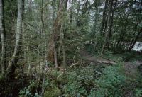
Title (German)
Reutigen BE, Spiez BE, Ufer der Kander bei km 3.00 in der Augand
Caption
Southwest view downstream along the left bank of the Kander with floodplain forest, old ingrown groyne and footpath at km 3.00, photo taken before renaturation, partial view; coordinates (LV03) of camera location: 614706/171842; keywords Documenta Natura: river renaturation, floodplain forest, river, foothills of the Alps, landscape change
Caption (German)
Südwestansicht flussabwärts entlang des linken Ufers der Kander mit auenähnlichem Wald, alter eingewachsener Buhne und Fussweg bei km 3.00, Aufnahme vor der Renaturierung, Teilansicht; Koordinaten (LV03) des Kamerastandorts: 614706/171842; Schlagworte Documenta Natura: Flussrenaturierung, Auenwald, Fluss, Voralpen, Landschaftswandel
Record Name
Dia_303-39088

Title (German)
Reichenbach im Kandertal BE, Blick (Ostansicht) auf die Aue Schwandi Ey
Caption
East view of the Schwandi Ey floodplain at km 16.7, first photograph taken before the vegetation phase (2006), partial view; coordinates (LV03) of the camera location: 617392/161340; keywords Documenta Natura: river degradation, floodplain forest, river, pre-Alps, landscape change.
Caption (German)
Ostansicht auf die Aue Schwandi Ey bei km 16.7, Erstaufnahme vor der Vegetationsphase (2006), Teilansicht; Koordinaten (LV03) des Kamerastandorts: 617392/161340; Schlagworte Documenta Natura: Flussverbauung, Auenwald, Fluss, Voralpen, Landschaftswandel
Record Name
Dia_303-39099
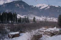
Title (German)
Reichenbach im Kandertal BE, Blick (Ostansicht) auf die Aue Schwandi Ey
Caption
East view of the Schwandi Ey floodplain at km 16.7 with wood storage area, first photograph taken before the vegetation phase (2006), partial view; coordinates (LV03) of camera location: 617392/161340; keywords Documenta Natura: river degradation, floodplain forest, river, pre-Alps, landscape change.
Caption (German)
Ostansicht auf die Aue Schwandi Ey bei km 16.7 mit Holzlagerplatz, Erstaufnahme vor der Vegetationsphase (2006), Teilansicht; Koordinaten (LV03) des Kamerastandorts: 617392/161340; Schlagworte Documenta Natura: Flussverbauung, Auenwald, Fluss, Voralpen, Landschaftswandel
Record Name
Dia_303-39109

Title (German)
Reichenbach im Kandertal BE, Blick (Ostansicht) auf die Aue Schwandi Ey
Caption
East view of the Schwandi Ey floodplain at km 16.7, 1st follow-up photograph after the widening and renaturation of the Kander, during the vegetation phase (2006), partial view; coordinates (LV03) of the camera location: 617392/161340; keywords Documenta Natura: river degradation, floodplain forest, river, pre-Alps, landscape change.
Caption (German)
Ostansicht auf die Aue Schwandi Ey bei km 16.7, 1. Folgeaufnahme nach der Ausweitung und Renaturierung der Kander, während der Vegetationsphase (2006), Teilansicht; Koordinaten (LV03) des Kamerastandorts: 617392/161340; Schlagworte Documenta Natura: Flussverbauung, Auenwald, Fluss, Voralpen, Landschaftswandel
Record Name
Dia_303-39119

Title (German)
Reichenbach im Kandertal BE, Blick (Ostansicht) auf die Aue Schwandi Ey
Caption
East view of the Schwandi Ey floodplain at km 16.7 with wood storage area, 1st follow-up photograph after the widening and renaturation of the Kander, during the vegetation phase (2006), partial view; coordinates (LV03) of the camera location: 617392/161340; keywords Documenta Natura: river degradation, floodplain forest, river, foothills of the Alps, landscape change
Caption (German)
Ostansicht auf die Aue Schwandi Ey bei km 16.7 mit Holzlagerplatz, 1. Folgeaufnahme nach der Ausweitung und Renaturierung der Kander, während der Vegetationsphase (2006), Teilansicht; Koordinaten (LV03) des Kamerastandorts: 617392/161340; Schlagworte Documenta Natura: Flussverbauung, Auenwald, Fluss, Voralpen, Landschaftswandel
Record Name
Dia_303-39129

Title (German)
Reichenbach im Kandertal BE, Ufer und Flussbett der Kander bei km 17.00 bei der Aue Schwandi Ey
Caption
Southwest view downstream from the left bank with roadway at km 17 onto riverbed and both obstructed banks of the Kander with riparian forest, first photograph before vegetation phase, partial view; coordinates (LV03) of camera location: 617125/161172; keywords Documenta Natura: river obstruction, riparian forest, river, foothills of the Alps, landscape change
Caption (German)
Südwestansicht flussabwärts vom linken Ufer mit Fahrweg bei km 17 auf Flussbett und beide verbaute Ufer der Kander mit Uferwald, Erstaufnahme vor der Vegetationsphase, Teilansicht; Koordinaten (LV03) des Kamerastandorts: 617125/161172; Schlagworte Documenta Natura: Flussverbauung, Auenwald, Fluss, Voralpen, Landschaftswandel
Record Name
Dia_303-39143

Title (German)
Reichenbach im Kandertal BE, Ufer und Flussbett der Kander bei km 17.00 bei der Aue Schwandi Ey
Caption
West view from left bank with roadway at km 17 onto riverbed and both obstructed banks of the Kander with riparian forest, first photograph before vegetation phase, partial view; coordinates (LV03) of camera location: 617125/161172; keywords Documenta Natura: river obstruction, riparian forest, river, pre-Alps, landscape change
Caption (German)
Westansicht vom linken Ufer mit Fahrweg bei km 17 auf Flussbett und beide verbaute Ufer der Kander mit Uferwald, Erstaufnahme vor der Vegetationsphase, Teilansicht; Koordinaten (LV03) des Kamerastandorts: 617125/161172; Schlagworte Documenta Natura: Flussverbauung, Auenwald, Fluss, Voralpen, Landschaftswandel
Record Name
Dia_303-39153

Title (German)
Reichenbach im Kandertal BE, Ufer und Flussbett der Kander bei km 17.00 bei der Aue Schwandi Ey
Caption
Southwestern view downstream from the left bank with roadway at km 17 onto riverbed and both banks of the Kander with riparian forest, 1st follow-up photograph after widening and renaturation, during vegetation phase, partial view; coordinates (LV03) of camera location: 617125/161172; keywords Documenta Natura: river degradation, riparian forest, river, Prealps, landscape change.
Caption (German)
Südwestansicht flussabwärts vom linken Ufer mit Fahrweg bei km 17 auf Flussbett und beide Ufer der Kander mit Uferwald, 1. Folgeaufnahme nach der Ausweitung und Renaturierierung, während der Vegetationsphase, Teilansicht; Koordinaten (LV03) des Kamerastandorts: 617125/161172; Schlagworte Documenta Natura: Flussverbauung, Auenwald, Fluss, Voralpen, Landschaftswandel
Record Name
Dia_303-39162

Title (German)
Reichenbach im Kandertal BE, Ufer und Flussbett der Kander bei km 17.00 bei der Aue Schwandi Ey
Caption
West view from the left bank with roadway at km 17 on riverbed and both banks of the Kander with riparian forest, 1st follow-up photograph after widening and renaturation, during vegetation phase, partial view; coordinates (LV03) of camera location: 617125/161172; keywords Documenta Natura: river degradation, riparian forest, river, foothills of the Alps, landscape change
Caption (German)
Westansicht vom linken Ufer mit Fahrweg bei km 17 auf Flussbett und beide Ufer der Kander mit Uferwald, 1. Folgeaufnahme nach der Ausweitung und Renaturierierung, während der Vegetationsphase, Teilansicht; Koordinaten (LV03) des Kamerastandorts: 617125/161172; Schlagworte Documenta Natura: Flussverbauung, Auenwald, Fluss, Voralpen, Landschaftswandel
Record Name
Dia_303-39172
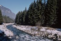
Title (German)
Reichenbach im Kandertal BE, Ufer und Flussbett der Kander bei km 17.05 bei der Aue Schwandi Ey
Caption
South view downstream from the log ramp (left bank) at km 17.05 on riverbed and both obstructed banks of the Kander with forest (spruce), first photograph before vegetation phase, general view; coordinates (LV03) of camera location: 617120/161124; keywords Documenta Natura: river obstruction, floodplain forest, river, foothills of the Alps, landscape change
Caption (German)
Südansicht flussabwärts von der Blockrampe (linkes Ufer) bei km 17.05 auf Flussbett und beide verbaute Ufer der Kander mit Wald (Fichte), Erstaufnahme vor der Vegetationsphase, Gesamtansicht; Koordinaten (LV03) des Kamerastandorts: 617120/161124; Schlagworte Documenta Natura: Flussverbauung, Auenwald, Fluss, Voralpen, Landschaftswandel
Record Name
Dia_303-39185

Title (German)
Reichenbach im Kandertal BE, Ufer und Flussbett der Kander bei km 17.05 bei der Aue Schwandi Ey
Caption
South view downstream at km 17.05 on riverbed and both dynamic banks of the Kander with forest (deciduous trees), 1st follow-up image after widening and renaturation, general view; coordinates (LV03) of camera location: 617120/161124; keywords Documenta Natura: river degradation, floodplain forest, river, foothills of the Alps, landscape change
Caption (German)
Südansicht flussabwärts bei km 17.05 auf Flussbett und beide dynamische Ufer der Kander mit Wald (Laubbäume), 1. Folgeaufnahme nach der Ausweitung und Renaturierung, Gesamtansicht; Koordinaten (LV03) des Kamerastandorts: 617120/161124; Schlagworte Documenta Natura: Flussverbauung, Auenwald, Fluss, Voralpen, Landschaftswandel
Record Name
Dia_303-39188

Title (German)
Reichenbach im Kandertal BE, Ufer und Flussbett der Kander bei km 16.80 bei der Aue Schwandi Ey
Caption
West view from the left bank at km 16.80 upstream on riverbed and obstructed banks of the Kander with forest (spruce), first photograph before vegetation phase, partial view; coordinates (LV03) of camera location: 617181/161365; keywords Documenta Natura: river obstruction, floodplain forest, river, pre-Alps, landscape change.
Caption (German)
Westansicht vom linken Ufer bei km 16.80 flussaufwärts auf Flussbett und verbaute Ufer der Kander mit Wald (Fichte), Erstaufnahme vor der Vegetationsphase, Teilansicht; Koordinaten (LV03) des Kamerastandorts: 617181/161365; Schlagworte Documenta Natura: Flussverbauung, Auenwald, Fluss, Voralpen, Landschaftswandel
Record Name
Dia_303-39199

Title (German)
Reichenbach im Kandertal BE, Ufer und Flussbett der Kander bei km 16.80 bei der Aue Schwandi Ey
Caption
Northwest view from the left bank at km 16.80 upstream on riverbed and obstructed banks of the Kander with forest (spruce), first photograph before vegetation phase, partial view; coordinates (LV03) of camera location: 617181/161365; keywords Documenta Natura: river obstruction, floodplain forest, river, pre-Alps, landscape change.
Caption (German)
Nordwestansicht vom linken Ufer bei km 16.80 flussaufwärts auf Flussbett und verbaute Ufer der Kander mit Wald (Fichte), Erstaufnahme vor der Vegetationsphase, Teilansicht; Koordinaten (LV03) des Kamerastandorts: 617181/161365; Schlagworte Documenta Natura: Flussverbauung, Auenwald, Fluss, Voralpen, Landschaftswandel
Record Name
Dia_303-39209

Title (German)
Reichenbach im Kandertal BE, Ufer und Flussbett der Kander bei km 16.80 bei der Aue Schwandi Ey
Caption
West view from the left bank at km 16.80 upstream on riverbed and dynamic banks of the Kander with recessed riparian forest (deciduous trees), 1st follow-up photograph after bank widening and renaturation, partial view; coordinates (LV03) of camera location: 617181/161365; keywords Documenta Natura: river degradation, riparian forest, river, Prealps, landscape change.
Caption (German)
Westansicht vom linken Ufer bei km 16.80 flussaufwärts auf Flussbett und dynamische Ufer der Kander mit zurückversetztem Uferwald (Laubbäume), 1. Folgeaufnahme nach der Uferausweitung und Renaturierung, Teilansicht; Koordinaten (LV03) des Kamerastandorts: 617181/161365; Schlagworte Documenta Natura: Flussverbauung, Auenwald, Fluss, Voralpen, Landschaftswandel
Record Name
Dia_303-39219

Title (German)
Reichenbach im Kandertal BE, Ufer und Flussbett der Kander bei km 16.80 bei der Aue Schwandi Ey
Caption
Northwest view from the left bank at km 16.80 upstream on riverbed and dynamic banks of the Kander with recessed riparian forest (deciduous trees), 1st follow-up photograph after bank widening and renaturation, partial view; coordinates (LV03) of camera location: 617181/161365; keywords Documenta Natura: river degradation, riparian forest, river, Prealps, landscape change.
Caption (German)
Nordwestansicht vom linken Ufer bei km 16.80 flussaufwärts auf Flussbett und dynamische Ufer der Kander mit zurückversetztem Uferwald (Laubbäume), 1. Folgeaufnahme nach der Uferausweitung und Renaturierung, Teilansicht; Koordinaten (LV03) des Kamerastandorts: 617181/161365; Schlagworte Documenta Natura: Flussverbauung, Auenwald, Fluss, Voralpen, Landschaftswandel
Record Name
Dia_303-39229

Title (German)
Reichenbach im Kandertal BE, Ufer und Flussbett der Kander bei km 16.69 bei der Aue Schwandi Ey
Caption
Southwest view downstream from the log ramp (left bank) at km 16.69 onto riverbed and both obstructed banks of the Kander with mixed forest, first photograph before vegetation phase, partial view; coordinates (LV03) of camera location: 617235/161459; keywords Documenta Natura: river obstruction, floodplain forest, river, foothills of the Alps, landscape change
Caption (German)
Südwestansicht flussabwärts von der Blockrampe (linkes Ufer) bei km 16.69 auf Flussbett und beide verbaute Ufer der Kander mit Mischwald, Erstaufnahme vor der Vegetationsphase, Teilansicht; Koordinaten (LV03) des Kamerastandorts: 617235/161459; Schlagworte Documenta Natura: Flussverbauung, Auenwald, Fluss, Voralpen, Landschaftswandel
Record Name
Dia_303-39240

Title (German)
Reichenbach im Kandertal BE, Ufer und Flussbett der Kander bei km 16.69 bei der Aue Schwandi Ey
Caption
Southwest view downstream from the log ramp (left bank) at km 16.69 on riverbed and both banks of the Kander with floodplain forest, 1st follow-up photograph after bank widening and renaturation, general view; coordinates (LV03) of camera location: 617235/161459; keywords Documenta Natura: river degradation, floodplain forest, river, Prealps, landscape change.
Caption (German)
Südwestansicht flussabwärts von der Blockrampe (linkes Ufer) bei km 16.69 auf Flussbett und beide Ufer der Kander mit Auenwald, 1. Folgeaufnahme nach der Uferausweitung und Renaturierung, Gesamtansicht; Koordinaten (LV03) des Kamerastandorts: 617235/161459; Schlagworte Documenta Natura: Flussverbauung, Auenwald, Fluss, Voralpen, Landschaftswandel
Record Name
Dia_303-39245

Title (German)
Tujetsch GR, Bei der Lichtung Tscheppa östlich von Bugnei
Caption
View from the clearing Tscheppa over the railroad line of the Furka-Oberalp-Bahn (FO), on the other side of the valley the hamlets Cavorgia and Surrein, first photo (1995), partial view; coordinates (LV03) of the camera location: 703778/170950; keywords Documenta Natura: construction site, change of landscape, track construction, material deposit
Caption (German)
Blick von der Waldlichtung Tscheppa über die Bahnlinie der Furka-Oberalp-Bahn (FO), auf der anderen Talseite die Weiler Cavorgia und Surrein, Erstaufnahme (1995), Teilansicht; Koordinaten (LV03) des Kamerastandorts: 703778/170950; Schlagworte Documenta Natura: Baustelle, Landschaftswandel, Gleisbau, Materialablagerung
Record Name
Dia_303-39256

Title (German)
Tujetsch GR, Bei der Lichtung Tscheppa östlich von Bugnei
Caption
View from the clearing Tscheppa up the valley over the railroad line of the Furka-Oberalp-Bahn (FO), first photograph (1995), partial view; coordinates (LV03) of the camera location: 703778/170950; keywords Documenta Natura: construction site, landscape change, track construction, material deposition.
Caption (German)
Blick von der Waldlichtung Tscheppa talaufwärts über die Bahnlinie der Furka-Oberalp-Bahn (FO), Erstaufnahme (1995), Teilansicht; Koordinaten (LV03) des Kamerastandorts: 703778/170950; Schlagworte Documenta Natura: Baustelle, Landschaftswandel, Gleisbau, Materialablagerung
Record Name
Dia_303-39268

Title (German)
Tujetsch GR, Bei der Lichtung Tscheppa östlich von Bugnei
Caption
View from the clearing Tscheppa over the railroad line of the Furka-Oberalp-Bahn (FO), on the other side of the valley the hamlets Cavorgia and Surrein, 1st follow-up photograph after the construction of the additional railroad line to the outdoor facility (1998), partial view; coordinates (LV03) of the camera location: 703778/170950; keywords Documenta Natura: construction site, change of landscape, track construction, material deposit
Caption (German)
Blick von der Waldlichtung Tscheppa über die Bahnlinie der Furka-Oberalp-Bahn (FO), auf der anderen Talseite die Weiler Cavorgia und Surrein, 1. Folgeaufnahme nach dem Bau der zusätzlichen Bahnlinie zur Aussenanlage (1998), Teilansicht; Koordinaten (LV03) des Kamerastandorts: 703778/170950; Schlagworte Documenta Natura: Baustelle, Landschaftswandel, Gleisbau, Materialablagerung
Record Name
Dia_303-39276

Title (German)
Tujetsch GR, Bei der Lichtung Tscheppa östlich von Bugnei
Caption
View from the forest clearing Tscheppa up the valley over the railroad line of the Furka-Oberalp-Bahn (FO), 1st follow-up photograph after the construction of the additional railroad line to the outdoor facility (1998), partial view; coordinates (LV03) of the camera location: 703778/170950; keywords Documenta Natura: construction site, change of landscape, track construction, material deposit
Caption (German)
Blick von der Waldlichtung Tscheppa talaufwärts über die Bahnlinie der Furka-Oberalp-Bahn (FO), 1. Folgeaufnahme nach dem Bau der zusätzlichen Bahnlinie zur Aussenanlage (1998), Teilansicht; Koordinaten (LV03) des Kamerastandorts: 703778/170950; Schlagworte Documenta Natura: Baustelle, Landschaftswandel, Gleisbau, Materialablagerung
Record Name
Dia_303-39286

Title (German)
Tujetsch GR, Auf dem Bahntrassee östlich des Dorfes Bugnei
Caption
View down the valley along the railroad line of the Furka-Oberalp-Bahn (FO), edge of the forest with shrubs and spruce, Piz Muraun in the background, first photograph (1995), partial view; coordinates (LV03) of the camera location: 703455/170950; keywords Documenta Natura: construction site, change of landscape, track construction, material deposit
Caption (German)
Blick talabwärts entlang der Bahnlinie der Furka-Oberalp-Bahn (FO), Waldrand mit Sträuchern und Fichte, im Hintergrund den Piz Muraun, Erstaufnahme (1995), Teilansicht; Koordinaten (LV03) des Kamerastandorts: 703455/170950; Schlagworte Documenta Natura: Baustelle, Landschaftswandel, Gleisbau, Materialablagerung
Record Name
Dia_303-39295

Title (German)
Tujetsch GR, Auf dem Bahntrassee östlich des Dorfes Bugnei
Caption
View down the valley along the railroad line of the Furka-Oberalp-Bahn (FO), edge of the forest, Piz Muraun in the background, 1st follow-up photograph after the construction of the additional railroad line to the outdoor facility with widened forest aisle (1998), partial view; coordinates (LV03) of the camera location: 703455/170950; keywords Documenta Natura: construction site, landscape change, track construction, material deposit
Caption (German)
Blick talabwärts entlang der Bahnlinie der Furka-Oberalp-Bahn (FO), Waldrand, im Hintergrund den Piz Muraun, 1. Folgeaufnahme nach dem Bau der zusätzlichen Bahnlinie zur Aussenanlage mit verbreiteter Waldschneise (1998), Teilansicht; Koordinaten (LV03) des Kamerastandorts: 703455/170950; Schlagworte Documenta Natura: Baustelle, Landschaftswandel, Gleisbau, Materialablagerung
Record Name
Dia_303-39305

Title (German)
Tujetsch GR, Kantonsstrasse bei Bugnei, Mulinets
Caption
View of cantonal road 19 before the construction of the tunnel under the additional railroad line to the installation site (intermediate attack), first photograph (1995), partial view; coordinates (LV03) of the camera location: 703225/170870; keywords Documenta Natura: construction site, landscape change, track construction, material deposition.
Caption (German)
Ansicht der Kantonsstrasse 19 vor dem Bau der Untertunnelung der zusätzlichen Bahnlinie zum Installationsplatz (Zwischenangriff), Erstaufnahme (1995), Teilansicht; Koordinaten (LV03) des Kamerastandorts: 703225/170870; Schlagworte Documenta Natura: Baustelle, Landschaftswandel, Gleisbau, Materialablagerung
Record Name
Dia_303-39315

Title (German)
Tujetsch GR, Kantonsstrasse bei Bugnei, Mulinets
Caption
View above cantonal road 19 before construction of the tunnel under the additional railroad line to the installation site (intermediate attack), on the other side of the valley the hamlet of Surrein, first photograph (1995), partial view; coordinates (LV03) of the camera location: 703340/170973; keywords Documenta Natura: construction site, change of landscape, track construction, material deposit
Caption (German)
Blick oberhalb der Kantonsstrasse 19 vor dem Bau der Untertunnelung der zusätzlichen Bahnlinie zum Installationsplatz (Zwischenangriff), auf der anderen Talseite der Weiler Surrein, Erstaufnahme (1995), Teilansicht; Koordinaten (LV03) des Kamerastandorts: 703340/170973; Schlagworte Documenta Natura: Baustelle, Landschaftswandel, Gleisbau, Materialablagerung
Record Name
Dia_303-39324

Title (German)
Tujetsch GR, Kantonsstrasse bei Bugnei, Mulinets
Caption
View of the cantonal road 19 before the construction of the tunnel under the additional railroad line to the installation site (intermediate attack), 1st follow-up photograph after the construction of the tunnel under (1998), partial view; coordinates (LV03) of the camera location: 703225/170870; keywords Documenta Natura: construction site, landscape change, track construction, material deposition.
Caption (German)
Ansicht der Kantonsstrasse 19 vor dem Bau der Untertunnelung der zusätzlichen Bahnlinie zum Installationsplatz (Zwischenangriff), 1. Folgeaufnahme nach dem Bau der Untertunnelung (1998), Teilansicht; Koordinaten (LV03) des Kamerastandorts: 703225/170870; Schlagworte Documenta Natura: Baustelle, Landschaftswandel, Gleisbau, Materialablagerung
Record Name
Dia_303-39334

Title (German)
Tujetsch GR, Kantonsstrasse bei Bugnei, Mulinets
Caption
View above the cantonal road 19 before the construction of the tunnel under the additional railroad line to the installation site (intermediate attack), on the other side of the valley the hamlet of Surrein,1st follow-up photo after the construction of the tunnel under (1998), partial view; coordinates (LV03) of the camera location: 703340/170973; keywords Documenta Natura: construction site, change of landscape, track construction, material deposit
Caption (German)
Blick oberhalb der Kantonsstrasse 19 vor dem Bau der Untertunnelung der zusätzlichen Bahnlinie zum Installationsplatz (Zwischenangriff), auf der anderen Talseite der Weiler Surrein,1. Folgeaufnahme nach dem Bau der Untertunnelung (1998), Teilansicht; Koordinaten (LV03) des Kamerastandorts: 703340/170973; Schlagworte Documenta Natura: Baustelle, Landschaftswandel, Gleisbau, Materialablagerung
Record Name
Dia_303-39344

Title (German)
Tujetsch GR, Südostansicht des unteren Val Bugnei mit dem Weiler Runs
Caption
Southeast view of the lower valley floor of Val Bugnei with the hamlet of Runs, first photograph taken before the start of construction of the Sedrun intermediate attack (1995), partial view; coordinates (LV03) of the camera location: 703195/170550; keywords Documenta Natura: construction site, landscape change, track construction, material deposition.
Caption (German)
Südostansicht des unteren Talbodens des Val Bugnei mit dem Weiler Runs, Erstaufnahme vor Baubeginn Zwischenangriff Sedrun (1995), Teilansicht; Koordinaten (LV03) des Kamerastandorts: 703195/170550; Schlagworte Documenta Natura: Baustelle, Landschaftswandel, Gleisbau, Materialablagerung
Record Name
Dia_303-39357

Title (German)
Tujetsch GR, Südostansicht des unteren Val Bugnei mit dem Weiler Runs
Caption
Southeast view of the lower valley floor of Val Bugnei with the hamlet of Runs, 1st follow-up photograph after the construction of the bridge for the additional railroad line to the outdoor facility (1998), partial view; coordinates (LV03) of the camera location: 703195/170550; keywords Documenta Natura: construction site, landscape change, track construction, material deposition.
Caption (German)
Südostansicht des unteren Talbodens des Val Bugnei mit dem Weiler Runs, 1. Folgeaufnahme nach dem Bau der Brücke für die zusätzliche Bahnlinie zur Aussenanlage (1998), Teilansicht; Koordinaten (LV03) des Kamerastandorts: 703195/170550; Schlagworte Documenta Natura: Baustelle, Landschaftswandel, Gleisbau, Materialablagerung
Record Name
Dia_303-39366

Title (German)
Tujetsch GR, Südostansicht des unteren Val Bugnei mit dem Weiler Runs
Caption
Southeast view of the lower valley floor of Val Bugnei with the hamlet of Runs, 2nd follow-up image during material deposition (2004), partial view; coordinates (LV03) of camera location: 703195/170550; keywords Documenta Natura: construction site, landscape change, track construction, material deposition.
Caption (German)
Südostansicht des unteren Talbodens des Val Bugnei mit dem Weiler Runs, 2. Folgeaufnahme während der Materialablagerung (2004), Teilansicht; Koordinaten (LV03) des Kamerastandorts: 703195/170550; Schlagworte Documenta Natura: Baustelle, Landschaftswandel, Gleisbau, Materialablagerung
Record Name
Dia_303-39376

Tujetsch GR, southwest view of the lower Val Bugnei with the cantonal road and Bugnei (western part)
Title (German)
Tujetsch GR, Südwestansicht des unteren Val Bugnei mit der Kantonsstrasse und Bugnei (Westteil)
Caption
Southwest view of the lower Val Bugnei, in the background the cantonal road 19 and the village of Bugnei (western part), first photograph (1995), partial view; coordinates (LV03) of the camera location: 702880/170775; keywords Documenta Natura: construction site, landscape change, track construction, material deposition.
Caption (German)
Südwestansicht des unteren Val Bugnei, im Hintergrund die Kantonsstrasse 19 und das Dorf Bugnei (Westteil), Erstaufnahme (1995), Teilansicht; Koordinaten (LV03) des Kamerastandorts: 702880/170775; Schlagworte Documenta Natura: Baustelle, Landschaftswandel, Gleisbau, Materialablagerung
Record Name
Dia_303-39388

Tujetsch GR, southwest view of the lower Val Bugnei with the cantonal road and Bugnei (western part)
Title (German)
Tujetsch GR, Südwestansicht des unteren Val Bugnei mit der Kantonsstrasse und Bugnei (Westteil)
Caption
Southwest view of the lower Val Bugnei, in the background the cantonal road 19 and the village of Bugnei (western part), 1st follow-up image during material deposition from the intermediate attack (2004), partial view; coordinates (LV03) of the camera location: 702880/170775; keywords Documenta Natura: construction site, landscape change, track construction, material deposition.
Caption (German)
Südwestansicht des unteren Val Bugnei, im Hintergrund die Kantonsstrasse 19 und das Dorf Bugnei (Westteil), 1. Folgeaufnahme während der Materialablagerung vom Zwischenangriff (2004), Teilansicht; Koordinaten (LV03) des Kamerastandorts: 702880/170775; Schlagworte Documenta Natura: Baustelle, Landschaftswandel, Gleisbau, Materialablagerung
Record Name
Dia_303-39397

Title (German)
Tujetsch GR, Südostansicht des Val da Claus mit Plauns Sedrun und Sedrun (Ostteil)
Caption
Southeast view of Val da Claus with meadowland and farmland Plauns Sedrun and the village of Sedrun (eastern part), first photograph (1995), general view; coordinates (LV03) of camera location: 702673/170185; keywords Documenta Natura: construction site, landscape change, track construction, material deposition.
Caption (German)
Südostansicht des Val da Claus mit Wiesland und Ackerland Plauns Sedrun und dem Dorf Sedrun (Ostteil), Erstaufnahme (1995), Gesamtansicht; Koordinaten (LV03) des Kamerastandorts: 702673/170185; Schlagworte Documenta Natura: Baustelle, Landschaftswandel, Gleisbau, Materialablagerung
Record Name
Dia_303-39409

Title (German)
Tujetsch GR, Südostansicht des Val da Claus mit Plauns Sedrun und Sedrun (Ostteil)
Caption
Southeast view of Val da Claus with meadowland and farmland Plauns Sedrun and the village of Sedrun (eastern part), 1st follow-up photograph after the construction of a dam for the access road and additional railroad line to the outdoor facility (1999), general view; coordinates (LV03) of the camera location: 702673/170185; keywords Documenta Natura: construction site, landscape change, railroad track construction, material deposit
Caption (German)
Südostansicht des Val da Claus mit Wiesland und Ackerland Plauns Sedrun und dem Dorf Sedrun (Ostteil), 1. Folgeaufnahme nach dem Bau eines Dammes für die Zufahrtsstrasse und zusätzliche Bahnlinie zur Aussenanlage (1999), Gesamtansicht; Koordinaten (LV03) des Kamerastandorts: 702673/170185; Schlagworte Documenta Natura: Baustelle, Landschaftswandel, Gleisbau, Materialablagerung
Record Name
Dia_303-39418

Title (German)
Tujetsch GR, Südostansicht des Val da Claus mit Plauns Sedrun und Sedrun (Ostteil)
Caption
Southeast view of Val da Claus with meadowland and farmland Plauns Sedrun and the village of Sedrun (eastern part), 2nd follow-up image during material deposition from the intermediate attack (2004), general view; coordinates (LV03) of the camera location: 702673/170185; keywords Documenta Natura: construction site, change of landscape, track construction, material deposition
Caption (German)
Südostansicht des Val da Claus mit Wiesland und Ackerland Plauns Sedrun und dem Dorf Sedrun (Ostteil), 2. Folgeaufnahme während der Materialablagerung vom Zwischenangriff (2004), Gesamtansicht; Koordinaten (LV03) des Kamerastandorts: 702673/170185; Schlagworte Documenta Natura: Baustelle, Landschaftswandel, Gleisbau, Materialablagerung
Record Name
Dia_303-39428

Title (German)
Tujetsch GR, Südansicht des Südosthanges Ruinas im Val Nalps
Caption
South view of the southeast slope Ruinas in Val Nalps (south of Sedrun)with typical alpine vegetation, first photograph (1995), partial view; coordinates (LV03) of camera location: 702213/168825; keywords Documenta Natura: construction site, landscape change, track construction, material deposition.
Caption (German)
Südansicht des Südosthanges Ruinas im Val Nalps (südlich von Sedrun)mit typischer alpiner Bewuchsung, Erstaufnahme (1995), Teilansicht; Koordinaten (LV03) des Kamerastandorts: 702213/168825; Schlagworte Documenta Natura: Baustelle, Landschaftswandel, Gleisbau, Materialablagerung
Record Name
Dia_303-39439

Title (German)
Tujetsch GR, Südansicht des Südosthanges Ruinas im Val Nalps
Caption
South view of the southeast slope Ruinas in Val Nalps (south of Sedrun), 1st follow-up photograph during the construction of the venting structure for the intermediate attack (1998), partial view; coordinates (LV03) of the camera location: 702213/168825; keywords Documenta Natura: construction site, landscape change, track construction, material deposition.
Caption (German)
Südansicht des Südosthanges Ruinas im Val Nalps (südlich von Sedrun), 1. Folgeaufnahme während dem Bau des Entlüftungsbauwerkes für den Zwischenangriff (1998), Teilansicht; Koordinaten (LV03) des Kamerastandorts: 702213/168825; Schlagworte Documenta Natura: Baustelle, Landschaftswandel, Gleisbau, Materialablagerung
Record Name
Dia_303-39449

Title (German)
Tujetsch GR, Südansicht des Südosthanges Ruinas im Val Nalps
Caption
South view of the southeast slope Ruinas in Val Nalps (south of Sedrun), 2nd follow-up image after the construction of the venting structure for the intermediate attack (2004), partial view; coordinates (LV03) of the camera location: 702213/168825; keywords Documenta Natura: construction site, landscape change, track construction, material deposition.
Caption (German)
Südansicht des Südosthanges Ruinas im Val Nalps (südlich von Sedrun), 2. Folgeaufnahme nach dem Bau des Entlüftungsbauwerkes für den Zwischenangriff (2004), Teilansicht; Koordinaten (LV03) des Kamerastandorts: 702213/168825; Schlagworte Documenta Natura: Baustelle, Landschaftswandel, Gleisbau, Materialablagerung
Record Name
Dia_303-39459

Title (German)
Tujetsch GR, Ostansicht des Talbodens und Südhanges Rueras mit dem Weiler Punt (z. T.)
Caption
East-southeast view from the slope of Rueras near Sedrun, at the edge of the slope stables of the hamlet of Punt and roadway, in the background the mountain range, first photograph (1995), partial view; coordinates (LV03) of the camera location: 702080/170335; keywords Documenta Natura: construction site, change of landscape, track construction, material deposit
Caption (German)
Ostsüdostansicht vom Hang Rueras bei Sedrun, am Böschungsrand Ställe des Weilers Punt und Fahrweg, im Hintergrund die Gebirgskette, Erstaufnahme (1995), Teilansicht; Koordinaten (LV03) des Kamerastandorts: 702080/170335; Schlagworte Documenta Natura: Baustelle, Landschaftswandel, Gleisbau, Materialablagerung
Record Name
Dia_303-39470

Title (German)
Tujetsch GR, Ostansicht des Talbodens und Südhanges Rueras mit dem Weiler Punt (z. T.)
Caption
East view of the valley floor of Rueras near Sedrun with outdoor installation, in the background the mountain range, 1st follow-up photograph after the construction of the funicular railroad for passenger transport (1998), partial view; coordinates (LV03) of the camera location: 702080/170335; keywords Documenta Natura: construction site, change of landscape, track construction, material deposit
Caption (German)
Ostansicht des Talbodens Rueras bei Sedrun mit Aussenanlage, im Hintergrund die Gebirgskette, 1. Folgeaufnahme nach dem Bau der Standseilbahn für den Personentransport (1998), Teilansicht; Koordinaten (LV03) des Kamerastandorts: 702080/170335; Schlagworte Documenta Natura: Baustelle, Landschaftswandel, Gleisbau, Materialablagerung
Record Name
Dia_303-39480

Title (German)
Tujetsch GR, Ostansicht des Talbodens und Südhanges Rueras mit dem Weiler Punt (z. T.)
Caption
East-southeast view from the slope of Rueras near Sedrun, in the background the mountain range, 1st follow-up photograph after the construction of the funicular railroad for passenger transport (1998), partial view; coordinates (LV03) of the camera location: 702080/170335; keywords Documenta Natura: construction site, landscape change, track construction, material deposition.
Caption (German)
Ostsüdostansicht vom Hang Rueras bei Sedrun, im Hintergrund die Gebirgskette, 1. Folgeaufnahme nach dem Bau der Standseilbahn für den Personentransport (1998), Teilansicht; Koordinaten (LV03) des Kamerastandorts: 702080/170335; Schlagworte Documenta Natura: Baustelle, Landschaftswandel, Gleisbau, Materialablagerung
Record Name
Dia_303-39490

Title (German)
Tujetsch GR, Ostansicht des Talbodens und Südhanges Rueras mit dem Weiler Punt (z. T.)
Caption
East view of the valley floor of Rueras near Sedrun with outdoor facilities, in the background the mountain range, 2nd follow-up image during the operation of the outdoor facilities for the intermediate attack (2004), partial view; coordinates (LV03) of the camera location: 702080/170335; keywords Documenta Natura: construction site, landscape change, track construction, material deposit
Caption (German)
Ostansicht des Talbodens Rueras bei Sedrun mit Aussenanlage, im Hintergrund die Gebirgskette, 2. Folgeaufnahme während dem Betrieb der Aussenanlagen für den Zwischenangriff (2004), Teilansicht; Koordinaten (LV03) des Kamerastandorts: 702080/170335; Schlagworte Documenta Natura: Baustelle, Landschaftswandel, Gleisbau, Materialablagerung
Record Name
Dia_303-39500

Title (German)
Tujetsch GR, Ostansicht des Talbodens und Südhanges Rueras mit dem Weiler Punt (z. T.)
Caption
East-southeast view of the valley floor Rueras with outdoor facilities, in the background the mountain range, 2nd follow-up image during the operation of the outdoor facilities for the intermediate attack (2004), partial view; coordinates (LV03) of the camera location: 702080/170335; keywords Documenta Natura: construction site, change of landscape, track construction, material deposit
Caption (German)
Ostsüdostansicht des Talbodens Rueras mit Aussenanlage, im Hintergrund die Gebirgskette, 2. Folgeaufnahme während dem Betrieb der Aussenanlagen für den Zwischenangriff (2004), Teilansicht; Koordinaten (LV03) des Kamerastandorts: 702080/170335; Schlagworte Documenta Natura: Baustelle, Landschaftswandel, Gleisbau, Materialablagerung
Record Name
Dia_303-39510

Title (German)
Tujetsch GR, Nordwestansicht der Gewerbezone Tgaglias, im Hintergrund Surrein
Caption
View of the Tgaglias industrial zone with concrete plant, industrial buildings, construction material storage areas, high-voltage power line with power line pylons and scrub forest, in the background the hamlet of Surrein, first photograph (1995), partial view; coordinates (LV03) of the camera location: 702120/170455; keywords Documenta Natura: construction site, change of landscape, track construction, material deposit
Caption (German)
Blick auf die Gewerbezone Tgaglias mit Betonwerk, Gewerbegebäuden, Baumateriallagerplätzen, Hochspannungsleitung mit Leitungsmasten und Gebüschwald, im Hintergrund der Weiler Surrein, Erstaufnahme (1995), Teilansicht; Koordinaten (LV03) des Kamerastandorts: 702120/170455; Schlagworte Documenta Natura: Baustelle, Landschaftswandel, Gleisbau, Materialablagerung
Record Name
Dia_303-39523

Title (German)
Tujetsch GR, Nordwestansicht der Gewerbezone Tgaglias, im Hintergrund Surrein
Caption
View of the Tgaglias industrial zone with concrete plant, industrial buildings, construction material storage areas, in the background the hamlet of Surrein, 1st follow-up photograph during the operation of the outdoor facilities, after the construction of the railroad line for the intermediate attack (1998), partial view; coordinates (LV03) of the camera location: 702120/170455; keywords Documenta Natura: construction site, landscape change, track construction, material deposit
Caption (German)
Blick auf die Gewerbezone Tgaglias mit Betonwerk, Gewerbegebäuden, Baumateriallagerplätzen, im Hintergrund der Weiler Surrein, 1. Folgeaufnahme während dem Betrieb der Aussenanlagen, nach dem Bau der Bahnlinie für den Zwischenangriff (1998), Teilansicht; Koordinaten (LV03) des Kamerastandorts: 702120/170455; Schlagworte Documenta Natura: Baustelle, Landschaftswandel, Gleisbau, Materialablagerung
Record Name
Dia_303-39531

Title (German)
Tujetsch GR, Nordwestansicht der Gewerbezone Tgaglias, im Hintergrund Surrein
Caption
View of the Tgaglias industrial zone with concrete and gravel works, construction material storage areas, in the background the hamlet of Surrein, 2nd follow-up photograph taken during operation of the outdoor facilities for the intermediate attack (2004), partial view; coordinates (LV03) of the camera location: 702120/170455; keywords Documenta Natura: construction site, change of landscape, track construction, material deposit
Caption (German)
Blick auf die Gewerbezone Tgaglias mit Beton- und Kieswerk, Baumateriallagerplätzen, im Hintergrund der Weiler Surrein, 2. Folgeaufnahme während dem Betrieb der Aussenanlagen für den Zwischenangriff (2004), Teilansicht; Koordinaten (LV03) des Kamerastandorts: 702120/170455; Schlagworte Documenta Natura: Baustelle, Landschaftswandel, Gleisbau, Materialablagerung
Record Name
Dia_303-39541

Title (German)
Tujetsch GR, Nordostansicht des Talbodens Rueras mit dem Weiler Punt
Caption
Northeast view of the Rueras valley floor with pastures, nature reserve, hamlet of Punt, high-voltage power line, substation in the background, first photograph (1995), general view; coordinates (LV03) of the camera location: 702118/170455; keywords Documenta Natura: construction site, change of landscape, track construction, material deposit
Caption (German)
Nordostansicht auf den Talboden Rueras mit Weiden, Naturschutzgebiet, Weiler Punt, Hochspannungsleitung, im Hintergrund das Unterwerk, Erstaufnahme (1995), Gesamtansicht; Koordinaten (LV03) des Kamerastandorts: 702118/170455; Schlagworte Documenta Natura: Baustelle, Landschaftswandel, Gleisbau, Materialablagerung
Record Name
Dia_303-39552

Title (German)
Tujetsch GR, Nordostansicht des Talbodens Rueras mit dem Weiler Punt
Caption
Northeast view of the Rueras valley floor, construction site storage yard, high-voltage line, substation in the background, 1st follow-up photograph taken during operation of the outdoor facilities for the intermediate attack (1998), general view; coordinates (LV03) of the camera location: 702118/170455; keywords Documenta Natura: construction site, landscape change, track construction, material deposit
Caption (German)
Nordostansicht auf den Talboden Rueras, Baustellenlagerplatz, Hochspannungsleitung, im Hintergrund das Unterwerk, 1. Folgeaufnahme während dem Betrieb der Aussenanlagen für den Zwischenangriff (1998), Gesamtansicht; Koordinaten (LV03) des Kamerastandorts: 702118/170455; Schlagworte Documenta Natura: Baustelle, Landschaftswandel, Gleisbau, Materialablagerung
Record Name
Dia_303-39562

Title (German)
Tujetsch GR, Nordostansicht des Talbodens Rueras mit dem Weiler Punt
Caption
Northeast view of the Rueras valley floor, construction shacks, high-voltage power line, substation in the background, 2nd follow-up shot during operation of the outdoor facilities for the intermediate attack (2004), general view; coordinates (LV03) of the camera location: 702118/170455; keywords Documenta Natura: construction site, landscape change, track construction, material deposit
Caption (German)
Nordostansicht auf den Talboden Rueras, Baubaracken, Hochspannungsleitung, im Hintergrund das Unterwerk, 2. Folgeaufnahme während dem Betrieb der Aussenanlagen für den Zwischenangriff (2004), Gesamtansicht; Koordinaten (LV03) des Kamerastandorts: 702118/170455; Schlagworte Documenta Natura: Baustelle, Landschaftswandel, Gleisbau, Materialablagerung
Record Name
Dia_303-39572

Title (German)
Tujetsch GR, Nordwestansicht der Böschung und des Talbodens Rueras mit dem Weiler Punt, im Hintergrund die Gewerbezone Tgaglias
Caption
View of Rueras embankment and valley floor with pastures, hamlet of Punt, high-voltage power line, nature reserve and substation, Tgaglias industrial zone in the background, first photograph (1995), general view; coordinates (LV03) of camera location: 701625/170405; keywords Documenta Natura: construction site, landscape change, railway track construction, material deposit
Caption (German)
Blick auf Böschung und Talboden Rueras mit Weiden, Weiler Punt, Hochspannungsleitung, Naturschutzgebiet und Unterwerk, im Hintergrund die Gewerbezone Tgaglias, Erstaufnahme (1995), Gesamtansicht; Koordinaten (LV03) des Kamerastandorts: 701625/170405; Schlagworte Documenta Natura: Baustelle, Landschaftswandel, Gleisbau, Materialablagerung
Record Name
Dia_303-39583

Title (German)
Tujetsch GR, Nordwestansicht der Böschung und des Talbodens Rueras mit dem Weiler Punt, im Hintergrund die Gewerbezone Tgaglias
Caption
View of Rueras valley floor with pastures, nature reserve and substation, first photograph (1995), partial view; coordinates (LV03) of camera location: 701625/170405; keywords Documenta Natura: construction site, landscape change, track construction, material deposition.
Caption (German)
Blick auf Talboden Rueras mit Weiden, Naturschutzgebiet und Unterwerk, Erstaufnahme (1995), Teilansicht; Koordinaten (LV03) des Kamerastandorts: 701625/170405; Schlagworte Documenta Natura: Baustelle, Landschaftswandel, Gleisbau, Materialablagerung
Record Name
Dia_303-39593

Title (German)
Tujetsch GR, Nordwestansicht der Böschung und des Talbodens Rueras mit dem Weiler Punt, im Hintergrund die Gewerbezone Tgaglias
Caption
View of Rueras embankment and valley floor with pastures, Tgaglias industrial zone with construction site storage area, 1st follow-up photograph taken during operation of the outdoor facilities for the intermediate attack (1998), general view; coordinates (LV03) of camera location: 701625/170405; keywords Documenta Natura: construction site, landscape change, track construction, material deposit
Caption (German)
Blick auf Böschung und Talboden Rueras mit Weiden, Gewerbezone Tgaglias mit Baustellenlagerplatz, 1. Folgeaufnahme während dem Betrieb der Aussenanlagen für den Zwischenangriff (1998), Gesamtansicht; Koordinaten (LV03) des Kamerastandorts: 701625/170405; Schlagworte Documenta Natura: Baustelle, Landschaftswandel, Gleisbau, Materialablagerung
Record Name
Dia_303-39603

Title (German)
Tujetsch GR, Nordwestansicht der Böschung und des Talbodens Rueras mit dem Weiler Punt, im Hintergrund die Gewerbezone Tgaglias
Caption
View of Rueras valley floor, Tgaglias industrial zone with construction site storage area, 1st follow-up photograph taken during operation of the outdoor facilities for the intermediate attack (1998), partial view; coordinates (LV03) of camera location: 701625/170405; keywords Documenta Natura: construction site, change of landscape, track construction, material deposit
Caption (German)
Blick auf Talboden Rueras, Gewerbezone Tgaglias mit Baustellenlagerplatz, 1. Folgeaufnahme während dem Betrieb der Aussenanlagen für den Zwischenangriff (1998), Teilansicht; Koordinaten (LV03) des Kamerastandorts: 701625/170405; Schlagworte Documenta Natura: Baustelle, Landschaftswandel, Gleisbau, Materialablagerung
Record Name
Dia_303-39613

Title (German)
Tujetsch GR, Nordwestansicht der Böschung und des Talbodens Rueras mit dem Weiler Punt, im Hintergrund die Gewerbezone Tgaglias
Caption
View of Rueras embankment and valley floor with pastures, Tgaglias industrial zone, construction barracks, gravel plant, 2nd follow-up image during operation of the outdoor facilities for the intermediate attack (2004), general view; coordinates (LV03) of the camera location: 701625/170405; keywords Documenta Natura: construction site, change of landscape, track construction, material deposit
Caption (German)
Blick auf Böschung und Talboden Rueras mit Weiden, Gewerbezone Tgaglias, Baubaracken, Kieswerk, 2. Folgeaufnahme während dem Betrieb der Aussenanlagen für den Zwischenangriff (2004), Gesamtansicht; Koordinaten (LV03) des Kamerastandorts: 701625/170405; Schlagworte Documenta Natura: Baustelle, Landschaftswandel, Gleisbau, Materialablagerung
Record Name
Dia_303-39623

Title (German)
Tujetsch GR, Nordwestansicht der Böschung und des Talbodens Rueras mit dem Weiler Punt, im Hintergrund die Gewerbezone Tgaglias
Caption
View of Rueras valley floor with construction barracks, 2nd follow-up photograph during operation of the outdoor facilities for the intermediate attack (2004), partial view; coordinates (LV03) of camera location: 701625/170405; keywords Documenta Natura: construction site, landscape change, track construction, material deposit
Caption (German)
Blick auf Talboden Rueras mit Baubaracken, 2. Folgeaufnahme während dem Betrieb der Aussenanlagen für den Zwischenangriff (2004), Teilansicht; Koordinaten (LV03) des Kamerastandorts: 701625/170405; Schlagworte Documenta Natura: Baustelle, Landschaftswandel, Gleisbau, Materialablagerung
Record Name
Dia_303-39633

Title (German)
Tujetsch GR, Südwestansicht der Weidelandschaft südlich von Camischolas
Caption
Southwest view of pasture and cultivated landscape south of Camischolas with roadway and edge of embankment, first photograph (1995), partial view; coordinates (LV03) of camera location: 701673/170445; keywords Documenta Natura: construction site, landscape change, track construction, material deposition.
Caption (German)
Südwestansicht der Weide und Kulturlandschaft südlich von Camischolas mit Fahrweg und Böschungskante, Erstaufnahme (1995), Teilansicht; Koordinaten (LV03) des Kamerastandorts: 701673/170445; Schlagworte Documenta Natura: Baustelle, Landschaftswandel, Gleisbau, Materialablagerung
Record Name
Dia_303-39644

Title (German)
Tujetsch GR, Südwestansicht der Weidelandschaft südlich von Camischolas
Caption
Southwest view of pasture and cultivated landscape south of Camischolas with embankment edge, 1st follow-up photograph after the construction of the first shelters for construction workers, container construction (1998), partial view; coordinates (LV03) of camera location: 701673/170445; keywords Documenta Natura: construction site, landscape change, track construction, material deposition.
Caption (German)
Südwestansicht der Weide und Kulturlandschaft südlich von Camischolas mit Böschungskante, 1. Folgeaufnahme nach dem Erstellen der ersten Unterkünfte für Bauarbeiter, Containerkonstruktion (1998), Teilansicht; Koordinaten (LV03) des Kamerastandorts: 701673/170445; Schlagworte Documenta Natura: Baustelle, Landschaftswandel, Gleisbau, Materialablagerung
Record Name
Dia_303-39654

Title (German)
Tujetsch GR, Südwestansicht der Weidelandschaft südlich von Camischolas
Caption
Southwestern view of pasture and cultivated landscape south of Camischolas with embankment edge, 2nd follow-up image during shelter operation, full extension (2004), partial view; coordinates (LV03) of camera location: 701673/170445; keywords Documenta Natura: construction site, landscape change, track construction, material deposition.
Caption (German)
Südwestansicht der Weide und Kulturlandschaft südlich von Camischolas mit Böschungskante, 2. Folgeaufnahme während dem Betrieb der Unterkünfte, Vollausbau (2004), Teilansicht; Koordinaten (LV03) des Kamerastandorts: 701673/170445; Schlagworte Documenta Natura: Baustelle, Landschaftswandel, Gleisbau, Materialablagerung
Record Name
Dia_303-39664
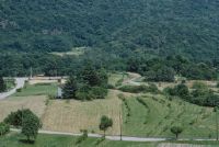
Title (German)
Sigirino TI, Ostansicht des Osthanges bei Dvan, im Vordergrund der Ortsteil Osignano
Caption
East view of the eastern slope near Dvan, in the foreground the hamlet of Osignano with cultural landscape, general view, counter-slope shot; coordinates (LV03) of the camera location: 714080/104223; keywords Documenta Natura: construction site, landscape change, material deposit
Caption (German)
Ostansicht des Osthanges bei Dvan, im Vordergrund der Ortsteil Osignano mit Kulturlandschaft, Gesamtansicht, Gegenhangaufnahme; Koordinaten (LV03) des Kamerastandorts: 714080/104223; Schlagworte Documenta Natura: Baustelle, Landschaftswandel, Materialablagerung
Record Name
Dia_303-39678

Title (German)
Sigirino TI, Ostansicht des Osthanges bei Dvan, im Vordergrund Ackerlandschaft
Caption
East view of the eastern slope near Dvan, arable field (corn), first photograph (1996), partial view; coordinates (LV03) of camera location: 715000/104255; keywords Documenta Natura: construction site, landscape change, material deposition.
Caption (German)
Ostansicht des Osthanges bei Dvan, Ackerfeld (Mais), Erstaufnahme (1996), Teilansicht; Koordinaten (LV03) des Kamerastandorts: 715000/104255; Schlagworte Documenta Natura: Baustelle, Landschaftswandel, Materialablagerung
Record Name
Dia_303-39686

Title (German)
Sigirino TI, Ostansicht des Osthanges bei Dvan, im Vordergrund Ackerlandschaft
Caption
East view of the eastern slope near Dvan, arable field (corn), first photograph (1996), partial view; coordinates (LV03) of camera location: 715000/104255; keywords Documenta Natura: construction site, landscape change, material deposition.
Caption (German)
Ostansicht des Osthanges bei Dvan, Ackerfeld (Mais), Erstaufnahme (1996), Teilansicht; Koordinaten (LV03) des Kamerastandorts: 715000/104255; Schlagworte Documenta Natura: Baustelle, Landschaftswandel, Materialablagerung
Record Name
Dia_303-39696

Title (German)
Sigirino TI, Ostansicht des Osthanges bei Dvan, im Vordergrund Ackerlandschaft
Caption
East view of the eastern slope near Dvan, 1st follow-up image after first phase of material deposition (2000), partial view; coordinates (LV03) of camera location: 715000/104255; keywords Documenta Natura: construction site, landscape change, material deposition.
Caption (German)
Ostansicht des Osthanges bei Dvan, 1. Folgeaufnahme nach erster Phase der Materialablagerung (2000), Teilansicht; Koordinaten (LV03) des Kamerastandorts: 715000/104255; Schlagworte Documenta Natura: Baustelle, Landschaftswandel, Materialablagerung
Record Name
Dia_303-39707

Title (German)
Sigirino TI, Ostansicht des Osthanges bei Dvan, im Vordergrund Ackerlandschaft
Caption
East view of the eastern slope near Dvan, 1st follow-up image after first phase of material deposition (2000), partial view; coordinates (LV03) of camera location: 715000/104255; keywords Documenta Natura: construction site, landscape change, material deposition.
Caption (German)
Ostansicht des Osthanges bei Dvan, 1. Folgeaufnahme nach erster Phase der Materialablagerung (2000), Teilansicht; Koordinaten (LV03) des Kamerastandorts: 715000/104255; Schlagworte Documenta Natura: Baustelle, Landschaftswandel, Materialablagerung
Record Name
Dia_303-39716

Title (German)
Sigirino TI, Beim Waldrand am Fuss des Osthanges nördlich von Dvan
Caption
Stepped forest edge with shrubs, first photograph (1996), general view; coordinates (LV03) of camera location: 714825/104625; keywords Documenta Natura: construction site, landscape change, material deposition.
Caption (German)
Stufiger Waldrand mit Sträucher, Erstaufnahme (1996), Gesamtansicht; Koordinaten (LV03) des Kamerastandorts: 714825/104625; Schlagworte Documenta Natura: Baustelle, Landschaftswandel, Materialablagerung
Record Name
Dia_303-39727

Title (German)
Sigirino TI, Beim Waldrand am Fuss des Osthanges nördlich von Dvan
Caption
First follow-up shot during the construction of the tunnel, with construction machinery, gravel pile in the foreground (2000), general view; coordinates (LV03) of the camera location: 714825/104625; keywords Documenta Natura: construction site, landscape change, material deposition.
Caption (German)
Erste Folgeaufnahme während dem Bau des Stollens, mit Baumaschinen, im Vordergrund Kieshaufen (2000), Gesamtansicht; Koordinaten (LV03) des Kamerastandorts: 714825/104625; Schlagworte Documenta Natura: Baustelle, Landschaftswandel, Materialablagerung
Record Name
Dia_303-39737

Title (German)
Silenen UR, Blick (Nordostansicht) auf den Talboden In den Gründen
Caption
View of the valley floor In den Gründen with fruit trees, construction site with railroad tracks, in the background the Grund neighborhood, first photo (1998), partial view; coordinates (LV03) of the camera location: 694150/181600; keywords Documenta Natura: construction site, landscape change, road construction
Caption (German)
Ansicht auf den Talboden In den Gründen mit Obstbäumen, Baustelle mit Gleisanlage, im Hintergrund das Quartier Grund, Erstaufnahme (1998), Teilansicht; Koordinaten (LV03) des Kamerastandorts: 694150/181600; Schlagworte Documenta Natura: Baustelle, Landschaftswandel, Strassenbau
Record Name
Dia_303-39748

Title (German)
Silenen UR, Blick (Nordostansicht) auf den Talboden In den Gründen
Caption
View of the valley floor In the grounds with fruit trees, construction site with railway track, commercial buildings, in the background the A2 freeway, first photograph (1998), partial view; coordinates (LV03) of the camera location: 694150/181600; keywords Documenta Natura: construction site, landscape change, road construction
Caption (German)
Ansicht auf den Talboden In den Gründen mit Obstbäumen, Baustelle mit Gleisanlage, Gewerbegebäuden, im Hintergrund die Autobahn A2, Erstaufnahme (1998), Teilansicht; Koordinaten (LV03) des Kamerastandorts: 694150/181600; Schlagworte Documenta Natura: Baustelle, Landschaftswandel, Strassenbau
Record Name
Dia_303-39758

Title (German)
Silenen UR, Blick (Nordostansicht) auf den Talboden In den Gründen
Caption
View of the valley floor In den Gründen, construction site with gravel and concrete plant, commercial buildings, 1st follow-up photo during operation of the outdoor facilities for the intermediate attack (2004), partial view; coordinates (LV03) of the camera location: 694150/181600; keywords Documenta Natura: construction site, landscape change, road construction
Caption (German)
Ansicht auf den Talboden In den Gründen, Baustelle mit Kies- und Betonwerk, Gewerbegebäuden, 1. Folgeaufnahme während dem Betrieb der Aussenanlagen für den Zwischenangriff (2004), Teilansicht; Koordinaten (LV03) des Kamerastandorts: 694150/181600; Schlagworte Documenta Natura: Baustelle, Landschaftswandel, Strassenbau
Record Name
Dia_303-39768

Title (German)
Silenen UR, Blick (Nordostansicht) auf den Talboden In den Gründen
Caption
View of the valley floor In den Gründen, construction site with gravel and concrete plant, commercial buildings, gravel pile, 1st follow-up photograph during operation of the outdoor facilities for the intermediate attack (2004), partial view; coordinates (LV03) of the camera location: 694150/181600; keywords Documenta Natura: construction site, landscape change, road construction
Caption (German)
Ansicht auf den Talboden In den Gründen, Baustelle mit Kies- und Betonwerk, Gewerbegebäuden, Kieshalde, 1. Folgeaufnahme während dem Betrieb der Aussenanlagen für den Zwischenangriff (2004), Teilansicht; Koordinaten (LV03) des Kamerastandorts: 694150/181600; Schlagworte Documenta Natura: Baustelle, Landschaftswandel, Strassenbau
Record Name
Dia_303-39778
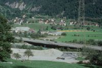
Title (German)
Silenen UR, Blick (Westansicht) auf den Talboden In den Gründen
Caption
View of the valley floor In den Gründen with construction site, A2 freeway, commercial buildings, in the background the village of Silenen with the SBB railroad line, first photograph (1998), partial view; coordinates (LV03) of the camera location: 693550/181453; keywords Documenta Natura: construction site, landscape change, road construction
Caption (German)
Blick auf den Talboden In den Gründen mit Baustelle, Autobahn A2, Gewerbegebäuden, im Hintergrund das Dorf Silenen mit der Bahnlinie SBB, Erstaufnahme (1998), Teilansicht; Koordinaten (LV03) des Kamerastandorts: 693550/181453; Schlagworte Documenta Natura: Baustelle, Landschaftswandel, Strassenbau
Record Name
Dia_303-39790

Title (German)
Silenen UR, Blick (Westansicht) auf den Talboden In den Gründen
Caption
View of the valley floor In den Gründen with construction site, A2 freeway, commercial buildings, in the background the village of Silenen with the SBB railroad line, first photograph (1998), partial view; coordinates (LV03) of the camera location: 693550/181453; keywords Documenta Natura: construction site, landscape change, road construction
Caption (German)
Blick auf den Talboden In den Gründen mit Baustelle, Autobahn A2, Gewerbegebäuden, im Hintergrund das Dorf Silenen mit der Bahnlinie SBB, Erstaufnahme (1998), Teilansicht; Koordinaten (LV03) des Kamerastandorts: 693550/181453; Schlagworte Documenta Natura: Baustelle, Landschaftswandel, Strassenbau
Record Name
Dia_303-39800

Title (German)
Silenen UR, Blick (Westansicht) auf den Talboden In den Gründen
Caption
View of the valley floor In den Gründen with construction site, A2 freeway, commercial buildings, in the background the village of Silenen with the SBB railroad line, 1st follow-up photograph during the operation of the outdoor facilities for the intermediate attack (2004), partial view; coordinates (LV03) of the camera location: 693550/181453; keywords Documenta Natura: construction site, landscape change, road construction
Caption (German)
Blick auf den Talboden In den Gründen mit Baustelle, Autobahn A2, Gewerbegebäuden, im Hintergrund das Dorf Silenen mit der Bahnlinie SBB, 1. Folgeaufnahme während dem Betrieb der Aussenanlagen für den Zwischenangriff (2004), Teilansicht; Koordinaten (LV03) des Kamerastandorts: 693550/181453; Schlagworte Documenta Natura: Baustelle, Landschaftswandel, Strassenbau
Record Name
Dia_303-39810

Title (German)
Silenen UR, Blick (Westansicht) auf den Talboden In den Gründen
Caption
View of the valley floor In den Gründen with construction site, A2 freeway, commercial buildings, in the background the village of Silenen with the SBB railroad line, 1st follow-up photograph during the operation of the outdoor facilities for the intermediate attack (2004), partial view; coordinates (LV03) of the camera location: 693550/181453; keywords Documenta Natura: construction site, landscape change, road construction
Caption (German)
Blick auf den Talboden In den Gründen mit Baustelle, Autobahn A2, Gewerbegebäuden, im Hintergrund das Dorf Silenen mit der Bahnlinie SBB, 1. Folgeaufnahme während dem Betrieb der Aussenanlagen für den Zwischenangriff (2004), Teilansicht; Koordinaten (LV03) des Kamerastandorts: 693550/181453; Schlagworte Documenta Natura: Baustelle, Landschaftswandel, Strassenbau
Record Name
Dia_303-39820

Title (German)
Silenen UR, Westansicht des Wohnhauses und Stall Teifenlachen auf dem Talboden in den Gründen
Caption
West view of the historic Uri house and stable Teifenlachen, in the foreground meadows with fruit trees, in the background the cantonal road 2, general view; coordinates (LV03) of the camera location: 694195/181408; keywords Documenta Natura: Old Uri house with stable before demolition and relocation of the road (AlpTransit Gotthard), 1998, Silenen
Caption (German)
Westansicht des historischen Urner Wohnhauses und Stalles Teifenlachen, im Vordergrund Wiesen mit Obstbäumen, im Hintergrund die Kantonsstrasse 2, Gesamtansicht; Koordinaten (LV03) des Kamerastandorts: 694195/181408; Schlagworte Documenta Natura: Altes Urner Haus mit Stall vor dem Abbruch und Verlegung der Strasse (AlpTransit Gotthard), 1998, Silenen
Record Name
Dia_303-39832

Title (German)
Silenen UR, Nordostansicht des Sustweges, der Kantonsstrasse bei Teifenlachen, Hintergrund der Talboden In den Gründen
Caption
Northeast view of the cantonal road 2 (Gotthardstrasse) near Teifenlachen with residential houses, in the foreground the Sustweg with private parking lot, in the background the valley floor In den Gründen with construction site (power plant construction) and the quarter Grund, first photo (1998), general view; coordinates (LV03) of the camera location: 694255/181458; keywords Documenta Natura: construction site, landscape change, road construction
Caption (German)
Nordostansicht der Kantonsstrasse 2 (Gotthardstrasse) bei Teifenlachen mit Wohnhäusern, im Vordergrund der Sustweg mit Privatparkplatz, im Hintergrund der Talboden In den Gründen mit Baustelle (Kraftwerkbau) und das Quartier Grund, Erstaufnahme (1998), Gesamtansicht; Koordinaten (LV03) des Kamerastandorts: 694255/181458; Schlagworte Documenta Natura: Baustelle, Landschaftswandel, Strassenbau
Record Name
Dia_303-39843

Title (German)
Silenen UR, Nordostansicht des Sustweges, der Kantonsstrasse bei Teifenlachen, Hintergrund der Talboden In den Gründen
Caption
Northeast view of the cantonal road 2 (Gotthardstrasse) near Teifenlachen, in the background the valley floor In den Gründen and the quarter Grund, 1st follow-up photograph after the relocation of the cantonal road, with new construction of a small workshop (2004), general view; coordinates (LV03) of the camera location: 694255/181458; keywords Documenta Natura: construction site, landscape change, road construction
Caption (German)
Nordostansicht der Kantonsstrasse 2 (Gotthardstrasse) bei Teifenlachen, im Hintergrund der Talboden In den Gründen und das Quartier Grund, 1. Folgeaufnahme nach der Verlegung der Kantonsstrasse, mit Neubau eines kleinen Werkhofes (2004), Gesamtansicht; Koordinaten (LV03) des Kamerastandorts: 694255/181458; Schlagworte Documenta Natura: Baustelle, Landschaftswandel, Strassenbau
Record Name
Dia_303-39853

Title (German)
Silenen UR, Südansicht des Ufers der Reuss bei der Autohalle Zeughaus
Caption
View along the bank of the river Reuss (south view downstream) with path along the bank, shrub forest, residential house with garden, existing road in the foreground, first photograph (1998), general view; coordinates (LV03) of the camera location: 693875/181040; keywords Documenta Natura: construction site, change of landscape, road construction
Caption (German)
Blick entlang des Ufers der Reuss (Südansicht flussabwärts) mit Uferweg, Gebüschwald, Wohnhaus mit Garten, im Vordergrund bestehende Strasse, Erstaufnahme (1998), Gesamtansicht; Koordinaten (LV03) des Kamerastandorts: 693875/181040; Schlagworte Documenta Natura: Baustelle, Landschaftswandel, Strassenbau
Record Name
Dia_303-39865

Title (German)
Silenen UR, Südansicht des Ufers der Reuss bei der Autohalle Zeughaus
Caption
South view downstream along the bank of the Reuss river with riverside path, residential house with garden, existing road in the foreground, 1st follow-up photograph after the construction of the access road for construction site Zwischenangriff (2004), general view; coordinates (LV03) of the camera location: 693875/181040; keywords Documenta Natura: construction site, landscape change, road construction
Caption (German)
Südansicht flussabwärts entlang des Ufers der Reuss mit Uferweg, Wohnhaus mit Garten, im Vordergrund bestehende Strasse, 1. Folgeaufnahme nach dem Bau der Erschliessungsstrasse für Baustelle Zwischenangriff (2004), Gesamtansicht; Koordinaten (LV03) des Kamerastandorts: 693875/181040; Schlagworte Documenta Natura: Baustelle, Landschaftswandel, Strassenbau
Record Name
Dia_303-39870

Title (German)
Silenen UR, Blick (Nordostansicht) auf den Talboden In den Gründen
Caption
Northeast view of the valley floor In den Gründen with existing landfill and railroad tracks, commercial buildings, in the background the Grund neighborhood and the A2 highway, first photo (1998), general view; coordinates (LV03) of the camera location: 694055/181913; keywords Documenta Natura: construction site, landscape change, road construction
Caption (German)
Nordostansicht auf den Talboden In den Gründen mit bestehender Deponie und Gleisanlage, Gewerbegebäuden, im Hintergrund das Quartier Grund und die Autobahn A2, Erstaufnahme (1998), Gesamtansicht; Koordinaten (LV03) des Kamerastandorts: 694055/181913; Schlagworte Documenta Natura: Baustelle, Landschaftswandel, Strassenbau
Record Name
Dia_303-39880

Title (German)
Silenen UR, Blick (Nordostansicht) auf den Talboden In den Gründen
Caption
Northeast view of the valley floor In den Gründen with gravel plant and railroad tracks, commercial buildings, in the background the Grund neighborhood and the A2 highway, 1st follow-up photograph during operation of the outdoor facilities of the construction site Zwischenangriff (2004), general view; coordinates (LV03) of the camera location: 694055/181913; keywords Documenta Natura: construction site, landscape change, road construction
Caption (German)
Nordostansicht auf den Talboden In den Gründen mit Kieswerk und Gleisanlage, Gewerbegebäuden, im Hintergrund das Quartier Grund und die Autobahn A2, 1. Folgeaufnahme während dem Betrieb der Aussenanlagen der Baustelle Zwischenangriff (2004), Gesamtansicht; Koordinaten (LV03) des Kamerastandorts: 694055/181913; Schlagworte Documenta Natura: Baustelle, Landschaftswandel, Strassenbau
Record Name
Dia_303-39890

Title (German)
Osco TI, Nordostansicht der alten Kantonsstrasse in der Piottino
Caption
Northeast view along the old cantonal road with young larch stand, first photograph (1999), partial view; coordinates (LV03) of camera location: 701305/149720; keywords Documenta Natura: construction site, landscape change, material deposition.
Caption (German)
Nordostansicht entlang der alten Kantonsstrasse mit jungem Lärchenbestand, Erstaufnahme (1999), Teilansicht; Koordinaten (LV03) des Kamerastandorts: 701305/149720; Schlagworte Documenta Natura: Baustelle, Landschaftswandel, Materialablagerung
Record Name
Dia_303-39901

Title (German)
Osco TI, Nordostansicht der alten Kantonsstrasse in der Piottino
Caption
Northeast view, 1st follow-up shot during material deposition (2002), partial view; coordinates (LV03) of camera location: 701305/149720; keywords Documenta Natura: construction site, landscape change, material deposition.
Caption (German)
Nordostansicht, 1. Folgeaufnahme während der Materialablagerung (2002), Teilansicht; Koordinaten (LV03) des Kamerastandorts: 701305/149720; Schlagworte Documenta Natura: Baustelle, Landschaftswandel, Materialablagerung
Record Name
Dia_303-39911

Title (German)
Osco TI, Nordwestansicht des Deponieplatzes im Nordhang der unteren Piottino
Caption
Northwest view of the landfill site on the north slope with the Ticino River and the new cantonal road, in the background the SBB railroad line and the A2 freeway bridge, first photograph (1999), general view; coordinates (LV03) of the camera location: 701375/149608; keywords Documenta Natura: construction site, landscape change, material deposit
Caption (German)
Nordwestansicht des Deponieplatzes im Nordhang mit dem Fluss Ticino und der neuen Kantonsstrasse, im Hintergrund die Bahnlinie der SBB und die Autobahnbrücke der A2, Erstaufnahme (1999), Gesamtansicht; Koordinaten (LV03) des Kamerastandorts: 701375/149608; Schlagworte Documenta Natura: Baustelle, Landschaftswandel, Materialablagerung
Record Name
Dia_303-39923

Title (German)
Osco TI, Nordwestansicht des Deponieplatzes im Nordhang der unteren Piottino
Caption
Northwest view of the dump site on the north slope with the Ticino river and the cantonal road, in the background the SBB railroad line and the A2 freeway bridge, 1st follow-up photograph during material deposition (2002), general view; coordinates (LV03) of the camera location: 701375/149608; keywords Documenta Natura: construction site, landscape change, material deposition
Caption (German)
Nordwestansicht des Deponieplatzes im Nordhang mit dem Fluss Ticino und der Kantonsstrasse, im Hintergrund die Bahnlinie der SBB und die Autobahnbrücke A2, 1. Folgeaufnahme während der Materialablagerung (2002), Gesamtansicht; Koordinaten (LV03) des Kamerastandorts: 701375/149608; Schlagworte Documenta Natura: Baustelle, Landschaftswandel, Materialablagerung
Record Name
Dia_303-39933

Title (German)
Osco TI, Holzumschlagplatz in der unteren Piottino
Caption
Northeast view of the timber transfer site with heap pile, cantonal road 2 (Gotthardstrasse), in the background the SBB railroad line and the A2 freeway bridge, first photograph (1999), partial view; coordinates (LV03) of the camera location: 701330/149715; keywords Documenta Natura: construction site, landscape change, material deposit
Caption (German)
Nordostansicht des Holzumschlagplatzes mit Haufenpolter, Kantonsstrasse 2 (Gotthardstrasse), im Hintergrund die Bahnlinie der SBB und die Autobahnbrücke der A2, Erstaufnahme (1999), Teilansicht; Koordinaten (LV03) des Kamerastandorts: 701330/149715; Schlagworte Documenta Natura: Baustelle, Landschaftswandel, Materialablagerung
Record Name
Dia_303-39944

Title (German)
Osco TI, Holzumschlagplatz in der unteren Piottino
Caption
Southwest view of the timber transfer site with heap pile, former cantonal road with adjacent young forest (larches), photo taken in 1999, partial view; coordinates (LV03) of the camera location: 701273/149620; keywords Documenta Natura: construction site, landscape change, material deposit
Caption (German)
Südwestansicht des Holzumschlagplatzes mit Haufenpolter, ehemalige Kantonsstrasse mit angrenzemdem Jungwald (Lärchen), Aufnahme 1999, Teilansicht; Koordinaten (LV03) des Kamerastandorts: 701273/149620; Schlagworte Documenta Natura: Baustelle, Landschaftswandel, Materialablagerung
Record Name
Dia_303-39954

Title (German)
Osco TI, Holzumschlagplatz in der unteren Piottino
Caption
Northeast view of the excavated material dump site, cantonal road 2 (Gotthardstrasse), in the background the SBB railroad line and the A2 freeway bridge, 1st follow-up photograph during material deposition (2002), partial view; coordinates (LV03) of the camera location: 701330/149715; keywords Documenta Natura: construction site, landscape change, material deposition
Caption (German)
Nordostansicht des Aushubdeponieplatzes, Kantonsstrasse 2 (Gotthardstrasse), im Hintergrund die Bahnlinie der SBB und die Autobahnbrücke der A2, 1. Folgeaufnahme während der Materialablagerung (2002), Teilansicht; Koordinaten (LV03) des Kamerastandorts: 701330/149715; Schlagworte Documenta Natura: Baustelle, Landschaftswandel, Materialablagerung
Record Name
Dia_303-39964

Title (German)
Faido, Mairengo TI, Blick (Südwestansicht) auf den Talboden Polmengo
Caption
Southwest view of the valley floor with the hamlet of Polmengo, the existing transfer station (former landfill) and the Ticino River, in the background the SBB railroad line and the village of Faido, first photograph (1999), general view; coordinates (LV03) of the camera location: 702883/148983; keywords Documenta Natura: construction site, landscape change.
Caption (German)
Südwestansicht auf den Talboden mit dem Weiler Polmengo, dem bestehenden Umschlagplatz (ehemalige Deponie) und dem Fluss Ticino, im Hintergrund die Bahnlinie der SBB und das Dorf Faido, Erstaufnahme (1999), Gesamtansicht; Koordinaten (LV03) des Kamerastandorts: 702883/148983; Schlagworte Documenta Natura: Baustelle, Landschaftswandel
Record Name
Dia_303-39976
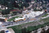
Title (German)
Faido, Mairengo TI, Blick (Südwestansicht) auf den Talboden Polmengo
Caption
Southwest view of the valley floor with the hamlet of Polmengo and the Ticino River, in the background the SBB railroad line and the village of Faido, 1st follow-up shot during the operation of the installation site (intermediate attack) with accommodations (2002), general view; coordinates (LV03) of the camera location: 702883/148983; keywords Documenta Natura: construction site, landscape change
Caption (German)
Südwestansicht auf den Talboden mit dem Weiler Polmengo und dem Fluss Ticino, im Hintergrund die Bahnlinie der SBB und das Dorf Faido, 1. Folgeaufnahme während dem Betrieb des Installationsplatzes (Zwischenangriff) mit Unterkünften (2002), Gesamtansicht; Koordinaten (LV03) des Kamerastandorts: 702883/148983; Schlagworte Documenta Natura: Baustelle, Landschaftswandel
Record Name
Dia_303-39986

Title (German)
Mairengo TI, Blick (Südwestansicht) auf den Talboden bei Polmengo
Caption
Southwest view of the valley floor with the Ticino River, the existing installation site, the new cantonal road, the SBB railroad line, first photograph (1999), partial view; coordinates (LV03) of the camera location: 762780/149225; keywords Documenta Natura: construction site, landscape change.
Caption (German)
Südwestansicht auf den Talboden mit dem Fluss Ticino, dem bestehenden Installationsplatz, der neuen Kantonsstrasse, der Bahnlinie der SBB, Erstaufnahme (1999), Teilansicht; Koordinaten (LV03) des Kamerastandorts: 762780/149225; Schlagworte Documenta Natura: Baustelle, Landschaftswandel
Record Name
Dia_303-39997

Title (German)
Mairengo TI, Blick (Südwestansicht) auf den Talboden bei Polmengo
Caption
West view of the valley floor with the Ticino River, the existing installation site, the new cantonal road, the SBB railroad line, the hamlet of Polmengo/ Faido, first photograph (1999), partial view; coordinates (LV03) of the camera location: 762780/149225; keywords Documenta Natura: construction site, landscape change
Caption (German)
Westansicht auf den Talboden mit dem Fluss Ticino, dem bestehenden Installationsplatz, der neuen Kantonsstrasse, der Bahnlinie der SBB, dem Weiler Polmengo/ Faido, Erstaufnahme (1999), Teilansicht; Koordinaten (LV03) des Kamerastandorts: 762780/149225; Schlagworte Documenta Natura: Baustelle, Landschaftswandel
Record Name
Dia_303-40007

Title (German)
Mairengo TI, Blick (Südwestansicht) auf den Talboden bei Polmengo
Caption
Southwest view of the valley floor with the river Ticino, the cantonal road 2, the railroad line of the SBB, 1st follow-up photograph 2002 during the operation of the installation site (intermediate attack Faido), partial view; coordinates (LV03) of the camera location: 762780/149225; keywords Documenta Natura: construction site, landscape change
Caption (German)
Südwestansicht auf den Talboden mit dem Fluss Ticino, der Kantonsstrasse 2, der Bahnlinie der SBB, 1. Folgeaufnahme 2002 während dem Betrieb des Installationsplatzes (Zwischenangriff Faido), Teilansicht; Koordinaten (LV03) des Kamerastandorts: 762780/149225; Schlagworte Documenta Natura: Baustelle, Landschaftswandel
Record Name
Dia_303-40017

Title (German)
Mairengo TI, Blick (Südwestansicht) auf den Talboden bei Polmengo
Caption
West view on the valley floor with the river Ticino, the cantonal road 2, the railroad line of the SBB, the hamlet Polmengo/ Faido, 1st follow-up photograph 2002 during the operation of the installation site (intermediate attack Faido), partial view; coordinates (LV03) of the camera location: 762780/149225; keywords Documenta Natura: construction site, landscape change
Caption (German)
Westansicht auf den Talboden mit dem Fluss Ticino, der Kantonsstrasse 2, der Bahnlinie der SBB, dem Weiler Polmengo/ Faido, 1. Folgeaufnahme 2002 während dem Betrieb des Installationsplatzes (Zwischenangriff Faido), Teilansicht; Koordinaten (LV03) des Kamerastandorts: 762780/149225; Schlagworte Documenta Natura: Baustelle, Landschaftswandel
Record Name
Dia_303-40027

Title (German)
Mairengo TI, Nordansicht des Talbodens bei Mondella
Caption
North view of the Mondella valley floor with the hamlet of Polmengo, meadowland, cantonal road 2 (Gotthard road), in the background the A2 freeway bridge, first photograph (1999), partial view; coordinates (LV03) of the camera location: 703070/149240; keywords Documenta Natura: construction site, landscape change
Caption (German)
Nordansicht des Talbodens Mondella mit dem Weiler Polmengo, Wiesland, Kantonsstrasse 2 (Gotthardstrasse), im Hintergrund die Autobahnbrücke der A2, Erstaufnahme (1999), Teilansicht; Koordinaten (LV03) des Kamerastandorts: 703070/149240; Schlagworte Documenta Natura: Baustelle, Landschaftswandel
Record Name
Dia_303-40038

Title (German)
Mairengo TI, Nordansicht des Talbodens bei Mondella
Caption
North view of the Mondella valley floor near the hamlet of Polmengo, cantonal road 2 (Gotthard road), in the background the A2 freeway bridge, 1st follow-up photograph during operation of the installation site, intermediate attack Faido (2002), partial view; coordinates (LV03) of the camera location: 703070/149240; keywords Documenta Natura: construction site, landscape change
Caption (German)
Nordansicht des Talbodens Mondella beim Weiler Polmengo, Kantonsstrasse 2 (Gotthardstrasse), im Hintergrund die Autobahnbrücke der A2, 1. Folgeaufnahme während dem Betrieb des Installationsplatzes, Zwischenangriff Faido (2002), Teilansicht; Koordinaten (LV03) des Kamerastandorts: 703070/149240; Schlagworte Documenta Natura: Baustelle, Landschaftswandel
Record Name
Dia_303-40048

Title (German)
Pollegio TI, Strassenkreuzung Kantonsstrasse/Gemeindestrassen nordwestlich des Dorfes Pollegio
Caption
Road junction cantonal road 2/municipal roads northwest of the village of Pollegio/ near Biasca, meadowland with copses and the SBB railroad line, first photograph (1999), general view; coordinates (LV03) of the camera location: 715550/136060; keywords Documenta Natura: construction site, landscape change
Caption (German)
Strassenkreuzung Kantonsstrasse 2/Gemeindestrassen nordwestlich des Dorfes Pollegio/ bei Biasca, Wiesland mit Gehölz und die Bahnlinie der SBB, Erstaufnahme (1999), Gesamtansicht; Koordinaten (LV03) des Kamerastandorts: 715550/136060; Schlagworte Documenta Natura: Baustelle, Landschaftswandel
Record Name
Dia_303-40059

Title (German)
Pollegio TI, Strassenkreuzung Kantonsstrasse/Gemeindestrassen nordwestlich des Dorfes Pollegio
Caption
Road junction cantonal road 2/municipal roads northwest of the village of Pollegio/ near Biasca, 1st follow-up photograph after the construction of a traffic traffic circle, construction site feeder south portal Bodio (2002), general view; coordinates (LV03) of the camera location: 715550/136060; keywords Documenta Natura: construction site, landscape change
Caption (German)
Strassenkreuzung Kantonsstrasse 2/Gemeindestrassen nordwestlich des Dorfes Pollegio/ bei Biasca, 1. Folgeaufnahme nach dem Bau eines Verkehrskreisels, Baustellenzubringer Südportal Bodio (2002), Gesamtansicht; Koordinaten (LV03) des Kamerastandorts: 715550/136060; Schlagworte Documenta Natura: Baustelle, Landschaftswandel
Record Name
Dia_303-40069

Title (German)
Bodio, Pollegio TI, Blick (Südwestansicht) auf Wiesland zwischen dem Fluss Ticino und der Autobahn A2 nordwestlich des Dorfes Pollegio
Caption
Southwest view on meadowland between the river Ticino and the highway A2 with copses and roadway along the Ticino, first photo (1999), general view; coordinates (LV03) of camera location: 714750/136315; keywords Documenta Natura: construction site, landscape change
Caption (German)
Südwestansicht auf Wiesland zwischen dem Fluss Ticino und der Autobahn A2 mit Gehölz und Fahrweg entlang des Ticino, Erstaufnahme (1999), Gesamtansicht; Koordinaten (LV03) des Kamerastandorts: 714750/136315; Schlagworte Documenta Natura: Baustelle, Landschaftswandel
Record Name
Dia_303-40081
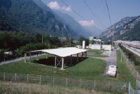
Title (German)
Bodio, Pollegio TI, Blick (Südwestansicht) auf Wiesland zwischen dem Fluss Ticino und der Autobahn A2 nordwestlich des Dorfes Pollegio
Caption
Southwest view between the Ticino river and the A2 freeway with copses and roadway along the Ticino river, 1st follow-up photograph during the operation of the covered sedimentation basin (2002), general view; coordinates (LV03) of the camera location: 714750/136315; keywords Documenta Natura: construction site, landscape change.
Caption (German)
Südwestansicht zwischen dem Fluss Ticino und der Autobahn A2 mit Gehölz und Fahrweg entlang des Ticino, 1. Folgeaufnahme während dem Betrieb des gedeckten Absetzbecken (2002), Gesamtansicht; Koordinaten (LV03) des Kamerastandorts: 714750/136315; Schlagworte Documenta Natura: Baustelle, Landschaftswandel
Record Name
Dia_303-40091

Title (German)
Bodio, Personico, Pollegio TI, Blick (Südansicht) vom Nordhang oberhalb des Dorfes Personico auf den Talboden zwischen den Dörfer Personico und Bodio
Caption
South view of the valley floor between the villages of Personico and Bodio with cultivated land, the Ticino river, the A2 freeway, the SBB railroad line and the cantonal road 2, first photograph (1999), reverse slope photograph, partial view; coordinates (LV03) of the camera location: 714145/136030; keywords Documenta Natura: construction site, landscape change
Caption (German)
Südansicht auf den Talboden zwischen den Dörfern Personico und Bodio mit Kulturland, Fluss Ticino, Autobahn A2, Bahnlinie der SBB und die Kantonsstrasse 2, Erstaufnahme (1999), Gegenhangaufnahme, Teilansicht; Koordinaten (LV03) des Kamerastandorts: 714145/136030; Schlagworte Documenta Natura: Baustelle, Landschaftswandel
Record Name
Dia_303-40102

Title (German)
Bodio, Personico, Pollegio TI, Blick (Südansicht) vom Nordhang oberhalb des Dorfes Personico auf den Talboden zwischen den Dörfer Personico und Bodio
Caption
South view of the valley floor between the villages of Personico and Bodio with cultivated land, the Ticino river, the A2 freeway, the SBB railroad line and the cantonal road 2, 1st follow-up photograph during the construction of the south portal (2002), reverse slope photograph, partial view; coordinates (LV03) of the camera location: 714145/136030; keywords Documenta Natura: construction site, landscape change
Caption (German)
Südansicht auf den Talboden zwischen den Dörfern Personico und Bodio mit Kulturland, Fluss Ticino, Autobahn A2, Bahnlinie der SBB und die Kantonsstrasse 2, 1. Folgeaufnahme während dem Bau des Südportals (2002), Gegenhangaufnahme, Teilansicht; Koordinaten (LV03) des Kamerastandorts: 714145/136030; Schlagworte Documenta Natura: Baustelle, Landschaftswandel
Record Name
Dia_303-40112

Title (German)
Bodio, Personico, Pollegio TI, Blick (Südansicht) vom Nordhang oberhalb des Dorfes Personico auf den Talboden zwischen den Dörfer Personico und Bodio
Caption
South view of the valley floor between the villages of Personico and Bodio with cultivated land, the Ticino River, the A2 freeway, the SBB railroad line and the cantonal road 2, 2nd follow-up photograph during the construction of the south portal, partial conversion to other uses (2004), reverse slope photograph, partial view; coordinates (LV03) of the camera location: 714145/136030; keywords Documenta Natura: construction site, landscape change
Caption (German)
Südansicht auf den Talboden zwischen den Dörfern Personico und Bodio mit Kulturland, Fluss Ticino, Autobahn A2, Bahnlinie der SBB und die Kantonsstrasse 2, 2. Folgeaufnahme während dem Bau des Südportals, teilweise Umnutzung (2004), Gegenhangaufnahme, Teilansicht; Koordinaten (LV03) des Kamerastandorts: 714145/136030; Schlagworte Documenta Natura: Baustelle, Landschaftswandel
Record Name
Dia_303-40123

Title (German)
Pollegio TI, Nordostansicht des Wieslandes Monda del Caplètt mit Gehölz, nordwestlich des Dorfes Pollegio
Caption
East view of the meadow Monda del Caplètt with tree hedges, in the background the cantonal road 2 and the railroad line of the SBB, first photograph (1999), partial view; coordinates (LV03) of the camera location: 715150/136375; keywords Documenta Natura: construction site, landscape change.
Caption (German)
Ostansicht des Wieslandes Monda del Caplètt mit Baumhecken, im Hintergrund die Kantonsstrasse 2 und die Bahnlinie der SBB, Erstaufnahme (1999), Teilansicht; Koordinaten (LV03) des Kamerastandorts: 715150/136375; Schlagworte Documenta Natura: Baustelle, Landschaftswandel
Record Name
Dia_303-40133

Title (German)
Pollegio TI, Nordostansicht des Wieslandes Monda del Caplètt mit Gehölz, nordwestlich des Dorfes Pollegio
Caption
Northeast view of the meadow Monda del Caplètt with tree hedges, in the background the cantonal road 2 and the railroad line of the SBB, first photo (1999), partial view; coordinates (LV03) of the camera location: 715150/136375; keywords Documenta Natura: construction site, landscape change
Caption (German)
Nordostansicht des Wieslandes Monda del Caplètt mit Baumhecken, im Hintergrund die Kantonsstrasse 2 und die Bahnlinie der SBB, Erstaufnahme (1999), Teilansicht; Koordinaten (LV03) des Kamerastandorts: 715150/136375; Schlagworte Documenta Natura: Baustelle, Landschaftswandel
Record Name
Dia_303-40144

Title (German)
Pollegio TI, Nordostansicht des Wieslandes Monda del Caplètt mit Gehölz, nordwestlich des Dorfes Pollegio
Caption
East view of the former meadowland Monda del Caplètt, 1st follow-up image during the operation of the accommodation for the construction site south portal Bodio, container construction, in the foreground vegetated earth wall and fence (2004), partial view; coordinates (LV03) of the camera location: 715150/136375; keywords Documenta Natura: construction site, landscape change.
Caption (German)
Ostansicht des ehemaligen Wieslandes Monda del Caplètt, 1. Folgeaufnahme während dem Betrieb der Unterkünfte für die Baustelle Südportal Bodio, Containerkonstruktion, im Vordergrund begrünter Erdwall und Zaun (2004), Teilansicht; Koordinaten (LV03) des Kamerastandorts: 715150/136375; Schlagworte Documenta Natura: Baustelle, Landschaftswandel
Record Name
Dia_303-40154

Title (German)
Pollegio TI, Nordostansicht des Wieslandes Monda del Caplètt mit Gehölz, nordwestlich des Dorfes Pollegio
Caption
Northeast view of the former meadow Monda del Caplètt, 1st follow-up image during the operation of the accommodation for the construction site south portal Bodio, container construction, in the foreground vegetated earth wall and fence (2004), partial view; coordinates (LV03) of the camera location: 715150/136375; keywords Documenta Natura: construction site, landscape change.
Caption (German)
Nordostansicht des ehemaligen Wieslandes Monda del Caplètt, 1. Folgeaufnahme während dem Betrieb der Unterkünfte für die Baustelle Südportal Bodio, Containerkonstruktion, im Vordergrund begrünter Erdwall und Zaun (2004), Teilansicht; Koordinaten (LV03) des Kamerastandorts: 715150/136375; Schlagworte Documenta Natura: Baustelle, Landschaftswandel
Record Name
Dia_303-40163

Pollegio TI, south view, west view of the meadow Monda del Caplètt northwest of the village Pollegio
Title (German)
Pollegio TI, Südansicht, Westansicht des Wieslandes Monda del Caplètt nordwestlich des Dorfes Pollegio
Caption
West view of the meadow Monda del Caplètt with the railroad line of the SBB, the cantonal road 2, with forest edge on the steep, rocky slope, first photo (1999), partial view; coordinates (LV03) of the camera location: 714830/136425; keywords Documenta Natura: construction site, landscape change
Caption (German)
Westansicht des Wieslandes Monda del Caplètt mit der Bahnlinie der SBB, die Kantonsstrasse 2, mit Waldrand am steilen, felsigen Hang, Erstaufnahme (1999), Teilansicht; Koordinaten (LV03) des Kamerastandorts: 714830/136425; Schlagworte Documenta Natura: Baustelle, Landschaftswandel
Record Name
Dia_303-40174

Pollegio TI, south view, west view of the meadow Monda del Caplètt northwest of the village Pollegio
Title (German)
Pollegio TI, Südansicht, Westansicht des Wieslandes Monda del Caplètt nordwestlich des Dorfes Pollegio
Caption
South view of the meadow Monda del Caplètt with the railroad line of the SBB, the cantonal road 2, single stables made of stone, with forest edge on the steep, rocky southwest slope, first photo (1999), partial view; coordinates (LV03) of the camera location: 714830/136425; keywords Documenta Natura: construction site, landscape change
Caption (German)
Südansicht des Wieslandes Monda del Caplètt mit der Bahnlinie der SBB, die Kantonsstrasse 2, einzelnen Ställen aus Stein, mit Waldrand am steilen, felsigen Südwesthang, Erstaufnahme (1999), Teilansicht; Koordinaten (LV03) des Kamerastandorts: 714830/136425; Schlagworte Documenta Natura: Baustelle, Landschaftswandel
Record Name
Dia_303-40184

Pollegio TI, south view, west view of the meadow Monda del Caplètt northwest of the village Pollegio
Title (German)
Pollegio TI, Südansicht, Westansicht des Wieslandes Monda del Caplètt nordwestlich des Dorfes Pollegio
Caption
West view of the former meadow Monda del Caplètt with the railroad line of the SBB, the cantonal road 2, 1st follow-up shot during the operation of the installation site south portal Bodio (2002), partial view; coordinates (LV03) of the camera location: 714830/136425; keywords Documenta Natura: construction site, landscape change
Caption (German)
Westansicht des ehemaligen Wieslandes Monda del Caplètt mit der Bahnlinie der SBB, die Kantonsstrasse 2, 1. Folgeaufnahme während dem Betrieb des Installationsplatz Südportal Bodio (2002), Teilansicht; Koordinaten (LV03) des Kamerastandorts: 714830/136425; Schlagworte Documenta Natura: Baustelle, Landschaftswandel
Record Name
Dia_303-40194
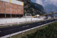
Pollegio TI, south view, west view of the meadow Monda del Caplètt northwest of the village Pollegio
Title (German)
Pollegio TI, Südansicht, Westansicht des Wieslandes Monda del Caplètt nordwestlich des Dorfes Pollegio
Caption
South view of the former meadow Monda del Caplètt with the railroad line of the SBB, the cantonal road 2, 1st follow-up photo during the operation of the installation site south portal Bodio (2002), partial view; coordinates (LV03) of the camera location: 714830/136425; keywords Documenta Natura: construction site, landscape change
Caption (German)
Südansicht des ehemaligen Wieslandes Monda del Caplètt mit der Bahnlinie der SBB, die Kantonsstrasse 2, 1. Folgeaufnahme während dem Betrieb des Installationsplatz Südportal Bodio (2002), Teilansicht; Koordinaten (LV03) des Kamerastandorts: 714830/136425; Schlagworte Documenta Natura: Baustelle, Landschaftswandel
Record Name
Dia_303-40204

Title (German)
Bodio TI, Südostansicht des Talbodens bei Pozzo Negro südöstlich des Dorfes Bodio
Caption
Southeast view of the valley floor near Pozzo Negro/ Bodio with the SBB railroad line, cantonal road 2, meadowland and forest edge on the steep, rocky southwest slope, first photograph (1999), partial view; coordinates (LV03) of the camera location: 714455/136740; keywords Documenta Natura: construction site, landscape change
Caption (German)
Südostansicht des Talbodens bei Pozzo Negro/ Bodio mit der Bahnlinie der SBB, Kantonsstrasse 2, Wiesland und Waldrand am steilen, felsigen Südwesthang, Erstaufnahme (1999), Teilansicht; Koordinaten (LV03) des Kamerastandorts: 714455/136740; Schlagworte Documenta Natura: Baustelle, Landschaftswandel
Record Name
Dia_303-40215

Title (German)
Bodio TI, Südostansicht des Talbodens bei Pozzo Negro südöstlich des Dorfes Bodio
Caption
Southeast view of the valley floor near Pozzo Negro/ Bodio with the railroad line of the SBB, 1st follow-up photograph during the construction of the south portal (2002), partial view; coordinates (LV03) of the camera location: 714455/136740; keywords Documenta Natura: construction site, landscape change
Caption (German)
Südostansicht des Talbodens bei Pozzo Negro/ Bodio mit der Bahnlinie der SBB, 1. Folgeaufnahme während dem Bau des Südportals (2002), Teilansicht; Koordinaten (LV03) des Kamerastandorts: 714455/136740; Schlagworte Documenta Natura: Baustelle, Landschaftswandel
Record Name
Dia_303-40225

Title (German)
Bodio TI, Talboden bei Pozzo Negro südöstlich des Dorfes Bodio
Caption
Boulder/ boulder (granite) with chiseled boundary marker (cross, hand with index finger), on the valley floor near Pozzo Negro, general view; keywords Documenta Natura: construction site, landscape change.
Caption (German)
Felsblock/ Findling (Granit) mit gemeisselter Grenzmarkierung (Kreuz, Hand mit Zeigefinger), auf dem Talboden bei Pozzo Negro, Gesamtansicht; Schlagworte Documenta Natura: Baustelle, Landschaftswandel
Record Name
Dia_303-40236

Title (German)
Bodio TI, Talboden bei Pozzo Negro südöstlich des Dorfes Bodio
Caption
Rock/ boulder (granite) with chiseled boundary marker (cross, hand with index finger), on the valley floor near Pozzo Negro, detail; keywords Documenta Natura: construction site, landscape change
Caption (German)
Felsblock/ Findling (Granit) mit gemeisselter Grenzmarkierung (Kreuz, Hand mit Zeigefinger), auf dem Talboden bei Pozzo Negro, Detailansicht; Schlagworte Documenta Natura: Baustelle, Landschaftswandel
Record Name
Dia_303-40243

Title (German)
Bodio TI, Talboden bei Pozzo Negro südöstlich des Dorfes Bodio
Caption
Rock/ boulder (granite) with chiseled boundary marker (cross, hand with index finger), on the valley floor near Pozzo Negro, detail; keywords Documenta Natura: construction site, landscape change
Caption (German)
Felsblock/ Findling (Granit) mit gemeisselter Grenzmarkierung (Kreuz, Hand mit Zeigefinger), auf dem Talboden bei Pozzo Negro, Detailansicht; Schlagworte Documenta Natura: Baustelle, Landschaftswandel
Record Name
Dia_303-40246

Title (German)
Bodio TI, Steinhaus bei Pozzo Negro südöstlich des Dorfes Bodio
Caption
South view of the old, crumbling stone house/ ruined house on the valley floor near Pozzo Negro, general view; keywords Documenta Natura: construction site, landscape change.
Caption (German)
Südansicht des alten, zerfallenen Steinhauses/ Hausruine auf dem Talboden bei Pozzo Negro, Gesamtansicht; Schlagworte Documenta Natura: Baustelle, Landschaftswandel
Record Name
Dia_303-40251
Title (German)
Bodio TI, Steinhaus bei Pozzo Negro südöstlich des Dorfes Bodio
Caption
South view of the old, crumbling stone house/ruin of a house on the valley floor near Pozzo Negro, general view; keywords Documenta Natura: construction site, landscape change.
Caption (German)
Südansicht des alten, zerfallenen Steinhauses/ Hausruine auf dem Talboden bei Pozzo Negro, Gesamtansicht; Schlagworte Documenta Natura: Baustelle, Landschaftswandel
Record Name
Dia_303-40256

Title (German)
Biasca TI, Talboden südlich von Loderio
Caption
North view over the valley floor near Loderio, in the foreground roadway, meadowland with bushes and utility pole (double pole), in the background the Büza di Biasca, first photo (2000), partial view; coordinates (LV03) of camera location: 717902/137683; keywords Documenta Natura: construction site, landscape change, material deposition.
Caption (German)
Nordansicht über den Talboden bei Loderio, im Vordergrund Fahrweg, Wiesland mit Gebüschen und Leitungsmast (Doppelmast), im Hintergrund die Büza di Biasca, Erstaufnahme (2000), Teilansicht; Koordinaten (LV03) des Kamerastandorts: 717902/137683; Schlagworte Documenta Natura: Baustelle, Landschaftswandel, Materialablagerung
Record Name
Dia_303-40261

Title (German)
Biasca TI, Talboden südlich von Loderio
Caption
East view over the valley floor near Loderio, meadowland with bushes and transmission line pole (double pole), in the background the Büza di Biasca, first photo (2000), partial view; coordinates (LV03) of the camera location: 717902/137683; keywords Documenta Natura: construction site, landscape change, material deposition.
Caption (German)
Ostansicht über den Talboden bei Loderio, Wiesland mit Gebüschen und Leitungsmast (Doppelmast), im Hintergrund die Büza di Biasca, Erstaufnahme (2000), Teilansicht; Koordinaten (LV03) des Kamerastandorts: 717902/137683; Schlagworte Documenta Natura: Baustelle, Landschaftswandel, Materialablagerung
Record Name
Dia_303-40271

Title (German)
Biasca TI, Talboden südlich von Loderio
Caption
North view over the valley floor near Loderio, in the foreground roadway, meadowland with bushes and utility pole, 1st follow-up photograph during operation of the conveyor system (2004), partial view; coordinates (LV03) of camera location: 717902/137683; keywords Documenta Natura: construction site, landscape change, material deposition.
Caption (German)
Nordansicht über den Talboden bei Loderio, im Vordergrund Fahrweg, Wiesland mit Gebüschen und Leitungsmast, 1. Folgeaufnahme während dem Betrieb der Förderanlage (2004), Teilansicht; Koordinaten (LV03) des Kamerastandorts: 717902/137683; Schlagworte Documenta Natura: Baustelle, Landschaftswandel, Materialablagerung
Record Name
Dia_303-40281

Title (German)
Biasca TI, Talboden südlich von Loderio
Caption
East view over the valley floor near Loderio, meadowland with bushes and pipeline mast, 1st follow-up photograph during operation of the conveyor system (2004), partial view; coordinates (LV03) of camera location: 717902/137683; keywords Documenta Natura: construction site, landscape change, material deposition.
Caption (German)
Ostansicht über den Talboden bei Loderio, Wiesland mit Gebüschen und Leitungsmast, 1. Folgeaufnahme während dem Betrieb der Förderanlage (2004), Teilansicht; Koordinaten (LV03) des Kamerastandorts: 717902/137683; Schlagworte Documenta Natura: Baustelle, Landschaftswandel, Materialablagerung
Record Name
Dia_303-40291

Title (German)
Biasca TI, Blick (Ostansicht) über die Büza di Biasca
Caption
East view over the Büza di Biasca and the valley floor, in the foreground partly the existing gravel pit with gravel plant, first photograph (2000), partial view; coordinates (LV03) of the camera location: 718445/137488; keywords Documenta Natura: construction site, landscape change, material deposition.
Caption (German)
Ostansicht über die Büza di Biasca und den Talboden, im Vordergrund teilweise die bestehende Kiesgrube mit Kieswerk, Erstaufnahme (2000), Teilansicht; Koordinaten (LV03) des Kamerastandorts: 718445/137488; Schlagworte Documenta Natura: Baustelle, Landschaftswandel, Materialablagerung
Record Name
Dia_303-40302

Title (German)
Biasca TI, Blick (Ostansicht) über die Büza di Biasca
Caption
East view over the Büza di Biasca and the valley floor, 1st follow-up shot during material deposition (2004), partial view; coordinates (LV03) of camera location: 718445/137488; keywords Documenta Natura: construction site, landscape change, material deposition.
Caption (German)
Ostansicht über die Büza di Biasca und den Talboden, 1. Folgeaufnahme während der Materialablagerung (2004), Teilansicht; Koordinaten (LV03) des Kamerastandorts: 718445/137488; Schlagworte Documenta Natura: Baustelle, Landschaftswandel, Materialablagerung
Record Name
Dia_303-40312

Title (German)
Biasca TI, Blick (Südwestansicht) über die Büza di Biasca
Caption
Southwest view over the Büza di Biasca and the valley floor, in the background the cantonal road and existing gravel pit with gravel plant, first photo (2000), partial view; coordinates (LV03) of the camera location: 717770/137123; keywords Documenta Natura: construction site, landscape change, material deposit
Caption (German)
Südwestansicht über die Büza di Biasca und den Talboden, im Hintergrund die Kantonsstrasse und bestehende Kiesgrube mit Kieswerk, Erstaufnahme (2000), Teilansicht; Koordinaten (LV03) des Kamerastandorts: 717770/137123; Schlagworte Documenta Natura: Baustelle, Landschaftswandel, Materialablagerung
Record Name
Dia_303-40323

Title (German)
Biasca TI, Blick (Südwestansicht) über die Büza di Biasca
Caption
Southwest view over the Büza di Biasca and the valley floor, cantonal road 2, 1st follow-up photograph during material deposition (2004), partial view; coordinates (LV03) of camera location: 717770/137123; keywords Documenta Natura: construction site, landscape change, material deposition.
Caption (German)
Südwestansicht über die Büza di Biasca und den Talboden, Kantonsstrasse 2, 1. Folgeaufnahme während der Materialablagerung (2004), Teilansicht; Koordinaten (LV03) des Kamerastandorts: 717770/137123; Schlagworte Documenta Natura: Baustelle, Landschaftswandel, Materialablagerung
Record Name
Dia_303-40333

Title (German)
Biasca TI, Nordostansicht des Ackerlandes Boscone östlich von Torett (Gewerbezone)
Caption
Northeast view of Torett farmland near Pollegio-Giustizia, with residential house and single tree, A2 highway in the background, partial view; coordinates (LV03) of camera location: 717880/133635; keywords Documenta Natura: construction site, landscape change.
Caption (German)
Nordostansicht des Ackerlandes Torett bei Pollegio-Giustizia, mit Wohnhaus und Einzelbaum, im Hintergrund die Autobahn A2, Teilansicht; Koordinaten (LV03) des Kamerastandorts: 717880/133635; Schlagworte Documenta Natura: Baustelle, Landschaftswandel
Record Name
Dia_303-40345

Title (German)
Biasca TI, Nordostansicht des Ackerlandes Boscone östlich von Torett (Gewerbezone)
Caption
Northeast view of the Torett farmland near Pollegio-Giustizia, in the background the A2 freeway and high-voltage power line, partial view; coordinates (LV03) of the camera location: 717880/133635; keywords Documenta Natura: construction site, landscape change.
Caption (German)
Nordostansicht des Ackerlandes Torett bei Pollegio-Giustizia, im Hintergrund die Autobahn A2 und Hochspannungsleitung, Teilansicht; Koordinaten (LV03) des Kamerastandorts: 717880/133635; Schlagworte Documenta Natura: Baustelle, Landschaftswandel
Record Name
Dia_303-40355

Title (German)
Biasca TI, Westansicht des Wieslandes, Sportplatzes Boscone östlich der Kläranlage
Caption
West view of Boscone meadow with single tree, the Stradale Boscone, in the background the railroad line, partial view; coordinates (LV03) of the camera location: 718425/132275; keywords Documenta Natura: construction site, landscape change.
Caption (German)
Westansicht des Wieslandes Boscone mit Einzelbaum, der Stradale Boscone, im Hintergrund die Bahnlinie, Teilansicht; Koordinaten (LV03) des Kamerastandorts: 718425/132275; Schlagworte Documenta Natura: Baustelle, Landschaftswandel
Record Name
Dia_303-40366

Title (German)
Biasca TI, Westansicht des Wieslandes, Sportplatzes Boscone östlich der Kläranlage
Caption
Northwest view of Boscone meadow with single tree, Stradale Boscone and sports field, in the background the substation, sewage treatment plant and railroad line, partial view; coordinates (LV03) of the camera location: 718425/132275; keywords Documenta Natura: construction site, landscape change.
Caption (German)
Nordwestansicht des Wieslandes Boscone mit Einzelbaum, der Stradale Boscone und des Sportplatzes, im Hintergrund das Unterwerk, die Kläranlage und die Bahnlinie, Teilansicht; Koordinaten (LV03) des Kamerastandorts: 718425/132275; Schlagworte Documenta Natura: Baustelle, Landschaftswandel
Record Name
Dia_303-40376

Title (German)
Biasca TI, Südwestansicht des Wieslandes, Ackerlandes Fosso südlich des Weilers Quaresima
Caption
Southwest view of the meadow and farmland Fosso with hedges, in the background the hamlet Quaresima, power line, partial view; coordinates (LV03) of the camera location: 717500/134060; keywords Documenta Natura: construction site, landscape change.
Caption (German)
Südwestansicht des Wieslandes und Ackerlandes Fosso mit Hecken, im Hintergrund der Weiler Quaresima, Hochspannungsleitung, Teilansicht; Koordinaten (LV03) des Kamerastandorts: 717500/134060; Schlagworte Documenta Natura: Baustelle, Landschaftswandel
Record Name
Dia_303-40387

Title (German)
Biasca TI, Südwestansicht des Wieslandes, Ackerlandes Fosso südlich des Weilers Quaresima
Caption
West view of meadowland and farmland Fosso with hedges, roads and road crossing, in the background the hamlet Quaresima, power line, partial view; coordinates (LV03) of the camera location: 717500/134060; keywords Documenta Natura: construction site, landscape change.
Caption (German)
Westansicht des Wieslandes und Ackerlandes Fosso mit Hecken, Strassen und Strassenkreuzung, im Hintergrund der Weiler Quaresima, Hochspannungsleitung, Teilansicht; Koordinaten (LV03) des Kamerastandorts: 717500/134060; Schlagworte Documenta Natura: Baustelle, Landschaftswandel
Record Name
Dia_303-40397

Title (German)
Biasca TI, Südostansicht des Ackerlandes Boscone südlich von Torett (Gewerbezone)
Caption
Southeast view of farmland south near Torett with Stradale Mondascia, A2 highway in background, power line, partial view; coordinates (LV03) of camera location: 718105/133175; keywords Documenta Natura: construction site, landscape change.
Caption (German)
Südostansicht des Ackerlandes südlich bei Torett mit der Stradale Mondascia, im Hintergrund die Autobahn A2, Hochspannungsleitung, Teilansicht; Koordinaten (LV03) des Kamerastandorts: 718105/133175; Schlagworte Documenta Natura: Baustelle, Landschaftswandel
Record Name
Dia_303-40408

Title (German)
Biasca TI, Südostansicht des Ackerlandes Boscone südlich von Torett (Gewerbezone)
Caption
South view of farmland south near Torett with Stradale Mondascia, in the background high-voltage power line and commercial zone, partial view; coordinates (LV03) of camera location: 718105/133175; keywords Documenta Natura: construction site, landscape change.
Caption (German)
Südansicht des Ackerlandes südlich bei Torett mit der Stradale Mondascia, im Hintergrund Hochspannungsleitung und Gewerbezone, Teilansicht; Koordinaten (LV03) des Kamerastandorts: 718105/133175; Schlagworte Documenta Natura: Baustelle, Landschaftswandel
Record Name
Dia_303-40418

Title (German)
Pollegio TI, Westansicht des Bahnhofs Pollegio mit Bahnlinie (Stammlinie) der SBB
Caption
West view of Pollegio station with railroad line (trunk line) of the SBB, in the background the village of Pollegio, in the course of the construction site and the line extension the station was shut down, partial view; coordinates (LV03) of the camera location: 715713/135855; keywords Documenta Natura: construction site, landscape change
Caption (German)
Westansicht des Bahnhofs Pollegio mit Bahnhlinie (Stammlinie) der SBB, im Hintergrund das Dorf Pollegio, im Laufe der Baustelle und des Linienausbaus wurde der Bahnhof stillgelegt, Teilansicht; Koordinaten (LV03) des Kamerastandorts: 715713/135855; Schlagworte Documenta Natura: Baustelle, Landschaftswandel
Record Name
Dia_303-40429

Title (German)
Pollegio TI, Westansicht des Wieslandes, Ackerlandes südöstlich von Pasquerio
Caption
West view of the meadowland before the deconstruction of the railroad line and the construction of the AlpTransit Gotthard (object Pollegio-Giustizia), farmland with the Stradale delle Bolle, in the background the railroad line and the village of Pasquerio, general view, panoramic view 2-part; coordinates (LV03) of the camera location: 716283/135525; keywords Documenta Natura: construction site, landscape change
Caption (German)
Westansicht des Wieslandes vor dem Rückbau der Bahnlinie und dem Bau der AlpTransit Gotthard (Objekt Pollegio-Giustizia), Ackerlandes mit der Stradale delle Bolle, im Hintergrund die Bahnlinie und das Dorf Pasquerio, Gesamtansicht, Panoramaaufnahme 2-teilig; Koordinaten (LV03) des Kamerastandorts: 716283/135525; Schlagworte Documenta Natura: Baustelle, Landschaftswandel
Record Name
Dia_303-40440

Title (German)
Erstfeld UR, Südansicht des Talbodens bei Grossried nördlich des Dorfes Erstfeld
Caption
South view of the valley floor near Grossried with the SBB railroad line, the Walenbrunnen stream, meadowland with individual houses, industrial zone in the foreground, first photograph (2003), partial view; coordinates (LV03) of the camera location: 692020/187825; keywords Documenta Natura: construction site, landscape change, rail traffic
Caption (German)
Südansicht auf den Talboden bei Grossried mit der Bahnlinie der SBB, dem Bach Walenbrunnen, Wiesland mit Einzelhäusern, im Vordergrund Industriezone, Erstaufnahme (2003), Teilansicht; Koordinaten (LV03) des Kamerastandorts: 692020/187825; Schlagworte Documenta Natura: Baustelle, Landschaftswandel, Schienenverkehr
Record Name
Dia_303-40451

Title (German)
Erstfeld UR, Südansicht des Talbodens bei Grossried nördlich des Dorfes Erstfeld
Caption
South view of the valley floor near Grossried with the SBB railroad line, meadowland with individual houses and cantonal road 2, in the foreground industrial zone, first photograph (2003), partial view; coordinates (LV03) of the camera location: 692020/187825; keywords Documenta Natura: construction site, landscape change, rail traffic
Caption (German)
Südansicht auf den Talboden bei Grossried mit der Bahnlinie der SBB, Wiesland mit Einzelhäusern und Kantonsstrasse 2, im Vordergrund Industriezone, Erstaufnahme (2003), Teilansicht; Koordinaten (LV03) des Kamerastandorts: 692020/187825; Schlagworte Documenta Natura: Baustelle, Landschaftswandel, Schienenverkehr
Record Name
Dia_303-40461

Title (German)
Erstfeld UR, Westansicht des Talbodens bei Rinächt nördlich des Dorfes Erstfeld
Caption
West view of the valley floor near Rinächt with meadowland, individual houses, the Walenbrunnen stream, the former landfill site in the background, partial view; coordinates (LV03) of the camera location: 691880/188370; keywords Documenta Natura: construction site, landscape change, rail transport
Caption (German)
Westansicht des Talbodens bei Rinächt mit Wiesland, Einzelhäusern, dem Bach Walenbrunnen, im Hintergrund die ehemalige Deponie, Teilansicht; Koordinaten (LV03) des Kamerastandorts: 691880/188370; Schlagworte Documenta Natura: Baustelle, Landschaftswandel, Schienenverkehr
Record Name
Dia_303-40472

Title (German)
Erstfeld UR, Westansicht des Talbodens bei Rinächt nördlich des Dorfes Erstfeld
Caption
West view of the valley floor near Rinächt with meadowland, individual houses, the Walenbrunnen stream and the SBB railroad line, in the background Cantonal Road 2, partial view; coordinates (LV03) of the camera location: 691880/188370; keywords Documenta Natura: construction site, landscape change, rail traffic
Caption (German)
Westansicht des Talbodens bei Rinächt mit Wiesland, Einzelhäusern, dem Bach Walenbrunnen und der Bahnlinie der SBB, im Hintergrund Kantonsstrasse 2, Teilansicht; Koordinaten (LV03) des Kamerastandorts: 691880/188370; Schlagworte Documenta Natura: Baustelle, Landschaftswandel, Schienenverkehr
Record Name
Dia_303-40482

Title (German)
Schattdorf UR, Ostansicht des Talbodens bei Schachen südlich des Dorfes Schattdorf
Caption
East view of the valley floor near Schachen with greenhouse, meadowland with fruit trees, in the background the railroad line of the SBB, partial view; coordinates (LV03) of the camera location: 691805/189070; keywords Documenta Natura: construction site, landscape change, rail traffic
Caption (German)
Ostansicht des Talbodens bei Schachen mit Gewächshaus, Wiesland mit Obstbäumen, im Hintergrund die Bahnlinie der SBB, Teilansicht; Koordinaten (LV03) des Kamerastandorts: 691805/189070; Schlagworte Documenta Natura: Baustelle, Landschaftswandel, Schienenverkehr
Record Name
Dia_303-40494

Title (German)
Schattdorf UR, Ostansicht des Talbodens bei Schachen südlich des Dorfes Schattdorf
Caption
Northeast view of the valley floor near Schachen with meadowland and fruit trees, settlement and roadway, in the background the railroad line of the SBB, partial view; coordinates (LV03) of the camera location: 691805/189070; keywords Documenta Natura: construction site, landscape change, rail traffic
Caption (German)
Nordostansicht des Talbodens bei Schachen mit Wiesland und Obstbäumen, Siedlung und Fahrweg, im Hintergrund die Bahnlinie der SBB, Teilansicht; Koordinaten (LV03) des Kamerastandorts: 691805/189070; Schlagworte Documenta Natura: Baustelle, Landschaftswandel, Schienenverkehr
Record Name
Dia_303-40504

Title (German)
Erstfeld UR, Nordansicht des Talbodens bei Grossried nördlich des Dorfes Erstfeld
Caption
North view of the valley floor near Grossried with old industrial buildings, meadowland, cantonal road 2, the Walenbrunnen stream and the SBB railroad line, in the background the village of Erstfeld, first photograph (2003), partial view; coordinates (LV03) of the camera location: 692005/187810; keywords Documenta Natura: construction site, landscape change, rail traffic
Caption (German)
Nordansicht auf den Talboden bei Grossried mit alten Gewerbegebäuden, Wiesland, Kantonsstrasse 2, dem Bach Walenbrunnen und der Bahnlinie der SBB, im Hintergrund das Dorf Erstfeld, Erstaufnahme (2003), Teilansicht; Koordinaten (LV03) des Kamerastandorts: 692005/187810; Schlagworte Documenta Natura: Baustelle, Landschaftswandel, Schienenverkehr
Record Name
Dia_303-40515

Title (German)
Erstfeld UR, Nordansicht des Talbodens bei Grossried nördlich des Dorfes Erstfeld
Caption
North view of the valley floor near Grossried, cantonal road 2, meadowland and the Walenbrunnen stream, SBB railroad line, in the background the village of Erstfeld, 1st follow-up photograph during construction (2005), partial view; coordinates (LV03) of the camera location: 692005/187810; keywords Documenta Natura: construction site, landscape change, rail traffic
Caption (German)
Nordansicht auf den Talboden bei Grossried, Kantonsstrasse 2, Wiesland und dem Bach Walenbrunnen, Bahnlinie SBB, im Hintergrund das Dorf Erstfeld, 1. Folgeaufnahme während dem Bau (2005), Teilansicht; Koordinaten (LV03) des Kamerastandorts: 692005/187810; Schlagworte Documenta Natura: Baustelle, Landschaftswandel, Schienenverkehr
Record Name
Dia_303-40525

Title (German)
Erstfeld, Schattdorf UR, Blick (Westansicht) von Sackberg auf den Talboden zwischen Schattdorf und Erstfeld
Caption
From Sackberg west view of the lower part of the valley floor between Schattdorf and Erstfeld with cultivated land, scattered settlement, A2 freeway, SBB railroad line, commercial zone and cantonal road 2, first photograph (2004), reverse slope photograph, partial view; coordinates (LV03) of the camera location: 691175/187525; keywords Documenta Natura: construction site, landscape change, rail transport
Caption (German)
Von Sackberg Westansicht auf den unteren Teil des Talboden zwischen Schattdorf und Erstfeld mit Kulturland, Streusiedlung, Autobahn A2, Bahnlinie der SBB, Gewerbezone und der Kantonsstrasse 2, Erstaufnahme (2004), Gegenhangaufnahme, Teilansicht; Koordinaten (LV03) des Kamerastandorts: 691175/187525; Schlagworte Documenta Natura: Baustelle, Landschaftswandel, Schienenverkehr
Record Name
Dia_303-40536

Title (German)
Erstfeld, Schattdorf UR, Blick (Westansicht) von Sackberg auf den Talboden zwischen Schattdorf und Erstfeld
Caption
From Sackberg west view of the middle part of the valley floor between Schattdorf and Erstfeld with cultivated land, scattered settlement, A2 freeway, SBB railroad line, commercial zone and cantonal road 2, first photograph (2004), reverse slope photograph, partial view; coordinates (LV03) of the camera location: 691175/187525; keywords Documenta Natura: construction site, landscape change, rail transport
Caption (German)
Von Sackberg Westansicht auf den mittleren Teil des Talboden zwischen Schattdorf und Erstfeld mit Kulturland, Streusiedlung, Autobahn A2, Bahnlinie der SBB, Gewerbezone und der Kantonsstrasse 2, Erstaufnahme (2004), Gegenhangaufnahme, Teilansicht; Koordinaten (LV03) des Kamerastandorts: 691175/187525; Schlagworte Documenta Natura: Baustelle, Landschaftswandel, Schienenverkehr
Record Name
Dia_303-40546

Title (German)
Erstfeld, Schattdorf UR, Blick (Westansicht) von Sackberg auf den Talboden zwischen Schattdorf und Erstfeld
Caption
From Sackberg west view of the upper part of the valley floor between Schattdorf and Erstfeld with cultivated land, scattered settlement, A2 freeway, SBB railroad line, commercial zone and cantonal road 2, first photograph (2004), reverse slope photograph, partial view; coordinates (LV03) of the camera location: 691175/187525; keywords Documenta Natura: construction site, landscape change, rail transport
Caption (German)
Von Sackberg Westansicht auf den oberen Teil des Talboden zwischen Schattdorf und Erstfeld mit Kulturland, Streusiedlung, Autobahn A2, Bahnlinie der SBB, Gewerbezone und der Kantonsstrasse 2, Erstaufnahme (2004), Gegenhangaufnahme, Teilansicht; Koordinaten (LV03) des Kamerastandorts: 691175/187525; Schlagworte Documenta Natura: Baustelle, Landschaftswandel, Schienenverkehr
Record Name
Dia_303-40556

Title (German)
Erstfeld, Schattdorf UR, Blick (Westansicht) von Sackberg auf den Talboden zwischen Schattdorf und Erstfeld
Caption
From Sackberg west view on the lower part of the valley floor between Schattdorf and Erstfeld with cultivated land, scattered settlement, A2 freeway, SBB railroad line, commercial zone and the cantonal road 2, 1st follow-up photograph during the construction of the north portal Erstfeld (2005), reverse slope photograph, partial view; coordinates (LV03) of the camera location: 691175/187525; keywords Documenta Natura: construction site, landscape change, rail traffic
Caption (German)
Von Sackberg Westansicht auf den unteren Teil des Talboden zwischen Schattdorf und Erstfeld mit Kulturland, Streusiedlung, Autobahn A2, Bahnlinie der SBB, Gewerbezone und der Kantonsstrasse 2, 1. Folgeaufnahme während dem Bau Nordportal Erstfeld (2005), Gegenhangaufnahme, Teilansicht; Koordinaten (LV03) des Kamerastandorts: 691175/187525; Schlagworte Documenta Natura: Baustelle, Landschaftswandel, Schienenverkehr
Record Name
Dia_303-40566

Title (German)
Erstfeld, Schattdorf UR, Blick (Westansicht) von Sackberg auf den Talboden zwischen Schattdorf und Erstfeld
Caption
From Sackberg west view on the middle part of the valley floor between Schattdorf and Erstfeld with cultivated land, scattered settlement, A2 freeway, SBB railroad line, commercial zone and the cantonal road 2, 1st follow-up photograph during the construction of the north portal Erstfeld (2005), reverse slope photograph, partial view; coordinates (LV03) of the camera location: 691175/187525; keywords Documenta Natura: construction site, landscape change, rail traffic
Caption (German)
Von Sackberg Westansicht auf den mittleren Teil des Talboden zwischen Schattdorf und Erstfeld mit Kulturland, Streusiedlung, Autobahn A2, Bahnlinie der SBB, Gewerbezone und der Kantonsstrasse 2, 1. Folgeaufnahme während dem Bau Nordportal Erstfeld (2005), Gegenhangaufnahme, Teilansicht; Koordinaten (LV03) des Kamerastandorts: 691175/187525; Schlagworte Documenta Natura: Baustelle, Landschaftswandel, Schienenverkehr
Record Name
Dia_303-40576

Title (German)
Erstfeld, Schattdorf UR, Blick (Westansicht) von Sackberg auf den Talboden zwischen Schattdorf und Erstfeld
Caption
From Sackberg west view on the upper part of the valley floor between Schattdorf and Erstfeld with cultivated land, scattered settlement, A2 freeway, SBB railroad line, commercial zone and the cantonal road 2, 1st follow-up photograph during the construction of the north portal Erstfeld (2005), reverse slope photograph, partial view; coordinates (LV03) of the camera location: 691175/187525; keywords Documenta Natura: construction site, landscape change, rail traffic
Caption (German)
Von Sackberg Westansicht auf den oberen Teil des Talboden zwischen Schattdorf und Erstfeld mit Kulturland, Streusiedlung, Autobahn A2, Bahnlinie der SBB, Gewerbezone und der Kantonsstrasse 2, 1. Folgeaufnahme während dem Bau Nordportal Erstfeld (2005), Gegenhangaufnahme, Teilansicht; Koordinaten (LV03) des Kamerastandorts: 691175/187525; Schlagworte Documenta Natura: Baustelle, Landschaftswandel, Schienenverkehr
Record Name
Dia_303-40586

Title (German)
Schattdorf UR, Südostansicht des Talbodens bei Ried südlich des Dorfes Schattdorf
Caption
Southeast view of the valley floor near Ried with meadowland and railroad line of the SBB, in the background the industrial zone of Schattdorf, partial view; coordinates (LV03) of the camera location: 691605/189720; keywords Documenta Natura: construction site, landscape change, rail traffic
Caption (German)
Südostansicht des Talbodens bei Ried mit Wiesland und Bahnlinie der SBB, im Hintergrund die Gewerbezone von Schattdorf, Teilansicht; Koordinaten (LV03) des Kamerastandorts: 691605/189720; Schlagworte Documenta Natura: Baustelle, Landschaftswandel, Schienenverkehr
Record Name
Dia_303-40598

Title (German)
Erstfeld UR, Südostansicht des Talbodens bei Wijer nördlich des Dorfes Erstfeld
Caption
Southeast view of the valley floor near Wijer with cantonal road 2 and group of houses, first photograph (2004), partial view; coordinates (LV03) of camera location: 692275/187370; keywords Documenta Natura: construction site, landscape change, rail traffic
Caption (German)
Südostansicht des Talbodens bei Wijer mit Kantonsstrasse 2 und Häusergruppe, Erstaufnahme (2004), Teilansicht; Koordinaten (LV03) des Kamerastandorts: 692275/187370; Schlagworte Documenta Natura: Baustelle, Landschaftswandel, Schienenverkehr
Record Name
Dia_303-40609

Title (German)
Erstfeld UR, Südostansicht des Talbodens bei Wijer nördlich des Dorfes Erstfeld
Caption
Southeast view of the valley floor near Wijer with cantonal road 2, in the background meadowland and the SBB railroad line, 1st follow-up photograph during construction (2005), partial view; coordinates (LV03) of the camera location: 692275/187370; keywords Documenta Natura: construction site, landscape change, rail traffic
Caption (German)
Südostansicht des Talbodens bei Wijer mit Kantonsstrasse 2, im Hintergrund Wiesland und die Bahnlinie der SBB, 1. Folgeaufnahme während dem Bau (2005), Teilansicht; Koordinaten (LV03) des Kamerastandorts: 692275/187370; Schlagworte Documenta Natura: Baustelle, Landschaftswandel, Schienenverkehr
Record Name
Dia_303-40619

Title (German)
Erstfeld UR, Westansicht des Talbodens bei Grossried nördlich des Dorfes Erstfeld
Caption
West view of the valley floor near Grossried with meadowland, individual houses and cantonal road 2, first photograph (2004), partial view; coordinates (LV03) of camera location: 692105/187885; keywords Documenta Natura: construction site, landscape change, rail traffic
Caption (German)
Westansicht des Talbodens bei Grossried mit Wiesland, Einzelhäusern und Kantonsstrasse 2, Erstaufnahme (2004), Teilansicht; Koordinaten (LV03) des Kamerastandorts: 692105/187885; Schlagworte Documenta Natura: Baustelle, Landschaftswandel, Schienenverkehr
Record Name
Dia_303-40631

Title (German)
Erstfeld UR, Westansicht des Talbodens bei Grossried nördlich des Dorfes Erstfeld
Caption
Northwest view of the valley floor near Grossried with meadowland, individual houses and cantonal road 2, first photograph (2004), partial view; coordinates (LV03) of camera location: 692105/187885; keywords Documenta Natura: construction site, landscape change, rail traffic
Caption (German)
Nordwestansicht des Talbodens bei Grossried mit Wiesland, Einzelhäusern und Kantonsstrasse 2, Erstaufnahme (2004), Teilansicht; Koordinaten (LV03) des Kamerastandorts: 692105/187885; Schlagworte Documenta Natura: Baustelle, Landschaftswandel, Schienenverkehr
Record Name
Dia_303-40641

Title (German)
Erstfeld UR, Westansicht des Talbodens bei Grossried nördlich des Dorfes Erstfeld
Caption
West view of the valley floor near Grossried with meadowland, cantonal road 2, 1st follow-up photograph during construction (2005), partial view; coordinates (LV03) of the camera location: 692105/187885; keywords Documenta Natura: construction site, landscape change, rail traffic
Caption (German)
Westansicht des Talbodens bei Grossried mit Wiesland, Kantonsstrasse 2, 1. Folgeaufnahme während dem Bau (2005), Teilansicht; Koordinaten (LV03) des Kamerastandorts: 692105/187885; Schlagworte Documenta Natura: Baustelle, Landschaftswandel, Schienenverkehr
Record Name
Dia_303-40651

Title (German)
Erstfeld UR, Westansicht des Talbodens bei Grossried nördlich des Dorfes Erstfeld
Caption
Northwest view of the valley floor near Grossried with meadowland, cantonal road 2, 1st follow-up photograph taken during construction (2005), partial view; coordinates (LV03) of camera location: 692105/187885; keywords Documenta Natura: construction site, landscape change, rail traffic
Caption (German)
Nordwestansicht des Talbodens bei Grossried mit Wiesland, Kantonsstrasse 2, 1. Folgeaufnahme während dem Bau (2005), Teilansicht; Koordinaten (LV03) des Kamerastandorts: 692105/187885; Schlagworte Documenta Natura: Baustelle, Landschaftswandel, Schienenverkehr
Record Name
Dia_303-40661

Title (German)
Sachseln OW, Nordansicht des Südhanges mit Rutschungen 604.5x im Ober Schwandenwald
Caption
North view of the southern slope with landslides 604.5x in Ober Schwandenwald during the shoring works, with worker and shovel excavator Menzi-Muck, general view; coordinates (LV03) of the camera location: 662426/189813; keywords Documenta Natura: landslide, mountain forest, landslide shoring, landscape change
Caption (German)
Nordansicht des Südhanges mit den Rutschungen 604.5x im Ober Schwandenwald während den Verbauungsarbeiten, mit Arbeiter und Schaufelbagger Menzi-Muck, Gesamtansicht; Koordinaten (LV03) des Kamerastandorts: 662426/189813; Schlagworte Documenta Natura: Rutschung, Gebirgswald, Rutschverbauung, Landschaftswandel
Record Name
Dia_303-40678

Title (German)
Sachseln OW, Nordwestansicht des Südhanges mit Rutschung 605.4x unterhalb des Weilers Helletsebnet
Caption
Northwest view of the south slope with landslide 605.4x below the hamlet of Helletsebnet, partial view; coordinates (LV03) of camera location: 661380/188955; keywords Documenta Natura: landslide, mountain forest, landslide obstruction, landscape change.
Caption (German)
Nordwestansicht des Südhanges mit der Rutschung 605.4x unterhalb des Weilers Helletsebnet, Teilansicht; Koordinaten (LV03) des Kamerastandorts: 661380/188955; Schlagworte Documenta Natura: Rutschung, Gebirgswald, Rutschverbauung, Landschaftswandel
Record Name
Dia_303-40688

Title (German)
Sachseln OW, Nordansicht, Nordostansicht des Nordosthanges Musbord mit verschiedenen Rutschungen 607.xx, im Vordergrund die Weide Helletsebnet
Caption
Northeast view from Helletsebnet pasture across Martisgraben to the northeast slope of Musbord with the various landslides 607.xx, partial view; coordinates (LV03) of the camera location: 661322/188738; keywords Documenta Natura: landslide, mountain forest, landslide obstruction, landscape change
Caption (German)
Nordostansicht von der Weide Helletsebnet über den Martisgraben an den Nordosthang Musbord mit den verschiedenen Rutschungen 607.xx, Teilansicht; Koordinaten (LV03) des Kamerastandorts: 661322/188738; Schlagworte Documenta Natura: Rutschung, Gebirgswald, Rutschverbauung, Landschaftswandel
Record Name
Dia_303-40699

Title (German)
Sachseln OW, Blick (Ostansicht) hangabwärts über die Rutschung 607.13 südlich des Weilers Helletsebnet
Caption
0; Coordinates (LV03) of camera location: 661405/188563; Keywords Documenta Natura: landslide, mountain forest, landslide obstruction, landscape change.
Caption (German)
0; Koordinaten (LV03) des Kamerastandorts: 661405/188563; Schlagworte Documenta Natura: Rutschung, Gebirgswald, Rutschverbauung, Landschaftswandel
Record Name
Dia_303-40709

Title (German)
Sachseln OW, Nordwestansicht des Südhanges mit Rutschung 607.32 westlich des Weilers Bitzlischwand
Caption
Northwest view of the southern slope with landslide 607.32, west of the hamlet of Bitzlischwand near Sachseln, partial view; coordinates (LV03) of camera location: 661341/188123; keywords Documenta Natura: landslide, mountain forest, landslide obstruction, landscape change.
Caption (German)
Nordwestansicht des Südhanges mit der Rutschung 607.32, westlich des Weilers Bitzlischwand bei Sachseln, Teilansicht; Koordinaten (LV03) des Kamerastandorts: 661341/188123; Schlagworte Documenta Natura: Rutschung, Gebirgswald, Rutschverbauung, Landschaftswandel
Record Name
Dia_303-40720

Title (German)
Sachseln OW, Westansicht des Westhanges mit dem Astelwald, verschiedenen Rutschungen 607.4x und 607.5x, im Vordergrund der Weiler Bitzlischwand
Caption
West view of the western slope with the Astel forest, with various landslides 607.4x and 607.5x, in the foreground the hamlet of Bitzlischwand, partial view; coordinates (LV03) of the camera location: 661405/188045; keywords Documenta Natura: landslide, mountain forest, landslide obstruction, landscape change.
Caption (German)
Westansicht des Westhanges mit dem Astelwald, mit verschiedenen Rutschungen 607.4x und 607.5x, im Vordergrund der Weiler Bitzlischwand, Teilansicht; Koordinaten (LV03) des Kamerastandorts: 661405/188045; Schlagworte Documenta Natura: Rutschung, Gebirgswald, Rutschverbauung, Landschaftswandel
Record Name
Dia_303-40731

Title (German)
Sachseln OW, Ostansicht des Nordosthanges Musbord mit Rutschung 607.17 unterhalb des Weilers Ober Mus
Caption
East view of the northeast slope Musbord with landslide 607.17 (left side), partial view upslope; coordinates (LV03) of camera location: 661117/188126; keywords Documenta Natura: landslide, mountain forest, landslide obstruction, landscape change.
Caption (German)
Ostansicht des Nordosthanges Musbord mit der Rutschung 607.17 (linke Seite), Teilansicht hangaufwärts; Koordinaten (LV03) des Kamerastandorts: 661117/188126; Schlagworte Documenta Natura: Rutschung, Gebirgswald, Rutschverbauung, Landschaftswandel
Record Name
Dia_303-40742

Title (German)
Sachseln OW, Ostansicht des Nordosthanges Musbord mit Rutschung 607.17 unterhalb des Weilers Ober Mus
Caption
East view of the northeast slope Musbord with landslide 607.17, partial view across the slope; coordinates (LV03) of camera location: 661117/188126; keywords Documenta Natura: landslide, mountain forest, landslide obstruction, landscape change.
Caption (German)
Ostansicht des Nordosthanges Musbord mit der Rutschung 607.17, Teilansicht quer zum Hang; Koordinaten (LV03) des Kamerastandorts: 661117/188126; Schlagworte Documenta Natura: Rutschung, Gebirgswald, Rutschverbauung, Landschaftswandel
Record Name
Dia_303-40752