 E-PICS - ETHBIB.Bildarchiv


The images presented on this page are part of E-Pics, a service provided by the ETH-Bibliothek of ETH Zurich. You find here static medium resolution images published under the creative commons
CC-BY-SA license or with the Public Domain Mark. This means that you are free to share, copy and redistribute the material in any medium or format; that you are free to remix, transform, and build upon the material for any purpose, even commercially, under the following conditions: You must give appropriate credit, provide a link to the license, and indicate if changes were made.
- More information about E-Pics is available at https://www.e-pics.ethz.ch
- This catalog can also be accessed at https://ba.e-pics.ethz.ch/ . There you can download the image in a higher resolution.

Title (German)
Ravenna, Esterno Basilica S. Giovanni Evangelista di Galla Placidia, Secolo V
Caption
Postmark 23.7.1927
Caption (German)
Poststempel 23.7.1927
Record Name
Fel_054289-RE

Title (German)
Ravenna, Esterno Basilica S. Giovanni Evangelista di Galla Placidia, Secolo V
Caption
Postmark 23.7.1927
Caption (German)
Poststempel 23.7.1927
Record Name
Fel_054289-VE

Title (German)
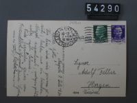
Napoli, Panorama da S. Martino
Caption
Postmark 7.7.1930.
Caption (German)
Poststempel 7.7.1930.
Record Name
Fel_054290-RE
Title (German)
Napoli, Panorama da S. Martino
Caption
Postmark 7.7.1930.
Caption (German)
Poststempel 7.7.1930.
Record Name
Fel_054290-VE

Title (German)
Nicolosi, Panorama coi monti Rossi
Caption
Postmark 13.10.1929
Caption (German)
Poststempel 13.10.1929
Record Name
Fel_054291-RE

Title (German)
Nicolosi, Panorama coi monti Rossi
Caption
Postmark 13.10.1929
Caption (German)
Poststempel 13.10.1929
Record Name
Fel_054291-VE

Title (German)
Catania, Via Etna e Via Caronda
Caption
Postmark 28.9.1929
Caption (German)
Poststempel 28.9.1929
Record Name
Fel_054292-RE

Title (German)
Catania, Via Etna e Via Caronda
Caption
Postmark 28.9.1929
Caption (German)
Poststempel 28.9.1929
Record Name
Fel_054292-VE

Title (German)
Ravenna, Basilica di sS. Apollinare Nuovo, Restaurata dopo il bombardemento austriaco del 12 febbraio 1916
Caption
Postmark 23.7.1923
Caption (German)
Poststempel 23.7.1923
Record Name
Fel_054293-RE

Title (German)
Ravenna, Basilica di sS. Apollinare Nuovo, Restaurata dopo il bombardemento austriaco del 12 febbraio 1916
Caption
Postmark 23.7.1923
Caption (German)
Poststempel 23.7.1923
Record Name
Fel_054293-VE

Title (German)
Ravenna, Pineto
Caption
Postmark 23.7.1923
Caption (German)
Poststempel 23.7.1923
Record Name
Fel_054294-RE

Title (German)
Ravenna, Pineto
Caption
Postmark 23.7.1923
Caption (German)
Poststempel 23.7.1923
Record Name
Fel_054294-VE

Title (German)
Ravenna, Chiesa di S. Apollinare Nuovo, Interno
Caption
Postmark 23.7.1923
Caption (German)
Poststempel 23.7.1923
Record Name
Fel_054295-RE

Title (German)
Ravenna, Chiesa di S. Apollinare Nuovo, Interno
Caption
Postmark 23.7.1923
Caption (German)
Poststempel 23.7.1923
Record Name
Fel_054295-VE

Title (German)
Ravenna, Campanile di S. Francesco ripristinato
Caption
Postmark 23.7.1923
Caption (German)
Poststempel 23.7.1923
Record Name
Fel_054296-RE

Title (German)
Ravenna, Campanile di S. Francesco ripristinato
Caption
Postmark 23.7.1923
Caption (German)
Poststempel 23.7.1923
Record Name
Fel_054296-VE

Title (German)
Gruppo delle Dolomiti, Siusi 1002 m dal Hotel Saligo 1125 m
Caption
Gruppo delle Dolomiti, Siusi 1002 m dal Hotel Saligo 1125 m - Santnerspitze (Great Sciliar Peak) on the Sciliar; view to the south (S). Message of the postcard: We spend our vacations with our children for a change not in Switzerland. Here in Siusi it is very beautiful and in these four weeks that we have already been here, the children have developed splendidly - especially our youngest, who had suffered from severe stomach and ? disorders in Catania. Postmark 13.8.1931
Caption (German)
Gruppo delle Dolomiti, Siusi 1002 m dal Hotel Saligo 1125 m - Santnerspitze (Grosser Schlernzacken) am Schlern; Blick nach Süden (S). Botschaft der Postkarte: Unsere Ferien verbringen wir mit unseren Kindern zur Abwechslung einmal nicht in der Schweiz. Hier in Seis ist es sehr schön und in diesen vier Wochen, die wir bereits hier weilen, haben sich die Kinder prächtig entwickelt - besonders unser Jüngster, der in Catania an schweren Magen- und ? störungen gelitten hatte. Poststempel 13.8.1931
Record Name
Fel_054298-RE

Title (German)
Gruppo delle Dolomiti, Siusi 1002 m dal Hotel Saligo 1125 m
Caption
Gruppo delle Dolomiti, Siusi 1002 m dal Hotel Saligo 1125 m - Santnerspitze (Great Sciliar Peak) on the Sciliar; view to the south (S). Message of the postcard: We spend our vacations with our children for a change not in Switzerland. Here in Siusi it is very beautiful and in these four weeks that we have already been here, the children have developed splendidly - especially our youngest, who had suffered from severe stomach and ? disorders in Catania. Postmark 13.8.1931
Caption (German)
Gruppo delle Dolomiti, Siusi 1002 m dal Hotel Saligo 1125 m - Santnerspitze (Grosser Schlernzacken) am Schlern; Blick nach Süden (S). Botschaft der Postkarte: Unsere Ferien verbringen wir mit unseren Kindern zur Abwechslung einmal nicht in der Schweiz. Hier in Seis ist es sehr schön und in diesen vier Wochen, die wir bereits hier weilen, haben sich die Kinder prächtig entwickelt - besonders unser Jüngster, der in Catania an schweren Magen- und ? störungen gelitten hatte. Poststempel 13.8.1931
Record Name
Fel_054298-VE

Title (German)
Catania, Fluss mit Brugg
Caption
Postmark 21.12.1928
Caption (German)
Poststempel 21.12.1928
Record Name
Fel_054299-RE

Title (German)
Catania, Fluss mit Brugg
Caption
Postmark 21.12.1928
Caption (German)
Poststempel 21.12.1928
Record Name
Fel_054299-VE

Title (German)
Genova, Piazza de Ferrari e Nuova Borsa
Caption
Postmark 2.3.1929
Caption (German)
Poststempel 2.3.1929
Record Name
Fel_054300-RE

Title (German)
Genova, Piazza de Ferrari e Nuova Borsa
Caption
Postmark 2.3.1929
Caption (German)
Poststempel 2.3.1929
Record Name
Fel_054300-VE

Title (German)
Catania, Eruzione dell’Etna, 7.11.1928, Mascali preda del torrente di fuogo
Caption
Postmark 21.12.1928
Caption (German)
Poststempel 21.12.1928
Record Name
Fel_054301-RE

Title (German)
Catania, Eruzione dell’Etna, 7.11.1928, Mascali preda del torrente di fuogo
Caption
Postmark 21.12.1928
Caption (German)
Poststempel 21.12.1928
Record Name
Fel_054301-VE

Title (German)
Siracusa, Villa Marina e Statua di Archimede
Caption
Postmark 15.3.1925
Caption (German)
Poststempel 15.3.1925
Record Name
Fel_054310-RE

Title (German)
Siracusa, Villa Marina e Statua di Archimede
Caption
Postmark 15.3.1925
Caption (German)
Poststempel 15.3.1925
Record Name
Fel_054310-VE

Title (German)
Catania, Vallerdel Bover, Rappalardo, Metzger Sen. und Jun (Albert Metzger auf dem Berg)
Caption
Message of the postcard: Thank you for the card from St. Moritz. We are content with modest places, take the 'Grand Hotel' in the backpack. Postmark 22.02.1925
Caption (German)
Botschaft der Postkarte: Besten Dank für Karte aus St. Moritz. Wir begnügen uns mit bescheidenen Orten, nehmen das ‘Grand Hotel’ im Rucksack mit. Poststempel 22.02.1925
Record Name
Fel_054312-RE

Title (German)
Catania, Vallerdel Bover, Rappalardo, Metzger Sen. und Jun (Albert Metzger auf dem Berg)
Caption
Message of the postcard: Thank you for the card from St. Moritz. We are content with modest places, take the 'Grand Hotel' in the backpack. Postmark 22.02.1925
Caption (German)
Botschaft der Postkarte: Besten Dank für Karte aus St. Moritz. Wir begnügen uns mit bescheidenen Orten, nehmen das ‘Grand Hotel’ im Rucksack mit. Poststempel 22.02.1925
Record Name
Fel_054312-VE

Title (German)
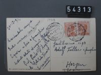
Siracusa, Fiume Anapo con plante di Papiro
Caption
Postmark 30.12.1924
Caption (German)
Poststempel 30.12.1924
Record Name
Fel_054313-RE
Title (German)
Siracusa, Fiume Anapo con plante di Papiro
Caption
Postmark 30.12.1924
Caption (German)
Poststempel 30.12.1924
Record Name
Fel_054313-VE

Title (German)
Taormina
Caption
Message of the postcard: As so often, I remember you also at the coming festive season and send you my warmest wishes. May you enjoy quite a lot of joy in your dear family circle and may the new year be as happy as the past ones. Remember that we have a 25th anniversary to celebrate together on Sicilian soil - in 1925! I am waiting for you in Taormina. More later by letter, thank you for the beautiful cards. Run around 1925
Caption (German)
Botschaft der Postkarte: Wie so oft gedenke ich auch zur kommenden Festzeit Ihrer und sende Ihnen hiefür meine herzlichsten Wünsche. mögen Sie in Ihrem lieben Familienkreis recht viel Freude geniessen und mög das neue Jahr sich ebenso glücklich an die vergangenen reihen. Denken Sie daran, dass wir zus. auf Siziliens Boden ein 25-jähriges Jubliäum zu feiern haben - im 1925! Dafür erwarte ich Sie in Taormina. Später brieflich mehr, vielen Dank f. die schönen Carten. Gelaufen um 1925
Record Name
Fel_054314-RE

Title (German)
Taormina
Caption
Message of the postcard: As so often, I remember you also at the coming festive season and send you my warmest wishes. May you enjoy quite a lot of joy in your dear family circle and may the new year be as happy as the past ones. Remember that we have a 25th anniversary to celebrate together on Sicilian soil - in 1925! I am waiting for you in Taormina. More later by letter, thank you for the beautiful cards. Run around 1925
Caption (German)
Botschaft der Postkarte: Wie so oft gedenke ich auch zur kommenden Festzeit Ihrer und sende Ihnen hiefür meine herzlichsten Wünsche. mögen Sie in Ihrem lieben Familienkreis recht viel Freude geniessen und mög das neue Jahr sich ebenso glücklich an die vergangenen reihen. Denken Sie daran, dass wir zus. auf Siziliens Boden ein 25-jähriges Jubliäum zu feiern haben - im 1925! Dafür erwarte ich Sie in Taormina. Später brieflich mehr, vielen Dank f. die schönen Carten. Gelaufen um 1925
Record Name
Fel_054314-VE

Title (German)
Catania, Via Etna dai quattro canti
Caption
Message of the postcard: Dear Mr. Feller I owe you your card of 5.6.24 from Basel and hope that the visit to the London exhibition was quite enjoyable. Unfortunately, I could not take a vacation this year, we had some bad luck with our employees in the last few years. Now we are complete again, although some could be a little better. Business is generally good and we always have a lot to do. Hope that this is also the case with you. ? Have you seen Metzger. Postmark 6.9.1924
Caption (German)
Botschaft der Postkarte: Lieber Herr Feller Ich verdanke Ihnen bestens Ihre Karte vom 5.6.24 aus Basel u. hoffe, dass der Besuch der Londoner Ausstellung recht genussreich war. Leider konnte ich dieses Jahrkeine Ferien machen, wir hatten in den letzten Jahren etwas Pech mit unseren Angestellten. Jetzt sind wir wieder komplett, obwohl manche noch etwas besser sein könnten. Die Geschäfte gehen im allgemeinen gut u. wir haben immer viel zu tun. Hoffe, dass das auch bei Ihnen der Fall ist. ? Haben Sie Metzger gesehen. Poststempel 6.9.1924
Record Name
Fel_054316-RE

Title (German)
Catania, Via Etna dai quattro canti
Caption
Message of the postcard: Dear Mr. Feller I owe you your card of 5.6.24 from Basel and hope that the visit to the London exhibition was quite enjoyable. Unfortunately, I could not take a vacation this year, we had some bad luck with our employees in the last few years. Now we are complete again, although some could be a little better. Business is generally good and we always have a lot to do. Hope that this is also the case with you. ? Have you seen Metzger. Postmark 6.9.1924
Caption (German)
Botschaft der Postkarte: Lieber Herr Feller Ich verdanke Ihnen bestens Ihre Karte vom 5.6.24 aus Basel u. hoffe, dass der Besuch der Londoner Ausstellung recht genussreich war. Leider konnte ich dieses Jahrkeine Ferien machen, wir hatten in den letzten Jahren etwas Pech mit unseren Angestellten. Jetzt sind wir wieder komplett, obwohl manche noch etwas besser sein könnten. Die Geschäfte gehen im allgemeinen gut u. wir haben immer viel zu tun. Hoffe, dass das auch bei Ihnen der Fall ist. ? Haben Sie Metzger gesehen. Poststempel 6.9.1924
Record Name
Fel_054316-VE

Title (German)
Catania, Via Etna
Caption
Postmark 9.8.1924
Caption (German)
Poststempel 9.8.1924
Record Name
Fel_054317-RE

Title (German)
Catania, Via Etna
Caption
Postmark 9.8.1924
Caption (German)
Poststempel 9.8.1924
Record Name
Fel_054317-VE

Title (German)
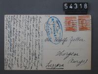
Catania, Stesicorea
Caption
Postmark 21.9.1928
Caption (German)
Poststempel 21.9.1928
Record Name
Fel_054318-RE
Title (German)
Catania, Stesicorea
Caption
Postmark 21.9.1928
Caption (German)
Poststempel 21.9.1928
Record Name
Fel_054318-VE

Title (German)
Cortina d'Ampezzo, Tre Croci col Cristallo e Piz Popena
Caption
Postmark 23.8.1926
Caption (German)
Poststempel 23.8.1926
Record Name
Fel_054320-RE

Title (German)
Cortina d'Ampezzo, Tre Croci col Cristallo e Piz Popena
Caption
Postmark 23.8.1926
Caption (German)
Poststempel 23.8.1926
Record Name
Fel_054320-VE
![Portofino Vetta 450 m, Riviera di Levante, Grand Hotel - Grand Restaurant, Panorama su S. Margherita [Ligure].](thumbnails/thumb_ETHBIB.Bildarchiv_161943.jpg)
Title (German)
Portofino Vetta 450 m, Riviera di Levante, Grand Hotel - Grand Restaurant, Panorama su S. Margherita [Ligure]
Caption
Postmark 6.12.1926
Caption (German)
Poststempel 6.12.1926
Record Name
Fel_054321-RE
![Portofino Vetta 450 m, Riviera di Levante, Grand Hotel - Grand Restaurant, Panorama su S. Margherita [Ligure].](thumbnails/thumb_ETHBIB.Bildarchiv_226030.jpg)
Title (German)
Portofino Vetta 450 m, Riviera di Levante, Grand Hotel - Grand Restaurant, Panorama su S. Margherita [Ligure]
Caption
Postmark 6.12.1926
Caption (German)
Poststempel 6.12.1926
Record Name
Fel_054321-VE

Title (German)
Rapallo, Panorama
Caption
Postmark 6.12.1926
Caption (German)
Poststempel 6.12.1926
Record Name
Fel_054322-RE

Title (German)
Rapallo, Panorama
Caption
Postmark 6.12.1926
Caption (German)
Poststempel 6.12.1926
Record Name
Fel_054322-VE

Title (German)
Pegli, Castello Wianson e Terrazza a Mare
Caption
Postmark 4.12.1926
Caption (German)
Poststempel 4.12.1926
Record Name
Fel_054323-RE

Title (German)
Pegli, Castello Wianson e Terrazza a Mare
Caption
Postmark 4.12.1926
Caption (German)
Poststempel 4.12.1926
Record Name
Fel_054323-VE

Title (German)
Pegli, Castello Chiozza e spiaggia
Caption
Postmark 4.12.1926
Caption (German)
Poststempel 4.12.1926
Record Name
Fel_054324-RE

Title (German)
Pegli, Castello Chiozza e spiaggia
Caption
Postmark 4.12.1926
Caption (German)
Poststempel 4.12.1926
Record Name
Fel_054324-VE
Title (German)
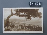
Pegli, Panorama
Caption
Postmark 28.3.1927
Caption (German)
Poststempel 28.3.1927
Record Name
Fel_054325-RE

Title (German)
Pegli, Panorama
Caption
Postmark 28.3.1927
Caption (German)
Poststempel 28.3.1927
Record Name
Fel_054325-VE

Title (German)
Pegli, La Spiaggia
Caption
Postmark 26.3.1927
Caption (German)
Poststempel 26.3.1927
Record Name
Fel_054326-RE

Title (German)
Pegli, La Spiaggia
Caption
Postmark 26.3.1927
Caption (German)
Poststempel 26.3.1927
Record Name
Fel_054326-VE

Title (German)
Firenze, Ponte Vecchio
Caption
Postmark 17.12.1929
Caption (German)
Poststempel 17.12.1929
Record Name
Fel_054327-RE

Title (German)
Firenze, Ponte Vecchio
Caption
Postmark 17.12.1929
Caption (German)
Poststempel 17.12.1929
Record Name
Fel_054327-VE

Title (German)
Rimini
Caption
Run around 1927
Caption (German)
Gelaufen um 1927
Record Name
Fel_054328-RE

Title (German)
Rimini
Caption
Run around 1927
Caption (German)
Gelaufen um 1927
Record Name
Fel_054328-VE

Title (German)
Pisa, l Campanile
Caption
Postmark 27.10.1926
Caption (German)
Poststempel 27.10.1926
Record Name
Fel_054329-RE

Title (German)
Pisa, l Campanile
Caption
Postmark 27.10.1926
Caption (German)
Poststempel 27.10.1926
Record Name
Fel_054329-VE

Title (German)
Lindo, Italien
Caption
Postmark 23.7.1928
Caption (German)
Poststempel 23.7.1928
Record Name
Fel_054331-RE

Title (German)
Lindo, Italien
Caption
Postmark 23.7.1928
Caption (German)
Poststempel 23.7.1928
Record Name
Fel_054331-VE

Title (German)
Catania, Via S. Eupilio e sottopassaggio Villa Bellini
Caption
Postmark 3.1.1934
Caption (German)
Poststempel 3.1.1934
Record Name
Fel_054336-RE

Title (German)
Catania, Via S. Eupilio e sottopassaggio Villa Bellini
Caption
Postmark 3.1.1934
Caption (German)
Poststempel 3.1.1934
Record Name
Fel_054336-VE

Title (German)
Catania, Wäckerlin e C.i, Fabbrica di Mobili in legno curvato a vapore
Caption
Postmark 26.12.1928
Caption (German)
Poststempel 26.12.1928
Record Name
Fel_054339-RE

Title (German)
Catania, Wäckerlin e C.i, Fabbrica di Mobili in legno curvato a vapore
Caption
Postmark 26.12.1928
Caption (German)
Poststempel 26.12.1928
Record Name
Fel_054339-VE

Title (German)
Parma
Caption
Postmark 23.7.1928
Caption (German)
Poststempel 23.7.1928
Record Name
Fel_054340-RE

Title (German)
Parma
Caption
Postmark 23.7.1928
Caption (German)
Poststempel 23.7.1928
Record Name
Fel_054340-VE

Title (German)
Taormina, Grosse Schiffe vor Ufer
Caption
Message of the postcard: Dear friends. After such a long time of my departure, it is only today that I come to express my heartfelt thanks to you for the pleasant Sunday afternoon you offered me and Else. The journey up to here went well, since 10 days we have a very exciting time, I will tell you later about what we have to fight. Postmark 26.10.1928
Caption (German)
Botschaft der Postkarte: Liebe Freunde. Nach so langer Zeit meiner Abreise, komme ich erst heute Ihnen meinen herzlichsten Dank auszusprechen, für den gemütlichen Sonntag-Nachmittag, den Sie mir und Else boten. Die Reise bis hierher verlief gut, seit 10 Tagen haben wir eine sehr aufregende Zeit, ich werde Ihnen später darüber berichten, was wir auszukämpfen haben. Poststempel 26.10.1928
Record Name
Fel_054341-RE

Title (German)
Taormina, Grosse Schiffe vor Ufer
Caption
Message of the postcard: Dear friends. After such a long time of my departure, it is only today that I come to express my heartfelt thanks to you for the pleasant Sunday afternoon you offered me and Else. The journey up to here went well, since 10 days we have a very exciting time, I will tell you later about what we have to fight. Postmark 26.10.1928
Caption (German)
Botschaft der Postkarte: Liebe Freunde. Nach so langer Zeit meiner Abreise, komme ich erst heute Ihnen meinen herzlichsten Dank auszusprechen, für den gemütlichen Sonntag-Nachmittag, den Sie mir und Else boten. Die Reise bis hierher verlief gut, seit 10 Tagen haben wir eine sehr aufregende Zeit, ich werde Ihnen später darüber berichten, was wir auszukämpfen haben. Poststempel 26.10.1928
Record Name
Fel_054341-VE

Title (German)
Como, Lago di Como, Ospedaletto e Sala
Caption
Message of the postcard: From a business trip to the south I send you and your dear family heartfelt greetings. Greetings. Later, many thanks for your card from London. Postmark 18.5.1931
Caption (German)
Botschaft der Postkarte: Von einem geschäftlichen Abstecher nach dem Süden sende ich Ihnen und Ihrer lb. Familie herzl. Grüsse. Nachträgl. noch vielen Dank für Ihre Karte aus London. Poststempel 18.5.1931
Record Name
Fel_054346-RE

Title (German)
Como, Lago di Como, Ospedaletto e Sala
Caption
Message of the postcard: From a business trip to the south I send you and your dear family heartfelt greetings. Greetings. Later, many thanks for your card from London. Postmark 18.5.1931
Caption (German)
Botschaft der Postkarte: Von einem geschäftlichen Abstecher nach dem Süden sende ich Ihnen und Ihrer lb. Familie herzl. Grüsse. Nachträgl. noch vielen Dank für Ihre Karte aus London. Poststempel 18.5.1931
Record Name
Fel_054346-VE

Title (German)
Catania, Visione dell’Etna fra gli ulivi secolari
Caption
Postmark 1.4.1931
Caption (German)
Poststempel 1.4.1931
Record Name
Fel_054347-RE

Title (German)
Catania, Visione dell’Etna fra gli ulivi secolari
Caption
Postmark 1.4.1931
Caption (German)
Poststempel 1.4.1931
Record Name
Fel_054347-VE

Title (German)
Venezia, Ponte Realto
Caption
Postmark 28.5.1926
Caption (German)
Poststempel 28.5.1926
Record Name
Fel_054348-RE

Title (German)
Venezia, Ponte Realto
Caption
Postmark 28.5.1926
Caption (German)
Poststempel 28.5.1926
Record Name
Fel_054348-VE

Title (German)
Roma, Il Colosseo
Caption
Postmark 28.11.1928
Caption (German)
Poststempel 28.11.1928
Record Name
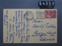
Fel_054350-RE
Title (German)
Roma, Il Colosseo
Caption
Postmark 28.11.1928
Caption (German)
Poststempel 28.11.1928
Record Name
Fel_054350-VE

Title (German)
Voltri, Molino di Crevas
Caption
Postmark 24.11.1926
Caption (German)
Poststempel 24.11.1926
Record Name
Fel_054351-RE

Title (German)
Voltri, Molino di Crevas
Caption
Postmark 24.11.1926
Caption (German)
Poststempel 24.11.1926
Record Name
Fel_054351-VE

Title (German)
Castelmola
Caption
Postmark 24.5.1933
Caption (German)
Poststempel 24.5.1933
Record Name
Fel_054352-RE

Title (German)
Castelmola
Caption
Postmark 24.5.1933
Caption (German)
Poststempel 24.5.1933
Record Name
Fel_054352-VE

Title (German)
Taormina, Panorama
Caption
Postmark 24.5.1925
Caption (German)
Poststempel 24.5.1925
Record Name
Fel_054353-RE

Title (German)
Taormina, Panorama
Caption
Postmark 24.5.1925
Caption (German)
Poststempel 24.5.1925
Record Name
Fel_054353-VE

Title (German)
Taormina, Teatro Greco
Caption
Postmark 24.5.1925
Caption (German)
Poststempel 24.5.1925
Record Name
Fel_054354-RE

Title (German)
Taormina, Teatro Greco
Caption
Postmark 24.5.1925
Caption (German)
Poststempel 24.5.1925
Record Name
Fel_054354-VE

Title (German)
Catania, Porta Uzeda
Caption
Run around 1929
Caption (German)
Gelaufen um 1929
Record Name
Fel_054355-RE

Title (German)
Catania, Porta Uzeda
Caption
Run around 1929
Caption (German)
Gelaufen um 1929
Record Name
Fel_054355-VE

Title (German)
Spoleto, Chiesa di S. Pietro, Sec. V
Caption
Not run
Caption (German)
Nicht gelaufen
Record Name
Fel_054356-VE

Title (German)
Rovigo, Colli Euganei, Rocca Pendice da una stampa antica
Caption
Postmark 6.1.1931
Caption (German)
Poststempel 6.1.1931
Record Name
Fel_054360-RE

Title (German)
Rovigo, Colli Euganei, Rocca Pendice da una stampa antica
Caption
Postmark 6.1.1931
Caption (German)
Poststempel 6.1.1931
Record Name
Fel_054360-VE

Title (German)
Roma, Pincio, Fontana del Mosè
Caption
Message of the postcard: From an interesting (pilgrim!) journey, which led me to Naples, I send you and your dear mother warm greetings. I would like to tell you occasionally orally my experiences of various kinds. Postmark 24.10.1950.
Caption (German)
Botschaft der Postkarte: Von einer interessanten (Pilger!) Reise, die mich bis nach Neapel führte, sende ich Ihnen und Ihrer lieben Mutter herzliche Grüsse. Gerne möchte ich Ihnen gelegentlich mündlich meine Erlebnisse verschiedenster Art mitteilen. Poststempel 24.10.1950.
Record Name
Fel_054362-RE

Title (German)
Roma, Pincio, Fontana del Mosè
Caption
Message of the postcard: From an interesting (pilgrim!) journey, which led me to Naples, I send you and your dear mother warm greetings. I would like to tell you occasionally orally my experiences of various kinds. Postmark 24.10.1950.
Caption (German)
Botschaft der Postkarte: Von einer interessanten (Pilger!) Reise, die mich bis nach Neapel führte, sende ich Ihnen und Ihrer lieben Mutter herzliche Grüsse. Gerne möchte ich Ihnen gelegentlich mündlich meine Erlebnisse verschiedenster Art mitteilen. Poststempel 24.10.1950.
Record Name
Fel_054362-VE

Title (German)
Girgenti, Hotel des Temples, Giardino in Gennaio e Febbrario
Caption
Postmark 5.5.1930
Caption (German)
Poststempel 5.5.1930
Record Name
Fel_054375-RE

Title (German)
Girgenti, Hotel des Temples, Giardino in Gennaio e Febbrario
Caption
Postmark 5.5.1930
Caption (German)
Poststempel 5.5.1930
Record Name
Fel_054375-VE

Title (German)
Girgenti, Hotel des Temples, Giardino in Gennaio e Febbrario
Caption
Postmark 6.5.1930
Caption (German)
Poststempel 6.5.1930
Record Name
Fel_054376-RE

Title (German)
Girgenti, Hotel des Temples, Giardino in Gennaio e Febbrario
Caption
Postmark 6.5.1930
Caption (German)
Poststempel 6.5.1930
Record Name
Fel_054376-VE

Title (German)
T. Ziomek: Laka, Prairie
Caption
Postmark 29.3.1929
Caption (German)
Poststempel 29.3.1929
Record Name
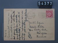
Fel_054377-RE
Title (German)
T. Ziomek: Laka, Prairie
Caption
Postmark 29.3.1929
Caption (German)
Poststempel 29.3.1929
Record Name
Fel_054377-VE

Title (German)
Comandante Guardie Svizzere, Tenuta di gala
Caption
Postmark 23.10.1930.
Caption (German)
Poststempel 23.10.1930.
Record Name
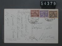
Fel_054379-RE
Title (German)
Comandante Guardie Svizzere, Tenuta di gala
Caption
Postmark 23.10.1930.
Caption (German)
Poststempel 23.10.1930.
Record Name
Fel_054379-VE

Title (German)
Comandante Guardie Svizzere, Tenuta di mezza gala
Caption
Postmark 24.12.1929
Caption (German)
Poststempel 24.12.1929
Record Name
Fel_054380-RE

Title (German)
Comandante Guardie Svizzere, Tenuta di mezza gala
Caption
Postmark 24.12.1929
Caption (German)
Poststempel 24.12.1929
Record Name
Fel_054380-VE

Title (German)
Comandante Guardie Svizzere, Ufficiale dei Gendarmi in alta uniforme
Caption
Postmark 24.12.1929
Caption (German)
Poststempel 24.12.1929
Record Name
Fel_054381-RE

Title (German)
Comandante Guardie Svizzere, Ufficiale dei Gendarmi in alta uniforme
Caption
Postmark 24.12.1929
Caption (German)
Poststempel 24.12.1929
Record Name
Fel_054381-VE

Title (German)
Catania, Eine Familie
Caption
Postmark 16.8.1923
Caption (German)
Poststempel 16.8.1923
Record Name
Fel_054382-RE

Title (German)
Catania, Eine Familie
Caption
Postmark 16.8.1923
Caption (German)
Poststempel 16.8.1923
Record Name
Fel_054382-VE

Title (German)
Roma, Papst
Caption
Postmark 24.12.1929
Caption (German)
Poststempel 24.12.1929
Record Name
Fel_054383-RE

Title (German)
Roma, Papst
Caption
Postmark 24.12.1929
Caption (German)
Poststempel 24.12.1929
Record Name
Fel_054383-VE

Title (German)
Roma, Vaticano
Caption
Postmark 20.9.1930
Caption (German)
Poststempel 20.9.1930
Record Name
Fel_054384-RE

Title (German)
Roma, Vaticano
Caption
Postmark 20.9.1930
Caption (German)
Poststempel 20.9.1930
Record Name
Fel_054384-VE

Title (German)
S.A.R. La Pssa Giovanna
Caption
Postmark 6.8.1924
Caption (German)
Poststempel 6.8.1924
Record Name
Fel_054385-RE

Title (German)
S.A.R. La Pssa Giovanna
Caption
Postmark 6.8.1924
Caption (German)
Poststempel 6.8.1924
Record Name
Fel_054385-VE

Title (German)
S.A.R. La Regina
Caption
Postmark 6.8.1924
Caption (German)
Poststempel 6.8.1924
Record Name
Fel_054386-RE

Title (German)
S.A.R. La Regina
Caption
Postmark 6.8.1924
Caption (German)
Poststempel 6.8.1924
Record Name
Fel_054386-VE

Title (German)
S.A.R. Il Re D’Italia
Caption
Postmark 6.8.1924
Caption (German)
Poststempel 6.8.1924
Record Name
Fel_054387-RE

Title (German)
S.A.R. Il Re D’Italia
Caption
Postmark 6.8.1924
Caption (German)
Poststempel 6.8.1924
Record Name
Fel_054387-VE

Title (German)
S.A.R. La Pssa Jolanda
Caption
Postmark 6.8.1924
Caption (German)
Poststempel 6.8.1924
Record Name
Fel_054388-RE

Title (German)
S.A.R. La Pssa Jolanda
Caption
Postmark 6.8.1924
Caption (German)
Poststempel 6.8.1924
Record Name
Fel_054388-VE

Title (German)
S.A.R. Il Principe Umberto
Caption
Postmark 6.8.1924
Caption (German)
Poststempel 6.8.1924
Record Name
Fel_054389-RE

Title (German)
S.A.R. Il Principe Umberto
Caption
Postmark 6.8.1924
Caption (German)
Poststempel 6.8.1924
Record Name
Fel_054389-VE

Title (German)
S. Benito Mussolini
Caption
Postmark 6.8.1924
Caption (German)
Poststempel 6.8.1924
Record Name
Fel_054390-RE

Title (German)
S. Benito Mussolini
Caption
Postmark 6.8.1924
Caption (German)
Poststempel 6.8.1924
Record Name
Fel_054390-VE

Title (German)
K. Belgramo
Caption
Postcard message: Voici notre glorieux general, une de plus grandes figures de l'independence argentine. Postmark 12.10.1927
Caption (German)
Botschaft der Postkarte: Voici notre glorieux general, une de plus grandes figures de l’independence argentine. Poststempel 12.10.1927
Record Name
Fel_054391-RE

Title (German)
K. Belgramo
Caption
Postcard message: Voici notre glorieux general, une de plus grandes figures de l'independence argentine. Postmark 12.10.1927
Caption (German)
Botschaft der Postkarte: Voici notre glorieux general, une de plus grandes figures de l’independence argentine. Poststempel 12.10.1927
Record Name
Fel_054391-VE
Title (German)
Roma, Umberto
Caption
Postmark 23.12.1929
Caption (German)
Poststempel 23.12.1929
Record Name
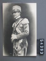
Fel_054393-RE

Title (German)
Roma, Umberto
Caption
Postmark 23.12.1929
Caption (German)
Poststempel 23.12.1929
Record Name
Fel_054393-VE

Title (German)
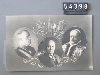
S.A.R. La Principessa Maria José, S.A.R. Il Principe Umberto
Caption
Postmark 23.12.1929
Caption (German)
Poststempel 23.12.1929
Record Name
Fel_054394-RE

Title (German)
S.A.R. La Principessa Maria José, S.A.R. Il Principe Umberto
Caption
Postmark 23.12.1929
Caption (German)
Poststempel 23.12.1929
Record Name
Fel_054394-VE

Title (German)
S.A.R. La Principessa Jolanda e le figlie
Caption
Postmark 23.12.1929
Caption (German)
Poststempel 23.12.1929
Record Name
Fel_054395-RE

Title (German)
S.A.R. La Principessa Jolanda e le figlie
Caption
Postmark 23.12.1929
Caption (German)
Poststempel 23.12.1929
Record Name
Fel_054395-VE

Title (German)
Roma, S.A.R. Maria José
Caption
Postmark 23.12.1929
Caption (German)
Poststempel 23.12.1929
Record Name
Fel_054396-RE

Title (German)
Roma, S.A.R. Maria José
Caption
Postmark 23.12.1929
Caption (German)
Poststempel 23.12.1929
Record Name
Fel_054396-VE
Title (German)
Roma
Caption
Postmark 23.12.1929
Caption (German)
Poststempel 23.12.1929
Record Name
Fel_054398-RE

Title (German)
Roma
Caption
Postmark 23.12.1929
Caption (German)
Poststempel 23.12.1929
Record Name
Fel_054398-VE

Title (German)
S.A.R. La Principessa Maria José, S.A.R. Il Principe Umberto
Caption
Message of the postcard: D's Mami söll dir de säge, was das für Lüt si. Postmark 22.12.1929
Caption (German)
Botschaft der Postkarte: D’s Mami söll Dir de säge, was das für Lüt si. Poststempel 22.12.1929
Record Name
Fel_054400-RE

Title (German)
S.A.R. La Principessa Maria José, S.A.R. Il Principe Umberto
Caption
Message of the postcard: D's Mami söll dir de säge, was das für Lüt si. Postmark 22.12.1929
Caption (German)
Botschaft der Postkarte: D’s Mami söll Dir de säge, was das für Lüt si. Poststempel 22.12.1929
Record Name
Fel_054400-VE

Title (German)
Pio H. X, Papst
Caption
Postcard message: M. L. Spend Sunday here, wonderful weather, not a cloud in the sky. Up to here you must come absolutely times. Postmark 4.10.1908
Caption (German)
Botschaft der Postkarte: M. L. Verbringe hier den Sonntag, wunderbares Wetter, kein Wölkchen am Himmel. Bis hier müsst Ihr unbedingt mal kommen. Poststempel 4.10.1908
Record Name
Fel_054401-RE
Title (German)
Pio H. X, Papst
Caption
Postcard message: M. L. Spend Sunday here, wonderful weather, not a cloud in the sky. Up to here you must come absolutely times. Postmark 4.10.1908
Caption (German)
Botschaft der Postkarte: M. L. Verbringe hier den Sonntag, wunderbares Wetter, kein Wölkchen am Himmel. Bis hier müsst Ihr unbedingt mal kommen. Poststempel 4.10.1908
Record Name
Fel_054401-VE

Title (German)
Firenze, Palazzo Vecchio, Il Cortile
Caption
Postmark 25.12.1929
Caption (German)
Poststempel 25.12.1929
Record Name
Fel_054404-RE

Title (German)
Firenze, Palazzo Vecchio, Il Cortile
Caption
Postmark 25.12.1929
Caption (German)
Poststempel 25.12.1929
Record Name
Fel_054404-VE

Title (German)
Venezia, Caput Canalis et Ingressus in Urbem
Caption
Postmark 27.12.1953
Caption (German)
Poststempel 27.12.1953
Record Name
Fel_054429-RE

Title (German)
Venezia, Caput Canalis et Ingressus in Urbem
Caption
Postmark 27.12.1953
Caption (German)
Poststempel 27.12.1953
Record Name
Fel_054429-VE

Title (German)
Littoria, Piazza XXIII Marzo
Caption
Postmark 20.11.1936
Caption (German)
Poststempel 20.11.1936
Record Name
Fel_054433-RE

Title (German)
Littoria, Piazza XXIII Marzo
Caption
Postmark 20.11.1936
Caption (German)
Poststempel 20.11.1936
Record Name
Fel_054433-VE

Title (German)
Firenze, Loggia del Lanzi
Caption
Postmark 10.1.1949
Caption (German)
Poststempel 10.1.1949
Record Name
Fel_054438-RE

Title (German)
Firenze, Loggia del Lanzi
Caption
Postmark 10.1.1949
Caption (German)
Poststempel 10.1.1949
Record Name
Fel_054438-VE

Title (German)
Roma, Fontana di Trevi
Caption
Postmark 21.12.1950
Caption (German)
Poststempel 21.12.1950
Record Name
Fel_054439-RE

Title (German)
Roma, Fontana di Trevi
Caption
Postmark 21.12.1950
Caption (German)
Poststempel 21.12.1950
Record Name
Fel_054439-VE

Title (German)
Ripella, Veduta del'Antico Porto
Caption
Postmark 17.12.1948
Caption (German)
Poststempel 17.12.1948
Record Name
Fel_054440-RE

Title (German)
Ripella, Veduta del'Antico Porto
Caption
Postmark 17.12.1948
Caption (German)
Poststempel 17.12.1948
Record Name
Fel_054440-VE

Title (German)
Roma, Arco di Tito
Caption
Postmark 29.8.1946
Caption (German)
Poststempel 29.8.1946
Record Name
Fel_054441-RE

Title (German)
Roma, Arco di Tito
Caption
Postmark 29.8.1946
Caption (German)
Poststempel 29.8.1946
Record Name
Fel_054441-VE

Title (German)
Roma, Campidoglio
Caption
Postmark 24.9.1948
Caption (German)
Poststempel 24.9.1948
Record Name
Fel_054443-RE

Title (German)
Roma, Campidoglio
Caption
Postmark 24.9.1948
Caption (German)
Poststempel 24.9.1948
Record Name
Fel_054443-VE

Title (German)
Roma, Basilica S. Giovanni Laterano
Caption
Postmark 12.10.1934
Caption (German)
Poststempel 12.10.1934
Record Name
Fel_054445-RE

Title (German)
Roma, Basilica S. Giovanni Laterano
Caption
Postmark 12.10.1934
Caption (German)
Poststempel 12.10.1934
Record Name
Fel_054445-VE

Title (German)
Roma, Terme di Diocleziano
Caption
Postmark 18.12.1939
Caption (German)
Poststempel 18.12.1939
Record Name
Fel_054446-RE

Title (German)
Roma, Terme di Diocleziano
Caption
Postmark 18.12.1939
Caption (German)
Poststempel 18.12.1939
Record Name
Fel_054446-VE

Title (German)
Pompei, Veduta generale del Foro
Caption
Postmark 30.3.1948
Caption (German)
Poststempel 30.3.1948
Record Name
Fel_054447-RE

Title (German)
Pompei, Veduta generale del Foro
Caption
Postmark 30.3.1948
Caption (German)
Poststempel 30.3.1948
Record Name
Fel_054447-VE

Title (German)
Capri, Panorama da M. Solaro
Caption
Postmark 3.9.1933
Caption (German)
Poststempel 3.9.1933
Record Name
Fel_054448-RE

Title (German)
Capri, Panorama da M. Solaro
Caption
Postmark 3.9.1933
Caption (German)
Poststempel 3.9.1933
Record Name
Fel_054448-VE

Title (German)
Marciana Marina, Isola d’Elba, Lungomare
Caption
Postmark 29.4.1946
Caption (German)
Poststempel 29.4.1946
Record Name
Fel_054449-RE
Title (German)
Marciana Marina, Isola d’Elba, Lungomare
Caption
Postmark 29.4.1946
Caption (German)
Poststempel 29.4.1946
Record Name
Fel_054449-VE

Title (German)
Milano, Teatro alla Scala (interno)
Caption
Postmark 30.7.1947
Caption (German)
Poststempel 30.7.1947
Record Name
Fel_054451-RE

Title (German)
Milano, Teatro alla Scala (interno)
Caption
Postmark 30.7.1947
Caption (German)
Poststempel 30.7.1947
Record Name
Fel_054451-VE

Title (German)
Milano, Corso Vittorio Emanuele II
Caption
Postcard message: I always owe you and dear Maura a letter about the planned business development. - I am going to Frauenfeld around Sept. 1 to conclude something final. May I see you again on that occasion? Ins was ill; now she is better again. - Thank you for your dear card from Pontresina - Ines would be very happy to see you and dear ? again, we are just afraid to disturb you. Don't you have the opportunity to come to Milano? It would be so nice. Postmark 25.8.1947
Caption (German)
Botschaft der Postkarte: Ich bin Dir und der lieben Maura immer ein Schreiben über die geplante Geschäftsentwicklung schuldig. - Ich fahre etwa am 1. Sept. nach Frauenfeld um etwas endgültiges abzuschliessen. Dürfte ich Dich bei dieser Gelegenheit wiedersehen? Ins war krank; nun geht es ihr wieder besser. - Besten Dank für deine liebe Karte aus Pontresina - Ines wäre ja sehr froh Dich und die liebe ? wiederzusehen zu können, wir befürchten bloss Euch zu stören. Hast du keine Gelegenheit nach Milano zu kommen? Es wäre so schön. Poststempel 25.8.1947
Record Name
Fel_054453-RE

Title (German)
Milano, Corso Vittorio Emanuele II
Caption
Postcard message: I always owe you and dear Maura a letter about the planned business development. - I am going to Frauenfeld around Sept. 1 to conclude something final. May I see you again on that occasion? Ins was ill; now she is better again. - Thank you for your dear card from Pontresina - Ines would be very happy to see you and dear ? again, we are just afraid to disturb you. Don't you have the opportunity to come to Milano? It would be so nice. Postmark 25.8.1947
Caption (German)
Botschaft der Postkarte: Ich bin Dir und der lieben Maura immer ein Schreiben über die geplante Geschäftsentwicklung schuldig. - Ich fahre etwa am 1. Sept. nach Frauenfeld um etwas endgültiges abzuschliessen. Dürfte ich Dich bei dieser Gelegenheit wiedersehen? Ins war krank; nun geht es ihr wieder besser. - Besten Dank für deine liebe Karte aus Pontresina - Ines wäre ja sehr froh Dich und die liebe ? wiederzusehen zu können, wir befürchten bloss Euch zu stören. Hast du keine Gelegenheit nach Milano zu kommen? Es wäre so schön. Poststempel 25.8.1947
Record Name
Fel_054453-VE

Title (German)
Palermo, Panorama
Caption
Postmark 3.4.1931
Caption (German)
Poststempel 3.4.1931
Record Name
Fel_054458-RE

Title (German)
Palermo, Panorama
Caption
Postmark 3.4.1931
Caption (German)
Poststempel 3.4.1931
Record Name
Fel_054458-VE

Title (German)
Rovigo, Palazzo Poste, Telegrafi
Caption
Postmark 7.4.1931
Caption (German)
Poststempel 7.4.1931
Record Name
Fel_054459-RE

Title (German)
Rovigo, Palazzo Poste, Telegrafi
Caption
Postmark 7.4.1931
Caption (German)
Poststempel 7.4.1931
Record Name
Fel_054459-VE

Title (German)
Balilla, Zeltlager
Caption
Postmark 14.8.1928
Caption (German)
Poststempel 14.8.1928
Record Name
Fel_054461-RE

Title (German)
Balilla, Zeltlager
Caption
Postmark 14.8.1928
Caption (German)
Poststempel 14.8.1928
Record Name
Fel_054461-VE

Title (German)
Milano, Via Fatebenefratelli
Caption
Postmark 22.2.1928
Caption (German)
Poststempel 22.2.1928
Record Name
Fel_054462-RE

Title (German)
Milano, Via Fatebenefratelli
Caption
Postmark 22.2.1928
Caption (German)
Poststempel 22.2.1928
Record Name
Fel_054462-VE

Title (German)
Milano, Citta degli Studi. R. Scuola d’Ingegneria R. Politecnico
Caption
Postmark 22.2.1928
Caption (German)
Poststempel 22.2.1928
Record Name
Fel_054463-RE

Title (German)
Milano, Citta degli Studi. R. Scuola d’Ingegneria R. Politecnico
Caption
Postmark 22.2.1928
Caption (German)
Poststempel 22.2.1928
Record Name
Fel_054463-VE

Title (German)
Amalfi, Chiostro Paradiso
Caption
Postmark 8.9.1938
Caption (German)
Poststempel 8.9.1938
Record Name
Fel_054464-RE

Title (German)
Amalfi, Chiostro Paradiso
Caption
Postmark 8.9.1938
Caption (German)
Poststempel 8.9.1938
Record Name
Fel_054464-VE

Title (German)
Venezia, Panorama
Caption
Postmark 30.6.1950.
Caption (German)
Poststempel 30.6.1950.
Record Name
Fel_054475-RE

Title (German)
Venezia, Panorama
Caption
Postmark 30.6.1950.
Caption (German)
Poststempel 30.6.1950.
Record Name
Fel_054475-VE

Title (German)
Foen, Panorama
Caption
Postmark 11.1.1951
Caption (German)
Poststempel 11.1.1951
Record Name
Fel_054478-RE

Title (German)
Foen, Panorama
Caption
Postmark 11.1.1951
Caption (German)
Poststempel 11.1.1951
Record Name
Fel_054478-VE

Title (German)
Siracusa, Grande Albergo Villa Politi
Caption
Postmark 5.4.1949
Caption (German)
Poststempel 5.4.1949
Record Name
Fel_054481-RE

Title (German)
Siracusa, Grande Albergo Villa Politi
Caption
Postmark 5.4.1949
Caption (German)
Poststempel 5.4.1949
Record Name
Fel_054481-VE

Title (German)
Castiglioncello, La Pineta
Caption
Postmark 27.7.1948
Caption (German)
Poststempel 27.7.1948
Record Name
Fel_054482-RE

Title (German)
Castiglioncello, La Pineta
Caption
Postmark 27.7.1948
Caption (German)
Poststempel 27.7.1948
Record Name
Fel_054482-VE

Title (German)
Forte dei Marmi, Panorama, Pensione Marina
Caption
Postmark 9.7.1926
Caption (German)
Poststempel 9.7.1926
Record Name
Fel_054483-RE

Title (German)
Forte dei Marmi, Panorama, Pensione Marina
Caption
Postmark 9.7.1926
Caption (German)
Poststempel 9.7.1926
Record Name
Fel_054483-VE

Title (German)
Enna, La Passeggiata del Belvedere
Caption
Postmark 3.7.1935
Caption (German)
Poststempel 3.7.1935
Record Name
Fel_054484-RE

Title (German)
Enna, La Passeggiata del Belvedere
Caption
Postmark 3.7.1935
Caption (German)
Poststempel 3.7.1935
Record Name
Fel_054484-VE

Title (German)
Roma, Piazza s. M. in Cosmedin e Tempio della Fortuna Virile
Caption
Postmark 24.12.1938
Caption (German)
Poststempel 24.12.1938
Record Name
Fel_054486-RE

Title (German)
Roma, Piazza s. M. in Cosmedin e Tempio della Fortuna Virile
Caption
Postmark 24.12.1938
Caption (German)
Poststempel 24.12.1938
Record Name
Fel_054486-VE

Title (German)
Torri del Benaco
Caption
Postmark 20.6.1938
Caption (German)
Poststempel 20.6.1938
Record Name
Fel_054488-RE

Title (German)
Torri del Benaco
Caption
Postmark 20.6.1938
Caption (German)
Poststempel 20.6.1938
Record Name
Fel_054488-VE

Title (German)
Torre Pellice, Il monumento all ‘Alpino’ Scultore Calderini Mit Gedicht von Parvus
Caption
Postmark 21.7.1950
Caption (German)
Poststempel 21.7.1950
Record Name
Fel_054490-RE

Title (German)
Torre Pellice, Il monumento all ‘Alpino’ Scultore Calderini Mit Gedicht von Parvus
Caption
Postmark 21.7.1950
Caption (German)
Poststempel 21.7.1950
Record Name
Fel_054490-VE
Title (German)
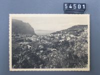
Capri, Panorama
Caption
Postmark 21.8.1936
Caption (German)
Poststempel 21.8.1936
Record Name
Fel_054501-RE
Title (German)
Capri, Panorama
Caption
Postmark 21.8.1936
Caption (German)
Poststempel 21.8.1936
Record Name
Fel_054501-VE

Title (German)
Firenze, Rosenkranz mit Vogel und Schnecke, Lorenzo Ghiberti
Caption
Message of the postcard: Dear Mr. Züst. Thank you. You have done a great job! - The planet is already in the next Beofenster - ad in print! Best regards and have a good trip. Postmark 4.10.1938
Caption (German)
Botschaft der Postkarte: Lieber Herr Züst. Danke. Das haben Sie grossartig gemacht! - Der Planet ist bereits im nächsten Beofenster - Inserat im Druck! Herzlichen Gruss und gute Reise. Poststempel 4.10.1938
Record Name
Fel_054502-RE

Title (German)
Firenze, Rosenkranz mit Vogel und Schnecke, Lorenzo Ghiberti
Caption
Message of the postcard: Dear Mr. Züst. Thank you. You have done a great job! - The planet is already in the next Beofenster - ad in print! Best regards and have a good trip. Postmark 4.10.1938
Caption (German)
Botschaft der Postkarte: Lieber Herr Züst. Danke. Das haben Sie grossartig gemacht! - Der Planet ist bereits im nächsten Beofenster - Inserat im Druck! Herzlichen Gruss und gute Reise. Poststempel 4.10.1938
Record Name
Fel_054502-VE

Title (German)
Formia, Grande Albergo Miramare
Caption
Postmark 14.6.1937
Caption (German)
Poststempel 14.6.1937
Record Name
Fel_054503-RE

Title (German)
Formia, Grande Albergo Miramare
Caption
Postmark 14.6.1937
Caption (German)
Poststempel 14.6.1937
Record Name
Fel_054503-VE

Title (German)
R. Chiesa di S. Chiara in Napoli, Distrutta nel 1943, Ricostruita nel 1953, Post Fata Resurgo
Caption
Not run
Caption (German)
Nicht gelaufen
Record Name
Fel_054504-VE
Title (German)
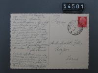
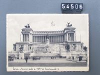
Roma, Monumento a Vittorio Emanuele II
Caption
Postmark 31.1.1935
Caption (German)
Poststempel 31.1.1935
Record Name
Fel_054506-RE

Title (German)
Roma, Monumento a Vittorio Emanuele II
Caption
Postmark 31.1.1935
Caption (German)
Poststempel 31.1.1935
Record Name
Fel_054506-VE

Title (German)
Roma, Via dell’Imperio dal Colosseo
Caption
Postmark 29.12.1934
Caption (German)
Poststempel 29.12.1934
Record Name
Fel_054507-RE

Title (German)
Roma, Via dell’Imperio dal Colosseo
Caption
Postmark 29.12.1934
Caption (German)
Poststempel 29.12.1934
Record Name
Fel_054507-VE

Title (German)
Agrigento, Tempio di Giunone = Tempel der Juno
Caption
Not run
Caption (German)
Nicht gelaufen
Record Name
Fel_054515-VE

Title (German)
Reggio Emilia, Piazza della Vittoria
Caption
Postmark 8.11.1950.
Caption (German)
Poststempel 8.11.1950.
Record Name
Fel_054523-RE

Title (German)
Reggio Emilia, Piazza della Vittoria
Caption
Postmark 8.11.1950.
Caption (German)
Poststempel 8.11.1950.
Record Name
Fel_054523-VE

Title (German)
Grosseto, Passeggiata sulle mura
Caption
Postmark 27.3.1949
Caption (German)
Poststempel 27.3.1949
Record Name
Fel_054524-RE

Title (German)
Grosseto, Passeggiata sulle mura
Caption
Postmark 27.3.1949
Caption (German)
Poststempel 27.3.1949
Record Name
Fel_054524-VE

Title (German)
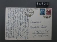
Cervia, La Pineta
Caption
Postmark 12.8.1949
Caption (German)
Poststempel 12.8.1949
Record Name
Fel_054525-RE
Title (German)
Cervia, La Pineta
Caption
Postmark 12.8.1949
Caption (German)
Poststempel 12.8.1949
Record Name
Fel_054525-VE

Title (German)
Viareggio, Panorama della Spiaggia
Caption
Postmark 9.1.1951
Caption (German)
Poststempel 9.1.1951
Record Name
Fel_054526-RE

Title (German)
Viareggio, Panorama della Spiaggia
Caption
Postmark 9.1.1951
Caption (German)
Poststempel 9.1.1951
Record Name
Fel_054526-VE

Title (German)
Diano Marina, Viale delle Palme
Caption
Message of the postcard: Dear Miss Feller While the right people are busy, I walk under palm trees and swim in the blue sea. So every 2 days, sometimes it is too cool. We have it well in this small seaside resort. Nice beach, not too many people yet, pretty walks inland. Hotel a bit spartan but very clean. Visibly recovering. Herzl. Greetings from your Anna. Postmark 3.6.1951
Caption (German)
Botschaft der Postkarte: Liebes Frl. Feller Während die rechten Leute fleissig sind, wandle ich unter Palmen und bade im blauen Meer. So alle 2 Tage, manchmal ist es zu kühl. Wir haben es in diesem kleinen Seebad gut getroffen. Schöner Strand, noch nicht zu viele Leute, hübsche Spaziergänge landeinwärts. Hotel etwas spartanisch aber sehr sauber. Ich erhole mich sichtlich. Herzl. Grüsse von Ihrer Anna . Poststempel 3.6.1951
Record Name
Fel_054528-RE

Title (German)
Diano Marina, Viale delle Palme
Caption
Message of the postcard: Dear Miss Feller While the right people are busy, I walk under palm trees and swim in the blue sea. So every 2 days, sometimes it is too cool. We have it well in this small seaside resort. Nice beach, not too many people yet, pretty walks inland. Hotel a bit spartan but very clean. Visibly recovering. Herzl. Greetings from your Anna. Postmark 3.6.1951
Caption (German)
Botschaft der Postkarte: Liebes Frl. Feller Während die rechten Leute fleissig sind, wandle ich unter Palmen und bade im blauen Meer. So alle 2 Tage, manchmal ist es zu kühl. Wir haben es in diesem kleinen Seebad gut getroffen. Schöner Strand, noch nicht zu viele Leute, hübsche Spaziergänge landeinwärts. Hotel etwas spartanisch aber sehr sauber. Ich erhole mich sichtlich. Herzl. Grüsse von Ihrer Anna . Poststempel 3.6.1951
Record Name
Fel_054528-VE

Title (German)
Agrigento, Panorama
Caption
Message of the postcard: My dear Elisabeth From electoral meeting to electoral meeting we have come to the important day in Agrigento! It is a carriage & roar in the streets - all everything goes on in peace & order. To uncounted posters d. opinion seems to have oriented itself. It is like a dream to me, this Sicily, bes. from Palermo to Trapani of Homeric beauty of the landscape and the temples. the other cliffs are partly difficult to circumnavigate and I am thus at a loss. Postmark 18.2.1938
Caption (German)
Botschaft der Postkarte: Meine liebe Elisabeth Von Wahlversammlung zu Wahlversammlung sind wir zu dem wichtigen Tag nach Agrigento gekommen! Es ist ein Wagen u. Getöse in den Strassen- alle alles geht in Ruhe & Ordnung vor sich. Zu ungezählten Plakaten scheint sich d. Meinung orientiert zu haben. Es ist mir wie ein Traum, dieses Sizilien, bes. von Palermo nach Trapani von homerischer Schönheit der Landschaft u. der Tempel. die anderen Klippen sind z.T. schwierig zu umschiffen u. ich bin also ratlos. Poststempel 18.2.1938
Record Name
Fel_054531-RE

Title (German)
Agrigento, Panorama
Caption
Message of the postcard: My dear Elisabeth From electoral meeting to electoral meeting we have come to the important day in Agrigento! It is a carriage & roar in the streets - all everything goes on in peace & order. To uncounted posters d. opinion seems to have oriented itself. It is like a dream to me, this Sicily, bes. from Palermo to Trapani of Homeric beauty of the landscape and the temples. the other cliffs are partly difficult to circumnavigate and I am thus at a loss. Postmark 18.2.1938
Caption (German)
Botschaft der Postkarte: Meine liebe Elisabeth Von Wahlversammlung zu Wahlversammlung sind wir zu dem wichtigen Tag nach Agrigento gekommen! Es ist ein Wagen u. Getöse in den Strassen- alle alles geht in Ruhe & Ordnung vor sich. Zu ungezählten Plakaten scheint sich d. Meinung orientiert zu haben. Es ist mir wie ein Traum, dieses Sizilien, bes. von Palermo nach Trapani von homerischer Schönheit der Landschaft u. der Tempel. die anderen Klippen sind z.T. schwierig zu umschiffen u. ich bin also ratlos. Poststempel 18.2.1938
Record Name
Fel_054531-VE

Title (German)
Milano, Esposizione, 1906, Milano, Stazione al Parco, Arch. Bongi
Caption
Postmark 6.9.1906.
Caption (German)
Poststempel 6.9.1906.
Record Name
Fel_054536-RE

Title (German)
Milano, Esposizione, 1906, Milano, Stazione al Parco, Arch. Bongi
Caption
Postmark 6.9.1906.
Caption (German)
Poststempel 6.9.1906.
Record Name
Fel_054536-VE

Title (German)
Assisi, Basilica di S. Francesco
Caption
Postmark 19.5.1949
Caption (German)
Poststempel 19.5.1949
Record Name
Fel_054537-RE

Title (German)
Assisi, Basilica di S. Francesco
Caption
Postmark 19.5.1949
Caption (German)
Poststempel 19.5.1949
Record Name
Fel_054537-VE

Title (German)
Firenze, Panorama
Caption
Postmark 23.7.1938
Caption (German)
Poststempel 23.7.1938
Record Name
Fel_054542-RE

Title (German)
Firenze, Panorama
Caption
Postmark 23.7.1938
Caption (German)
Poststempel 23.7.1938
Record Name
Fel_054542-VE

Title (German)
Riccione, Riposo di Vele
Caption
Postmark 22.8.1940.
Caption (German)
Poststempel 22.8.1940.
Record Name
Fel_054543-RE

Title (German)
Riccione, Riposo di Vele
Caption
Postmark 22.8.1940.
Caption (German)
Poststempel 22.8.1940.
Record Name
Fel_054543-VE

Title (German)
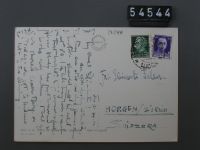
Forte dei Marmi, Ponte Caricatore
Caption
Postmark 24.8.1938
Caption (German)
Poststempel 24.8.1938
Record Name
Fel_054544-RE
Title (German)
Forte dei Marmi, Ponte Caricatore
Caption
Postmark 24.8.1938
Caption (German)
Poststempel 24.8.1938
Record Name
Fel_054544-VE
Title (German)
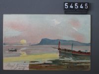
Palermo, Golfo di Palermo
Caption
Postmark 8.4.1913
Caption (German)
Poststempel 8.4.1913
Record Name
Fel_054545-RE

Title (German)
Palermo, Golfo di Palermo
Caption
Postmark 8.4.1913
Caption (German)
Poststempel 8.4.1913
Record Name
Fel_054545-VE

Title (German)
Catania, S. E. Cardinale G. Francica Nava, Arcirescovo
Caption
Postmark 24.9.1908
Caption (German)
Poststempel 24.9.1908
Record Name
Fel_054552-RE

Title (German)
Catania, S. E. Cardinale G. Francica Nava, Arcirescovo
Caption
Postmark 24.9.1908
Caption (German)
Poststempel 24.9.1908
Record Name
Fel_054552-VE

Title (German)
Dampfschiff, Esperia
Caption
Built in 1919/20 by Esercizio Bacini in Riva Trigoso for the Società Italiana di Servizi Marittimi in Venice. The luxuriously furnished steamer of a good 11,000 GRT was propelled by two screws, these by steam turbines. The ship changed owners several times, shortly before the war she was still sailing for the "Adriatica", an association of various shipping companies operating in the Adriatic area. During the war, the ship was used as a troop carrier for the Axis powers. During one such voyage from Naples to Tripoli, the "Esperia" was attacked by an English submarine with three torpedoes on August 20, 1941 and sank within 10 minutes. Postmark 22.3.1927
Caption (German)
Erbaut 1919/20 von Esercizio Bacini in Riva Trigoso für die Società Italiana di Servizi Marittimi in Venedig. Der luxuriös eingerichtete Dampfer von gut 11‘000 BRT wurde von zwei Schrauben angetrieben, diese von Dampfturbinen. Das Schiff wechselte mehrfach die Reederei, kurz vor dem Krieg lief sie noch für die "Adriatica", ein Zusammenschluss verschiedener im Gebiet der Adria tätiger Reedereien. Im Krieg wurde das Schiff für die Achsenmächte als Truppentransporter eingesetzt. Bei einer solchen Reise von Neapel nach Tripoli wurde die "Esperia" am 20. August 1941 von einem englischen U-Boot mit drei Torpedos angegriffen und versank innerhalb von 10 Minuten. Poststempel 22.3.1927
Record Name
Fel_054553-VE

Title (German)
Costume Valdese
Caption
Postmark 24.3.1951
Caption (German)
Poststempel 24.3.1951
Record Name
Fel_054562-RE

Title (German)
Costume Valdese
Caption
Postmark 24.3.1951
Caption (German)
Poststempel 24.3.1951
Record Name
Fel_054562-VE

Title (German)
Cortina d’Ampezzo, Terrazza e Piscina Pensile, del Grande Albergo Savoia
Caption
Postmark 31.1.1959
Caption (German)
Poststempel 31.1.1959
Record Name
Fel_054569-VE

Title (German)
Venezia, Chiesa della Salute
Caption
Postmark 12.1.1929
Caption (German)
Poststempel 12.1.1929
Record Name
Fel_054572-RE

Title (German)
Venezia, Chiesa della Salute
Caption
Postmark 12.1.1929
Caption (German)
Poststempel 12.1.1929
Record Name
Fel_054572-VE
Title (German)
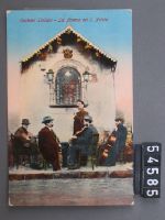
Costumi Siciliani, La Novena del S. Natale
Caption
Postmark 29.12.1922
Caption (German)
Poststempel 29.12.1922
Record Name
Fel_054585-RE

Title (German)
Costumi Siciliani, La Novena del S. Natale
Caption
Postmark 29.12.1922
Caption (German)
Poststempel 29.12.1922
Record Name
Fel_054585-VE

Title (German)
Venezia, Ponte dei Sospiri
Caption
Postmark 13.10.1935
Caption (German)
Poststempel 13.10.1935
Record Name
Fel_054586-RE
Title (German)
Venezia, Ponte dei Sospiri
Caption
Postmark 13.10.1935
Caption (German)
Poststempel 13.10.1935
Record Name
Fel_054586-VE

Title (German)
Pompei, Casa del Poeta tragico
Caption
Postmark 14.11.1927
Caption (German)
Poststempel 14.11.1927
Record Name
Fel_054587-RE

Title (German)
Pompei, Casa del Poeta tragico
Caption
Postmark 14.11.1927
Caption (German)
Poststempel 14.11.1927
Record Name
Fel_054587-VE

Title (German)
Riviera dei Fiori, Alassio, spiaggia di Ponente
Caption
Postmark 26.9.1953
Caption (German)
Poststempel 26.9.1953
Record Name
Fel_054596-RE

Title (German)
Riviera dei Fiori, Alassio, spiaggia di Ponente
Caption
Postmark 26.9.1953
Caption (German)
Poststempel 26.9.1953
Record Name
Fel_054596-VE

Title (German)
Roma, Campidoglio
Caption
Postmark 5.4.1952
Caption (German)
Poststempel 5.4.1952
Record Name
Fel_054607-RE

Title (German)
Roma, Campidoglio
Caption
Postmark 5.4.1952
Caption (German)
Poststempel 5.4.1952
Record Name
Fel_054607-VE

Title (German)
Cuneo, Largo Garibaldi
Caption
Postmark 26.8.1951
Caption (German)
Poststempel 26.8.1951
Record Name
Fel_054702-RE

Title (German)
Cuneo, Largo Garibaldi
Caption
Postmark 26.8.1951
Caption (German)
Poststempel 26.8.1951
Record Name
Fel_054702-VE

Title (German)
Porto Ischia, Pineta e Castello
Caption
Run around 1951
Caption (German)
Gelaufen um 1951
Record Name
Fel_054703-RE

Title (German)
Porto Ischia, Pineta e Castello
Caption
Run around 1951
Caption (German)
Gelaufen um 1951
Record Name
Fel_054703-VE
Title (German)
Ascoli Piceno, Porta della chiesa di S. Francesco (Cosi. del sec. XIV)
Caption
Not run
Caption (German)
Nicht gelaufen
Record Name
Fel_054706-VE

Title (German)
Ravenna, Basilica di S. Vitale, Interno, L‘Absidie, VI sec.
Caption
Not run
Caption (German)
Nicht gelaufen
Record Name
Fel_054709-RE

Title (German)
Ravenna, Basilica di S. Vitale, Interno, L‘Absidie, VI sec.
Caption
Not run
Caption (German)
Nicht gelaufen
Record Name
Fel_054709-VE

Title (German)
Ravenna, Mausoleo di Galla Placidia, Lunetta di fronte alla porta, S. Lorenzo (Musaico del V. sec.)
Caption
Not run
Caption (German)
Nicht gelaufen
Record Name
Fel_054710-RE

Title (German)
Ravenna, Mausoleo di Galla Placidia, Lunetta di fronte alla porta, S. Lorenzo (Musaico del V. sec.)
Caption
Not run
Caption (German)
Nicht gelaufen
Record Name
Fel_054710-VE

Title (German)
Ravenna, Mausoleo di Galla Placidia, L‘Interno, V sec.
Caption
Not run
Caption (German)
Nicht gelaufen
Record Name
Fel_054714-RE

Title (German)
Ravenna, Mausoleo di Galla Placidia, L‘Interno, V sec.
Caption
Not run
Caption (German)
Nicht gelaufen
Record Name
Fel_054714-VE

Title (German)
Ravenna, Basilica di S. Vitale, Interno con veduta parziale della Tribuna (VI sec)
Caption
Not run
Caption (German)
Nicht gelaufen
Record Name
Fel_054720-RE

Title (German)
Ravenna, Basilica di S. Vitale, Interno con veduta parziale della Tribuna (VI sec)
Caption
Not run
Caption (German)
Nicht gelaufen
Record Name
Fel_054720-VE

Title (German)
Lago Maggiore, Isola Bella Vista da Stresa
Caption
Message of the postcard: Thank you for the letter. The mistake lies with the B ? I have informed them that October 14 is impossible. So it can go forward with W ? . can go forward now. Would you ? . notify accordingly. Postmark 30.7.1949
Caption (German)
Botschaft der Postkarte: Danke für den Brief. Der Fehler leigt bei der B ?. Ich habe sie verständigt, dass der 14. Oktober unmöglich ist. Also kann es mit W ? . nun vorwärts gehen. Würdest Du ? . demgemäss verständigen. Poststempel 30.7.1949
Record Name
Fel_054731-RE

Title (German)
Lago Maggiore, Isola Bella Vista da Stresa
Caption
Message of the postcard: Thank you for the letter. The mistake lies with the B ? I have informed them that October 14 is impossible. So it can go forward with W ? . can go forward now. Would you ? . notify accordingly. Postmark 30.7.1949
Caption (German)
Botschaft der Postkarte: Danke für den Brief. Der Fehler leigt bei der B ?. Ich habe sie verständigt, dass der 14. Oktober unmöglich ist. Also kann es mit W ? . nun vorwärts gehen. Würdest Du ? . demgemäss verständigen. Poststempel 30.7.1949
Record Name
Fel_054731-VE

Title (German)
Venezia, S. Marco, Panorama
Caption
Postmark 10.10.1949
Caption (German)
Poststempel 10.10.1949
Record Name
Fel_054732-RE

Title (German)
Venezia, S. Marco, Panorama
Caption
Postmark 10.10.1949
Caption (German)
Poststempel 10.10.1949
Record Name
Fel_054732-VE

Title (German)
Catania, Via Etnea con la sondo dell Etna
Caption
Postmark 13.4.1947
Caption (German)
Poststempel 13.4.1947
Record Name
Fel_054736-RE

Title (German)
Catania, Via Etnea con la sondo dell Etna
Caption
Postmark 13.4.1947
Caption (German)
Poststempel 13.4.1947
Record Name
Fel_054736-VE

Title (German)
Padova, Abano Terme, La miglore Stazione Termale
Caption
Postmark 24.9.1950.
Caption (German)
Poststempel 24.9.1950.
Record Name
Fel_054741-RE

Title (German)
Padova, Abano Terme, La miglore Stazione Termale
Caption
Postmark 24.9.1950.
Caption (German)
Poststempel 24.9.1950.
Record Name
Fel_054741-VE

Title (German)
Taormina, Teatro greco-romano e l‘Etna, 3274 m
Caption
Postmark 26.9.1949
Caption (German)
Poststempel 26.9.1949
Record Name
Fel_054742-RE

Title (German)
Taormina, Teatro greco-romano e l‘Etna, 3274 m
Caption
Postmark 26.9.1949
Caption (German)
Poststempel 26.9.1949
Record Name
Fel_054742-VE

Title (German)
Catania, Schweizer Schule, 1930
Caption
Postmark 13.7.1930
Caption (German)
Poststempel 13.7.1930
Record Name
Fel_054744-RE

Title (German)
Catania, Schweizer Schule, 1930
Caption
Postmark 13.7.1930
Caption (German)
Poststempel 13.7.1930
Record Name
Fel_054744-VE

Title (German)
Urbino, Panorama della città visto dalla via maestra dei Cappuccini
Caption
Not run
Caption (German)
Nicht gelaufen
Record Name
Fel_054748-RE

Title (German)
Urbino, Panorama della città visto dalla via maestra dei Cappuccini
Caption
Not run
Caption (German)
Nicht gelaufen
Record Name
Fel_054748-VE

Title (German)
Perugia, Arco Etrusco e Universita Italiana per Stranieri
Caption
Postmark 8.11.1953
Caption (German)
Poststempel 8.11.1953
Record Name
Fel_054790-RE

Title (German)
Perugia, Arco Etrusco e Universita Italiana per Stranieri
Caption
Postmark 8.11.1953
Caption (German)
Poststempel 8.11.1953
Record Name
Fel_054790-VE

Title (German)
Perugia, Fontana Maggiore e Palazzo Comunale
Caption
Postmark 9.10.1952
Caption (German)
Poststempel 9.10.1952
Record Name
Fel_054792-RE

Title (German)
Perugia, Fontana Maggiore e Palazzo Comunale
Caption
Postmark 9.10.1952
Caption (German)
Poststempel 9.10.1952
Record Name
Fel_054792-VE

Title (German)
Perugia, Fontana Maggiore e Duomo
Caption
Run around 1952
Caption (German)
Gelaufen um 1952
Record Name
Fel_054793-RE

Title (German)
Perugia, Fontana Maggiore e Duomo
Caption
Run around 1952
Caption (German)
Gelaufen um 1952
Record Name
Fel_054793-VE

Title (German)
Perugia, Panorama da Monteripido
Caption
Postmark 19.10.1953
Caption (German)
Poststempel 19.10.1953
Record Name
Fel_054794-RE

Title (German)
Perugia, Panorama da Monteripido
Caption
Postmark 19.10.1953
Caption (German)
Poststempel 19.10.1953
Record Name
Fel_054794-VE

Title (German)
Perugia, Panorama parziale dai giardini pubblici
Caption
Run around 1953
Caption (German)
Gelaufen um 1953
Record Name
Fel_054795-RE

Title (German)
Perugia, Panorama parziale dai giardini pubblici
Caption
Run around 1953
Caption (German)
Gelaufen um 1953
Record Name
Fel_054795-VE

Title (German)
Perugia, Die S. Bernard Kirche
Caption
Postmark 26.8.1953
Caption (German)
Poststempel 26.8.1953
Record Name
Fel_054796-RE

Title (German)
Perugia, Die S. Bernard Kirche
Caption
Postmark 26.8.1953
Caption (German)
Poststempel 26.8.1953
Record Name
Fel_054796-VE

Title (German)
Perugia, Collegio del Gambio, Sala dell‘Udienza con gli affreschi del Perugino e li bancone di Dom del Tasso
Caption
Not run
Caption (German)
Nicht gelaufen
Record Name
Fel_054812-RE

Title (German)
Perugia, Collegio del Gambio, Sala dell‘Udienza con gli affreschi del Perugino e li bancone di Dom del Tasso
Caption
Not run
Caption (German)
Nicht gelaufen
Record Name
Fel_054812-VE

Title (German)
Roma, Der Kostantinsbogen, Arco Costantiono
Caption
Postmark 29.4.1953
Caption (German)
Poststempel 29.4.1953
Record Name
Fel_054826-RE

Title (German)
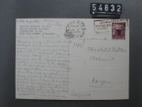
Roma, Der Kostantinsbogen, Arco Costantiono
Caption
Postmark 29.4.1953
Caption (German)
Poststempel 29.4.1953
Record Name
Fel_054826-VE

Title (German)
Città del Vaticano, St. Peterskirche = San Pietro
Caption
Postmark 26.4.1948
Caption (German)
Poststempel 26.4.1948
Record Name
Fel_054832-RE
Title (German)
Città del Vaticano, St. Peterskirche = San Pietro
Caption
Postmark 26.4.1948
Caption (German)
Poststempel 26.4.1948
Record Name
Fel_054832-VE

Title (German)
Roma, Olympisches Stadium = Stadio Olympico
Caption
Run around 1953
Caption (German)
Gelaufen um 1953
Record Name
Fel_054833-RE

Title (German)
Roma, Olympisches Stadium = Stadio Olympico
Caption
Run around 1953
Caption (German)
Gelaufen um 1953
Record Name
Fel_054833-VE

Title (German)
Roma, Foro Romano
Caption
Postmark 29.8.1950.
Caption (German)
Poststempel 29.8.1950.
Record Name
Fel_054835-RE

Title (German)
Roma, Foro Romano
Caption
Postmark 29.8.1950.
Caption (German)
Poststempel 29.8.1950.
Record Name
Fel_054835-VE

Title (German)
Roma, Tramonto
Caption
Run around 1951
Caption (German)
Gelaufen um 1951
Record Name
Fel_054836-RE
Title (German)
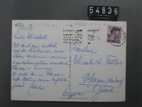
Roma, Tramonto
Caption
Run around 1951
Caption (German)
Gelaufen um 1951
Record Name
Fel_054836-VE

Title (German)
Roma, Gambidoglio
Caption
Run around 1952
Caption (German)
Gelaufen um 1952
Record Name
Fel_054837-RE

Title (German)
Roma, Gambidoglio
Caption
Run around 1952
Caption (German)
Gelaufen um 1952
Record Name
Fel_054837-VE

Title (German)
Città del Vaticano, St. Peter
Caption
Postmark 31.12.1953
Caption (German)
Poststempel 31.12.1953
Record Name
Fel_054838-RE

Title (German)
Città del Vaticano, St. Peter
Caption
Postmark 31.12.1953
Caption (German)
Poststempel 31.12.1953
Record Name
Fel_054838-VE

Title (German)
Roma, Cupola di S. Pietro
Caption
Postmark 17.10.1948
Caption (German)
Poststempel 17.10.1948
Record Name
Fel_054839-RE

Title (German)
Roma, Cupola di S. Pietro
Caption
Postmark 17.10.1948
Caption (German)
Poststempel 17.10.1948
Record Name
Fel_054839-VE

Title (German)
Roma, Tempio di Vesta
Caption
Postmark 20.3.1950
Caption (German)
Poststempel 20.3.1950
Record Name
Fel_054840-RE

Title (German)
Roma, Tempio di Vesta
Caption
Postmark 20.3.1950
Caption (German)
Poststempel 20.3.1950
Record Name
Fel_054840-VE

Title (German)
Roma, di notte, Fontana di Trevi
Caption
Postmark 9.8.1938
Caption (German)
Poststempel 9.8.1938
Record Name
Fel_054841-RE

Title (German)
Roma, di notte, Fontana di Trevi
Caption
Postmark 9.8.1938
Caption (German)
Poststempel 9.8.1938
Record Name
Fel_054841-VE

Title (German)
Verona, Basilica di S. Zeno Maggiore
Caption
Not run
Caption (German)
Nicht gelaufen
Record Name
Fel_054842-RE

Title (German)
Verona, Basilica di S. Zeno Maggiore
Caption
Not run
Caption (German)
Nicht gelaufen
Record Name
Fel_054842-VE

Title (German)
Verona, Basilica di S. Zeno Maggiore
Caption
Not run
Caption (German)
Nicht gelaufen
Record Name
Fel_054843-RE

Title (German)
Verona, Basilica di S. Zeno Maggiore
Caption
Not run
Caption (German)
Nicht gelaufen
Record Name
Fel_054843-VE

Title (German)
Verona, Basilica di S. Zeno, Bassorilievi laterali alla porta dell Facciata (XII sec.)
Caption
Not run
Caption (German)
Nicht gelaufen
Record Name
Fel_054844-RE

Title (German)
Verona, Basilica di S. Zeno, Bassorilievi laterali alla porta dell Facciata (XII sec.)
Caption
Not run
Caption (German)
Nicht gelaufen
Record Name
Fel_054844-VE

Title (German)
Verona, Basilica di S. Zeno Maggiore
Caption
Not run
Caption (German)
Nicht gelaufen
Record Name
Fel_054845-RE

Title (German)
Verona, Basilica di S. Zeno Maggiore
Caption
Not run
Caption (German)
Nicht gelaufen
Record Name
Fel_054845-VE

Title (German)
Verona, Basilica di S. Zeno Maggiore
Caption
Not run
Caption (German)
Nicht gelaufen
Record Name
Fel_054855-RE

Title (German)
Verona, Basilica di S. Zeno Maggiore
Caption
Not run
Caption (German)
Nicht gelaufen
Record Name
Fel_054855-VE

Title (German)
Venezia, Treghetto S. Marco
Caption
Postmark 1.10.1948
Caption (German)
Poststempel 1.10.1948
Record Name
Fel_054856-RE

Title (German)
Venezia, Treghetto S. Marco
Caption
Postmark 1.10.1948
Caption (German)
Poststempel 1.10.1948
Record Name
Fel_054856-VE

Title (German)
Venezia, Piazza e Chiesa S. Marco
Caption
Postmark 12.10.1950
Caption (German)
Poststempel 12.10.1950
Record Name
Fel_054865-RE

Title (German)
Venezia, Piazza e Chiesa S. Marco
Caption
Postmark 12.10.1950
Caption (German)
Poststempel 12.10.1950
Record Name
Fel_054865-VE

Title (German)
Paestum, Tempio cosiddetta Basilica
Caption
Not run
Caption (German)
Nicht gelaufen
Record Name
Fel_054908-VE

Title (German)
Orvieto, Scrocio Panoramico
Caption
Postmark 8.10.1932
Caption (German)
Poststempel 8.10.1932
Record Name
Fel_054931-RE

Title (German)
Orvieto, Scrocio Panoramico
Caption
Postmark 8.10.1932
Caption (German)
Poststempel 8.10.1932
Record Name
Fel_054931-VE

Title (German)
Bologna, Chiesa di S. Petronius, Porta Maggiore
Caption
Not run
Caption (German)
Nicht gelaufen
Record Name
Fel_054944-VE

Title (German)
Firenze, Basilica di S. Croce, Il secondo Chiostro
Caption
Not run
Caption (German)
Nicht gelaufen
Record Name
Fel_054946-RE

Title (German)
Firenze, Basilica di S. Croce, Il secondo Chiostro
Caption
Not run
Caption (German)
Nicht gelaufen
Record Name
Fel_054946-VE

Title (German)
Firenze, Basilica di S. Croce, Il Chiostro con la Cappella Pazzi e il Campanile
Caption
Not run
Caption (German)
Nicht gelaufen
Record Name
Fel_054947-RE

Title (German)
Firenze, Basilica di S. Croce, Il Chiostro con la Cappella Pazzi e il Campanile
Caption
Not run
Caption (German)
Nicht gelaufen
Record Name
Fel_054947-VE

Title (German)
Firenze, Basilica di S. Croce, L‘interno, Riedificato da Arnolfo di Cambio
Caption
Not run
Caption (German)
Nicht gelaufen
Record Name
Fel_054949-RE

Title (German)
Firenze, Basilica di S. Croce, L‘interno, Riedificato da Arnolfo di Cambio
Caption
Not run
Caption (German)
Nicht gelaufen
Record Name
Fel_054949-VE

Title (German)
Siena, Cattedrale, Il Paradiso, Dettaglio del Pulpito
Caption
Not run
Caption (German)
Nicht gelaufen
Record Name
Fel_054993-RE

Title (German)
Siena, Cattedrale, Il Paradiso, Dettaglio del Pulpito
Caption
Not run
Caption (German)
Nicht gelaufen
Record Name
Fel_054993-VE

Title (German)
Siena, Cattedrale (Libreria Piccolomini), Enea Piccolomini è fatto Cardinale dal Papa Calisto III
Caption
Not run
Caption (German)
Nicht gelaufen
Record Name
Fel_054994-RE

Title (German)
Siena, Cattedrale (Libreria Piccolomini), Enea Piccolomini è fatto Cardinale dal Papa Calisto III
Caption
Not run
Caption (German)
Nicht gelaufen
Record Name
Fel_054994-VE

Title (German)
Cosenza, Panorama
Caption
Postmark 6.3.1952
Caption (German)
Poststempel 6.3.1952
Record Name
Fel_055038-RE

Title (German)
Cosenza, Panorama
Caption
Postmark 6.3.1952
Caption (German)
Poststempel 6.3.1952
Record Name
Fel_055038-VE

Title (German)
Firenze, S. Gimignano, Porta S. Giovanni
Caption
Postmark 19.9.1953
Caption (German)
Poststempel 19.9.1953
Record Name
Fel_055050-RE

Title (German)
Firenze, S. Gimignano, Porta S. Giovanni
Caption
Postmark 19.9.1953
Caption (German)
Poststempel 19.9.1953
Record Name
Fel_055050-VE

Title (German)
Catania, Via Etnea, Sullo sfondo l‘Etna
Caption
Postmark 2.4.1952
Caption (German)
Poststempel 2.4.1952
Record Name
Fel_055058-RE

Title (German)
Catania, Via Etnea, Sullo sfondo l‘Etna
Caption
Postmark 2.4.1952
Caption (German)
Poststempel 2.4.1952
Record Name
Fel_055058-VE

Title (German)
Catania, Ritorno dal mercato
Caption
Postmark 2.4.1952
Caption (German)
Poststempel 2.4.1952
Record Name
Fel_055059-RE

Title (German)
Catania, Ritorno dal mercato
Caption
Postmark 2.4.1952
Caption (German)
Poststempel 2.4.1952
Record Name
Fel_055059-VE

Title (German)
Catania, L‘Etna visto dalla Villa Bellini
Caption
Postmark 25.12.1953
Caption (German)
Poststempel 25.12.1953
Record Name
Fel_055063-RE

Title (German)
Catania, L‘Etna visto dalla Villa Bellini
Caption
Postmark 25.12.1953
Caption (German)
Poststempel 25.12.1953
Record Name
Fel_055063-VE

Title (German)
Catania, Il Duomo
Caption
Postmark 30.12.1951
Caption (German)
Poststempel 30.12.1951
Record Name
Fel_055064-RE

Title (German)
Catania, Il Duomo
Caption
Postmark 30.12.1951
Caption (German)
Poststempel 30.12.1951
Record Name
Fel_055064-VE

Title (German)
Vicenza, Ponte S. Michele (Arch. G.B. Albanese 1621)
Caption
Run around 1953
Caption (German)
Gelaufen um 1953
Record Name
Fel_055073-RE

Title (German)
Vicenza, Ponte S. Michele (Arch. G.B. Albanese 1621)
Caption
Run around 1953
Caption (German)
Gelaufen um 1953
Record Name
Fel_055073-VE

Title (German)
Isola d‘Ischia, Panorama
Caption
Postmark 5.8.1950.
Caption (German)
Poststempel 5.8.1950.
Record Name
Fel_055076-RE

Title (German)
Isola d‘Ischia, Panorama
Caption
Postmark 5.8.1950.
Caption (German)
Poststempel 5.8.1950.
Record Name
Fel_055076-VE

Title (German)
Porto D‘Ischia, Panorama
Caption
Postmark 28.4.1953
Caption (German)
Poststempel 28.4.1953
Record Name
Fel_055079-RE

Title (German)
Porto D‘Ischia, Panorama
Caption
Postmark 28.4.1953
Caption (German)
Poststempel 28.4.1953
Record Name
Fel_055079-VE
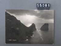
Title (German)
Capri, Faraglioni
Caption
Run around 1953
Caption (German)
Gelaufen um 1953
Record Name
Fel_055081-RE

Title (German)
Capri, Faraglioni
Caption
Run around 1953
Caption (German)
Gelaufen um 1953
Record Name
Fel_055081-VE

Title (German)
Napoli, Panorama
Caption
Run around 1951
Caption (German)
Gelaufen um 1951
Record Name
Fel_055131-RE

Title (German)
Napoli, Panorama
Caption
Run around 1951
Caption (German)
Gelaufen um 1951
Record Name
Fel_055131-VE

Title (German)
Pompei, Tempio di Giove
Caption
Postmark 14.5.1949
Caption (German)
Poststempel 14.5.1949
Record Name
Fel_055136-RE

Title (German)
Pompei, Tempio di Giove
Caption
Postmark 14.5.1949
Caption (German)
Poststempel 14.5.1949
Record Name
Fel_055136-VE

Title (German)
Milano, Galleria
Caption
Postmark 20.11.1949
Caption (German)
Poststempel 20.11.1949
Record Name
Fel_055146-RE

Title (German)
Milano, Galleria
Caption
Postmark 20.11.1949
Caption (German)
Poststempel 20.11.1949
Record Name
Fel_055146-VE

Title (German)
Lago Maggiore, Castelli di Cannero
Caption
Postmark 6.9.1938
Caption (German)
Poststempel 6.9.1938
Record Name
Fel_055147-RE

Title (German)
Lago Maggiore, Castelli di Cannero
Caption
Postmark 6.9.1938
Caption (German)
Poststempel 6.9.1938
Record Name
Fel_055147-VE

Title (German)
Monreale, Chiostro dei Benedettini, Fontana
Caption
Postmark 28.3.1952
Caption (German)
Poststempel 28.3.1952
Record Name
Fel_055151-RE

Title (German)
Monreale, Chiostro dei Benedettini, Fontana
Caption
Postmark 28.3.1952
Caption (German)
Poststempel 28.3.1952
Record Name
Fel_055151-VE

Title (German)
Torino, Reale Basilica di Superga e Monumento a Umberto I
Caption
Postmark 11.7.1939
Caption (German)
Poststempel 11.7.1939
Record Name
Fel_055167-RE

Title (German)
Torino, Reale Basilica di Superga e Monumento a Umberto I
Caption
Postmark 11.7.1939
Caption (German)
Poststempel 11.7.1939
Record Name
Fel_055167-VE

Title (German)
Rapallo, Scogliera
Caption
Postmark 5.10.1949
Caption (German)
Poststempel 5.10.1949
Record Name
Fel_055172-RE

Title (German)
Rapallo, Scogliera
Caption
Postmark 5.10.1949
Caption (German)
Poststempel 5.10.1949
Record Name
Fel_055172-VE

Title (German)
Viareggio, Festa di Luci
Caption
Run around 1951; night shot
Caption (German)
Gelaufen um 1951; Nachtaufnahme
Record Name
Fel_055173-RE

Title (German)
Viareggio, Festa di Luci
Caption
Run around 1951; night shot
Caption (German)
Gelaufen um 1951; Nachtaufnahme
Record Name
Fel_055173-VE

Title (German)
Praly, 1450 m, Agape Ghigou e le Alpi
Caption
Postmark 4.8.1950
Caption (German)
Poststempel 4.8.1950
Record Name
Fel_055199-RE
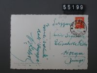
Title (German)
Praly, 1450 m, Agape Ghigou e le Alpi
Caption
Postmark 4.8.1950
Caption (German)
Poststempel 4.8.1950
Record Name
Fel_055199-VE

Title (German)
Sirmione, Approdo solitario
Caption
Postmark 15.10.1959
Caption (German)
Poststempel 15.10.1959
Record Name
Fel_055214-VE

Title (German)
Castel Gandolfo, Palazzo Pontificio
Caption
Postmark 14.9.1950
Caption (German)
Poststempel 14.9.1950
Record Name
Fel_055220-RE

Title (German)
Castel Gandolfo, Palazzo Pontificio
Caption
Postmark 14.9.1950
Caption (German)
Poststempel 14.9.1950
Record Name
Fel_055220-VE

Title (German)
Sottomarina, Luci ed ombre
Caption
Postmark 12.8.1956
Caption (German)
Poststempel 12.8.1956
Record Name
Fel_055227-RE

Title (German)
Sottomarina, Luci ed ombre
Caption
Postmark 12.8.1956
Caption (German)
Poststempel 12.8.1956
Record Name
Fel_055227-VE

Title (German)
Bordighera, Notturno
Caption
Postmark 13.4.1939
Caption (German)
Poststempel 13.4.1939
Record Name
Fel_055233-RE

Title (German)
Bordighera, Notturno
Caption
Postmark 13.4.1939
Caption (German)
Poststempel 13.4.1939
Record Name
Fel_055233-VE

Title (German)
S. Margherita, Ligure, Panorama
Caption
Postmark 13.9.1944
Caption (German)
Poststempel 13.9.1944
Record Name
Fel_055234-RE

Title (German)
S. Margherita, Ligure, Panorama
Caption
Postmark 13.9.1944
Caption (German)
Poststempel 13.9.1944
Record Name
Fel_055234-VE

Title (German)
Dolomiti, Campi di sci a Passo Sellsa, rifugio Valentini colle cime Grohmann e Cinque Dita
Caption
Postmark 31.12.1939
Caption (German)
Poststempel 31.12.1939
Record Name
Fel_055236-RE

Title (German)
Dolomiti, Campi di sci a Passo Sellsa, rifugio Valentini colle cime Grohmann e Cinque Dita
Caption
Postmark 31.12.1939
Caption (German)
Poststempel 31.12.1939
Record Name
Fel_055236-VE

Title (German)
Como, Panorama
Caption
Postmark 22.7.1939
Caption (German)
Poststempel 22.7.1939
Record Name
Fel_055241-RE

Title (German)
Como, Panorama
Caption
Postmark 22.7.1939
Caption (German)
Poststempel 22.7.1939
Record Name
Fel_055241-VE

Title (German)
Nervi, Porticiuola
Caption
Postmark 8.4.1949
Caption (German)
Poststempel 8.4.1949
Record Name
Fel_055274-RE

Title (German)
Nervi, Porticiuola
Caption
Postmark 8.4.1949
Caption (German)
Poststempel 8.4.1949
Record Name
Fel_055274-VE

Title (German)
Forte dei Marmi, Mare e Monti
Caption
Postmark 2.8.1951
Caption (German)
Poststempel 2.8.1951
Record Name
Fel_055275-RE

Title (German)
Forte dei Marmi, Mare e Monti
Caption
Postmark 2.8.1951
Caption (German)
Poststempel 2.8.1951
Record Name
Fel_055275-VE

Title (German)
Fiesole, S. Francesco, chiostrino della Sacrestia
Caption
Postmark 16.4.1952
Caption (German)
Poststempel 16.4.1952
Record Name
Fel_055278-RE

Title (German)
Fiesole, S. Francesco, chiostrino della Sacrestia
Caption
Postmark 16.4.1952
Caption (German)
Poststempel 16.4.1952
Record Name
Fel_055278-VE

Title (German)
Paestum, Tempio di Ceres e colonna votiva
Caption
Postmark 25.5.1951
Caption (German)
Poststempel 25.5.1951
Record Name
Fel_055362-RE

Title (German)
Paestum, Tempio di Ceres e colonna votiva
Caption
Postmark 25.5.1951
Caption (German)
Poststempel 25.5.1951
Record Name
Fel_055362-VE

Title (German)
Napoli, La Piazza Cavour
Caption
Message of the postcard: My dear parents. Had good passage from Marseille . Here it makes nice and warm. Tomorrow Sunday I will be back in Catania. Postmark 12.12.1904.
Caption (German)
Botschaft der Postkarte: Meine liebe Eltern. Hatte gute Überfahrt von Marseille . Hier macht es schön warm. Morgen Sonntag bin ich in Catania zurück. Poststempel 12.12.1904.
Record Name
Fel_055633-RE

Title (German)
Napoli, La Piazza Cavour
Caption
Message of the postcard: My dear parents. Had good passage from Marseille . Here it makes nice and warm. Tomorrow Sunday I will be back in Catania. Postmark 12.12.1904.
Caption (German)
Botschaft der Postkarte: Meine liebe Eltern. Hatte gute Überfahrt von Marseille . Hier macht es schön warm. Morgen Sonntag bin ich in Catania zurück. Poststempel 12.12.1904.
Record Name
Fel_055633-VE

Title (German)
Napoli, Panorama della Citta visto dalla Tomba di Virgillo
Caption
Postcard message: thunderstorm and downpour. Postmark 25.8.1908
Caption (German)
Botschaft der Postkarte: Gewitter und Platzregen. Poststempel 25.8.1908
Record Name
Fel_055634-RE

Title (German)
Napoli, Panorama della Citta visto dalla Tomba di Virgillo
Caption
Postcard message: thunderstorm and downpour. Postmark 25.8.1908
Caption (German)
Botschaft der Postkarte: Gewitter und Platzregen. Poststempel 25.8.1908
Record Name
Fel_055634-VE

Title (German)
Napoli, Via Santa Lucia
Caption
Postmark 25.8.1908
Caption (German)
Poststempel 25.8.1908
Record Name
Fel_055635-RE

Title (German)
Napoli, Via Santa Lucia
Caption
Postmark 25.8.1908
Caption (German)
Poststempel 25.8.1908
Record Name
Fel_055635-VE

Title (German)
Napoli, Santa Lucia
Caption
Message of the postcard: Back on Italian soil. Return to Catania tomorrow. Postmark 12.12.1904.
Caption (German)
Botschaft der Postkarte: Wieder auf italienischem Boden. Morgen nach Catania retour. Poststempel 12.12.1904.
Record Name
Fel_055636-RE

Title (German)
Napoli, Santa Lucia
Caption
Message of the postcard: Back on Italian soil. Return to Catania tomorrow. Postmark 12.12.1904.
Caption (German)
Botschaft der Postkarte: Wieder auf italienischem Boden. Morgen nach Catania retour. Poststempel 12.12.1904.
Record Name
Fel_055636-VE

Title (German)
Napoli, Castello dell’Ovo con vista del Vesuvio
Caption
Message of the postcard: Dear Käthi Now we are already a bit closer home. If we didn't have two lovely children, we would still be on vacation. Many greetings to Gom. Postmark 3.5.1930.
Caption (German)
Botschaft der Postkarte: Liebes Käthi Jetzt sind wir schon wieder einen Bitz näher daheime. Wenn wir nicht zwei liebi Chindli hätten, so würden wir noch weiter Ferien machen. Viele Grüsse an Gom. Poststempel 3.5.1930.
Record Name
Fel_055637-RE

Title (German)
Napoli, Castello dell’Ovo con vista del Vesuvio
Caption
Message of the postcard: Dear Käthi Now we are already a bit closer home. If we didn't have two lovely children, we would still be on vacation. Many greetings to Gom. Postmark 3.5.1930.
Caption (German)
Botschaft der Postkarte: Liebes Käthi Jetzt sind wir schon wieder einen Bitz näher daheime. Wenn wir nicht zwei liebi Chindli hätten, so würden wir noch weiter Ferien machen. Viele Grüsse an Gom. Poststempel 3.5.1930.
Record Name
Fel_055637-VE

Title (German)
Napoli, Via Caracciolo
Caption
Postmark 3.5.1903
Caption (German)
Poststempel 3.5.1903
Record Name
Fel_055638-RE

Title (German)
Napoli, Via Caracciolo
Caption
Postmark 3.5.1903
Caption (German)
Poststempel 3.5.1903
Record Name
Fel_055638-VE

Title (German)
Napoli, Colonna dei Martiri e Chiesa Evangelica Scozzese
Caption
Postmark 27.9.1903
Caption (German)
Poststempel 27.9.1903
Record Name
Fel_055639-RE

Title (German)
Napoli, Colonna dei Martiri e Chiesa Evangelica Scozzese
Caption
Postmark 27.9.1903
Caption (German)
Poststempel 27.9.1903
Record Name
Fel_055639-VE

Title (German)
Napoli, Capodimonte
Caption
Postmark 3.7.1903
Caption (German)
Poststempel 3.7.1903
Record Name
Fel_055640-RE

Title (German)
Napoli, Capodimonte
Caption
Postmark 3.7.1903
Caption (German)
Poststempel 3.7.1903
Record Name
Fel_055640-VE

Title (German)
Formia, Spiaggia di levante
Caption
Postmark 14.1.1924
Caption (German)
Poststempel 14.1.1924
Record Name
Fel_055641-RE

Title (German)
Formia, Spiaggia di levante
Caption
Postmark 14.1.1924
Caption (German)
Poststempel 14.1.1924
Record Name
Fel_055641-VE

Title (German)
Pompei, Arco di Trionfo e foro
Caption
Postmark 27.10.1906
Caption (German)
Poststempel 27.10.1906
Record Name
Fel_055642-RE

Title (German)
Pompei, Arco di Trionfo e foro
Caption
Postmark 27.10.1906
Caption (German)
Poststempel 27.10.1906
Record Name
Fel_055642-VE

Title (German)
Pompej, Casa dei Vettji
Caption
Message of the postcard: For the first time in Pompeii. Postmark 27.10.1906
Caption (German)
Botschaft der Postkarte: Zum ersten Mal in Pompej. Poststempel 27.10.1906
Record Name
Fel_055643-RE

Title (German)
Pompej, Casa dei Vettji
Caption
Message of the postcard: For the first time in Pompeii. Postmark 27.10.1906
Caption (German)
Botschaft der Postkarte: Zum ersten Mal in Pompej. Poststempel 27.10.1906
Record Name
Fel_055643-VE

Title (German)
Vesuvio veduto da mare, Torre del Greco, Eruzione Aprile 1906
Caption
Postcard message: Left yesterday & slowly going up through Italy now. Will be home during the next week, probably around Wednesday. Postmark 5.10.1908.
Caption (German)
Botschaft der Postkarte: Bin gestern abgereist & langsam geht es nun durch Italien hinauf. Komme im Laufe der nächsten Woche heim, wahrscheinlich gegen Mittwoch. Poststempel 5.10.1908.
Record Name
Fel_055644-RE

Title (German)
Vesuvio veduto da mare, Torre del Greco, Eruzione Aprile 1906
Caption
Postcard message: Left yesterday & slowly going up through Italy now. Will be home during the next week, probably around Wednesday. Postmark 5.10.1908.
Caption (German)
Botschaft der Postkarte: Bin gestern abgereist & langsam geht es nun durch Italien hinauf. Komme im Laufe der nächsten Woche heim, wahrscheinlich gegen Mittwoch. Poststempel 5.10.1908.
Record Name
Fel_055644-VE

Title (German)
Paris, La Gare d’Orléans et le Quai d’Orsay
Caption
Message of the postcard: Dear Tsi Tsi Now I've already moved a little closer & soon we'll see each other again. Think, I sit just on a completely golden chair, in a splendidly large writing room, and everything shines like in a small firework. Now I will like it twice as much on the Stotzweid. Postmark 30.10.1919
Caption (German)
Botschaft der Postkarte: Liebes Tsi Tsi Jetzt bin ich schon wieder etwas näher gerückt & bald schon sehen wir uns wieder. Denk dir, ich sitze gerade auf einem ganz goldenen Stuhl, in einem prächtig grossen Schreibzimmer, und alles glänzt wie in einem kleinen Feuerwerk. Jetzt wirds mir dann auf der Stotzweid gerade doppelt gut gefallen. Poststempel 30.10.1919
Record Name
Fel_056014-RE

Title (German)
Paris, La Gare d’Orléans et le Quai d’Orsay
Caption
Message of the postcard: Dear Tsi Tsi Now I've already moved a little closer & soon we'll see each other again. Think, I sit just on a completely golden chair, in a splendidly large writing room, and everything shines like in a small firework. Now I will like it twice as much on the Stotzweid. Postmark 30.10.1919
Caption (German)
Botschaft der Postkarte: Liebes Tsi Tsi Jetzt bin ich schon wieder etwas näher gerückt & bald schon sehen wir uns wieder. Denk dir, ich sitze gerade auf einem ganz goldenen Stuhl, in einem prächtig grossen Schreibzimmer, und alles glänzt wie in einem kleinen Feuerwerk. Jetzt wirds mir dann auf der Stotzweid gerade doppelt gut gefallen. Poststempel 30.10.1919
Record Name
Fel_056014-VE

Title (German)
Paris, La Colonne du Juillet, Place de la Bastille
Caption
Not run
Caption (German)
Nicht gelaufen
Record Name
Fel_056015-RE

Title (German)
Paris, La Colonne du Juillet, Place de la Bastille
Caption
Not run
Caption (German)
Nicht gelaufen
Record Name
Fel_056015-VE

Title (German)
Paris, Le Boulevard Montmartre
Caption
Not run
Caption (German)
Nicht gelaufen
Record Name
Fel_056016-RE

Title (German)
Paris, Le Boulevard Montmartre
Caption
Not run
Caption (German)
Nicht gelaufen
Record Name
Fel_056016-VE

Title (German)
Paris, Hôtel-de-Ville, La Salle des Fêtes
Caption
Not run
Caption (German)
Nicht gelaufen
Record Name
Fel_056017-RE

Title (German)
Paris, Hôtel-de-Ville, La Salle des Fêtes
Caption
Not run
Caption (German)
Nicht gelaufen
Record Name
Fel_056017-VE

Title (German)
Paris, Rue de Vaugirard, prise du Boulevard Montparnasse
Caption
Not run
Caption (German)
Nicht gelaufen
Record Name
Fel_056018-RE

Title (German)
Paris, Rue de Vaugirard, prise du Boulevard Montparnasse
Caption
Not run
Caption (German)
Nicht gelaufen
Record Name
Fel_056018-VE

Title (German)
Paris, Panorama du Pont et de la Place de la Concorde, Vue prise de la Chambre des Députés
Caption
Not run
Caption (German)
Nicht gelaufen
Record Name
Fel_056019-RE

Title (German)
Paris, Panorama du Pont et de la Place de la Concorde, Vue prise de la Chambre des Députés
Caption
Not run
Caption (German)
Nicht gelaufen
Record Name
Fel_056019-VE

Title (German)
Paris, Les Buttes-Chaumont, Le Pont suspendu et le Belvédère
Caption
Not run
Caption (German)
Nicht gelaufen
Record Name
Fel_056020-RE

Title (German)
Paris, Les Buttes-Chaumont, Le Pont suspendu et le Belvédère
Caption
Not run
Caption (German)
Nicht gelaufen
Record Name
Fel_056020-VE

Title (German)
Paris, Le Bassin du Luxembourg
Caption
Not run
Caption (German)
Nicht gelaufen
Record Name
Fel_056021-RE

Title (German)
Paris, Le Bassin du Luxembourg
Caption
Not run
Caption (German)
Nicht gelaufen
Record Name
Fel_056021-VE

Title (German)
Paris, Perspective des Invalides et Pont Alexandre III
Caption
Not run
Caption (German)
Nicht gelaufen
Record Name
Fel_056022-RE

Title (German)
Paris, Perspective des Invalides et Pont Alexandre III
Caption
Not run
Caption (German)
Nicht gelaufen
Record Name
Fel_056022-VE

Title (German)
Paris, L’Arc de Triomphe
Caption
Postmark 13.6.1909
Caption (German)
Poststempel 13.6.1909
Record Name
Fel_056023-RE

Title (German)
Paris, L’Arc de Triomphe
Caption
Postmark 13.6.1909
Caption (German)
Poststempel 13.6.1909
Record Name
Fel_056023-VE

Title (German)
Paris, Les Champs-Élysées
Caption
Message of the postcard: Presumably we will arrive on Sunday evening 7 o'clock & could by Direkte in Berne, it would be pleasant to us if we (because much luggage) at the station Berne would be fetched, otherwise we would go at 7 o'clock 25 min. ach Bümpliz, upper station, where likewise someone could expect us. Postmark 14.10.1910
Caption (German)
Botschaft der Postkarte: Voraussichtlich werden wir am Sonntag Abend 7 Uhr & könnten per Direkte in Bern eintreffen, es wäre uns angenehm, wenn wir (weil viel Gepäck) am Bahnhof Bern abgeholt würden, ansonst wir um 7 Uhr 25 Min.ach Bümpliz, obere Station fahren würden, wo uns ebenfalls jemand erwarten könnte. Poststempel 14.10.1910
Record Name
Fel_056024-RE

Title (German)
Paris, Les Champs-Élysées
Caption
Message of the postcard: Presumably we will arrive on Sunday evening 7 o'clock & could by Direkte in Berne, it would be pleasant to us if we (because much luggage) at the station Berne would be fetched, otherwise we would go at 7 o'clock 25 min. ach Bümpliz, upper station, where likewise someone could expect us. Postmark 14.10.1910
Caption (German)
Botschaft der Postkarte: Voraussichtlich werden wir am Sonntag Abend 7 Uhr & könnten per Direkte in Bern eintreffen, es wäre uns angenehm, wenn wir (weil viel Gepäck) am Bahnhof Bern abgeholt würden, ansonst wir um 7 Uhr 25 Min.ach Bümpliz, obere Station fahren würden, wo uns ebenfalls jemand erwarten könnte. Poststempel 14.10.1910
Record Name
Fel_056024-VE

Title (German)
Paris, En flanant, Perspective sur la Place du Carrousel
Caption
Postmark 28.4.1931
Caption (German)
Poststempel 28.4.1931
Record Name
Fel_056025-RE

Title (German)
Paris, En flanant, Perspective sur la Place du Carrousel
Caption
Postmark 28.4.1931
Caption (German)
Poststempel 28.4.1931
Record Name
Fel_056025-VE

Title (German)
Paris, Le Lac Daumesnil, Au Bois de Vincennes
Caption
Postmark 8.6.1905
Caption (German)
Poststempel 8.6.1905
Record Name
Fel_056026-RE

Title (German)
Paris, Le Lac Daumesnil, Au Bois de Vincennes
Caption
Postmark 8.6.1905
Caption (German)
Poststempel 8.6.1905
Record Name
Fel_056026-VE

Title (German)
Paris, Fontaine Carpeaux
Caption
Postmark 22.1.1907
Caption (German)
Poststempel 22.1.1907
Record Name
Fel_056027-RE

Title (German)
Paris, Fontaine Carpeaux
Caption
Postmark 22.1.1907
Caption (German)
Poststempel 22.1.1907
Record Name
Fel_056027-VE

Title (German)
Paris, Place de Rennes, prise de la rue de l’Arivée
Caption
Run around 1907
Caption (German)
Gelaufen um 1907
Record Name
Fel_056028-RE

Title (German)
Paris, Place de Rennes, prise de la rue de l’Arivée
Caption
Run around 1907
Caption (German)
Gelaufen um 1907
Record Name
Fel_056028-VE

Title (German)
Paris, Hôtel de Ville et Pont d’Arcole
Caption
Postmark 23.5.1905
Caption (German)
Poststempel 23.5.1905
Record Name
Fel_056029-RE

Title (German)
Paris, Hôtel de Ville et Pont d’Arcole
Caption
Postmark 23.5.1905
Caption (German)
Poststempel 23.5.1905
Record Name
Fel_056029-VE

Title (German)
Paris, Le Pont au Change et le Palais de Justice
Caption
Postmark 24.1.1907
Caption (German)
Poststempel 24.1.1907
Record Name
Fel_056030-RE

Title (German)
Paris, Le Pont au Change et le Palais de Justice
Caption
Postmark 24.1.1907
Caption (German)
Poststempel 24.1.1907
Record Name
Fel_056030-VE

Title (German)
Paris, La Bourse
Caption
Postmark 1.5.1906
Caption (German)
Poststempel 1.5.1906
Record Name
Fel_056031-RE

Title (German)
Paris, La Bourse
Caption
Postmark 1.5.1906
Caption (German)
Poststempel 1.5.1906
Record Name
Fel_056031-VE

Title (German)
Paris, Gare de l’Est
Caption
Postmark 1.5.1906
Caption (German)
Poststempel 1.5.1906
Record Name
Fel_056032-RE

Title (German)
Paris, Gare de l’Est
Caption
Postmark 1.5.1906
Caption (German)
Poststempel 1.5.1906
Record Name
Fel_056032-VE

Title (German)
Paris, Tour Eiffel
Caption
Postmark 27.4.1906
Caption (German)
Poststempel 27.4.1906
Record Name
Fel_056033-RE

Title (German)
Paris, Tour Eiffel
Caption
Postmark 27.4.1906
Caption (German)
Poststempel 27.4.1906
Record Name
Fel_056033-VE

Title (German)
Paris, La Place et la Colonne Vendôme
Caption
Postmark 1.5.1906
Caption (German)
Poststempel 1.5.1906
Record Name
Fel_056034-RE

Title (German)
Paris, La Place et la Colonne Vendôme
Caption
Postmark 1.5.1906
Caption (German)
Poststempel 1.5.1906
Record Name
Fel_056034-VE

Title (German)
Paris, Tour Saint-Jacques
Caption
Postmark 1.5.1906
Caption (German)
Poststempel 1.5.1906
Record Name
Fel_056035-RE

Title (German)
Paris, Tour Saint-Jacques
Caption
Postmark 1.5.1906
Caption (German)
Poststempel 1.5.1906
Record Name
Fel_056035-VE

Title (German)
Paris, Place de la Bastille et Colonne de Juillet
Caption
Postmark 23.4.1906
Caption (German)
Poststempel 23.4.1906
Record Name
Fel_056036-RE

Title (German)
Paris, Place de la Bastille et Colonne de Juillet
Caption
Postmark 23.4.1906
Caption (German)
Poststempel 23.4.1906
Record Name
Fel_056036-VE

Title (German)
Paris, Arc de Triomphe de l’Etoile
Caption
Postmark 1.5.1906
Caption (German)
Poststempel 1.5.1906
Record Name
Fel_056037-RE

Title (German)
Paris, Arc de Triomphe de l’Etoile
Caption
Postmark 1.5.1906
Caption (German)
Poststempel 1.5.1906
Record Name
Fel_056037-VE

Title (German)
Paris, L’Arc de Triomphe de la Victoire, Place du Carrousel
Caption
Postmark 1.5.1906
Caption (German)
Poststempel 1.5.1906
Record Name
Fel_056038-RE

Title (German)
Paris, L’Arc de Triomphe de la Victoire, Place du Carrousel
Caption
Postmark 1.5.1906
Caption (German)
Poststempel 1.5.1906
Record Name
Fel_056038-VE

Title (German)
Paris, le funiculaire de Montmartre et le Sacré-Coeur
Caption
Postmark 27.9.1906
Caption (German)
Poststempel 27.9.1906
Record Name
Fel_056039-RE

Title (German)
Paris, le funiculaire de Montmartre et le Sacré-Coeur
Caption
Postmark 27.9.1906
Caption (German)
Poststempel 27.9.1906
Record Name
Fel_056039-VE

Title (German)
Paris, Jardin de Luxembourg
Caption
Postmark 1.5.1906
Caption (German)
Poststempel 1.5.1906
Record Name
Fel_056040-RE

Title (German)
Paris, Jardin de Luxembourg
Caption
Postmark 1.5.1906
Caption (German)
Poststempel 1.5.1906
Record Name
Fel_056040-VE

Title (German)
Paris, Les Invalides, Le Tombeau de Napoléon
Caption
Postmark 29.4.1931
Caption (German)
Poststempel 29.4.1931
Record Name
Fel_056041-RE

Title (German)
Paris, Les Invalides, Le Tombeau de Napoléon
Caption
Postmark 29.4.1931
Caption (German)
Poststempel 29.4.1931
Record Name
Fel_056041-VE

Title (German)
Paris, Musée du Luxembourg, La Galerie des Sculptures
Caption
Not run
Caption (German)
Nicht gelaufen
Record Name
Fel_056042-RE

Title (German)
Paris, Musée du Luxembourg, La Galerie des Sculptures
Caption
Not run
Caption (German)
Nicht gelaufen
Record Name
Fel_056042-VE

Title (German)
Paris, Le Grand Palais
Caption
Not run
Caption (German)
Nicht gelaufen
Record Name
Fel_056043-RE

Title (German)
Paris, Le Grand Palais
Caption
Not run
Caption (German)
Nicht gelaufen
Record Name
Fel_056043-VE

Title (German)
Paris, Vue des sept Ponts, prise de Saint-Gervais
Caption
Not run
Caption (German)
Nicht gelaufen
Record Name
Fel_056044-RE

Title (German)
Paris, Vue des sept Ponts, prise de Saint-Gervais
Caption
Not run
Caption (German)
Nicht gelaufen
Record Name
Fel_056044-VE

Title (German)
Paris, La Place de la Concorde
Caption
Not run
Caption (German)
Nicht gelaufen
Record Name
Fel_056045-RE

Title (German)
Paris, La Place de la Concorde
Caption
Not run
Caption (German)
Nicht gelaufen
Record Name
Fel_056045-VE

Title (German)
Paris, L’Eglise de la Madeleine
Caption
Not run
Caption (German)
Nicht gelaufen
Record Name
Fel_056046-RE

Title (German)
Paris, L’Eglise de la Madeleine
Caption
Not run
Caption (German)
Nicht gelaufen
Record Name
Fel_056046-VE

Title (German)
Paris, La Rue Soufflot et le Panthéon
Caption
Not run
Caption (German)
Nicht gelaufen
Record Name
Fel_056047-RE

Title (German)
Paris, La Rue Soufflot et le Panthéon
Caption
Not run
Caption (German)
Nicht gelaufen
Record Name
Fel_056047-VE

Title (German)
Paris, Le Palais de Luxembourg
Caption
Not run
Caption (German)
Nicht gelaufen
Record Name
Fel_056048-RE

Title (German)
Paris, Le Palais de Luxembourg
Caption
Not run
Caption (German)
Nicht gelaufen
Record Name
Fel_056048-VE

Title (German)
Paris, Perspective du Boulevard des Capucines et le Grand Hotel
Caption
Not run
Caption (German)
Nicht gelaufen
Record Name
Fel_056049-RE

Title (German)
Paris, Perspective du Boulevard des Capucines et le Grand Hotel
Caption
Not run
Caption (German)
Nicht gelaufen
Record Name
Fel_056049-VE

Title (German)
Paris, L’Opéra, Académie Nationale de Musique
Caption
Not run
Caption (German)
Nicht gelaufen
Record Name
Fel_056051-RE

Title (German)
Paris, L’Opéra, Académie Nationale de Musique
Caption
Not run
Caption (German)
Nicht gelaufen
Record Name
Fel_056051-VE

Title (German)
Paris, Le Palais du Trocadéro
Caption
Not run
Caption (German)
Nicht gelaufen
Record Name
Fel_056052-RE

Title (German)
Paris, Le Palais du Trocadéro
Caption
Not run
Caption (German)
Nicht gelaufen
Record Name
Fel_056052-VE

Title (German)
Paris, La Tour Eiffel
Caption
Not run
Caption (German)
Nicht gelaufen
Record Name
Fel_056053-RE