 E-PICS - ETHBIB.Bildarchiv


The images presented on this page are part of E-Pics, a service provided by the ETH-Bibliothek of ETH Zurich. You find here static medium resolution images published under the creative commons
CC-BY-SA license or with the Public Domain Mark. This means that you are free to share, copy and redistribute the material in any medium or format; that you are free to remix, transform, and build upon the material for any purpose, even commercially, under the following conditions: You must give appropriate credit, provide a link to the license, and indicate if changes were made.
- More information about E-Pics is available at https://www.e-pics.ethz.ch
- This catalog can also be accessed at https://ba.e-pics.ethz.ch/ . There you can download the image in a higher resolution.

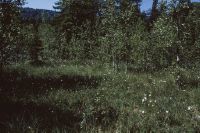
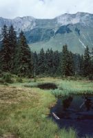
Title (German)
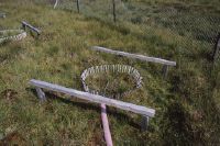
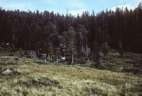
HM 305, Breitried
Caption
Coordinates: 705'400, 215'200
Caption (German)
Koordinaten: 705'400, 215'200
Record Name
Dia_358-1577

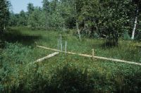
Title (German)
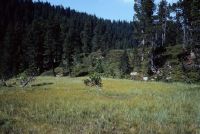
HM 305, Breitried, im Nord-Nordwesten (NNW) des sich selbst überlassenen Breitried
Caption
Coordinates: 705'400, 215'200
Caption (German)
Koordinaten: 705'400, 215'200
Record Name
Dia_358-1579

Title (German)
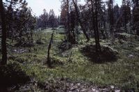
HM 305, Breitried
Caption
Coordinates: 705'400, 215'200
Caption (German)
Koordinaten: 705'400, 215'200
Record Name
Dia_358-1580

Title (German)
HM 305, Breitried
Caption
Coordinates: 705'400, 215'200
Caption (German)
Koordinaten: 705'400, 215'200
Record Name
Dia_358-1581

Title (German)
HM 305, Unteriberg, Breitried, Drainagegraben verlängert, nach Mitte Juli 1989/Entwässerung
Caption
Coordinates: 705'400, 215'200
Caption (German)
Koordinaten: 705'400, 215'200
Record Name
Dia_358-1582

Title (German)
HM 305, Unteriberg, Breitried, Drainagegraben verlängert, nach Mitte Juli 1989/Entwässerung
Caption
Coordinates: 705'400, 215'200
Caption (German)
Koordinaten: 705'400, 215'200
Record Name
Dia_358-1583

Title (German)
HM 305, Unteriberg, Breitried, Drainageröhre in Kiesfilter/Entwässerung
Caption
Coordinates: 705'400, 215'200
Caption (German)
Koordinaten: 705'400, 215'200
Record Name
Dia_358-1584

Title (German)
HM 305, Breitried
Caption
Coordinates: 705'400, 215'200
Caption (German)
Koordinaten: 705'400, 215'200
Record Name
Dia_358-1585

Title (German)
HM 305, Breitried
Caption
Coordinates: 705'400, 215'200
Caption (German)
Koordinaten: 705'400, 215'200
Record Name
Dia_358-1586

Title (German)
HM 305, Breitried
Caption
Coordinates: 705'400, 215'200
Caption (German)
Koordinaten: 705'400, 215'200
Record Name
Dia_358-1587

Title (German)
HM 305, Breitried
Caption
Coordinates: 705'400, 215'200
Caption (German)
Koordinaten: 705'400, 215'200
Record Name
Dia_358-1588

Title (German)
HM 305, Breitried
Caption
Coordinates: 705'400, 215'200
Caption (German)
Koordinaten: 705'400, 215'200
Record Name
Dia_358-1589

Title (German)
HM 305, Unteriberg, Breitried, Chilenried, systematische Drainage des Hangriedes/Entwässerung
Caption
Coordinates: 705'400, 215'200
Caption (German)
Koordinaten: 705'400, 215'200
Record Name
Dia_358-1590

Title (German)
HM 305, Unteriberg, Breitried, Chilenried, systematische Drainage des Hangriedes. Kontakt zu Breitried/Entwässerung
Caption
Coordinates: 705'400, 215'200
Caption (German)
Koordinaten: 705'400, 215'200
Record Name
Dia_358-1591

Title (German)
HM 305, Breitried, Neu ausgehobener Graben
Caption
Coordinates: 705'400, 215'200
Caption (German)
Koordinaten: 705'400, 215'200
Record Name
Dia_358-1592

Title (German)
HM 305, Breitried, Überschüttung, Hochmoor-Vegetation
Caption
Coordinates: 705'400, 215'200
Caption (German)
Koordinaten: 705'400, 215'200
Record Name
Dia_358-1593

Title (German)
HM 305, Breitried, Schutt
Caption
Coordinates: 705'400, 215'200
Caption (German)
Koordinaten: 705'400, 215'200
Record Name
Dia_358-1594

Title (German)
HM 305, Breitried, Schutt
Caption
Coordinates: 705'400, 215'200
Caption (German)
Koordinaten: 705'400, 215'200
Record Name
Dia_358-1595

Title (German)
HM 305, Breitried, Schutt
Caption
Coordinates: 705'400, 215'200
Caption (German)
Koordinaten: 705'400, 215'200
Record Name
Dia_358-1596

Title (German)
HM 305, Breitried
Caption
Coordinates: 705'400, 215'200
Caption (German)
Koordinaten: 705'400, 215'200
Record Name
Dia_358-1597

Title (German)
HM 305, Breitried
Caption
Coordinates: 705'400, 215'200
Caption (German)
Koordinaten: 705'400, 215'200
Record Name
Dia_358-1598

Title (German)
HM 305, Breitried
Caption
Coordinates: 705'400, 215'200
Caption (German)
Koordinaten: 705'400, 215'200
Record Name
Dia_358-1599

Title (German)
HM 305, Breitried
Caption
Coordinates: 705'400, 215'200
Caption (German)
Koordinaten: 705'400, 215'200
Record Name
Dia_358-1600

Title (German)
HM 305, Breitried
Caption
Coordinates: 705'400, 215'200
Caption (German)
Koordinaten: 705'400, 215'200
Record Name
Dia_358-1601

Title (German)
HM 305, Breitried
Caption
Coordinates: 705'400, 215'200
Caption (German)
Koordinaten: 705'400, 215'200
Record Name
Dia_358-1602

Title (German)
HM 305, Breitried
Caption
Coordinates: 705'400, 215'200
Caption (German)
Koordinaten: 705'400, 215'200
Record Name
Dia_358-1603

Title (German)
HM 305, Breitried
Caption
Coordinates: 705'400, 215'200
Caption (German)
Koordinaten: 705'400, 215'200
Record Name
Dia_358-1604

Title (German)
HM 305, Breitried
Caption
Coordinates: 705'400, 215'200
Caption (German)
Koordinaten: 705'400, 215'200
Record Name
Dia_358-1605

Title (German)
HM 305, Breitried
Caption
Coordinates: 705'400, 215'200
Caption (German)
Koordinaten: 705'400, 215'200
Record Name
Dia_358-1606

Title (German)
HM 305, Breitried
Caption
Coordinates: 705'400, 215'200
Caption (German)
Koordinaten: 705'400, 215'200
Record Name
Dia_358-1607

Title (German)
HM 305, Breitried
Caption
Coordinates: 705'400, 215'200
Caption (German)
Koordinaten: 705'400, 215'200
Record Name
Dia_358-1608

Title (German)
HM 305, Breitried
Caption
Coordinates: 705'400, 215'200
Caption (German)
Koordinaten: 705'400, 215'200
Record Name
Dia_358-1609

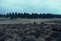
Title (German)
HM 305, Breitried, Schnee
Caption
Coordinates: 705'400, 215'200
Caption (German)
Koordinaten: 705'400, 215'200
Record Name
Dia_358-1610

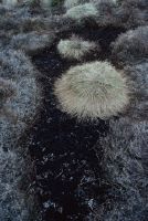
Title (German)
HM 307, Roblosen, Oxycoccus quadripetalus, Andromeda polifolia, Vaccinium uliginosum, Sphagnum, Potentilla erecta, Calluna vulgaris, Trientalis
Caption
Coordinates: 700'900, 223'200
Caption (German)
Koordinaten: 700'900, 223'200
Record Name
Dia_358-1611

Title (German)
HM 307, Roblosen, Moorgarten, Weekend-Haus
Caption
Coordinates: 700'900, 223'200
Caption (German)
Koordinaten: 700'900, 223'200
Record Name
Dia_358-1612

Title (German)
HM 307, Roblosen, Moorgarten, Weekend-Haus
Caption
Coordinates: 700'900, 223'200
Caption (German)
Koordinaten: 700'900, 223'200
Record Name
Dia_358-1613

Title (German)
HM 307, Roblosen, Moorgarten mit Rasenfläche
Caption
Coordinates: 700'900, 223'200
Caption (German)
Koordinaten: 700'900, 223'200
Record Name
Dia_358-1614

Title (German)
HM 309, Furenwald, Verbrennen von Ästen im Flachmoor
Caption
Coordinates: 700'100, 210'400
Caption (German)
Koordinaten: 700'100, 210'400
Record Name
Dia_358-1615

Title (German)
HM 309, Furenwald, Brandstelle nach Räumung eines Holzschlages
Caption
Coordinates: 700'100, 210'400
Caption (German)
Koordinaten: 700'100, 210'400
Record Name
Dia_358-1616

Title (German)
HM 309, Furenwald, Verbrennen von Ästen im Flachmoor
Caption
Coordinates: 700'100, 210'400
Caption (German)
Koordinaten: 700'100, 210'400
Record Name
Dia_358-1617

Title (German)
HM 309, Furenwald, verbrennen von Ästen im Flachmoor: Brandschaden
Caption
Coordinates: 700'100, 210'400
Caption (German)
Koordinaten: 700'100, 210'400
Record Name
Dia_358-1618

Title (German)
HM 309, Furenwald, Stützmast
Caption
Coordinates: 700'100, 210'400
Caption (German)
Koordinaten: 700'100, 210'400
Record Name
Dia_358-1619

Title (German)
HM 309, Furenwald, Holzschlag auf Torfboden
Caption
Coordinates: 700'100, 210'400
Caption (German)
Koordinaten: 700'100, 210'400
Record Name
Dia_358-1620

Title (German)
HM 309, Furenwald, nicht beweidetes Gebiet, beweidetes Gebiet
Caption
Coordinates: 700'100, 210'400
Caption (German)
Koordinaten: 700'100, 210'400
Record Name
Dia_358-1621

Title (German)
HM 309, Furenwald, Schäden infolge Holzrücken
Caption
Coordinates: 700'100, 210'400
Caption (German)
Koordinaten: 700'100, 210'400
Record Name
Dia_358-1622

Title (German)
HM 309, Furenwald, Schleifschäden durch Transportseilbahn, Torfkörper aufgerissen: Erosion
Caption
Coordinates: 700'100, 210'400
Caption (German)
Koordinaten: 700'100, 210'400
Record Name
Dia_358-1623

Title (German)
HM 311, Gross Underbäch, Carex fusca Schlenke, Bulte abgetragen mit Vaccinium myrtillus
Caption
Coordinates: 699'800, 210'100
Caption (German)
Koordinaten: 699'800, 210'100
Record Name
Dia_358-1624

Title (German)
HM 311, Gross Underbäch, Asthaufen, Wirkungskontrolle Objekt 72
Caption
Coordinates: 699'800, 210'100
Caption (German)
Koordinaten: 699'800, 210'100
Record Name
Dia_358-1625

Title (German)
HM 311, Gross Underbäch, Asthaufen, Wirkungskontrolle Objekt 72
Caption
Coordinates: 699'800, 210'100
Caption (German)
Koordinaten: 699'800, 210'100
Record Name
Dia_358-1626

Title (German)
HM 311, Gross Underbäch, Asthaufen, Wirkungskontrolle Objekt 72
Caption
Coordinates: 699'800, 210'100
Caption (German)
Koordinaten: 699'800, 210'100
Record Name
Dia_358-1627

Title (German)
HM 311, Gross Underbäch, Asthaufen, Wirkungskontrolle Objekt 72
Caption
Coordinates: 699'800, 210'100
Caption (German)
Koordinaten: 699'800, 210'100
Record Name
Dia_358-1628

Title (German)
HM 311, Gross Underbäch, Asthaufen im Moor, Wirkungskontrolle Objekt 72
Caption
Coordinates: 699'800, 210'100
Caption (German)
Koordinaten: 699'800, 210'100
Record Name
Dia_358-1629

Title (German)
HM 311, Gross Underbäch, Umgestürtzte Fichte: Hindernis für den Streuschnitt
Caption
Coordinates: 699'800, 210'100
Caption (German)
Koordinaten: 699'800, 210'100
Record Name
Dia_358-1630

Title (German)
HM 311, Gross Underbäch, Asthaufen im Moor, Wirkungskontrolle Objekt 72
Caption
Coordinates: 699'800, 210'100
Caption (German)
Koordinaten: 699'800, 210'100
Record Name
Dia_358-1631

Title (German)
HM 311, Gross Underbäch, Asthaufen im Moor, Wirkungskontrolle Objekt 72
Caption
Coordinates: 699'800, 210'100
Caption (German)
Koordinaten: 699'800, 210'100
Record Name
Dia_358-1632

Title (German)
HM 311, Gross Underbäch, Asthaufen im Moor, Wirkungskontrolle Objekt 72
Caption
Coordinates: 699'800, 210'100
Caption (German)
Koordinaten: 699'800, 210'100
Record Name
Dia_358-1633

Title (German)
HM 325, Tierfäderen
Caption
Coordinates: 706'400, 212'100
Caption (German)
Koordinaten: 706'400, 212'100
Record Name
Dia_358-1634

Title (German)
HM 325, Tierfäderen
Caption
Coordinates: 706'400, 212'100
Caption (German)
Koordinaten: 706'400, 212'100
Record Name
Dia_358-1635

Title (German)
HM 325, Tierfäderen
Caption
Coordinates: 706'400, 212'100
Caption (German)
Koordinaten: 706'400, 212'100
Record Name
Dia_358-1636

Title (German)
HM 325, Tierfäderen, Vietritt
Caption
Coordinates: 706'400, 212'100
Caption (German)
Koordinaten: 706'400, 212'100
Record Name
Dia_358-1637

Title (German)
HM 325, Tierfäderen
Caption
Coordinates: 706'400, 212'100
Caption (German)
Koordinaten: 706'400, 212'100
Record Name
Dia_358-1638

Title (German)
HM 325, Tierfäderen
Caption
Coordinates: 706'400, 212'100
Caption (German)
Koordinaten: 706'400, 212'100
Record Name
Dia_358-1639

Title (German)
HM 429, Mäderen, Viehtritt
Caption
Coordinates: 692'600, 214'800
Caption (German)
Koordinaten: 692'600, 214'800
Record Name
Dia_358-1640

Title (German)
HM 429, Mäderen, Viehtritt
Caption
Coordinates: 692'600, 214'800
Caption (German)
Koordinaten: 692'600, 214'800
Record Name
Dia_358-1641

Title (German)
HM 429, Mäderen, Viehtritt
Caption
Coordinates: 692'600, 214'800
Caption (German)
Koordinaten: 692'600, 214'800
Record Name
Dia_358-1642

Title (German)
HM 429, Mäderen, Viehtritt
Caption
Coordinates: 692'600, 214'800
Caption (German)
Koordinaten: 692'600, 214'800
Record Name
Dia_358-1643

Title (German)
HM 429, Mäderen, Viehtritt
Caption
Coordinates: 692'600, 214'800
Caption (German)
Koordinaten: 692'600, 214'800
Record Name
Dia_358-1644

Title (German)
HM 497, Gnossenweid
Caption
Coordinates: 712'200, 221'000
Caption (German)
Koordinaten: 712'200, 221'000
Record Name
Dia_358-1645

Title (German)
HM 497, Gnossenweid
Caption
Coordinates: 712'200, 221'000
Caption (German)
Koordinaten: 712'200, 221'000
Record Name
Dia_358-1646

Title (German)
HM 497, Gnossenweid
Caption
Coordinates: 712'200, 221'000
Caption (German)
Koordinaten: 712'200, 221'000
Record Name
Dia_358-1647

Title (German)
HM 001, La Sagne et les Tourbières de Bellelay
Caption
Coordinates: 579'900, 233'800
Caption (German)
Koordinaten: 579'900, 233'800
Record Name
Dia_358-1648

Title (German)
HM 001, La Sagne et les Tourbières de Bellelay
Caption
Coordinates: 579'900, 233'800
Caption (German)
Koordinaten: 579'900, 233'800
Record Name
Dia_358-1649
![HM 001, La Sagne et les Tourbières de Bellelay, Rouge Eau [blurred image].](thumbnails/thumb_ETHBIB.Bildarchiv_1147766.jpg)
Title (German)
HM 001, La Sagne et les Tourbières de Bellelay, Rouge Eau [unscharfe Aufnahme]
Caption
Coordinates: 579'900, 233'800
Caption (German)
Koordinaten: 579'900, 233'800
Record Name
Dia_358-1650

Title (German)
HM 001, La Sagne et les Tourbières de Bellelay, Rouge Eau, kanalisiert
Caption
Coordinates: 579'900, 233'800
Caption (German)
Koordinaten: 579'900, 233'800
Record Name
Dia_358-1651

Title (German)
HM 001, La Sagne et les Tourbières de Bellelay, Beweidung
Caption
Coordinates: 579'900, 233'800
Caption (German)
Koordinaten: 579'900, 233'800
Record Name
Dia_358-1652
Title (German)
HM 001, La Sagne et les Tourbières de Bellelay, Drohende Verbirkung
Caption
Coordinates: 579'900, 233'800
Caption (German)
Koordinaten: 579'900, 233'800
Record Name
Dia_358-1653

Title (German)
HM 001, La Sagne et les Tourbières de Bellelay, Künstliche Lichtung im Pinetum
Caption
Coordinates: 579'900, 233'800
Caption (German)
Koordinaten: 579'900, 233'800
Record Name
Dia_358-1654
Title (German)
HM 001, La Sagne et les Tourbières de Bellelay, Versuchsfläche Grosvernier
Caption
Coordinates: 579'900, 233'800
Caption (German)
Koordinaten: 579'900, 233'800
Record Name
Dia_358-1655

Title (German)
HM 001, La Sagne et les Tourbières de Bellelay, Versuchsfläche Grosvernier
Caption
Coordinates: 579'900, 233'800
Caption (German)
Koordinaten: 579'900, 233'800
Record Name
Dia_358-1656

Title (German)
HM 001, La Sagne et les Tourbières de Bellelay, Regeneration in Torfstich
Caption
Coordinates: 579'900, 233'800
Caption (German)
Koordinaten: 579'900, 233'800
Record Name
Dia_358-1657

Title (German)
HM 001, La Sagne et les Tourbières de Bellelay, Regeneration in Torfstich
Caption
Coordinates: 579'900, 233'800
Caption (German)
Koordinaten: 579'900, 233'800
Record Name
Dia_358-1658

Title (German)
HM 003, La Tourbière de la Chaux-des-Breuleux, Regenerationsfläche 1 Jahr nach Aufstau
Caption
Coordinates: 570'200, 230'400
Caption (German)
Koordinaten: 570'200, 230'400
Record Name
Dia_358-1659

Title (German)
HM 003, La Tourbière de la Chaux-des-Breuleux, Drainages, Barrages/Entwässerung
Caption
Coordinates: 570'200, 230'400
Caption (German)
Koordinaten: 570'200, 230'400
Record Name
Dia_358-1660

Title (German)
HM 003, La Tourbière de la Chaux-des-Breuleux, Region S P.005
Caption
Coordinates: 570'200, 230'400
Caption (German)
Koordinaten: 570'200, 230'400
Record Name
Dia_358-1662

Title (German)
HM 003, La Tourbière de la Chaux-des-Breuleux
Caption
Coordinates: 570'200, 230'400
Caption (German)
Koordinaten: 570'200, 230'400
Record Name
Dia_358-1663

Title (German)
HM 003, La Tourbière de la Chaux-des-Breuleux, Grosse Doline, Narcissen
Caption
Coordinates: 570'200, 230'400
Caption (German)
Koordinaten: 570'200, 230'400
Record Name
Dia_358-1664

Title (German)
HM 003, La Tourbière de la Chaux-des-Breuleux, Narcissus Pseudonarcissus bei grosser Doline
Caption
Coordinates: 570'200, 230'400
Caption (German)
Koordinaten: 570'200, 230'400
Record Name
Dia_358-1665

Title (German)
HM 003, La Tourbière de la Chaux-des-Breuleux, Dolinen als Voraussetzung für Hochmoor-Bildung, Entwässerungsgraben/Drainage
Caption
Coordinates: 570'200, 230'400
Caption (German)
Koordinaten: 570'200, 230'400
Record Name
Dia_358-1666

Title (German)
HM 003, La Tourbière de la Chaux-des-Breuleux, Heidelandschaft
Caption
Coordinates: 570'200, 230'400
Caption (German)
Koordinaten: 570'200, 230'400
Record Name
Dia_358-1667

Title (German)
HM 003, La Tourbière de la Chaux-des-Breuleux, Heide, Drainage, Weide, verwehen von Dünger/Entwässerung
Caption
Coordinates: 570'200, 230'400
Caption (German)
Koordinaten: 570'200, 230'400
Record Name
Dia_358-1668
Title (German)
HM 003, La Tourbière de la Chaux-des-Breuleux, Heide, verwehen von Dünger
Caption
Coordinates: 570'200, 230'400
Caption (German)
Koordinaten: 570'200, 230'400
Record Name
Dia_358-1669

Title (German)
HM 003, La Tourbière de la Chaux-des-Breuleux, verwehen von Dünger
Caption
Coordinates: 570'200, 230'400
Caption (German)
Koordinaten: 570'200, 230'400
Record Name
Dia_358-1670

Title (German)
HM 003, La Tourbière de la Chaux-des-Breuleux, Heide, ausbringen von Mineraldünger, Calluna, Eriophorum vaginatum
Caption
Coordinates: 570'200, 230'400
Caption (German)
Koordinaten: 570'200, 230'400
Record Name
Dia_358-1671

Title (German)
HM 003, La Tourbière de la Chaux-des-Breuleux, Regenerationskomplex, Eriophorum vaginatum, Calluna
Caption
Coordinates: 570'200, 230'400
Caption (German)
Koordinaten: 570'200, 230'400
Record Name
Dia_358-1672

Title (German)
HM 003, La Tourbière de la Chaux-des-Breuleux, Regenerationskomplex, Eriophorum vaginatum, Calluna
Caption
Coordinates: 570'200, 230'400
Caption (German)
Koordinaten: 570'200, 230'400
Record Name
Dia_358-1673
Title (German)
HM 003, La Tourbière de la Chaux-des-Breuleux, Eriophorum vaginatum, Calluna
Caption
Coordinates: 570'200, 230'400
Caption (German)
Koordinaten: 570'200, 230'400
Record Name
Dia_358-1674

Title (German)
HM 003, La Tourbière de la Chaux-des-Breuleux, Eriophorum vaginatum, Regenerationskomplex
Caption
Coordinates: 570'200, 230'400
Caption (German)
Koordinaten: 570'200, 230'400
Record Name
Dia_358-1675

Title (German)
HM 003, La Tourbière de la Chaux-des-Breuleux, Solifluktionsböden
Caption
Coordinates: 570'200, 230'400
Caption (German)
Koordinaten: 570'200, 230'400
Record Name
Dia_358-1676

Title (German)
HM 003, La Tourbière de la Chaux-des-Breuleux, Regeneration im Torstich (Cx. Rostrata), Torfrücken verheidet
Caption
Coordinates: 570'200, 230'400
Caption (German)
Koordinaten: 570'200, 230'400
Record Name
Dia_358-1677

Title (German)
HM 003, La Tourbière de la Chaux-des-Breuleux, Tourbière de Tramelan, Riesentorfstich = Rülle?
Caption
Coordinates: 570'200, 230'400
Caption (German)
Koordinaten: 570'200, 230'400
Record Name
Dia_358-1678

Title (German)
HM 003, La Tourbière de la Chaux-des-Breuleux, Tourbière de Tramelan
Caption
Coordinates: 570'200, 230'400
Caption (German)
Koordinaten: 570'200, 230'400
Record Name
Dia_358-1679

Title (German)
HM 003, La Tourbière de la Chaux-des-Breuleux, Tourbière de Tramelan
Caption
Coordinates: 570'200, 230'400
Caption (German)
Koordinaten: 570'200, 230'400
Record Name
Dia_358-1680

Title (German)
HM 003, La Tourbière de la Chaux-des-Breuleux, Tourbière de Tramelan
Caption
Coordinates: 570'200, 230'400
Caption (German)
Koordinaten: 570'200, 230'400
Record Name
Dia_358-1681

Title (German)
HM 003, La Tourbière de la Chaux-des-Breuleux, Tourbière de Tramelan
Caption
Coordinates: 570'200, 230'400
Caption (German)
Koordinaten: 570'200, 230'400
Record Name
Dia_358-1682

Title (German)
HM 003, La Tourbière de la Chaux-des-Breuleux
Caption
Coordinates: 570'200, 230'400
Caption (German)
Koordinaten: 570'200, 230'400
Record Name
Dia_358-1683

Title (German)
HM 003, La Tourbière de la Chaux-des-Breuleux
Caption
Coordinates: 570'200, 230'400
Caption (German)
Koordinaten: 570'200, 230'400
Record Name
Dia_358-1684

Title (German)
HM 003, La Tourbière de la Chaux-des-Breuleux, arrieère tarraux P.001, Blick nach Westen (W)
Caption
Coordinates: 570'200, 230'400
Caption (German)
Koordinaten: 570'200, 230'400
Record Name
Dia_358-1685

Title (German)
HM 003, La Tourbière de la Chaux-des-Breuleux, arrière tarraux P.001, Blick nach Westen (W)
Caption
Coordinates: 570'200, 230'400
Caption (German)
Koordinaten: 570'200, 230'400
Record Name
Dia_358-1686

Title (German)
HM 003, La Tourbière de la Chaux-des-Breuleux, P 001 et barrage du 01.04.1986, Blick nach Westen (W)
Caption
Coordinates: 570'200, 230'400
Caption (German)
Koordinaten: 570'200, 230'400
Record Name
Dia_358-1687

Title (German)
HM 003, La Tourbière de la Chaux-des-Breuleux
Caption
Coordinates: 570'200, 230'400
Caption (German)
Koordinaten: 570'200, 230'400
Record Name
Dia_358-1688

Title (German)
HM 003, La Tourbière de la Chaux-des-Breuleux
Caption
Coordinates: 570'200, 230'400
Caption (German)
Koordinaten: 570'200, 230'400
Record Name
Dia_358-1689

Title (German)
HM 003, La Tourbière de la Chaux-des-Breuleux, région S du P68, Blick nach Norden (N)
Caption
Coordinates: 570'200, 230'400
Caption (German)
Koordinaten: 570'200, 230'400
Record Name
Dia_358-1690

Title (German)
HM 003, La Tourbière de la Chaux-des-Breuleux, aux environs P 68
Caption
Coordinates: 570'200, 230'400
Caption (German)
Koordinaten: 570'200, 230'400
Record Name
Dia_358-1691

Title (German)
HM 003, La Tourbière de la Chaux-des-Breuleux, région S P.006
Caption
Coordinates: 570'200, 230'400
Caption (German)
Koordinaten: 570'200, 230'400
Record Name
Dia_358-1692

Title (German)
HM 003, La Tourbière de la Chaux-des-Breuleux, région S P.005
Caption
Coordinates: 570'200, 230'400
Caption (German)
Koordinaten: 570'200, 230'400
Record Name
Dia_358-1693

Title (German)
HM 003, La Tourbière de la Chaux-des-Breuleux, Abgetorfte Fläche im Osten (E)
Caption
Coordinates: 570'200, 230'400
Caption (German)
Koordinaten: 570'200, 230'400
Record Name
Dia_358-1694

Title (German)
HM 003, La Tourbière de la Chaux-des-Breuleux, Regenerationsfläche 1 Jahr nach Aufstau
Caption
Coordinates: 570'200, 230'400
Caption (German)
Koordinaten: 570'200, 230'400
Record Name
Dia_358-1695

Title (German)
HM 003, La Tourbière de la Chaux-des-Breuleux
Caption
Coordinates: 570'200, 230'400
Caption (German)
Koordinaten: 570'200, 230'400
Record Name
Dia_358-1696

Title (German)
HM 003, La Tourbière de la Chaux-des-Breuleux
Caption
Coordinates: 570'200, 230'400
Caption (German)
Koordinaten: 570'200, 230'400
Record Name
Dia_358-1697

Title (German)
HM 003, La Tourbière de la Chaux-des-Breuleux, Regenerationsfläche
Caption
Coordinates: 570'200, 230'400
Caption (German)
Koordinaten: 570'200, 230'400
Record Name
Dia_358-1698

Title (German)
HM 003, La Tourbière de la Chaux-des-Breuleux
Caption
Coordinates: 570'200, 230'400
Caption (German)
Koordinaten: 570'200, 230'400
Record Name
Dia_358-1699

Title (German)
HM 003, La Tourbière de la Chaux-des-Breuleux, Helikopteraufnahme, Drainagenetz, P078 au centre, Blick nach Norden (N)/Entwässerung
Caption
Coordinates: 570'200, 230'400
Caption (German)
Koordinaten: 570'200, 230'400
Record Name
Dia_358-1700

Title (German)
HM 003, La Tourbière de la Chaux-des-Breuleux, Vue générale
Caption
Coordinates: 570'200, 230'400
Caption (German)
Koordinaten: 570'200, 230'400
Record Name
Dia_358-1701

Title (German)
HM 003, La Tourbière de la Chaux-des-Breuleux, Cladonia sp.
Caption
Coordinates: 570'200, 230'400
Caption (German)
Koordinaten: 570'200, 230'400
Record Name
Dia_358-1702

Title (German)
HM 003, La Tourbière de la Chaux-des-Breuleux, Cladonia sp.
Caption
Coordinates: 570'200, 230'400
Caption (German)
Koordinaten: 570'200, 230'400
Record Name
Dia_358-1703

Title (German)
HM 003, La Tourbière de la Chaux-des-Breuleux, Carex rostrata, etang neuf
Caption
Coordinates: 570'200, 230'400
Caption (German)
Koordinaten: 570'200, 230'400
Record Name
Dia_358-1704

Title (German)
HM 003, La Tourbière de la Chaux-des-Breuleux, Begasungsanlage
Caption
Coordinates: 570'200, 230'400
Caption (German)
Koordinaten: 570'200, 230'400
Record Name
Dia_358-1706

Title (German)
HM 003, La Tourbière de la Chaux-des-Breuleux, Begasungsanlage, Universität Neuchâtel, CH4, CO2
Caption
Coordinates: 570'200, 230'400
Caption (German)
Koordinaten: 570'200, 230'400
Record Name
Dia_358-1707

Title (German)
HM 003, La Tourbière de la Chaux-des-Breuleux, Begasungsanlage, Universität Neuchâtel, CH4, CO2
Caption
Coordinates: 570'200, 230'400
Caption (German)
Koordinaten: 570'200, 230'400
Record Name
Dia_358-1708
Title (German)
HM 003, La Tourbière de la Chaux-des-Breuleux, Begasungsanlage, Universität Neuchâtel, CH4, CO2
Caption
Coordinates: 570'200, 230'400
Caption (German)
Koordinaten: 570'200, 230'400
Record Name
Dia_358-1709

Title (German)
HM 003, La Tourbière de la Chaux-des-Breuleux, Begasungsanlage, Universität Neuchâtel, CH4, CO2, Versuchsanlage Uni NE
Caption
Coordinates: 570'200, 230'400
Caption (German)
Koordinaten: 570'200, 230'400
Record Name
Dia_358-1710

Title (German)
HM 003, La Tourbière de la Chaux-des-Breuleux, Beweidete-nicht beweidete Fläche
Caption
Coordinates: 570'200, 230'400
Caption (German)
Koordinaten: 570'200, 230'400
Record Name
Dia_358-1711

Title (German)
HM 003, La Tourbière de la Chaux-des-Breuleux
Caption
Coordinates: 570'200, 230'400
Caption (German)
Koordinaten: 570'200, 230'400
Record Name
Dia_358-1712

Title (German)
HM 011, Les Pontins, Randlagg
Caption
Coordinates: 566'400, 219'900
Caption (German)
Koordinaten: 566'400, 219'900
Record Name
Dia_358-1713

Title (German)
HM 011, Les Pontin, Grenze Moor-Weide
Caption
Coordinates: 566'400, 219'900
Caption (German)
Koordinaten: 566'400, 219'900
Record Name
Dia_358-1714

Title (German)
HM 011, Les Pontin, Grenze Moor-Wald, Fondrière
Caption
Coordinates: 566'400, 219'900
Caption (German)
Koordinaten: 566'400, 219'900
Record Name
Dia_358-1715

Title (German)
HM 011, Les Pontin, Grenze Moor - Weide, grande mare
Caption
Coordinates: 566'400, 219'900
Caption (German)
Koordinaten: 566'400, 219'900
Record Name
Dia_358-1716

Title (German)
HM 011, Les Pontin, Moorzentrum
Caption
Coordinates: 566'400, 219'900
Caption (German)
Koordinaten: 566'400, 219'900
Record Name
Dia_358-1717

Title (German)
HM 011, Les Pontin, Zone raclée, encroûtée
Caption
Coordinates: 566'400, 219'900
Caption (German)
Koordinaten: 566'400, 219'900
Record Name
Dia_358-1718

Title (German)
HM 011, Les Pontin, regenerierender Torfstich
Caption
Coordinates: 566'400, 219'900
Caption (German)
Koordinaten: 566'400, 219'900
Record Name
Dia_358-1719

Title (German)
HM 011, Les Pontin, regenerierender Torfstich
Caption
Coordinates: 566'400, 219'900
Caption (German)
Koordinaten: 566'400, 219'900
Record Name
Dia_358-1720

Title (German)
HM 011, Les Pontin, regenerierender Torfstich
Caption
Coordinates: 566'400, 219'900
Caption (German)
Koordinaten: 566'400, 219'900
Record Name
Dia_358-1721

Title (German)
HM 011, Les Pontin, regenerierender Torfstich
Caption
Coordinates: 566'400, 219'900
Caption (German)
Koordinaten: 566'400, 219'900
Record Name
Dia_358-1722

Title (German)
HM 011, Les Pontin, Sphagnen an Torfstichkante
Caption
Coordinates: 566'400, 219'900
Caption (German)
Koordinaten: 566'400, 219'900
Record Name
Dia_358-1723

Title (German)
HM 011, Les Pontin, Sphagnen am Fuss der Torfstichkante
Caption
Coordinates: 566'400, 219'900
Caption (German)
Koordinaten: 566'400, 219'900
Record Name
Dia_358-1724

Title (German)
HM 071, Lörmoos
Caption
Coordinates: 598'000, 203'500
Caption (German)
Koordinaten: 598'000, 203'500
Record Name
Dia_358-1725

Title (German)
HM 071, Lörmoos
Caption
Coordinates: 598'000, 203'500
Caption (German)
Koordinaten: 598'000, 203'500
Record Name
Dia_358-1726

Title (German)
HM 071, Lörmoos, Moorpfad
Caption
Coordinates: 598'000, 203'500
Caption (German)
Koordinaten: 598'000, 203'500
Record Name
Dia_358-1727

Title (German)
HM 071, Lörmoos
Caption
Coordinates: 598'000, 203'500
Caption (German)
Koordinaten: 598'000, 203'500
Record Name
Dia_358-1728

Title (German)
HM 071, Lörmoos
Caption
Coordinates: 598'000, 203'500
Caption (German)
Koordinaten: 598'000, 203'500
Record Name
Dia_358-1729

Title (German)
HM 072, Büsselimoos
Caption
Coordinates: 599'400, 203'900
Caption (German)
Koordinaten: 599'400, 203'900
Record Name
Dia_358-1730

Title (German)
HM 072, Büsselimoos, Dauerfläche, eingerichtet von M. Wyler
Caption
Coordinates: 599'400, 203'900
Caption (German)
Koordinaten: 599'400, 203'900
Record Name
Dia_358-1731

Title (German)
HM 072, Büsselimoos, Moorpfad, Dauerfläche, eingerichtet von M. Wyler
Caption
Coordinates: 599'400, 203'900
Caption (German)
Koordinaten: 599'400, 203'900
Record Name
Dia_358-1732

Title (German)
HM 072, Büsselimoos, Dauerfläche, eingerichtet von M. Wyler
Caption
Coordinates: 599'400, 203'900
Caption (German)
Koordinaten: 599'400, 203'900
Record Name
Dia_358-1733

Title (German)
HM 075, Sewelimoos, Rentigenmoos
Caption
Coordinates: 612'100, 172'700
Caption (German)
Koordinaten: 612'100, 172'700
Record Name
Dia_358-1734

Title (German)
HM 075, Sewelimoos, Rentigenmoos
Caption
Coordinates: 612'100, 172'700
Caption (German)
Koordinaten: 612'100, 172'700
Record Name
Dia_358-1735

Title (German)
HM 075, Sewelimoos, Rentigenmoos
Caption
Coordinates: 612'100, 172'700
Caption (German)
Koordinaten: 612'100, 172'700
Record Name
Dia_358-1736

Title (German)
HM 075, Sewelimoos, Rentigenmoos b. Thun
Caption
Coordinates: 612'100, 172'700
Caption (German)
Koordinaten: 612'100, 172'700
Record Name
Dia_358-1737

Title (German)
HM 075, Sewelimoos, frisch "gerodete Fläche"
Caption
Coordinates: 612'100, 172'700
Caption (German)
Koordinaten: 612'100, 172'700
Record Name
Dia_358-1738

Title (German)
HM 075, Sewelimoos
Caption
Coordinates: 612'100, 172'700
Caption (German)
Koordinaten: 612'100, 172'700
Record Name
Dia_358-1739

Title (German)
HM 075, Sewelimoos, Verbrennungsstelle im Hochmoor
Caption
Coordinates: 612'100, 172'700
Caption (German)
Koordinaten: 612'100, 172'700
Record Name
Dia_358-1740

Title (German)
HM 075, Sewelimoos, Verbrennungsstelle im Hochmoor
Caption
Coordinates: 612'100, 172'700
Caption (German)
Koordinaten: 612'100, 172'700
Record Name
Dia_358-1741

Title (German)
HM 075, Sewelimoos, Verbrennungsstelle im Hochmoor
Caption
Coordinates: 612'100, 172'700
Caption (German)
Koordinaten: 612'100, 172'700
Record Name
Dia_358-1742

Title (German)
HM 075, Sewelimoos, Faulbäume und Erlen
Caption
Coordinates: 612'100, 172'700
Caption (German)
Koordinaten: 612'100, 172'700
Record Name
Dia_358-1743

Title (German)
HM 075, Sewelimoos, Verbuschung
Caption
Coordinates: 612'100, 172'700
Caption (German)
Koordinaten: 612'100, 172'700
Record Name
Dia_358-1744

Title (German)
HM 075, Sewelimoos, Verbuschung
Caption
Coordinates: 612'100, 172'700
Caption (German)
Koordinaten: 612'100, 172'700
Record Name
Dia_358-1745

Title (German)
HM 075, Sewelimoos, Trampelpfad im Hochmoor
Caption
Coordinates: 612'100, 172'700
Caption (German)
Koordinaten: 612'100, 172'700
Record Name
Dia_358-1746

Title (German)
HM 075, Sewelimoos, Trampelpfad im Hochmoor
Caption
Coordinates: 612'100, 172'700
Caption (German)
Koordinaten: 612'100, 172'700
Record Name
Dia_358-1747

Title (German)
HM 075, Sewelimoos, Verbrennungsstelle im Hochmoor
Caption
Coordinates: 612'100, 172'700
Caption (German)
Koordinaten: 612'100, 172'700
Record Name
Dia_358-1748

Title (German)
HM 075, Sewelimoos, Brandfläche im Hochmoor
Caption
Coordinates: 612'100, 172'700
Caption (German)
Koordinaten: 612'100, 172'700
Record Name
Dia_358-1749

Title (German)
HM 075, Sewelimoos, Brandfläche im Hochmoor
Caption
Coordinates: 612'100, 172'700
Caption (German)
Koordinaten: 612'100, 172'700
Record Name
Dia_358-1750

Title (German)
HM 076, Chlepfimoos, Burgmoos
Caption
Coordinates: 617'700, 224'500
Caption (German)
Koordinaten: 617'700, 224'500
Record Name
Dia_358-1751

Title (German)
HM 076, Chlepfimoos, Burgmoos
Caption
Coordinates: 617'700, 224'500
Caption (German)
Koordinaten: 617'700, 224'500
Record Name
Dia_358-1752

Title (German)
HM 076, Chlepfimoos, Burgmoos
Caption
Coordinates: 617'700, 224'500
Caption (German)
Koordinaten: 617'700, 224'500
Record Name
Dia_358-1753

Title (German)
HM 076, Chlepfimoos, Burgmoos
Caption
Coordinates: 617'700, 224'500
Caption (German)
Koordinaten: 617'700, 224'500
Record Name
Dia_358-1754

Title (German)
HM 180, Siehenmoos, Waldrand
Caption
Coordinates: 627'300, 188'200
Caption (German)
Koordinaten: 627'300, 188'200
Record Name
Dia_358-1755

Title (German)
HM 180, Siehenmoos, Randwald
Caption
Coordinates: 627'300, 188'200
Caption (German)
Koordinaten: 627'300, 188'200
Record Name
Dia_358-1756

Title (German)
HM 180, Siehenmoos, Torfstich
Caption
Coordinates: 627'300, 188'200
Caption (German)
Koordinaten: 627'300, 188'200
Record Name
Dia_358-1757

Title (German)
HM 180, Siehenmoos, Torfstich
Caption
Coordinates: 627'300, 188'200
Caption (German)
Koordinaten: 627'300, 188'200
Record Name
Dia_358-1758

Title (German)
HM 181, Flüegfääl, Steinmoos, gewerblicher Torfabbau
Caption
Coordinates: 629'600, 185'900
Caption (German)
Koordinaten: 629'600, 185'900
Record Name
Dia_358-1759

Title (German)
HM 181, Flüegfääl, Steinmoos, gewerblicher Torfabbau
Caption
Coordinates: 629'600, 185'900
Caption (German)
Koordinaten: 629'600, 185'900
Record Name
Dia_358-1760

Title (German)
HM 181, Flüegfääl, Steinmoos, gewerblicher Torfabbau
Caption
Coordinates: 629'600, 185'900
Caption (German)
Koordinaten: 629'600, 185'900
Record Name
Dia_358-1761

Title (German)
HM 181, Flüegfääl, Steinmoos, gewerblicher Torfabbau
Caption
Coordinates: 629'600, 185'900
Caption (German)
Koordinaten: 629'600, 185'900
Record Name
Dia_358-1762

Title (German)
HM 181, Flüegfääl, Steinmoos, gewerblicher Torfabbau
Caption
Coordinates: 629'600, 185'900
Caption (German)
Koordinaten: 629'600, 185'900
Record Name
Dia_358-1763

Title (German)
HM 181, Flüegfääl, Steinmoos, vorentwässerte Flächen, Drainage
Caption
Coordinates: 629'600, 185'900
Caption (German)
Koordinaten: 629'600, 185'900
Record Name
Dia_358-1764

Title (German)
HM 181, Flüegfääl, Steinmoos, sekundäre Schlenke in Torfstich
Caption
Coordinates: 629'600, 185'900
Caption (German)
Koordinaten: 629'600, 185'900
Record Name
Dia_358-1765

Title (German)
HM 181, Flüegfääl, Steinmoos, sekundäre Schlenke und Blänke in Torfstich
Caption
Coordinates: 629'600, 185'900
Caption (German)
Koordinaten: 629'600, 185'900
Record Name
Dia_358-1766

Title (German)
HM 181, Flüegfääl, Steinmoos, Rhododendren im Hochmoor
Caption
Coordinates: 629'600, 185'900
Caption (German)
Koordinaten: 629'600, 185'900
Record Name
Dia_358-1767

Title (German)
HM 181, Flüegfääl, Steinmoos, Sauger im Molinietum
Caption
Coordinates: 629'600, 185'900
Caption (German)
Koordinaten: 629'600, 185'900
Record Name
Dia_358-1768

Title (German)
HM 181, Flüegfääl, Steinmoos, Plan zu Naturschutzverordnung Steinmoos
Caption
Coordinates: 629'600, 185'900
Caption (German)
Koordinaten: 629'600, 185'900
Record Name
Dia_358-1769

Title (German)
HM 181, Flüegfääl, Steinmoos, Plan zu Naturschutzverordnung Steinmoos
Caption
Coordinates: 629'600, 185'900
Caption (German)
Koordinaten: 629'600, 185'900
Record Name
Dia_358-1770

Title (German)
HM 183, Hängstmoor, Schlenke
Caption
Coordinates: 630'000, 182'400
Caption (German)
Koordinaten: 630'000, 182'400
Record Name
Dia_358-1771

Title (German)
HM 183, Hängstmoor, Spuren Knickschlepper
Caption
Coordinates: 630'000, 182'400
Caption (German)
Koordinaten: 630'000, 182'400
Record Name
Dia_358-1772

Title (German)
HM 183, Hängstmoor
Caption
Coordinates: 630'000, 182'400
Caption (German)
Koordinaten: 630'000, 182'400
Record Name
Dia_358-1773

Title (German)
HM 183, Hängstmoor, Fichtenhochmoor, Schleifspuren
Caption
Coordinates: 630'000, 182'400
Caption (German)
Koordinaten: 630'000, 182'400
Record Name
Dia_358-1774

Title (German)
HM 183, Hängstmoor, Fichtenhochmoor, Schleifspuren
Caption
Coordinates: 630'000, 182'400
Caption (German)
Koordinaten: 630'000, 182'400
Record Name
Dia_358-1775

Title (German)
HM 183, Hängstmoor
Caption
Coordinates: 630'000, 182'400
Caption (German)
Koordinaten: 630'000, 182'400
Record Name
Dia_358-1776

Title (German)
HM 183, Hängstmoor
Caption
Coordinates: 630'000, 182'400
Caption (German)
Koordinaten: 630'000, 182'400
Record Name
Dia_358-1777

Title (German)
HM 183, Hängstmoor, geworfene Fichten
Caption
Coordinates: 630'000, 182'400
Caption (German)
Koordinaten: 630'000, 182'400
Record Name
Dia_358-1778

Title (German)
HM 183, Hängstmoor, Holz
Caption
Coordinates: 630'000, 182'400
Caption (German)
Koordinaten: 630'000, 182'400
Record Name
Dia_358-1779

Title (German)
HM 183, Hängstmoor, Holz
Caption
Coordinates: 630'000, 182'400
Caption (German)
Koordinaten: 630'000, 182'400
Record Name
Dia_358-1780

Title (German)
HM 184, Rotmoos
Caption
Coordinates: 630'700, 182'400
Caption (German)
Koordinaten: 630'700, 182'400
Record Name
Dia_358-1781

Title (German)
HM 184, Rotmoos
Caption
Coordinates: 630'700, 182'400
Caption (German)
Koordinaten: 630'700, 182'400
Record Name
Dia_358-1782

Title (German)
HM 184, Rotmoos
Caption
Coordinates: 630'700, 182'400
Caption (German)
Koordinaten: 630'700, 182'400
Record Name
Dia_358-1783

Title (German)
HM 184, Rotmoos
Caption
Coordinates: 630'700, 182'400
Caption (German)
Koordinaten: 630'700, 182'400
Record Name
Dia_358-1784

Title (German)
HM 184, Rotmoos
Caption
Coordinates: 630'700, 182'400
Caption (German)
Koordinaten: 630'700, 182'400
Record Name
Dia_358-1785

Title (German)
HM 184, Rotmoos
Caption
Coordinates: 630'700, 182'400
Caption (German)
Koordinaten: 630'700, 182'400
Record Name
Dia_358-1786

Title (German)
HM 184, Rotmoos, Polytrichumrasen
Caption
Coordinates: 630'700, 182'400
Caption (German)
Koordinaten: 630'700, 182'400
Record Name
Dia_358-1787

Title (German)
HM 184, Rotmoos
Caption
Coordinates: 630'700, 182'400
Caption (German)
Koordinaten: 630'700, 182'400
Record Name
Dia_358-1788

Title (German)
HM 184, Rotmoos
Caption
Coordinates: 630'700, 182'400
Caption (German)
Koordinaten: 630'700, 182'400
Record Name
Dia_358-1789

Title (German)
HM 184, Rotmoos
Caption
Coordinates: 630'700, 182'400
Caption (German)
Koordinaten: 630'700, 182'400
Record Name
Dia_358-1790

Title (German)
HM 184, Rotmoos
Caption
Coordinates: 630'700, 182'400
Caption (German)
Koordinaten: 630'700, 182'400
Record Name
Dia_358-1791

Title (German)
HM 185, Vorderes Rotmösli
Caption
Coordinates: 630'400, 181'700
Caption (German)
Koordinaten: 630'400, 181'700
Record Name
Dia_358-1792

Title (German)
HM 185, Vorderes Rotmösli, starke Verheidung
Caption
Coordinates: 630'400, 181'700
Caption (German)
Koordinaten: 630'400, 181'700
Record Name
Dia_358-1793

Title (German)
HM 185, Vorderes Rotmösli
Caption
Coordinates: 630'400, 181'700
Caption (German)
Koordinaten: 630'400, 181'700
Record Name
Dia_358-1794

Title (German)
HM 186, Fischbachmoos, Obermoos
Caption
Coordinates: 622'600, 182'800
Caption (German)
Koordinaten: 622'600, 182'800
Record Name
Dia_358-1795

Title (German)
HM 186, Fischbachmoos, Obermoos
Caption
Coordinates: 622'600, 182'800
Caption (German)
Koordinaten: 622'600, 182'800
Record Name
Dia_358-1796

Title (German)
HM 186, Fischbachmoos, Obermoos
Caption
Coordinates: 622'600, 182'800
Caption (German)
Koordinaten: 622'600, 182'800
Record Name
Dia_358-1797

Title (German)
HM 186, Fischbachmoos, Obermoos
Caption
Coordinates: 622'600, 182'800
Caption (German)
Koordinaten: 622'600, 182'800
Record Name
Dia_358-1798

Title (German)
HM 193, Moore nördlich Grünenbergpass
Caption
Coordinates: 631'800, 179'500
Caption (German)
Koordinaten: 631'800, 179'500
Record Name
Dia_358-1799

Title (German)
HM 193, Moore nördlich Grünenbergpass
Caption
Coordinates: 631'800, 179'500
Caption (German)
Koordinaten: 631'800, 179'500
Record Name
Dia_358-1800

Title (German)
HM 193, Moore nördlich Grünenbergpass
Caption
Coordinates: 631'800, 179'500
Caption (German)
Koordinaten: 631'800, 179'500
Record Name
Dia_358-1801
Title (German)
HM 193, Moore nördlich Grünenbergpass, Hangmoor, Trichophorumaspekt
Caption
Coordinates: 631'800, 179'500
Caption (German)
Koordinaten: 631'800, 179'500
Record Name
Dia_358-1802

Title (German)
HM 193, Moore nördlich Grünenbergpass
Caption
Coordinates: 631'800, 179'500
Caption (German)
Koordinaten: 631'800, 179'500
Record Name
Dia_358-1803

Title (German)
HM 194, Moore südwestlich Grünenbergpass, Heide
Caption
Coordinates: 631'600, 178'500
Caption (German)
Koordinaten: 631'600, 178'500
Record Name
Dia_358-1804

Title (German)
HM 194, Moore südwestlich Grünenbergpass
Caption
Coordinates: 631'600, 178'500
Caption (German)
Koordinaten: 631'600, 178'500
Record Name
Dia_358-1805

Title (German)
HM 195, Trogenmoos
Caption
Coordinates: 632'400, 179'100
Caption (German)
Koordinaten: 632'400, 179'100
Record Name
Dia_358-1806

Title (German)
HM 195, Trogenmoos
Caption
Coordinates: 632'400, 179'100
Caption (German)
Koordinaten: 632'400, 179'100
Record Name
Dia_358-1807

Title (German)
HM 195, Trogenmoos, Bult-Schlenke
Caption
Coordinates: 632'400, 179'100
Caption (German)
Koordinaten: 632'400, 179'100
Record Name
Dia_358-1808

Title (German)
HM 195, Trogenmoos
Caption
Coordinates: 632'400, 179'100
Caption (German)
Koordinaten: 632'400, 179'100
Record Name
Dia_358-1809

Title (German)
HM 195, Trogenmoos
Caption
Coordinates: 632'400, 179'100
Caption (German)
Koordinaten: 632'400, 179'100
Record Name
Dia_358-1810

Title (German)
HM 195, Trogenmoos
Caption
Coordinates: 632'400, 179'100
Caption (German)
Koordinaten: 632'400, 179'100
Record Name
Dia_358-1811

Title (German)
HM 195, Trogenmoos
Caption
Coordinates: 632'400, 179'100
Caption (German)
Koordinaten: 632'400, 179'100
Record Name
Dia_358-1812

Title (German)
HM 195, Trogenmoos
Caption
Coordinates: 632'400, 179'100
Caption (German)
Koordinaten: 632'400, 179'100
Record Name
Dia_358-1813

Title (German)
HM 195, Trogenmoos
Caption
Coordinates: 632'400, 179'100
Caption (German)
Koordinaten: 632'400, 179'100
Record Name
Dia_358-1814

Title (German)
HM 195, Trogenmoos
Caption
Coordinates: 632'400, 179'100
Caption (German)
Koordinaten: 632'400, 179'100
Record Name
Dia_358-1815

Title (German)
HM 195, Trogenmoos
Caption
Coordinates: 632'400, 179'100
Caption (German)
Koordinaten: 632'400, 179'100
Record Name
Dia_358-1817

Title (German)
HM 195, Trogenmoos
Caption
Coordinates: 632'400, 179'100
Caption (German)
Koordinaten: 632'400, 179'100
Record Name
Dia_358-1818

Title (German)
HM 195, Trogenmoos
Caption
Coordinates: 632'400, 179'100
Caption (German)
Koordinaten: 632'400, 179'100
Record Name
Dia_358-1819

Title (German)
HM 195, Trogenmoos
Caption
Coordinates: 632'400, 179'100
Caption (German)
Koordinaten: 632'400, 179'100
Record Name
Dia_358-1820

Title (German)
HM 195, Trogenmoos
Caption
Coordinates: 632'400, 179'100
Caption (German)
Koordinaten: 632'400, 179'100
Record Name
Dia_358-1821
Title (German)
HM 195, Trogenmoos
Caption
Coordinates: 632'400, 179'100
Caption (German)
Koordinaten: 632'400, 179'100
Record Name
Dia_358-1822

Title (German)
HM 195, Trogenmoos
Caption
Coordinates: 632'400, 179'100
Caption (German)
Koordinaten: 632'400, 179'100
Record Name
Dia_358-1823

Title (German)
HM 195, Trogenmoos
Caption
Coordinates: 632'400, 179'100
Caption (German)
Koordinaten: 632'400, 179'100
Record Name
Dia_358-1824

Title (German)
HM 195, Trogenmoos
Caption
Coordinates: 632'400, 179'100
Caption (German)
Koordinaten: 632'400, 179'100
Record Name
Dia_358-1825

Title (German)
HM 195, Trogenmoos
Caption
Coordinates: 632'400, 179'100
Caption (German)
Koordinaten: 632'400, 179'100
Record Name
Dia_358-1826

Title (German)
HM 195, Trogenmoos
Caption
Coordinates: 632'400, 179'100
Caption (German)
Koordinaten: 632'400, 179'100
Record Name
Dia_358-1827

Title (German)
HM 195, Trogenmoos, Trittschäden
Caption
Coordinates: 632'400, 179'100
Caption (German)
Koordinaten: 632'400, 179'100
Record Name
Dia_358-1828

Title (German)
HM 195, Trogenmoos
Caption
Coordinates: 632'400, 179'100
Caption (German)
Koordinaten: 632'400, 179'100
Record Name
Dia_358-1829
Title (German)
HM 195, Trogenmoos
Caption
Coordinates: 632'400, 179'100
Caption (German)
Koordinaten: 632'400, 179'100
Record Name
Dia_358-1830

Title (German)
HM 195, Trogenmoos
Caption
Coordinates: 632'400, 179'100
Caption (German)
Koordinaten: 632'400, 179'100
Record Name
Dia_358-1831

Title (German)
HM 195, Trogenmoos
Caption
Coordinates: 632'400, 179'100
Caption (German)
Koordinaten: 632'400, 179'100
Record Name
Dia_358-1833

Title (German)
HM 195, Trogenmoos, Muneli-Kolk
Caption
Coordinates: 632'400, 178'860
Caption (German)
Koordinaten: 632'400, 178'860
Record Name
Dia_358-1834

Title (German)
HM 195, Trogenmoos, Entwässerungsgraben, Schlenke/Drainage
Caption
Coordinates: 632'500, 179'200
Caption (German)
Koordinaten: 632'500, 179'200
Record Name
Dia_358-1835

Title (German)
HM 195, Trogenmoos, eingezäunte nasse Stelle im Lagg
Caption
Coordinates: 632'350, 179'070
Caption (German)
Koordinaten: 632'350, 179'070
Record Name
Dia_358-1836

Title (German)
HM 195, Trogenmoos, eingezäunte nasse Stelle im Lagg
Caption
Coordinates: 632'440, 179'070
Caption (German)
Koordinaten: 632'440, 179'070
Record Name
Dia_358-1837

Title (German)
HM 195, Trogenmoos, entwässerte Schlenke/Drainage
Caption
Coordinates: 632'400, 179'100
Caption (German)
Koordinaten: 632'400, 179'100
Record Name
Dia_358-1838

Title (German)
HM 195, Trogenmoos
Caption
Coordinates: 632'400, 179'100
Caption (German)
Koordinaten: 632'400, 179'100
Record Name
Dia_358-1839

Title (German)
HM 195, Trogenmoos, Eingriff, Trittschäden
Caption
Coordinates: 632'400, 179'100
Caption (German)
Koordinaten: 632'400, 179'100
Record Name
Dia_358-1840

Title (German)
HM 195, Trogenmoos, Trittschäden in Schlenke
Caption
Coordinates: 632'420, 178'940
Caption (German)
Koordinaten: 632'420, 178'940
Record Name
Dia_358-1841

Title (German)
HM 195, Trogenmoos, Erosionsschäden, Tritt
Caption
Coordinates: 632'420, 179'080
Caption (German)
Koordinaten: 632'420, 179'080
Record Name
Dia_358-1842

Title (German)
HM 195, Trogenmoos, Erosionsschäden, Tritt
Caption
Coordinates: 632'340, 179'070
Caption (German)
Koordinaten: 632'340, 179'070
Record Name
Dia_358-1843

Title (German)
HM 196, Moore im Schäpfewald
Caption
Coordinates: 631'200, 176'900
Caption (German)
Koordinaten: 631'200, 176'900
Record Name
Dia_358-1844

Title (German)
HM 196, Moore im Schäpfewald
Caption
Coordinates: 631'200, 176'900
Caption (German)
Koordinaten: 631'200, 176'900
Record Name
Dia_358-1845

Title (German)
HM 196, Moore im Schäpfewald
Caption
Coordinates: 631'200, 176'900
Caption (German)
Koordinaten: 631'200, 176'900
Record Name
Dia_358-1846

Title (German)
HM 196, Moore im Schäpfewald
Caption
Coordinates: 631'200, 176'900
Caption (German)
Koordinaten: 631'200, 176'900
Record Name
Dia_358-1847

Title (German)
HM 198, Moore östlich Aellgäuli, Moorsee, Einheit 2
Caption
Coordinates: 635'600, 180'700
Caption (German)
Koordinaten: 635'600, 180'700
Record Name
Dia_358-1848

Title (German)
HM 198, Moore östlich Aellgäuli, Moorsee, Einheit 2
Caption
Coordinates: 635'600, 180'700
Caption (German)
Koordinaten: 635'600, 180'700
Record Name
Dia_358-1849

Title (German)
HM 198, Moore östlich Aellgäuli, Moorsee
Caption
Coordinates: 635'600, 180'700
Caption (German)
Koordinaten: 635'600, 180'700
Record Name
Dia_358-1850

Title (German)
HM 198, Moore östlich Aellgäuli, Schlenke, E. Morsee, Einheit 6
Caption
Coordinates: 635'600, 180'700
Caption (German)
Koordinaten: 635'600, 180'700
Record Name
Dia_358-1851

Title (German)
HM 198, Moore östlich Aellgäuli, Moorsee, Einheit 2
Caption
Coordinates: 635'600, 180'700
Caption (German)
Koordinaten: 635'600, 180'700
Record Name
Dia_358-1853

Title (German)
HM 199, Möser östlich Widegg, sekundäre Schlenke, Blick von Einheit 11 nach Norden (N)
Caption
Coordinates: 635'200, 179'200
Caption (German)
Koordinaten: 635'200, 179'200
Record Name
Dia_358-1854

Title (German)
HM 199, Möser östlich Widegg, Degradiertes Hochmoor durch Beweidung
Caption
Coordinates: 635'200, 179'200
Caption (German)
Koordinaten: 635'200, 179'200
Record Name
Dia_358-1855

Title (German)
HM 199, Möser östlich Widegg, Degradiertes Hochmoor durch Beweidung
Caption
Coordinates: 635'200, 179'200
Caption (German)
Koordinaten: 635'200, 179'200
Record Name
Dia_358-1856

Title (German)
HM 199, Möser östlich Widegg, Degradiertes Hochmoor durch Beweidung
Caption
Coordinates: 635'200, 179'200
Caption (German)
Koordinaten: 635'200, 179'200
Record Name
Dia_358-1857

Title (German)
HM 200, Moor im Steiniwald, Schlenke
Caption
Coordinates: 636'900, 181'300
Caption (German)
Koordinaten: 636'900, 181'300
Record Name
Dia_358-1858

Title (German)
HM 200, Moor im Steiniwald, Schlenke dient als Wasservorrat für Viehtränke
Caption
Coordinates: 636'900, 181'300
Caption (German)
Koordinaten: 636'900, 181'300
Record Name
Dia_358-1859

Title (German)
HM 200, Moor im Steiniwald, Schlenke dient als Wasservorrat für Viehtränke
Caption
Coordinates: 636'900, 181'300
Caption (German)
Koordinaten: 636'900, 181'300
Record Name
Dia_358-1860

Title (German)
HM 200, Moor im Steiniwald, Schlenke
Caption
Coordinates: 636'900, 181'300
Caption (German)
Koordinaten: 636'900, 181'300
Record Name
Dia_358-1861

Title (German)
HM 302, Turen, Chaltenbrunnen, Stäckewäldli
Caption
Coordinates: 654'600, 173'400
Caption (German)
Koordinaten: 654'600, 173'400
Record Name
Dia_358-1862

Title (German)
HM 302, Turen, Chaltenbrunnen, Stäckewäldli, Rinder im Moor
Caption
Coordinates: 654'600, 173'400
Caption (German)
Koordinaten: 654'600, 173'400
Record Name
Dia_358-1863

Title (German)
HM 302, Turen, Chaltenbrunnen, Stäckewäldli
Caption
Coordinates: 654'600, 173'400
Caption (German)
Koordinaten: 654'600, 173'400
Record Name
Dia_358-1864

Title (German)
HM 302, Turen, Chaltenbrunnen, Stäckewäldli
Caption
Coordinates: 654'600, 173'400
Caption (German)
Koordinaten: 654'600, 173'400
Record Name
Dia_358-1865

Title (German)
HM 302, Turen, Chaltenbrunnen, Stäckewäldli
Caption
Coordinates: 654'600, 173'400
Caption (German)
Koordinaten: 654'600, 173'400
Record Name
Dia_358-1866

Title (German)
HM 302, Turen, Chaltenbrunnen, Stäckewäldli
Caption
Coordinates: 654'600, 173'400
Caption (German)
Koordinaten: 654'600, 173'400
Record Name
Dia_358-1867

Title (German)
HM 302, Turen, Chaltenbrunnen, Stäckewäldli
Caption
Coordinates: 654'600, 173'400
Caption (German)
Koordinaten: 654'600, 173'400
Record Name
Dia_358-1868

Title (German)
HM 302, Turen, Chaltenbrunnen, Stäckewäldli
Caption
Coordinates: 654'600, 173'400
Caption (German)
Koordinaten: 654'600, 173'400
Record Name
Dia_358-1869

Title (German)
HM 302, Turen, Chaltenbrunnen, Stäckewäldli, Moor Kaltenbrunnen
Caption
Coordinates: 654'600, 173'400
Caption (German)
Koordinaten: 654'600, 173'400
Record Name
Dia_358-1870

Title (German)
HM 302, Turen, Chaltenbrunnen, Stäckewäldli, Moor Kaltenbrunnen
Caption
Coordinates: 654'600, 173'400
Caption (German)
Koordinaten: 654'600, 173'400
Record Name
Dia_358-1871

Title (German)
HM 302, Turen, Chaltenbrunnen, Stäckewäldli, Moor Kaltenbrunnen
Caption
Coordinates: 654'600, 173'400
Caption (German)
Koordinaten: 654'600, 173'400
Record Name
Dia_358-1872

Title (German)
HM 302, Turen, Chaltenbrunnen, Stäckewäldli
Caption
Coordinates: 654'600, 173'400
Caption (German)
Koordinaten: 654'600, 173'400
Record Name
Dia_358-1873

Title (German)
HM 302, Turen, Chaltenbrunnen, Stäckewäldli
Caption
Coordinates: 654'600, 173'400
Caption (German)
Koordinaten: 654'600, 173'400
Record Name
Dia_358-1874

Title (German)
HM 302, Turen, Chaltenbrunnen, Stäckewäldli
Caption
Coordinates: 654'600, 173'400
Caption (German)
Koordinaten: 654'600, 173'400
Record Name
Dia_358-1875

Title (German)
HM 302, Turen, Chaltenbrunnen, Stäckewäldli
Caption
Coordinates: 654'600, 173'400
Caption (German)
Koordinaten: 654'600, 173'400
Record Name
Dia_358-1876

Title (German)
HM 302, Turen, Chaltenbrunnen, Stäckewäldli, Sphagnum-Teppich
Caption
Coordinates: 654'600, 173'400
Caption (German)
Koordinaten: 654'600, 173'400
Record Name
Dia_358-1878

Title (German)
HM 302, Turen, Chaltenbrunnen, Stäckewäldli
Caption
Coordinates: 654'600, 173'400
Caption (German)
Koordinaten: 654'600, 173'400
Record Name
Dia_358-1879

Title (German)
HM 302, Turen, Chaltenbrunnen, Stäckewäldli
Caption
Coordinates: 654'600, 173'400
Caption (German)
Koordinaten: 654'600, 173'400
Record Name
Dia_358-1880

Title (German)
HM 302, Turen, Chaltenbrunnen, Stäckewäldli, Blänke
Caption
Coordinates: 654'600, 173'400
Caption (German)
Koordinaten: 654'600, 173'400
Record Name
Dia_358-1882

Title (German)
HM 302, Turen, Chaltenbrunnen, Stäckewäldli, Moorsee
Caption
Coordinates: 654'600, 173'400
Caption (German)
Koordinaten: 654'600, 173'400
Record Name
Dia_358-1884

Title (German)
HM 302, Turen, Chaltenbrunnen, Stäckewäldli
Caption
Coordinates: 654'600, 173'400
Caption (German)
Koordinaten: 654'600, 173'400
Record Name
Dia_358-1886

Title (German)
HM 328, Witiwald, Dälenwald, Sturmschadenräumung, Seillinie
Caption
Coordinates: 626'200, 172'500
Caption (German)
Koordinaten: 626'200, 172'500
Record Name
Dia_358-1887

Title (German)
HM 328, Witiwald, Dälenwald, Torfmoosteppich, Bergföhre
Caption
Coordinates: 626'200, 172'500
Caption (German)
Koordinaten: 626'200, 172'500
Record Name
Dia_358-1888

Title (German)
HM 328, Witiwald, Dälenwald, Aufforstung
Caption
Coordinates: 626'200, 172'500
Caption (German)
Koordinaten: 626'200, 172'500
Record Name
Dia_358-1889

Title (German)
HM 328, Witiwald, Dälenwald, Holzlager an neuer Waldstrasse im Hochmoor
Caption
Coordinates: 626'200, 172'500
Caption (German)
Koordinaten: 626'200, 172'500
Record Name
Dia_358-1890

Title (German)
HM 328, Witiwald, Dälenwald, Erosion des Torfteppichs
Caption
Coordinates: 626'200, 172'500
Caption (German)
Koordinaten: 626'200, 172'500
Record Name
Dia_358-1891

Title (German)
HM 328, Witiwald, Dälenwald
Caption
Coordinates: 626'200, 172'500
Caption (German)
Koordinaten: 626'200, 172'500
Record Name
Dia_358-1892

Title (German)
HM 328, Witiwald, Dälenwald
Caption
Coordinates: 626'200, 172'500
Caption (German)
Koordinaten: 626'200, 172'500
Record Name
Dia_358-1893

Title (German)
HM 328, Witiwald, Dälenwald
Caption
Coordinates: 626'200, 172'500
Caption (German)
Koordinaten: 626'200, 172'500
Record Name
Dia_358-1894

Title (German)
HM 328, Witiwald, Dälenwald, Schäden durch Forsttraktoren
Caption
Coordinates: 626'200, 172'500
Caption (German)
Koordinaten: 626'200, 172'500
Record Name
Dia_358-1895

Title (German)
HM 328, Witiwald, Dälenwald, Schleifspur, Seiltransport im Hochmoor
Caption
Coordinates: 626'200, 172'500
Caption (German)
Koordinaten: 626'200, 172'500
Record Name
Dia_358-1896

Title (German)
HM 331, Schalenberg
Caption
Coordinates: 600'800, 176'900
Caption (German)
Koordinaten: 600'800, 176'900
Record Name
Dia_358-1897

Title (German)
HM 331, Schalenberg
Caption
Coordinates: 600'800, 176'900
Caption (German)
Koordinaten: 600'800, 176'900
Record Name
Dia_358-1898

Title (German)
HM 331, Schalenberg, Entwässerungsgraben im Hochmoor/Drainage
Caption
Coordinates: 600'800, 176'900
Caption (German)
Koordinaten: 600'800, 176'900
Record Name
Dia_358-1899

Title (German)
HM 331, Schalenberg, Handgranatenwurfstelle
Caption
Coordinates: 600'800, 176'900
Caption (German)
Koordinaten: 600'800, 176'900
Record Name
Dia_358-1900

Title (German)
HM 331, Schalenberg, Handgranatenwurfstelle
Caption
Coordinates: 600'800, 176'900
Caption (German)
Koordinaten: 600'800, 176'900
Record Name
Dia_358-1901

Title (German)
HM 335, Ladengrat
Caption
Coordinates: 594'600, 172'000
Caption (German)
Koordinaten: 594'600, 172'000
Record Name
Dia_358-1902

Title (German)
HM 335, Ladengrat
Caption
Coordinates: 594'600, 172'000
Caption (German)
Koordinaten: 594'600, 172'000
Record Name
Dia_358-1904

Title (German)
HM 501, Moor südlich Möser, Hanghochmoor
Caption
Coordinates: 635'100, 178'800
Caption (German)
Koordinaten: 635'100, 178'800
Record Name
Dia_358-1906

Title (German)
HM 502, Moor nordöstlich (NE) Färrich am Bol, Rülle aus grosser Schlenke
Caption
Coordinates: 635'200, 178'500
Caption (German)
Koordinaten: 635'200, 178'500
Record Name
Dia_358-1907

Title (German)
HM 502, Moor nordöstlich Färrich am Bol, Flachmoor-Hochmoor Übergang
Caption
Coordinates: 635'200, 178'500
Caption (German)
Koordinaten: 635'200, 178'500
Record Name
Dia_358-1908

Title (German)
HM 502, Moor nordöstlich Färrich am Bol, Einheit 6 W grosser Schlenke
Caption
Coordinates: 635'200, 178'500
Caption (German)
Koordinaten: 635'200, 178'500
Record Name
Dia_358-1909

Title (German)
HM 502, Moor nordöstlich Färrich am Bol, Schlenke im Bergföhrenhochmoor
Caption
Coordinates: 635'200, 178'500
Caption (German)
Koordinaten: 635'200, 178'500
Record Name
Dia_358-1910

Title (German)
HM 502, Moor nordöstlich Färrich am Bol, Rülle zwischen Hochmoor-Bulten
Caption
Coordinates: 635'200, 178'500
Caption (German)
Koordinaten: 635'200, 178'500
Record Name
Dia_358-1911

Title (German)
HM 502, Moor nordöstlich Färrich am Bol, Grosse Rülle
Caption
Coordinates: 635'200, 178'500
Caption (German)
Koordinaten: 635'200, 178'500
Record Name
Dia_358-1912

Title (German)
HM 502, Moor nordöstlich Färrich am Bol, Scharfe Grenze zu Parnassia
Caption
Coordinates: 635'200, 178'500
Caption (German)
Koordinaten: 635'200, 178'500
Record Name
Dia_358-1913

Title (German)
HM 504, Moor zwischen Flösch und Häliloch
Caption
Coordinates: 626'700, 173'100
Caption (German)
Koordinaten: 626'700, 173'100
Record Name
Dia_358-1914

Title (German)
HM 504, Moor zwischen Flösch und Häliloch
Caption
Coordinates: 626'700, 173'100
Caption (German)
Koordinaten: 626'700, 173'100
Record Name
Dia_358-1915

Title (German)
HM 504, Moor zwischen Flösch und Häliloch
Caption
Coordinates: 626'700, 173'100
Caption (German)
Koordinaten: 626'700, 173'100
Record Name
Dia_358-1916

Title (German)
HM 505, Moor oberhalb Burgfeldflüe
Caption
Coordinates: 628'200, 173'700
Caption (German)
Koordinaten: 628'200, 173'700
Record Name
Dia_358-1917

Title (German)
HM 506, Moor östlich Gemmenalp
Caption
Coordinates: 628'100, 174'900
Caption (German)
Koordinaten: 628'100, 174'900
Record Name
Dia_358-1918

Title (German)
HM 510, Esleren, Gummenalp, Hydrologische Barriere = Zufahrt zu Alphütte im Moor
Caption
Coordinates: 648'500, 180'300
Caption (German)
Koordinaten: 648'500, 180'300
Record Name
Dia_358-1919

Title (German)
HM 510, Esleren, Gummenalp, Pinus mugo
Caption
Coordinates: 648'500, 180'300
Caption (German)
Koordinaten: 648'500, 180'300
Record Name
Dia_358-1920
Title (German)
HM 510, Esleren, Gummenalp, Eutrophierter Kolk (im Flachmoor-Bereich)
Caption
Coordinates: 648'500, 180'300
Caption (German)
Koordinaten: 648'500, 180'300
Record Name
Dia_358-1921

Title (German)
HM 510, Esleren, Gummenalp, eutrophierter Verlandungsbereich
Caption
Coordinates: 648'500, 180'300
Caption (German)
Koordinaten: 648'500, 180'300
Record Name
Dia_358-1922

Title (German)
HM 510, Esleren, Gummenalp, Schweine im Moor
Caption
Coordinates: 648'500, 180'300
Caption (German)
Koordinaten: 648'500, 180'300
Record Name
Dia_358-1923

Title (German)
HM 510, Esleren, Gummenalp, Schweine im Moor
Caption
Coordinates: 648'500, 180'300
Caption (German)
Koordinaten: 648'500, 180'300
Record Name
Dia_358-1924

Title (German)
HM 511, Höhenschwandmoor
Caption
Coordinates: 657'700, 179'000
Caption (German)
Koordinaten: 657'700, 179'000
Record Name
Dia_358-1925

Title (German)
HM 511, Höhenschwandmoor, Entwässerungsgraben/Drainage
Caption
Coordinates: 657'700, 179'000
Caption (German)
Koordinaten: 657'700, 179'000
Record Name
Dia_358-1926

Title (German)
HM 511, Höhenschwandmoor, Entwässerungsgraben/Drainage
Caption
Coordinates: 657'700, 179'000
Caption (German)
Koordinaten: 657'700, 179'000
Record Name
Dia_358-1927

Title (German)
HM 512, Moor hinder der Egg, Zwischenmoor
Caption
Coordinates: 659'100, 178'800
Caption (German)
Koordinaten: 659'100, 178'800
Record Name
Dia_358-1928

Title (German)
HM 512, Moor hinder der Egg, Zwischenmoor
Caption
Coordinates: 659'100, 178'800
Caption (German)
Koordinaten: 659'100, 178'800
Record Name
Dia_358-1929

Title (German)
HM 512, Moor hinder der Egg, Verlandender See, Carex limosa, Carex rostrata
Caption
Coordinates: 659'100, 178'800
Caption (German)
Koordinaten: 659'100, 178'800
Record Name
Dia_358-1930

Title (German)
HM 513, Seelein bei der Mägisalp, Seemad, Schwingrasen bei Station Mägisalp, Torfmoosrasen
Caption
Coordinates: 661'000, 177'600
Caption (German)
Koordinaten: 661'000, 177'600
Record Name
Dia_358-1931

Title (German)
HM 513, Seelein bei der Mägisalp, Seemad, See Station Mägisalp
Caption
Coordinates: 661'000, 177'600
Caption (German)
Koordinaten: 661'000, 177'600
Record Name
Dia_358-1932

Title (German)
HM 513, Seelein bei der Mägisalp, Seemad, Ufervegetation in Bedrängnis: Festhütte l., Bergrestaurant r. , Aufschüttung
Caption
Coordinates: 661'000, 177'600
Caption (German)
Koordinaten: 661'000, 177'600
Record Name
Dia_358-1933

Title (German)
HM 513, Seelein bei der Mägisalp, Seemad
Caption
Coordinates: 661'000, 177'600
Caption (German)
Koordinaten: 661'000, 177'600
Record Name
Dia_358-1934

Title (German)
HM 514, In Miseren, an der Sustenstrasse
Caption
Coordinates: 674'600, 175'800
Caption (German)
Koordinaten: 674'600, 175'800
Record Name
Dia_358-1935

Title (German)
HM 514, In Miseren
Caption
Coordinates: 674'600, 175'800
Caption (German)
Koordinaten: 674'600, 175'800
Record Name
Dia_358-1936

Title (German)
HM 514, In Miseren, an der Sustenstrasse, Verlandeter Kolk
Caption
Coordinates: 674'600, 175'800
Caption (German)
Koordinaten: 674'600, 175'800
Record Name
Dia_358-1937

Title (German)
HM 514, In Miseren, an der Sustenstrasse, Kolk
Caption
Coordinates: 674'600, 175'800
Caption (German)
Koordinaten: 674'600, 175'800
Record Name
Dia_358-1938

Title (German)
HM 514, In Miseren, Gouille avec SR parmi roche moutonnées
Caption
Coordinates: 674'600, 175'800
Caption (German)
Koordinaten: 674'600, 175'800
Record Name
Dia_358-1939

Title (German)
HM 514, In Miseren, vom EMD verpflockte Stellungen im Moor
Caption
Coordinates: 674'600, 175'800
Caption (German)
Koordinaten: 674'600, 175'800
Record Name
Dia_358-1940

Title (German)
HM 514, In Miseren
Caption
Coordinates: 674'600, 175'800
Caption (German)
Koordinaten: 674'600, 175'800
Record Name
Dia_358-1941

Title (German)
HM 514, In Miseren
Caption
Coordinates: 674'600, 175'800
Caption (German)
Koordinaten: 674'600, 175'800
Record Name
Dia_358-1942

Title (German)
HM 514, In Miseren
Caption
Coordinates: 674'600, 175'800
Caption (German)
Koordinaten: 674'600, 175'800
Record Name
Dia_358-1943

Title (German)
HM 515, Feldmoos, Moore auf dem Feldmooshubel, an der Sustenstrasse, Talstation einer Bauseilbahn im Hochmoor
Caption
Coordinates: 672'800, 176'500
Caption (German)
Koordinaten: 672'800, 176'500
Record Name
Dia_358-1944

Title (German)
HM 515, Feldmoos, Moore auf dem Feldmooshubel
Caption
Coordinates: 672'800, 176'500
Caption (German)
Koordinaten: 672'800, 176'500
Record Name
Dia_358-1945

Title (German)
HM 515, Feldmoos, Moore auf dem Feldmooshubel
Caption
Coordinates: 672'800, 176'500
Caption (German)
Koordinaten: 672'800, 176'500
Record Name
Dia_358-1946

Title (German)
HM 515, Feldmoos, Moore auf dem Feldmooshubel
Caption
Coordinates: 672'800, 176'500
Caption (German)
Koordinaten: 672'800, 176'500
Record Name
Dia_358-1947

Title (German)
HM 515, Feldmoos, Moore auf dem Feldmooshubel
Caption
Coordinates: 672'800, 176'500
Caption (German)
Koordinaten: 672'800, 176'500
Record Name
Dia_358-1948

Title (German)
HM 515, Feldmoos, Moore auf dem Feldmooshubel
Caption
Coordinates: 672'800, 176'500
Caption (German)
Koordinaten: 672'800, 176'500
Record Name
Dia_358-1949

Title (German)
HM 517, Breitmoos, Eiger
Caption
Coordinates: 641'300, 162'500
Caption (German)
Koordinaten: 641'300, 162'500
Record Name
Dia_358-1950

Title (German)
HM 517, Breitmoos, Schreckhorn
Caption
Coordinates: 641'300, 162'500
Caption (German)
Koordinaten: 641'300, 162'500
Record Name
Dia_358-1951

Title (German)
HM 517, Breitmoos, Einheit 1
Caption
Coordinates: 641'300, 162'500
Caption (German)
Koordinaten: 641'300, 162'500
Record Name
Dia_358-1952

Title (German)
HM 517, Breitmoos, Schlenke
Caption
Coordinates: 641'300, 162'500
Caption (German)
Koordinaten: 641'300, 162'500
Record Name
Dia_358-1953

Title (German)
HM 518, Moore und Seen bei Burstblätz, Moorteil N auslaufender See
Caption
Coordinates: 641'800, 161'500
Caption (German)
Koordinaten: 641'800, 161'500
Record Name
Dia_358-1954

Title (German)
HM 518, Moore und Seen bei Burstblätz, Schlenkenmoor
Caption
Coordinates: 641'800, 161'500
Caption (German)
Koordinaten: 641'800, 161'500
Record Name
Dia_358-1955

Title (German)
HM 518, Moore und Seen bei Burstblätz, grosser See
Caption
Coordinates: 641'800, 161'500
Caption (German)
Koordinaten: 641'800, 161'500
Record Name
Dia_358-1956

Title (German)
HM 518, Moore und Seen bei Burstblätz, kleiner See
Caption
Coordinates: 641'825, 161'600
Caption (German)
Koordinaten: 641'825, 161'600
Record Name
Dia_358-1957

Title (German)
HM 519, Moor beim Fysteren Graben
Caption
Coordinates: 641'400, 160'600
Caption (German)
Koordinaten: 641'400, 160'600
Record Name
Dia_358-1958

Title (German)
HM 520, Moor bei Aelbi Flue
Caption
Coordinates: 641'100, 160'800
Caption (German)
Koordinaten: 641'100, 160'800
Record Name
Dia_358-1959

Title (German)
HM 521, Moor nordöstlich Hochräjen
Caption
Coordinates: 640'600, 162'300
Caption (German)
Koordinaten: 640'600, 162'300
Record Name
Dia_358-1960

Title (German)
HM 523, Moor nordöstlich Mettlen
Caption
Coordinates: 641'800, 163'900
Caption (German)
Koordinaten: 641'800, 163'900
Record Name
Dia_358-1961

Title (German)
HM 524, Selenen, Rüllenvegetation in Torfstichgrube
Caption
Coordinates: 600'500, 176'100
Caption (German)
Koordinaten: 600'500, 176'100
Record Name
Dia_358-1962

Title (German)
HM 524, Selenen, Pinetum im Randlagg mit Carex rostrata und Carex lasiocarpa
Caption
Coordinates: 600'500, 176'100
Caption (German)
Koordinaten: 600'500, 176'100
Record Name
Dia_358-1963

Title (German)
HM 524, Selenen, starkes Aufkommen von Fichten im entwässerten Hochmoor/Drainage
Caption
Coordinates: 600'500, 176'100
Caption (German)
Koordinaten: 600'500, 176'100
Record Name
Dia_358-1964

Title (German)
HM 524, Selenen, vergreistes Pinetum
Caption
Coordinates: 600'500, 176'100
Caption (German)
Koordinaten: 600'500, 176'100
Record Name
Dia_358-1965

Title (German)
HM 524, Selenen, Gurnigel, Molinia und Fichte im entwässerten Flachmoor/Drainage
Caption
Coordinates: 600'500, 176'100
Caption (German)
Koordinaten: 600'500, 176'100
Record Name
Dia_358-1966

Title (German)
HM 528, Ägelsee-Moor auf dem Diemtigbergli, Verbuschung des ehem. Zentrums
Caption
Coordinates: 608'200, 166'300
Caption (German)
Koordinaten: 608'200, 166'300
Record Name
Dia_358-1967

Title (German)
HM 528, Ägelsee-Moor auf dem Diemtigbergli, Verbuschung des ehem. Zentrums
Caption
Coordinates: 608'200, 166'300
Caption (German)
Koordinaten: 608'200, 166'300
Record Name
Dia_358-1968

Title (German)
HM 528, Ägelsee-Moor auf dem Diemtigbergli
Caption
Coordinates: 608'200, 166'300
Caption (German)
Koordinaten: 608'200, 166'300
Record Name
Dia_358-1969

Title (German)
HM 528, Ägelsee-Moor auf dem Diemtigbergli, Ausgleichsbecken, früher Hochmoor
Caption
Coordinates: 608'200, 166'300
Caption (German)
Koordinaten: 608'200, 166'300
Record Name
Dia_358-1970

Title (German)
HM 528, Ägelsee-Moor auf dem Diemtigbergli, Regenmoos
Caption
Coordinates: 608'200, 166'300
Caption (German)
Koordinaten: 608'200, 166'300
Record Name
Dia_358-1971

Title (German)
HM 528, Ägelsee-Moor auf dem Diemtigbergli, aus dem Gutachten M. Welten, 1953
Caption
Coordinates: 608'200, 166'300
Caption (German)
Koordinaten: 608'200, 166'300
Record Name
Dia_358-1972

Title (German)
HM 528, Ägelsee-Moor auf dem Diemtigbergli, aus dem Gutachten M. Welten, 1953
Caption
Coordinates: 608'200, 166'300
Caption (German)
Koordinaten: 608'200, 166'300
Record Name
Dia_358-1974

Title (German)
HM 528, Ägelsee-Moor auf dem Diemtigbergli, aus dem Gutachten M. Welten, 1953
Caption
Coordinates: 608'200, 166'300
Caption (German)
Koordinaten: 608'200, 166'300
Record Name
Dia_358-1976

Title (German)
HM 528, Ägelsee-Moor auf dem Diemtigbergli, aus dem Gutachten M. Welten, 1953
Caption
Coordinates: 608'200, 166'300
Caption (German)
Koordinaten: 608'200, 166'300
Record Name
Dia_358-1978

Title (German)
HM 528, Ägelsee-Moor auf dem Diemtigbergli, aus dem Gutachten M. Welten, 1953
Caption
Coordinates: 608'200, 166'300
Caption (German)
Koordinaten: 608'200, 166'300
Record Name
Dia_358-1980

Title (German)
HM 528, Ägelsee-Moor auf dem Diemtigbergli, aus dem Gutachten M. Welten, 1953
Caption
Coordinates: 608'200, 166'300
Caption (German)
Koordinaten: 608'200, 166'300
Record Name
Dia_358-1982

Title (German)
HM 528, Ägelsee-Moor auf dem Diemtigbergli, aus dem Gutachten M. Welten, 1953
Caption
Coordinates: 608'200, 166'300
Caption (German)
Koordinaten: 608'200, 166'300
Record Name
Dia_358-1984

Title (German)
HM 528, Ägelsee-Moor auf dem Diemtigbergli, aus dem Gutachten M. Welten, 1953
Caption
Coordinates: 608'200, 166'300
Caption (German)
Koordinaten: 608'200, 166'300
Record Name
Dia_358-1986

Title (German)
HM 528, Ägelsee-Moor auf dem Diemtigbergli, aus dem Gutachten M. Welten, 1953
Caption
Coordinates: 608'200, 166'300
Caption (German)
Koordinaten: 608'200, 166'300
Record Name
Dia_358-1988

Title (German)
HM 541, Schluchhole
Caption
Coordinates: 630'600, 178'900
Caption (German)
Koordinaten: 630'600, 178'900
Record Name
Dia_358-1990

Title (German)
HM 541, Schluchhole
Caption
Coordinates: 630'600, 178'900
Caption (German)
Koordinaten: 630'600, 178'900
Record Name
Dia_358-1991

Title (German)
HM 541, Schluchhole
Caption
Coordinates: 630'600, 178'900
Caption (German)
Koordinaten: 630'600, 178'900
Record Name
Dia_358-1992

Title (German)
HM 541, Schluchhole
Caption
Coordinates: 630'600, 178'900
Caption (German)
Koordinaten: 630'600, 178'900
Record Name
Dia_358-1993

Title (German)
HM 542, Horneggwald
Caption
Coordinates: 625'600, 180'100
Caption (German)
Koordinaten: 625'600, 180'100
Record Name
Dia_358-1994

Title (German)
HM 542, Horneggwald
Caption
Coordinates: 625'600, 180'100
Caption (German)
Koordinaten: 625'600, 180'100
Record Name
Dia_358-1995

Title (German)
HM 543, Moor zwischen Mirrenegg und Aellgäuli
Caption
Coordinates: 639'900, 180'900
Caption (German)
Koordinaten: 639'900, 180'900
Record Name
Dia_358-1996

Title (German)
HM 543, Moor zwischen Mirrenegg und Aellgäuli
Caption
Coordinates: 639'900, 180'900
Caption (German)
Koordinaten: 639'900, 180'900
Record Name
Dia_358-1997

Title (German)
HM 543, Moor zwischen Mirrenegg und Aellgäuli
Caption
Coordinates: 639'900, 180'900
Caption (German)
Koordinaten: 639'900, 180'900
Record Name
Dia_358-1998

Title (German)
HM 561, Lauenensee
Caption
Coordinates: 591'800, 138'100
Caption (German)
Koordinaten: 591'800, 138'100
Record Name
Dia_358-1999

Title (German)
HM 561, Lauenensee, roter Lauenen
Caption
Coordinates: 591'800, 138'100
Caption (German)
Koordinaten: 591'800, 138'100
Record Name
Dia_358-2000

Title (German)
HM 561, Lauenensee, Auweid Öu
Caption
Coordinates: 591'800, 138'100
Caption (German)
Koordinaten: 591'800, 138'100
Record Name
Dia_358-2001

Title (German)
HM 561, Lauenensee
Caption
Coordinates: 591'800, 138'100
Caption (German)
Koordinaten: 591'800, 138'100
Record Name
Dia_358-2002

Title (German)
HM 561, Lauenensee
Caption
Coordinates: 591'800, 138'100
Caption (German)
Koordinaten: 591'800, 138'100
Record Name
Dia_358-2003

Title (German)
HM 561, Lauenensee
Caption
Coordinates: 591'800, 138'100
Caption (German)
Koordinaten: 591'800, 138'100
Record Name
Dia_358-2004

Title (German)
HM 561, Lauenensee
Caption
Coordinates: 591'800, 138'100
Caption (German)
Koordinaten: 591'800, 138'100
Record Name
Dia_358-2005

Title (German)
HM 561, Lauenensee
Caption
Coordinates: 591'800, 138'100
Caption (German)
Koordinaten: 591'800, 138'100
Record Name
Dia_358-2006

Title (German)
HM 561, Lauenensee
Caption
Coordinates: 591'800, 138'100
Caption (German)
Koordinaten: 591'800, 138'100
Record Name
Dia_358-2007

Title (German)
HM 562, Moore auf Betelberg, Schwingrasen in Mulde
Caption
Coordinates: 597'900, 142'200
Caption (German)
Koordinaten: 597'900, 142'200
Record Name
Dia_358-2008

Title (German)
HM 563, Moore südöstlich Haslerberg, treppenförmiger Schwingrasen
Caption
Coordinates: 597'400, 142'000
Caption (German)
Koordinaten: 597'400, 142'000
Record Name
Dia_358-2009

Title (German)
HM 563, Moore südöstlich Haslerberg, Schwingrasen mit Carex rostrata, Scheuchzeria palustris, Carex limosa
Caption
Coordinates: 597'400, 142'000
Caption (German)
Koordinaten: 597'400, 142'000
Record Name
Dia_358-2010

Title (German)
HM 563, Moore südöstlich Haslerberg, grosser Schwingrasen
Caption
Coordinates: 597'400, 142'000
Caption (German)
Koordinaten: 597'400, 142'000
Record Name
Dia_358-2011

Title (German)
HM 563, Moore südöstlich Haslerberg, Erosionskomplex
Caption
Coordinates: 597'400, 142'000
Caption (German)
Koordinaten: 597'400, 142'000
Record Name
Dia_358-2012

Title (German)
HM 563, Moore südöstlich Haslerberg, Viehtritte in Flachmoor, vom Sessellift aufgenommen
Caption
Coordinates: 597'400, 142'000
Caption (German)
Koordinaten: 597'400, 142'000
Record Name
Dia_358-2013

Title (German)
HM 564, Dälmoos Achseten, Verheidung, Verbuschung auf wenig mächtigen Torflagen
Caption
Coordinates: 613'500, 155'100
Caption (German)
Koordinaten: 613'500, 155'100
Record Name
Dia_358-2014

Title (German)
HM 564, Dälmoos Achseten, Verheidung auf Torfstichkante
Caption
Coordinates: 613'500, 155'100
Caption (German)
Koordinaten: 613'500, 155'100
Record Name
Dia_358-2015

Title (German)
HM 564, Dälmoos Achseten, Verheidung, Regeneration in Torfstichgrube
Caption
Coordinates: 613'500, 155'100
Caption (German)
Koordinaten: 613'500, 155'100
Record Name
Dia_358-2016

Title (German)
HM 564, Dälmoos Achseten, ehemalige Torfstichgrube als Grünland genutzt
Caption
Coordinates: 613'500, 155'100
Caption (German)
Koordinaten: 613'500, 155'100
Record Name
Dia_358-2017

Title (German)
HM 565, Filfalle, Hochmoorteil und Ausbruch Lötschbergtunnel
Caption
Coordinates: 617'700, 147'900
Caption (German)
Koordinaten: 617'700, 147'900
Record Name
Dia_358-2018

Title (German)
HM 565, Filfalle, Waldlehrpfad durch Moor
Caption
Coordinates: 617'700, 147'900
Caption (German)
Koordinaten: 617'700, 147'900
Record Name
Dia_358-2019

Title (German)
HM 565, Filfalle
Caption
Coordinates: 617'700, 147'900
Caption (German)
Koordinaten: 617'700, 147'900
Record Name
Dia_358-2020

Title (German)
HM 566, Chänelegg
Caption
Coordinates: 634'800, 157'500
Caption (German)
Koordinaten: 634'800, 157'500
Record Name
Dia_358-2021

Title (German)
HM 566, Chänelegg
Caption
Coordinates: 634'800, 157'500
Caption (German)
Koordinaten: 634'800, 157'500
Record Name
Dia_358-2022

Title (German)
HM 566, Chänelegg, Pseudo-Schwingrasen
Caption
Coordinates: 634'800, 157'500
Caption (German)
Koordinaten: 634'800, 157'500
Record Name
Dia_358-2023

Title (German)
HM 566, Chänelegg, Pseudo-Schwingrasen
Caption
Coordinates: 634'800, 157'500
Caption (German)
Koordinaten: 634'800, 157'500
Record Name
Dia_358-2024

Title (German)
HM 566, Chänelegg, Pseudo-Schwingrasen
Caption
Coordinates: 634'800, 157'500
Caption (German)
Koordinaten: 634'800, 157'500
Record Name
Dia_358-2025

Title (German)
HM 567, Träjen, Urbach
Caption
Coordinates: 660'300, 164'700
Caption (German)
Koordinaten: 660'300, 164'700
Record Name
Dia_358-2026

Title (German)
HM 567, Träjen, Urbach, Niedermoorvegetation mit Eriophorum angustifolium
Caption
Coordinates: 660'300, 164'700
Caption (German)
Koordinaten: 660'300, 164'700
Record Name
Dia_358-2027

Title (German)
HM 567, Träjen, Moor am Oberaarsee
Caption
Coordinates: 660'300, 164'700
Caption (German)
Koordinaten: 660'300, 164'700
Record Name
Dia_358-2028

Title (German)
HM 567, Träjen, Moor und Gletscher am Oberaarsee
Caption
Coordinates: 660'300, 164'700
Caption (German)
Koordinaten: 660'300, 164'700
Record Name
Dia_358-2029

Title (German)
HM 567, Träjen, Moor am Oberaarsee
Caption
Coordinates: 660'300, 164'700
Caption (German)
Koordinaten: 660'300, 164'700
Record Name
Dia_358-2030

Title (German)
HM 567, Träjen, Moore auf Grimselpasshöhe
Caption
Coordinates: 660'300, 164'700
Caption (German)
Koordinaten: 660'300, 164'700
Record Name
Dia_358-2031

Title (German)
HM 078, Ballmoos Lieli
Caption
Coordinates: 666'400, 230'400
Caption (German)
Koordinaten: 666'400, 230'400
Record Name
Dia_358-2032
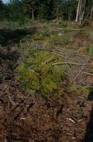
Title (German)
HM 078, Ballmoos Lieli
Caption
Coordinates: 666'400, 230'400
Caption (German)
Koordinaten: 666'400, 230'400
Record Name
Dia_358-2033

Title (German)
HM 078, Ballmoos Lieli
Caption
Coordinates: 666'400, 230'400
Caption (German)
Koordinaten: 666'400, 230'400
Record Name
Dia_358-2034

Title (German)
HM 294, Ober Lauenberg
Caption
Coordinates: 654'800, 199'100
Caption (German)
Koordinaten: 654'800, 199'100
Record Name
Dia_358-2047

Title (German)
HM 294, Ober Lauenberg
Caption
Coordinates: 654'800, 199'100
Caption (German)
Koordinaten: 654'800, 199'100
Record Name
Dia_358-2048

Title (German)
HM 295, Riedboden, Seilkran durchs Moor
Caption
Coordinates: 654'400, 200'100
Caption (German)
Koordinaten: 654'400, 200'100
Record Name
Dia_358-2049
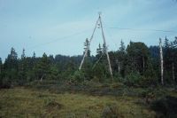
Title (German)
HM 295, Riedboden, Seilkran durchs Moor
Caption
Coordinates: 654'400, 200'100
Caption (German)
Koordinaten: 654'400, 200'100
Record Name
Dia_358-2050

Title (German)
HM 295, Riedboden, Seilkran durchs Moor
Caption
Coordinates: 654'400, 200'100
Caption (German)
Koordinaten: 654'400, 200'100
Record Name
Dia_358-2051

Title (German)
HM 295, Riedboden, Risetestock, Bl. 1169
Caption
Coordinates: 654'000, 201'000
Caption (German)
Koordinaten: 654'000, 201'000
Record Name
Dia_358-2052

Title (German)
HM 296, Balmoos
Caption
Coordinates: 647'300, 201'500
Caption (German)
Koordinaten: 647'300, 201'500
Record Name
Dia_358-2053

Title (German)
HM 296, Balmoos
Caption
Coordinates: 647'300, 201'500
Caption (German)
Koordinaten: 647'300, 201'500
Record Name
Dia_358-2054

Title (German)
HM 296, Balmoos
Caption
Coordinates: 647'300, 201'500
Caption (German)
Koordinaten: 647'300, 201'500
Record Name
Dia_358-2055

Title (German)
HM 296, Balmoos, Konflikt, intensive Mähwiese, Zwischenmoorvegetation
Caption
Coordinates: 647'300, 201'500
Caption (German)
Koordinaten: 647'300, 201'500
Record Name
Dia_358-2056

Title (German)
HM 296, Balmoos, Düngereinfluss, Parzelle Schmidiger
Caption
Coordinates: 647'300, 201'500
Caption (German)
Koordinaten: 647'300, 201'500
Record Name
Dia_358-2057

Title (German)
HM 296, Balmoos, Kunstdünger von Hand ausgestreut, Hochstauden, intensivierte Feuchtwiese
Caption
Coordinates: 647'300, 201'500
Caption (German)
Koordinaten: 647'300, 201'500
Record Name
Dia_358-2058

Title (German)
HM 296, Balmoos, abgetrocknetes Hochmoor, Hanganschluss, Trichophorum, eutrophes Wasser wird durch einen Quergraben vom Moor abgeleitet
Caption
Coordinates: 647'300, 201'500
Caption (German)
Koordinaten: 647'300, 201'500
Record Name
Dia_358-2059

Title (German)
HM 296, Balmoos, trockengefallene Schlenken, die Sphagnen sind z.T. verschwunden
Caption
Coordinates: 647'300, 201'500
Caption (German)
Koordinaten: 647'300, 201'500
Record Name
Dia_358-2060

Title (German)
HM 296, Balmoos
Caption
Coordinates: 647'300, 201'500
Caption (German)
Koordinaten: 647'300, 201'500
Record Name
Dia_358-2061

Title (German)
HM 296, Balmoos
Caption
Coordinates: 647'300, 201'500
Caption (German)
Koordinaten: 647'300, 201'500
Record Name
Dia_358-2062

Title (German)
HM 296, Balmoos
Caption
Coordinates: 647'300, 201'500
Caption (German)
Koordinaten: 647'300, 201'500
Record Name
Dia_358-2063
![HM 296, Balmoos [blurred image].](thumbnails/thumb_ETHBIB.Bildarchiv_1148180.jpg)
Title (German)
HM 296, Balmoos [unscharfe Aufnahme]
Caption
Coordinates: 647'300, 201'500
Caption (German)
Koordinaten: 647'300, 201'500
Record Name
Dia_358-2064
![HM 296, Balmoos [blurred image].](thumbnails/thumb_ETHBIB.Bildarchiv_1148181.jpg)
Title (German)
HM 296, Balmoos [unscharfe Aufnahme]
Caption
Coordinates: 647'300, 201'500
Caption (German)
Koordinaten: 647'300, 201'500
Record Name
Dia_358-2065

Title (German)
HM 296, Balmoos
Caption
Coordinates: 647'300, 201'500
Caption (German)
Koordinaten: 647'300, 201'500
Record Name
Dia_358-2066

Title (German)
HM 296, Balmoos
Caption
Coordinates: 647'300, 201'500
Caption (German)
Koordinaten: 647'300, 201'500
Record Name
Dia_358-2067

Title (German)
HM 296, Balmoos
Caption
Coordinates: 647'300, 201'500
Caption (German)
Koordinaten: 647'300, 201'500
Record Name
Dia_358-2068

Title (German)
HM 296, Balmoos
Caption
Coordinates: 647'300, 201'500
Caption (German)
Koordinaten: 647'300, 201'500
Record Name
Dia_358-2069

Title (German)
HM 296, Balmoos
Caption
Coordinates: 647'300, 201'500
Caption (German)
Koordinaten: 647'300, 201'500
Record Name
Dia_358-2070

Title (German)
HM 296, Balmoos, Dürrenegg, regionale Abfalldeponie auf Feuchtwiesen
Caption
Coordinates: 647'000, 202'000
Caption (German)
Koordinaten: 647'000, 202'000
Record Name
Dia_358-2071

Title (German)
HM 296, Balmoos, Dürrenegg, trockengelegter Torfstichsee, Bl. 1169
Caption
Coordinates: 647'000, 202'000
Caption (German)
Koordinaten: 647'000, 202'000
Record Name
Dia_358-2072

Title (German)
HM 296, Balmoos, Dürrenegg, regionale Abfalldeponie auf Feuchtwiesen
Caption
Coordinates: 647'300, 201'500
Caption (German)
Koordinaten: 647'300, 201'500
Record Name
Dia_358-2073

Title (German)
HM 296, Balmoos, Dürrenegg, regionale Abfalldeponie auf Feuchtwiesen
Caption
Coordinates: 647'300, 201'500
Caption (German)
Koordinaten: 647'300, 201'500
Record Name
Dia_358-2074

Title (German)
HM 296, Balmoos, Dürrenegg, regionale Abfalldeponie auf Feuchtwiesen
Caption
Coordinates: 647'300, 201'500
Caption (German)
Koordinaten: 647'300, 201'500
Record Name
Dia_358-2075

Title (German)
HM 312, Stächelegg, Ghack
Caption
Coordinates: 642'400, 187'300
Caption (German)
Koordinaten: 642'400, 187'300
Record Name
Dia_358-2085

Title (German)
HM 312, Stächelegg, Ghack
Caption
Coordinates: 642'400, 187'300
Caption (German)
Koordinaten: 642'400, 187'300
Record Name
Dia_358-2086

Title (German)
HM 312, Stächelegg, Ghack
Caption
Coordinates: 642'400, 187'300
Caption (German)
Koordinaten: 642'400, 187'300
Record Name
Dia_358-2087

Title (German)
HM 312, Stächelegg, Ghack
Caption
Coordinates: 642'400, 187'300
Caption (German)
Koordinaten: 642'400, 187'300
Record Name
Dia_358-2088

Title (German)
HM 312, Stächelegg, Ghack
Caption
Coordinates: 642'400, 187'300
Caption (German)
Koordinaten: 642'400, 187'300
Record Name
Dia_358-2089

Title (German)
HM 312, Stächelegg, Ghack
Caption
Coordinates: 642'400, 187'300
Caption (German)
Koordinaten: 642'400, 187'300
Record Name
Dia_358-2090

Title (German)
HM 312, Stächelegg, Ghack
Caption
Coordinates: 642'400, 187'300
Caption (German)
Koordinaten: 642'400, 187'300
Record Name
Dia_358-2091

Title (German)
HM 312, Stächelegg, Ghack
Caption
Coordinates: 642'400, 187'300
Caption (German)
Koordinaten: 642'400, 187'300
Record Name
Dia_358-2092

Title (German)
HM 312, Stächelegg, Ghack
Caption
Coordinates: 642'400, 187'300
Caption (German)
Koordinaten: 642'400, 187'300
Record Name
Dia_358-2093

Title (German)
HM 313, Salwideli, Randlagg
Caption
Coordinates: 642'200, 184'800
Caption (German)
Koordinaten: 642'200, 184'800
Record Name
Dia_358-2094

Title (German)
HM 313, Salwideli
Caption
Coordinates: 642'200, 184'800
Caption (German)
Koordinaten: 642'200, 184'800
Record Name
Dia_358-2095

Title (German)
HM 313, Salwideli
Caption
Coordinates: 642'200, 184'800
Caption (German)
Koordinaten: 642'200, 184'800
Record Name
Dia_358-2096

Title (German)
HM 313, Salwideli
Caption
Coordinates: 642'200, 184'800
Caption (German)
Koordinaten: 642'200, 184'800
Record Name
Dia_358-2097

Title (German)
HM 313, Salwideli
Caption
Coordinates: 642'200, 184'800
Caption (German)
Koordinaten: 642'200, 184'800
Record Name
Dia_358-2098

Title (German)
HM 313, Salwideli
Caption
Coordinates: 642'200, 184'800
Caption (German)
Koordinaten: 642'200, 184'800
Record Name
Dia_358-2099

Title (German)
HM 313, Salwideli
Caption
Coordinates: 642'200, 184'800
Caption (German)
Koordinaten: 642'200, 184'800
Record Name
Dia_358-2100
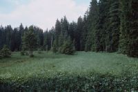
Title (German)
HM 313, Salwideli
Caption
Coordinates: 642'200, 184'800
Caption (German)
Koordinaten: 642'200, 184'800
Record Name
Dia_358-2101

Title (German)
HM 313, Salwideli
Caption
Coordinates: 642'200, 184'800
Caption (German)
Koordinaten: 642'200, 184'800
Record Name
Dia_358-2102

Title (German)
HM 313, Salwideli
Caption
Coordinates: 642'200, 184'800
Caption (German)
Koordinaten: 642'200, 184'800
Record Name
Dia_358-2103

Title (German)
HM 313, Salwideli
Caption
Coordinates: 642'200, 184'800
Caption (German)
Koordinaten: 642'200, 184'800
Record Name
Dia_358-2104

Title (German)
HM 313, Salwideli
Caption
Coordinates: 642'200, 184'800
Caption (German)
Koordinaten: 642'200, 184'800
Record Name
Dia_358-2105

Title (German)
HM 313, Salwideli
Caption
Coordinates: 642'200, 184'800
Caption (German)
Koordinaten: 642'200, 184'800
Record Name
Dia_358-2106

Title (German)
HM 313, Salwideli, Randlagg
Caption
Coordinates: 642'200, 184'800
Caption (German)
Koordinaten: 642'200, 184'800
Record Name
Dia_358-2107

Title (German)
HM 313, Salwideli, Randlagg
Caption
Coordinates: 642'200, 184'800
Caption (German)
Koordinaten: 642'200, 184'800
Record Name
Dia_358-2108

Title (German)
HM 313, Salwideli
Caption
Coordinates: 642'200, 184'800
Caption (German)
Koordinaten: 642'200, 184'800
Record Name
Dia_358-2109

Title (German)
HM 313, Salwideli
Caption
Coordinates: 642'200, 184'800
Caption (German)
Koordinaten: 642'200, 184'800
Record Name
Dia_358-2110

Title (German)
HM 313, Salwideli
Caption
Coordinates: 642'200, 184'800
Caption (German)
Koordinaten: 642'200, 184'800
Record Name
Dia_358-2111

Title (German)
HM 313, Salwideli
Caption
Coordinates: 642'200, 184'800
Caption (German)
Koordinaten: 642'200, 184'800
Record Name
Dia_358-2112

Title (German)
HM 313, Salwideli
Caption
Coordinates: 642'200, 184'800
Caption (German)
Koordinaten: 642'200, 184'800
Record Name
Dia_358-2113

Title (German)
HM 313, Salwideli, Eingriff, Holzrücken, Traktor
Caption
Coordinates: 642'200, 184'800
Caption (German)
Koordinaten: 642'200, 184'800
Record Name
Dia_358-2114

Title (German)
HM 313, Salwideli, Eingriff, Holzrücken, Traktor
Caption
Coordinates: 642'200, 184'800
Caption (German)
Koordinaten: 642'200, 184'800
Record Name
Dia_358-2115

Title (German)
HM 313, Salwideli, Eingriff, Holzrücken, Traktor
Caption
Coordinates: 642'200, 184'800
Caption (German)
Koordinaten: 642'200, 184'800
Record Name
Dia_358-2116

Title (German)
HM 313, Salwideli, Eingriff, Holzrücken, Traktor
Caption
Coordinates: 642'200, 184'800
Caption (German)
Koordinaten: 642'200, 184'800
Record Name
Dia_358-2117

Title (German)
HM 313, Salwideli, Eingriff, Holzrücken, Traktor
Caption
Coordinates: 642'200, 184'800
Caption (German)
Koordinaten: 642'200, 184'800
Record Name
Dia_358-2118