 E-PICS - ETHBIB.Bildarchiv


The images presented on this page are part of E-Pics, a service provided by the ETH-Bibliothek of ETH Zurich. You find here static medium resolution images published under the creative commons
CC-BY-SA license or with the Public Domain Mark. This means that you are free to share, copy and redistribute the material in any medium or format; that you are free to remix, transform, and build upon the material for any purpose, even commercially, under the following conditions: You must give appropriate credit, provide a link to the license, and indicate if changes were made.
- More information about E-Pics is available at https://www.e-pics.ethz.ch
- This catalog can also be accessed at https://ba.e-pics.ethz.ch/ . There you can download the image in a higher resolution.

Title (German)
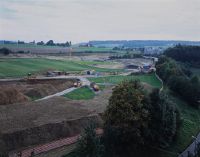
Bern BE, Blick (Westansicht) vom Dach der Kraft Foods auf das Brünnenfeld
Caption
West view from the roof of Kraft Foods onto Brünnenfeld (west part) with road intersection, highway exit 35 of A1 Bern-Brünnen, copses and cultivated land, in the background the housing estates Gäbelbach, Holenacker, and Tscharnergut, 1. Follow-up shot during construction, earthworks (2004), partial view; coordinates (LV03) of the camera location: 594750/199150; keywords Documenta Natura: shopping center, leisure facility, construction work, landscape change agglomeration, tunnel construction, rail traffic, housing estate
Caption (German)
Westansicht vom Dach der Kraft Foods auf das Brünnenfeld (Westteil) mit Strassenkreuzung, Autobahnauffahrt 35 der A1 Bern-Brünnen, Gehölz und Kulturland, im Hintergrund die Wohnsiedlungen Gäbelbach, Holenacker und Tscharnergut, 1. Folgeaufnahme während dem Bau, Erdarbeiten (2004), Teilansicht; Koordinaten (LV03) des Kamerastandorts: 594750/199150; Schlagworte Documenta Natura: Einkaufszentrum, Freizeitanlage, Bauarbeit, Landschaftswandel Agglomeration, Tunnelbau, Schienenverkehr, Wohnsiedlung
Record Name
Dia_303-14284

Title (German)
Bern BE, Blick (Westansicht) vom Dach der Kraft Foods auf das Brünnenfeld
Caption
West view from the roof of Kraft Foods onto Brünnenfeld (west part) with road intersection, highway exit 35 of A1 Bern-Brünnen, woods and cultivated land, railroad line of the SBB, in the background the housing estates Gäbelbach, Holenacker and Tscharnergut, 2nd photo. Follow-up shot (April 2005) during construction (earthworks and roofing), general view; coordinates (LV03) of the camera location: 594750/199150; keywords Documenta Natura: shopping mall, leisure facility, construction work, landscape change agglomeration, tunnel construction, rail traffic, residential area
Caption (German)
Westansicht vom Dach der Kraft Foods auf das Brünnenfeld (Westteil) mit Strassenkreuzung, Autobahnauffahrt 35 der A1 Bern-Brünnen, Gehölz und Kulturland, Bahnlinie der SBB, im Hintergrund die Wohnsiedlungen Gäbelbach, Holenacker und Tscharnergut, 2. Folgeaufnahme (April 2005) während dem Bau (Erdarbeiten und Überdachung), Gesamtansicht; Koordinaten (LV03) des Kamerastandorts: 594750/199150; Schlagworte Documenta Natura: Einkaufszentrum, Freizeitanlage, Bauarbeit, Landschaftswandel Agglomeration, Tunnelbau, Schienenverkehr, Wohnsiedlung
Record Name
Dia_303-14291

Title (German)
Bern BE, Blick (Westansicht) vom Dach der Kraft Foods auf das Brünnenfeld
Caption
West view from the roof of Kraft Foods onto Brünnenfeld (west part) with road intersection, highway exit 35 of A1 Bern-Brünnen, woods and cultivated land, railroad line of the SBB, in the background the housing estates Gäbelbach, Holenacker and Tscharnergut, 2nd photo. Follow-up shot (April 2005) during construction (earthworks and roofing), general view; coordinates (LV03) of the camera location: 594750/199150; keywords Documenta Natura: shopping mall, leisure facility, construction work, landscape change agglomeration, tunnel construction, rail traffic, residential area
Caption (German)
Westansicht vom Dach der Kraft Foods auf das Brünnenfeld (Westteil) mit Strassenkreuzung, Autobahnauffahrt 35 der A1 Bern-Brünnen, Gehölz und Kulturland, Bahnlinie der SBB, im Hintergrund die Wohnsiedlungen Gäbelbach, Holenacker und Tscharnergut, 2. Folgeaufnahme (April 2005) während dem Bau (Erdarbeiten und Überdachung), Gesamtansicht; Koordinaten (LV03) des Kamerastandorts: 594750/199150; Schlagworte Documenta Natura: Einkaufszentrum, Freizeitanlage, Bauarbeit, Landschaftswandel Agglomeration, Tunnelbau, Schienenverkehr, Wohnsiedlung
Record Name
Dia_303-14294

Title (German)
Bern BE, Blick (Westansicht) vom Dach der Kraft Foods auf das Brünnenfeld
Caption
West view from the roof of Kraft Foods onto Brünnenfeld (west part) with road intersection, highway exit 35 of A1 Bern-Brünnen, copses, in the background the housing estates Gäbelbach, Holenacker and Tscharnergut, 2nd photo. Follow-up photo (April 2005) during construction (earthworks and roofing), partial view; coordinates (LV03) of the camera location: 594750/199150; keywords Documenta Natura: shopping center, leisure facility, construction work, landscape change agglomeration, tunnel construction, rail traffic, housing estate
Caption (German)
Westansicht vom Dach der Kraft Foods auf das Brünnenfeld (Westteil) mit Strassenkreuzung, Autobahnauffahrt 35 der A1 Bern-Brünnen, Gehölz, im Hintergrund die Wohnsiedlungen Gäbelbach, Holenacker und Tscharnergut, 2. Folgeaufnahme (April 2005) während dem Bau (Erdarbeiten und Überdachung), Teilansicht; Koordinaten (LV03) des Kamerastandorts: 594750/199150; Schlagworte Documenta Natura: Einkaufszentrum, Freizeitanlage, Bauarbeit, Landschaftswandel Agglomeration, Tunnelbau, Schienenverkehr, Wohnsiedlung
Record Name
Dia_303-14304

Title (German)
Bern BE, Blick (Westansicht) vom Dach der Kraft Foods auf das Brünnenfeld
Caption
West view from the roof of Kraft Foods onto Brünnenfeld (west part) with road intersection, highway exit 35 of A1 Bern-Brünnen, woods and cultivated land, railroad line of the SBB, in the background the housing estates Gäbelbach, Holenacker and Tscharnergut, 3rd photo. Follow-up shot (October 2005) during construction (roofing), general view; coordinates (LV03) of the camera location: 594750/199150; keywords Documenta Natura: shopping center, leisure facility, construction work, landscape change agglomeration, tunnel construction, rail traffic, housing estate
Caption (German)
Westansicht vom Dach der Kraft Foods auf das Brünnenfeld (Westteil) mit Strassenkreuzung, Autobahnauffahrt 35 der A1 Bern-Brünnen, Gehölz und Kulturland, Bahnlinie der SBB, im Hintergrund die Wohnsiedlungen Gäbelbach, Holenacker und Tscharnergut, 3. Folgeaufnahme (Oktober 2005) während dem Bau (Überdachung), Gesamtansicht; Koordinaten (LV03) des Kamerastandorts: 594750/199150; Schlagworte Documenta Natura: Einkaufszentrum, Freizeitanlage, Bauarbeit, Landschaftswandel Agglomeration, Tunnelbau, Schienenverkehr, Wohnsiedlung
Record Name
Dia_303-14308

Title (German)
Bern BE, Blick (Westansicht) vom Dach der Kraft Foods auf das Brünnenfeld
Caption
West view from the roof of Kraft Foods onto Brünnenfeld (west part) with road intersection, highway exit 35 of A1 Bern-Brünnen, woods and cultivated land, railroad line of the SBB, in the background the housing estates Gäbelbach, Holenacker and Tscharnergut, 3rd photo. Follow-up shot (October 2005) during construction (roofing), general view; coordinates (LV03) of the camera location: 594750/199150; keywords Documenta Natura: shopping center, leisure facility, construction work, landscape change agglomeration, tunnel construction, rail traffic, housing estate
Caption (German)
Westansicht vom Dach der Kraft Foods auf das Brünnenfeld (Westteil) mit Strassenkreuzung, Autobahnauffahrt 35 der A1 Bern-Brünnen, Gehölz und Kulturland, Bahnlinie der SBB, im Hintergrund die Wohnsiedlungen Gäbelbach, Holenacker und Tscharnergut, 3. Folgeaufnahme (Oktober 2005) während dem Bau (Überdachung), Gesamtansicht; Koordinaten (LV03) des Kamerastandorts: 594750/199150; Schlagworte Documenta Natura: Einkaufszentrum, Freizeitanlage, Bauarbeit, Landschaftswandel Agglomeration, Tunnelbau, Schienenverkehr, Wohnsiedlung
Record Name
Dia_303-14312

Title (German)
Bern BE, Blick (Westansicht) vom Dach der Kraft Foods auf das Brünnenfeld
Caption
West view from the roof of Kraft Foods onto Brünnenfeld (west part) with road intersection, highway exit 35 of A1 Bern-Brünnen, copses, in the background the housing estates Gäbelbach, Holenacker and Tscharnergut, 3rd photo. Follow-up photo (October 2005) during construction (roofing), partial view; coordinates (LV03) of the camera location: 594750/199150; keywords Documenta Natura: shopping center, leisure facility, construction work, landscape change agglomeration, tunnel construction, rail traffic, housing estate
Caption (German)
Westansicht vom Dach der Kraft Foods auf das Brünnenfeld (Westteil) mit Strassenkreuzung, Autobahnauffahrt 35 der A1 Bern-Brünnen, Gehölz, im Hintergrund die Wohnsiedlungen Gäbelbach, Holenacker und Tscharnergut, 3. Folgeaufnahme (Oktober 2005) während dem Bau (Überdachung), Teilansicht; Koordinaten (LV03) des Kamerastandorts: 594750/199150; Schlagworte Documenta Natura: Einkaufszentrum, Freizeitanlage, Bauarbeit, Landschaftswandel Agglomeration, Tunnelbau, Schienenverkehr, Wohnsiedlung
Record Name
Dia_303-14320

Title (German)
Bern BE, Blick (Westansicht) vom Dach der Kraft Foods auf das Brünnenfeld
Caption
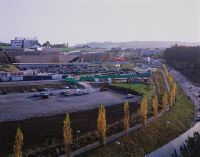
West view from the roof of Kraft Foods onto Brünnenfeld (western part) with road intersection, highway exit 35 of A1 Bern-Brünnen, woods and cultivated land, railroad line of the SBB, in the background the housing estates Gäbelbach, Holenacker and Tscharnergut, 4th photo (May 2006) during construction. Follow-up shot (May 2006) during construction (laying of the foundation stone for Westside on April 28), general view; coordinates (LV03) of the camera location: 594750/199150; keywords Documenta Natura: shopping center, leisure facility, construction work, landscape change agglomeration, tunnel construction, rail traffic, housing estate
Caption (German)
Westansicht vom Dach der Kraft Foods auf das Brünnenfeld (Westteil) mit Strassenkreuzung, Autobahnauffahrt 35 der A1 Bern-Brünnen, Gehölz und Kulturland, Bahnlinie der SBB, im Hintergrund die Wohnsiedlungen Gäbelbach, Holenacker und Tscharnergut, 4. Folgeaufnahme (Mai 2006) während dem Bau (Grundsteinlegung Westside am 28.04.), Gesamtansicht; Koordinaten (LV03) des Kamerastandorts: 594750/199150; Schlagworte Documenta Natura: Einkaufszentrum, Freizeitanlage, Bauarbeit, Landschaftswandel Agglomeration, Tunnelbau, Schienenverkehr, Wohnsiedlung
Record Name
Dia_303-14326

Title (German)
Bern BE, Blick (Westansicht) vom Dach der Kraft Foods auf das Brünnenfeld
Caption
West view from the roof of Kraft Foods onto Brünnenfeld (western part) with road intersection, highway exit 35 of A1 Bern-Brünnen, woods and cultivated land, railroad line of the SBB, in the background the housing estates Gäbelbach, Holenacker and Tscharnergut, 4th photo (May 2006) during construction. Follow-up shot (May 2006) during construction (laying of the foundation stone for Westside on April 28), general view; coordinates (LV03) of the camera location: 594750/199150; keywords Documenta Natura: shopping center, leisure facility, construction work, landscape change agglomeration, tunnel construction, rail traffic, housing estate
Caption (German)
Westansicht vom Dach der Kraft Foods auf das Brünnenfeld (Westteil) mit Strassenkreuzung, Autobahnauffahrt 35 der A1 Bern-Brünnen, Gehölz und Kulturland, Bahnlinie der SBB, im Hintergrund die Wohnsiedlungen Gäbelbach, Holenacker und Tscharnergut, 4. Folgeaufnahme (Mai 2006) während dem Bau (Grundsteinlegung Westside am 28.04.), Gesamtansicht; Koordinaten (LV03) des Kamerastandorts: 594750/199150; Schlagworte Documenta Natura: Einkaufszentrum, Freizeitanlage, Bauarbeit, Landschaftswandel Agglomeration, Tunnelbau, Schienenverkehr, Wohnsiedlung
Record Name
Dia_303-14329

Title (German)
Bern BE, Blick (Westansicht) vom Dach der Kraft Foods auf das Brünnenfeld
Caption
West view from the roof of Kraft Foods onto the Brünnenfeld (west part) with street intersection, highway exit 35 of the A1 Bern-Brünnen, woods, in the background the housing estates Gäbelbach, Holenacker and Tscharnergut, 4th follow-up photo (May 2006) during construction (laying of the foundation stone Westside on 28.04.), partial view; coordinates (LV03) of the camera location: 594750/199150; keywords Documenta Natura: shopping center, leisure facility, construction work, landscape change agglomeration, tunnel construction, rail traffic, housing estate
Caption (German)
Westansicht vom Dach der Kraft Foods auf das Brünnenfeld (Westteil) mit Strassenkreuzung, Autobahnauffahrt 35 der A1 Bern-Brünnen, Gehölz, im Hintergrund die Wohnsiedlungen Gäbelbach, Holenacker und Tscharnergut, 4. Folgeaufnahme (Mai 2006) während dem Bau (Grundsteinlegung Westside am 28.04.), Teilansicht; Koordinaten (LV03) des Kamerastandorts: 594750/199150; Schlagworte Documenta Natura: Einkaufszentrum, Freizeitanlage, Bauarbeit, Landschaftswandel Agglomeration, Tunnelbau, Schienenverkehr, Wohnsiedlung
Record Name
Dia_303-14338

Title (German)
Bern BE, Blick (Westansicht) vom Dach der Kraft Foods auf das Brünnenfeld
Caption
West view from the roof of Kraft Foods onto Brünnenfeld (west part) with road intersection, highway exit 35 of A1 Bern-Brünnen, woods and cultivated land, railroad line of the SBB, in the background the housing estates Gäbelbach, Holenacker and Tscharnergut, 5th photo. Follow-up photo (July 2006) during construction, general view; coordinates (LV03) of the camera location: 594750/199150; keywords Documenta Natura: shopping center, leisure facility, construction work, landscape change agglomeration, tunnel construction, rail traffic, housing estate
Caption (German)
Westansicht vom Dach der Kraft Foods auf das Brünnenfeld (Westteil) mit Strassenkreuzung, Autobahnauffahrt 35 der A1 Bern-Brünnen, Gehölz und Kulturland, Bahnlinie der SBB, im Hintergrund die Wohnsiedlungen Gäbelbach, Holenacker und Tscharnergut, 5. Folgeaufnahme (Juli 2006) während dem Bau, Gesamtansicht; Koordinaten (LV03) des Kamerastandorts: 594750/199150; Schlagworte Documenta Natura: Einkaufszentrum, Freizeitanlage, Bauarbeit, Landschaftswandel Agglomeration, Tunnelbau, Schienenverkehr, Wohnsiedlung
Record Name
Dia_303-14343

Title (German)
Bern BE, Blick (Westansicht) vom Dach der Kraft Foods auf das Brünnenfeld
Caption
West view from the roof of Kraft Foods onto Brünnenfeld (west part) with road intersection, highway exit 35 of A1 Bern-Brünnen, woods and cultivated land, railroad line of the SBB, in the background the housing estates Gäbelbach, Holenacker and Tscharnergut, 5th photo. Follow-up photo (July 2006) during construction, general view; coordinates (LV03) of the camera location: 594750/199150; keywords Documenta Natura: shopping center, leisure facility, construction work, landscape change agglomeration, tunnel construction, rail traffic, housing estate
Caption (German)
Westansicht vom Dach der Kraft Foods auf das Brünnenfeld (Westteil) mit Strassenkreuzung, Autobahnauffahrt 35 der A1 Bern-Brünnen, Gehölz und Kulturland, Bahnlinie der SBB, im Hintergrund die Wohnsiedlungen Gäbelbach, Holenacker und Tscharnergut, 5. Folgeaufnahme (Juli 2006) während dem Bau, Gesamtansicht; Koordinaten (LV03) des Kamerastandorts: 594750/199150; Schlagworte Documenta Natura: Einkaufszentrum, Freizeitanlage, Bauarbeit, Landschaftswandel Agglomeration, Tunnelbau, Schienenverkehr, Wohnsiedlung
Record Name
Dia_303-14347

Title (German)
Bern BE, Blick (Westansicht) vom Dach der Kraft Foods auf das Brünnenfeld
Caption
West view from the roof of Kraft Foods onto the Brünnenfeld (west part) with road intersection, highway exit 35 of the A1 Bern-Brünnen, copses, in the background the housing estates Gäbelbach, Holenacker and Tscharnergut, 5th follow-up photo (July 2006) during construction, partial view; coordinates (LV03) of the camera location: 594750/199150; keywords Documenta Natura: shopping mall, leisure facility, construction work, landscape change agglomeration, tunnel construction, rail traffic, housing estate
Caption (German)
Westansicht vom Dach der Kraft Foods auf das Brünnenfeld (Westteil) mit Strassenkreuzung, Autobahnauffahrt 35 der A1 Bern-Brünnen, Gehölz, im Hintergrund die Wohnsiedlungen Gäbelbach, Holenacker und Tscharnergut, 5. Folgeaufnahme (Juli 2006) während dem Bau, Teilansicht; Koordinaten (LV03) des Kamerastandorts: 594750/199150; Schlagworte Documenta Natura: Einkaufszentrum, Freizeitanlage, Bauarbeit, Landschaftswandel Agglomeration, Tunnelbau, Schienenverkehr, Wohnsiedlung
Record Name
Dia_303-14355

Title (German)
Bern BE, Blick (Westansicht) vom Dach der Kraft Foods auf das Brünnenfeld
Caption
West view from the roof of Kraft Foods onto Brünnenfeld (west part) with road intersection, highway exit 35 of A1 Bern-Brünnen, woods and cultivated land, railroad line of the SBB, in the background the housing estates Gäbelbach, Holenacker and Tscharnergut, 6th photo. Follow-up photo (November 2006) during construction, general view; coordinates (LV03) of the camera location: 594750/199150; keywords Documenta Natura: shopping center, leisure facility, construction work, landscape change agglomeration, tunnel construction, rail traffic, housing estate
Caption (German)
Westansicht vom Dach der Kraft Foods auf das Brünnenfeld (Westteil) mit Strassenkreuzung, Autobahnauffahrt 35 der A1 Bern-Brünnen, Gehölz und Kulturland, Bahnlinie der SBB, im Hintergrund die Wohnsiedlungen Gäbelbach, Holenacker und Tscharnergut, 6. Folgeaufnahme (November 2006) während dem Bau, Gesamtansicht; Koordinaten (LV03) des Kamerastandorts: 594750/199150; Schlagworte Documenta Natura: Einkaufszentrum, Freizeitanlage, Bauarbeit, Landschaftswandel Agglomeration, Tunnelbau, Schienenverkehr, Wohnsiedlung
Record Name
Dia_303-14361

Title (German)
Bern BE, Blick (Westansicht) vom Dach der Kraft Foods auf das Brünnenfeld
Caption
West view from the roof of Kraft Foods onto Brünnenfeld (west part) with road intersection, highway exit 35 of A1 Bern-Brünnen, woods and cultivated land, railroad line of the SBB, in the background the housing estates Gäbelbach, Holenacker and Tscharnergut, 6th photo. Follow-up photo (November 2006) during construction, general view; coordinates (LV03) of the camera location: 594750/199150; keywords Documenta Natura: shopping center, leisure facility, construction work, landscape change agglomeration, tunnel construction, rail traffic, housing estate
Caption (German)
Westansicht vom Dach der Kraft Foods auf das Brünnenfeld (Westteil) mit Strassenkreuzung, Autobahnauffahrt 35 der A1 Bern-Brünnen, Gehölz und Kulturland, Bahnlinie der SBB, im Hintergrund die Wohnsiedlungen Gäbelbach, Holenacker und Tscharnergut, 6. Folgeaufnahme (November 2006) während dem Bau, Gesamtansicht; Koordinaten (LV03) des Kamerastandorts: 594750/199150; Schlagworte Documenta Natura: Einkaufszentrum, Freizeitanlage, Bauarbeit, Landschaftswandel Agglomeration, Tunnelbau, Schienenverkehr, Wohnsiedlung
Record Name
Dia_303-14365

Title (German)
Bern BE, Blick (Westansicht) vom Dach der Kraft Foods auf das Brünnenfeld
Caption
West view from the roof of Kraft Foods onto the Brünnenfeld (west part) with road intersection, highway exit 35 of the A1 Bern-Brünnen, copses, in the background the housing estates Gäbelbach, Holenacker and Tscharnergut, 6th follow-up photo (November 2006) during construction, partial view; coordinates (LV03) of the camera location: 594750/199150; keywords Documenta Natura: shopping mall, leisure facility, construction work, landscape change agglomeration, tunnel construction, rail traffic, housing estate
Caption (German)
Westansicht vom Dach der Kraft Foods auf das Brünnenfeld (Westteil) mit Strassenkreuzung, Autobahnauffahrt 35 der A1 Bern-Brünnen, Gehölz, im Hintergrund die Wohnsiedlungen Gäbelbach, Holenacker und Tscharnergut, 6. Folgeaufnahme (November 2006) während dem Bau, Teilansicht; Koordinaten (LV03) des Kamerastandorts: 594750/199150; Schlagworte Documenta Natura: Einkaufszentrum, Freizeitanlage, Bauarbeit, Landschaftswandel Agglomeration, Tunnelbau, Schienenverkehr, Wohnsiedlung
Record Name
Dia_303-14373

Title (German)
Bern BE, Blick (Westansicht) vom Dach der Kraft Foods auf das Brünnenfeld
Caption
West view from the roof of Kraft Foods onto Brünnenfeld (west part) with road intersection, highway exit 35 of the A1 Bern-Brünnen, woods and cultivated land, railroad line of the SBB, in the background the housing estates Gäbelbach, Holenacker and Tscharnergut, 7th photo (April 2007). Follow-up photo (April 2007) during construction, general view; coordinates (LV03) of the camera location: 594750/199150; keywords Documenta Natura: shopping center, leisure facility, construction work, landscape change agglomeration, tunnel construction, rail traffic, housing estate
Caption (German)
Westansicht vom Dach der Kraft Foods auf das Brünnenfeld (Westteil) mit Strassenkreuzung, Autobahnauffahrt 35 der A1 Bern-Brünnen, Gehölz und Kulturland, Bahnlinie der SBB, im Hintergrund die Wohnsiedlungen Gäbelbach, Holenacker und Tscharnergut, 7. Folgeaufnahme (April 2007) während dem Bau, Gesamtansicht; Koordinaten (LV03) des Kamerastandorts: 594750/199150; Schlagworte Documenta Natura: Einkaufszentrum, Freizeitanlage, Bauarbeit, Landschaftswandel Agglomeration, Tunnelbau, Schienenverkehr, Wohnsiedlung
Record Name
Dia_303-14379

Title (German)
Bern BE, Blick (Westansicht) vom Dach der Kraft Foods auf das Brünnenfeld
Caption
West view from the roof of Kraft Foods onto Brünnenfeld (west part) with road intersection, highway exit 35 of the A1 Bern-Brünnen, woods and cultivated land, railroad line of the SBB, in the background the housing estates Gäbelbach, Holenacker and Tscharnergut, 7th photo (April 2007). Follow-up photo (April 2007) during construction, general view; coordinates (LV03) of the camera location: 594750/199150; keywords Documenta Natura: shopping center, leisure facility, construction work, landscape change agglomeration, tunnel construction, rail traffic, residential area
Caption (German)
Westansicht vom Dach der Kraft Foods auf das Brünnenfeld (Westteil) mit Strassenkreuzung, Autobahnauffahrt 35 der A1 Bern-Brünnen, Gehölz und Kulturland, Bahnlinie der SBB, im Hintergrund die Wohnsiedlungen Gäbelbach, Holenacker und Tscharnergut, 7. Folgeaufnahme (April 2007) während dem Bau, Gesamtansicht; Koordinaten (LV03) des Kamerastandorts: 594750/199150; Schlagworte Documenta Natura: Einkaufszentrum, Freizeitanlage, Bauarbeit, Landschaftswandel Agglomeration, Tunnelbau, Schienenverkehr, Wohnsiedlung
Record Name
Dia_303-14383

Title (German)
Bern BE, Blick (Westansicht) vom Dach der Kraft Foods auf das Brünnenfeld
Caption
West view from the roof of Kraft Foods onto the Brünnenfeld (west part) with road intersection, highway exit 35 of the A1 Bern-Brünnen, copses, in the background the housing estates Gäbelbach, Holenacker and Tscharnergut, 7th follow-up photo (April 2007) during construction, partial view; coordinates (LV03) of the camera location: 594750/199150; keywords Documenta Natura: shopping mall, leisure facility, construction work, landscape change agglomeration, tunnel construction, rail traffic, housing estate
Caption (German)
Westansicht vom Dach der Kraft Foods auf das Brünnenfeld (Westteil) mit Strassenkreuzung, Autobahnauffahrt 35 der A1 Bern-Brünnen, Gehölz, im Hintergrund die Wohnsiedlungen Gäbelbach, Holenacker und Tscharnergut, 7. Folgeaufnahme (April 2007) während dem Bau, Teilansicht; Koordinaten (LV03) des Kamerastandorts: 594750/199150; Schlagworte Documenta Natura: Einkaufszentrum, Freizeitanlage, Bauarbeit, Landschaftswandel Agglomeration, Tunnelbau, Schienenverkehr, Wohnsiedlung
Record Name
Dia_303-14391

Title (German)
Bern BE, Blick (Westansicht) vom Dach der Kraft Foods auf das Brünnenfeld
Caption
West view from the roof of Kraft Foods onto Brünnenfeld (west part) with road intersection, highway exit 35 of the A1 Bern-Brünnen, woods and cultivated land, railroad line of the SBB, in the background the housing estates Gäbelbach, Holenacker and Tscharnergut, 8th photo. Follow-up photo (October 2007) during construction (erection), general view; coordinates (LV03) of the camera location: 594750/199150; keywords Documenta Natura: shopping center, leisure facility, construction work, landscape change agglomeration, tunnel construction, rail traffic, housing estate
Caption (German)
Westansicht vom Dach der Kraft Foods auf das Brünnenfeld (Westteil) mit Strassenkreuzung, Autobahnauffahrt 35 der A1 Bern-Brünnen, Gehölz und Kulturland, Bahnlinie der SBB, im Hintergrund die Wohnsiedlungen Gäbelbach, Holenacker und Tscharnergut, 8. Folgeaufnahme (Oktober 2007) während dem Bau (Aufrichte), Gesamtansicht; Koordinaten (LV03) des Kamerastandorts: 594750/199150; Schlagworte Documenta Natura: Einkaufszentrum, Freizeitanlage, Bauarbeit, Landschaftswandel Agglomeration, Tunnelbau, Schienenverkehr, Wohnsiedlung
Record Name
Dia_303-14397

Title (German)
Bern BE, Blick (Westansicht) vom Dach der Kraft Foods auf das Brünnenfeld
Caption
West view from the roof of Kraft Foods onto Brünnenfeld (west part) with road intersection, highway exit 35 of the A1 Bern-Brünnen, woods and cultivated land, railroad line of the SBB, in the background the housing estates Gäbelbach, Holenacker and Tscharnergut, 8th photo. Follow-up photo (October 2007) during construction (erection), general view; coordinates (LV03) of the camera location: 594750/199150; keywords Documenta Natura: shopping center, leisure facility, construction work, landscape change agglomeration, tunnel construction, rail traffic, housing estate
Caption (German)
Westansicht vom Dach der Kraft Foods auf das Brünnenfeld (Westteil) mit Strassenkreuzung, Autobahnauffahrt 35 der A1 Bern-Brünnen, Gehölz und Kulturland, Bahnlinie der SBB, im Hintergrund die Wohnsiedlungen Gäbelbach, Holenacker und Tscharnergut, 8. Folgeaufnahme (Oktober 2007) während dem Bau (Aufrichte), Gesamtansicht; Koordinaten (LV03) des Kamerastandorts: 594750/199150; Schlagworte Documenta Natura: Einkaufszentrum, Freizeitanlage, Bauarbeit, Landschaftswandel Agglomeration, Tunnelbau, Schienenverkehr, Wohnsiedlung
Record Name
Dia_303-14405

Title (German)
Bern BE, Blick (Westansicht) vom Dach der Kraft Foods auf das Brünnenfeld
Caption
West view from the roof of Kraft Foods onto Brünnenfeld (west part) with road intersection, highway exit 35 of the A1 Bern-Brünnen, copses, in the background the housing estates Gäbelbach, Holenacker and Tscharnergut, 8th photo. Follow-up photo (October 2007) during construction (erection), partial view; coordinates (LV03) of the camera location: 594750/199150; keywords Documenta Natura: shopping center, leisure facility, construction work, landscape change agglomeration, tunnel construction, rail traffic, housing estate
Caption (German)
Westansicht vom Dach der Kraft Foods auf das Brünnenfeld (Westteil) mit Strassenkreuzung, Autobahnauffahrt 35 der A1 Bern-Brünnen, Gehölz, im Hintergrund die Wohnsiedlungen Gäbelbach, Holenacker und Tscharnergut, 8. Folgeaufnahme (Oktober 2007) während dem Bau (Aufrichte), Teilansicht; Koordinaten (LV03) des Kamerastandorts: 594750/199150; Schlagworte Documenta Natura: Einkaufszentrum, Freizeitanlage, Bauarbeit, Landschaftswandel Agglomeration, Tunnelbau, Schienenverkehr, Wohnsiedlung
Record Name
Dia_303-14416

Title (German)
Bern BE, Blick (Westansicht) vom Dach der Kraft Foods auf das Brünnenfeld
Caption
West view from the roof of Kraft Foods onto the Brünnenfeld (west part) with road intersection, highway exit 35 of the A1 Bern-Brünnen, railroad line of the SBB, in the background the housing estates Gäbelbach, Holenacker and Tscharnergut, 9th follow-up photo (May 2008) during construction, general view; coordinates (LV03) of the camera location: 594750/199150; keywords Documenta Natura: shopping mall, leisure facility, construction work, landscape change agglomeration, tunnel construction, railroad traffic, housing estate
Caption (German)
Westansicht vom Dach der Kraft Foods auf das Brünnenfeld (Westteil) mit Strassenkreuzung, Autobahnauffahrt 35 der A1 Bern-Brünnen, Bahnlinie der SBB, im Hintergrund die Wohnsiedlungen Gäbelbach, Holenacker und Tscharnergut, 9. Folgeaufnahme (Mai 2008) während dem Bau, Gesamtansicht; Koordinaten (LV03) des Kamerastandorts: 594750/199150; Schlagworte Documenta Natura: Einkaufszentrum, Freizeitanlage, Bauarbeit, Landschaftswandel Agglomeration, Tunnelbau, Schienenverkehr, Wohnsiedlung
Record Name
Dia_303-14421

Title (German)
Bern BE, Blick (Westansicht) vom Dach der Kraft Foods auf das Brünnenfeld
Caption
West view from the roof of Kraft Foods onto the Brünnenfeld (west part) with road intersection, highway exit 35 of the A1 Bern-Brünnen, railroad line of the SBB, in the background the housing estates Gäbelbach, Holenacker and Tscharnergut, 9th follow-up photo (May 2008) during construction, general view; coordinates (LV03) of the camera location: 594750/199150; keywords Documenta Natura: shopping mall, leisure facility, construction work, landscape change agglomeration, tunnel construction, railroad traffic, housing estate
Caption (German)
Westansicht vom Dach der Kraft Foods auf das Brünnenfeld (Westteil) mit Strassenkreuzung, Autobahnauffahrt 35 der A1 Bern-Brünnen, Bahnlinie der SBB, im Hintergrund die Wohnsiedlungen Gäbelbach, Holenacker und Tscharnergut, 9. Folgeaufnahme (Mai 2008) während dem Bau, Gesamtansicht; Koordinaten (LV03) des Kamerastandorts: 594750/199150; Schlagworte Documenta Natura: Einkaufszentrum, Freizeitanlage, Bauarbeit, Landschaftswandel Agglomeration, Tunnelbau, Schienenverkehr, Wohnsiedlung
Record Name
Dia_303-14425

Title (German)
Bern BE, Blick (Westansicht) vom Dach der Kraft Foods auf das Brünnenfeld
Caption
West view from the roof of Kraft Foods onto Brünnenfeld (west part) with road intersection, highway exit 35 of A1 Bern-Brünnen, in the background the housing estates Gäbelbach, Holenacker and Tscharnergut, 9th follow-up photo (May 2008) during construction, partial view; coordinates (LV03) of the camera location: 594750/199150; keywords Documenta Natura: shopping mall, leisure facility, construction work, landscape change agglomeration, tunnel construction, rail traffic, housing estate
Caption (German)
Westansicht vom Dach der Kraft Foods auf das Brünnenfeld (Westteil) mit Strassenkreuzung, Autobahnauffahrt 35 der A1 Bern-Brünnen, im Hintergrund die Wohnsiedlungen Gäbelbach, Holenacker und Tscharnergut, 9. Folgeaufnahme (Mai 2008) während dem Bau, Teilansicht; Koordinaten (LV03) des Kamerastandorts: 594750/199150; Schlagworte Documenta Natura: Einkaufszentrum, Freizeitanlage, Bauarbeit, Landschaftswandel Agglomeration, Tunnelbau, Schienenverkehr, Wohnsiedlung
Record Name
Dia_303-14434

Title (German)
Bern BE, Blick (Westansicht) vom Dach der Kraft Foods auf das Brünnenfeld
Caption
West view from the roof of Kraft Foods onto Brünnenfeld (western part) with street intersection, highway exit 35 of A1 Bern-Brünnen, railroad line of SBB, in the background the housing estates Gäbelbach, Holenacker and Tscharnergut, 10th floor. Follow-up photo (October 2008) after the opening of Westside (08.10.2008), general view; coordinates (LV03) of the camera location: 594750/199150; keywords Documenta Natura: shopping center, leisure facility, construction work, landscape change agglomeration, tunnel construction, rail traffic, housing estate
Caption (German)
Westansicht vom Dach der Kraft Foods auf das Brünnenfeld (Westteil) mit Strassenkreuzung, Autobahnauffahrt 35 der A1 Bern-Brünnen, Bahnlinie der SBB, im Hintergrund die Wohnsiedlungen Gäbelbach, Holenacker und Tscharnergut, 10. Folgeaufnahme (Oktober 2008) nach der Eröffnung Westside (08.10.2008), Gesamtansicht; Koordinaten (LV03) des Kamerastandorts: 594750/199150; Schlagworte Documenta Natura: Einkaufszentrum, Freizeitanlage, Bauarbeit, Landschaftswandel Agglomeration, Tunnelbau, Schienenverkehr, Wohnsiedlung
Record Name
Dia_303-14439

Title (German)
Bern BE, Blick (Westansicht) vom Dach der Kraft Foods auf das Brünnenfeld
Caption
West view from the roof of Kraft Foods onto Brünnenfeld (western part) with street intersection, highway exit 35 of A1 Bern-Brünnen, railroad line of SBB, in the background the housing estates Gäbelbach, Holenacker and Tscharnergut, 10th floor. Follow-up photo (October 2008) after the opening of Westside (08.10.2008), general view; coordinates (LV03) of the camera location: 594750/199150; keywords Documenta Natura: shopping center, leisure facility, construction work, landscape change agglomeration, tunnel construction, rail traffic, housing estate
Caption (German)
Westansicht vom Dach der Kraft Foods auf das Brünnenfeld (Westteil) mit Strassenkreuzung, Autobahnauffahrt 35 der A1 Bern-Brünnen, Bahnlinie der SBB, im Hintergrund die Wohnsiedlungen Gäbelbach, Holenacker und Tscharnergut, 10. Folgeaufnahme (Oktober 2008) nach der Eröffnung Westside (08.10.2008), Gesamtansicht; Koordinaten (LV03) des Kamerastandorts: 594750/199150; Schlagworte Documenta Natura: Einkaufszentrum, Freizeitanlage, Bauarbeit, Landschaftswandel Agglomeration, Tunnelbau, Schienenverkehr, Wohnsiedlung
Record Name
Dia_303-14443

Title (German)
Bern BE, Blick (Westansicht) vom Dach der Kraft Foods auf das Brünnenfeld
Caption
West view from the roof of Kraft Foods onto Brünnenfeld (western part) with street intersection, highway exit 35 of A1 Bern-Brünnen, in the background the housing estates Gäbelbach, Holenacker and Tscharnergut, 10th follow-up photo (October 2008) after the opening Westside (08.10.2008), partial view; coordinates (LV03) of the camera location: 594750/199150; keywords Documenta Natura: shopping mall, leisure facility, construction work, landscape change agglomeration, tunnel construction, rail traffic, housing estate
Caption (German)
Westansicht vom Dach der Kraft Foods auf das Brünnenfeld (Westteil) mit Strassenkreuzung, Autobahnauffahrt 35 der A1 Bern-Brünnen, im Hintergrund die Wohnsiedlungen Gäbelbach, Holenacker und Tscharnergut, 10. Folgeaufnahme (Oktober 2008) nach der Eröffnung Westside (08.10.2008), Teilansicht; Koordinaten (LV03) des Kamerastandorts: 594750/199150; Schlagworte Documenta Natura: Einkaufszentrum, Freizeitanlage, Bauarbeit, Landschaftswandel Agglomeration, Tunnelbau, Schienenverkehr, Wohnsiedlung
Record Name
Dia_303-14452

Title (German)
Bern BE, Blick (Westansicht) vom Dach der Kraft Foods auf das Brünnenfeld
Caption
West view from the roof of Kraft Foods onto Brünnenfeld (west part) with road intersection, freeway exit 35 of the A1 Bern-Brünnen, railroad line of the SBB, in the background the housing estates Gäbelbach, Holenacker and Tscharnergut, 11th follow-up photo (October 2009) during operation Westside, general view; coordinates (LV03) of the camera location: 594750/199150; keywords Documenta Natura: shopping mall, leisure facility, construction work, landscape change agglomeration, tunnel construction, railroad traffic, housing estate
Caption (German)
Westansicht vom Dach der Kraft Foods auf das Brünnenfeld (Westteil) mit Strassenkreuzung, Autobahnauffahrt 35 der A1 Bern-Brünnen, Bahnlinie der SBB, im Hintergrund die Wohnsiedlungen Gäbelbach, Holenacker und Tscharnergut, 11. Folgeaufnahme (Oktober 2009) während Betrieb Westside, Gesamtansicht; Koordinaten (LV03) des Kamerastandorts: 594750/199150; Schlagworte Documenta Natura: Einkaufszentrum, Freizeitanlage, Bauarbeit, Landschaftswandel Agglomeration, Tunnelbau, Schienenverkehr, Wohnsiedlung
Record Name
Dia_303-14457

Title (German)
Bern BE, Blick (Westansicht) vom Dach der Kraft Foods auf das Brünnenfeld
Caption
West view from the roof of Kraft Foods onto Brünnenfeld (west part) with road intersection, freeway exit 35 of the A1 Bern-Brünnen, railroad line of the SBB, in the background the housing estates Gäbelbach, Holenacker and Tscharnergut, 11th follow-up photo (October 2009) during operation Westside, general view; coordinates (LV03) of the camera location: 594750/199150; keywords Documenta Natura: shopping mall, leisure facility, construction work, landscape change agglomeration, tunnel construction, railroad traffic, housing estate
Caption (German)
Westansicht vom Dach der Kraft Foods auf das Brünnenfeld (Westteil) mit Strassenkreuzung, Autobahnauffahrt 35 der A1 Bern-Brünnen, Bahnlinie der SBB, im Hintergrund die Wohnsiedlungen Gäbelbach, Holenacker und Tscharnergut, 11. Folgeaufnahme (Oktober 2009) während Betrieb Westside, Gesamtansicht; Koordinaten (LV03) des Kamerastandorts: 594750/199150; Schlagworte Documenta Natura: Einkaufszentrum, Freizeitanlage, Bauarbeit, Landschaftswandel Agglomeration, Tunnelbau, Schienenverkehr, Wohnsiedlung
Record Name
Dia_303-14461

Title (German)
Bern BE, Blick (Westansicht) vom Dach der Kraft Foods auf das Brünnenfeld
Caption
West view from the roof of Kraft Foods onto Brünnenfeld (west part) with road intersection, highway exit 35 of A1 Bern-Brünnen, in the background the housing estates Gäbelbach, Holenacker and Tscharnergut, 11th follow-up photo (October 2009) during operation Westside, partial view; coordinates (LV03) of the camera location: 594750/199150; keywords Documenta Natura: shopping mall, leisure facility, construction work, landscape change agglomeration, tunnel construction, rail traffic, housing estate
Caption (German)
Westansicht vom Dach der Kraft Foods auf das Brünnenfeld (Westteil) mit Strassenkreuzung, Autobahnauffahrt 35 der A1 Bern-Brünnen, im Hintergrund die Wohnsiedlungen Gäbelbach, Holenacker und Tscharnergut, 11. Folgeaufnahme (Oktober 2009) während Betrieb Westside, Teilansicht; Koordinaten (LV03) des Kamerastandorts: 594750/199150; Schlagworte Documenta Natura: Einkaufszentrum, Freizeitanlage, Bauarbeit, Landschaftswandel Agglomeration, Tunnelbau, Schienenverkehr, Wohnsiedlung
Record Name
Dia_303-14470

Title (German)
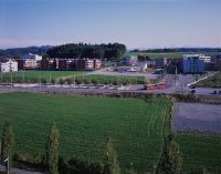
Bern BE, Blick (Nordansicht) vom Gäbelbachwohnhaus 70 auf das Brünnenfeld
Caption
North view from Gäbelbachwohnhaus 70 onto Brünnenfeld (northern part) with farmland and copses, first shot before start of construction Westside (2002), general view; coordinates (LV03) of camera location: 595100/199720; keywords Documenta Natura: shopping mall, leisure complex, construction work, landscape change agglomeration, tunnel construction, rail traffic, housing estate
Caption (German)
Nordansicht vom Gäbelbachwohnhaus 70 auf das Brünnenfeld (Nordteil) mit Ackerland und Gehölz, Erstaufnahme vor Baubeginn Westside (2002), Gesamtansicht; Koordinaten (LV03) des Kamerastandorts: 595100/199720; Schlagworte Documenta Natura: Einkaufszentrum, Freizeitanlage, Bauarbeit, Landschaftswandel Agglomeration, Tunnelbau, Schienenverkehr, Wohnsiedlung
Record Name
Dia_303-14475

Title (German)
Bern BE, Blick (Nordansicht) vom Gäbelbachwohnhaus 70 auf das Brünnenfeld
Caption
North view from Gäbelbachwohnhaus 70 onto Brünnenfeld (northern part) with farmland and copses, first shot before start of construction Westside (2002), general view; coordinates (LV03) of camera location: 595100/199720; keywords Documenta Natura: shopping mall, leisure complex, construction work, landscape change agglomeration, tunnel construction, rail traffic, housing estate
Caption (German)
Nordansicht vom Gäbelbachwohnhaus 70 auf das Brünnenfeld (Nordteil) mit Ackerland und Gehölz, Erstaufnahme vor Baubeginn Westside (2002), Gesamtansicht; Koordinaten (LV03) des Kamerastandorts: 595100/199720; Schlagworte Documenta Natura: Einkaufszentrum, Freizeitanlage, Bauarbeit, Landschaftswandel Agglomeration, Tunnelbau, Schienenverkehr, Wohnsiedlung
Record Name
Dia_303-14478

Title (German)
Bern BE, Blick (Nordansicht) vom Gäbelbachwohnhaus 70 auf das Brünnenfeld
Caption
North view from Gäbelbachwohnhaus 70 onto Brünnenfeld (northern part) with farmland and copses, first shot before start of construction Westside (2002), general view; coordinates (LV03) of camera location: 595100/199720; keywords Documenta Natura: shopping mall, leisure complex, construction work, landscape change agglomeration, tunnel construction, rail traffic, housing estate
Caption (German)
Nordansicht vom Gäbelbachwohnhaus 70 auf das Brünnenfeld (Nordteil) mit Ackerland und Gehölz, Erstaufnahme vor Baubeginn Westside (2002), Gesamtansicht; Koordinaten (LV03) des Kamerastandorts: 595100/199720; Schlagworte Documenta Natura: Einkaufszentrum, Freizeitanlage, Bauarbeit, Landschaftswandel Agglomeration, Tunnelbau, Schienenverkehr, Wohnsiedlung
Record Name
Dia_303-14482

Title (German)
Bern BE, Blick (Nordansicht) vom Gäbelbachwohnhaus 70 auf das Brünnenfeld
Caption
North view from Gäbelbachwohnhaus 70 onto Brünnenfeld (northern part), 1st follow-up photo (2004) during construction Westside (earthworks), general view; coordinates (LV03) of camera location: 595100/199720; keywords Documenta Natura: shopping mall, leisure complex, construction work, landscape change agglomeration, tunnel construction, rail traffic, housing estate
Caption (German)
Nordansicht vom Gäbelbachwohnhaus 70 auf das Brünnenfeld (Nordteil), 1. Folgeaufnahme (2004) während dem Bau Westside (Erdarbeiten), Gesamtansicht; Koordinaten (LV03) des Kamerastandorts: 595100/199720; Schlagworte Documenta Natura: Einkaufszentrum, Freizeitanlage, Bauarbeit, Landschaftswandel Agglomeration, Tunnelbau, Schienenverkehr, Wohnsiedlung
Record Name
Dia_303-14492

Title (German)
Bern BE, Blick (Nordansicht) vom Gäbelbachwohnhaus 70 auf das Brünnenfeld
Caption
North view from Gäbelbachwohnhaus 70 onto Brünnenfeld (northern part), 1st follow-up photo (2004) during construction Westside (earthworks), general view; coordinates (LV03) of camera location: 595100/199720; keywords Documenta Natura: shopping mall, leisure complex, construction work, landscape change agglomeration, tunnel construction, rail traffic, housing estate
Caption (German)
Nordansicht vom Gäbelbachwohnhaus 70 auf das Brünnenfeld (Nordteil), 1. Folgeaufnahme (2004) während dem Bau Westside (Erdarbeiten), Gesamtansicht; Koordinaten (LV03) des Kamerastandorts: 595100/199720; Schlagworte Documenta Natura: Einkaufszentrum, Freizeitanlage, Bauarbeit, Landschaftswandel Agglomeration, Tunnelbau, Schienenverkehr, Wohnsiedlung
Record Name
Dia_303-14496
Title (German)
Bern BE, Blick (Nordansicht) vom Gäbelbachwohnhaus 70 auf das Brünnenfeld
Caption
North view from Gäbelbachwohnhaus 70 onto Brünnenfeld (northern part), 1st follow-up photo (2004) during construction Westside (earthworks), general view; coordinates (LV03) of camera location: 595100/199720; keywords Documenta Natura: shopping mall, leisure complex, construction work, landscape change agglomeration, tunnel construction, rail traffic, housing estate
Caption (German)
Nordansicht vom Gäbelbachwohnhaus 70 auf das Brünnenfeld (Nordteil), 1. Folgeaufnahme (2004) während dem Bau Westside (Erdarbeiten), Gesamtansicht; Koordinaten (LV03) des Kamerastandorts: 595100/199720; Schlagworte Documenta Natura: Einkaufszentrum, Freizeitanlage, Bauarbeit, Landschaftswandel Agglomeration, Tunnelbau, Schienenverkehr, Wohnsiedlung
Record Name
Dia_303-14500

Title (German)
Bern BE, Blick (Nordansicht) vom Gäbelbachwohnhaus 70 auf das Brünnenfeld
Caption
North view from Gäbelbachwohnhaus 70 onto Brünnenfeld (northern part), 2nd follow-up photo (2005) during construction Westside (earthworks), general view; coordinates (LV03) of camera location: 595100/199720; keywords Documenta Natura: shopping mall, leisure complex, construction work, landscape change agglomeration, tunnel construction, rail traffic, housing estate
Caption (German)
Nordansicht vom Gäbelbachwohnhaus 70 auf das Brünnenfeld (Nordteil), 2. Folgeaufnahme (2005) während dem Bau Westside (Erdarbeiten), Gesamtansicht; Koordinaten (LV03) des Kamerastandorts: 595100/199720; Schlagworte Documenta Natura: Einkaufszentrum, Freizeitanlage, Bauarbeit, Landschaftswandel Agglomeration, Tunnelbau, Schienenverkehr, Wohnsiedlung
Record Name
Dia_303-14511

Title (German)
Bern BE, Blick (Nordansicht) vom Gäbelbachwohnhaus 70 auf das Brünnenfeld
Caption
North view from Gäbelbachwohnhaus 70 onto Brünnenfeld (northern part), 2nd follow-up photo (2005) during construction Westside (earthworks), general view; coordinates (LV03) of camera location: 595100/199720; keywords Documenta Natura: shopping mall, leisure complex, construction work, landscape change agglomeration, tunnel construction, rail traffic, housing estate
Caption (German)
Nordansicht vom Gäbelbachwohnhaus 70 auf das Brünnenfeld (Nordteil), 2. Folgeaufnahme (2005) während dem Bau Westside (Erdarbeiten), Gesamtansicht; Koordinaten (LV03) des Kamerastandorts: 595100/199720; Schlagworte Documenta Natura: Einkaufszentrum, Freizeitanlage, Bauarbeit, Landschaftswandel Agglomeration, Tunnelbau, Schienenverkehr, Wohnsiedlung
Record Name
Dia_303-14516

Title (German)
Bern BE, Blick (Nordansicht) vom Gäbelbachwohnhaus 70 auf das Brünnenfeld
Caption
North view from Gäbelbachwohnhaus 70 onto Brünnenfeld (northern part), 2nd follow-up photo (2005) during construction Westside (earthworks), general view; coordinates (LV03) of camera location: 595100/199720; keywords Documenta Natura: shopping mall, leisure complex, construction work, landscape change agglomeration, tunnel construction, rail traffic, housing estate
Caption (German)
Nordansicht vom Gäbelbachwohnhaus 70 auf das Brünnenfeld (Nordteil), 2. Folgeaufnahme (2005) während dem Bau Westside (Erdarbeiten), Gesamtansicht; Koordinaten (LV03) des Kamerastandorts: 595100/199720; Schlagworte Documenta Natura: Einkaufszentrum, Freizeitanlage, Bauarbeit, Landschaftswandel Agglomeration, Tunnelbau, Schienenverkehr, Wohnsiedlung
Record Name
Dia_303-14519

Title (German)
Bern BE, Blick (Nordansicht) vom Gäbelbachwohnhaus 70 auf das Brünnenfeld
Caption
North view from Gäbelbachwohnhaus 70 onto Brünnenfeld (northern part), 3rd follow-up photo (May 2006) during construction Westside (earthworks), general view; coordinates (LV03) of camera location: 595100/199720; keywords Documenta Natura: shopping mall, leisure complex, construction work, landscape change agglomeration, tunnel construction, rail traffic, housing estate
Caption (German)
Nordansicht vom Gäbelbachwohnhaus 70 auf das Brünnenfeld (Nordteil), 3. Folgeaufnahme (Mai 2006) während dem Bau Westside (Erdarbeiten), Gesamtansicht; Koordinaten (LV03) des Kamerastandorts: 595100/199720; Schlagworte Documenta Natura: Einkaufszentrum, Freizeitanlage, Bauarbeit, Landschaftswandel Agglomeration, Tunnelbau, Schienenverkehr, Wohnsiedlung
Record Name
Dia_303-14529

Title (German)
Bern BE, Blick (Nordansicht) vom Gäbelbachwohnhaus 70 auf das Brünnenfeld
Caption
North view from Gäbelbachwohnhaus 70 onto Brünnenfeld (northern part), 3rd follow-up photo (May 2006) during construction Westside (earthworks), general view; coordinates (LV03) of camera location: 595100/199720; keywords Documenta Natura: shopping mall, leisure complex, construction work, landscape change agglomeration, tunnel construction, rail traffic, housing estate
Caption (German)
Nordansicht vom Gäbelbachwohnhaus 70 auf das Brünnenfeld (Nordteil), 3. Folgeaufnahme (Mai 2006) während dem Bau Westside (Erdarbeiten), Gesamtansicht; Koordinaten (LV03) des Kamerastandorts: 595100/199720; Schlagworte Documenta Natura: Einkaufszentrum, Freizeitanlage, Bauarbeit, Landschaftswandel Agglomeration, Tunnelbau, Schienenverkehr, Wohnsiedlung
Record Name
Dia_303-14533

Title (German)
Bern BE, Blick (Nordansicht) vom Gäbelbachwohnhaus 70 auf das Brünnenfeld
Caption
North view from Gäbelbachwohnhaus 70 onto Brünnenfeld (northern part), 3rd follow-up photo (May 2006) during construction Westside (earthworks), general view; coordinates (LV03) of camera location: 595100/199720; keywords Documenta Natura: shopping mall, leisure complex, construction work, landscape change agglomeration, tunnel construction, rail traffic, housing estate
Caption (German)
Nordansicht vom Gäbelbachwohnhaus 70 auf das Brünnenfeld (Nordteil), 3. Folgeaufnahme (Mai 2006) während dem Bau Westside (Erdarbeiten), Gesamtansicht; Koordinaten (LV03) des Kamerastandorts: 595100/199720; Schlagworte Documenta Natura: Einkaufszentrum, Freizeitanlage, Bauarbeit, Landschaftswandel Agglomeration, Tunnelbau, Schienenverkehr, Wohnsiedlung
Record Name
Dia_303-14537

Title (German)
Bern BE, Blick (Nordansicht) vom Gäbelbachwohnhaus 70 auf das Brünnenfeld
Caption
North view from Gäbelbachwohnhaus 70 onto Brünnenfeld (northern part), 4th follow-up photo (July 2006) during construction Westside, general view; coordinates (LV03) of camera location: 595100/199720; keywords Documenta Natura: shopping mall, leisure complex, construction work, landscape change agglomeration, tunnel construction, rail traffic, housing estate
Caption (German)
Nordansicht vom Gäbelbachwohnhaus 70 auf das Brünnenfeld (Nordteil), 4. Folgeaufnahme (Juli 2006) während dem Bau Westside, Gesamtansicht; Koordinaten (LV03) des Kamerastandorts: 595100/199720; Schlagworte Documenta Natura: Einkaufszentrum, Freizeitanlage, Bauarbeit, Landschaftswandel Agglomeration, Tunnelbau, Schienenverkehr, Wohnsiedlung
Record Name
Dia_303-14547

Title (German)
Bern BE, Blick (Nordansicht) vom Gäbelbachwohnhaus 70 auf das Brünnenfeld
Caption
North view from Gäbelbachwohnhaus 70 onto Brünnenfeld (northern part), 4th follow-up photo (July 2006) during construction Westside, general view; coordinates (LV03) of camera location: 595100/199720; keywords Documenta Natura: shopping mall, leisure complex, construction work, landscape change agglomeration, tunnel construction, rail traffic, housing estate
Caption (German)
Nordansicht vom Gäbelbachwohnhaus 70 auf das Brünnenfeld (Nordteil), 4. Folgeaufnahme (Juli 2006) während dem Bau Westside, Gesamtansicht; Koordinaten (LV03) des Kamerastandorts: 595100/199720; Schlagworte Documenta Natura: Einkaufszentrum, Freizeitanlage, Bauarbeit, Landschaftswandel Agglomeration, Tunnelbau, Schienenverkehr, Wohnsiedlung
Record Name
Dia_303-14551

Title (German)
Bern BE, Blick (Nordansicht) vom Gäbelbachwohnhaus 70 auf das Brünnenfeld
Caption
North view from Gäbelbachwohnhaus 70 onto Brünnenfeld (northern part), 4th follow-up photo (July 2006) during construction Westside, general view; coordinates (LV03) of camera location: 595100/199720; keywords Documenta Natura: shopping mall, leisure complex, construction work, landscape change agglomeration, tunnel construction, rail traffic, housing estate
Caption (German)
Nordansicht vom Gäbelbachwohnhaus 70 auf das Brünnenfeld (Nordteil), 4. Folgeaufnahme (Juli 2006) während dem Bau Westside, Gesamtansicht; Koordinaten (LV03) des Kamerastandorts: 595100/199720; Schlagworte Documenta Natura: Einkaufszentrum, Freizeitanlage, Bauarbeit, Landschaftswandel Agglomeration, Tunnelbau, Schienenverkehr, Wohnsiedlung
Record Name
Dia_303-14555

Title (German)
Bern BE, Blick (Nordansicht) vom Gäbelbachwohnhaus 70 auf das Brünnenfeld
Caption
North view from Gäbelbachwohnhaus 70 onto Brünnenfeld (northern part), 5th follow-up photo (November 2006) during construction Westside, general view; coordinates (LV03) of camera location: 595100/199720; keywords Documenta Natura: shopping mall, leisure complex, construction work, landscape change agglomeration, tunnel construction, rail traffic, housing estate
Caption (German)
Nordansicht vom Gäbelbachwohnhaus 70 auf das Brünnenfeld (Nordteil), 5. Folgeaufnahme (November 2006) während dem Bau Westside, Gesamtansicht; Koordinaten (LV03) des Kamerastandorts: 595100/199720; Schlagworte Documenta Natura: Einkaufszentrum, Freizeitanlage, Bauarbeit, Landschaftswandel Agglomeration, Tunnelbau, Schienenverkehr, Wohnsiedlung
Record Name
Dia_303-14565

Title (German)
Bern BE, Blick (Nordansicht) vom Gäbelbachwohnhaus 70 auf das Brünnenfeld
Caption
North view from Gäbelbachwohnhaus 70 onto Brünnenfeld (northern part), 5th follow-up photo (November 2006) during construction Westside, general view; coordinates (LV03) of camera location: 595100/199720; keywords Documenta Natura: shopping mall, leisure complex, construction work, landscape change agglomeration, tunnel construction, rail traffic, housing estate
Caption (German)
Nordansicht vom Gäbelbachwohnhaus 70 auf das Brünnenfeld (Nordteil), 5. Folgeaufnahme (November 2006) während dem Bau Westside, Gesamtansicht; Koordinaten (LV03) des Kamerastandorts: 595100/199720; Schlagworte Documenta Natura: Einkaufszentrum, Freizeitanlage, Bauarbeit, Landschaftswandel Agglomeration, Tunnelbau, Schienenverkehr, Wohnsiedlung
Record Name
Dia_303-14569

Title (German)
Bern BE, Blick (Nordansicht) vom Gäbelbachwohnhaus 70 auf das Brünnenfeld
Caption
North view from Gäbelbachwohnhaus 70 onto Brünnenfeld (northern part), 5th follow-up photo (November 2006) during construction Westside, general view; coordinates (LV03) of camera location: 595100/199720; keywords Documenta Natura: shopping mall, leisure complex, construction work, landscape change agglomeration, tunnel construction, rail traffic, housing estate
Caption (German)
Nordansicht vom Gäbelbachwohnhaus 70 auf das Brünnenfeld (Nordteil), 5. Folgeaufnahme (November 2006) während dem Bau Westside, Gesamtansicht; Koordinaten (LV03) des Kamerastandorts: 595100/199720; Schlagworte Documenta Natura: Einkaufszentrum, Freizeitanlage, Bauarbeit, Landschaftswandel Agglomeration, Tunnelbau, Schienenverkehr, Wohnsiedlung
Record Name
Dia_303-14573

Title (German)
Bern BE, Blick (Nordansicht) vom Gäbelbachwohnhaus 70 auf das Brünnenfeld
Caption
North view from Gäbelbachwohnhaus 70 onto Brünnenfeld (northern part), 6th follow-up photo (April 2007) during construction Westside, general view; coordinates (LV03) of camera location: 595100/199720; keywords Documenta Natura: shopping mall, leisure complex, construction work, landscape change agglomeration, tunnel construction, rail traffic, housing estate
Caption (German)
Nordansicht vom Gäbelbachwohnhaus 70 auf das Brünnenfeld (Nordteil), 6. Folgeaufnahme (April 2007) während dem Bau Westside, Gesamtansicht; Koordinaten (LV03) des Kamerastandorts: 595100/199720; Schlagworte Documenta Natura: Einkaufszentrum, Freizeitanlage, Bauarbeit, Landschaftswandel Agglomeration, Tunnelbau, Schienenverkehr, Wohnsiedlung
Record Name
Dia_303-14583

Title (German)
Bern BE, Blick (Nordansicht) vom Gäbelbachwohnhaus 70 auf das Brünnenfeld
Caption
North view from Gäbelbachwohnhaus 70 onto Brünnenfeld (northern part), 6th follow-up photo (April 2007) during construction Westside, general view; coordinates (LV03) of camera location: 595100/199720; keywords Documenta Natura: shopping mall, leisure complex, construction work, landscape change agglomeration, tunnel construction, rail traffic, housing estate
Caption (German)
Nordansicht vom Gäbelbachwohnhaus 70 auf das Brünnenfeld (Nordteil), 6. Folgeaufnahme (April 2007) während dem Bau Westside, Gesamtansicht; Koordinaten (LV03) des Kamerastandorts: 595100/199720; Schlagworte Documenta Natura: Einkaufszentrum, Freizeitanlage, Bauarbeit, Landschaftswandel Agglomeration, Tunnelbau, Schienenverkehr, Wohnsiedlung
Record Name
Dia_303-14587

Title (German)
Bern BE, Blick (Nordansicht) vom Gäbelbachwohnhaus 70 auf das Brünnenfeld
Caption
North view from Gäbelbachwohnhaus 70 onto Brünnenfeld (northern part), 6th follow-up photo (April 2007) during construction Westside, general view; coordinates (LV03) of camera location: 595100/199720; keywords Documenta Natura: shopping mall, leisure complex, construction work, landscape change agglomeration, tunnel construction, rail traffic, housing estate
Caption (German)
Nordansicht vom Gäbelbachwohnhaus 70 auf das Brünnenfeld (Nordteil), 6. Folgeaufnahme (April 2007) während dem Bau Westside, Gesamtansicht; Koordinaten (LV03) des Kamerastandorts: 595100/199720; Schlagworte Documenta Natura: Einkaufszentrum, Freizeitanlage, Bauarbeit, Landschaftswandel Agglomeration, Tunnelbau, Schienenverkehr, Wohnsiedlung
Record Name
Dia_303-14591

Title (German)
Bern BE, Blick (Nordansicht) vom Gäbelbachwohnhaus 70 auf das Brünnenfeld
Caption
North view from Gäbelbachwohnhaus 70 onto Brünnenfeld (northern part), 7th follow-up photo (October 2007) during construction Westside (Aufrichte), general view; coordinates (LV03) of camera location: 595100/199720; keywords Documenta Natura: shopping mall, leisure facility, construction work, landscape change agglomeration, tunnel construction, rail traffic, housing estate
Caption (German)
Nordansicht vom Gäbelbachwohnhaus 70 auf das Brünnenfeld (Nordteil), 7. Folgeaufnahme (Oktober 2007) während dem Bau Westside (Aufrichte), Gesamtansicht; Koordinaten (LV03) des Kamerastandorts: 595100/199720; Schlagworte Documenta Natura: Einkaufszentrum, Freizeitanlage, Bauarbeit, Landschaftswandel Agglomeration, Tunnelbau, Schienenverkehr, Wohnsiedlung
Record Name
Dia_303-14602

Title (German)
Bern BE, Blick (Nordansicht) vom Gäbelbachwohnhaus 70 auf das Brünnenfeld
Caption
North view from Gäbelbachwohnhaus 70 onto Brünnenfeld (northern part), 7th follow-up photo (October 2007) during construction Westside (Aufrichte), general view; coordinates (LV03) of camera location: 595100/199720; keywords Documenta Natura: shopping mall, leisure facility, construction work, landscape change agglomeration, tunnel construction, rail traffic, housing estate
Caption (German)
Nordansicht vom Gäbelbachwohnhaus 70 auf das Brünnenfeld (Nordteil), 7. Folgeaufnahme (Oktober 2007) während dem Bau Westside (Aufrichte), Gesamtansicht; Koordinaten (LV03) des Kamerastandorts: 595100/199720; Schlagworte Documenta Natura: Einkaufszentrum, Freizeitanlage, Bauarbeit, Landschaftswandel Agglomeration, Tunnelbau, Schienenverkehr, Wohnsiedlung
Record Name
Dia_303-14605

Title (German)
Bern BE, Blick (Nordansicht) vom Gäbelbachwohnhaus 70 auf das Brünnenfeld
Caption
North view from Gäbelbachwohnhaus 70 onto Brünnenfeld (northern part), 7th follow-up photo (October 2007) during construction Westside (Aufrichte), general view; coordinates (LV03) of camera location: 595100/199720; keywords Documenta Natura: shopping mall, leisure facility, construction work, landscape change agglomeration, tunnel construction, rail traffic, housing estate
Caption (German)
Nordansicht vom Gäbelbachwohnhaus 70 auf das Brünnenfeld (Nordteil), 7. Folgeaufnahme (Oktober 2007) während dem Bau Westside (Aufrichte), Gesamtansicht; Koordinaten (LV03) des Kamerastandorts: 595100/199720; Schlagworte Documenta Natura: Einkaufszentrum, Freizeitanlage, Bauarbeit, Landschaftswandel Agglomeration, Tunnelbau, Schienenverkehr, Wohnsiedlung
Record Name
Dia_303-14609

Title (German)
Bern BE, Blick (Nordansicht) vom Gäbelbachwohnhaus 70 auf das Brünnenfeld
Caption
North view from Gäbelbachwohnhaus 70 onto Brünnenfeld (northern part), 8th follow-up photo (May 2008) during construction Westside, general view; coordinates (LV03) of camera location: 595100/199720; keywords Documenta Natura: shopping mall, leisure complex, construction work, landscape change agglomeration, tunnel construction, rail traffic, housing estate
Caption (German)
Nordansicht vom Gäbelbachwohnhaus 70 auf das Brünnenfeld (Nordteil), 8. Folgeaufnahme (Mai 2008) während dem Bau Westside, Gesamtansicht; Koordinaten (LV03) des Kamerastandorts: 595100/199720; Schlagworte Documenta Natura: Einkaufszentrum, Freizeitanlage, Bauarbeit, Landschaftswandel Agglomeration, Tunnelbau, Schienenverkehr, Wohnsiedlung
Record Name
Dia_303-14619

Title (German)
Bern BE, Blick (Nordansicht) vom Gäbelbachwohnhaus 70 auf das Brünnenfeld
Caption
North view from Gäbelbachwohnhaus 70 onto Brünnenfeld (northern part), 8th follow-up photo (May 2008) during construction Westside, general view; coordinates (LV03) of camera location: 595100/199720; keywords Documenta Natura: shopping mall, leisure complex, construction work, landscape change agglomeration, tunnel construction, rail traffic, housing estate
Caption (German)
Nordansicht vom Gäbelbachwohnhaus 70 auf das Brünnenfeld (Nordteil), 8. Folgeaufnahme (Mai 2008) während dem Bau Westside, Gesamtansicht; Koordinaten (LV03) des Kamerastandorts: 595100/199720; Schlagworte Documenta Natura: Einkaufszentrum, Freizeitanlage, Bauarbeit, Landschaftswandel Agglomeration, Tunnelbau, Schienenverkehr, Wohnsiedlung
Record Name
Dia_303-14623

Title (German)
Bern BE, Blick (Nordansicht) vom Gäbelbachwohnhaus 70 auf das Brünnenfeld
Caption
North view from Gäbelbachwohnhaus 70 onto Brünnenfeld (northern part), 8th follow-up photo (May 2008) during construction Westside, general view; coordinates (LV03) of camera location: 595100/199720; keywords Documenta Natura: shopping mall, leisure complex, construction work, landscape change agglomeration, tunnel construction, rail traffic, housing estate
Caption (German)
Nordansicht vom Gäbelbachwohnhaus 70 auf das Brünnenfeld (Nordteil), 8. Folgeaufnahme (Mai 2008) während dem Bau Westside, Gesamtansicht; Koordinaten (LV03) des Kamerastandorts: 595100/199720; Schlagworte Documenta Natura: Einkaufszentrum, Freizeitanlage, Bauarbeit, Landschaftswandel Agglomeration, Tunnelbau, Schienenverkehr, Wohnsiedlung
Record Name
Dia_303-14627

Title (German)
Bern BE, Blick (Nordansicht) vom Gäbelbachwohnhaus 70 auf das Brünnenfeld
Caption
North view from Gäbelbachwohnhaus 70 onto Brünnenfeld (northern part), 9th follow-up photo (October 2008) after the opening of Westside (08.10.2008), general view; coordinates (LV03) of the camera location: 595100/199720; keywords Documenta Natura: shopping mall, leisure facility, construction work, landscape change agglomeration, tunnel construction, rail traffic, housing estate
Caption (German)
Nordansicht vom Gäbelbachwohnhaus 70 auf das Brünnenfeld (Nordteil), 9. Folgeaufnahme (Oktober 2008) nach der Eröffnung von Westside (08.10.2008), Gesamtansicht; Koordinaten (LV03) des Kamerastandorts: 595100/199720; Schlagworte Documenta Natura: Einkaufszentrum, Freizeitanlage, Bauarbeit, Landschaftswandel Agglomeration, Tunnelbau, Schienenverkehr, Wohnsiedlung
Record Name
Dia_303-14637

Title (German)
Bern BE, Blick (Nordansicht) vom Gäbelbachwohnhaus 70 auf das Brünnenfeld
Caption
North view from Gäbelbachwohnhaus 70 onto Brünnenfeld (northern part), 9th follow-up photo (October 2008) after the opening of Westside (08.10.2008), general view; coordinates (LV03) of the camera location: 595100/199720; keywords Documenta Natura: shopping mall, leisure facility, construction work, landscape change agglomeration, tunnel construction, rail traffic, housing estate
Caption (German)
Nordansicht vom Gäbelbachwohnhaus 70 auf das Brünnenfeld (Nordteil), 9. Folgeaufnahme (Oktober 2008) nach der Eröffnung von Westside (08.10.2008), Gesamtansicht; Koordinaten (LV03) des Kamerastandorts: 595100/199720; Schlagworte Documenta Natura: Einkaufszentrum, Freizeitanlage, Bauarbeit, Landschaftswandel Agglomeration, Tunnelbau, Schienenverkehr, Wohnsiedlung
Record Name
Dia_303-14641
Title (German)
Bern BE, Blick (Nordansicht) vom Gäbelbachwohnhaus 70 auf das Brünnenfeld
Caption
North view from Gäbelbachwohnhaus 70 onto Brünnenfeld (northern part), 9th follow-up photo (October 2008) after the opening of Westside (08.10.2008), general view; coordinates (LV03) of the camera location: 595100/199720; keywords Documenta Natura: shopping mall, leisure facility, construction work, landscape change agglomeration, tunnel construction, rail traffic, housing estate
Caption (German)
Nordansicht vom Gäbelbachwohnhaus 70 auf das Brünnenfeld (Nordteil), 9. Folgeaufnahme (Oktober 2008) nach der Eröffnung von Westside (08.10.2008), Gesamtansicht; Koordinaten (LV03) des Kamerastandorts: 595100/199720; Schlagworte Documenta Natura: Einkaufszentrum, Freizeitanlage, Bauarbeit, Landschaftswandel Agglomeration, Tunnelbau, Schienenverkehr, Wohnsiedlung
Record Name
Dia_303-14645

Title (German)
Bern BE, Blick (Nordansicht) vom Gäbelbachwohnhaus 70 auf das Brünnenfeld
Caption
North view from Gäbelbachwohnhaus 70 onto Brünnenfeld (northern part), 10th follow-up shot during the operation of Westside (2009), general view; coordinates (LV03) of the camera location: 595100/199720; keywords Documenta Natura: shopping mall, leisure facility, construction work, landscape change agglomeration, tunnel construction, rail traffic, housing development
Caption (German)
Nordansicht vom Gäbelbachwohnhaus 70 auf das Brünnenfeld (Nordteil), 10. Folgeaufnahme während dem Betrieb von Westside (2009), Gesamtansicht; Koordinaten (LV03) des Kamerastandorts: 595100/199720; Schlagworte Documenta Natura: Einkaufszentrum, Freizeitanlage, Bauarbeit, Landschaftswandel Agglomeration, Tunnelbau, Schienenverkehr, Wohnsiedlung
Record Name
Dia_303-14655
Title (German)
Bern BE, Blick (Nordansicht) vom Gäbelbachwohnhaus 70 auf das Brünnenfeld
Caption
North view from Gäbelbachwohnhaus 70 onto Brünnenfeld (northern part), 10th follow-up shot during the operation of Westside (2009), general view; coordinates (LV03) of the camera location: 595100/199720; keywords Documenta Natura: shopping mall, leisure facility, construction work, landscape change agglomeration, tunnel construction, rail traffic, housing development
Caption (German)
Nordansicht vom Gäbelbachwohnhaus 70 auf das Brünnenfeld (Nordteil), 10. Folgeaufnahme während dem Betrieb von Westside (2009), Gesamtansicht; Koordinaten (LV03) des Kamerastandorts: 595100/199720; Schlagworte Documenta Natura: Einkaufszentrum, Freizeitanlage, Bauarbeit, Landschaftswandel Agglomeration, Tunnelbau, Schienenverkehr, Wohnsiedlung
Record Name
Dia_303-14659

Title (German)
Bern BE, Blick (Nordansicht) vom Gäbelbachwohnhaus 70 auf das Brünnenfeld
Caption
North view from Gäbelbachwohnhaus 70 onto Brünnenfeld (northern part), 10th follow-up shot during the operation of Westside (2009), general view; coordinates (LV03) of the camera location: 595100/199720; keywords Documenta Natura: shopping mall, leisure facility, construction work, landscape change agglomeration, tunnel construction, rail traffic, housing development
Caption (German)
Nordansicht vom Gäbelbachwohnhaus 70 auf das Brünnenfeld (Nordteil), 10. Folgeaufnahme während dem Betrieb von Westside (2009), Gesamtansicht; Koordinaten (LV03) des Kamerastandorts: 595100/199720; Schlagworte Documenta Natura: Einkaufszentrum, Freizeitanlage, Bauarbeit, Landschaftswandel Agglomeration, Tunnelbau, Schienenverkehr, Wohnsiedlung
Record Name
Dia_303-14663

Title (German)
Bern BE, Nordostansicht des Brünnenfeld (Westteil)
Caption
Northeast view of Brünnenfeld (northwest part) with farmland (corn) and copses, first photo before start of construction Westside, with construction information board and construction profiles (2003), partial view, panorama photo 2-part; coordinates (LV03) of camera location: 594969/199517; keywords Documenta Natura: shopping mall, leisure facility, construction work, landscape change agglomeration, tunnel construction, rail traffic, residential area
Caption (German)
Nordostansicht des Brünnenfeld (Nordwestteil) mit Ackerland (Mais) und Gehölz, Erstaufnahme vor Baubeginn Westside, mit Bauinfotafel und Bauprofilen (2003), Teilansicht, Panoramaufnahme 2-teilig; Koordinaten (LV03) des Kamerastandorts: 594969/199517; Schlagworte Documenta Natura: Einkaufszentrum, Freizeitanlage, Bauarbeit, Landschaftswandel Agglomeration, Tunnelbau, Schienenverkehr, Wohnsiedlung
Record Name
Dia_303-14673

Title (German)
Bern BE, Nordostansicht des Brünnenfeld (Westteil)
Caption
Northeast view of Brünnenfeld (northwest part) with farmland (corn) and copses, first photo before start of construction Westside, with construction information board and construction profiles (2003), partial view, panorama photo 2-part; coordinates (LV03) of camera location: 594969/199517; keywords Documenta Natura: shopping mall, leisure facility, construction work, landscape change agglomeration, tunnel construction, rail traffic, residential area
Caption (German)
Nordostansicht des Brünnenfeld (Nordwestteil) mit Ackerland (Mais) und Gehölz, Erstaufnahme vor Baubeginn Westside, mit Bauinfotafel und Bauprofilen (2003), Teilansicht, Panoramaufnahme 2-teilig; Koordinaten (LV03) des Kamerastandorts: 594969/199517; Schlagworte Documenta Natura: Einkaufszentrum, Freizeitanlage, Bauarbeit, Landschaftswandel Agglomeration, Tunnelbau, Schienenverkehr, Wohnsiedlung
Record Name
Dia_303-14677

Title (German)
Bern BE, Nordostansicht des Brünnenfeld (Westteil)
Caption
Northeast view of Brünnenfeld (northwest part) with farmland (corn) and copses, 1st follow-up image (2004) during construction Westside (earthworks), partial view, panoramic image 2-part; coordinates (LV03) of the camera location: 594969/199517; keywords Documenta Natura: shopping mall, leisure facility, construction work, landscape change agglomeration, tunnel construction, rail traffic, housing estate
Caption (German)
Nordostansicht des Brünnenfeld (Nordwestteil) mit Ackerland (Mais) und Gehölz, 1. Folgeaufnahme (2004) während dem Bau Westside (Erdarbeiten), Teilansicht, Panoramaufnahme 2-teilig; Koordinaten (LV03) des Kamerastandorts: 594969/199517; Schlagworte Documenta Natura: Einkaufszentrum, Freizeitanlage, Bauarbeit, Landschaftswandel Agglomeration, Tunnelbau, Schienenverkehr, Wohnsiedlung
Record Name
Dia_303-14685

Title (German)
Bern BE, Nordostansicht des Brünnenfeld (Westteil)
Caption
Northeast view of Brünnenfeld (northwest part) with farmland (corn) and copses, 1st follow-up image (2004) during construction Westside (earthworks), partial view, panoramic image 2-part; coordinates (LV03) of the camera location: 594969/199517; keywords Documenta Natura: shopping mall, leisure facility, construction work, landscape change agglomeration, tunnel construction, rail traffic, housing estate
Caption (German)
Nordostansicht des Brünnenfeld (Nordwestteil) mit Ackerland (Mais) und Gehölz, 1. Folgeaufnahme (2004) während dem Bau Westside (Erdarbeiten), Teilansicht, Panoramaufnahme 2-teilig; Koordinaten (LV03) des Kamerastandorts: 594969/199517; Schlagworte Documenta Natura: Einkaufszentrum, Freizeitanlage, Bauarbeit, Landschaftswandel Agglomeration, Tunnelbau, Schienenverkehr, Wohnsiedlung
Record Name
Dia_303-14689

Title (German)
Bern BE, Nordostansicht des Brünnenfeld (Westteil)
Caption
Northeast view of Brünnenfeld (northwest part) with farmland (corn) and copses, 2nd follow-up image (2009) after completion of Westside (in the foreground access road and parking lot), partial view, panoramic image 2-part; coordinates (LV03) of the camera location: 594969/199517; keywords Documenta Natura: shopping mall, recreational facility, construction work, landscape change agglomeration, tunnel construction, railroad traffic, residential area
Caption (German)
Nordostansicht des Brünnenfeld (Nordwestteil) mit Ackerland (Mais) und Gehölz, 2. Folgeaufnahme (2009) nach der Fertigstellung von Westside (im Vordergrund Zufahrt und Parkplatz), Teilansicht, Panoramaufnahme 2-teilig; Koordinaten (LV03) des Kamerastandorts: 594969/199517; Schlagworte Documenta Natura: Einkaufszentrum, Freizeitanlage, Bauarbeit, Landschaftswandel Agglomeration, Tunnelbau, Schienenverkehr, Wohnsiedlung
Record Name
Dia_303-14697

Title (German)
Bern BE, Nordostansicht des Brünnenfeld (Westteil)
Caption
Northeast view of Brünnenfeld (northwest part) with farmland (corn) and copses, 2nd follow-up image (2009) after completion of Westside (in the foreground access road and parking lot), partial view, panoramic image 2-part; coordinates (LV03) of the camera location: 594969/199517; keywords Documenta Natura: shopping mall, recreational facility, construction work, landscape change agglomeration, tunnel construction, railroad traffic, residential area
Caption (German)
Nordostansicht des Brünnenfeld (Nordwestteil) mit Ackerland (Mais) und Gehölz, 2. Folgeaufnahme (2009) nach der Fertigstellung von Westside (im Vordergrund Zufahrt und Parkplatz), Teilansicht, Panoramaufnahme 2-teilig; Koordinaten (LV03) des Kamerastandorts: 594969/199517; Schlagworte Documenta Natura: Einkaufszentrum, Freizeitanlage, Bauarbeit, Landschaftswandel Agglomeration, Tunnelbau, Schienenverkehr, Wohnsiedlung
Record Name
Dia_303-14701

Title (German)
Bern BE, Ostansicht des Brünnenfeld (mittlerer Teil)
Caption
East view of Brünnenfeld (middle part) with highway A1 (driving direction Lausanne), old residential building, cultivated land, in the background the chocolate factory Kraft Foods and the housing estate Gäbelbach, first photo (2003) before start of construction Westside (construction profiles on the field), general view; coordinates (LV03) of the camera location: 595186/199390; keywords Documenta Natura: shopping mall, leisure facility, construction work, landscape change agglomeration, tunnel construction, rail traffic, housing estate
Caption (German)
Ostansicht des Brünnenfeld (mittlerer Teil) mit Autobahn A1 (Fahrtrichtung Lausanne), altem Wohnhaus, Kulturland, im Hintergrund die Schokoladenfabrik Kraft Foods und die Wohnsiedlung Gäbelbach, Erstaufnahme (2003) vor Baubeginn Westside (Bauprofile auf dem Feld), Gesamtansicht; Koordinaten (LV03) des Kamerastandorts: 595186/199390; Schlagworte Documenta Natura: Einkaufszentrum, Freizeitanlage, Bauarbeit, Landschaftswandel Agglomeration, Tunnelbau, Schienenverkehr, Wohnsiedlung
Record Name
Dia_303-14711

Title (German)
Bern BE, Ostansicht des Brünnenfeld (mittlerer Teil)
Caption
East view of Brünnenfeld (middle part) with highway A1 (driving direction Lausanne), old residential building, cultivated land, in the background the chocolate factory Kraft Foods and the housing estate Gäbelbach, first photo (2003) before start of construction Westside (construction profiles on the field), general view; coordinates (LV03) of the camera location: 595186/199390; keywords Documenta Natura: shopping mall, leisure facility, construction work, landscape change agglomeration, tunnel construction, rail traffic, housing estate
Caption (German)
Ostansicht des Brünnenfeld (mittlerer Teil) mit Autobahn A1 (Fahrtrichtung Lausanne), altem Wohnhaus, Kulturland, im Hintergrund die Schokoladenfabrik Kraft Foods und die Wohnsiedlung Gäbelbach, Erstaufnahme (2003) vor Baubeginn Westside (Bauprofile auf dem Feld), Gesamtansicht; Koordinaten (LV03) des Kamerastandorts: 595186/199390; Schlagworte Documenta Natura: Einkaufszentrum, Freizeitanlage, Bauarbeit, Landschaftswandel Agglomeration, Tunnelbau, Schienenverkehr, Wohnsiedlung
Record Name
Dia_303-14715

Title (German)
Bern BE, Ostansicht des Brünnenfeld (mittlerer Teil)
Caption
East view of Brünnenfeld (middle part) with highway A1 (driving direction Lausanne), old residential building, cultivated land, in the background the chocolate factory Kraft Foods and the housing estate Gäbelbach, first photo (2003) before start of construction Westside (construction profiles on the field), general view; coordinates (LV03) of the camera location: 595186/199390; keywords Documenta Natura: shopping mall, leisure facility, construction work, landscape change agglomeration, tunnel construction, rail traffic, housing estate
Caption (German)
Ostansicht des Brünnenfeld (mittlerer Teil) mit Autobahn A1 (Fahrtrichtung Lausanne), altem Wohnhaus, Kulturland, im Hintergrund die Schokoladenfabrik Kraft Foods und die Wohnsiedlung Gäbelbach, Erstaufnahme (2003) vor Baubeginn Westside (Bauprofile auf dem Feld), Gesamtansicht; Koordinaten (LV03) des Kamerastandorts: 595186/199390; Schlagworte Documenta Natura: Einkaufszentrum, Freizeitanlage, Bauarbeit, Landschaftswandel Agglomeration, Tunnelbau, Schienenverkehr, Wohnsiedlung
Record Name
Dia_303-14719

Title (German)
Bern BE, Ostansicht des Brünnenfeld (mittlerer Teil)
Caption
East view of Brünnenfeld (middle part) with highway A1 (driving direction Lausanne), old residential building, cultivated land, in the background the chocolate factory Kraft Foods and the housing estate Gäbelbach, first photo (2003) before start of construction Westside (construction profiles on the field), general view; coordinates (LV03) of the camera location: 595186/199390; keywords Documenta Natura: shopping mall, leisure facility, construction work, landscape change agglomeration, tunnel construction, rail traffic, housing estate
Caption (German)
Ostansicht des Brünnenfeld (mittlerer Teil) mit Autobahn A1 (Fahrtrichtung Lausanne), altem Wohnhaus, Kulturland, im Hintergrund die Schokoladenfabrik Kraft Foods und die Wohnsiedlung Gäbelbach, Erstaufnahme (2003) vor Baubeginn Westside (Bauprofile auf dem Feld), Gesamtansicht; Koordinaten (LV03) des Kamerastandorts: 595186/199390; Schlagworte Documenta Natura: Einkaufszentrum, Freizeitanlage, Bauarbeit, Landschaftswandel Agglomeration, Tunnelbau, Schienenverkehr, Wohnsiedlung
Record Name
Dia_303-14722

Title (German)
Bern BE, Ostansicht des Brünnenfeld (mittlerer Teil)
Caption
East view of Brünnenfeld (middle part) with A1 freeway (driving direction Lausanne), 1st follow-up photo (2009) after completion of Westside and retirement home, in the foreground neighborhood street Ramuzstrasse (avenue of trees), general view; coordinates (LV03) of camera location: 595186/199390; keywords Documenta Natura: shopping mall, leisure complex, construction work, landscape change agglomeration, tunnel construction, rail traffic, residential area
Caption (German)
Ostansicht des Brünnenfeld (mittlerer Teil) mit Autobahn A1 (Fahrtrichtung Lausanne), 1. Folgeaufnahme (2009) nach der Fertigstellung von Westside und Altersheim, im Vordergrund Quartierstrasse Ramuzstrasse (Baumallee), Gesamtansicht; Koordinaten (LV03) des Kamerastandorts: 595186/199390; Schlagworte Documenta Natura: Einkaufszentrum, Freizeitanlage, Bauarbeit, Landschaftswandel Agglomeration, Tunnelbau, Schienenverkehr, Wohnsiedlung
Record Name
Dia_303-14733

Title (German)
Bern BE, Ostansicht des Brünnenfeld (mittlerer Teil)
Caption
East view of Brünnenfeld (middle part) with A1 freeway (driving direction Lausanne), 1st follow-up photo (2009) after completion of Westside and retirement home, in the foreground neighborhood street Ramuzstrasse (avenue of trees), general view; coordinates (LV03) of camera location: 595186/199390; keywords Documenta Natura: shopping mall, leisure complex, construction work, landscape change agglomeration, tunnel construction, rail traffic, residential area
Caption (German)
Ostansicht des Brünnenfeld (mittlerer Teil) mit Autobahn A1 (Fahrtrichtung Lausanne), 1. Folgeaufnahme (2009) nach der Fertigstellung von Westside und Altersheim, im Vordergrund Quartierstrasse Ramuzstrasse (Baumallee), Gesamtansicht; Koordinaten (LV03) des Kamerastandorts: 595186/199390; Schlagworte Documenta Natura: Einkaufszentrum, Freizeitanlage, Bauarbeit, Landschaftswandel Agglomeration, Tunnelbau, Schienenverkehr, Wohnsiedlung
Record Name
Dia_303-14737

Title (German)
Bern BE, Ostansicht des Brünnenfeld (mittlerer Teil)
Caption
East view of Brünnenfeld (middle part) with A1 freeway (driving direction Lausanne), 1st follow-up photo (2009) after completion of Westside and retirement home, in the foreground neighborhood street Ramuzstrasse (avenue of trees), general view; coordinates (LV03) of camera location: 595186/199390; keywords Documenta Natura: shopping mall, leisure complex, construction work, landscape change agglomeration, tunnel construction, rail traffic, residential area
Caption (German)
Ostansicht des Brünnenfeld (mittlerer Teil) mit Autobahn A1 (Fahrtrichtung Lausanne), 1. Folgeaufnahme (2009) nach der Fertigstellung von Westside und Altersheim, im Vordergrund Quartierstrasse Ramuzstrasse (Baumallee), Gesamtansicht; Koordinaten (LV03) des Kamerastandorts: 595186/199390; Schlagworte Documenta Natura: Einkaufszentrum, Freizeitanlage, Bauarbeit, Landschaftswandel Agglomeration, Tunnelbau, Schienenverkehr, Wohnsiedlung
Record Name
Dia_303-14741

Title (German)
Bern BE, Ostansicht des Brünnenfeld (mittlerer Teil)
Caption
East view of Brünnenfeld (middle part) with A1 freeway (driving direction Lausanne), 1st follow-up photo (2009) after completion of Westside and retirement home, in the foreground neighborhood street Ramuzstrasse (avenue of trees), general view; coordinates (LV03) of camera location: 595186/199390; keywords Documenta Natura: shopping mall, leisure complex, construction work, landscape change agglomeration, tunnel construction, rail traffic, residential area
Caption (German)
Ostansicht des Brünnenfeld (mittlerer Teil) mit Autobahn A1 (Fahrtrichtung Lausanne), 1. Folgeaufnahme (2009) nach der Fertigstellung von Westside und Altersheim, im Vordergrund Quartierstrasse Ramuzstrasse (Baumallee), Gesamtansicht; Koordinaten (LV03) des Kamerastandorts: 595186/199390; Schlagworte Documenta Natura: Einkaufszentrum, Freizeitanlage, Bauarbeit, Landschaftswandel Agglomeration, Tunnelbau, Schienenverkehr, Wohnsiedlung
Record Name
Dia_303-14744

Title (German)
Bern BE, Südwestansicht des Brünnenfeld (Nordwestteil)
Caption
Southwest view of Brünnenfeld (northwest part) with meadowland and A1 freeway (exit 35 Brünnen), in the background the housing estates Gäbelbach, Holenacker and Tscharnergut, first photograph (2003) before start of construction Westside (construction profiles on the field), general view; coordinates (LV03) of the camera location: 594948/199314; keywords Documenta Natura: shopping mall, leisure facility, construction work, landscape change agglomeration, tunnel construction, rail traffic, housing estate
Caption (German)
Südwestansicht des Brünnenfeld (Nordwestteil) mit Wiesland und Autobahn A1 (Ausfahrt 35 Brünnen), im Hintergrund die Wohnsiedlungen Gäbelbach, Holenacker und Tscharnergut, Erstaufnahme (2003) vor Baubeginn Westside (Bauprofile auf dem Feld), Gesamtansicht; Koordinaten (LV03) des Kamerastandorts: 594948/199314; Schlagworte Documenta Natura: Einkaufszentrum, Freizeitanlage, Bauarbeit, Landschaftswandel Agglomeration, Tunnelbau, Schienenverkehr, Wohnsiedlung
Record Name
Dia_303-14756
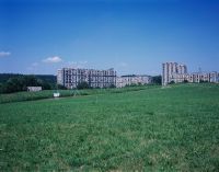
Title (German)
Bern BE, Südwestansicht des Brünnenfeld (Nordwestteil)
Caption
Southwest view of Brünnenfeld (northwest part) with meadowland and A1 freeway (exit 35 Brünnen), in the background the housing estates Gäbelbach, Holenacker and Tscharnergut, first photograph (2003) before start of construction Westside (construction profiles on the field), general view; coordinates (LV03) of the camera location: 594948/199314; keywords Documenta Natura: shopping mall, leisure facility, construction work, landscape change agglomeration, tunnel construction, rail traffic, housing estate
Caption (German)
Südwestansicht des Brünnenfeld (Nordwestteil) mit Wiesland und Autobahn A1 (Ausfahrt 35 Brünnen), im Hintergrund die Wohnsiedlungen Gäbelbach, Holenacker und Tscharnergut, Erstaufnahme (2003) vor Baubeginn Westside (Bauprofile auf dem Feld), Gesamtansicht; Koordinaten (LV03) des Kamerastandorts: 594948/199314; Schlagworte Documenta Natura: Einkaufszentrum, Freizeitanlage, Bauarbeit, Landschaftswandel Agglomeration, Tunnelbau, Schienenverkehr, Wohnsiedlung
Record Name
Dia_303-14760

Title (German)
Bern BE, Südwestansicht des Brünnenfeld (Nordwestteil)
Caption
Southwest view of Brünnenfeld (northwest part) with meadowland and A1 freeway (exit 35 Brünnen), in the background the housing estates Gäbelbach, Holenacker and Tscharnergut, first photograph (2003) before start of construction Westside (construction profiles on the field), general view; coordinates (LV03) of the camera location: 594948/199314; keywords Documenta Natura: shopping mall, leisure facility, construction work, landscape change agglomeration, tunnel construction, rail traffic, housing estate
Caption (German)
Südwestansicht des Brünnenfeld (Nordwestteil) mit Wiesland und Autobahn A1 (Ausfahrt 35 Brünnen), im Hintergrund die Wohnsiedlungen Gäbelbach, Holenacker und Tscharnergut, Erstaufnahme (2003) vor Baubeginn Westside (Bauprofile auf dem Feld), Gesamtansicht; Koordinaten (LV03) des Kamerastandorts: 594948/199314; Schlagworte Documenta Natura: Einkaufszentrum, Freizeitanlage, Bauarbeit, Landschaftswandel Agglomeration, Tunnelbau, Schienenverkehr, Wohnsiedlung
Record Name
Dia_303-14763

Title (German)
Bern BE, Südwestansicht des Brünnenfeld (Nordwestteil)
Caption
Southwestern view of Brünnenfeld (northwestern part) 1st follow-up photo (2009) after the completion of Westside, with recreational facility (slide)and the covering of the A1 freeway, general view; coordinates (LV03) of the camera location: 594948/199314; keywords Documenta Natura: shopping mall, recreational facility, construction work, landscape change agglomeration, tunnel construction, rail traffic, housing development
Caption (German)
Südwestansicht des Brünnenfeld (Nordwestteil) 1. Folgeaufnahme (2009) nach der Fertigstellung von Westside, mit Freizeitanlage (Rutschbahn)und der Überdeckung der Autobahn A1, Gesamtansicht; Koordinaten (LV03) des Kamerastandorts: 594948/199314; Schlagworte Documenta Natura: Einkaufszentrum, Freizeitanlage, Bauarbeit, Landschaftswandel Agglomeration, Tunnelbau, Schienenverkehr, Wohnsiedlung
Record Name
Dia_303-14773

Title (German)
Bern BE, Südwestansicht des Brünnenfeld (Nordwestteil)
Caption
Southwestern view of Brünnenfeld (northwestern part) 1st follow-up photo (2009) after the completion of Westside, with recreational facility (slide)and the covering of the A1 freeway, general view; coordinates (LV03) of the camera location: 594948/199314; keywords Documenta Natura: shopping mall, recreational facility, construction work, landscape change agglomeration, tunnel construction, rail traffic, housing development
Caption (German)
Südwestansicht des Brünnenfeld (Nordwestteil) 1. Folgeaufnahme (2009) nach der Fertigstellung von Westside, mit Freizeitanlage (Rutschbahn)und der Überdeckung der Autobahn A1, Gesamtansicht; Koordinaten (LV03) des Kamerastandorts: 594948/199314; Schlagworte Documenta Natura: Einkaufszentrum, Freizeitanlage, Bauarbeit, Landschaftswandel Agglomeration, Tunnelbau, Schienenverkehr, Wohnsiedlung
Record Name
Dia_303-14777

Title (German)
Bern BE, Südwestansicht des Brünnenfeld (Nordwestteil)
Caption
Southwestern view of Brünnenfeld (northwestern part) 1st follow-up photo (2009) after the completion of Westside, with recreational facility (slide)and the covering of the A1 freeway, general view; coordinates (LV03) of the camera location: 594948/199314; keywords Documenta Natura: shopping mall, recreational facility, construction work, landscape change agglomeration, tunnel construction, rail traffic, housing development
Caption (German)
Südwestansicht des Brünnenfeld (Nordwestteil) 1. Folgeaufnahme (2009) nach der Fertigstellung von Westside, mit Freizeitanlage (Rutschbahn)und der Überdeckung der Autobahn A1, Gesamtansicht; Koordinaten (LV03) des Kamerastandorts: 594948/199314; Schlagworte Documenta Natura: Einkaufszentrum, Freizeitanlage, Bauarbeit, Landschaftswandel Agglomeration, Tunnelbau, Schienenverkehr, Wohnsiedlung
Record Name
Dia_303-14781

Title (German)
Bern BE, Südostansicht des Brünnenfeld (Südwestteil)
Caption
Southeast view of Brünnenfeld (southwest part) with meadowland and fruit trees, in the background the chocolate factory Kraft Foods (Suchard) and the hamlet Riedern, first photo (2003) before the start of construction Westside (construction profiles in the field), general view; coordinates (LV03) of the camera location: 595141/199223; keywords Documenta Natura: shopping mall, leisure facility, construction work, landscape change agglomeration, tunnel construction, rail traffic, residential area
Caption (German)
Südostansicht des Brünnenfeld (Südwestteil) mit Wiesland und Obstbäumen, im Hintergrund die Schokoladenfabrik Kraft Foods (Suchard) und der Weiler Riedern, Erstaufnahme (2003) vor Baubeginn Westside (Bauprofile im Feld), Gesamtansicht; Koordinaten (LV03) des Kamerastandorts: 595141/199223; Schlagworte Documenta Natura: Einkaufszentrum, Freizeitanlage, Bauarbeit, Landschaftswandel Agglomeration, Tunnelbau, Schienenverkehr, Wohnsiedlung
Record Name
Dia_303-14791

Title (German)
Bern BE, Südostansicht des Brünnenfeld (Südwestteil)
Caption
Southeast view of Brünnenfeld (southwest part) with meadowland and fruit trees, in the background the chocolate factory Kraft Foods (Suchard) and the hamlet Riedern, first photo (2003) before the start of construction Westside (construction profiles in the field), general view; coordinates (LV03) of the camera location: 595141/199223; keywords Documenta Natura: shopping mall, leisure facility, construction work, landscape change agglomeration, tunnel construction, rail traffic, residential area
Caption (German)
Südostansicht des Brünnenfeld (Südwestteil) mit Wiesland und Obstbäumen, im Hintergrund die Schokoladenfabrik Kraft Foods (Suchard) und der Weiler Riedern, Erstaufnahme (2003) vor Baubeginn Westside (Bauprofile im Feld), Gesamtansicht; Koordinaten (LV03) des Kamerastandorts: 595141/199223; Schlagworte Documenta Natura: Einkaufszentrum, Freizeitanlage, Bauarbeit, Landschaftswandel Agglomeration, Tunnelbau, Schienenverkehr, Wohnsiedlung
Record Name
Dia_303-14795

Title (German)
Bern BE, Südostansicht des Brünnenfeld (Südwestteil)
Caption
Southeast view of Brünnenfeld (southwest part) with meadowland and fruit trees, in the background the chocolate factory Kraft Foods (Suchard) and the hamlet Riedern, first photo (2003) before the start of construction Westside (construction profiles in the field), general view; coordinates (LV03) of the camera location: 595141/199223; keywords Documenta Natura: shopping mall, leisure facility, construction work, landscape change agglomeration, tunnel construction, rail traffic, residential area
Caption (German)
Südostansicht des Brünnenfeld (Südwestteil) mit Wiesland und Obstbäumen, im Hintergrund die Schokoladenfabrik Kraft Foods (Suchard) und der Weiler Riedern, Erstaufnahme (2003) vor Baubeginn Westside (Bauprofile im Feld), Gesamtansicht; Koordinaten (LV03) des Kamerastandorts: 595141/199223; Schlagworte Documenta Natura: Einkaufszentrum, Freizeitanlage, Bauarbeit, Landschaftswandel Agglomeration, Tunnelbau, Schienenverkehr, Wohnsiedlung
Record Name
Dia_303-14799

Title (German)
Bern BE, Südostansicht des Brünnenfeld (Südwestteil)
Caption
Southeast view of Brünnenfeld (southwest part) with meadowland and fruit trees, in the background the chocolate factory Kraft Foods (Suchard) and the hamlet Riedern, 1st follow-up photo (2004) during the construction Westside (earthworks), general view; coordinates (LV03) of the camera location: 595141/199223; keywords Documenta Natura: shopping mall, leisure facility, construction work, landscape change agglomeration, tunnel construction, rail traffic, residential area
Caption (German)
Südostansicht des Brünnenfeld (Südwestteil) mit Wiesland und Obstbäumen, im Hintergrund die Schokoladenfabrik Kraft Foods (Suchard) und der Weiler Riedern, 1. Folgeaufnahme (2004) während dem Bau Westside (Erdarbeiten), Gesamtansicht; Koordinaten (LV03) des Kamerastandorts: 595141/199223; Schlagworte Documenta Natura: Einkaufszentrum, Freizeitanlage, Bauarbeit, Landschaftswandel Agglomeration, Tunnelbau, Schienenverkehr, Wohnsiedlung
Record Name
Dia_303-14810

Title (German)
Bern BE, Südostansicht des Brünnenfeld (Südwestteil)
Caption
Southeast view of Brünnenfeld (southwest part) with meadowland and fruit trees, in the background the chocolate factory Kraft Foods (Suchard) and the hamlet Riedern, 1st follow-up photo (2004) during the construction Westside (earthworks), general view; coordinates (LV03) of the camera location: 595141/199223; keywords Documenta Natura: shopping mall, leisure facility, construction work, landscape change agglomeration, tunnel construction, rail traffic, residential area
Caption (German)
Südostansicht des Brünnenfeld (Südwestteil) mit Wiesland und Obstbäumen, im Hintergrund die Schokoladenfabrik Kraft Foods (Suchard) und der Weiler Riedern, 1. Folgeaufnahme (2004) während dem Bau Westside (Erdarbeiten), Gesamtansicht; Koordinaten (LV03) des Kamerastandorts: 595141/199223; Schlagworte Documenta Natura: Einkaufszentrum, Freizeitanlage, Bauarbeit, Landschaftswandel Agglomeration, Tunnelbau, Schienenverkehr, Wohnsiedlung
Record Name
Dia_303-14813

Title (German)
Bern BE, Südostansicht des Brünnenfeld (Südwestteil)
Caption
Southeast view of Brünnenfeld (southwest part) with meadowland and fruit trees, in the background the chocolate factory Kraft Foods (Suchard) and the hamlet Riedern, 1st follow-up photo (2004) during the construction Westside (earthworks), general view; coordinates (LV03) of the camera location: 595141/199223; keywords Documenta Natura: shopping mall, leisure facility, construction work, landscape change agglomeration, tunnel construction, rail traffic, residential area
Caption (German)
Südostansicht des Brünnenfeld (Südwestteil) mit Wiesland und Obstbäumen, im Hintergrund die Schokoladenfabrik Kraft Foods (Suchard) und der Weiler Riedern, 1. Folgeaufnahme (2004) während dem Bau Westside (Erdarbeiten), Gesamtansicht; Koordinaten (LV03) des Kamerastandorts: 595141/199223; Schlagworte Documenta Natura: Einkaufszentrum, Freizeitanlage, Bauarbeit, Landschaftswandel Agglomeration, Tunnelbau, Schienenverkehr, Wohnsiedlung
Record Name
Dia_303-14817

Title (German)
Bern BE, Südostansicht des Brünnenfeld (Südwestteil)
Caption
Southeastern view of Brünnenfeld (southwestern part) 2nd follow-up image (2009) after completion of Westside, with Holiday Inn hotel, Gilberte de Courgenay square in the foreground, general view; coordinates (LV03) of the camera location: 595141/199223; keywords Documenta Natura: shopping mall, leisure complex, construction work, landscape change agglomeration, tunnel construction, rail traffic, residential area
Caption (German)
Südostansicht des Brünnenfeld (Südwestteil) 2. Folgeaufnahme (2009) nach der Fertigstellung von Westside, mit Hotel Holiday Inn, im Vordergrund der Gilberte de Courgenay Platz, Gesamtansicht; Koordinaten (LV03) des Kamerastandorts: 595141/199223; Schlagworte Documenta Natura: Einkaufszentrum, Freizeitanlage, Bauarbeit, Landschaftswandel Agglomeration, Tunnelbau, Schienenverkehr, Wohnsiedlung
Record Name
Dia_303-14827

Title (German)
Bern BE, Südostansicht des Brünnenfeld (Südwestteil)
Caption
Southeastern view of Brünnenfeld (southwestern part) 2nd follow-up image (2009) after completion of Westside, with Holiday Inn hotel, Gilberte de Courgenay square in the foreground, general view; coordinates (LV03) of the camera location: 595141/199223; keywords Documenta Natura: shopping mall, leisure complex, construction work, landscape change agglomeration, tunnel construction, rail traffic, residential area
Caption (German)
Südostansicht des Brünnenfeld (Südwestteil) 2. Folgeaufnahme (2009) nach der Fertigstellung von Westside, mit Hotel Holiday Inn, im Vordergrund der Gilberte de Courgenay Platz, Gesamtansicht; Koordinaten (LV03) des Kamerastandorts: 595141/199223; Schlagworte Documenta Natura: Einkaufszentrum, Freizeitanlage, Bauarbeit, Landschaftswandel Agglomeration, Tunnelbau, Schienenverkehr, Wohnsiedlung
Record Name
Dia_303-14831

Title (German)
Bern BE, Südostansicht des Brünnenfeld (Südwestteil)
Caption
Southeastern view of Brünnenfeld (southwestern part) 2nd follow-up image (2009) after completion of Westside, with Holiday Inn hotel, Gilberte de Courgenay square in the foreground, general view; coordinates (LV03) of the camera location: 595141/199223; keywords Documenta Natura: shopping mall, leisure complex, construction work, landscape change agglomeration, tunnel construction, rail traffic, residential area
Caption (German)
Südostansicht des Brünnenfeld (Südwestteil) 2. Folgeaufnahme (2009) nach der Fertigstellung von Westside, mit Hotel Holiday Inn, im Vordergrund der Gilberte de Courgenay Platz, Gesamtansicht; Koordinaten (LV03) des Kamerastandorts: 595141/199223; Schlagworte Documenta Natura: Einkaufszentrum, Freizeitanlage, Bauarbeit, Landschaftswandel Agglomeration, Tunnelbau, Schienenverkehr, Wohnsiedlung
Record Name
Dia_303-14835

Title (German)
Bern BE, Südostansicht des Brünnenfeld (Südostteil)
Caption
Southeast view of Brünnenfeld (southeast part with the residential construction areas 14, 15, 20 and 21), with soccer field, in the foreground Brünnenstrasse, photograph taken before the start of construction, general view, panoramic view 2-part; coordinates (LV03) of the camera location: 595675/199375; keywords Documenta Natura: construction work, landscape change, agglomeration, tunnel construction rail traffic, housing estate
Caption (German)
Südostansicht des Brünnenfeld (Südostteil mit den Wohnbaufeldern 14, 15, 20 und 21), mit Fussballplatz, im Vordergrund Brünnenstrasse, Aufnahme vor Baubeginn, Gesamtansicht, Panoramaufnahme 2-teilig; Koordinaten (LV03) des Kamerastandorts: 595675/199375; Schlagworte Documenta Natura: Bauarbeit, Landschaftswandel, Agglomeration, Tunnelbau Schienenverkehr, Wohnsiedlung
Record Name
Dia_303-14845

Title (German)
Bern BE, Südostansicht des Brünnenfeld (Südostteil)
Caption
Southeast view of Brünnenfeld (southeast part with the residential construction areas 14, 15, 20 and 21), with soccer field, in the foreground Brünnenstrasse, photograph taken before the start of construction, general view, panoramic view 2-part; coordinates (LV03) of the camera location: 595675/199375; keywords Documenta Natura: construction work, landscape change, agglomeration, tunnel construction rail traffic, housing estate
Caption (German)
Südostansicht des Brünnenfeld (Südostteil mit den Wohnbaufeldern 14, 15, 20 und 21), mit Fussballplatz, im Vordergrund Brünnenstrasse, Aufnahme vor Baubeginn, Gesamtansicht, Panoramaufnahme 2-teilig; Koordinaten (LV03) des Kamerastandorts: 595675/199375; Schlagworte Documenta Natura: Bauarbeit, Landschaftswandel, Agglomeration, Tunnelbau Schienenverkehr, Wohnsiedlung
Record Name
Dia_303-14849

Title (German)
Bern BE, Westansicht des Brünnenfeld (Nordteil)
Caption
West view of Brünnenfeld (northern part with the residential and construction fields 2, 3, 4, 5 and 6), with farmland, in the background the housing estates Gäbelbach, Holenacher and Tscharnergut, photograph taken before the start of construction, general view; coordinates (LV03) of the camera location: 595155/199583; keywords Documenta Natura: construction work, landscape change, agglomeration, tunnel construction rail traffic, housing estate
Caption (German)
Westansicht des Brünnenfeld (Nordteil mit den Wohn- und Baufeldern 2, 3, 4, 5 und 6), mit Ackerland, im Hintergrund die Wohnsiedlungen Gäbelbach, Holenacher und Tscharnergut, Aufnahme vor dem Baubeginn, Gesamtansicht; Koordinaten (LV03) des Kamerastandorts: 595155/199583; Schlagworte Documenta Natura: Bauarbeit, Landschaftswandel, Agglomeration, Tunnelbau Schienenverkehr, Wohnsiedlung
Record Name
Dia_303-14859

Title (German)
Bern BE, Westansicht des Brünnenfeld (Nordteil)
Caption
West view of Brünnenfeld (northern part with the residential and construction fields 2, 3, 4, 5 and 6), with farmland, in the background the housing estates Gäbelbach, Holenacher and Tscharnergut, photograph taken before the start of construction, general view; coordinates (LV03) of the camera location: 595155/199583; keywords Documenta Natura: construction work, landscape change, agglomeration, tunnel construction rail traffic, housing estate
Caption (German)
Westansicht des Brünnenfeld (Nordteil mit den Wohn- und Baufeldern 2, 3, 4, 5 und 6), mit Ackerland, im Hintergrund die Wohnsiedlungen Gäbelbach, Holenacher und Tscharnergut, Aufnahme vor dem Baubeginn, Gesamtansicht; Koordinaten (LV03) des Kamerastandorts: 595155/199583; Schlagworte Documenta Natura: Bauarbeit, Landschaftswandel, Agglomeration, Tunnelbau Schienenverkehr, Wohnsiedlung
Record Name
Dia_303-14863

Title (German)
Bern BE, Westansicht des Brünnenfeld (Nordteil)
Caption
West view of Brünnenfeld (northern part with the residential and construction fields 2, 3, 4, 5 and 6), with farmland, in the background the housing estates Gäbelbach, Holenacher and Tscharnergut, photograph taken before the start of construction, general view; coordinates (LV03) of the camera location: 595155/199583; keywords Documenta Natura: construction work, landscape change, agglomeration, tunnel construction rail traffic, housing estate
Caption (German)
Westansicht des Brünnenfeld (Nordteil mit den Wohn- und Baufeldern 2, 3, 4, 5 und 6), mit Ackerland, im Hintergrund die Wohnsiedlungen Gäbelbach, Holenacher und Tscharnergut, Aufnahme vor dem Baubeginn, Gesamtansicht; Koordinaten (LV03) des Kamerastandorts: 595155/199583; Schlagworte Documenta Natura: Bauarbeit, Landschaftswandel, Agglomeration, Tunnelbau Schienenverkehr, Wohnsiedlung
Record Name
Dia_303-14866

Title (German)
Bern BE, Westansicht des Brünnenfeld (Nordteil)
Caption
West view of Brünnenfeld (northern part with the residential and construction fields 2, 3, 4, 5 and 6), with farmland, in the background the housing estates Gäbelbach, Holenacher and Tscharnergut, photograph taken before the start of construction, general view; coordinates (LV03) of the camera location: 595155/199583; keywords Documenta Natura: construction work, landscape change, agglomeration, tunnel construction rail traffic, housing estate
Caption (German)
Westansicht des Brünnenfeld (Nordteil mit den Wohn- und Baufeldern 2, 3, 4, 5 und 6), mit Ackerland, im Hintergrund die Wohnsiedlungen Gäbelbach, Holenacher und Tscharnergut, Aufnahme vor dem Baubeginn, Gesamtansicht; Koordinaten (LV03) des Kamerastandorts: 595155/199583; Schlagworte Documenta Natura: Bauarbeit, Landschaftswandel, Agglomeration, Tunnelbau Schienenverkehr, Wohnsiedlung
Record Name
Dia_303-14868

Title (German)
Bern BE, Südostansicht des Brünnenfeld (Nordostteil)
Caption
Southeast view of Brünnenfeld (northeast part with the residential construction fields 6 and 9), with highway A1 (driving direction Lausanne), roadway and farmland, in the background the housing estate Gäbelbach, photograph taken before the start of construction, general view; coordinates (LV03) of the camera location: 595430/199510; keywords Documenta Natura: construction work, landscape change, agglomeration, tunnel construction rail traffic, housing estate
Caption (German)
Südostansicht des Brünnenfeld (Nordostteil mit den Wohnbaufeldern 6 und 9), mit Autobahn A1 (Fahrtrichtung Lausanne), Fahrweg und Ackerland, im Hintergrund die Wohnsiedlung Gäbelbach, Aufnahme vor dem Baubeginn, Gesamtansicht; Koordinaten (LV03) des Kamerastandorts: 595430/199510; Schlagworte Documenta Natura: Bauarbeit, Landschaftswandel, Agglomeration, Tunnelbau Schienenverkehr, Wohnsiedlung
Record Name
Dia_303-14880

Title (German)
Bern BE, Südostansicht des Brünnenfeld (Nordostteil)
Caption
Southeast view of Brünnenfeld (northeast part with the residential construction fields 6 and 9), with highway A1 (driving direction Lausanne), roadway and farmland, in the background the housing estate Gäbelbach, photograph taken before the start of construction, general view; coordinates (LV03) of the camera location: 595430/199510; keywords Documenta Natura: construction work, landscape change, agglomeration, tunnel construction rail traffic, housing estate
Caption (German)
Südostansicht des Brünnenfeld (Nordostteil mit den Wohnbaufeldern 6 und 9), mit Autobahn A1 (Fahrtrichtung Lausanne), Fahrweg und Ackerland, im Hintergrund die Wohnsiedlung Gäbelbach, Aufnahme vor dem Baubeginn, Gesamtansicht; Koordinaten (LV03) des Kamerastandorts: 595430/199510; Schlagworte Documenta Natura: Bauarbeit, Landschaftswandel, Agglomeration, Tunnelbau Schienenverkehr, Wohnsiedlung
Record Name
Dia_303-14883

Title (German)
Bern BE, Südostansicht des Brünnenfeld (Nordostteil)
Caption
Southeast view of Brünnenfeld (northeast part with the residential construction fields 6 and 9), with highway A1 (driving direction Lausanne), roadway and farmland, in the background the housing estate Gäbelbach, photograph taken before the start of construction, general view; coordinates (LV03) of the camera location: 595430/199510; keywords Documenta Natura: construction work, landscape change, agglomeration, tunnel construction rail traffic, housing estate
Caption (German)
Südostansicht des Brünnenfeld (Nordostteil mit den Wohnbaufeldern 6 und 9), mit Autobahn A1 (Fahrtrichtung Lausanne), Fahrweg und Ackerland, im Hintergrund die Wohnsiedlung Gäbelbach, Aufnahme vor dem Baubeginn, Gesamtansicht; Koordinaten (LV03) des Kamerastandorts: 595430/199510; Schlagworte Documenta Natura: Bauarbeit, Landschaftswandel, Agglomeration, Tunnelbau Schienenverkehr, Wohnsiedlung
Record Name
Dia_303-14887

Title (German)
Bern BE, Blick (Südansicht) vom Dach des Interdiscount auf das Brünnenfeld
Caption
South view from the roof of the Interdiscount Repair Center on the Brünnenfeld (southern part with the residential construction areas 10 - 21) with commercial zone, railroad line of the SBB, road, meadow, flower field and soccer field, in the background the housing estates Gäbelbach, Holenacker and Tscharnergut, first shot before the start of construction (2003) general view; coordinates (LV03) of the camera location: 595520/199285; Keywords Documenta Natura: construction work, landscape change, agglomeration, tunnel construction rail traffic, housing estate.
Caption (German)
Südansicht vom Dach des Interdiscount Repair Centers auf das Brünnenfeld (Südteil mit den Wohnbaufeldern 10 - 21) mit Gewerbezone, Bahnlinie der SBB, Strasse, Wiesland, Blumenfeld und Fussballplatz, im Hintergrund die Wohnsiedlungen Gäbelbach, Holenacker und Tscharnergut, Erstaufnahme vor dem Baubeginn (2003) Gesamtansicht; Koordinaten (LV03) des Kamerastandorts: 595520/199285; Schlagworte Documenta Natura: Bauarbeit, Landschaftswandel, Agglomeration, Tunnelbau Schienenverkehr, Wohnsiedlung
Record Name
Dia_303-14897

Title (German)
Bern BE, Blick (Südansicht) vom Dach des Interdiscount auf das Brünnenfeld
Caption
South view from the roof of the Interdiscount Repair Center on the Brünnenfeld (southern part with the residential construction areas 10 - 21) with commercial zone, railroad line of the SBB, road, meadow, flower field and soccer field, in the background the housing estates Gäbelbach, Holenacker and Tscharnergut, first shot before the start of construction (2003) general view; coordinates (LV03) of the camera location: 595520/199285; Keywords Documenta Natura: construction work, landscape change, agglomeration, tunnel construction rail traffic, housing estate.
Caption (German)
Südansicht vom Dach des Interdiscount Repair Centers auf das Brünnenfeld (Südteil mit den Wohnbaufeldern 10 - 21) mit Gewerbezone, Bahnlinie der SBB, Strasse, Wiesland, Blumenfeld und Fussballplatz, im Hintergrund die Wohnsiedlungen Gäbelbach, Holenacker und Tscharnergut, Erstaufnahme vor dem Baubeginn (2003) Gesamtansicht; Koordinaten (LV03) des Kamerastandorts: 595520/199285; Schlagworte Documenta Natura: Bauarbeit, Landschaftswandel, Agglomeration, Tunnelbau Schienenverkehr, Wohnsiedlung
Record Name
Dia_303-14901

Title (German)
Bern BE, Blick (Südansicht) vom Dach des Interdiscount auf das Brünnenfeld
Caption
South view from the roof of the Interdiscount Repair Center on the Brünnenfeld (southern part with the residential construction areas 10 - 21) with commercial zone, railroad line of the SBB, road, meadow, flower field and soccer field, in the background the housing estates Gäbelbach, Holenacker and Tscharnergut, first shot before the start of construction (2003) general view; coordinates (LV03) of the camera location: 595520/199285; Keywords Documenta Natura: construction work, landscape change, agglomeration, tunnel construction rail traffic, housing estate.
Caption (German)
Südansicht vom Dach des Interdiscount Repair Centers auf das Brünnenfeld (Südteil mit den Wohnbaufeldern 10 - 21) mit Gewerbezone, Bahnlinie der SBB, Strasse, Wiesland, Blumenfeld und Fussballplatz, im Hintergrund die Wohnsiedlungen Gäbelbach, Holenacker und Tscharnergut, Erstaufnahme vor dem Baubeginn (2003) Gesamtansicht; Koordinaten (LV03) des Kamerastandorts: 595520/199285; Schlagworte Documenta Natura: Bauarbeit, Landschaftswandel, Agglomeration, Tunnelbau Schienenverkehr, Wohnsiedlung
Record Name
Dia_303-14905

Title (German)
Bern BE, Blick (Südansicht) vom Dach des Interdiscount auf das Brünnenfeld
Caption
South view from the roof of the Interdiscount Repair Center on the Brünnenfeld (southern part with the residential construction areas 10 - 21) with commercial zone, railroad line of the SBB, road, meadow, flower field and soccer field, in the background the housing estates Gäbelbach, Holenacker and Tscharnergut, first shot before the start of construction (2003) general view; coordinates (LV03) of the camera location: 595520/199285; Keywords Documenta Natura: construction work, landscape change, agglomeration, tunnel construction rail traffic, housing estate.
Caption (German)
Südansicht vom Dach des Interdiscount Repair Centers auf das Brünnenfeld (Südteil mit den Wohnbaufeldern 10 - 21) mit Gewerbezone, Bahnlinie der SBB, Strasse, Wiesland, Blumenfeld und Fussballplatz, im Hintergrund die Wohnsiedlungen Gäbelbach, Holenacker und Tscharnergut, Erstaufnahme vor dem Baubeginn (2003) Gesamtansicht; Koordinaten (LV03) des Kamerastandorts: 595520/199285; Schlagworte Documenta Natura: Bauarbeit, Landschaftswandel, Agglomeration, Tunnelbau Schienenverkehr, Wohnsiedlung
Record Name
Dia_303-14909

Title (German)
Bern BE, Blick (Südansicht) vom Dach des Interdiscount auf das Brünnenfeld
Caption
South view from the roof of the Interdiscount Repair Center onto the Brünnenfeld (southern part with the residential construction areas 10 - 21) with commercial zone, railroad line of the SBB, road, meadow, flower field and soccer field, in the background the housing estates Gäbelbach, Holenacker and Tscharnergut, 1st photo (2004). Follow-up shot (2004) during construction (earthworks), general view; coordinates (LV03) of the camera location: 595520/199285; keywords Documenta Natura: construction work, landscape change, agglomeration, tunnel construction, rail traffic, housing estate
Caption (German)
Südansicht vom Dach des Interdiscount Repair Centers auf das Brünnenfeld (Südteil mit den Wohnbaufeldern 10 - 21) mit Gewerbezone, Bahnlinie der SBB, Strasse, Wiesland, Blumenfeld und Fussballplatz, im Hintergrund die Wohnsiedlungen Gäbelbach, Holenacker und Tscharnergut, 1. Folgeaufnahme (2004) während dem Baub (Erdarbeiten) Gesamtansicht; Koordinaten (LV03) des Kamerastandorts: 595520/199285; Schlagworte Documenta Natura: Bauarbeit, Landschaftswandel, Agglomeration, Tunnelbau Schienenverkehr, Wohnsiedlung
Record Name
Dia_303-14922

Title (German)
Bern BE, Blick (Südansicht) vom Dach des Interdiscount auf das Brünnenfeld
Caption
South view from the roof of the Interdiscount Repair Center onto the Brünnenfeld (southern part with the residential construction areas 10 - 21) with commercial zone, railroad line of the SBB, road, meadow, flower field and soccer field, in the background the housing estates Gäbelbach, Holenacker and Tscharnergut, 1st photo (2004). Follow-up shot (2004) during construction (earthworks), general view; coordinates (LV03) of the camera location: 595520/199285; keywords Documenta Natura: construction work, landscape change, agglomeration, tunnel construction, rail traffic, housing estate
Caption (German)
Südansicht vom Dach des Interdiscount Repair Centers auf das Brünnenfeld (Südteil mit den Wohnbaufeldern 10 - 21) mit Gewerbezone, Bahnlinie der SBB, Strasse, Wiesland, Blumenfeld und Fussballplatz, im Hintergrund die Wohnsiedlungen Gäbelbach, Holenacker und Tscharnergut, 1. Folgeaufnahme (2004) während dem Baub (Erdarbeiten) Gesamtansicht; Koordinaten (LV03) des Kamerastandorts: 595520/199285; Schlagworte Documenta Natura: Bauarbeit, Landschaftswandel, Agglomeration, Tunnelbau Schienenverkehr, Wohnsiedlung
Record Name
Dia_303-14925
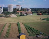
Title (German)
Bern BE, Blick (Südansicht) vom Dach des Interdiscount auf das Brünnenfeld
Caption
South view from the roof of the Interdiscount Repair Center onto the Brünnenfeld (southern part with the residential construction areas 10 - 21) with commercial zone, railroad line of the SBB, road, meadow, flower field and soccer field, in the background the housing estates Gäbelbach, Holenacker and Tscharnergut, 1st photo (2004). Follow-up shot (2004) during construction (earthworks), general view; coordinates (LV03) of the camera location: 595520/199285; keywords Documenta Natura: construction work, landscape change, agglomeration, tunnel construction, rail traffic, housing estate
Caption (German)
Südansicht vom Dach des Interdiscount Repair Centers auf das Brünnenfeld (Südteil mit den Wohnbaufeldern 10 - 21) mit Gewerbezone, Bahnlinie der SBB, Strasse, Wiesland, Blumenfeld und Fussballplatz, im Hintergrund die Wohnsiedlungen Gäbelbach, Holenacker und Tscharnergut, 1. Folgeaufnahme (2004) während dem Baub (Erdarbeiten) Gesamtansicht; Koordinaten (LV03) des Kamerastandorts: 595520/199285; Schlagworte Documenta Natura: Bauarbeit, Landschaftswandel, Agglomeration, Tunnelbau Schienenverkehr, Wohnsiedlung
Record Name
Dia_303-14929

Title (German)
Bern BE, Blick (Südansicht) vom Dach des Interdiscount auf das Brünnenfeld
Caption
South view from the roof of the Interdiscount Repair Center onto the Brünnenfeld (southern part with the residential construction areas 10 - 21) with commercial zone, railroad line of the SBB, road, meadowland, flower field and soccer field, in the background the housing estates Gäbelbach, Holenacker and Tscharnergut, 1st photo (2004). Follow-up shot (2004) during construction (earthworks), general view; coordinates (LV03) of the camera location: 595520/199285; keywords Documenta Natura: construction work, landscape change, agglomeration, tunnel construction, rail traffic, housing estate
Caption (German)
Südansicht vom Dach des Interdiscount Repair Centers auf das Brünnenfeld (Südteil mit den Wohnbaufeldern 10 - 21) mit Gewerbezone, Bahnlinie der SBB, Strasse, Wiesland, Blumenfeld und Fussballplatz, im Hintergrund die Wohnsiedlungen Gäbelbach, Holenacker und Tscharnergut, 1. Folgeaufnahme (2004) während dem Baub (Erdarbeiten) Gesamtansicht; Koordinaten (LV03) des Kamerastandorts: 595520/199285; Schlagworte Documenta Natura: Bauarbeit, Landschaftswandel, Agglomeration, Tunnelbau Schienenverkehr, Wohnsiedlung
Record Name
Dia_303-14933

Title (German)
Bern BE, Nordostansicht des Brünnenfeld (Südostteil)
Caption
Northeast view of the Brünnenfeld (southeast part with the residential construction fields 13, 14, and 15), with soccer field, photograph taken before the start of construction, general view; coordinates (LV03) of the camera location: 595638/199450; keywords Documenta Natura: construction work, landscape change, agglomeration, tunnel construction rail traffic, housing development
Caption (German)
Nordostansicht des Brünnenfeld (Südostteil mit den Wohnbaufeldern 13, 14, und 15), mit Fussballplatz, Aufnahme vor dem Baubeginn, Gesamtansicht; Koordinaten (LV03) des Kamerastandorts: 595638/199450; Schlagworte Documenta Natura: Bauarbeit, Landschaftswandel, Agglomeration, Tunnelbau Schienenverkehr, Wohnsiedlung
Record Name
Dia_303-14945

Title (German)
Bern BE, Nordostansicht des Brünnenfeld (Südostteil)
Caption
Northeast view of the Brünnenfeld (southeast part with the residential construction fields 13, 14, and 15), with soccer field, photograph taken before the start of construction, general view; coordinates (LV03) of the camera location: 595638/199450; keywords Documenta Natura: construction work, landscape change, agglomeration, tunnel construction rail traffic, housing development
Caption (German)
Nordostansicht des Brünnenfeld (Südostteil mit den Wohnbaufeldern 13, 14, und 15), mit Fussballplatz, Aufnahme vor dem Baubeginn, Gesamtansicht; Koordinaten (LV03) des Kamerastandorts: 595638/199450; Schlagworte Documenta Natura: Bauarbeit, Landschaftswandel, Agglomeration, Tunnelbau Schienenverkehr, Wohnsiedlung
Record Name
Dia_303-14949

Title (German)
Bern BE, Nordostansicht des Brünnenfeld (Südostteil)
Caption
Northeast view of the Brünnenfeld (southeast part with the residential construction fields 13, 14, and 15), with soccer field, photograph taken before the start of construction, general view; coordinates (LV03) of the camera location: 595638/199450; keywords Documenta Natura: construction work, landscape change, agglomeration, tunnel construction rail traffic, housing development
Caption (German)
Nordostansicht des Brünnenfeld (Südostteil mit den Wohnbaufeldern 13, 14, und 15), mit Fussballplatz, Aufnahme vor dem Baubeginn, Gesamtansicht; Koordinaten (LV03) des Kamerastandorts: 595638/199450; Schlagworte Documenta Natura: Bauarbeit, Landschaftswandel, Agglomeration, Tunnelbau Schienenverkehr, Wohnsiedlung
Record Name
Dia_303-14953

Title (German)
Bern BE, Südansicht des Brünnenfeld (Südostteil)
Caption
South view of the Brünnenfeld (southeast part with the residential construction fields 19, 20 and 21), with soccer field, in the foreground Winterholzstrasse and railroad line of the SBB, photograph taken before the start of construction, general view; coordinates (LV03) of the camera location: 595645/199315; keywords Documenta Natura: construction work, landscape change, agglomeration, tunnel construction railroad traffic, residential area
Caption (German)
Südansicht des Brünnenfeld (Südostteil mit den Wohnbaufeldern 19, 20 und 21), mit Fussballplatz, im Vordergrund Winterholzstrasse und Bahnlinie der SBB, Aufnahme vor dem Baubeginn, Gesamtansicht; Koordinaten (LV03) des Kamerastandorts: 595645/199315; Schlagworte Documenta Natura: Bauarbeit, Landschaftswandel, Agglomeration, Tunnelbau Schienenverkehr, Wohnsiedlung
Record Name
Dia_303-14966

Title (German)
Bern BE, Südansicht des Brünnenfeld (Südostteil)
Caption
South view of the Brünnenfeld (southeast part with the residential construction fields 19, 20 and 21), with soccer field, in the foreground Winterholzstrasse and railroad line of the SBB, photograph taken before the start of construction, general view; coordinates (LV03) of the camera location: 595645/199315; keywords Documenta Natura: construction work, landscape change, agglomeration, tunnel construction railroad traffic, residential area
Caption (German)
Südansicht des Brünnenfeld (Südostteil mit den Wohnbaufeldern 19, 20 und 21), mit Fussballplatz, im Vordergrund Winterholzstrasse und Bahnlinie der SBB, Aufnahme vor dem Baubeginn, Gesamtansicht; Koordinaten (LV03) des Kamerastandorts: 595645/199315; Schlagworte Documenta Natura: Bauarbeit, Landschaftswandel, Agglomeration, Tunnelbau Schienenverkehr, Wohnsiedlung
Record Name
Dia_303-14971

Title (German)
Bern BE, Südansicht des Brünnenfeld (Südostteil)
Caption
South view of the Brünnenfeld (southeast part with the residential construction fields 19, 20 and 21), with soccer field, in the foreground Winterholzstrasse and railroad line of the SBB, photograph taken before the start of construction, general view; coordinates (LV03) of the camera location: 595645/199315; keywords Documenta Natura: construction work, landscape change, agglomeration, tunnel construction railroad traffic, residential area
Caption (German)
Südansicht des Brünnenfeld (Südostteil mit den Wohnbaufeldern 19, 20 und 21), mit Fussballplatz, im Vordergrund Winterholzstrasse und Bahnlinie der SBB, Aufnahme vor dem Baubeginn, Gesamtansicht; Koordinaten (LV03) des Kamerastandorts: 595645/199315; Schlagworte Documenta Natura: Bauarbeit, Landschaftswandel, Agglomeration, Tunnelbau Schienenverkehr, Wohnsiedlung
Record Name
Dia_303-14975

Title (German)
Bern BE, Blick (Nordostansicht) vom alten Tunnelportal auf die A1 beim Brünnenfeld
Caption
Northeast view from the old tunnel portal onto the A1 freeway (direction Lausanne) and the Brünnenfeld (eastern part with the residential construction areas 6, 9 and 12) , first shot (April 2005) with construction site operations (earthworks), general view; coordinates (LV03) of the camera location: 595475/199500; keywords Documenta Natura: construction work, landscape change, agglomeration, tunnel construction rail traffic, housing estate
Caption (German)
Nordostansicht vom alten Tunnelportal auf die Autobahn A1 (Richtung Lausanne) und das Brünnenfeld (Ostteil mit den Wohnbaufeldern 6, 9 und 12) , Erstaufnahme (April 2005) mit Baustellenbetrieb (Erdarbeiten), Gesamtansicht; Koordinaten (LV03) des Kamerastandorts: 595475/199500; Schlagworte Documenta Natura: Bauarbeit, Landschaftswandel, Agglomeration, Tunnelbau Schienenverkehr, Wohnsiedlung
Record Name
Dia_303-14985

Title (German)
Bern BE, Blick (Nordostansicht) vom alten Tunnelportal auf die A1 beim Brünnenfeld
Caption
Northeast view from the old tunnel portal onto the A1 freeway (direction Lausanne) and the Brünnenfeld (eastern part with the residential construction areas 6, 9 and 12) , first shot (April 2005) with construction site operations (earthworks), general view; coordinates (LV03) of the camera location: 595475/199500; keywords Documenta Natura: construction work, landscape change, agglomeration, tunnel construction rail traffic, housing estate
Caption (German)
Nordostansicht vom alten Tunnelportal auf die Autobahn A1 (Richtung Lausanne) und das Brünnenfeld (Ostteil mit den Wohnbaufeldern 6, 9 und 12) , Erstaufnahme (April 2005) mit Baustellenbetrieb (Erdarbeiten), Gesamtansicht; Koordinaten (LV03) des Kamerastandorts: 595475/199500; Schlagworte Documenta Natura: Bauarbeit, Landschaftswandel, Agglomeration, Tunnelbau Schienenverkehr, Wohnsiedlung
Record Name
Dia_303-14989

Title (German)
Bern BE, Blick (Nordostansicht) vom alten Tunnelportal auf die A1 beim Brünnenfeld
Caption
Northeast view from the old tunnel portal onto the A1 freeway (direction Lausanne) and the Brünnenfeld (eastern part with the residential construction areas 6, 9 and 12) , first shot (April 2005) with construction site operations (earthworks), general view; coordinates (LV03) of the camera location: 595475/199500; keywords Documenta Natura: construction work, landscape change, agglomeration, tunnel construction rail traffic, housing estate
Caption (German)
Nordostansicht vom alten Tunnelportal auf die Autobahn A1 (Richtung Lausanne) und das Brünnenfeld (Ostteil mit den Wohnbaufeldern 6, 9 und 12) , Erstaufnahme (April 2005) mit Baustellenbetrieb (Erdarbeiten), Gesamtansicht; Koordinaten (LV03) des Kamerastandorts: 595475/199500; Schlagworte Documenta Natura: Bauarbeit, Landschaftswandel, Agglomeration, Tunnelbau Schienenverkehr, Wohnsiedlung
Record Name
Dia_303-14993

Title (German)
Bern BE, Blick (Nordostansicht) vom alten Tunnelportal auf die A1 beim Brünnenfeld
Caption
Northeast view from the former tunnel portal onto the A1 freeway (direction Lausanne) and the Brünnenfeld (eastern part with the residential construction sites 6, 9 and 12) , 1st follow-up image (October 2005) with construction site operation (roofing/tunnel constructed in open cut), general view; coordinates (LV03) of the camera location: 595475/199500; keywords Documenta Natura: construction work, landscape change, agglomeration, tunnel construction rail traffic, residential development
Caption (German)
Nordostansicht vom ehemaligen Tunnelportal auf die Autobahn A1 (Richtung Lausanne) und das Brünnenfeld (Ostteil mit den Wohnbaufeldern 6, 9 und 12) , 1. Folgeaufnahme (Oktober 2005) mit Baustellenbetrieb (Überdachung/ Tunnel im Tagbau erstellt), Gesamtansicht; Koordinaten (LV03) des Kamerastandorts: 595475/199500; Schlagworte Documenta Natura: Bauarbeit, Landschaftswandel, Agglomeration, Tunnelbau Schienenverkehr, Wohnsiedlung
Record Name
Dia_303-15003

Title (German)
Bern BE, Blick (Nordostansicht) vom alten Tunnelportal auf die A1 beim Brünnenfeld
Caption
Northeast view from the former tunnel portal onto the A1 freeway (direction Lausanne) and the Brünnenfeld (eastern part with the residential construction sites 6, 9 and 12) , 1st follow-up image (October 2005) with construction site operation (roofing/tunnel constructed in open cut), general view; coordinates (LV03) of the camera location: 595475/199500; keywords Documenta Natura: construction work, landscape change, agglomeration, tunnel construction rail traffic, residential development
Caption (German)
Nordostansicht vom ehemaligen Tunnelportal auf die Autobahn A1 (Richtung Lausanne) und das Brünnenfeld (Ostteil mit den Wohnbaufeldern 6, 9 und 12) , 1. Folgeaufnahme (Oktober 2005) mit Baustellenbetrieb (Überdachung/ Tunnel im Tagbau erstellt), Gesamtansicht; Koordinaten (LV03) des Kamerastandorts: 595475/199500; Schlagworte Documenta Natura: Bauarbeit, Landschaftswandel, Agglomeration, Tunnelbau Schienenverkehr, Wohnsiedlung
Record Name
Dia_303-15007

Title (German)
Bern BE, Blick (Nordostansicht) vom alten Tunnelportal auf die A1 beim Brünnenfeld
Caption
Northeast view from the former tunnel portal onto the A1 freeway (direction Lausanne) and the Brünnenfeld (eastern part with the residential construction sites 6, 9 and 12) , 1st follow-up image (October 2005) with construction site operation (roofing/tunnel constructed in open cut), general view; coordinates (LV03) of the camera location: 595475/199500; keywords Documenta Natura: construction work, landscape change, agglomeration, tunnel construction rail traffic, residential development
Caption (German)
Nordostansicht vom ehemaligen Tunnelportal auf die Autobahn A1 (Richtung Lausanne) und das Brünnenfeld (Ostteil mit den Wohnbaufeldern 6, 9 und 12) , 1. Folgeaufnahme (Oktober 2005) mit Baustellenbetrieb (Überdachung/ Tunnel im Tagbau erstellt), Gesamtansicht; Koordinaten (LV03) des Kamerastandorts: 595475/199500; Schlagworte Documenta Natura: Bauarbeit, Landschaftswandel, Agglomeration, Tunnelbau Schienenverkehr, Wohnsiedlung
Record Name
Dia_303-15011

Title (German)
Andelfingen ZH, Kleinandelfingen ZH, Ufer und Flussbett der Thur beim Eggrank bei ca. km 4.80
Caption
East view downstream from the left bank at km 4.80 on riverbed and both banks of the Thur with tributary, stream, gravel bank and riparian forest Widen, photo taken before renaturation of the Thur floodplains, general view; coordinates (LV03) of camera location: 691225/271600; keywords Documenta Natura: river degradation
Caption (German)
Ostansicht flussabwärts vom linken Ufer bei km 4.80 auf Flussbett und beide Ufer der Thur mit Zufluss, Bach, Kiesbank und Uferwald Widen, Aufnahme vor der Renaturierung der Thurauen, Gesamtansicht; Koordinaten (LV03) des Kamerastandorts: 691225/271600; Schlagworte Documenta Natura: Flussverbauung
Record Name
Dia_303-15022
Title (German)
Andelfingen ZH, Kleinandelfingen ZH, Ufer und Flussbett der Thur beim Eggrank bei ca. km 4.80
Caption
East view downstream from the left bank at km 4.80 on riverbed and both banks of the Thur with tributary, stream, gravel bank and riparian forest Widen, photo taken before renaturation of the Thur floodplains, general view; coordinates (LV03) of camera location: 691225/271600; keywords Documenta Natura: river degradation
Caption (German)
Ostansicht flussabwärts vom linken Ufer bei km 4.80 auf Flussbett und beide Ufer der Thur mit Zufluss, Bach, Kiesbank und Uferwald Widen, Aufnahme vor der Renaturierung der Thurauen, Gesamtansicht; Koordinaten (LV03) des Kamerastandorts: 691225/271600; Schlagworte Documenta Natura: Flussverbauung
Record Name
Dia_303-15025

Title (German)
Flaach ZH, Kleinandelfingen ZH, Ufer und Flussbett der Thur beim Engihäuli bei ca. km 3.90
Caption
South view from the left bank at km 3.90 across the Thur River onto riverbed, foreland, obstructed bank zone, in the background the riparian forest Wannenmacher, general view; coordinates (LV03) of the camera location: 690200/271915; keywords Documenta Natura: river obstruction
Caption (German)
Südansicht vom linken Ufer bei km 3.90 über die Thur auf Flussbett, Vorland, verbaute Uferzone, im Hintergrund der Uferwald Wannenmacher, Gesamtansicht; Koordinaten (LV03) des Kamerastandorts: 690200/271915; Schlagworte Documenta Natura: Flussverbauung
Record Name
Dia_303-15033

Title (German)
Flaach ZH, Kleinandelfingen ZH, Ufer und Flussbett der Thur beim Engihäuli bei ca. km 3.90
Caption
South view from the left bank at km 3.90 across the Thur River onto riverbed, foreland, obstructed bank zone, in the background the riparian forest Wannenmacher, general view; coordinates (LV03) of the camera location: 690200/271915; keywords Documenta Natura: river obstruction
Caption (German)
Südansicht vom linken Ufer bei km 3.90 über die Thur auf Flussbett, Vorland, verbaute Uferzone, im Hintergrund der Uferwald Wannenmacher, Gesamtansicht; Koordinaten (LV03) des Kamerastandorts: 690200/271915; Schlagworte Documenta Natura: Flussverbauung
Record Name
Dia_303-15037
Title (German)
Flaach ZH, Kleinandelfingen ZH, Ufer und Flussbett der Thur beim Engihäuli bei ca. km 3.90
Caption
South view from the left bank at km 3.90 across the Thur River onto riverbed, foreland, obstructed bank zone, in the background the riparian forest Wannenmacher, general view; coordinates (LV03) of the camera location: 690200/271915; keywords Documenta Natura: river obstruction
Caption (German)
Südansicht vom linken Ufer bei km 3.90 über die Thur auf Flussbett, Vorland, verbaute Uferzone, im Hintergrund der Uferwald Wannenmacher, Gesamtansicht; Koordinaten (LV03) des Kamerastandorts: 690200/271915; Schlagworte Documenta Natura: Flussverbauung
Record Name
Dia_303-15041

Title (German)
Flaach ZH, Ufer und Flussbett der Thur bei der Ellikerbrücke bei ca. km 1.50 flussaufwärts
Caption
West view upstream from Ellikerbrücke at km 1.50 on Thur (restricted water level width and low variability of flow pattern), both obstructed banks with forest and foreland, photo taken before renaturation, general view; coordinates (LV03) of camera location: 687845/272125; keywords Documenta Natura: river obstruction.
Caption (German)
Westansicht flussaufwärts von der Ellikerbrücke bei km 1.50 auf Thur (eingeschränkte Wasserspiegelbreite und geringe Variabilität des Strömungsmuster), beide verbaute Ufer mit Wald und Vorland, Aufnahme vor der Renaturierung, Gesamtansicht; Koordinaten (LV03) des Kamerastandorts: 687845/272125; Schlagworte Documenta Natura: Flussverbauung
Record Name
Dia_303-15051

Title (German)
Flaach ZH, Ufer und Flussbett der Thur bei der Ellikerbrücke bei ca. km 1.50 flussaufwärts
Caption
West view upstream from Ellikerbrücke at km 1.50 on Thur (restricted water level width and low variability of flow pattern), both obstructed banks with forest and foreland, photo taken before renaturation, general view; coordinates (LV03) of camera location: 687845/272125; keywords Documenta Natura: river obstruction.
Caption (German)
Westansicht flussaufwärts von der Ellikerbrücke bei km 1.50 auf Thur (eingeschränkte Wasserspiegelbreite und geringe Variabilität des Strömungsmuster), beide verbaute Ufer mit Wald und Vorland, Aufnahme vor der Renaturierung, Gesamtansicht; Koordinaten (LV03) des Kamerastandorts: 687845/272125; Schlagworte Documenta Natura: Flussverbauung
Record Name
Dia_303-15056

Title (German)
Flaach ZH, Ufer und Flussbett der Thur bei der Ellikerbrücke bei ca. km 1.50 flussaufwärts
Caption
West view upstream from Ellikerbrücke at km 1.50 on Thur (restricted water level width and low variability of flow pattern), both obstructed banks with forest and foreland, photo taken before renaturation, general view; coordinates (LV03) of camera location: 687845/272125; keywords Documenta Natura: river obstruction.
Caption (German)
Westansicht flussaufwärts von der Ellikerbrücke bei km 1.50 auf Thur (eingeschränkte Wasserspiegelbreite und geringe Variabilität des Strömungsmuster), beide verbaute Ufer mit Wald und Vorland, Aufnahme vor der Renaturierung, Gesamtansicht; Koordinaten (LV03) des Kamerastandorts: 687845/272125; Schlagworte Documenta Natura: Flussverbauung
Record Name
Dia_303-15059

Title (German)
Marthalen ZH, Nordostansicht des Rieds Schöni am Rhein bei ca. km 64.25
Caption
Northeast view of the reed Schöni on the Rhine at km 64.25 (at the mouth of the Thur)with reed belt, Dürrholz and copses, photo taken before ecological enhancement/renaturalization, general view; coordinates (LV03) of the camera location: 687130/272675; keywords Documenta Natura: river degradation
Caption (German)
Nordostansicht des Rieds Schöni am Rhein bei km 64.25 (bei der Thurmündung)mit Schilfgürtel, Dürrholz und Gehölz, Aufnahme vor der ökologischen Aufwertung/ Renaturierung, Gesamtansicht; Koordinaten (LV03) des Kamerastandorts: 687130/272675; Schlagworte Documenta Natura: Flussverbauung
Record Name
Dia_303-15069

Title (German)
Marthalen ZH, Nordostansicht des Rieds Schöni am Rhein bei ca. km 64.25
Caption
Northeast view of the reed Schöni on the Rhine at km 64.25 (at the mouth of the Thur)with reed belt, Dürrholz and copses, photo taken before ecological enhancement/renaturalization, general view; coordinates (LV03) of the camera location: 687130/272675; keywords Documenta Natura: river degradation
Caption (German)
Nordostansicht des Rieds Schöni am Rhein bei km 64.25 (bei der Thurmündung)mit Schilfgürtel, Dürrholz und Gehölz, Aufnahme vor der ökologischen Aufwertung/ Renaturierung, Gesamtansicht; Koordinaten (LV03) des Kamerastandorts: 687130/272675; Schlagworte Documenta Natura: Flussverbauung
Record Name
Dia_303-15073

Title (German)
Marthalen ZH, Nordostansicht des Rieds Schöni am Rhein bei ca. km 64.25
Caption
Northeast view of the reed Schöni on the Rhine at km 64.25 (at the mouth of the Thur)with reed belt, Dürrholz and copses, photo taken before ecological enhancement/renaturalization, general view; coordinates (LV03) of the camera location: 687130/272675; keywords Documenta Natura: river degradation
Caption (German)
Nordostansicht des Rieds Schöni am Rhein bei km 64.25 (bei der Thurmündung)mit Schilfgürtel, Dürrholz und Gehölz, Aufnahme vor der ökologischen Aufwertung/ Renaturierung, Gesamtansicht; Koordinaten (LV03) des Kamerastandorts: 687130/272675; Schlagworte Documenta Natura: Flussverbauung
Record Name
Dia_303-15078

Title (German)
Flaach ZH, Ufer und Flussbett der Thur bei der Ellikerbrücke bei ca. km 1.50 flussabwärts
Caption
East view downstream from Ellikerbrücke at km 1.50 on Thur (restricted water level width and low variability of flow pattern), both obstructed banks with forest and foreland, mouth of Thur into Rhine in the background, photo taken before renaturation, general view; coordinates (LV03) of camera location: 687842/272125; keywords Documenta Natura: river obstruction.
Caption (German)
Ostansicht flussabwärts von der Ellikerbrücke bei km 1.50 auf Thur (eingeschränkte Wasserspiegelbreite und geringe Variabilität des Strömungsmuster), beide verbaute Ufer mit Wald und Vorland, Thurmündung in den Rhein im Hintergrund, Aufnahme vor der Renaturierung, Gesamtansicht; Koordinaten (LV03) des Kamerastandorts: 687842/272125; Schlagworte Documenta Natura: Flussverbauung
Record Name
Dia_303-15089

Title (German)
Flaach ZH, Ufer und Flussbett der Thur bei der Ellikerbrücke bei ca. km 1.50 flussabwärts
Caption
East view downstream from Ellikerbrücke at km 1.50 on Thur (restricted water level width and low variability of flow pattern), both obstructed banks with forest and foreland, mouth of Thur into Rhine in the background, photo taken before renaturation, general view; coordinates (LV03) of camera location: 687842/272125; keywords Documenta Natura: river obstruction.
Caption (German)
Ostansicht flussabwärts von der Ellikerbrücke bei km 1.50 auf Thur (eingeschränkte Wasserspiegelbreite und geringe Variabilität des Strömungsmuster), beide verbaute Ufer mit Wald und Vorland, Thurmündung in den Rhein im Hintergrund, Aufnahme vor der Renaturierung, Gesamtansicht; Koordinaten (LV03) des Kamerastandorts: 687842/272125; Schlagworte Documenta Natura: Flussverbauung
Record Name
Dia_303-15093

Title (German)
Flaach ZH, Ufer und Flussbett der Thur bei der Ellikerbrücke bei ca. km 1.50 flussabwärts
Caption
East view downstream from Ellikerbrücke at km 1.50 on Thur (restricted water level width and low variability of flow pattern), both obstructed banks with forest and foreland, mouth of Thur into Rhine in the background, photo taken before renaturation, general view; coordinates (LV03) of camera location: 687842/272125; keywords Documenta Natura: river obstruction.
Caption (German)
Ostansicht flussabwärts von der Ellikerbrücke bei km 1.50 auf Thur (eingeschränkte Wasserspiegelbreite und geringe Variabilität des Strömungsmuster), beide verbaute Ufer mit Wald und Vorland, Thurmündung in den Rhein im Hintergrund, Aufnahme vor der Renaturierung, Gesamtansicht; Koordinaten (LV03) des Kamerastandorts: 687842/272125; Schlagworte Documenta Natura: Flussverbauung
Record Name
Dia_303-15097

Title (German)
Flaach ZH, Ufer des Rheins beim Forspitz bei ca. km 65.19
Caption
Southwest view upstream at km 65.19 along the bank of the Rhine with old flood protection dam, single trees (aspens/ poplars), roadway and farmland, photo taken before the dam was raised and the mouth of the Thur was renaturalized, partial view; coordinates (LV03) of camera location: 686100/271875; keywords Documenta Natura: river degradation.
Caption (German)
Südwestansicht flussaufwärts bei km 65.19 entlang des Ufers des Rheins mit altem Hochwasserschutzdamm, Einzelbäumen (Aspen/ Pappeln), Fahrweg und Ackerland, Aufnahme vor der Erhöhung des Dammes und Renaturierung der Thurmündung, Teilansicht; Koordinaten (LV03) des Kamerastandorts: 686100/271875; Schlagworte Documenta Natura: Flussverbauung
Record Name
Dia_303-15108

Title (German)
Flaach ZH, Kleinandelfingen ZH, Ufer und Flussbett der Thur bei Wolauerhau bei ca. km 2.40
Caption
South view from the left bank of the Thur at km 2.40 onto foreland and riverbed, in the background the forest Wolauerhau, photo taken before renaturation, general view; coordinates (LV03) of camera location: 688775/272050; keywords Documenta Natura: river restoration
Caption (German)
Südansicht vom linken Thur-Ufer bei km 2.40 auf Vorland und Flussbett, im Hintergrund der Wald Wolauerhau, Aufnahme vor der Renaturierung, Gesamtansicht; Koordinaten (LV03) des Kamerastandorts: 688775/272050; Schlagworte Documenta Natura: Flussverbauung
Record Name
Dia_303-15113

Title (German)
Flaach ZH, Kleinandelfingen ZH, Ufer und Flussbett der Thur bei Wolauerhau bei ca. km 2.40
Caption
South view from the left bank of the Thur at km 2.40 onto foreland and riverbed, in the background the forest Wolauerhau, photo taken before renaturation, general view; coordinates (LV03) of camera location: 688775/272050; keywords Documenta Natura: river restoration
Caption (German)
Südansicht vom linken Thur-Ufer bei km 2.40 auf Vorland und Flussbett, im Hintergrund der Wald Wolauerhau, Aufnahme vor der Renaturierung, Gesamtansicht; Koordinaten (LV03) des Kamerastandorts: 688775/272050; Schlagworte Documenta Natura: Flussverbauung
Record Name
Dia_303-15117

Title (German)
Flaach ZH, Kleinandelfingen ZH, Ufer und Flussbett der Thur bei Wolauerhau bei ca. km 2.40
Caption
South view from the left bank of the Thur at km 2.40 onto foreland and riverbed, in the background the forest Wolauerhau, photo taken before renaturation, general view; coordinates (LV03) of camera location: 688775/272050; keywords Documenta Natura: river restoration
Caption (German)
Südansicht vom linken Thur-Ufer bei km 2.40 auf Vorland und Flussbett, im Hintergrund der Wald Wolauerhau, Aufnahme vor der Renaturierung, Gesamtansicht; Koordinaten (LV03) des Kamerastandorts: 688775/272050; Schlagworte Documenta Natura: Flussverbauung
Record Name
Dia_303-15121

Title (German)
Marthalen ZH, Südansicht des Ackerlandes Auen am Rhein bei ca. km 64.20
Caption
South view of the farmland Auen am Rhein at km 64.20 with dam path and riparian grove, photo taken before the widening and renaturation of the mouth of the Thur, general view; coordinates (LV03) of the camera location: 687050/272695; keywords Documenta Natura: river defences
Caption (German)
Südansicht des Ackerlandes Auen am Rhein bei km 64.20 mit Dammweg und Ufergehölz, Aufnahme vor der Aufweitung und Renaturierung der Thurmündung, Gesamtansicht; Koordinaten (LV03) des Kamerastandorts: 687050/272695; Schlagworte Documenta Natura: Flussverbauung
Record Name
Dia_303-15131

Title (German)
Marthalen ZH, Südansicht des Ackerlandes Auen am Rhein bei ca. km 64.20
Caption
South view of the farmland Auen am Rhein at km 64.20 with dam path and riparian grove, photo taken before the widening and renaturation of the mouth of the Thur, general view; coordinates (LV03) of the camera location: 687050/272695; keywords Documenta Natura: river defences
Caption (German)
Südansicht des Ackerlandes Auen am Rhein bei km 64.20 mit Dammweg und Ufergehölz, Aufnahme vor der Aufweitung und Renaturierung der Thurmündung, Gesamtansicht; Koordinaten (LV03) des Kamerastandorts: 687050/272695; Schlagworte Documenta Natura: Flussverbauung
Record Name
Dia_303-15135

Title (German)
Marthalen ZH, Südwestansicht des Wieslandes, Ackerlandes Landzig am Rhein bei ca. km 63.65
Caption
Southwest view of the meadow and farmland Landzig am Rhein at km 63.65 with left bank, riparian woodland, dam path, sewage treatment plant, settlement (Ellikon), photograph taken before the construction of a new protective dam and the renaturalization of the mouth of the Thur, general view; coordinates (LV03) of the camera location: 687020/273100; keywords Documenta Natura: River degradation
Caption (German)
Südwestansicht des Wieslandes und Ackerlandes Landzig am Rhein bei km 63.65 mit linkem Ufer, Ufergehölz, Dammweg, Kläranlage, Siedlung (Ellikon), Aufnahme vor dem Bau eines neuen Schutzdammes und der Renaturierung der Thurmündung, Gesamtansicht; Koordinaten (LV03) des Kamerastandorts: 687020/273100; Schlagworte Documenta Natura: Flussverbauung
Record Name
Dia_303-15143

Title (German)
Marthalen ZH, Südwestansicht des Wieslandes, Ackerlandes Landzig am Rhein bei ca. km 63.65
Caption
Southwest view of the meadow and farmland Landzig am Rhein at km 63.65 with left bank, riparian woodland, dam path, sewage treatment plant, settlement (Ellikon), photograph taken before the construction of a new protective dam and the renaturalization of the mouth of the Thur, general view; coordinates (LV03) of the camera location: 687020/273100; keywords Documenta Natura: River degradation
Caption (German)
Südwestansicht des Wieslandes und Ackerlandes Landzig am Rhein bei km 63.65 mit linkem Ufer, Ufergehölz, Dammweg, Kläranlage, Siedlung (Ellikon), Aufnahme vor dem Bau eines neuen Schutzdammes und der Renaturierung der Thurmündung, Gesamtansicht; Koordinaten (LV03) des Kamerastandorts: 687020/273100; Schlagworte Documenta Natura: Flussverbauung
Record Name
Dia_303-15147

Title (German)
Marthalen ZH, Südwestansicht des Wieslandes, Ackerlandes Landzig am Rhein bei ca. km 63.65
Caption
Southwest view of the meadow and farmland Landzig am Rhein at km 63.65 with left bank, riparian woodland, dam path, sewage treatment plant, settlement (Ellikon), photograph taken before the construction of a new protective dam and the renaturalization of the mouth of the Thur, general view; coordinates (LV03) of the camera location: 687020/273100; keywords Documenta Natura: River degradation
Caption (German)
Südwestansicht des Wieslandes und Ackerlandes Landzig am Rhein bei km 63.65 mit linkem Ufer, Ufergehölz, Dammweg, Kläranlage, Siedlung (Ellikon), Aufnahme vor dem Bau eines neuen Schutzdammes und der Renaturierung der Thurmündung, Gesamtansicht; Koordinaten (LV03) des Kamerastandorts: 687020/273100; Schlagworte Documenta Natura: Flussverbauung
Record Name
Dia_303-15151

Title (German)
Marthalen ZH, Nordwestansicht des Rieds Schöni am Rhein bei ca. km 64.25
Caption
Northwest view downstream onto the left bank of the Rhine at km 64.25 with reeds and copses, in the background the reedbed Schöni, photo taken before the renaturation of the mouth of the Thur, general view; coordinates (LV03) of the camera location: 687013/272675; keywords Documenta Natura: river defences
Caption (German)
Nordwestansicht flussabwärts auf das linke Ufer des Rheins bei km 64.25 mit Schilf und Gehölz, im Hintergrund das Ried Schöni, Aufnahme vor der Renaturierung der Thurmündung, Gesamtansicht; Koordinaten (LV03) des Kamerastandorts: 687013/272675; Schlagworte Documenta Natura: Flussverbauung
Record Name
Dia_303-15161

Title (German)
Marthalen ZH, Nordwestansicht des Rieds Schöni am Rhein bei ca. km 64.25
Caption
Northwest view downstream onto the left bank of the Rhine at km 64.25 with reeds and copses, in the background the reedbed Schöni, photo taken before the renaturation of the mouth of the Thur, general view; coordinates (LV03) of the camera location: 687013/272675; keywords Documenta Natura: river defences
Caption (German)
Nordwestansicht flussabwärts auf das linke Ufer des Rheins bei km 64.25 mit Schilf und Gehölz, im Hintergrund das Ried Schöni, Aufnahme vor der Renaturierung der Thurmündung, Gesamtansicht; Koordinaten (LV03) des Kamerastandorts: 687013/272675; Schlagworte Documenta Natura: Flussverbauung
Record Name
Dia_303-15165

Title (German)
Fully VS, Südostansicht der Rebberge Tassony oberhalb des Dorfes Châtaignier
Caption
Southeast view of Tassony vineyards with roads (Chemin de la Tornaire = transect 218), taken at the beginning of biodiversity monitoring, general view; coordinates (LV03) of camera location: 575679/110678; keywords Documenta Natura: landscape change, viticulture, orcharding, village.
Caption (German)
Südostansicht der Rebberge Tassony mit Strassen (Chemin de la Tornaire = Transekt 218), Aufnahme bei Beginn des Biodiversitätsmonitoring, Gesamtansicht; Koordinaten (LV03) des Kamerastandorts: 575679/110678; Schlagworte Documenta Natura: Landschaftswandel, Weinbau, Obstbau, Dorf
Record Name
Dia_303-15173

Title (German)
Fully VS, Südostansicht der Rebberge Tassony oberhalb des Dorfes Châtaignier
Caption
Southeast view of Tassony vineyards with roads (Chemin de la Tornaire = transect 218), taken at the beginning of biodiversity monitoring, general view; coordinates (LV03) of camera location: 575679/110678; keywords Documenta Natura: landscape change, viticulture, orcharding, village.
Caption (German)
Südostansicht der Rebberge Tassony mit Strassen (Chemin de la Tornaire = Transekt 218), Aufnahme bei Beginn des Biodiversitätsmonitoring, Gesamtansicht; Koordinaten (LV03) des Kamerastandorts: 575679/110678; Schlagworte Documenta Natura: Landschaftswandel, Weinbau, Obstbau, Dorf
Record Name
Dia_303-15177

Title (German)
Fully VS, Blick (Südwestansicht) der Quartierstrasse Chemin Marais Roulet in Châtaignier
Caption
Southwest view along the neighborhood road Chemin Marais Roulet with farmland, residential houses with front gardens and forecourts, orchards, in the background the village of Châtaignier near Fully/VS and the vineyard Le Carre, photograph taken at the beginning of the biodiversity monitoring, general view; coordinates (LV03) of the camera location: 575830/110302; keywords Documenta Natura: landscape change, viticulture, orchards, village
Caption (German)
Südwestansicht entlang der Quartierstrasse Chemin Marais Roulet mit Ackerland, Wohnhäusern mit Vorgärten und Vorplätzen, Obstbau, im Hintergrund das Dorf Châtaignier bei Fully/VS und der Rebberg Le Carre, Aufnahme bei Beginn des Biodiversitätsmonitoring, Gesamtansicht; Koordinaten (LV03) des Kamerastandorts: 575830/110302; Schlagworte Documenta Natura: Landschaftswandel, Weinbau, Obstbau, Dorf
Record Name
Dia_303-15185

Title (German)
Fully VS, Blick (Südwestansicht) der Quartierstrasse Chemin Marais Roulet in Châtaignier
Caption
Southwest view along the neighborhood road Chemin Marais Roulet with farmland, residential houses with front gardens and forecourts, orchards, in the background the village of Châtaignier near Fully/VS and the vineyard Le Carre, photograph taken at the beginning of the biodiversity monitoring, general view; coordinates (LV03) of the camera location: 575830/110302; keywords Documenta Natura: landscape change, viticulture, orchards, village
Caption (German)
Südwestansicht entlang der Quartierstrasse Chemin Marais Roulet mit Ackerland, Wohnhäusern mit Vorgärten und Vorplätzen, Obstbau, im Hintergrund das Dorf Châtaignier bei Fully/VS und der Rebberg Le Carre, Aufnahme bei Beginn des Biodiversitätsmonitoring, Gesamtansicht; Koordinaten (LV03) des Kamerastandorts: 575830/110302; Schlagworte Documenta Natura: Landschaftswandel, Weinbau, Obstbau, Dorf
Record Name
Dia_303-15189

Title (German)
Fully VS, Blick (Südwestansicht) der Quartierstrasse Chemin Marais Roulet in Châtaignier
Caption
Southwest view along the neighborhood road Chemin Marais Roulet with farmland, residential houses with front gardens and forecourts, orchards, in the background the village of Châtaignier near Fully/VS and the vineyard Le Carre, photograph taken at the beginning of the biodiversity monitoring, general view; coordinates (LV03) of the camera location: 575830/110302; keywords Documenta Natura: landscape change, viticulture, orchards, village
Caption (German)
Südwestansicht entlang der Quartierstrasse Chemin Marais Roulet mit Ackerland, Wohnhäusern mit Vorgärten und Vorplätzen, Obstbau, im Hintergrund das Dorf Châtaignier bei Fully/VS und der Rebberg Le Carre, Aufnahme bei Beginn des Biodiversitätsmonitoring, Gesamtansicht; Koordinaten (LV03) des Kamerastandorts: 575830/110302; Schlagworte Documenta Natura: Landschaftswandel, Weinbau, Obstbau, Dorf
Record Name
Dia_303-15193

Title (German)
Fully VS, Blick (Südwestansicht) der Quartierstrasse Chemin Marais Roulet in Châtaignier
Caption
Southwest view along the neighborhood road Chemin Marais Roulet with farmland, residential houses with front gardens and forecourts, orchards, in the background the village of Châtaignier near Fully/VS and the vineyard Le Carre, photograph taken at the beginning of the biodiversity monitoring, general view; coordinates (LV03) of the camera location: 575830/110302; keywords Documenta Natura: landscape change, viticulture, orchards, village
Caption (German)
Südwestansicht entlang der Quartierstrasse Chemin Marais Roulet mit Ackerland, Wohnhäusern mit Vorgärten und Vorplätzen, Obstbau, im Hintergrund das Dorf Châtaignier bei Fully/VS und der Rebberg Le Carre, Aufnahme bei Beginn des Biodiversitätsmonitoring, Gesamtansicht; Koordinaten (LV03) des Kamerastandorts: 575830/110302; Schlagworte Documenta Natura: Landschaftswandel, Weinbau, Obstbau, Dorf
Record Name
Dia_303-15197

Title (German)
Fully VS, Blick (Nordwestansicht) von den Rebbergen, Chemin de la Tornaire auf das Dorf Châtaignier und den Talboden
Caption
Northwest view from the vineyards Tassony to the village Châtaignier and the valley floor with the new quarters, orchards, commercial zone, in the foreground the vineyards, photo taken at the beginning of the biodiversity monitoring, general view; coordinates (LV03) of the camera location: 575423/110489; keywords Documenta Natura: landscape change, viticulture, orchards, village.
Caption (German)
Nordwestansicht von den Rebbergen Tassony auf das Dorf Châtaignier und den Talboden mit den neuen Quartieren, Obstbau, Gewerbezone, im Vordergrund die Rebberge, Aufnahme bei Beginn des Biodiversitätsmonitoring, Gesamtansicht; Koordinaten (LV03) des Kamerastandorts: 575423/110489; Schlagworte Documenta Natura: Landschaftswandel, Weinbau, Obstbau, Dorf
Record Name
Dia_303-15209

Title (German)
Fully VS, Blick (Nordwestansicht) von den Rebbergen, Chemin de la Tornaire auf das Dorf Châtaignier und den Talboden
Caption
Northwest view from the vineyards Tassony to the village Châtaignier and the valley floor with the new quarters, orchards, commercial zone, in the foreground the vineyards, photo taken at the beginning of the biodiversity monitoring, general view; coordinates (LV03) of the camera location: 575423/110489; keywords Documenta Natura: landscape change, viticulture, orchards, village.
Caption (German)
Nordwestansicht von den Rebbergen Tassony auf das Dorf Châtaignier und den Talboden mit den neuen Quartieren, Obstbau, Gewerbezone, im Vordergrund die Rebberge, Aufnahme bei Beginn des Biodiversitätsmonitoring, Gesamtansicht; Koordinaten (LV03) des Kamerastandorts: 575423/110489; Schlagworte Documenta Natura: Landschaftswandel, Weinbau, Obstbau, Dorf
Record Name
Dia_303-15213

Title (German)
Fully VS, Blick (Nordwestansicht) von den Rebbergen, Chemin de la Tornaire auf das Dorf Châtaignier und den Talboden
Caption
Northwest view from the vineyards Tassony to the village Châtaignier and the valley floor with the new quarters, orchards, commercial zone, in the foreground the vineyards, photo taken at the beginning of the biodiversity monitoring, general view; coordinates (LV03) of the camera location: 575423/110489; keywords Documenta Natura: landscape change, viticulture, orchards, village.
Caption (German)
Nordwestansicht von den Rebbergen Tassony auf das Dorf Châtaignier und den Talboden mit den neuen Quartieren, Obstbau, Gewerbezone, im Vordergrund die Rebberge, Aufnahme bei Beginn des Biodiversitätsmonitoring, Gesamtansicht; Koordinaten (LV03) des Kamerastandorts: 575423/110489; Schlagworte Documenta Natura: Landschaftswandel, Weinbau, Obstbau, Dorf
Record Name
Dia_303-15217

Title (German)
Fully VS, Nordostansicht der Rebberge und Kapelle oberhalb des Dorfes Châtaignier
Caption
Northeast view of the vineyards and chapel with garden and seating area, road = transect 218, in the background the village of Châtaignier, photo taken at the beginning of the biodiversity monitoring, general view; coordinates (LV03) of the camera location: 575834/110719; keywords Documenta Natura: landscape change, viticulture, orcharding, village.
Caption (German)
Nordostansicht der Rebberge und Kapelle mit Garten und Sitzplatz, Strasse = Transekt 218, im Hintergrund das Dorf Châtaignier, Aufnahme bei Beginn des Biodiversitätsmonitoring, Gesamtansicht; Koordinaten (LV03) des Kamerastandorts: 575834/110719; Schlagworte Documenta Natura: Landschaftswandel, Weinbau, Obstbau, Dorf
Record Name
Dia_303-15227

Title (German)
Fully VS, Nordostansicht der Rebberge und Kapelle oberhalb des Dorfes Châtaignier
Caption
Northeast view of the vineyards and chapel with garden and seating area, road = transect 218, in the background the village of Châtaignier, photo taken at the beginning of the biodiversity monitoring, general view; coordinates (LV03) of the camera location: 575834/110719; keywords Documenta Natura: landscape change, viticulture, orcharding, village.
Caption (German)
Nordostansicht der Rebberge und Kapelle mit Garten und Sitzplatz, Strasse = Transekt 218, im Hintergrund das Dorf Châtaignier, Aufnahme bei Beginn des Biodiversitätsmonitoring, Gesamtansicht; Koordinaten (LV03) des Kamerastandorts: 575834/110719; Schlagworte Documenta Natura: Landschaftswandel, Weinbau, Obstbau, Dorf
Record Name
Dia_303-15231

Title (German)
Fully VS, Nordostansicht der Rebberge und Kapelle oberhalb des Dorfes Châtaignier
Caption
Northeast view of the vineyards and chapel with garden and seating area, road = transect 218, in the background the village of Châtaignier, photo taken at the beginning of the biodiversity monitoring, general view; coordinates (LV03) of the camera location: 575834/110719; keywords Documenta Natura: landscape change, viticulture, orcharding, village.
Caption (German)
Nordostansicht der Rebberge und Kapelle mit Garten und Sitzplatz, Strasse = Transekt 218, im Hintergrund das Dorf Châtaignier, Aufnahme bei Beginn des Biodiversitätsmonitoring, Gesamtansicht; Koordinaten (LV03) des Kamerastandorts: 575834/110719; Schlagworte Documenta Natura: Landschaftswandel, Weinbau, Obstbau, Dorf
Record Name
Dia_303-15235

Title (German)
Fully VS, Südostansicht des Dorfrandes Châtaignier mit Wohnhäuserin im Rebberg
Caption
Southeast view of the edge of the village of Châtaignier with residential houses in the vineyard, sidewalk with planting and seating area, taken at the beginning of the biodiversity monitoring, general view; coordinates (LV03) of the camera location: 575492/110356; keywords Documenta Natura: landscape change, viticulture, orcharding, village.
Caption (German)
Südostansicht des Dorfrandes von Châtaignier mit Wohnhäusern im Rebenfeld, Trottoir mit Bepflanzung und Sitzplatz, Aufnahme bei Beginn des Biodiversitätsmonitoring, Gesamtansicht; Koordinaten (LV03) des Kamerastandorts: 575492/110356; Schlagworte Documenta Natura: Landschaftswandel, Weinbau, Obstbau, Dorf
Record Name
Dia_303-15245

Title (German)
Fully VS, Südostansicht des Dorfrandes Châtaignier mit Wohnhäuserin im Rebberg
Caption
Southeast view of the edge of the village of Châtaignier with residential houses in the vineyard, sidewalk with planting and seating area, taken at the beginning of the biodiversity monitoring, general view; coordinates (LV03) of the camera location: 575492/110356; keywords Documenta Natura: landscape change, viticulture, orcharding, village.
Caption (German)
Südostansicht des Dorfrandes von Châtaignier mit Wohnhäusern im Rebenfeld, Trottoir mit Bepflanzung und Sitzplatz, Aufnahme bei Beginn des Biodiversitätsmonitoring, Gesamtansicht; Koordinaten (LV03) des Kamerastandorts: 575492/110356; Schlagworte Documenta Natura: Landschaftswandel, Weinbau, Obstbau, Dorf
Record Name
Dia_303-15249

Title (German)
Fully VS, Ostansicht des Naturparkes nordöstlich des Dorfes Fully
Caption
East view of the park with animal enclosure and nature trail (fig avenue), in the background the edge of the village of Fully, taken at the beginning of the biodiversity monitoring, general view; coordinates (LV03) of the camera location: 575128/110092; keywords Documenta Natura: landscape change, viticulture, orcharding, village.
Caption (German)
Ostansicht des Parkes mit Tiergehege und Naturlehrpfad (Feigenallee), im Hintergrund der Dorfrand von Fully, Aufnahme bei Beginn des Biodiversitätsmonitoring, Gesamtansicht; Koordinaten (LV03) des Kamerastandorts: 575128/110092; Schlagworte Documenta Natura: Landschaftswandel, Weinbau, Obstbau, Dorf
Record Name
Dia_303-15257

Title (German)
Fully VS, Ostansicht des Naturparkes nordöstlich des Dorfes Fully
Caption
East view of the park with animal enclosure and nature trail (fig avenue), in the background the edge of the village of Fully, taken at the beginning of the biodiversity monitoring, general view; coordinates (LV03) of the camera location: 575128/110092; keywords Documenta Natura: landscape change, viticulture, orcharding, village.
Caption (German)
Ostansicht des Parkes mit Tiergehege und Naturlehrpfad (Feigenallee), im Hintergrund der Dorfrand von Fully, Aufnahme bei Beginn des Biodiversitätsmonitoring, Gesamtansicht; Koordinaten (LV03) des Kamerastandorts: 575128/110092; Schlagworte Documenta Natura: Landschaftswandel, Weinbau, Obstbau, Dorf
Record Name
Dia_303-15261

Title (German)
Villaz-St-Pierre FR, Westansicht der Einfamilienhaussiedlung am östlichen Dorfrand
Caption
West view of the single-family house settlement at the eastern edge of the village of Villaz-St-Pierre with meadowland and front garden, road = transect 311, in the background the meadowland and farmland Cudr and the forest Bois de la Fortune, photo taken at the beginning of the biodiversity monitoring, general view; coordinates (LV03) of the camera location: 563561/174607; keywords Documenta Natura: landscape change, lowland, industrial zone, stream, orchard.
Caption (German)
Westansicht der Einfamilienhaussiedlung am östlichen Dorfrand von Villaz-St-Pierre mit Wiesland und Vorgarten, Strasse = Transekt 311, im Hintergrund das Wiesland und Ackerland Cudr und der Wald Bois de la Fortune, Aufnahme bei Beginn des Biodiversitätsmonitoring, Gesamtansicht; Koordinaten (LV03) des Kamerastandorts: 563561/174607; Schlagworte Documenta Natura: Landschaftswandel, Flachland, Gewerbezone, Bach, Obstbau
Record Name
Dia_303-15269

Title (German)
Villaz-St-Pierre FR, Westansicht der Einfamilienhaussiedlung am östlichen Dorfrand
Caption
West view of the single-family house settlement at the eastern edge of the village of Villaz-St-Pierre with meadowland and front garden, road = transect 311, in the background the meadowland and farmland Cudr and the forest Bois de la Fortune, photo taken at the beginning of the biodiversity monitoring, general view; coordinates (LV03) of the camera location: 563561/174607; keywords Documenta Natura: landscape change, lowland, industrial zone, stream, orchard.
Caption (German)
Westansicht der Einfamilienhaussiedlung am östlichen Dorfrand von Villaz-St-Pierre mit Wiesland und Vorgarten, Strasse = Transekt 311, im Hintergrund das Wiesland und Ackerland Cudr und der Wald Bois de la Fortune, Aufnahme bei Beginn des Biodiversitätsmonitoring, Gesamtansicht; Koordinaten (LV03) des Kamerastandorts: 563561/174607; Schlagworte Documenta Natura: Landschaftswandel, Flachland, Gewerbezone, Bach, Obstbau
Record Name
Dia_303-15272

Title (German)
Villaz-St-Pierre FR, Westansicht der Einfamilienhaussiedlung am östlichen Dorfrand
Caption
West view of the single-family house settlement at the eastern edge of the village of Villaz-St-Pierre with meadowland and front garden, road = transect 311, in the background the meadowland and farmland Cudr and the forest Bois de la Fortune, photo taken at the beginning of the biodiversity monitoring, general view; coordinates (LV03) of the camera location: 563561/174607; keywords Documenta Natura: landscape change, lowland, industrial zone, stream, orchard.
Caption (German)
Westansicht der Einfamilienhaussiedlung am östlichen Dorfrand von Villaz-St-Pierre mit Wiesland und Vorgarten, Strasse = Transekt 311, im Hintergrund das Wiesland und Ackerland Cudr und der Wald Bois de la Fortune, Aufnahme bei Beginn des Biodiversitätsmonitoring, Gesamtansicht; Koordinaten (LV03) des Kamerastandorts: 563561/174607; Schlagworte Documenta Natura: Landschaftswandel, Flachland, Gewerbezone, Bach, Obstbau
Record Name
Dia_303-15276

Title (German)
Villaz-St-Pierre FR, Nordwestansicht des Wieslandes mit Mehrzweckhalle am westlichen Dorfrand
Caption
Northwest view of the meadowland with fruit trees, multipurpose hall, railroad line of the SBB, in the background the cultivated land Le Vioier with commercial zone and sports facility, photo taken at the beginning of the biodiversity monitoring, general view; coordinates (LV03) of the camera location: 563096/174303; keywords Documenta Natura: landscape change, lowland, commercial zone, creek, fruit growing.
Caption (German)
Nordwestansicht des Wieslandes mit Obstbäumen, Mehrzweckhalle, Bahnlinie der SBB, im Hintergrund das Kulturland Le Vioier mit Gewerbezone und Sportanlage, Aufnahme bei Beginn des Biodiversitätsmonitoring, Gesamtansicht; Koordinaten (LV03) des Kamerastandorts: 563096/174303; Schlagworte Documenta Natura: Landschaftswandel, Flachland, Gewerbezone, Bach, Obstbau
Record Name
Dia_303-15287

Title (German)
Villaz-St-Pierre FR, Nordwestansicht des Wieslandes mit Mehrzweckhalle am westlichen Dorfrand
Caption
Northwest view of the meadowland with fruit trees, multipurpose hall, railroad line of the SBB, in the background the cultivated land Le Vioier with commercial zone and sports facility, photo taken at the beginning of the biodiversity monitoring, general view; coordinates (LV03) of the camera location: 563096/174303; keywords Documenta Natura: landscape change, lowland, commercial zone, creek, fruit growing.
Caption (German)
Nordwestansicht des Wieslandes mit Obstbäumen, Mehrzweckhalle, Bahnlinie der SBB, im Hintergrund das Kulturland Le Vioier mit Gewerbezone und Sportanlage, Aufnahme bei Beginn des Biodiversitätsmonitoring, Gesamtansicht; Koordinaten (LV03) des Kamerastandorts: 563096/174303; Schlagworte Documenta Natura: Landschaftswandel, Flachland, Gewerbezone, Bach, Obstbau
Record Name
Dia_303-15292

Title (German)
Villaz-St-Pierre FR, Nordansicht des Wieslandes am nördlichen Dorfrand
Caption
North view of the meadowland at the northern edge of the village with footpath (= transect 311), row of houses and church, photo taken at the beginning of the biodiversity monitoring, general view; coordinates (LV03) of the camera location: 563297/174729; keywords Documenta Natura: landscape change, lowland, industrial zone, stream, orchards
Caption (German)
Nordansicht des Wieslandes am nördlichen Dorfrand mit Fussweg (= Transekt 311), Häuserzeile und Kirche, Aufnahme bei Beginn des Biodiversitätsmonitoring, Gesamtansicht; Koordinaten (LV03) des Kamerastandorts: 563297/174729; Schlagworte Documenta Natura: Landschaftswandel, Flachland, Gewerbezone, Bach, Obstbau
Record Name
Dia_303-15300

Title (German)
Villaz-St-Pierre FR, Nordansicht des Wieslandes am nördlichen Dorfrand
Caption
North view of the meadowland at the northern edge of the village with footpath (= transect 311), row of houses and church, photo taken at the beginning of the biodiversity monitoring, general view; coordinates (LV03) of the camera location: 563297/174729; keywords Documenta Natura: landscape change, lowland, industrial zone, stream, orchards
Caption (German)
Nordansicht des Wieslandes am nördlichen Dorfrand mit Fussweg (= Transekt 311), Häuserzeile und Kirche, Aufnahme bei Beginn des Biodiversitätsmonitoring, Gesamtansicht; Koordinaten (LV03) des Kamerastandorts: 563297/174729; Schlagworte Documenta Natura: Landschaftswandel, Flachland, Gewerbezone, Bach, Obstbau
Record Name
Dia_303-15304

Title (German)
Villaz-St-Pierre FR, Nordostansicht des Ackerlandes, Wieslandes Cudr‚, im Hintergrund das Dorf Villaz-St-Pierre
Caption
Northeast view of the farmland and meadow Cudr' with road (= transect 311), single farm, in the background the forest Bois de Muay and the village Villaz-St-Pierre with SBB railroad line, photograph taken at the beginning of the biodiversity monitoring, general view; coordinates (LV03) of the camera location: 563939/174898; keywords Documenta Natura: landscape change, lowland, industrial zone, stream, orchard.
Caption (German)
Nordostansicht des Acker- und Wieslandes Cudr‚ mit Strasse (= Transekt 311), Einzelhof, im Hintergrund der Wald Bois de Muay und das Dorf Villaz-St-Pierre mit SBB-Bahnlinie, Aufnahme bei Beginn des Biodiversitätsmonitoring, Gesamtansicht; Koordinaten (LV03) des Kamerastandorts: 563939/174898; Schlagworte Documenta Natura: Landschaftswandel, Flachland, Gewerbezone, Bach, Obstbau
Record Name
Dia_303-15312

Title (German)
Villaz-St-Pierre FR, Nordostansicht des Ackerlandes, Wieslandes Cudr‚, im Hintergrund das Dorf Villaz-St-Pierre
Caption
Northeast view of the farmland and meadow Cudr' with road (= transect 311), single farm, in the background the forest Bois de Muay and the village Villaz-St-Pierre with SBB railroad line, photograph taken at the beginning of the biodiversity monitoring, general view; coordinates (LV03) of the camera location: 563939/174898; keywords Documenta Natura: landscape change, lowland, industrial zone, stream, orchard.
Caption (German)
Nordostansicht des Acker- und Wieslandes Cudr‚ mit Strasse (= Transekt 311), Einzelhof, im Hintergrund der Wald Bois de Muay und das Dorf Villaz-St-Pierre mit SBB-Bahnlinie, Aufnahme bei Beginn des Biodiversitätsmonitoring, Gesamtansicht; Koordinaten (LV03) des Kamerastandorts: 563939/174898; Schlagworte Documenta Natura: Landschaftswandel, Flachland, Gewerbezone, Bach, Obstbau
Record Name
Dia_303-15317

Title (German)
Villaz-St-Pierre FR, Nordostansicht des Ackerlandes, Wieslandes Cudr‚, im Hintergrund das Dorf Villaz-St-Pierre
Caption
Northeast view of the farmland and meadow Cudr' with road (= transect 311), single farm, in the background the forest Bois de Muay and the village Villaz-St-Pierre with SBB railroad line, photograph taken at the beginning of the biodiversity monitoring, general view; coordinates (LV03) of the camera location: 563939/174898; keywords Documenta Natura: landscape change, lowland, industrial zone, stream, orchard.
Caption (German)
Nordostansicht des Acker- und Wieslandes Cudr‚ mit Strasse (= Transekt 311), Einzelhof, im Hintergrund der Wald Bois de Muay und das Dorf Villaz-St-Pierre mit SBB-Bahnlinie, Aufnahme bei Beginn des Biodiversitätsmonitoring, Gesamtansicht; Koordinaten (LV03) des Kamerastandorts: 563939/174898; Schlagworte Documenta Natura: Landschaftswandel, Flachland, Gewerbezone, Bach, Obstbau
Record Name
Dia_303-15321

Title (German)
Villaz-St-Pierre FR, Ostansicht des Ackerlandes Le Vioier, im Hintergrund das Dorf Villaz-St-Pierre
Caption
East view of the farmland Le Vioier with the brook La Glâne and copses, in the background the industrial zone and the village Villaz-St-Pierre, photograph taken at the beginning of the biodiversity monitoring, general view; coordinates (LV03) of the camera location: 564069/174129; keywords Documenta Natura: landscape change, lowland, industrial zone, brook, orchard.
Caption (German)
Ostansicht des Ackerlandes Le Vioier mit dem Bach La Glâne und Gehölz, im Hintergrund die Gewerbezone und das Dorf Villaz-St-Pierre, Aufnahme bei Beginn des Biodiversitätsmonitoring, Gesamtansicht; Koordinaten (LV03) des Kamerastandorts: 564069/174129; Schlagworte Documenta Natura: Landschaftswandel, Flachland, Gewerbezone, Bach, Obstbau
Record Name
Dia_303-15332

Title (German)
Villaz-St-Pierre FR, Ostansicht des Ackerlandes Le Vioier, im Hintergrund das Dorf Villaz-St-Pierre
Caption
East view of the farmland Le Vioier with the brook La Glâne and copses, in the background the industrial zone and the village Villaz-St-Pierre, photograph taken at the beginning of the biodiversity monitoring, general view; coordinates (LV03) of the camera location: 564069/174129; keywords Documenta Natura: landscape change, lowland, industrial zone, brook, orchard.
Caption (German)
Ostansicht des Ackerlandes Le Vioier mit dem Bach La Glâne und Gehölz, im Hintergrund die Gewerbezone und das Dorf Villaz-St-Pierre, Aufnahme bei Beginn des Biodiversitätsmonitoring, Gesamtansicht; Koordinaten (LV03) des Kamerastandorts: 564069/174129; Schlagworte Documenta Natura: Landschaftswandel, Flachland, Gewerbezone, Bach, Obstbau
Record Name
Dia_303-15336

Title (German)
Villaz-St-Pierre FR, Südwestansicht des Wieslandes am westlichen Dorfrand Dorfrand
Caption
Southwest view of meadowland and farmland (rape field in bloom) at the western edge of the village, in the foreground core indicator Z9 in meadowland, in the background the SBB railroad line and the village of Villaz-St-Pierre with church and multipurpose hall, photograph taken at the start of biodiversity monitoring, partial view; coordinates (LV03) of camera location: 562963/173965; keywords Documenta Natura: landscape change, lowland, industrial zone, stream, orchard.
Caption (German)
Südwestansicht des Wieslandes und Ackerlandes (blühendes Rapsfeld) am westlichen Dorfrand, im Vordergrund der Kernindikator Z9 im Wiesland, im Hintergrund die SBB-Bahnlinie und das Dorf Villaz-St-Pierre mit Kirche und Mehrzweckhalle, Aufnahme bei Beginn des Biodiversitätsmonitoring, Teilansicht; Koordinaten (LV03) des Kamerastandorts: 562963/173965; Schlagworte Documenta Natura: Landschaftswandel, Flachland, Gewerbezone, Bach, Obstbau
Record Name
Dia_303-15344

Title (German)
Biel/Bienne BE, Blick (Südwestansicht) entlang der Quartierstrasse Länggasse in Bözingen
Caption
Southwest view along the Länggasse neighborhood road (= transect 430) in the Bözingen neighborhood of Biel, outdoor sports facility (playing fields), parking lot, residential block and deciduous trees (tree alley), photograph taken at the start of biodiversity monitoring, general view; coordinates (LV03) of camera location: 587597/222339; keywords Documenta Natura: landscape change, lowland, commercial zone, stream, sports facility.
Caption (German)
Südwestansicht entlang der Quartierstrasse Länggasse (= Transekt 430) im Bieler Quartier Bözingen, Aussen-Sportanlage (Spielfelder), Parkplatz, Wohnblock und Laubbäume (Baumallee), Aufnahme bei Beginn des Biodiversitätsmonitoring, Gesamtansicht; Koordinaten (LV03) des Kamerastandorts: 587597/222339; Schlagworte Documenta Natura: Landschaftswandel, Flachland, Gewerbezone, Bach, Sportanlage
Record Name
Dia_303-15352
Title (German)
Biel/Bienne BE, Blick (Südwestansicht) entlang der Quartierstrasse Länggasse in Bözingen
Caption
Southwest view along the Länggasse neighborhood road (= transect 430) in the Bözingen neighborhood of Biel, outdoor sports facility (playing fields), parking lot, residential block and deciduous trees (tree alley), photograph taken at the start of biodiversity monitoring, general view; coordinates (LV03) of camera location: 587597/222339; keywords Documenta Natura: landscape change, lowland, commercial zone, stream, sports facility.
Caption (German)
Südwestansicht entlang der Quartierstrasse Länggasse (= Transekt 430) im Bieler Quartier Bözingen, Aussen-Sportanlage (Spielfelder), Parkplatz, Wohnblock und Laubbäume (Baumallee), Aufnahme bei Beginn des Biodiversitätsmonitoring, Gesamtansicht; Koordinaten (LV03) des Kamerastandorts: 587597/222339; Schlagworte Documenta Natura: Landschaftswandel, Flachland, Gewerbezone, Bach, Sportanlage
Record Name
Dia_303-15358

Title (German)
Biel/Bienne BE, Blick (Südwestansicht) entlang der Quartierstrasse Länggasse in Bözingen
Caption
Southwest view along the Länggasse neighborhood road (= transect 430) in the Bözingen neighborhood of Biel, outdoor sports facility (playing fields), parking lot, residential block and deciduous trees (tree alley), photograph taken at the start of biodiversity monitoring, general view; coordinates (LV03) of camera location: 587597/222339; keywords Documenta Natura: landscape change, lowland, commercial zone, stream, sports facility.
Caption (German)
Südwestansicht entlang der Quartierstrasse Länggasse (= Transekt 430) im Bieler Quartier Bözingen, Aussen-Sportanlage (Spielfelder), Parkplatz, Wohnblock und Laubbäume (Baumallee), Aufnahme bei Beginn des Biodiversitätsmonitoring, Gesamtansicht; Koordinaten (LV03) des Kamerastandorts: 587597/222339; Schlagworte Documenta Natura: Landschaftswandel, Flachland, Gewerbezone, Bach, Sportanlage
Record Name
Dia_303-15362

Title (German)
Biel/Bienne BE, Blick (Nordwestansicht) entlang der Quartierstrasse Feldschützenweg
Caption
Northwest view along the quarter road Feldschützenweg (= transect 430) with residential buildings and shrub forest, photo taken at the beginning of the biodiversity monitoring, partial view; coordinates (LV03) of the camera location: 587157/222911; keywords Documenta Natura: landscape change, lowland, commercial zone, stream, sports facility.
Caption (German)
Nordwestansicht entlang der Quartierstrasse Feldschützenweg (= Transekt 430) mit Wohnhäusern und Gebüschwald, Aufnahme bei Beginn des Biodiversitätsmonitoring, Teilansicht; Koordinaten (LV03) des Kamerastandorts: 587157/222911; Schlagworte Documenta Natura: Landschaftswandel, Flachland, Gewerbezone, Bach, Sportanlage
Record Name
Dia_303-15372

Title (German)
Biel/Bienne BE, Südostansicht der Überbauung (Wohnhof) Schlösslifeld
Caption
Southeast view of the Schlösslifeld development (residential courtyard) with the Schlösslistrasse and Schlösslifeld neighborhood streets with deciduous trees (tree avenue), fallow land (building land) in the foreground, photograph taken at the start of biodiversity monitoring, general view; coordinates (LV03) of the camera location: 587081/222078; keywords Documenta Natura: landscape change, lowland, commercial zone, stream, sports facility.
Caption (German)
Südostansicht der Überbauung (Wohnhof) Schlösslifeld mit den Quartierstrassen Schlösslistrasse und Schlösslifeld mit Laubbäumen (Baumallee), im Vordergrund Brachland (Bauland), Aufnahme bei Beginn des Biodiversitätsmonitoring, Gesamtansicht; Koordinaten (LV03) des Kamerastandorts: 587081/222078; Schlagworte Documenta Natura: Landschaftswandel, Flachland, Gewerbezone, Bach, Sportanlage
Record Name
Dia_303-15378

Title (German)
Biel/Bienne BE, Südostansicht der Überbauung (Wohnhof) Schlösslifeld
Caption
Southeast view of the Schlösslifeld development (residential courtyard) with the Schlösslistrasse and Schlösslifeld neighborhood streets with deciduous trees (tree avenue), fallow land (building land) in the foreground, photograph taken at the start of biodiversity monitoring, general view; coordinates (LV03) of the camera location: 587081/222078; keywords Documenta Natura: landscape change, lowland, commercial zone, stream, sports facility.
Caption (German)
Südostansicht der Überbauung (Wohnhof) Schlösslifeld mit den Quartierstrassen Schlösslistrasse und Schlösslifeld mit Laubbäumen (Baumallee), im Vordergrund Brachland (Bauland), Aufnahme bei Beginn des Biodiversitätsmonitoring, Gesamtansicht; Koordinaten (LV03) des Kamerastandorts: 587081/222078; Schlagworte Documenta Natura: Landschaftswandel, Flachland, Gewerbezone, Bach, Sportanlage
Record Name
Dia_303-15382

Title (German)
Biel/Bienne BE, Südostansicht der Überbauung (Wohnhof) Schlösslifeld
Caption
Southeast view of the Schlösslifeld development (residential courtyard) with the Schlösslistrasse and Schlösslifeld neighborhood streets with deciduous trees (tree avenue), fallow land (building land) in the foreground, photograph taken at the start of biodiversity monitoring, general view; coordinates (LV03) of the camera location: 587081/222078; keywords Documenta Natura: landscape change, lowland, commercial zone, stream, sports facility.
Caption (German)
Südostansicht der Überbauung (Wohnhof) Schlösslifeld mit den Quartierstrassen Schlösslistrasse und Schlösslifeld mit Laubbäumen (Baumallee), im Vordergrund Brachland (Bauland), Aufnahme bei Beginn des Biodiversitätsmonitoring, Gesamtansicht; Koordinaten (LV03) des Kamerastandorts: 587081/222078; Schlagworte Documenta Natura: Landschaftswandel, Flachland, Gewerbezone, Bach, Sportanlage
Record Name
Dia_303-15386

Title (German)
Biel/Bienne BE, Blick (Nordwestansicht) von der Fussbrücke auf den Bach Schüss und das Schlösslifeld
Caption
Northeast view from a small bridge (footpath) onto the Schüss stream and the Schlösslifeld housing estate with avenue of poplars, footpath and green space, taken at the beginning of the biodiversity monitoring, general view; coordinates (LV03) of the camera location: 587199/222315; keywords Documenta Natura: landscape change, lowland, industrial zone, stream, sports facility
Caption (German)
Nordostansicht von kleiner Brücke (Fussweg) auf den Bach Schüss und die Überbauung (Wohnhof) Schlösslifeld mit Pappelallee, Fussweg und Grünanlage, Aufnahme bei Beginn des Biodiversitätsmonitoring, Gesamtansicht; Koordinaten (LV03) des Kamerastandorts: 587199/222315; Schlagworte Documenta Natura: Landschaftswandel, Flachland, Gewerbezone, Bach, Sportanlage
Record Name
Dia_303-15396

Title (German)
Biel/Bienne BE, Blick (Nordwestansicht) von der Fussbrücke auf den Bach Schüss und das Schlösslifeld
Caption
Northeast view from a small bridge (footpath) onto the Schüss stream and the Schlösslifeld housing estate with avenue of poplars, footpath and green space, taken at the beginning of the biodiversity monitoring, general view; coordinates (LV03) of the camera location: 587199/222315; keywords Documenta Natura: landscape change, lowland, industrial zone, stream, sports facility
Caption (German)
Nordostansicht von kleiner Brücke (Fussweg) auf den Bach Schüss und die Überbauung (Wohnhof) Schlösslifeld mit Pappelallee, Fussweg und Grünanlage, Aufnahme bei Beginn des Biodiversitätsmonitoring, Gesamtansicht; Koordinaten (LV03) des Kamerastandorts: 587199/222315; Schlagworte Documenta Natura: Landschaftswandel, Flachland, Gewerbezone, Bach, Sportanlage
Record Name
Dia_303-15400

Title (German)
Biel/Bienne BE, Nordostansicht des Ackerlandes Bergfeld in Bözingen
Caption
Northeast view of the farmland Bergfeld, outer quarter Bözingen, with roadway, in the background the eastern outskirts of Biel, photo taken at the beginning of the biodiversity monitoring, general view; coordinates (LV03) of the camera location: 587943/222959; keywords Documenta Natura: landscape change, lowland, commercial zone, stream, sports facility.
Caption (German)
Nordostansicht des Ackerlandes Bergfeld, Aussenquartier Bözingen, mit Fahrweg, im Hintergrund der östliche Stadtrand von Biel, Aufnahme bei Beginn des Biodiversitätsmonitoring, Gesamtansicht; Koordinaten (LV03) des Kamerastandorts: 587943/222959; Schlagworte Documenta Natura: Landschaftswandel, Flachland, Gewerbezone, Bach, Sportanlage
Record Name
Dia_303-15409

Title (German)
Biel/Bienne BE, Nordostansicht des Ackerlandes Bergfeld in Bözingen
Caption
Northeast view of the farmland Bergfeld, outer quarter Bözingen, with roadway, in the background the eastern outskirts of Biel, photo taken at the beginning of the biodiversity monitoring, general view; coordinates (LV03) of the camera location: 587943/222959; keywords Documenta Natura: landscape change, lowland, commercial zone, stream, sports facility.
Caption (German)
Nordostansicht des Ackerlandes Bergfeld, Aussenquartier Bözingen, mit Fahrweg, im Hintergrund der östliche Stadtrand von Biel, Aufnahme bei Beginn des Biodiversitätsmonitoring, Gesamtansicht; Koordinaten (LV03) des Kamerastandorts: 587943/222959; Schlagworte Documenta Natura: Landschaftswandel, Flachland, Gewerbezone, Bach, Sportanlage
Record Name
Dia_303-15413

Title (German)
Cortébert BE, Im Wald südwestlich des Hofes Pierrefeu
Caption
Southwest view with structure of Jura high forest at/with kerindicator Z9 (blue mark) with forest floor, taken at the beginning of biodiversity monitoring, partial view; coordinates (LV03) of camera location: 574995/221996; keywords Documenta Natura: landscape change, Jura, forest_general, grassland farm, forest clearing, dry stone wall.
Caption (German)
Südwestansicht mit Struktur des Jura-Hochwaldes beim/mit Kerindikator Z9 (blaue Markierung) mit Waldboden, Aufnahme bei Beginn des Biodiversitätsmonitoring, Teilansicht; Koordinaten (LV03) des Kamerastandorts: 574995/221996; Schlagworte Documenta Natura: Landschaftswandel, Jura, Wald_Allgemein, Wiesland Landwirtschaftsbetrieb, Waldlichtung, Trockenmauer
Record Name
Dia_303-15420

Title (German)
Cortébert, Nods BE, Südansicht der Waldweide Clédar de Pierrefeu auf Krete südlich des Hofes Pierrefeu
Caption
South view of the forest pasture Clédar de Pierrefeu on ridge with footpath (= transect 317), photo taken at the beginning of the biodiversity monitoring, general view; coordinates (LV03) of the camera location: 575837/222203; keywords Documenta Natura: landscape change, Jura, forest_general, meadow farm, forest clearing, dry stone wall.
Caption (German)
Südansicht der Waldweide Clédar de Pierrefeu auf Krete mit Fussweg (= Transekt 317), Aufnahme bei Beginn des Biodiversitätsmonitoring, Gesamtansicht; Koordinaten (LV03) des Kamerastandorts: 575837/222203; Schlagworte Documenta Natura: Landschaftswandel, Jura, Wald_Allgemein, Wiesland Landwirtschaftsbetrieb, Waldlichtung, Trockenmauer
Record Name
Dia_303-15428

Title (German)
Cortébert, Nods BE, Südansicht der Waldweide Clédar de Pierrefeu auf Krete südlich des Hofes Pierrefeu
Caption
South view of the forest pasture Clédar de Pierrefeu on ridge with footpath (= transect 317), photo taken at the beginning of the biodiversity monitoring, general view; coordinates (LV03) of the camera location: 575837/222203; keywords Documenta Natura: landscape change, Jura, forest_general, meadow farm, forest clearing, dry stone wall.
Caption (German)
Südansicht der Waldweide Clédar de Pierrefeu auf Krete mit Fussweg (= Transekt 317), Aufnahme bei Beginn des Biodiversitätsmonitoring, Gesamtansicht; Koordinaten (LV03) des Kamerastandorts: 575837/222203; Schlagworte Documenta Natura: Landschaftswandel, Jura, Wald_Allgemein, Wiesland Landwirtschaftsbetrieb, Waldlichtung, Trockenmauer
Record Name
Dia_303-15434

Title (German)
Cortébert BE, Rundblick (Südwestansicht) über Weidelandschaft Pierrefeu
Caption
Southwest view over Jura meadow landscape with Pierrefeu farm, deciduous trees (sycamore maple)and conifers (spruce), dry stone wall, roadway with avenue of trees and footpath (= transect 317) as well as farm buildings, in the background ridge with forest, photo taken at the beginning of biodiversity monitoring, general view; coordinates (LV03) of camera location: 575679/222771; Keywords Documenta Natura: landscape change, Jura, forest_general, meadow farm, forest clearing, dry stone wall.
Caption (German)
Südwestansicht über Jura-Weidelandschaft mit dem Hof Pierrefeu, Laubbäumen (Bergahorn)und Nadelbäumen (Fichten), Trockenmauer, Fahrweg mit Baumallee und Fussweg (= Transekt 317) sowie Hofgebäude, im Hintergrund Krete mit Wald, Aufnahme bei Beginn des Biodiversitätsmonitoring, Gesamtansicht; Koordinaten (LV03) des Kamerastandorts: 575679/222771; Schlagworte Documenta Natura: Landschaftswandel, Jura, Wald_Allgemein, Wiesland Landwirtschaftsbetrieb, Waldlichtung, Trockenmauer
Record Name
Dia_303-15442

Title (German)
Cortébert BE, Rundblick (Südwestansicht) über Weidelandschaft Pierrefeu
Caption
Southwest view over Jura meadow landscape with Pierrefeu farm, deciduous trees (sycamore maple)and conifers (spruce), dry stone wall, roadway with avenue of trees and footpath (= transect 317) as well as farm buildings, in the background ridge with forest, photo taken at the beginning of biodiversity monitoring, general view; coordinates (LV03) of camera location: 575679/222771; Keywords Documenta Natura: landscape change, Jura, forest_general, meadow farm, forest clearing, dry stone wall.
Caption (German)
Südwestansicht über Jura-Weidelandschaft mit dem Hof Pierrefeu, Laubbäumen (Bergahorn)und Nadelbäumen (Fichten), Trockenmauer, Fahrweg mit Baumallee und Fussweg (= Transekt 317) sowie Hofgebäude, im Hintergrund Krete mit Wald, Aufnahme bei Beginn des Biodiversitätsmonitoring, Gesamtansicht; Koordinaten (LV03) des Kamerastandorts: 575679/222771; Schlagworte Documenta Natura: Landschaftswandel, Jura, Wald_Allgemein, Wiesland Landwirtschaftsbetrieb, Waldlichtung, Trockenmauer
Record Name
Dia_303-15446

Title (German)
Cortébert BE, Rundblick (Südwestansicht) über Weidelandschaft Pierrefeu
Caption
Southwest view over Jura meadow landscape with Pierrefeu farm, deciduous trees (sycamore maple)and conifers (spruce), dry stone wall, roadway with avenue of trees and footpath (= transect 317) as well as farm buildings, in the background ridge with forest, photo taken at the beginning of biodiversity monitoring, general view; coordinates (LV03) of camera location: 575679/222771; Keywords Documenta Natura: landscape change, Jura, forest_general, meadow farm, forest clearing, dry stone wall.
Caption (German)
Südwestansicht über Jura-Weidelandschaft mit dem Hof Pierrefeu, Laubbäumen (Bergahorn)und Nadelbäumen (Fichten), Trockenmauer, Fahrweg mit Baumallee und Fussweg (= Transekt 317) sowie Hofgebäude, im Hintergrund Krete mit Wald, Aufnahme bei Beginn des Biodiversitätsmonitoring, Gesamtansicht; Koordinaten (LV03) des Kamerastandorts: 575679/222771; Schlagworte Documenta Natura: Landschaftswandel, Jura, Wald_Allgemein, Wiesland Landwirtschaftsbetrieb, Waldlichtung, Trockenmauer
Record Name
Dia_303-15450

Title (German)
Cortébert BE, Rundblick (Südwestansicht) über Weidelandschaft Pierrefeu
Caption
Southwest view over Jura meadow landscape with Pierrefeu farm, deciduous trees (sycamore maple)and conifers (spruce), dry stone wall, roadway with avenue of trees and footpath (= transect 317) as well as farm buildings, in the background ridge with forest, photo taken at the beginning of biodiversity monitoring, general view; coordinates (LV03) of camera location: 575679/222771; Keywords Documenta Natura: landscape change, Jura, forest_general, meadow farm, forest clearing, dry stone wall.
Caption (German)
Südwestansicht über Jura-Weidelandschaft mit dem Hof Pierrefeu, Laubbäumen (Bergahorn)und Nadelbäumen (Fichten), Trockenmauer, Fahrweg mit Baumallee und Fussweg (= Transekt 317) sowie Hofgebäude, im Hintergrund Krete mit Wald, Aufnahme bei Beginn des Biodiversitätsmonitoring, Gesamtansicht; Koordinaten (LV03) des Kamerastandorts: 575679/222771; Schlagworte Documenta Natura: Landschaftswandel, Jura, Wald_Allgemein, Wiesland Landwirtschaftsbetrieb, Waldlichtung, Trockenmauer
Record Name
Dia_303-15454

Title (German)
Cortébert BE, Rundblick (Südwestansicht) über Weidelandschaft Pierrefeu
Caption
Southwest view over Jura meadow landscape with Pierrefeu farm, deciduous trees (sycamore maple)and conifers (spruce), dry stone wall, roadway with avenue of trees and footpath (= transect 317) as well as farm buildings, in the background ridge with forest, photo taken at the beginning of biodiversity monitoring, general view; coordinates (LV03) of camera location: 575679/222771; Keywords Documenta Natura: landscape change, Jura, forest_general, meadow farm, forest clearing, dry stone wall.
Caption (German)
Südwestansicht über Jura-Weidelandschaft mit dem Hof Pierrefeu, Laubbäumen (Bergahorn)und Nadelbäumen (Fichten), Trockenmauer, Fahrweg mit Baumallee und Fussweg (= Transekt 317) sowie Hofgebäude, im Hintergrund Krete mit Wald, Aufnahme bei Beginn des Biodiversitätsmonitoring, Gesamtansicht; Koordinaten (LV03) des Kamerastandorts: 575679/222771; Schlagworte Documenta Natura: Landschaftswandel, Jura, Wald_Allgemein, Wiesland Landwirtschaftsbetrieb, Waldlichtung, Trockenmauer
Record Name
Dia_303-15458

Title (German)
Cortébert, Nods BE, Westansicht der Waldweide und Alphütte Les Colisses du Haut auf Krete südlich des Hofes Pierrefeu
Caption
West view of the Jura forest clearing and alpine hut Les Colisses du Haut on the ridge with footpath (= transect 317), photo taken at the beginning of the biodiversity monitoring, general view; coordinates (LV03) of the camera location: 575642/222150; keywords Documenta Natura: landscape change, Jura, forest_general, meadow farm, forest clearing, dry stone wall.
Caption (German)
Westansicht der Jura-Waldweide und Alphütte Les Colisses du Haut auf der Krete mit Fussweg (= Transekt 317), Aufnahme bei Beginn des Biodiversitätsmonitoring, Gesamtansicht; Koordinaten (LV03) des Kamerastandorts: 575642/222150; Schlagworte Documenta Natura: Landschaftswandel, Jura, Wald_Allgemein, Wiesland Landwirtschaftsbetrieb, Waldlichtung, Trockenmauer
Record Name
Dia_303-15472

Title (German)
Cortébert, Nods BE, Westansicht der Waldweide und Alphütte Les Colisses du Haut auf Krete südlich des Hofes Pierrefeu
Caption
West view of the Jura forest clearing and alpine hut Les Colisses du Haut on the ridge with footpath (= transect 317), photo taken at the beginning of the biodiversity monitoring, general view; coordinates (LV03) of the camera location: 575642/222150; keywords Documenta Natura: landscape change, Jura, forest_general, meadow farm, forest clearing, dry stone wall.
Caption (German)
Westansicht der Jura-Waldweide und Alphütte Les Colisses du Haut auf der Krete mit Fussweg (= Transekt 317), Aufnahme bei Beginn des Biodiversitätsmonitoring, Gesamtansicht; Koordinaten (LV03) des Kamerastandorts: 575642/222150; Schlagworte Documenta Natura: Landschaftswandel, Jura, Wald_Allgemein, Wiesland Landwirtschaftsbetrieb, Waldlichtung, Trockenmauer
Record Name
Dia_303-15476

Title (German)
Hirzel ZH, Südwestansicht der Moorlandschaft Ägertenried
Caption
Southwest view of the Ägertenried fen landscape with meadowland, in the foreground the core indicator Z9 at the edge of the fen (left of the bush), in the background the forest Änderholz, photo taken at the beginning of the biodiversity monitoring, general view; coordinates (LV03) of the camera location: 688989/229950; keywords Documenta Natura: landscape change, wetland, forest_general farm, clearing, moraen landscape
Caption (German)
Südwestansicht der Flachmoorlandschaft Ägertenried mit Wiesland, im Vordergrund der Kernindikator Z9 am Moorrand (links des Gebüsches), im Hintergrund der Wald Änderholz, Aufnahme bei Beginn des Biodiversitätsmonitoring, Gesamtansicht; Koordinaten (LV03) des Kamerastandorts: 688989/229950; Schlagworte Documenta Natura: Landschaftswandel, Feuchtgebiet, Wald_Allgemein Landwirtschaftsbetrieb, Waldlichtung, Moraenenlandschaft
Record Name
Dia_303-15484

Title (German)
Hirzel ZH, Südwestansicht der Moorlandschaft Ägertenried
Caption
Southwest view of the Ägertenried fen landscape with meadowland, in the foreground the core indicator Z9 at the edge of the fen (left of the bush), in the background the forest Änderholz, photo taken at the beginning of the biodiversity monitoring, general view; coordinates (LV03) of the camera location: 688989/229950; keywords Documenta Natura: landscape change, wetland, forest_general farm, clearing, moraen landscape
Caption (German)
Südwestansicht der Flachmoorlandschaft Ägertenried mit Wiesland, im Vordergrund der Kernindikator Z9 am Moorrand (links des Gebüsches), im Hintergrund der Wald Änderholz, Aufnahme bei Beginn des Biodiversitätsmonitoring, Gesamtansicht; Koordinaten (LV03) des Kamerastandorts: 688989/229950; Schlagworte Documenta Natura: Landschaftswandel, Feuchtgebiet, Wald_Allgemein Landwirtschaftsbetrieb, Waldlichtung, Moraenenlandschaft
Record Name
Dia_303-15488

Title (German)
Wädenswil ZH, Blick (Südansicht) über das Wiesland oberhalb des Weilers Bachgad
Caption
South view over the meadowland above the hamlet Bachgad with forest edge Rinderholz, in the background the hamlet Strasshus, photo taken at the beginning of the biodiversity monitoring, partial view; coordinates (LV03) of the camera location: 689805/230614; keywords Documenta Natura: landscape change, wetland, forest_general farm, forest clearing, moraine landscape
Caption (German)
Südansicht über das Wiesland oberhalb des Weilers Bachgad mit Waldrand Rinderholz, im Hintergrund der Weiler Strasshus, Aufnahme bei Beginn des Biodiversitätsmonitoring, Teilansicht; Koordinaten (LV03) des Kamerastandorts: 689805/230614; Schlagworte Documenta Natura: Landschaftswandel, Feuchtgebiet, Wald_Allgemein Landwirtschaftsbetrieb, Waldlichtung, Moraenenlandschaft
Record Name
Dia_303-15496
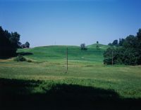
Title (German)
Hirzel, Wädenswil ZH, Westansicht der Moorlandschaft Schlieregg östlich von Hirzel
Caption
West view of the Schlieregg fen landscape with forest edge Rinderholz, in the background the Rennweg farm with meadowland, photo taken at the beginning of the biodiversity monitoring, general view; coordinates (LV03) of the camera location: 689816/230313; keywords Documenta Natura: landscape change, wetland, forest_general farm, forest clearing, moraine landscape
Caption (German)
Westansicht der Flachmoorlandschaft Schlieregg mit Waldrand Rinderholz, im Hintergrund der Hof Rennweg mit Wiesland, Aufnahme bei Beginn des Biodiversitätsmonitoring, Gesamtansicht; Koordinaten (LV03) des Kamerastandorts: 689816/230313; Schlagworte Documenta Natura: Landschaftswandel, Feuchtgebiet, Wald_Allgemein Landwirtschaftsbetrieb, Waldlichtung, Moraenenlandschaft
Record Name
Dia_303-15501

Title (German)
Hirzel, Wädenswil ZH, Westansicht der Moorlandschaft Schlieregg östlich von Hirzel
Caption
West view of the Schlieregg fen landscape with forest edge Rinderholz, in the background the Rennweg farm with meadowland, photo taken at the beginning of the biodiversity monitoring, general view; coordinates (LV03) of the camera location: 689816/230313; keywords Documenta Natura: landscape change, wetland, forest_general farm, forest clearing, moraine landscape
Caption (German)
Westansicht der Flachmoorlandschaft Schlieregg mit Waldrand Rinderholz, im Hintergrund der Hof Rennweg mit Wiesland, Aufnahme bei Beginn des Biodiversitätsmonitoring, Gesamtansicht; Koordinaten (LV03) des Kamerastandorts: 689816/230313; Schlagworte Documenta Natura: Landschaftswandel, Feuchtgebiet, Wald_Allgemein Landwirtschaftsbetrieb, Waldlichtung, Moraenenlandschaft
Record Name
Dia_303-15505

Title (German)
Hirzel, Wädenswil ZH, Blick (Südansicht) auf den Hof Geristeg mit Wiesland, Ackerland und Moorlandschaft
Caption
South view of Geristeg farm with access road, fruit trees (high trunk), meadow and arable land, moorland at the edge of the Rinderholz forest, photograph taken at the start of biodiversity monitoring, general view; coordinates (LV03) of camera location: 689458/230283; keywords Documenta Natura: landscape change, wetland, forest_general farm, forest clearing, moraine landscape
Caption (German)
Südansicht auf den Hof Geristeg mit Zufahrtsstrasse, Obstbäumen (Hochstamm), Wies- und Ackerland, Moorlandschaften am Waldrand Rinderholz, Aufnahme bei Beginn des Biodiversitätsmonitoring, Gesamtansicht; Koordinaten (LV03) des Kamerastandorts: 689458/230283; Schlagworte Documenta Natura: Landschaftswandel, Feuchtgebiet, Wald_Allgemein Landwirtschaftsbetrieb, Waldlichtung, Moraenenlandschaft
Record Name
Dia_303-15513

Title (German)
Hirzel, Wädenswil ZH, Blick (Südansicht) auf den Hof Geristeg mit Wiesland, Ackerland und Moorlandschaft
Caption
South view of Geristeg farm with access road, fruit trees (high trunk), meadow and arable land, moorland at the edge of the Rinderholz forest, photograph taken at the start of biodiversity monitoring, general view; coordinates (LV03) of camera location: 689458/230283; keywords Documenta Natura: landscape change, wetland, forest_general farm, forest clearing, moraine landscape
Caption (German)
Südansicht auf den Hof Geristeg mit Zufahrtsstrasse, Obstbäumen (Hochstamm), Wies- und Ackerland, Moorlandschaften am Waldrand Rinderholz, Aufnahme bei Beginn des Biodiversitätsmonitoring, Gesamtansicht; Koordinaten (LV03) des Kamerastandorts: 689458/230283; Schlagworte Documenta Natura: Landschaftswandel, Feuchtgebiet, Wald_Allgemein Landwirtschaftsbetrieb, Waldlichtung, Moraenenlandschaft
Record Name
Dia_303-15517

Title (German)
Hirzel, Wädenswil ZH, Blick (Südansicht) auf den Hof Geristeg mit Wiesland, Ackerland und Moorlandschaft
Caption
South view of Geristeg farm with access road, fruit trees (high trunk), meadow and arable land, moorland at the edge of the Rinderholz forest, photograph taken at the start of biodiversity monitoring, general view; coordinates (LV03) of camera location: 689458/230283; keywords Documenta Natura: landscape change, wetland, forest_general farm, forest clearing, moraine landscape
Caption (German)
Südansicht auf den Hof Geristeg mit Zufahrtsstrasse, Obstbäumen (Hochstamm), Wies- und Ackerland, Moorlandschaften am Waldrand Rinderholz, Aufnahme bei Beginn des Biodiversitätsmonitoring, Gesamtansicht; Koordinaten (LV03) des Kamerastandorts: 689458/230283; Schlagworte Documenta Natura: Landschaftswandel, Feuchtgebiet, Wald_Allgemein Landwirtschaftsbetrieb, Waldlichtung, Moraenenlandschaft
Record Name
Dia_303-15521

Title (German)
Hirzel ZH, Nordwestansicht des Wieslandes und der Moorlandschaft nordwestlich des Hofes Schlieregg
Caption
Northwest view of meadowland and fen Schlieregg with forest edge, roadway and the farm Schlieregg, photo taken at the beginning of the biodiversity monitoring, general view; coordinates (LV03) of the camera location: 689697/230092; keywords Documenta Natura: landscape change, wetland, forest_general farm, forest clearing, moraine landscape
Caption (German)
Nordwestansicht des Wieslandes und der Flachmoorlandschaft Schlieregg mit Waldrand, Fahrweg und dem Hof Schlieregg, Aufnahme bei Beginn des Biodiversitätsmonitoring, Gesamtansicht; Koordinaten (LV03) des Kamerastandorts: 689697/230092; Schlagworte Documenta Natura: Landschaftswandel, Feuchtgebiet, Wald_Allgemein Landwirtschaftsbetrieb, Waldlichtung, Moraenenlandschaft
Record Name
Dia_303-15531

Title (German)
Hirzel ZH, Nordwestansicht des Wieslandes und der Moorlandschaft nordwestlich des Hofes Schlieregg
Caption
Northwest view of meadowland and fen Schlieregg with forest edge, roadway and the farm Schlieregg, photo taken at the beginning of the biodiversity monitoring, general view; coordinates (LV03) of the camera location: 689697/230092; keywords Documenta Natura: landscape change, wetland, forest_general farm, forest clearing, moraine landscape
Caption (German)
Nordwestansicht des Wieslandes und der Flachmoorlandschaft Schlieregg mit Waldrand, Fahrweg und dem Hof Schlieregg, Aufnahme bei Beginn des Biodiversitätsmonitoring, Gesamtansicht; Koordinaten (LV03) des Kamerastandorts: 689697/230092; Schlagworte Documenta Natura: Landschaftswandel, Feuchtgebiet, Wald_Allgemein Landwirtschaftsbetrieb, Waldlichtung, Moraenenlandschaft
Record Name
Dia_303-15535

Title (German)
Hirzel ZH, Nordwestansicht des Wieslandes und der Moorlandschaft nordwestlich des Hofes Schlieregg
Caption
Northwest view of meadowland and fen Schlieregg with forest edge, roadway and the farm Schlieregg, photo taken at the beginning of the biodiversity monitoring, general view; coordinates (LV03) of the camera location: 689697/230092; keywords Documenta Natura: landscape change, wetland, forest_general farm, forest clearing, moraine landscape
Caption (German)
Nordwestansicht des Wieslandes und der Flachmoorlandschaft Schlieregg mit Waldrand, Fahrweg und dem Hof Schlieregg, Aufnahme bei Beginn des Biodiversitätsmonitoring, Gesamtansicht; Koordinaten (LV03) des Kamerastandorts: 689697/230092; Schlagworte Documenta Natura: Landschaftswandel, Feuchtgebiet, Wald_Allgemein Landwirtschaftsbetrieb, Waldlichtung, Moraenenlandschaft
Record Name
Dia_303-15539

Title (German)
Breil/Brigels, Waltensburg/Vuorz GR, Blick (Ostansicht) über das Wiesland Spinatsch
Caption
East view across the slope over the meadow Spinatsch with single houses (stable, vacation home), road (= transect 383), forest areas, photo taken at the beginning of the biodiversity monitoring, general view; coordinates (LV03) of the camera location: 725780/182684; keywords Documenta Natura: landscape change, mountain forest, mountain area, mountain railroad, wetland
Caption (German)
Ostansicht quer zum Hang über das Wiesland Spinatsch mit Einzelhäusern (Stall, Ferienhaus), Strasse (= Transekt 383), Waldflächen, Aufnahme bei Beginn des Biodiversitätsmonitoring, Gesamtansicht; Koordinaten (LV03) des Kamerastandorts: 725780/182684; Schlagworte Documenta Natura: Landschaftswandel, Gebirgswald, Berggebiet, Bergbahn, Feuchtgebiet
Record Name
Dia_303-15549

Title (German)
Breil/Brigels, Waltensburg/Vuorz GR, Blick (Ostansicht) über das Wiesland Spinatsch
Caption
East view across the slope over the meadow Spinatsch with single houses (stable, vacation home), road (= transect 383), forest areas, photo taken at the beginning of the biodiversity monitoring, general view; coordinates (LV03) of the camera location: 725780/182684; keywords Documenta Natura: landscape change, mountain forest, mountain area, mountain railroad, wetland
Caption (German)
Ostansicht quer zum Hang über das Wiesland Spinatsch mit Einzelhäusern (Stall, Ferienhaus), Strasse (= Transekt 383), Waldflächen, Aufnahme bei Beginn des Biodiversitätsmonitoring, Gesamtansicht; Koordinaten (LV03) des Kamerastandorts: 725780/182684; Schlagworte Documenta Natura: Landschaftswandel, Gebirgswald, Berggebiet, Bergbahn, Feuchtgebiet
Record Name
Dia_303-15553

Title (German)
Breil/Brigels, Waltensburg/Vuorz GR, Blick (Ostansicht) über das Wiesland Spinatsch
Caption
East view across the slope over the meadow Spinatsch with single houses (stable, vacation home), road (= transect 383), forest areas, photo taken at the beginning of the biodiversity monitoring, general view; coordinates (LV03) of the camera location: 725780/182684; keywords Documenta Natura: landscape change, mountain forest, mountain area, mountain railroad, wetland
Caption (German)
Ostansicht quer zum Hang über das Wiesland Spinatsch mit Einzelhäusern (Stall, Ferienhaus), Strasse (= Transekt 383), Waldflächen, Aufnahme bei Beginn des Biodiversitätsmonitoring, Gesamtansicht; Koordinaten (LV03) des Kamerastandorts: 725780/182684; Schlagworte Documenta Natura: Landschaftswandel, Gebirgswald, Berggebiet, Bergbahn, Feuchtgebiet
Record Name
Dia_303-15557

Title (German)
Breil/Brigels, Waltensburg/Vuorz GR, Blick (Ostansicht) über das Wiesland Spinatsch
Caption
East view across the slope over the meadow Spinatsch with single houses (stable, vacation home), road (= transect 383), forest areas, photo taken at the beginning of the biodiversity monitoring, general view; coordinates (LV03) of the camera location: 725780/182684; keywords Documenta Natura: landscape change, mountain forest, mountain area, mountain railroad, wetland
Caption (German)
Ostansicht quer zum Hang über das Wiesland Spinatsch mit Einzelhäusern (Stall, Ferienhaus), Strasse (= Transekt 383), Waldflächen, Aufnahme bei Beginn des Biodiversitätsmonitoring, Gesamtansicht; Koordinaten (LV03) des Kamerastandorts: 725780/182684; Schlagworte Documenta Natura: Landschaftswandel, Gebirgswald, Berggebiet, Bergbahn, Feuchtgebiet
Record Name
Dia_303-15561

Title (German)
Breil/Brigels, Waltensburg/Vuorz GR, Blick (Südostansicht) hangaufwärts über das Wiesland Paliu Marscha
Caption
Southeast view uphill over the meadow Paliu Marscha with small copses (forest areas), ski lift, single houses (stable, vacation home), road (= transect 383), photo taken at the beginning of the biodiversity monitoring, general view; coordinates (LV03) of the camera location: 725753/182367; keywords Documenta Natura: landscape change, mountain forest, mountain area, mountain railroad, wetland
Caption (German)
Südostansicht hangaufwärts über das Wiesland Paliu Marscha mit kleinen Gehölzen (Waldflächen), Skilift, Einzelhäusern (Stall, Ferienhaus), Strasse (= Transekt 383), Aufnahme bei Beginn des Biodiversitätsmonitoring, Gesamtansicht; Koordinaten (LV03) des Kamerastandorts: 725753/182367; Schlagworte Documenta Natura: Landschaftswandel, Gebirgswald, Berggebiet, Bergbahn, Feuchtgebiet
Record Name
Dia_303-15573

Title (German)
Breil/Brigels, Waltensburg/Vuorz GR, Blick (Südostansicht) hangaufwärts über das Wiesland Paliu Marscha
Caption
Southeast view uphill over the meadow Paliu Marscha with small copses (forest areas), ski lift, single houses (stable, vacation home), road (= transect 383), photo taken at the beginning of the biodiversity monitoring, general view; coordinates (LV03) of the camera location: 725753/182367; keywords Documenta Natura: landscape change, mountain forest, mountain area, mountain railroad, wetland
Caption (German)
Südostansicht hangaufwärts über das Wiesland Paliu Marscha mit kleinen Gehölzen (Waldflächen), Skilift, Einzelhäusern (Stall, Ferienhaus), Strasse (= Transekt 383), Aufnahme bei Beginn des Biodiversitätsmonitoring, Gesamtansicht; Koordinaten (LV03) des Kamerastandorts: 725753/182367; Schlagworte Documenta Natura: Landschaftswandel, Gebirgswald, Berggebiet, Bergbahn, Feuchtgebiet
Record Name
Dia_303-15577

Title (German)
Breil/Brigels, Waltensburg/Vuorz GR, Blick (Südostansicht) hangaufwärts über das Wiesland Paliu Marscha
Caption
Southeast view uphill over the meadow Paliu Marscha with small copses (forest areas), ski lift, single houses (stable, vacation home), road (= transect 383), photo taken at the beginning of the biodiversity monitoring, general view; coordinates (LV03) of the camera location: 725753/182367; keywords Documenta Natura: landscape change, mountain forest, mountain area, mountain railroad, wetland
Caption (German)
Südostansicht hangaufwärts über das Wiesland Paliu Marscha mit kleinen Gehölzen (Waldflächen), Skilift, Einzelhäusern (Stall, Ferienhaus), Strasse (= Transekt 383), Aufnahme bei Beginn des Biodiversitätsmonitoring, Gesamtansicht; Koordinaten (LV03) des Kamerastandorts: 725753/182367; Schlagworte Documenta Natura: Landschaftswandel, Gebirgswald, Berggebiet, Bergbahn, Feuchtgebiet
Record Name
Dia_303-15581

Title (German)
Breil/Brigels GR, Blick (Südwestansicht) hangaufwärts über Moor und Wiesland östlich von Cuolms Breil
Caption
Southwest view upslope over alpine lowland moor and meadowland with small copses (forest areas), individual houses (stable), ski lift, vacation home (Maiensäss), photo taken at the start of biodiversity monitoring, general view; coordinates (LV03) of camera location: 725183/182647; keywords Documenta Natura: landscape change, mountain forest, mountain area, mountain railroad, wetland
Caption (German)
Südwestansicht hangaufwärts über alpines Flachmoor und Wiesland mit kleinen Gehölzen (Waldflächen), Einzelhäusern (Stall), Skilift, Ferienhaus (Maiensäss), Aufnahme bei Beginn des Biodiversitätsmonitoring, Gesamtansicht; Koordinaten (LV03) des Kamerastandorts: 725183/182647; Schlagworte Documenta Natura: Landschaftswandel, Gebirgswald, Berggebiet, Bergbahn, Feuchtgebiet
Record Name
Dia_303-15591

Title (German)
Breil/Brigels GR, Blick (Südwestansicht) hangaufwärts über Moor und Wiesland östlich von Cuolms Breil
Caption
Southwest view upslope over alpine lowland moor and meadowland with small copses (forest areas), individual houses (stable), ski lift, vacation home (Maiensäss), photo taken at the start of biodiversity monitoring, general view; coordinates (LV03) of camera location: 725183/182647; keywords Documenta Natura: landscape change, mountain forest, mountain area, mountain railroad, wetland
Caption (German)
Südwestansicht hangaufwärts über alpines Flachmoor und Wiesland mit kleinen Gehölzen (Waldflächen), Einzelhäusern (Stall), Skilift, Ferienhaus (Maiensäss), Aufnahme bei Beginn des Biodiversitätsmonitoring, Gesamtansicht; Koordinaten (LV03) des Kamerastandorts: 725183/182647; Schlagworte Documenta Natura: Landschaftswandel, Gebirgswald, Berggebiet, Bergbahn, Feuchtgebiet
Record Name
Dia_303-15595

Title (German)
Breil/Brigels GR, Blick (Südwestansicht) hangaufwärts über Moor und Wiesland östlich von Cuolms Breil
Caption
Southwest view upslope over alpine lowland moor and meadowland with small copses (forest areas), individual houses (stable), ski lift, vacation home (Maiensäss), photo taken at the start of biodiversity monitoring, general view; coordinates (LV03) of camera location: 725183/182647; keywords Documenta Natura: landscape change, mountain forest, mountain area, mountain railroad, wetland
Caption (German)
Südwestansicht hangaufwärts über alpines Flachmoor und Wiesland mit kleinen Gehölzen (Waldflächen), Einzelhäusern (Stall), Skilift, Ferienhaus (Maiensäss), Aufnahme bei Beginn des Biodiversitätsmonitoring, Gesamtansicht; Koordinaten (LV03) des Kamerastandorts: 725183/182647; Schlagworte Documenta Natura: Landschaftswandel, Gebirgswald, Berggebiet, Bergbahn, Feuchtgebiet
Record Name
Dia_303-15599

Title (German)
Breil/Brigels GR, Blick (Nordwestansicht) hangabwärts auf das Wiesland Paliu Marscha
Caption
Northwest view downslope onto the meadowland Paliu Marscha with roadway (= transect 383), smaller forest areas, single houses (stable, cottage, maiensäss), photo taken before the beginning of the ground diversity monitoring, general view; coordinates (LV03) of the camera location: 725183/182276; keywords Documenta Natura: landscape change, mountain forest, mountain area, mountain railroad, wetland
Caption (German)
Nordwestansicht hangabwärts auf das Wiesland Paliu Marscha mit Fahrweg (= Transekt 383), kleineren Waldflächen, Einzelhäusern (Stall, Ferienhaus, Maiensäss), Aufnahme vor Beginn des Bodiversitätsmonitoring, Gesamtansicht; Koordinaten (LV03) des Kamerastandorts: 725183/182276; Schlagworte Documenta Natura: Landschaftswandel, Gebirgswald, Berggebiet, Bergbahn, Feuchtgebiet
Record Name
Dia_303-15609

Title (German)
Breil/Brigels GR, Blick (Nordwestansicht) hangabwärts auf das Wiesland Paliu Marscha
Caption
Northwest view downslope onto the meadowland Paliu Marscha with roadway (= transect 383), smaller forest areas, single houses (stable, cottage, maiensäss), photo taken before the beginning of the ground diversity monitoring, general view; coordinates (LV03) of the camera location: 725183/182276; keywords Documenta Natura: landscape change, mountain forest, mountain area, mountain railroad, wetland
Caption (German)
Nordwestansicht hangabwärts auf das Wiesland Paliu Marscha mit Fahrweg (= Transekt 383), kleineren Waldflächen, Einzelhäusern (Stall, Ferienhaus, Maiensäss), Aufnahme vor Beginn des Bodiversitätsmonitoring, Gesamtansicht; Koordinaten (LV03) des Kamerastandorts: 725183/182276; Schlagworte Documenta Natura: Landschaftswandel, Gebirgswald, Berggebiet, Bergbahn, Feuchtgebiet
Record Name
Dia_303-15613

Title (German)
Breil/Brigels GR, Blick (Nordwestansicht) hangabwärts auf das Wiesland Paliu Marscha
Caption
Northwest view downslope onto the meadowland Paliu Marscha with roadway (= transect 383), smaller forest areas, single houses (stable, cottage, maiensäss), photo taken before the beginning of the ground diversity monitoring, general view; coordinates (LV03) of the camera location: 725183/182276; keywords Documenta Natura: landscape change, mountain forest, mountain area, mountain railroad, wetland
Caption (German)
Nordwestansicht hangabwärts auf das Wiesland Paliu Marscha mit Fahrweg (= Transekt 383), kleineren Waldflächen, Einzelhäusern (Stall, Ferienhaus, Maiensäss), Aufnahme vor Beginn des Bodiversitätsmonitoring, Gesamtansicht; Koordinaten (LV03) des Kamerastandorts: 725183/182276; Schlagworte Documenta Natura: Landschaftswandel, Gebirgswald, Berggebiet, Bergbahn, Feuchtgebiet
Record Name
Dia_303-15617

Title (German)
Hellikon AG, Westansicht des Wieslandes Neulig östlich des Dorfes Hellikon
Caption
West view of the meadow landscape Neulig with orchard (high trunk), road (= transect 343), roadway and agricultural building, photograph taken before the start of the ground diversity monitoring (2006), partial view; coordinates (LV03) of the camera location: 635386/262354; keywords Documenta Natura: landscape change, Jura, forest_general, meadow farm, forest clearing, orchard.
Caption (German)
Westansicht der Wieslandschaft Neulig mit Obstbau (Hochstamm), Strasse (= Transekt 343), Fahrweg und Landwirtschaftsgebäude, Aufnahme vor Beginn des Bodiversitätsmonitoring (2006), Teilansicht; Koordinaten (LV03) des Kamerastandorts: 635386/262354; Schlagworte Documenta Natura: Landschaftswandel, Jura, Wald_Allgemein, Wiesland Landwirtschaftsbetrieb, Waldlichtung, Obstbau
Record Name
Dia_303-15627

Title (German)
Hellikon AG, Westansicht des Wieslandes Neulig östlich des Dorfes Hellikon
Caption
West view of the meadow landscape Neulig with orchard (high trunk), road (= transect 343), roadway and agricultural building, photograph taken before the start of the soil diversity monitoring, general view; coordinates (LV03) of the camera location: 635386/262354; keywords Documenta Natura: landscape change, Jura, forest_general, meadow farm, forest clearing, orchard.
Caption (German)
Westansicht der Wieslandschaft Neulig mit Obstbau (Hochstamm), Strasse (= Transekt 343), Fahrweg und Landwirtschaftsgebäude, Aufnahme vor Beginn des Bodiversitätsmonitoring, Gesamtansicht; Koordinaten (LV03) des Kamerastandorts: 635386/262354; Schlagworte Documenta Natura: Landschaftswandel, Jura, Wald_Allgemein, Wiesland Landwirtschaftsbetrieb, Waldlichtung, Obstbau
Record Name
Dia_303-15631

Title (German)
Hellikon AG, Westansicht des Wieslandes Neulig östlich des Dorfes Hellikon
Caption
West view of the meadow landscape Neulig with orchard (high trunk), road (= transect 343), roadway and agricultural building, photograph taken before the start of the soil diversity monitoring, general view; coordinates (LV03) of the camera location: 635386/262354; keywords Documenta Natura: landscape change, Jura, forest_general, meadow farm, forest clearing, orchard.
Caption (German)
Westansicht der Wieslandschaft Neulig mit Obstbau (Hochstamm), Strasse (= Transekt 343), Fahrweg und Landwirtschaftsgebäude, Aufnahme vor Beginn des Bodiversitätsmonitoring, Gesamtansicht; Koordinaten (LV03) des Kamerastandorts: 635386/262354; Schlagworte Documenta Natura: Landschaftswandel, Jura, Wald_Allgemein, Wiesland Landwirtschaftsbetrieb, Waldlichtung, Obstbau
Record Name
Dia_303-15635

Title (German)
Hellikon AG, Nordwestansicht des Ackerlandes, Wieslandes Neulig östlich des Dorfes Hellikon
Caption
Northwestern view of the farmland and meadow Neulig with roadway and orchard (high-trunk avenue), photograph taken before the start of the soil diversity monitoring, general view; coordinates (LV03) of the camera location: 635085/262562; keywords Documenta Natura: landscape change, Jura, forest_general, meadow farm, forest clearing, orchard.
Caption (German)
Nordwestansicht des Ackerlandes und Wieslandes Neulig mit Fahrweg und Obstbau (Hochstammallee), Aufnahme vor Beginn des Bodiversitätsmonitoring, Gesamtansicht; Koordinaten (LV03) des Kamerastandorts: 635085/262562; Schlagworte Documenta Natura: Landschaftswandel, Jura, Wald_Allgemein, Wiesland Landwirtschaftsbetrieb, Waldlichtung, Obstbau
Record Name
Dia_303-15645

Title (German)
Hellikon AG, Nordwestansicht des Ackerlandes, Wieslandes Neulig östlich des Dorfes Hellikon
Caption
Northwestern view of the farmland and meadow Neulig with roadway and orchard (high-trunk avenue), photograph taken before the start of the soil diversity monitoring, general view; coordinates (LV03) of the camera location: 635085/262562; keywords Documenta Natura: landscape change, Jura, forest_general, meadow farm, forest clearing, orchard.
Caption (German)
Nordwestansicht des Ackerlandes und Wieslandes Neulig mit Fahrweg und Obstbau (Hochstammallee), Aufnahme vor Beginn des Bodiversitätsmonitoring, Gesamtansicht; Koordinaten (LV03) des Kamerastandorts: 635085/262562; Schlagworte Documenta Natura: Landschaftswandel, Jura, Wald_Allgemein, Wiesland Landwirtschaftsbetrieb, Waldlichtung, Obstbau
Record Name
Dia_303-15649

Title (German)
Hellikon AG, Nordansicht des Ackerlandes Neulig östlich des Dorfes Hellikon
Caption
North view of the farmland Neulig with forest edge, roadway (= transect 343 along the forest edge) and orchard (high trunk), photograph taken before the start of the soil diversity monitoring, general view; coordinates (LV03) of the camera location: 635257/262851; keywords Documenta Natura: landscape change, Jura, forest_general, grassland farm, forest clearing, orchard.
Caption (German)
Nordansicht des Ackerlandes Neulig mit Waldrand, Fahrweg (= Transekt 343 entlang des Waldrandes) und Obstbau (Hochstamm), Aufnahme vor Beginn des Bodiversitätsmonitoring, Gesamtansicht; Koordinaten (LV03) des Kamerastandorts: 635257/262851; Schlagworte Documenta Natura: Landschaftswandel, Jura, Wald_Allgemein, Wiesland Landwirtschaftsbetrieb, Waldlichtung, Obstbau
Record Name
Dia_303-15657

Title (German)
Hellikon AG, Nordansicht des Ackerlandes Neulig östlich des Dorfes Hellikon
Caption
North view of the farmland Neulig with forest edge, roadway (= transect 343 along the forest edge) and orchard (high trunk), photograph taken before the start of the soil diversity monitoring, general view; coordinates (LV03) of the camera location: 635257/262851; keywords Documenta Natura: landscape change, Jura, forest_general, grassland farm, forest clearing, orchard.
Caption (German)
Nordansicht des Ackerlandes Neulig mit Waldrand, Fahrweg (= Transekt 343 entlang des Waldrandes) und Obstbau (Hochstamm), Aufnahme vor Beginn des Bodiversitätsmonitoring, Gesamtansicht; Koordinaten (LV03) des Kamerastandorts: 635257/262851; Schlagworte Documenta Natura: Landschaftswandel, Jura, Wald_Allgemein, Wiesland Landwirtschaftsbetrieb, Waldlichtung, Obstbau
Record Name
Dia_303-15661

Title (German)
Hellikon AG, Ostansicht des Wieslandes, Ackerlandes Neulig östlich des Dorfes Hellikon
Caption
East view of the meadow and farmland Neulig with road and driveway (= transect 343) and orchard (high trunk), photograph taken before the start of the soil diversity monitoring, general view; coordinates (LV03) of the camera location: 635623/262480; keywords Documenta Natura: landscape change, Jura, forest_general, meadow farm, forest clearing, orchard.
Caption (German)
Ostansicht des Wieslandes und Ackerlandes Neulig mit Strasse und Fahrweg (= Transekt 343) und Obstbau (Hochstamm), Aufnahme vor Beginn des Bodiversitätsmonitoring, Gesamtansicht; Koordinaten (LV03) des Kamerastandorts: 635623/262480; Schlagworte Documenta Natura: Landschaftswandel, Jura, Wald_Allgemein, Wiesland Landwirtschaftsbetrieb, Waldlichtung, Obstbau
Record Name
Dia_303-15669

Title (German)
Hellikon AG, Ostansicht des Wieslandes, Ackerlandes Neulig östlich des Dorfes Hellikon
Caption
East view of the meadow and farmland Neulig with road and driveway (= transect 343) and orchard (high trunk), photograph taken before the start of the soil diversity monitoring, general view; coordinates (LV03) of the camera location: 635623/262480; keywords Documenta Natura: landscape change, Jura, forest_general, meadow farm, forest clearing, orchard.
Caption (German)
Ostansicht des Wieslandes und Ackerlandes Neulig mit Strasse und Fahrweg (= Transekt 343) und Obstbau (Hochstamm), Aufnahme vor Beginn des Bodiversitätsmonitoring, Gesamtansicht; Koordinaten (LV03) des Kamerastandorts: 635623/262480; Schlagworte Documenta Natura: Landschaftswandel, Jura, Wald_Allgemein, Wiesland Landwirtschaftsbetrieb, Waldlichtung, Obstbau
Record Name
Dia_303-15673

Title (German)
Hellikon AG, Ostansicht des Wieslandes, Ackerlandes Neulig östlich des Dorfes Hellikon
Caption
East view of the meadow and farmland Neulig with road and driveway (= transect 343) and orchard (high trunk), photograph taken before the start of the soil diversity monitoring, general view; coordinates (LV03) of the camera location: 635623/262480; keywords Documenta Natura: landscape change, Jura, forest_general, meadow farm, forest clearing, orchard.
Caption (German)
Ostansicht des Wieslandes und Ackerlandes Neulig mit Strasse und Fahrweg (= Transekt 343) und Obstbau (Hochstamm), Aufnahme vor Beginn des Bodiversitätsmonitoring, Gesamtansicht; Koordinaten (LV03) des Kamerastandorts: 635623/262480; Schlagworte Documenta Natura: Landschaftswandel, Jura, Wald_Allgemein, Wiesland Landwirtschaftsbetrieb, Waldlichtung, Obstbau
Record Name
Dia_303-15677

Title (German)
Sevelen SG, Nordansicht des Wieslandes, Ackerlandes Graben mit Wohnhaus östlich des Dorfes Rans
Caption
North view of meadowland and farmland ditch with road (= transect 393) deciduous tree, hedge, front garden and residential house, in the background the SBB railroad line, photograph taken before the start of the soil diversity monitoring, general view; coordinates (LV03) of the camera location: 755317/223006; keywords Documenta Natura: landscape change, Pre-Alps, meadowland, farmland, stream.
Caption (German)
Nordansicht des Wieslandes und Ackerlandes Graben mit Strasse (= Transekt 393) Laubbaum, Hecke, Vorgarten und Wohnhaus, im Hintergrund die SBB-Bahnlinie, Aufnahme vor Beginn des Bodiversitätsmonitoring, Gesamtansicht; Koordinaten (LV03) des Kamerastandorts: 755317/223006; Schlagworte Documenta Natura: Landschaftswandel, Voralpen, Wiesland, Ackerland, Bach
Record Name
Dia_303-15687

Title (German)
Sevelen SG, Nordansicht des Wieslandes, Ackerlandes Graben mit Wohnhaus östlich des Dorfes Rans
Caption
North view of meadowland and farmland ditch with road (= transect 393) deciduous tree, hedge, front garden and residential house, in the background the SBB railroad line, photograph taken before the start of the soil diversity monitoring, general view; coordinates (LV03) of the camera location: 755317/223006; keywords Documenta Natura: landscape change, Pre-Alps, meadowland, farmland, stream.
Caption (German)
Nordansicht des Wieslandes und Ackerlandes Graben mit Strasse (= Transekt 393) Laubbaum, Hecke, Vorgarten und Wohnhaus, im Hintergrund die SBB-Bahnlinie, Aufnahme vor Beginn des Bodiversitätsmonitoring, Gesamtansicht; Koordinaten (LV03) des Kamerastandorts: 755317/223006; Schlagworte Documenta Natura: Landschaftswandel, Voralpen, Wiesland, Ackerland, Bach
Record Name
Dia_303-15691

Title (German)
Sevelen SG, Blick (Südansicht) entlang der Bahnlinie der SBB beim Hof Eichholz nördlich des Dorfes Sevelen
Caption
South view along the SBB railroad line, with embankment, road (= transect 393), meadowland and farmland, Hof Eichholz, photograph taken before the start of the soil diversity monitoring, general view; coordinates (LV03) of the camera location: 755781/222025; keywords Documenta Natura: landscape change, Pre-Alps, meadowland, farmland, stream.
Caption (German)
Südansicht entlang der SBB-Bahnlinie, mit Böschung, Strasse (= Transekt 393), Wiesland und Ackerland, Hof Eichholz, Aufnahme vor Beginn des Bodiversitätsmonitoring, Gesamtansicht; Koordinaten (LV03) des Kamerastandorts: 755781/222025; Schlagworte Documenta Natura: Landschaftswandel, Voralpen, Wiesland, Ackerland, Bach
Record Name
Dia_303-15699

Title (German)
Sevelen SG, Blick (Südansicht) entlang der Bahnlinie der SBB beim Hof Eichholz nördlich des Dorfes Sevelen
Caption
South view along the SBB railroad line, with embankment, road (= transect 393), meadowland and farmland, Hof Eichholz, photograph taken before the start of the soil diversity monitoring, general view; coordinates (LV03) of the camera location: 755781/222025; keywords Documenta Natura: landscape change, Pre-Alps, meadowland, farmland, stream.
Caption (German)
Südansicht entlang der SBB-Bahnlinie, mit Böschung, Strasse (= Transekt 393), Wiesland und Ackerland, Hof Eichholz, Aufnahme vor Beginn des Bodiversitätsmonitoring, Gesamtansicht; Koordinaten (LV03) des Kamerastandorts: 755781/222025; Schlagworte Documenta Natura: Landschaftswandel, Voralpen, Wiesland, Ackerland, Bach
Record Name
Dia_303-15705

Title (German)
Sevelen SG, Blick (Südansicht) entlang der Bahnlinie der SBB beim Hof Eichholz nördlich des Dorfes Sevelen
Caption
South view along the SBB railroad line, with embankment, road (= transect 393), meadowland and farmland, Hof Eichholz, photograph taken before the start of the soil diversity monitoring, general view; coordinates (LV03) of the camera location: 755781/222025; keywords Documenta Natura: landscape change, Pre-Alps, meadowland, farmland, stream.
Caption (German)
Südansicht entlang der SBB-Bahnlinie, mit Böschung, Strasse (= Transekt 393), Wiesland und Ackerland, Hof Eichholz, Aufnahme vor Beginn des Bodiversitätsmonitoring, Gesamtansicht; Koordinaten (LV03) des Kamerastandorts: 755781/222025; Schlagworte Documenta Natura: Landschaftswandel, Voralpen, Wiesland, Ackerland, Bach
Record Name
Dia_303-15709
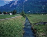
Title (German)
Sevelen SG, Blick (Südwestansicht) auf den Seveler Bach im Wiesland, Ackerland Hofwis nördlich des Dorfes Sevelen
Caption
Southwestern view from the bridge Bahnweg Nord onto the Seveler Bach with cultivated land Hofwis and road (= partial transect 393), photo taken before the start of the soil diversity monitoring, partial view; coordinates (LV03) of the camera location: 755744/222188; keywords Documenta Natura: landscape change, Pre-Alps, meadowland, farmland, brook.
Caption (German)
Südwestansicht von der Brücke Bahnweg Nord auf den Seveler Bach mit Kulturland Hofwis und Strasse (= teilweise Transekt 393), Aufnahme vor Beginn des Bodiversitätsmonitoring, Teilansicht; Koordinaten (LV03) des Kamerastandorts: 755744/222188; Schlagworte Documenta Natura: Landschaftswandel, Voralpen, Wiesland, Ackerland, Bach
Record Name
Dia_303-15719

Title (German)
Sevelen SG, Südansicht des Wieslandes, Ackerlandes Graben, im Hintergrund das Dorf Rans
Caption
South view of the meadowland and farmland ditch with road (= transect 393), fruit trees, in the background the village of Rans and the SBB railroad line, photograph taken before the start of the soil diversity monitoring, general view; coordinates (LV03) of the camera location: 755412/222666; keywords Documenta Natura: landscape change, foothills of the Alps, meadowland, farmland, brook.
Caption (German)
Südansicht des Wieslandes und Ackerlandes Graben mit Strasse (= Transekt 393), Obstbäumen, im Hintergrund das Dorf Rans und die SBB-Bahnlinie, Aufnahme vor Beginn des Bodiversitätsmonitoring, Gesamtansicht; Koordinaten (LV03) des Kamerastandorts: 755412/222666; Schlagworte Documenta Natura: Landschaftswandel, Voralpen, Wiesland, Ackerland, Bach
Record Name
Dia_303-15725

Title (German)
Sevelen SG, Südansicht des Wieslandes, Ackerlandes Graben, im Hintergrund das Dorf Rans
Caption
South view of the meadowland and farmland ditch with road (= transect 393), fruit trees, in the background the village of Rans and the SBB railroad line, photograph taken before the start of the soil diversity monitoring, general view; coordinates (LV03) of the camera location: 755412/222666; keywords Documenta Natura: landscape change, foothills of the Alps, meadowland, farmland, brook.
Caption (German)
Südansicht des Wieslandes und Ackerlandes Graben mit Strasse (= Transekt 393), Obstbäumen, im Hintergrund das Dorf Rans und die SBB-Bahnlinie, Aufnahme vor Beginn des Bodiversitätsmonitoring, Gesamtansicht; Koordinaten (LV03) des Kamerastandorts: 755412/222666; Schlagworte Documenta Natura: Landschaftswandel, Voralpen, Wiesland, Ackerland, Bach
Record Name
Dia_303-15729

Title (German)
Sevelen SG, Südansicht des Wieslandes, Ackerlandes Graben, im Hintergrund das Dorf Rans
Caption
South view of the meadowland and farmland ditch with road (= transect 393), fruit trees, in the background the village of Rans and the SBB railroad line, photograph taken before the start of the soil diversity monitoring, general view; coordinates (LV03) of the camera location: 755412/222666; keywords Documenta Natura: landscape change, foothills of the Alps, meadowland, farmland, brook.
Caption (German)
Südansicht des Wieslandes und Ackerlandes Graben mit Strasse (= Transekt 393), Obstbäumen, im Hintergrund das Dorf Rans und die SBB-Bahnlinie, Aufnahme vor Beginn des Bodiversitätsmonitoring, Gesamtansicht; Koordinaten (LV03) des Kamerastandorts: 755412/222666; Schlagworte Documenta Natura: Landschaftswandel, Voralpen, Wiesland, Ackerland, Bach
Record Name
Dia_303-15734

Title (German)
Sevelen SG, Nordansicht des Wieslandes, Ackerlandes Langengraben mit dem Saarbach östlich von Bad Rans
Caption
North view of the meadowland and farmland Langengraben with roads (= transect 393), road bridge over Saarbach with freshly planted embankment, photograph taken before the start of the soil diversity monitoring, general view; coordinates (LV03) of the camera location: 755068/222535; keywords Documenta Natura: landscape change, Pre-Alps, meadowland, farmland, brook.
Caption (German)
Nordansicht des Wieslandes und Ackerlandes Langengraben mit Strassen (= Transekt 393), Strassenbrücke über Saarbach mit frisch bepflanzter Uferböschung, Aufnahme vor Beginn des Bodiversitätsmonitoring, Gesamtansicht; Koordinaten (LV03) des Kamerastandorts: 755068/222535; Schlagworte Documenta Natura: Landschaftswandel, Voralpen, Wiesland, Ackerland, Bach
Record Name
Dia_303-15743

Title (German)
Sevelen SG, Nordansicht des Wieslandes, Ackerlandes Langengraben mit dem Saarbach östlich von Bad Rans
Caption
North view of the meadowland and farmland Langengraben with roads (= transect 393), road bridge over Saarbach with freshly planted embankment, photograph taken before the start of the soil diversity monitoring, general view; coordinates (LV03) of the camera location: 755068/222535; keywords Documenta Natura: landscape change, Pre-Alps, meadowland, farmland, brook.
Caption (German)
Nordansicht des Wieslandes und Ackerlandes Langengraben mit Strassen (= Transekt 393), Strassenbrücke über Saarbach mit frisch bepflanzter Uferböschung, Aufnahme vor Beginn des Bodiversitätsmonitoring, Gesamtansicht; Koordinaten (LV03) des Kamerastandorts: 755068/222535; Schlagworte Documenta Natura: Landschaftswandel, Voralpen, Wiesland, Ackerland, Bach
Record Name
Dia_303-15747

Title (German)
Sevelen SG, Nordansicht des Wieslandes, Ackerlandes Hofwis östlich des Dorfes Rans
Caption
North view of the meadowland and farmland Hofwis, stable and single fruit trees, road (= transect 393), SBB railroad line, photograph taken before the start of the soil diversity monitoring, general view; coordinates (LV03) of the camera location: 755553/222910; keywords Documenta Natura: landscape change, Pre-Alps, meadowland, farmland, stream.
Caption (German)
Nordansicht des Wieslandes und Ackerlandes Hofwis, Stall und einzelne Obstbäume, Strasse (= Transekt 393), SBB-Bahnlinie, Aufnahme vor Beginn des Bodiversitätsmonitoring, Gesamtansicht; Koordinaten (LV03) des Kamerastandorts: 755553/222910; Schlagworte Documenta Natura: Landschaftswandel, Voralpen, Wiesland, Ackerland, Bach
Record Name
Dia_303-15755

Title (German)
Sevelen SG, Nordansicht des Wieslandes, Ackerlandes Hofwis östlich des Dorfes Rans
Caption
North view of the meadowland and farmland Hofwis, stable and single fruit trees, road (= transect 393), SBB railroad line, photograph taken before the start of the soil diversity monitoring, general view; coordinates (LV03) of the camera location: 755553/222910; keywords Documenta Natura: landscape change, Pre-Alps, meadowland, farmland, stream.
Caption (German)
Nordansicht des Wieslandes und Ackerlandes Hofwis, Stall und einzelne Obstbäume, Strasse (= Transekt 393), SBB-Bahnlinie, Aufnahme vor Beginn des Bodiversitätsmonitoring, Gesamtansicht; Koordinaten (LV03) des Kamerastandorts: 755553/222910; Schlagworte Documenta Natura: Landschaftswandel, Voralpen, Wiesland, Ackerland, Bach
Record Name
Dia_303-15759
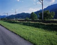
Title (German)
Sevelen SG, Nordansicht des Wieslandes, Ackerlandes Hofwis östlich des Dorfes Rans
Caption
North view of the meadowland and farmland Hofwis, stable and single fruit trees, road (= transect 393), SBB railroad line, photograph taken before the start of the soil diversity monitoring, general view; coordinates (LV03) of the camera location: 755553/222910; keywords Documenta Natura: landscape change, Pre-Alps, meadowland, farmland, stream.
Caption (German)
Nordansicht des Wieslandes und Ackerlandes Hofwis, Stall und einzelne Obstbäume, Strasse (= Transekt 393), SBB-Bahnlinie, Aufnahme vor Beginn des Bodiversitätsmonitoring, Gesamtansicht; Koordinaten (LV03) des Kamerastandorts: 755553/222910; Schlagworte Documenta Natura: Landschaftswandel, Voralpen, Wiesland, Ackerland, Bach
Record Name
Dia_303-15763

Title (German)
Sevelen SG, Südostansicht des Wieslandes Glatried, im Hintergrund der Weiler Valnätscha
Caption
Southeast view of the meadow Glatriet with the core indicator point Z9 (inserted reed branch) in the foreground, in the background the hamlet Valnätscha and forest, photograph taken before the start of the biodiversity monitoring, partial view; coordinates (LV03) of the camera location: 755022/221986; keywords Documenta Natura: landscape change, Pre-Alps, meadowland, farmland, stream.
Caption (German)
Südostansicht des Wieslandes Glatriet mit dem Kernindikatorenpunkt Z9 (eingesteckter Schilfzweig) im Vordergrund, im Hintergrund der Weiler Valnätscha und Wald, Aufnahme vor Beginn des Bodiversitätsmonitoring, Teilansicht; Koordinaten (LV03) des Kamerastandorts: 755022/221986; Schlagworte Documenta Natura: Landschaftswandel, Voralpen, Wiesland, Ackerland, Bach
Record Name
Dia_303-15773

Title (German)
Sta. Maria in Calanca GR, In Waldlichtung Nadi oberhalb Sta. Maria
Caption
South view of the clearing Nadi in the forest Bosch Nadi with forest road (= transect 385), photo taken before the beginning of the ground diversity monitoring, general view uphill; coordinates (LV03) of the camera location: 731510/126542; keywords Documenta Natura: landscape change, mountain forest, forestation, alpine settlement forest clearing.
Caption (German)
Südansicht der Waldlichtung Nadi im Wald Bosch Nadi mit Waldstrasse (= Transekt 385), Aufnahme vor Beginn des Bodiversitätsmonitoring, Gesamtansicht hangaufwärts; Koordinaten (LV03) des Kamerastandorts: 731510/126542; Schlagworte Documenta Natura: Landschaftswandel, Gebirgswald, Verwaldung, Alpsiedlung Waldlichtung
Record Name
Dia_303-15779

Title (German)
Sta. Maria in Calanca GR, In Waldlichtung Nadi oberhalb Sta. Maria
Caption
South view of the clearing Nadi in the forest Bosch Nadi with forest road (= transect 385), photo taken before the beginning of the ground diversity monitoring, general view uphill; coordinates (LV03) of the camera location: 731510/126542; keywords Documenta Natura: landscape change, mountain forest, forestation, alpine settlement forest clearing.
Caption (German)
Südansicht der Waldlichtung Nadi im Wald Bosch Nadi mit Waldstrasse (= Transekt 385), Aufnahme vor Beginn des Bodiversitätsmonitoring, Gesamtansicht hangaufwärts; Koordinaten (LV03) des Kamerastandorts: 731510/126542; Schlagworte Documenta Natura: Landschaftswandel, Gebirgswald, Verwaldung, Alpsiedlung Waldlichtung
Record Name
Dia_303-15783

Title (German)
Sta. Maria in Calanca GR, Ostansicht der Alp/Waldlichtung Scalader oberhalb Sta. Maria
Caption
East view of the alp and forest clearing Scalader with meadowland, scrub forest, stables and alp road, in the background church of St.Maria, photo taken before the beginning of the biodiversity monitoring, general view across the slope; coordinates (LV03) of the camera location: 731974/126541; keywords Documenta Natura: landscape change, mountain forest, forestation, alp settlement forest clearing
Caption (German)
Ostansicht der Alp und Waldlichtung Scalader mit Wiesland, Gebüschwald, Ställen und Alpstrasse, im Hintergrund Kirche von St.Maria, Aufnahme vor Beginn des Bodiversitätsmonitoring, Gesamtansicht quer zum Hang; Koordinaten (LV03) des Kamerastandorts: 731974/126541; Schlagworte Documenta Natura: Landschaftswandel, Gebirgswald, Verwaldung, Alpsiedlung Waldlichtung
Record Name
Dia_303-15790

Title (German)
Sta. Maria in Calanca GR, Ostansicht der Alp/Waldlichtung Scalader oberhalb Sta. Maria
Caption
East view of the alp and forest clearing Scalader with meadowland, scrub forest, stables and alp road, in the background church of St.Maria, photo taken before the beginning of the biodiversity monitoring, general view across the slope; coordinates (LV03) of the camera location: 731974/126541; keywords Documenta Natura: landscape change, mountain forest, forestation, alp settlement forest clearing
Caption (German)
Ostansicht der Alp und Waldlichtung Scalader mit Wiesland, Gebüschwald, Ställen und Alpstrasse, im Hintergrund Kirche von St.Maria, Aufnahme vor Beginn des Bodiversitätsmonitoring, Gesamtansicht quer zum Hang; Koordinaten (LV03) des Kamerastandorts: 731974/126541; Schlagworte Documenta Natura: Landschaftswandel, Gebirgswald, Verwaldung, Alpsiedlung Waldlichtung
Record Name
Dia_303-15793

Title (German)
Sta. Maria in Calanca GR, Ostansicht der Alp/Waldlichtung Scalader oberhalb Sta. Maria
Caption
East view of the alp and forest clearing Scalader with meadowland, scrub forest, stables and alp road, in the background church of St.Maria, photo taken before the beginning of the biodiversity monitoring, general view across the slope; coordinates (LV03) of the camera location: 731974/126541; keywords Documenta Natura: landscape change, mountain forest, forestation, alp settlement forest clearing
Caption (German)
Ostansicht der Alp und Waldlichtung Scalader mit Wiesland, Gebüschwald, Ställen und Alpstrasse, im Hintergrund Kirche von St.Maria, Aufnahme vor Beginn des Bodiversitätsmonitoring, Gesamtansicht quer zum Hang; Koordinaten (LV03) des Kamerastandorts: 731974/126541; Schlagworte Documenta Natura: Landschaftswandel, Gebirgswald, Verwaldung, Alpsiedlung Waldlichtung
Record Name
Dia_303-15797

Title (German)
Sta. Maria in Calanca GR, Blick (Südansicht) vom Turm auf den Südosthang oberhalb des Dorfes
Caption
South view from the church tower in St.Maria on the southeast slope with village edge, forest Bosch Nadi as well as alp and forest clearing Scalader, picture taken before the beginning of the biodiversity monitoring, general view; coordinates (LV03) of the camera location: 731616/124865; keywords Documenta Natura: landscape change, mountain forest, forestation, alp settlement forest clearing
Caption (German)
Südansicht vom Kirchturm in St.Maria auf den Südosthang mit Dorfrand, Wald Bosch Nadi sowie Alp und Waldlichtung Scalader, Aufnahme vor Beginn des Bodiversitätsmonitoring, Gesamtansicht; Koordinaten (LV03) des Kamerastandorts: 731616/124865; Schlagworte Documenta Natura: Landschaftswandel, Gebirgswald, Verwaldung, Alpsiedlung Waldlichtung
Record Name
Dia_303-15807

Title (German)
Sta. Maria in Calanca GR, Ostansicht der Alp/Waldlichtung Nadi oberhalb Sta. Maria
Caption
East view of the alp and clearing Nadi with alp road (= transect 385), young forest, meadowland, stables, photo taken before the beginning of the biodiversity monitoring, general view across the slope; coordinates (LV03) of the camera location: 731516/126516; keywords Documenta Natura: landscape change, mountain forest, forestation, alp settlement forest clearing
Caption (German)
Ostansicht der Alp und Waldlichtung Nadi mit Alpstrasse (= Transekt 385), Jungwald, Wiesland, Ställen, Aufnahme vor Beginn des Bodiversitätsmonitoring, Gesamtansicht quer zum Hang; Koordinaten (LV03) des Kamerastandorts: 731516/126516; Schlagworte Documenta Natura: Landschaftswandel, Gebirgswald, Verwaldung, Alpsiedlung Waldlichtung
Record Name
Dia_303-15813

Title (German)
Sta. Maria in Calanca GR, Ostansicht der Alp/Waldlichtung Nadi oberhalb Sta. Maria
Caption
East view of the alp and clearing Nadi with alp road (= transect 385), young forest, meadowland, stables, photo taken before the beginning of the biodiversity monitoring, general view across the slope; coordinates (LV03) of the camera location: 731516/126516; keywords Documenta Natura: landscape change, mountain forest, forestation, alp settlement forest clearing
Caption (German)
Ostansicht der Alp und Waldlichtung Nadi mit Alpstrasse (= Transekt 385), Jungwald, Wiesland, Ställen, Aufnahme vor Beginn des Bodiversitätsmonitoring, Gesamtansicht quer zum Hang; Koordinaten (LV03) des Kamerastandorts: 731516/126516; Schlagworte Documenta Natura: Landschaftswandel, Gebirgswald, Verwaldung, Alpsiedlung Waldlichtung
Record Name
Dia_303-15817

Title (German)
Sta. Maria in Calanca GR, Ostansicht der Alp/Waldlichtung Nadi oberhalb Sta. Maria
Caption
East view of the alp and clearing Nadi with alp road (= transect 385), young forest, meadowland, stables, photo taken before the beginning of the biodiversity monitoring, general view across the slope; coordinates (LV03) of the camera location: 731516/126516; keywords Documenta Natura: landscape change, mountain forest, forestation, alp settlement forest clearing
Caption (German)
Ostansicht der Alp und Waldlichtung Nadi mit Alpstrasse (= Transekt 385), Jungwald, Wiesland, Ställen, Aufnahme vor Beginn des Bodiversitätsmonitoring, Gesamtansicht quer zum Hang; Koordinaten (LV03) des Kamerastandorts: 731516/126516; Schlagworte Documenta Natura: Landschaftswandel, Gebirgswald, Verwaldung, Alpsiedlung Waldlichtung
Record Name
Dia_303-15821

Title (German)
Sta. Maria in Calanca GR, Nordostansicht der Waldlichtung Scalader oberhalb Sta. Maria
Caption
Northeast view of the Scalader clearing (edge area) with alpine road and alpine path (= transect 385), young forest, photo taken before the start of the biodiversity monitoring, partial view; coordinates (LV03) of the camera location: 731880/126412; keywords Documenta Natura: landscape change, mountain forest, forestation, alpine settlement forest clearing
Caption (German)
Nordostansicht der Waldlichtung Scalader (Randbereich) mit Alpstrasse und Alpweg (= Transekt 385), Jungwald, Aufnahme vor Beginn des Bodiversitätsmonitoring, Teilansicht; Koordinaten (LV03) des Kamerastandorts: 731880/126412; Schlagworte Documenta Natura: Landschaftswandel, Gebirgswald, Verwaldung, Alpsiedlung Waldlichtung
Record Name
Dia_303-15832

Title (German)
Pontresina GR, Im Südhang unterhalb des Piz Chatscheders
Caption
Southeast view over the lower southern slope of Piz Chatscheder with alpine meadowland and small debris flows (swards), in the background mountain range with the Diavolezza, photograph taken before the start of the soil diversity monitoring, general view; coordinates (LV03) of the camera location: 797730/150070; keywords Documenta Natura: landscape change, high mountains
Caption (German)
Südostansicht über den unteren Südhang des Piz Chatscheders mit alpinem Wiesland und kleinen Murgängen (Grasnarben), im Hintergrund Gebirgskette mit der Diavolezza, Aufnahme vor Beginn des Bodiversitätsmonitoring, Gesamtansicht; Koordinaten (LV03) des Kamerastandorts: 797730/150070; Schlagworte Documenta Natura: Landschaftswandel, Hochgebirge
Record Name
Dia_303-15837

Title (German)
Pontresina GR, Im Südhang unterhalb des Piz Chatscheders
Caption
Southeast view over the lower southern slope of Piz Chatscheder with alpine meadowland and small debris flows (swards), in the background mountain range with the Diavolezza, photograph taken before the start of the soil diversity monitoring, general view; coordinates (LV03) of the camera location: 797730/150070; keywords Documenta Natura: landscape change, high mountains
Caption (German)
Südostansicht über den unteren Südhang des Piz Chatscheders mit alpinem Wiesland und kleinen Murgängen (Grasnarben), im Hintergrund Gebirgskette mit der Diavolezza, Aufnahme vor Beginn des Bodiversitätsmonitoring, Gesamtansicht; Koordinaten (LV03) des Kamerastandorts: 797730/150070; Schlagworte Documenta Natura: Landschaftswandel, Hochgebirge
Record Name
Dia_303-15842

Title (German)
Pontresina GR, Im Südhang unterhalb des Piz Chatscheders
Caption
Southeast view over the lower southern slope of Piz Chatscheder with alpine meadowland and small debris flows (swards), in the background mountain range with the Diavolezza, photograph taken before the start of the soil diversity monitoring, general view; coordinates (LV03) of the camera location: 797730/150070; keywords Documenta Natura: landscape change, high mountains
Caption (German)
Südostansicht über den unteren Südhang des Piz Chatscheders mit alpinem Wiesland und kleinen Murgängen (Grasnarben), im Hintergrund Gebirgskette mit der Diavolezza, Aufnahme vor Beginn des Bodiversitätsmonitoring, Gesamtansicht; Koordinaten (LV03) des Kamerastandorts: 797730/150070; Schlagworte Documenta Natura: Landschaftswandel, Hochgebirge
Record Name
Dia_303-15845

Title (German)
Pontresina GR, Im Südhang unterhalb des Piz Chatscheders
Caption
Southeast view over the lower southern slope of Piz Chatscheder with alpine meadowland and small debris flows (swards), in the background mountain range with the Diavolezza, photograph taken before the start of the soil diversity monitoring, general view; coordinates (LV03) of the camera location: 797730/150070; keywords Documenta Natura: landscape change, high mountains
Caption (German)
Südostansicht über den unteren Südhang des Piz Chatscheders mit alpinem Wiesland und kleinen Murgängen (Grasnarben), im Hintergrund Gebirgskette mit der Diavolezza, Aufnahme vor Beginn des Bodiversitätsmonitoring, Gesamtansicht; Koordinaten (LV03) des Kamerastandorts: 797730/150070; Schlagworte Documenta Natura: Landschaftswandel, Hochgebirge
Record Name
Dia_303-15849

Title (German)
Pontresina GR, Im Südhang unterhalb des Piz Chatscheders
Caption
South view over the upper south slope of Piz Chatscheder with alpine meadowland and scree slopes, photo taken before the start of the ground diversity monitoring (2006), general view; coordinates (LV03) of the camera location: 797721/150181; keywords Documenta Natura: landscape change, high mountains
Caption (German)
Südansicht über den oberen Südhang des Piz Chatscheders mit alpinem Wiesland und Geröllhalden, Aufnahme vor Beginn des Bodiversitätsmonitoring (2006), Gesamtansicht; Koordinaten (LV03) des Kamerastandorts: 797721/150181; Schlagworte Documenta Natura: Landschaftswandel, Hochgebirge
Record Name
Dia_303-15861

Title (German)
Pontresina GR, Im Südhang unterhalb des Piz Chatscheders
Caption
South view over the upper south slope of Piz Chatscheder with alpine meadowland and scree slopes, photo taken before the start of the ground diversity monitoring (2006), general view; coordinates (LV03) of the camera location: 797721/150181; keywords Documenta Natura: landscape change, high mountains
Caption (German)
Südansicht über den oberen Südhang des Piz Chatscheders mit alpinem Wiesland und Geröllhalden, Aufnahme vor Beginn des Bodiversitätsmonitoring (2006), Gesamtansicht; Koordinaten (LV03) des Kamerastandorts: 797721/150181; Schlagworte Documenta Natura: Landschaftswandel, Hochgebirge
Record Name
Dia_303-15865

Title (German)
Pontresina GR, Im Südhang unterhalb des Piz Chatscheders
Caption
South view over the upper south slope of Piz Chatscheder with alpine meadowland and scree slopes, photo taken before the start of the ground diversity monitoring (2006), general view; coordinates (LV03) of the camera location: 797721/150181; keywords Documenta Natura: landscape change, high mountains
Caption (German)
Südansicht über den oberen Südhang des Piz Chatscheders mit alpinem Wiesland und Geröllhalden, Aufnahme vor Beginn des Bodiversitätsmonitoring (2006), Gesamtansicht; Koordinaten (LV03) des Kamerastandorts: 797721/150181; Schlagworte Documenta Natura: Landschaftswandel, Hochgebirge
Record Name
Dia_303-15869

Title (German)
Pontresina GR, Im Südhang unterhalb des Piz Chatscheders
Caption
South view over the upper south slope of Piz Chatscheder with alpine meadowland and scree slopes, photo taken before the start of the ground diversity monitoring (2006), general view; coordinates (LV03) of the camera location: 797721/150181; keywords Documenta Natura: landscape change, high mountains
Caption (German)
Südansicht über den oberen Südhang des Piz Chatscheders mit alpinem Wiesland und Geröllhalden, Aufnahme vor Beginn des Bodiversitätsmonitoring (2006), Gesamtansicht; Koordinaten (LV03) des Kamerastandorts: 797721/150181; Schlagworte Documenta Natura: Landschaftswandel, Hochgebirge
Record Name
Dia_303-15873

Title (German)
Bürglen UR, Nordostansicht der Waldweide oberhalb Grund
Caption
Northeast view of forest pasture with Hüribach stream, small water catchment and bridge, road (= transect 477), photograph taken before the start of the soil diversity monitoring, general view; coordinates (LV03) of camera location: 701380/198738; keywords Documenta Natura: landscape change, high mountains, forestation, mountain forest.
Caption (German)
Nordostansicht der Waldweide mit Hüribach, kleiner Wasserfassung und Brücke, Strasse (= Transekt 477), Aufnahme vor Beginn des Bodiversitätsmonitoring, Gesamtansicht; Koordinaten (LV03) des Kamerastandorts: 701380/198738; Schlagworte Documenta Natura: Landschaftswandel, Hochgebirge, Verwaldung, Gebirgswald
Record Name
Dia_303-15885

Title (German)
Bürglen UR, Nordostansicht der Waldweide oberhalb Grund
Caption
Northeast view of forest pasture with Hüribach stream, small water catchment and bridge, road (= transect 477), photograph taken before the start of the soil diversity monitoring, general view; coordinates (LV03) of camera location: 701380/198738; keywords Documenta Natura: landscape change, high mountains, forestation, mountain forest.
Caption (German)
Nordostansicht der Waldweide mit Hüribach, kleiner Wasserfassung und Brücke, Strasse (= Transekt 477), Aufnahme vor Beginn des Bodiversitätsmonitoring, Gesamtansicht; Koordinaten (LV03) des Kamerastandorts: 701380/198738; Schlagworte Documenta Natura: Landschaftswandel, Hochgebirge, Verwaldung, Gebirgswald
Record Name
Dia_303-15889

Title (German)
Bürglen UR, Nordostansicht der Waldweide oberhalb Grund
Caption
Northeast view of forest pasture with Hüribach stream, small water catchment and bridge, road (= transect 477), photograph taken before the start of the soil diversity monitoring, general view; coordinates (LV03) of camera location: 701380/198738; keywords Documenta Natura: landscape change, high mountains, forestation, mountain forest.
Caption (German)
Nordostansicht der Waldweide mit Hüribach, kleiner Wasserfassung und Brücke, Strasse (= Transekt 477), Aufnahme vor Beginn des Bodiversitätsmonitoring, Gesamtansicht; Koordinaten (LV03) des Kamerastandorts: 701380/198738; Schlagworte Documenta Natura: Landschaftswandel, Hochgebirge, Verwaldung, Gebirgswald
Record Name
Dia_303-15893

Title (German)
Bürglen UR, Südwestansicht der Waldweide oberhalb Grund
Caption
Southwestern view of forest pasture with road (= transect 477), photograph taken before the start of ground diversity monitoring, general view; coordinates (LV03) of camera location: 701126/198607; keywords Documenta Natura: landscape change, high mountains, forestation, mountain forest.
Caption (German)
Südwestansicht der Waldweide mit Strasse (= Transekt 477), Aufnahme vor Beginn des Bodiversitätsmonitoring, Gesamtansicht; Koordinaten (LV03) des Kamerastandorts: 701126/198607; Schlagworte Documenta Natura: Landschaftswandel, Hochgebirge, Verwaldung, Gebirgswald
Record Name
Dia_303-15903

Title (German)
Bürglen UR, Südwestansicht der Waldweide oberhalb Grund
Caption
Southwestern view of forest pasture with road (= transect 477), photograph taken before the start of ground diversity monitoring, general view; coordinates (LV03) of camera location: 701126/198607; keywords Documenta Natura: landscape change, high mountains, forestation, mountain forest.
Caption (German)
Südwestansicht der Waldweide mit Strasse (= Transekt 477), Aufnahme vor Beginn des Bodiversitätsmonitoring, Gesamtansicht; Koordinaten (LV03) des Kamerastandorts: 701126/198607; Schlagworte Documenta Natura: Landschaftswandel, Hochgebirge, Verwaldung, Gebirgswald
Record Name
Dia_303-15907

Title (German)
Bürglen UR, Südwestansicht der Waldweide oberhalb Grund
Caption
Southwestern view of forest pasture with road (= transect 477), photograph taken before the start of ground diversity monitoring, general view; coordinates (LV03) of camera location: 701126/198607; keywords Documenta Natura: landscape change, high mountains, forestation, mountain forest.
Caption (German)
Südwestansicht der Waldweide mit Strasse (= Transekt 477), Aufnahme vor Beginn des Bodiversitätsmonitoring, Gesamtansicht; Koordinaten (LV03) des Kamerastandorts: 701126/198607; Schlagworte Documenta Natura: Landschaftswandel, Hochgebirge, Verwaldung, Gebirgswald
Record Name
Dia_303-15911

Title (German)
Bürglen UR, Südostansicht der Weide Alt Rüti und Grüen Boden oberhalb Grund
Caption
Southeast view of the alpine pastures Alt Rüti and Grüen Boden with sparse tree cover (spruce) and road (= transect 477), photo taken before the start of the ground diversity monitoring, general view; coordinates (LV03) of the camera location: 701384/198270; keywords Documenta Natura: landscape change, high mountains, forestation, mountain forest
Caption (German)
Südostansicht der Alpweiden Alt Rüti und Grüen Boden mit lichtem Baumbestand (Fichte) und Strasse (= Transekt 477), Aufnahme vor Beginn des Bodiversitätsmonitoring, Gesamtansicht; Koordinaten (LV03) des Kamerastandorts: 701384/198270; Schlagworte Documenta Natura: Landschaftswandel, Hochgebirge, Verwaldung, Gebirgswald
Record Name
Dia_303-15921

Title (German)
Bürglen UR, Südostansicht der Weide Alt Rüti und Grüen Boden oberhalb Grund
Caption
Southeast view of the alpine pastures Alt Rüti and Grüen Boden with sparse tree cover (spruce) and road (= transect 477), photo taken before the start of the ground diversity monitoring, general view; coordinates (LV03) of the camera location: 701384/198270; keywords Documenta Natura: landscape change, high mountains, forestation, mountain forest
Caption (German)
Südostansicht der Alpweiden Alt Rüti und Grüen Boden mit lichtem Baumbestand (Fichte) und Strasse (= Transekt 477), Aufnahme vor Beginn des Bodiversitätsmonitoring, Gesamtansicht; Koordinaten (LV03) des Kamerastandorts: 701384/198270; Schlagworte Documenta Natura: Landschaftswandel, Hochgebirge, Verwaldung, Gebirgswald
Record Name
Dia_303-15925

Title (German)
Bürglen UR, Südostansicht der Weide Alt Rüti und Grüen Boden oberhalb Grund
Caption
Southeast view of the alpine pastures Alt Rüti and Grüen Boden with sparse tree cover (spruce) and road (= transect 477), photo taken before the start of the ground diversity monitoring, general view; coordinates (LV03) of the camera location: 701384/198270; keywords Documenta Natura: landscape change, high mountains, forestation, mountain forest
Caption (German)
Südostansicht der Alpweiden Alt Rüti und Grüen Boden mit lichtem Baumbestand (Fichte) und Strasse (= Transekt 477), Aufnahme vor Beginn des Bodiversitätsmonitoring, Gesamtansicht; Koordinaten (LV03) des Kamerastandorts: 701384/198270; Schlagworte Documenta Natura: Landschaftswandel, Hochgebirge, Verwaldung, Gebirgswald
Record Name
Dia_303-15929

Title (German)
Bürglen UR, Südwestansicht des Wieslandes Alt Rüti und Grüen Boden oberhalb Grund
Caption
Southwest view of the meadow Alt Rüti and Grüen Boden with sparse tree cover (spruces) and road (= transect 477), photograph taken before the start of the soil diversity monitoring, general view; coordinates (LV03) of the camera location: 701195/198080; keywords Documenta Natura: landscape change, high mountains, forestation, mountain forest.
Caption (German)
Südwestansicht des Wieslandes Alt Rüti und Grüen Boden mit lichtem Baumbestand (Fichten) und Strasse (= Transekt 477), Aufnahme vor Beginn des Bodiversitätsmonitoring, Gesamtansicht; Koordinaten (LV03) des Kamerastandorts: 701195/198080; Schlagworte Documenta Natura: Landschaftswandel, Hochgebirge, Verwaldung, Gebirgswald
Record Name
Dia_303-15939
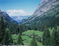
Title (German)
Bürglen UR, Südwestansicht des Wieslandes Alt Rüti und Grüen Boden oberhalb Grund
Caption
Southwest view of the meadow Alt Rüti and Grüen Boden with sparse tree cover (spruces) and road (= transect 477), photograph taken before the start of the soil diversity monitoring, general view; coordinates (LV03) of the camera location: 701195/198080; keywords Documenta Natura: landscape change, high mountains, forestation, mountain forest.
Caption (German)
Südwestansicht des Wieslandes Alt Rüti und Grüen Boden mit lichtem Baumbestand (Fichten) und Strasse (= Transekt 477), Aufnahme vor Beginn des Bodiversitätsmonitoring, Gesamtansicht; Koordinaten (LV03) des Kamerastandorts: 701195/198080; Schlagworte Documenta Natura: Landschaftswandel, Hochgebirge, Verwaldung, Gebirgswald
Record Name
Dia_303-15943

Title (German)
Bürglen UR, Südwestansicht des Wieslandes Alt Rüti und Grüen Boden oberhalb Grund
Caption
Southwest view of the meadow Alt Rüti and Grüen Boden with sparse tree cover (spruces) and road (= transect 477), photograph taken before the start of the soil diversity monitoring, general view; coordinates (LV03) of the camera location: 701195/198080; keywords Documenta Natura: landscape change, high mountains, forestation, mountain forest.
Caption (German)
Südwestansicht des Wieslandes Alt Rüti und Grüen Boden mit lichtem Baumbestand (Fichten) und Strasse (= Transekt 477), Aufnahme vor Beginn des Bodiversitätsmonitoring, Gesamtansicht; Koordinaten (LV03) des Kamerastandorts: 701195/198080; Schlagworte Documenta Natura: Landschaftswandel, Hochgebirge, Verwaldung, Gebirgswald
Record Name
Dia_303-15947

Title (German)
Bürglen UR, Nordwestansicht des Wieslandes Grüen Boden oberhalb Grund
Caption
Northwestern view of the alpine pasture Grüen Boden with sparse and dense tree cover (spruces) and road (= transect 477), photograph taken before the start of the soil diversity monitoring, general view; coordinates (LV03) of the camera location: 701086/198475; keywords Documenta Natura: landscape change, high mountains, forestation, mountain forest.
Caption (German)
Nordwestansicht der Alpweide Grüen Boden mit lichtem und dichtem Baumbestand (Fichten) und Strasse (= Transekt 477), Aufnahme vor Beginn des Bodiversitätsmonitoring, Gesamtansicht; Koordinaten (LV03) des Kamerastandorts: 701086/198475; Schlagworte Documenta Natura: Landschaftswandel, Hochgebirge, Verwaldung, Gebirgswald
Record Name
Dia_303-15957

Title (German)
Bürglen UR, Nordwestansicht des Wieslandes Grüen Boden oberhalb Grund
Caption
Northwestern view of the alpine pasture Grüen Boden with sparse and dense tree cover (spruces) and road (= transect 477), photograph taken before the start of the soil diversity monitoring, general view; coordinates (LV03) of the camera location: 701086/198475; keywords Documenta Natura: landscape change, high mountains, forestation, mountain forest.
Caption (German)
Nordwestansicht der Alpweide Grüen Boden mit lichtem und dichtem Baumbestand (Fichten) und Strasse (= Transekt 477), Aufnahme vor Beginn des Bodiversitätsmonitoring, Gesamtansicht; Koordinaten (LV03) des Kamerastandorts: 701086/198475; Schlagworte Documenta Natura: Landschaftswandel, Hochgebirge, Verwaldung, Gebirgswald
Record Name
Dia_303-15961

Title (German)
Bürglen UR, Nordwestansicht des Wieslandes Grüen Boden oberhalb Grund
Caption
Northwestern view of the alpine pasture Grüen Boden with sparse and dense tree cover (spruces) and road (= transect 477), photograph taken before the start of the soil diversity monitoring, general view; coordinates (LV03) of the camera location: 701086/198475; keywords Documenta Natura: landscape change, high mountains, forestation, mountain forest.
Caption (German)
Nordwestansicht der Alpweide Grüen Boden mit lichtem und dichtem Baumbestand (Fichten) und Strasse (= Transekt 477), Aufnahme vor Beginn des Bodiversitätsmonitoring, Gesamtansicht; Koordinaten (LV03) des Kamerastandorts: 701086/198475; Schlagworte Documenta Natura: Landschaftswandel, Hochgebirge, Verwaldung, Gebirgswald
Record Name
Dia_303-15965

Title (German)
Oberwald VS, Rundblick (Südostansicht) von der Furkapassstrasse auf Gletschbode mit der Rhone, Südosthang mit Rhonegletscher
Caption
Southeast view from the Furka Pass road onto Gletschbode with the Rhone, outwash plain, meadowland, scrub forest as well as the southeast slope with the Rhone glacier, photograph taken before the start of the ground diversity monitoring, counter-slope photograph, general view; coordinates (LV03) of the camera location: 671980/157480; keywords Documenta Natura: landscape change, high mountains, stream, glacier
Caption (German)
Südostansicht von der Furkapassstrasse auf Gletschbode mit der Rhone, Sander, Wiesland, Gebüschwald sowie dem Südosthang mit dem Rhonegletscher, Aufnahme vor Beginn des Bodiversitätsmonitoring, Gegenhangaufnahme, Gesamtansicht; Koordinaten (LV03) des Kamerastandorts: 671980/157480; Schlagworte Documenta Natura: Landschaftswandel, Hochgebirge, Bach, Gletscher
Record Name
Dia_303-15976

Title (German)
Oberwald VS, Rundblick (Südostansicht) von der Furkapassstrasse auf Gletschbode mit der Rhone, Südosthang mit Rhonegletscher
Caption
Southeast view from the Furka Pass road onto Gletschbode with the Rhone, outwash plain, meadowland, scrub forest as well as the southeast slope with the Rhone glacier, photograph taken before the start of the ground diversity monitoring, counter-slope photograph, general view; coordinates (LV03) of the camera location: 671980/157480; keywords Documenta Natura: landscape change, high mountains, stream, glacier
Caption (German)
Südostansicht von der Furkapassstrasse auf Gletschbode mit der Rhone, Sander, Wiesland, Gebüschwald sowie dem Südosthang mit dem Rhonegletscher, Aufnahme vor Beginn des Bodiversitätsmonitoring, Gegenhangaufnahme, Gesamtansicht; Koordinaten (LV03) des Kamerastandorts: 671980/157480; Schlagworte Documenta Natura: Landschaftswandel, Hochgebirge, Bach, Gletscher
Record Name
Dia_303-15980

Title (German)
Oberwald VS, Rundblick (Südostansicht) von der Furkapassstrasse auf Gletschbode mit der Rhone, Südosthang mit Rhonegletscher
Caption
Southeast view from the Furka Pass road onto Gletschbode with the Rhone, outwash plain, meadowland, scrub forest as well as the southeast slope with the Rhone glacier, photograph taken before the start of the ground diversity monitoring, counter-slope photograph, general view; coordinates (LV03) of the camera location: 671980/157480; keywords Documenta Natura: landscape change, high mountains, stream, glacier
Caption (German)
Südostansicht von der Furkapassstrasse auf Gletschbode mit der Rhone, Sander, Wiesland, Gebüschwald sowie dem Südosthang mit dem Rhonegletscher, Aufnahme vor Beginn des Bodiversitätsmonitoring, Gegenhangaufnahme, Gesamtansicht; Koordinaten (LV03) des Kamerastandorts: 671980/157480; Schlagworte Documenta Natura: Landschaftswandel, Hochgebirge, Bach, Gletscher
Record Name
Dia_303-15984

Title (German)
Oberwald VS, Südwestansicht des Gletschbode am Fusse des Rhonegletscher
Caption
Southwestern view of the glacier bode with outwash plain, young forest and scrub forest, footpath (= transect 463), in the background the Rhone glacier, photograph taken before the start of the bodiversity monitoring, general view; coordinates (LV03) of the camera location: 671899/158010; keywords Documenta Natura: landscape change, high mountains, stream, glacier.
Caption (German)
Südwestansicht des Gletschbode mit Sander, Jungwald und Gebüschwald, Fussweg (= Transekt 463), im Hintergrund der Rhonegletscher, Aufnahme vor Beginn des Bodiversitätsmonitoring, Gesamtansicht; Koordinaten (LV03) des Kamerastandorts: 671899/158010; Schlagworte Documenta Natura: Landschaftswandel, Hochgebirge, Bach, Gletscher
Record Name
Dia_303-15992

Title (German)
Oberwald VS, Südwestansicht des Gletschbode am Fusse des Rhonegletscher
Caption
Southwestern view of the glacier bode with outwash plain, young forest and scrub forest, footpath (= transect 463), in the background the Rhone glacier, photograph taken before the start of the bodiversity monitoring, general view; coordinates (LV03) of the camera location: 671899/158010; keywords Documenta Natura: landscape change, high mountains, stream, glacier.
Caption (German)
Südwestansicht des Gletschbode mit Sander, Jungwald und Gebüschwald, Fussweg (= Transekt 463), im Hintergrund der Rhonegletscher, Aufnahme vor Beginn des Bodiversitätsmonitoring, Gesamtansicht; Koordinaten (LV03) des Kamerastandorts: 671899/158010; Schlagworte Documenta Natura: Landschaftswandel, Hochgebirge, Bach, Gletscher
Record Name
Dia_303-15996

Title (German)
Oberwald VS, Südwestansicht des Gletschbode am Fusse des Rhonegletscher
Caption
Southwestern view of the glacier bode with outwash plain, young forest and scrub forest, footpath (= transect 463), in the background the Rhone glacier, photograph taken before the start of the bodiversity monitoring, general view; coordinates (LV03) of the camera location: 671899/158010; keywords Documenta Natura: landscape change, high mountains, stream, glacier.
Caption (German)
Südwestansicht des Gletschbode mit Sander, Jungwald und Gebüschwald, Fussweg (= Transekt 463), im Hintergrund der Rhonegletscher, Aufnahme vor Beginn des Bodiversitätsmonitoring, Gesamtansicht; Koordinaten (LV03) des Kamerastandorts: 671899/158010; Schlagworte Documenta Natura: Landschaftswandel, Hochgebirge, Bach, Gletscher
Record Name
Dia_303-16000

Title (German)
Oberwald VS, Im Südosthang unterhalb Sattelegg
Caption
East view of the southeast slope below Sattelegg with core indicator Z9 (top right at Legföhre/yellow marker), image taken before the start of the biodiversity monitoring, partial view across the slope; coordinates (LV03) of camera location: 671044/157992; keywords Documenta Natura: landscape change, high mountains, stream, glacier.
Caption (German)
Ostansicht des Südosthanges unterhalb Sattelegg mit dem Kernindikator Z9 (rechts oben bei Legföhre/gelbe Markierung), Aufnahme vor Beginn des Bodiversitätsmonitoring, Teilansicht quer zum Hang; Koordinaten (LV03) des Kamerastandorts: 671044/157992; Schlagworte Documenta Natura: Landschaftswandel, Hochgebirge, Bach, Gletscher
Record Name
Dia_303-16010

Title (German)
Bern BE, Ostansicht des Bahnhofplatzes bei der UBS, Ecke Christoffelgasse/Schauplatzgasse
Caption
East view of the Bahnhofplatz at the bank UBS, corner Christoffelgasse/Schauplatzgasse with bus stops, traffic (bus public transport, cars) and pedestrians, first photo before start of reconstruction/ redesign (12-2006), general view; coordinates (LV03) of camera location: 600170/199577; keywords Documenta Natura: city, construction site, landscape change
Caption (German)
Ostansicht des Bahnhofplatzes bei der Bank UBS, Ecke Christoffelgasse/Schauplatzgasse mit Bushaltestellen, Verkehr (Bus ÖV, Autos) und Fussgängern, Erstaufnahme vor Beginn Umbau/ Neugestaltung (12-2006), Gesamtansicht; Koordinaten (LV03) des Kamerastandorts: 600170/199577; Schlagworte Documenta Natura: Stadt, Baustelle, Landschaftswandel
Record Name
Dia_303-16016

Title (German)
Bern BE, Ostansicht des Bahnhofplatzes bei der UBS, Ecke Christoffelgasse/Schauplatzgasse
Caption
East view of the Bahnhofplatz at the bank UBS, corner Christoffelgasse/Schauplatzgasse with bus stops, traffic (bus public transport, cars) and pedestrians, first photo before start of reconstruction/ redesign (12-2006), general view; coordinates (LV03) of camera location: 600170/199577; keywords Documenta Natura: city, construction site, landscape change
Caption (German)
Ostansicht des Bahnhofplatzes bei der Bank UBS, Ecke Christoffelgasse/Schauplatzgasse mit Bushaltestellen, Verkehr (Bus ÖV, Autos) und Fussgängern, Erstaufnahme vor Beginn Umbau/ Neugestaltung (12-2006), Gesamtansicht; Koordinaten (LV03) des Kamerastandorts: 600170/199577; Schlagworte Documenta Natura: Stadt, Baustelle, Landschaftswandel
Record Name
Dia_303-16020

Title (German)
Bern BE, Ostansicht des Bahnhofplatzes bei der UBS, Ecke Christoffelgasse/Schauplatzgasse
Caption
East view of the Bahnhofplatz near the bank UBS, corner Christoffelgasse/Schauplatzgasse, 1st follow-up shot during construction (06-2007), general view; coordinates (LV03) of the camera location: 600170/199577; keywords Documenta Natura: city, construction site, landscape change
Caption (German)
Ostansicht des Bahnhofplatzes bei der Bank UBS, Ecke Christoffelgasse/Schauplatzgasse, 1. Folgeaufnahme während dem Bau (06-2007), Gesamtansicht; Koordinaten (LV03) des Kamerastandorts: 600170/199577; Schlagworte Documenta Natura: Stadt, Baustelle, Landschaftswandel
Record Name
Dia_303-16028

Title (German)
Bern BE, Ostansicht des Bahnhofplatzes bei der UBS, Ecke Christoffelgasse/Schauplatzgasse
Caption
East view of the Bahnhofplatz near the bank UBS, corner Christoffelgasse/Schauplatzgasse, 1st follow-up shot during construction (06-2007), general view; coordinates (LV03) of the camera location: 600170/199577; keywords Documenta Natura: city, construction site, landscape change
Caption (German)
Ostansicht des Bahnhofplatzes bei der Bank UBS, Ecke Christoffelgasse/Schauplatzgasse, 1. Folgeaufnahme während dem Bau (06-2007), Gesamtansicht; Koordinaten (LV03) des Kamerastandorts: 600170/199577; Schlagworte Documenta Natura: Stadt, Baustelle, Landschaftswandel
Record Name
Dia_303-16032

Title (German)
Bern BE, Ostansicht des Bahnhofplatzes bei der UBS, Ecke Christoffelgasse/Schauplatzgasse
Caption
East view of Bahnhofplatz near UBS bank, corner Christoffelgasse/Schauplatzgasse with bus stop, traffic (bus ÖV) and pedestrians, 2nd follow-up shot during construction, with canopy/canopy (02-2008), general view; coordinates (LV03) of camera location: 600170/199577; keywords Documenta Natura: city, construction site, landscape change
Caption (German)
Ostansicht des Bahnhofplatzes bei der Bank UBS, Ecke Christoffelgasse/Schauplatzgasse mit Bushaltestelle, Verkehr (Bus ÖV) und Fussgängern, 2. Folgeaufnahme während dem Bau, mit Überdachung/ Baldachin (02-2008), Gesamtansicht; Koordinaten (LV03) des Kamerastandorts: 600170/199577; Schlagworte Documenta Natura: Stadt, Baustelle, Landschaftswandel
Record Name
Dia_303-16040

Title (German)
Bern BE, Ostansicht des Bahnhofplatzes bei der UBS, Ecke Christoffelgasse/Schauplatzgasse
Caption
East view of Bahnhofplatz near UBS bank, corner Christoffelgasse/Schauplatzgasse with bus stop, traffic (bus ÖV) and pedestrians, 2nd follow-up shot during construction, with canopy/canopy (02-2008), general view; coordinates (LV03) of camera location: 600170/199577; keywords Documenta Natura: city, construction site, landscape change
Caption (German)
Ostansicht des Bahnhofplatzes bei der Bank UBS, Ecke Christoffelgasse/Schauplatzgasse mit Bushaltestelle, Verkehr (Bus ÖV) und Fussgängern, 2. Folgeaufnahme während dem Bau, mit Überdachung/ Baldachin (02-2008), Gesamtansicht; Koordinaten (LV03) des Kamerastandorts: 600170/199577; Schlagworte Documenta Natura: Stadt, Baustelle, Landschaftswandel
Record Name
Dia_303-16044

Title (German)
Bern BE, Ostansicht des Bahnhofplatzes bei der UBS, Ecke Christoffelgasse/Schauplatzgasse
Caption
East view of the Bahnhofplatz near the bank UBS, corner Christoffelgasse/Schauplatzgasse with bus stop, traffic (bus ÖV) and pedestrians, 3rd follow-up photo after completion (07-2008), general view; coordinates (LV03) of the camera location: 600170/199577; keywords Documenta Natura: city, construction site, landscape change
Caption (German)
Ostansicht des Bahnhofplatzes bei der Bank UBS, Ecke Christoffelgasse/Schauplatzgasse mit Bushaltestelle, Verkehr (Bus ÖV) und Fussgängern, 3. Folgeaufnahme nach der Fertigstellung (07-2008), Gesamtansicht; Koordinaten (LV03) des Kamerastandorts: 600170/199577; Schlagworte Documenta Natura: Stadt, Baustelle, Landschaftswandel
Record Name
Dia_303-16052

Title (German)
Bern BE, Ostansicht des Bahnhofplatzes bei der UBS, Ecke Christoffelgasse/Schauplatzgasse
Caption
East view of the Bahnhofplatz near the bank UBS, corner Christoffelgasse/Schauplatzgasse with bus stop, traffic (bus ÖV) and pedestrians, 3rd follow-up photo after completion (07-2008), general view; coordinates (LV03) of the camera location: 600170/199577; keywords Documenta Natura: city, construction site, landscape change
Caption (German)
Ostansicht des Bahnhofplatzes bei der Bank UBS, Ecke Christoffelgasse/Schauplatzgasse mit Bushaltestelle, Verkehr (Bus ÖV) und Fussgängern, 3. Folgeaufnahme nach der Fertigstellung (07-2008), Gesamtansicht; Koordinaten (LV03) des Kamerastandorts: 600170/199577; Schlagworte Documenta Natura: Stadt, Baustelle, Landschaftswandel
Record Name
Dia_303-16056

Title (German)
Bern BE, Blick (Ostansicht) entlang der Spitalgasse zum Bahnhofplatz
Caption
East view along Spitalgasse to Bahnhofplatz with streetcar stops and pedestrians, first photo before start of construction/ redesign (12-2006), partial view; coordinates (LV03) of camera location: 600190/199645; keywords Documenta Natura: city, construction site, landscape change
Caption (German)
Ostansicht entlang der Spitalgasse zum Bahnhofplatz mit Tramhaltestellen und Fussgängern, Erstaufnahme vor Baubeginn/ Umgestaltung (12-2006), Teilansicht; Koordinaten (LV03) des Kamerastandorts: 600190/199645; Schlagworte Documenta Natura: Stadt, Baustelle, Landschaftswandel
Record Name
Dia_303-16064

Title (German)
Bern BE, Blick (Ostansicht) entlang der Spitalgasse zum Bahnhofplatz
Caption
East view along Spitalgasse towards Bahnhofplatz, 1st follow-up shot during construction (06-2007), partial view; coordinates (LV03) of camera location: 600190/199645; keywords Documenta Natura: city, construction site, landscape change
Caption (German)
Ostansicht entlang der Spitalgasse zum Bahnhofplatz, 1. Folgeaufnahme während dem Bau (06-2007), Teilansicht; Koordinaten (LV03) des Kamerastandorts: 600190/199645; Schlagworte Documenta Natura: Stadt, Baustelle, Landschaftswandel
Record Name
Dia_303-16070

Title (German)
Bern BE, Blick (Ostansicht) entlang der Spitalgasse zum Bahnhofplatz
Caption
East view along Spitalgasse to Bahnhofplatz with streetcar stops and pedestrians, 2nd follow-up shot during construction, shell of roofing/canopy (01-2008), partial view; coordinates (LV03) of camera location: 600190/199645; keywords Documenta Natura: city, construction site, landscape change
Caption (German)
Ostansicht entlang der Spitalgasse zum Bahnhofplatz mit Tramhaltestellen und Fussgängern, 2. Folgeaufnahme während dem Bau, Rohbau Überdachung/ Baldachin (01-2008), Teilansicht; Koordinaten (LV03) des Kamerastandorts: 600190/199645; Schlagworte Documenta Natura: Stadt, Baustelle, Landschaftswandel
Record Name
Dia_303-16076

Title (German)
Bern BE, Blick (Ostansicht) entlang der Spitalgasse zum Bahnhofplatz
Caption
East view along Spitalgasse to Bahnhofplatz with streetcar stops and pedestrians, 3rd follow-up photo after completion (07-2008), partial view; coordinates (LV03) of camera location: 600190/199645; keywords Documenta Natura: city, construction site, landscape change
Caption (German)
Ostansicht entlang der Spitalgasse zum Bahnhofplatz mit Tramhaltestellen und Fussgängern, 3. Folgeaufnahme nach der Fertigstellung (07-2008), Teilansicht; Koordinaten (LV03) des Kamerastandorts: 600190/199645; Schlagworte Documenta Natura: Stadt, Baustelle, Landschaftswandel
Record Name
Dia_303-16082

Title (German)
Bern BE, Blick (Südostansicht) vom Warenhaus Loeb (Balkon) auf den Bubenbergplatz und Bahnhofplatz
Caption
Southeast view from Loeb department store (balcony) onto Bubenbergplatz and Bahnhofplatz with bus and streetcar stops, public traffic (bus, streetcar), private traffic (trucks, cars) and pedestrians, first photo before start of construction/ redesign (12-2006), general view; coordinates (LV03) of camera location: 600168/199597; keywords Documenta Natura: city, construction site, landscape change
Caption (German)
Südostansicht vom Warenhaus Loeb (Balkon) auf den Bubenbergplatz und Bahnhofplatz mit Bus- und Tramhaltestellen, öffentlicher Verkehr (Bus, Tram), Privatverkehr (Lastwagen, Autos) und Fussgängern, Erstaufnahme vor Baubeginn/ Neugestaltung (12-2006), Gesamtansicht; Koordinaten (LV03) des Kamerastandorts: 600168/199597; Schlagworte Documenta Natura: Stadt, Baustelle, Landschaftswandel
Record Name
Dia_303-16088

Title (German)
Bern BE, Blick (Südostansicht) vom Warenhaus Loeb (Balkon) auf den Bubenbergplatz und Bahnhofplatz
Caption
Southeast view from Loeb department store (balcony) onto Bubenbergplatz and Bahnhofplatz with bus and streetcar stops, public traffic (bus, streetcar), private traffic (trucks, cars) and pedestrians, first photo before start of construction/ redesign (12-2006), general view; coordinates (LV03) of camera location: 600168/199597; keywords Documenta Natura: city, construction site, landscape change
Caption (German)
Südostansicht vom Warenhaus Loeb (Balkon) auf den Bubenbergplatz und Bahnhofplatz mit Bus- und Tramhaltestellen, öffentlicher Verkehr (Bus, Tram), Privatverkehr (Lastwagen, Autos) und Fussgängern, Erstaufnahme vor Baubeginn/ Neugestaltung (12-2006), Gesamtansicht; Koordinaten (LV03) des Kamerastandorts: 600168/199597; Schlagworte Documenta Natura: Stadt, Baustelle, Landschaftswandel
Record Name
Dia_303-16092

Title (German)
Bern BE, Blick (Südostansicht) vom Warenhaus Loeb (Balkon) auf den Bubenbergplatz und Bahnhofplatz
Caption
Southeast view from Loeb department store (balcony) onto Bubenbergplatz and Bahnhofplatz with bus and streetcar stops, public traffic (bus, streetcar), private traffic (trucks, cars) and pedestrians, first photo before start of construction/ redesign (12-2006), general view; coordinates (LV03) of camera location: 600168/199597; keywords Documenta Natura: city, construction site, landscape change
Caption (German)
Südostansicht vom Warenhaus Loeb (Balkon) auf den Bubenbergplatz und Bahnhofplatz mit Bus- und Tramhaltestellen, öffentlicher Verkehr (Bus, Tram), Privatverkehr (Lastwagen, Autos) und Fussgängern, Erstaufnahme vor Baubeginn/ Neugestaltung (12-2006), Gesamtansicht; Koordinaten (LV03) des Kamerastandorts: 600168/199597; Schlagworte Documenta Natura: Stadt, Baustelle, Landschaftswandel
Record Name
Dia_303-16096

Title (German)
Bern BE, Blick (Südostansicht) vom Warenhaus Loeb (Balkon) auf den Bubenbergplatz und Bahnhofplatz
Caption
Southeast view from Loeb department store (balcony) onto Bubenbergplatz and Bahnhofplatz, 1st follow-up photo (06-2007) during construction with construction site operations (crane, storage yard), general view; coordinates (LV03) of camera location: 600168/199597; keywords Documenta Natura: city, construction site, landscape change
Caption (German)
Südostansicht vom Warenhaus Loeb (Balkon) auf den Bubenbergplatz und Bahnhofplatz, 1. Folgeaufnahme (06-2007) während dem Bau mit Baustellenbetrieb (Kran, Lagerplatz), Gesamtansicht; Koordinaten (LV03) des Kamerastandorts: 600168/199597; Schlagworte Documenta Natura: Stadt, Baustelle, Landschaftswandel
Record Name
Dia_303-16106

Title (German)
Bern BE, Blick (Südostansicht) vom Warenhaus Loeb (Balkon) auf den Bubenbergplatz und Bahnhofplatz
Caption
Southeast view from Loeb department store (balcony) onto Bubenbergplatz and Bahnhofplatz, 1st follow-up photo (06-2007) during construction with construction site operations (crane, storage yard), general view; coordinates (LV03) of camera location: 600168/199597; keywords Documenta Natura: city, construction site, landscape change
Caption (German)
Südostansicht vom Warenhaus Loeb (Balkon) auf den Bubenbergplatz und Bahnhofplatz, 1. Folgeaufnahme (06-2007) während dem Bau mit Baustellenbetrieb (Kran, Lagerplatz), Gesamtansicht; Koordinaten (LV03) des Kamerastandorts: 600168/199597; Schlagworte Documenta Natura: Stadt, Baustelle, Landschaftswandel
Record Name
Dia_303-16110

Title (German)
Bern BE, Blick (Südostansicht) vom Warenhaus Loeb (Balkon) auf den Bubenbergplatz und Bahnhofplatz
Caption
Southeast view from Loeb department store (balcony) onto Bubenbergplatz and Bahnhofplatz, 1st follow-up photo (06-2007) during construction with construction site operations (crane, storage yard), general view; coordinates (LV03) of camera location: 600168/199597; keywords Documenta Natura: city, construction site, landscape change
Caption (German)
Südostansicht vom Warenhaus Loeb (Balkon) auf den Bubenbergplatz und Bahnhofplatz, 1. Folgeaufnahme (06-2007) während dem Bau mit Baustellenbetrieb (Kran, Lagerplatz), Gesamtansicht; Koordinaten (LV03) des Kamerastandorts: 600168/199597; Schlagworte Documenta Natura: Stadt, Baustelle, Landschaftswandel
Record Name
Dia_303-16114

Title (German)
Bern BE, Blick (Südostansicht) vom Warenhaus Loeb (Balkon) auf den Bubenbergplatz und Bahnhofplatz
Caption
Southeast view from Loeb department store (balcony) onto Bubenbergplatz and Bahnhofplatz with bus and streetcar stops, pedestrians, 2nd follow-up shot during construction, shell of roofing/canopy (02-2008), general view; coordinates (LV03) of camera location: 600168/199597; keywords Documenta Natura: city, construction site, landscape change
Caption (German)
Südostansicht vom Warenhaus Loeb (Balkon) auf den Bubenbergplatz und Bahnhofplatz mit Bus- und Tramhaltestellen, Fussgängern, 2. Folgeaufnahme während dem Bau, Rohbau Überdachung/ Baldachin (02-2008), Gesamtansicht; Koordinaten (LV03) des Kamerastandorts: 600168/199597; Schlagworte Documenta Natura: Stadt, Baustelle, Landschaftswandel
Record Name
Dia_303-16124

Title (German)
Bern BE, Blick (Südostansicht) vom Warenhaus Loeb (Balkon) auf den Bubenbergplatz und Bahnhofplatz
Caption
Southeast view from Loeb department store (balcony) onto Bubenbergplatz and Bahnhofplatz with bus and streetcar stops, pedestrians, 2nd follow-up shot during construction, shell of roofing/canopy (02-2008), general view; coordinates (LV03) of camera location: 600168/199597; keywords Documenta Natura: city, construction site, landscape change
Caption (German)
Südostansicht vom Warenhaus Loeb (Balkon) auf den Bubenbergplatz und Bahnhofplatz mit Bus- und Tramhaltestellen, Fussgängern, 2. Folgeaufnahme während dem Bau, Rohbau Überdachung/ Baldachin (02-2008), Gesamtansicht; Koordinaten (LV03) des Kamerastandorts: 600168/199597; Schlagworte Documenta Natura: Stadt, Baustelle, Landschaftswandel
Record Name
Dia_303-16128

Title (German)
Bern BE, Blick (Südostansicht) vom Warenhaus Loeb (Balkon) auf den Bubenbergplatz und Bahnhofplatz
Caption
Southeast view from Loeb department store (balcony) onto Bubenbergplatz and Bahnhofplatz with bus and streetcar stops, pedestrians, 2nd follow-up shot during construction, shell of roofing/canopy (02-2008), general view; coordinates (LV03) of camera location: 600168/199597; keywords Documenta Natura: city, construction site, landscape change
Caption (German)
Südostansicht vom Warenhaus Loeb (Balkon) auf den Bubenbergplatz und Bahnhofplatz mit Bus- und Tramhaltestellen, Fussgängern, 2. Folgeaufnahme während dem Bau, Rohbau Überdachung/ Baldachin (02-2008), Gesamtansicht; Koordinaten (LV03) des Kamerastandorts: 600168/199597; Schlagworte Documenta Natura: Stadt, Baustelle, Landschaftswandel
Record Name
Dia_303-16133

Title (German)
Bern BE, Blick (Südostansicht) vom Warenhaus Loeb (Balkon) auf den Bubenbergplatz und Bahnhofplatz
Caption
Southeast view from Loeb department store (balcony) onto Bubenbergplatz and Bahnhofplatz with bus and streetcar stops, 3rd follow-up photo after completion (07-2008), general view; coordinates (LV03) of camera location: 600168/199597; keywords Documenta Natura: city, construction site, landscape change
Caption (German)
Südostansicht vom Warenhaus Loeb (Balkon) auf den Bubenbergplatz und Bahnhofplatz mit Bus- und Tramhaltestellen, 3. Folgeaufnahme nach der Fertigstellung (07-2008), Gesamtansicht; Koordinaten (LV03) des Kamerastandorts: 600168/199597; Schlagworte Documenta Natura: Stadt, Baustelle, Landschaftswandel
Record Name
Dia_303-16144

Title (German)
Bern BE, Blick (Südostansicht) vom Warenhaus Loeb (Balkon) auf den Bubenbergplatz und Bahnhofplatz
Caption
Southeast view from Loeb department store (balcony) onto Bubenbergplatz and Bahnhofplatz with bus and streetcar stops, 3rd follow-up photo after completion (07-2008), general view; coordinates (LV03) of camera location: 600168/199597; keywords Documenta Natura: city, construction site, landscape change
Caption (German)
Südostansicht vom Warenhaus Loeb (Balkon) auf den Bubenbergplatz und Bahnhofplatz mit Bus- und Tramhaltestellen, 3. Folgeaufnahme nach der Fertigstellung (07-2008), Gesamtansicht; Koordinaten (LV03) des Kamerastandorts: 600168/199597; Schlagworte Documenta Natura: Stadt, Baustelle, Landschaftswandel
Record Name
Dia_303-16148

Title (German)
Bern BE, Blick (Südostansicht) vom Warenhaus Loeb (Balkon) auf den Bubenbergplatz und Bahnhofplatz
Caption
Southeast view from Loeb department store (balcony) onto Bubenbergplatz and Bahnhofplatz with bus and streetcar stops, 3rd follow-up photo after completion (07-2008), general view; coordinates (LV03) of camera location: 600168/199597; keywords Documenta Natura: city, construction site, landscape change
Caption (German)
Südostansicht vom Warenhaus Loeb (Balkon) auf den Bubenbergplatz und Bahnhofplatz mit Bus- und Tramhaltestellen, 3. Folgeaufnahme nach der Fertigstellung (07-2008), Gesamtansicht; Koordinaten (LV03) des Kamerastandorts: 600168/199597; Schlagworte Documenta Natura: Stadt, Baustelle, Landschaftswandel
Record Name
Dia_303-16152

Title (German)
Bern BE, Blick (Südwestansicht) vom Hotel City auf den Bahnhofplatz mit Bahnhofgebäude und Heiliggeistkirche
Caption
Southwest view from Hotel City onto Bahnhofplatz with bus and streetcar stops, public traffic (buses, streetcars), private traffic (trucks, cars) and pedestrians, station building, Heiliggeistkirche, first photo before start of construction/ redesign (12-2006), partial view; coordinates (LV03) of camera location: 600070/199570; keywords Documenta Natura: city, construction site, landscape change
Caption (German)
Südwestansicht aus dem Hotel City auf den Bahnhofplatz mit Bus- und Tramhaltestellen, öffentlicher Verkehr (Bussen, Trams), Privatverkehr (Lastwagen, Autos) und Fussgängern, Bahnhofgebäude, Heiliggeistkirche, Erstaufnahme vor Baubeginn/ Neugestaltung (12-2006), Teilansicht; Koordinaten (LV03) des Kamerastandorts: 600070/199570; Schlagworte Documenta Natura: Stadt, Baustelle, Landschaftswandel
Record Name
Dia_303-16162

Title (German)
Bern BE, Blick (Südwestansicht) vom Hotel City auf den Bahnhofplatz mit Bahnhofgebäude und Heiliggeistkirche
Caption
Southwest view from Hotel City onto Bahnhofplatz, station building, Heiliggeistkirche, 1st follow-up shot during construction (06-2007), partial view; coordinates (LV03) of camera location: 600070/199570; keywords Documenta Natura: city, construction site, landscape change
Caption (German)
Südwestansicht aus dem Hotel City auf den Bahnhofplatz, Bahnhofgebäude, Heiliggeistkirche, 1. Folgeaufnahme während dem Baubetrieb (06-2007), Teilansicht; Koordinaten (LV03) des Kamerastandorts: 600070/199570; Schlagworte Documenta Natura: Stadt, Baustelle, Landschaftswandel
Record Name
Dia_303-16168

Title (German)
Bern BE, Blick (Südwestansicht) vom Hotel City auf den Bahnhofplatz mit Bahnhofgebäude und Heiliggeistkirche
Caption
Southwest view from Hotel City onto Bahnhofplatz with bus and streetcar stops and pedestrians, station building, Heiliggeistkirche (church of the Holy Spirit), 2nd follow-up shot during construction, shell of roofing/canopy (02-2008), partial view; coordinates (LV03) of camera location: 600070/199570; keywords Documenta Natura: city, construction site, landscape change
Caption (German)
Südwestansicht aus dem Hotel City auf den Bahnhofplatz mit Bus- und Tramhaltestellen und Fussgängern, Bahnhofgebäude, Heiliggeistkirche, 2. Folgeaufnahme während dem Bau, Rohbau Überdachung/ Baldachin (02-2008), Teilansicht; Koordinaten (LV03) des Kamerastandorts: 600070/199570; Schlagworte Documenta Natura: Stadt, Baustelle, Landschaftswandel
Record Name
Dia_303-16174

Title (German)
Bern BE, Blick (Südwestansicht) vom Hotel City auf den Bahnhofplatz mit Bahnhofgebäude und Heiliggeistkirche
Caption
Southwest view from Hotel City onto Bahnhofplatz with bus and streetcar stops and pedestrians, private traffic (cars), station building, Heiliggeistkirche, 3rd follow-up photo after completion (07-2008), partial view; coordinates (LV03) of camera location: 600070/199570; keywords Documenta Natura: city, construction site, landscape change
Caption (German)
Südwestansicht aus dem Hotel City auf den Bahnhofplatz mit Bus- und Tramhaltestellen und Fussgängern, Privatverkehr (Autos), Bahnhofgebäude, Heiliggeistkirche, 3. Folgeaufnahme nach der Fertigstellung (07-2008), Teilansicht; Koordinaten (LV03) des Kamerastandorts: 600070/199570; Schlagworte Documenta Natura: Stadt, Baustelle, Landschaftswandel
Record Name
Dia_303-16180

Title (German)
Bern BE, Blick (Westansicht) vom Haus Laupenstrasse 1 auf den Bubenbergplatz, im Hintergrund die Heiliggeistkirche
Caption
West view from the balcony Laupenstrasse 1 onto Bubenbergplatz with streetcar stops, public traffic (streetcars, buses), private traffic (trucks, cars) and pedestrians, in the background the Heiliggeistkirche, first photo before start of construction/ redesign (12-2006), partial view; coordinates (LV03) of camera location: 599912/199555; keywords Documenta Natura: city, construction site, landscape change
Caption (German)
Westansicht vom Balkon Laupenstrasse 1 auf den Bubenbergplatz mit Tramhaltestellen, öffentlicher Verkehr (Trams, Bussen), Privatverkehr (Lastwagen, Autos) und Fussgängern, im Hintergrund die Heiliggeistkirche, Erstaufnahme vor Baubeginn/ Neugestaltung (12-2006), Teilansicht; Koordinaten (LV03) des Kamerastandorts: 599912/199555; Schlagworte Documenta Natura: Stadt, Baustelle, Landschaftswandel
Record Name
Dia_303-16186

Title (German)
Bern BE, Blick (Westansicht) vom Haus Laupenstrasse 1 auf den Bubenbergplatz, im Hintergrund die Heiliggeistkirche
Caption
West view from the balcony Laupenstrasse 1 onto the Bubenbergplatz with pedestrians, in the background the Heiliggeistkirche, 1st follow-up shots during construction (06-2007), partial view; coordinates (LV03) of the camera location: 599912/199555; keywords Documenta Natura: city, construction site, landscape change
Caption (German)
Westansicht vom Balkon Laupenstrasse 1 auf den Bubenbergplatz mit Fussgängern, im Hintergrund die Heiliggeistkirche, 1. Folgeaufnahmen während dem Baubetrieb (06-2007), Teilansicht; Koordinaten (LV03) des Kamerastandorts: 599912/199555; Schlagworte Documenta Natura: Stadt, Baustelle, Landschaftswandel
Record Name
Dia_303-16192

Title (German)
Bern BE, Blick (Westansicht) vom Haus Laupenstrasse 1 auf den Bubenbergplatz, im Hintergrund die Heiliggeistkirche
Caption
West view from the balcony Laupenstrasse 1 onto Bubenbergplatz with pedestrians, new streetcar tracks, in the background the Heiliggeistkirche, 2nd follow-up shots during construction, shell of roofing/canopy (02-2008), partial view; coordinates (LV03) of the camera location: 599912/199555; keywords Documenta Natura: city, construction site, landscape change
Caption (German)
Westansicht vom Balkon Laupenstrasse 1 auf den Bubenbergplatz mit Fussgängern, neuen Tramgeleisen, im Hintergrund die Heiliggeistkirche, 2. Folgeaufnahmen während dem Bau, Rohbau Überdachung/ Baldachin (02-2008), Teilansicht; Koordinaten (LV03) des Kamerastandorts: 599912/199555; Schlagworte Documenta Natura: Stadt, Baustelle, Landschaftswandel
Record Name
Dia_303-16198

Title (German)
Bern BE, Blick (Westansicht) vom Haus Laupenstrasse 1 auf den Bubenbergplatz, im Hintergrund die Heiliggeistkirche
Caption
West view from the balcony Laupenstrasse 1 onto Bubenbergplatz with streetcar stops, public traffic (streetcars, buses), private traffic (trucks, cars) and pedestrians, in the background the Heiliggeistkirche (church of the Holy Spirit), 3rd follow-up photo after completion (07-2008), partial view; coordinates (LV03) of the camera location: 599912/199555; keywords Documenta Natura: city, construction site, landscape change
Caption (German)
Westansicht vom Balkon Laupenstrasse 1 auf den Bubenbergplatz mit Tramhaltestellen, öffentlicher Verkehr (Trams, Bussen), Privatverkehr (Lastwagen, Autos) und Fussgängern, im Hintergrund die Heiliggeistkirche, 3. Folgeaufnahme nach der Fertigstellung (07-2008), Teilansicht; Koordinaten (LV03) des Kamerastandorts: 599912/199555; Schlagworte Documenta Natura: Stadt, Baustelle, Landschaftswandel
Record Name
Dia_303-16204

Title (German)
Bern BE, Südwestansicht des Bahnhofplatzes beim Hotel City
Caption
Southwest view of Bahnhofplatz near Hotel City with streetcar and bus stops, public traffic (streetcars, buses), private traffic (trucks, cars) and pedestrians, in the background the Heiliggeistkirche (Church of the Holy Spirit), first photo before start of construction/ redesign (12-2006), general view; coordinates (LV03) of camera location: 600095/199580; keywords Documenta Natura: city, construction site, landscape change
Caption (German)
Südwestansicht des Bahnhofplatzes beim Hotel City mit Tram- und Bushaltestellen, öffentlicher Verkehr (Trams, Bussen), Privatverkehr (Lastwagen, Autos) und Fussgängern, im Hintergrund die Heiliggeistkirche, Erstaufnahme vor Baubeginn/ Neugestaltung (12-2006), Gesamtansicht; Koordinaten (LV03) des Kamerastandorts: 600095/199580; Schlagworte Documenta Natura: Stadt, Baustelle, Landschaftswandel
Record Name
Dia_303-16212

Title (German)
Bern BE, Südwestansicht des Bahnhofplatzes beim Hotel City
Caption
Southwest view of Bahnhofplatz near Hotel City with streetcar and bus stops, public traffic (streetcars, buses), private traffic (trucks, cars) and pedestrians, in the background the Heiliggeistkirche (Church of the Holy Spirit), first photo before start of construction/ redesign (12-2006), general view; coordinates (LV03) of camera location: 600095/199580; keywords Documenta Natura: city, construction site, landscape change
Caption (German)
Südwestansicht des Bahnhofplatzes beim Hotel City mit Tram- und Bushaltestellen, öffentlicher Verkehr (Trams, Bussen), Privatverkehr (Lastwagen, Autos) und Fussgängern, im Hintergrund die Heiliggeistkirche, Erstaufnahme vor Baubeginn/ Neugestaltung (12-2006), Gesamtansicht; Koordinaten (LV03) des Kamerastandorts: 600095/199580; Schlagworte Documenta Natura: Stadt, Baustelle, Landschaftswandel
Record Name
Dia_303-16216

Title (German)
Bern BE, Südwestansicht des Bahnhofplatzes beim Hotel City
Caption
Southwest view of the station square near the Hotel City, in the background the Heiliggeistkirche, 1st follow-up shot during construction (07-2007), general view; coordinates (LV03) of the camera location: 600095/199580; keywords Documenta Natura: city, construction site, landscape change
Caption (German)
Südwestansicht des Bahnhofplatzes beim Hotel City, im Hintergrund die Heiliggeistkirche, 1. Folgeaufnahme während dem Bau (07-2007), Gesamtansicht; Koordinaten (LV03) des Kamerastandorts: 600095/199580; Schlagworte Documenta Natura: Stadt, Baustelle, Landschaftswandel
Record Name
Dia_303-16226

Title (German)
Bern BE, Südwestansicht des Bahnhofplatzes beim Hotel City
Caption
Southwest view of the station square near the Hotel City, in the background the Heiliggeistkirche, 1st follow-up shot during construction (07-2007), general view; coordinates (LV03) of the camera location: 600095/199580; keywords Documenta Natura: city, construction site, landscape change
Caption (German)
Südwestansicht des Bahnhofplatzes beim Hotel City, im Hintergrund die Heiliggeistkirche, 1. Folgeaufnahme während dem Bau (07-2007), Gesamtansicht; Koordinaten (LV03) des Kamerastandorts: 600095/199580; Schlagworte Documenta Natura: Stadt, Baustelle, Landschaftswandel
Record Name
Dia_303-16230

Title (German)
Bern BE, Südwestansicht des Bahnhofplatzes beim Hotel City
Caption
Southwest view of Bahnhofplatz near Hotel City, streetcar stop, Heiliggeistkirche in the background, 2nd follow-up shot during construction, shell of roofing/canopy (02-2008), general view; coordinates (LV03) of the camera location: 600095/199580; keywords Documenta Natura: city, construction site, landscape change
Caption (German)
Südwestansicht des Bahnhofplatzes beim Hotel City, Tramhaltestelle, im Hintergrund die Heiliggeistkirche, 2. Folgeaufnahme während dem Bau, Rohbau Überdachung/ Baldachin (02-2008), Gesamtansicht; Koordinaten (LV03) des Kamerastandorts: 600095/199580; Schlagworte Documenta Natura: Stadt, Baustelle, Landschaftswandel
Record Name
Dia_303-16238

Title (German)
Bern BE, Südwestansicht des Bahnhofplatzes beim Hotel City
Caption
Southwest view of Bahnhofplatz near Hotel City, streetcar stop, Heiliggeistkirche in the background, 2nd follow-up shot during construction, shell of roofing/canopy (02-2008), general view; coordinates (LV03) of the camera location: 600095/199580; keywords Documenta Natura: city, construction site, landscape change
Caption (German)
Südwestansicht des Bahnhofplatzes beim Hotel City, Tramhaltestelle, im Hintergrund die Heiliggeistkirche, 2. Folgeaufnahme während dem Bau, Rohbau Überdachung/ Baldachin (02-2008), Gesamtansicht; Koordinaten (LV03) des Kamerastandorts: 600095/199580; Schlagworte Documenta Natura: Stadt, Baustelle, Landschaftswandel
Record Name
Dia_303-16243

Title (German)
Bern BE, Südwestansicht des Bahnhofplatzes beim Hotel City
Caption
Southwest view of Bahnhofplatz near Hotel City with streetcar and bus stops, public traffic (streetcars, buses), private traffic (trucks, cars) and pedestrians, in the background the Heiliggeistkirche, 3rd follow-up photo after completion (07-2008), general view; coordinates (LV03) of camera location: 600095/199580; keywords Documenta Natura: city, construction site, landscape change
Caption (German)
Südwestansicht des Bahnhofplatzes beim Hotel City mit Tram- und Bushaltestellen, öffentlicher Verkehr (Trams, Bussen), Privatverkehr (Lastwagen, Autos) und Fussgängern, im Hintergrund die Heiliggeistkirche, 3. Folgeaufnahme nach der Fertigstellung (07-2008), Gesamtansicht; Koordinaten (LV03) des Kamerastandorts: 600095/199580; Schlagworte Documenta Natura: Stadt, Baustelle, Landschaftswandel
Record Name
Dia_303-16250

Title (German)
Bern BE, Südwestansicht des Bahnhofplatzes beim Hotel City
Caption
Southwest view of Bahnhofplatz near Hotel City with streetcar and bus stops, public traffic (streetcars, buses), private traffic (trucks, cars) and pedestrians, in the background the Heiliggeistkirche, 3rd follow-up photo after completion (07-2008), general view; keywords Documenta Natura: city, construction site, landscape change
Caption (German)
Südwestansicht des Bahnhofplatzes beim Hotel City mit Tram- und Bushaltestellen, öffentlicher Verkehr (Trams, Bussen), Privatverkehr (Lastwagen, Autos) und Fussgängern, im Hintergrund die Heiliggeistkirche, 3. Folgeaufnahme nach der Fertigstellung (07-2008), Gesamtansicht; Schlagworte Documenta Natura: Stadt, Baustelle, Landschaftswandel
Record Name
Dia_303-16254

Title (German)
Bern BE, Blick (Südansicht) von der Bank UBS (Bubenbergplatz 3) auf den Bahnhofplatz mit Bahnhof und Heiliggeistkirche
Caption
Photo taken after 77 years with new station building moved back, new streetcar tracks and stops and new traffic routing, reconstruction photo (12-2006); coordinates (LV03) of camera location: 600135/199565; keywords Documenta Natura: city, construction site, landscape change.
Caption (German)
Aufnahme nach 77 Jahren mit neuem zurückversetztem Bahnhofgebäude, neuen Tramgeleisen und Haltestellen und neuer Verkehrsführung, Rekonstruktionsaufnahme (12-2006); Koordinaten (LV03) des Kamerastandorts: 600135/199565; Schlagworte Documenta Natura: Stadt, Baustelle, Landschaftswandel
Record Name
Dia_303-16262

Title (German)
Bern BE, Blick (Südansicht) von der Bank UBS (Bubenbergplatz 3) auf den Bahnhofplatz mit Bahnhof und Heiliggeistkirche
Caption
Photo taken after 77 years with new station building moved back, new streetcar tracks and stops and new traffic routing, reconstruction photo (12-2006); coordinates (LV03) of camera location: 600135/199565; keywords Documenta Natura: city, construction site, landscape change.
Caption (German)
Aufnahme nach 77 Jahren mit neuem zurückversetztem Bahnhofgebäude, neuen Tramgeleisen und Haltestellen und neuer Verkehrsführung, Rekonstruktionsaufnahme (12-2006); Koordinaten (LV03) des Kamerastandorts: 600135/199565; Schlagworte Documenta Natura: Stadt, Baustelle, Landschaftswandel
Record Name
Dia_303-16264

Title (German)
Bern BE, Blick (Südansicht) von der Bank UBS (Bubenbergplatz 3) auf den Bahnhofplatz mit Bahnhof und Heiliggeistkirche
Caption
Reconstruction shot after 78 years with station building moved back, 1st follow-up shot during construction (06-2007); coordinates (LV03) of camera location: 600135/199565; keywords Documenta Natura: city, construction site, landscape change
Caption (German)
Rekonstruktionsaufnahme nach 78 Jahren mit zurückversetztem Bahnhofgebäude, 1. Folgeaufnahme während dem Baubetrieb (06-2007); Koordinaten (LV03) des Kamerastandorts: 600135/199565; Schlagworte Documenta Natura: Stadt, Baustelle, Landschaftswandel
Record Name
Dia_303-16267

Title (German)
Bern BE, Blick (Südansicht) von der Bank UBS (Bubenbergplatz 3) auf den Bahnhofplatz mit Bahnhof und Heiliggeistkirche
Caption
Reconstruction shot after 78 years with station building moved back, 1st follow-up shot during construction (06-2007); coordinates (LV03) of camera location: 600135/199565; keywords Documenta Natura: city, construction site, landscape change
Caption (German)
Rekonstruktionsaufnahme nach 78 Jahren mit zurückversetztem Bahnhofgebäude, 1. Folgeaufnahme während dem Baubetrieb (06-2007); Koordinaten (LV03) des Kamerastandorts: 600135/199565; Schlagworte Documenta Natura: Stadt, Baustelle, Landschaftswandel
Record Name
Dia_303-16269

Title (German)
Bern BE, Blick (Südansicht) von der Bank UBS (Bubenbergplatz 3) auf den Bahnhofplatz mit Bahnhof und Heiliggeistkirche
Caption
Reconstruction shot after 79 years with station building moved back, 2nd follow-up shot during construction, shell canopy/canopy (02-2008); coordinates (LV03) of camera location: 600135/199565; keywords Documenta Natura: city, construction site, landscape change.
Caption (German)
Rekonstruktionsaufnahme nach 79 Jahren mit zurückversetztem Bahnhofgebäude, 2. Folgeaufnahme während dem Bau, Rohbau Überdachung/ Baldachin (02-2008); Koordinaten (LV03) des Kamerastandorts: 600135/199565; Schlagworte Documenta Natura: Stadt, Baustelle, Landschaftswandel
Record Name
Dia_303-16274

Title (German)
Bern BE, Blick (Südansicht) von der Bank UBS (Bubenbergplatz 3) auf den Bahnhofplatz mit Bahnhof und Heiliggeistkirche
Caption
Reconstruction shot after 79 years with station building moved back, 2nd follow-up shot during construction, shell canopy/canopy (02-2008); coordinates (LV03) of camera location: 600135/199565; keywords Documenta Natura: city, construction site, landscape change.
Caption (German)
Rekonstruktionsaufnahme nach 79 Jahren mit zurückversetztem Bahnhofgebäude, 2. Folgeaufnahme während dem Bau, Rohbau Überdachung/ Baldachin (02-2008); Koordinaten (LV03) des Kamerastandorts: 600135/199565; Schlagworte Documenta Natura: Stadt, Baustelle, Landschaftswandel
Record Name
Dia_303-16276

Title (German)
Bern BE, Blick (Südansicht) von der Bank UBS (Bubenbergplatz 3) auf den Bahnhofplatz mit Bahnhof und Heiliggeistkirche
Caption
Reconstruction photo after 79 years with station building, redesign of traffic routing public transport and stop, 3rd follow-up photo after completion (07-2008) ; coordinates (LV03) of camera location: 600135/199565; keywords Documenta Natura: city, construction site, landscape change
Caption (German)
Rekonstruktionsaufnahme nach 79 Jahren mit Bahnhofgebäude, Neugestaltung Verkehrsführung ÖV und Haltestelle, 3. Folgeaufnahme nach der Fertigstellung (07-2008) ; Koordinaten (LV03) des Kamerastandorts: 600135/199565; Schlagworte Documenta Natura: Stadt, Baustelle, Landschaftswandel
Record Name
Dia_303-16282

Title (German)
Bern BE, Nordwestansicht des Bahnhofplatzes beim Milchgässli mit der Heiliggeistkirche
Caption
Northwest view of Bahnhofplatz near Milchgässli with bus stops, cars, pedestrians and the Heiliggeistkirche, first shot before the start of construction/ redesign (12-2006), general view; coordinates (LV03) of the camera location: 600075/199715; keywords Documenta Natura: city, construction site, landscape change
Caption (German)
Nordwestansicht des Bahnhofplatzes beim Milchgässli mit Bushaltestellen, Autos, Fussgängern und der Heiliggeistkirche, Erstaufnahme vor dem Baubeginn/ Neugestaltung (12-2006), Gesamtansicht; Koordinaten (LV03) des Kamerastandorts: 600075/199715; Schlagworte Documenta Natura: Stadt, Baustelle, Landschaftswandel
Record Name
Dia_303-16288

Title (German)
Bern BE, Nordwestansicht des Bahnhofplatzes beim Milchgässli mit der Heiliggeistkirche
Caption
Northwest view of Bahnhofplatz near Milchgässli with bus stops, cars, pedestrians and the Heiliggeistkirche, first shot before the start of construction/ redesign (12-2006), general view; coordinates (LV03) of the camera location: 600075/199715; keywords Documenta Natura: city, construction site, landscape change
Caption (German)
Nordwestansicht des Bahnhofplatzes beim Milchgässli mit Bushaltestellen, Autos, Fussgängern und der Heiliggeistkirche, Erstaufnahme vor dem Baubeginn/ Neugestaltung (12-2006), Gesamtansicht; Koordinaten (LV03) des Kamerastandorts: 600075/199715; Schlagworte Documenta Natura: Stadt, Baustelle, Landschaftswandel
Record Name
Dia_303-16291

Title (German)
Bern BE, Nordwestansicht des Bahnhofplatzes beim Milchgässli mit der Heiliggeistkirche
Caption
Northwest view of Bahnhofplatz near Milchgässli, Heiliggeistkirche, 1st follow-up shot during construction (07-2007), general view; coordinates (LV03) of camera location: 600075/199715; keywords Documenta Natura: city, construction site, landscape change
Caption (German)
Nordwestansicht des Bahnhofplatzes beim Milchgässli, Heiliggeistkirche, 1. Folgeaufnahme während dem Baubetrieb (07-2007), Gesamtansicht; Koordinaten (LV03) des Kamerastandorts: 600075/199715; Schlagworte Documenta Natura: Stadt, Baustelle, Landschaftswandel
Record Name
Dia_303-16299

Title (German)
Bern BE, Nordwestansicht des Bahnhofplatzes beim Milchgässli mit der Heiliggeistkirche
Caption
Northwest view of Bahnhofplatz near Milchgässli, Heiliggeistkirche, 1st follow-up shot during construction (07-2007), general view; coordinates (LV03) of camera location: 600075/199715; keywords Documenta Natura: city, construction site, landscape change
Caption (German)
Nordwestansicht des Bahnhofplatzes beim Milchgässli, Heiliggeistkirche, 1. Folgeaufnahme während dem Baubetrieb (07-2007), Gesamtansicht; Koordinaten (LV03) des Kamerastandorts: 600075/199715; Schlagworte Documenta Natura: Stadt, Baustelle, Landschaftswandel
Record Name
Dia_303-16303

Title (German)
Bern BE, Nordwestansicht des Bahnhofplatzes beim Milchgässli mit der Heiliggeistkirche
Caption
Northwest view of Bahnhofplatz near Milchgässli, Heiliggeistkirche, 2nd follow-up shot during construction, shell of roofing/canopy (02-2008), general view; coordinates (LV03) of camera location: 600075/199715; keywords Documenta Natura: city, construction site, landscape change
Caption (German)
Nordwestansicht des Bahnhofplatzes beim Milchgässli, Heiliggeistkirche, 2. Folgeaufnahme während dem Bau, Rohbau Überdachung/ Baldachin (02-2008), Gesamtansicht; Koordinaten (LV03) des Kamerastandorts: 600075/199715; Schlagworte Documenta Natura: Stadt, Baustelle, Landschaftswandel
Record Name
Dia_303-16310

Title (German)
Bern BE, Nordwestansicht des Bahnhofplatzes beim Milchgässli mit der Heiliggeistkirche
Caption
Northwest view of Bahnhofplatz near Milchgässli, Heiliggeistkirche, 2nd follow-up shot during construction, shell of roofing/canopy (02-2008), general view; coordinates (LV03) of camera location: 600075/199715; keywords Documenta Natura: city, construction site, landscape change
Caption (German)
Nordwestansicht des Bahnhofplatzes beim Milchgässli, Heiliggeistkirche, 2. Folgeaufnahme während dem Bau, Rohbau Überdachung/ Baldachin (02-2008), Gesamtansicht; Koordinaten (LV03) des Kamerastandorts: 600075/199715; Schlagworte Documenta Natura: Stadt, Baustelle, Landschaftswandel
Record Name
Dia_303-16312

Title (German)
Bern BE, Nordwestansicht des Bahnhofplatzes beim Milchgässli mit der Heiliggeistkirche
Caption
Northwest view of Bahnhofplatz near Milchgässli with redesigned bus stops, cars, pedestrians, and the Heiliggeistkirche, 3rd follow-up image after completion (07-2008), general view; coordinates (LV03) of camera location: 600075/199715; keywords Documenta Natura: city, construction site, landscape change
Caption (German)
Nordwestansicht des Bahnhofplatzes beim Milchgässli mit neugestalteten Bushaltestellen, Autos, Fussgängern und der Heiliggeistkirche, 3. Folgeaufnahme nach der Fertigstellung (07-2008), Gesamtansicht; Koordinaten (LV03) des Kamerastandorts: 600075/199715; Schlagworte Documenta Natura: Stadt, Baustelle, Landschaftswandel
Record Name
Dia_303-16318

Title (German)
Bern BE, Nordwestansicht des Bahnhofplatzes beim Milchgässli mit der Heiliggeistkirche
Caption
Northwest view of Bahnhofplatz near Milchgässli with redesigned bus stops, cars, pedestrians, and the Heiliggeistkirche, 3rd follow-up image after completion (07-2008), general view; coordinates (LV03) of camera location: 600075/199715; keywords Documenta Natura: city, construction site, landscape change
Caption (German)
Nordwestansicht des Bahnhofplatzes beim Milchgässli mit neugestalteten Bushaltestellen, Autos, Fussgängern und der Heiliggeistkirche, 3. Folgeaufnahme nach der Fertigstellung (07-2008), Gesamtansicht; Koordinaten (LV03) des Kamerastandorts: 600075/199715; Schlagworte Documenta Natura: Stadt, Baustelle, Landschaftswandel
Record Name
Dia_303-16322

Title (German)
Bern BE, Blick (Nordansicht) vom Bahnhofgebäude auf den Bahnhofplatz
Caption
North view from the station building (terrace of the Restauant Côte sud) onto the station square with bus and streetcar stops, buses and streetcars, cars and pedestrians, first shot before the start of construction/ redesign (12-2006), partial view; coordinates (LV03) of the camera location: 600125/199725; keywords Documenta Natura: city, construction site, landscape change
Caption (German)
Nordansicht vom Bahnhofgebäude (Terrasse des Restauant Côte sud) auf den Bahnhofplatz mit Bus- und Tramhaltestellen, Bussen und Trams, Autos und Fussgängern, Erstaufnahme vor dem Baubeginn/ Umgestaltung (12-2006), Teilansicht; Koordinaten (LV03) des Kamerastandorts: 600125/199725; Schlagworte Documenta Natura: Stadt, Baustelle, Landschaftswandel
Record Name
Dia_303-16330

Title (German)
Bern BE, Blick (Nordansicht) vom Bahnhofgebäude auf den Bahnhofplatz
Caption
North view from the station building (terrace of the Restauant Côte sud) onto the station square, 1st follow-up shot during construction (06-2007), partial view; coordinates (LV03) of the camera location: 600125/199725; keywords Documenta Natura: city, construction site, landscape change
Caption (German)
Nordansicht vom Bahnhofgebäude (Terrasse des Restauant Côte sud) auf den Bahnhofplatz, 1. Folgeaufnahme während dem Baubetrieb (06-2007), Teilansicht; Koordinaten (LV03) des Kamerastandorts: 600125/199725; Schlagworte Documenta Natura: Stadt, Baustelle, Landschaftswandel
Record Name
Dia_303-16336

Title (German)
Bern BE, Blick (Nordansicht) vom Bahnhofgebäude auf den Bahnhofplatz
Caption
North view from the station building (terrace of the Restauant Côte sud) onto the station square, 2nd follow-up shot during construction, shell of roofing/canopy (02-2008), partial view; coordinates (LV03) of the camera location: 600125/199725; keywords Documenta Natura: city, construction site, landscape change
Caption (German)
Nordansicht vom Bahnhofgebäude (Terrasse des Restauant Côte sud) auf den Bahnhofplatz, 2. Folgeaufnahme während dem Bau, Rohbau Überdachung/ Baldachin (02-2008), Teilansicht; Koordinaten (LV03) des Kamerastandorts: 600125/199725; Schlagworte Documenta Natura: Stadt, Baustelle, Landschaftswandel
Record Name
Dia_303-16342

Title (German)
Bern BE, Blick (Nordansicht) vom Bahnhofgebäude auf den Bahnhofplatz
Caption
North view from the station building (terrace of the Restauant Côte sud) onto the station square with bus and streetcar stops, public transport (buses and streetcars), pedestrians, 3rd follow-up photo after completion (07-2008), partial view; coordinates (LV03) of the camera location: 600125/199725; keywords Documenta Natura: city, construction site, landscape change
Caption (German)
Nordansicht vom Bahnhofgebäude (Terrasse des Restauant Côte sud) auf den Bahnhofplatz mit Bus- und Tramhaltestellen, öffentlicher Verkehr (Bussen und Trams), Fussgängern, 3. Folgeaufnahme nach der Fertigstellung (07-2008), Teilansicht; Koordinaten (LV03) des Kamerastandorts: 600125/199725; Schlagworte Documenta Natura: Stadt, Baustelle, Landschaftswandel
Record Name
Dia_303-16348

Title (German)
Bern BE, Südansicht des Bahnhofplatzes mit Baldachin und Heiliggeistkirche
Caption
South view of Bahnhofplatz with canopy (roofing for public transport stops), streetcar stop with streetcar, pedestrians, Heiliggeistkirche, pedestrians, single shot (2008), partial view; keywords Documenta Natura: city, construction site, landscape change
Caption (German)
Südansicht des Bahnhofplatzes mit Baldachin (Überdachung für ÖV-Haltestellen), Tramhaltestelle mit Tram, Fussgänger, Heiliggeistkirche, Fussgängern, Einzelaufnahme (2008), Teilansicht; Schlagworte Documenta Natura: Stadt, Baustelle, Landschaftswandel
Record Name
Dia_303-16355

Title (German)
Bern BE, Blick (Nordansicht) von der Aarebrücke auf das Ufer der Aare und Quartier Felsenau
Caption
North view from the Aare bridge onto the riverbed and bank of the Aare with copses, before the vegetation phase, in the background the flood-prone Felsenau quarter, first photo taken before the construction of the flood dam (01-2009), partial view; coordinates (LV03) of the camera location: 600120/202773; keywords Documenta Natura: river engineering, city, quarter
Caption (German)
Nordansicht von der Aarebrücke auf das Flussbett und Ufer der Aare mit Gehölz, vor der Vegetationsphase, im Hintergrund das hochwassergefährdete Quartier Felsenau, Erstaufnahme vor dem Bau Hochwasserdamm (01-2009), Teilansicht; Koordinaten (LV03) des Kamerastandorts: 600120/202773; Schlagworte Documenta Natura: Flussverbauung, Stadt, Quartier
Record Name
Dia_303-16362

Title (German)
Bern BE, Blick (Nordansicht) von der Aarebrücke auf das Ufer der Aare und Quartier Felsenau
Caption
North view from the Aare bridge onto the riverbed and bank of the Aare, during the vegetation phase, in the background the flood-prone Felsenau quarter, 1st follow-up photograph during the construction of the embankment wall with construction slope (04-2009), partial view; coordinates (LV03) of the camera location: 600120/202773; keywords Documenta Natura: river engineering, city, quarter
Caption (German)
Nordansicht von der Aarebrücke auf das Flussbett und Ufer der Aare, während der Vegetationsphase, im Hintergrund das hochwassergefährdete Quartier Felsenau, 1. Folgeaufnahme während dem Bau der Ufermauer mit Baupiste (04-2009), Teilansicht; Koordinaten (LV03) des Kamerastandorts: 600120/202773; Schlagworte Documenta Natura: Flussverbauung, Stadt, Quartier
Record Name
Dia_303-16370

Title (German)
Bern BE, Blick (Nordansicht) von der Aarebrücke auf das Ufer der Aare und Quartier Felsenau
Caption
North view from the Aare bridge onto the riverbed and bank of the Aare, after the vegetation phase, in the background the flood-prone Felsenau quarter, 2nd follow-up photograph after completion of the embankment wall with construction slope (11-2009), partial view; coordinates (LV03) of the camera location: 600120/202773; keywords Documenta Natura: river engineering, city, quarter
Caption (German)
Nordansicht von der Aarebrücke auf das Flussbett und Ufer der Aare, nach der Vegetationsphase, im Hintergrund das hochwassergefährdete Quartier Felsenau, 2. Folgeaufnahme nach der Fertigstellung der Ufermauer mit Baupiste (11-2009), Teilansicht; Koordinaten (LV03) des Kamerastandorts: 600120/202773; Schlagworte Documenta Natura: Flussverbauung, Stadt, Quartier
Record Name
Dia_303-16378

Title (German)
Bern BE, Blick (Westansicht) vom rechten Ufer über die Aare auf das linke Ufer mit dem Quartier Felsenau
Caption
West view from the right bank over the riverbed of the Aare to the left bank with copses, in the background the flood endangered quarter Felsenau with industry (brewery Felsenau Bier), first photo before the construction of the flood protection (01-2009), general view, panorama photo 3-part; coordinates (LV03) of the camera location: 600049/202526; keywords Documenta Natura: river protection, city, quarter
Caption (German)
Westansicht vom rechten Ufer über das Flussbett der Aare auf das linke Ufer mit Gehölz, im Hintergrund das hochwassergefährdete Quartier Felsenau mit Industrie (Brauerei Felsenau Bier), Erstaufnahme vor dem Bau des Hochwasserschutzes (01-2009), Gesamtansicht, Panoramaaufnahme 3-teilig; Koordinaten (LV03) des Kamerastandorts: 600049/202526; Schlagworte Documenta Natura: Flussverbauung, Stadt, Quartier
Record Name
Dia_303-16386

Title (German)
Bern BE, Blick (Westansicht) vom rechten Ufer über die Aare auf das linke Ufer mit dem Quartier Felsenau
Caption
West view from the right bank over the riverbed of the Aare to the left bank with copses, in the background the flood endangered quarter Felsenau with industry (brewery Felsenau Bier), first photo before the construction of the flood protection (01-2009), general view, panorama photo 3-part; coordinates (LV03) of the camera location: 600049/202526; keywords Documenta Natura: river protection, city, quarter
Caption (German)
Westansicht vom rechten Ufer über das Flussbett der Aare auf das linke Ufer mit Gehölz, im Hintergrund das hochwassergefährdete Quartier Felsenau mit Industrie (Brauerei Felsenau Bier), Erstaufnahme vor dem Bau des Hochwasserschutzes (01-2009), Gesamtansicht, Panoramaaufnahme 3-teilig; Koordinaten (LV03) des Kamerastandorts: 600049/202526; Schlagworte Documenta Natura: Flussverbauung, Stadt, Quartier
Record Name
Dia_303-16390
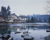
Title (German)
Bern BE, Blick (Westansicht) vom rechten Ufer über die Aare auf das linke Ufer mit dem Quartier Felsenau
Caption
West view from the right bank over the riverbed of the Aare to the left bank with copses, in the background the flood endangered quarter Felsenau with industry (brewery Felsenau Bier), first photo before the construction of the flood protection (01-2009), general view, panorama photo 3-part; coordinates (LV03) of the camera location: 600049/202526; keywords Documenta Natura: river protection, city, quarter
Caption (German)
Westansicht vom rechten Ufer über das Flussbett der Aare auf das linke Ufer mit Gehölz, im Hintergrund das hochwassergefährdete Quartier Felsenau mit Industrie (Brauerei Felsenau Bier), Erstaufnahme vor dem Bau des Hochwasserschutzes (01-2009), Gesamtansicht, Panoramaaufnahme 3-teilig; Koordinaten (LV03) des Kamerastandorts: 600049/202526; Schlagworte Documenta Natura: Flussverbauung, Stadt, Quartier
Record Name
Dia_303-16394

Title (German)
Bern BE, Blick (Westansicht) vom rechten Ufer über die Aare auf das linke Ufer mit dem Quartier Felsenau
Caption
West view from the right bank across the riverbed of the Aare to the left bank with copses, in the background the flood-prone Felsenau quarter with industry (Felsenau Bier brewery), 1st follow-up photograph during the construction of the riverbank wall with construction slope (04-2009), general view; coordinates (LV03) of the camera location: 600049/202526; keywords Documenta Natura: river engineering, city, quarter
Caption (German)
Westansicht vom rechten Ufer über das Flussbett der Aare auf das linke Ufer mit Gehölz, im Hintergrund das hochwassergefährdete Quartier Felsenau mit Industrie (Brauerei Felsenau Bier), 1. Folgeaufnahme während dem Bau der Ufermauer mit Baupiste (04-2009), Gesamtansicht; Koordinaten (LV03) des Kamerastandorts: 600049/202526; Schlagworte Documenta Natura: Flussverbauung, Stadt, Quartier
Record Name
Dia_303-16404

Title (German)
Bern BE, Blick (Westansicht) vom rechten Ufer über die Aare auf das linke Ufer mit dem Quartier Felsenau
Caption
West view from the right bank across the riverbed of the Aare to the left bank with copses, in the background the flood-prone Felsenau quarter with industry (Felsenau Bier brewery), 1st follow-up photograph during the construction of the riverbank wall with construction slope (04-2009), general view; coordinates (LV03) of the camera location: 600049/202526; keywords Documenta Natura: river engineering, city, quarter
Caption (German)
Westansicht vom rechten Ufer über das Flussbett der Aare auf das linke Ufer mit Gehölz, im Hintergrund das hochwassergefährdete Quartier Felsenau mit Industrie (Brauerei Felsenau Bier), 1. Folgeaufnahme während dem Bau der Ufermauer mit Baupiste (04-2009), Gesamtansicht; Koordinaten (LV03) des Kamerastandorts: 600049/202526; Schlagworte Documenta Natura: Flussverbauung, Stadt, Quartier
Record Name
Dia_303-16408

Title (German)
Bern BE, Blick (Westansicht) vom rechten Ufer über die Aare auf das linke Ufer mit dem Quartier Felsenau
Caption
West view from the right bank across the riverbed of the Aare to the left bank with copses, in the background the flood-prone Felsenau quarter with industry (Felsenau Bier brewery), 1st follow-up photograph during the construction of the riverbank wall with construction slope (04-2009), general view; coordinates (LV03) of the camera location: 600049/202526; keywords Documenta Natura: river engineering, city, quarter
Caption (German)
Westansicht vom rechten Ufer über das Flussbett der Aare auf das linke Ufer mit Gehölz, im Hintergrund das hochwassergefährdete Quartier Felsenau mit Industrie (Brauerei Felsenau Bier), 1. Folgeaufnahme während dem Bau der Ufermauer mit Baupiste (04-2009), Gesamtansicht; Koordinaten (LV03) des Kamerastandorts: 600049/202526; Schlagworte Documenta Natura: Flussverbauung, Stadt, Quartier
Record Name
Dia_303-16412

Title (German)
Bern BE, Blick (Westansicht) vom rechten Ufer über die Aare auf das linke Ufer mit dem Quartier Felsenau
Caption
West view from the right bank across the riverbed of the Aare to the left bank, in the background the flood-prone Felsenau quarter with industry (Felsenau beer brewery), 2nd follow-up photo after completion of the riverbank wall with construction slope, additional sturgeon stones in the riverbed (11-2010), general view; coordinates (LV03) of the camera location: 600049/202526; keywords Documenta Natura: river engineering, city, quarter
Caption (German)
Westansicht vom rechten Ufer über das Flussbett der Aare auf das linke Ufer, im Hintergrund das hochwassergefährdete Quartier Felsenau mit Industrie (Brauerei Felsenau Bier), 2. Folgeaufnahme nach der Fertigstellung der Ufermauer mit Baupiste, zusätzliche Störsteine im Flussbett (11-2010), Gesamtansicht; Koordinaten (LV03) des Kamerastandorts: 600049/202526; Schlagworte Documenta Natura: Flussverbauung, Stadt, Quartier
Record Name
Dia_303-16422

Title (German)
Bern BE, Blick (Westansicht) vom rechten Ufer über die Aare auf das linke Ufer mit dem Quartier Felsenau
Caption
West view from the right bank across the riverbed of the Aare to the left bank, in the background the flood-prone Felsenau quarter with industry (Felsenau beer brewery), 2nd follow-up photo after completion of the riverbank wall with construction slope, additional sturgeon stones in the riverbed (11-2010), general view; coordinates (LV03) of the camera location: 600049/202526; keywords Documenta Natura: river engineering, city, quarter
Caption (German)
Westansicht vom rechten Ufer über das Flussbett der Aare auf das linke Ufer, im Hintergrund das hochwassergefährdete Quartier Felsenau mit Industrie (Brauerei Felsenau Bier), 2. Folgeaufnahme nach der Fertigstellung der Ufermauer mit Baupiste, zusätzliche Störsteine im Flussbett (11-2010), Gesamtansicht; Koordinaten (LV03) des Kamerastandorts: 600049/202526; Schlagworte Documenta Natura: Flussverbauung, Stadt, Quartier
Record Name
Dia_303-16426

Title (German)
Bern BE, Blick (Westansicht) vom rechten Ufer über die Aare auf das linke Ufer mit dem Quartier Felsenau
Caption
West view from the right bank across the riverbed of the Aare to the left bank, in the background the flood-prone Felsenau quarter with industry (Felsenau beer brewery), 2nd follow-up photo after completion of the riverbank wall with construction slope, additional sturgeon stones in the riverbed (11-2010), general view; coordinates (LV03) of the camera location: 600049/202526; keywords Documenta Natura: river engineering, city, quarter
Caption (German)
Westansicht vom rechten Ufer über das Flussbett der Aare auf das linke Ufer, im Hintergrund das hochwassergefährdete Quartier Felsenau mit Industrie (Brauerei Felsenau Bier), 2. Folgeaufnahme nach der Fertigstellung der Ufermauer mit Baupiste, zusätzliche Störsteine im Flussbett (11-2010), Gesamtansicht; Koordinaten (LV03) des Kamerastandorts: 600049/202526; Schlagworte Documenta Natura: Flussverbauung, Stadt, Quartier
Record Name
Dia_303-16430
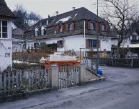
Title (German)
Bern BE, Blick (Südansicht) entlang des Strandweges mit Quartier Felsenau und Aare
Caption
South view along the beach path with residential houses and parked cars, bank with copses, course of the river Aare, in the background the right bank (Bremgarten quarter), first photograph before the construction of the flood protection (01-2009), general view; coordinates (LV03) of the camera location: 600114/202595; keywords Documenta Natura: river protection, city, quarter
Caption (German)
Südansicht entlang des Strandweges mit Wohnhäusern und parkierten Autos, Ufer mit Gehölz, Flusslauf der Aare, im Hintergrund das rechte Ufer (Quartier Bremgarten), Erstaufnahme vor dem Bau des Hochwasserschutzes (01-2009), Gesamtansicht; Koordinaten (LV03) des Kamerastandorts: 600114/202595; Schlagworte Documenta Natura: Flussverbauung, Stadt, Quartier
Record Name
Dia_303-16440

Title (German)
Bern BE, Blick (Südansicht) entlang des Strandweges mit Quartier Felsenau und Aare
Caption
South view along the beach path with residential houses and parked cars, bank with copses, course of the river Aare, in the background the right bank (Bremgarten quarter), first photograph before the construction of the flood protection (01-2009), general view; coordinates (LV03) of the camera location: 600114/202595; keywords Documenta Natura: river protection, city, quarter
Caption (German)
Südansicht entlang des Strandweges mit Wohnhäusern und parkierten Autos, Ufer mit Gehölz, Flusslauf der Aare, im Hintergrund das rechte Ufer (Quartier Bremgarten), Erstaufnahme vor dem Bau des Hochwasserschutzes (01-2009), Gesamtansicht; Koordinaten (LV03) des Kamerastandorts: 600114/202595; Schlagworte Documenta Natura: Flussverbauung, Stadt, Quartier
Record Name
Dia_303-16444

Title (German)
Bern BE, Blick (Südansicht) entlang des Strandweges mit Quartier Felsenau und Aare
Caption
South view along the beach path with residential houses and parked cars, bank with copses, course of the river Aare, in the background the right bank (Bremgarten quarter), first photograph before the construction of the flood protection (01-2009), general view; coordinates (LV03) of the camera location: 600114/202595; keywords Documenta Natura: river protection, city, quarter
Caption (German)
Südansicht entlang des Strandweges mit Wohnhäusern und parkierten Autos, Ufer mit Gehölz, Flusslauf der Aare, im Hintergrund das rechte Ufer (Quartier Bremgarten), Erstaufnahme vor dem Bau des Hochwasserschutzes (01-2009), Gesamtansicht; Koordinaten (LV03) des Kamerastandorts: 600114/202595; Schlagworte Documenta Natura: Flussverbauung, Stadt, Quartier
Record Name
Dia_303-16448

Title (German)
Bern BE, Blick (Südansicht) entlang des Strandweges mit Quartier Felsenau und Aare
Caption
South view along the beach path with residential houses, in the background the right bank (Bremgarten neighborhood), 1st follow-up shot during the construction of the seawall (04-2009), general view; coordinates (LV03) of the camera location: 600115/202595; keywords Documenta Natura: river engineering, city, neighborhood
Caption (German)
Südansicht entlang des Strandweges mit Wohnhäusern, im Hintergrund das rechte Ufer (Quartier Bremgarten), 1. Folgeaufnahme während dem Bau der Ufermauer (04-2009), Gesamtansicht; Koordinaten (LV03) des Kamerastandorts: 600115/202595; Schlagworte Documenta Natura: Flussverbauung, Stadt, Quartier
Record Name
Dia_303-16458

Title (German)
Bern BE, Blick (Südansicht) entlang des Strandweges mit Quartier Felsenau und Aare
Caption
South view along the beach path with residential houses, in the background the right bank (Bremgarten neighborhood), 1st follow-up shot during the construction of the seawall (04-2009), general view; coordinates (LV03) of the camera location: 600115/202595; keywords Documenta Natura: river engineering, city, neighborhood
Caption (German)
Südansicht entlang des Strandweges mit Wohnhäusern, im Hintergrund das rechte Ufer (Quartier Bremgarten), 1. Folgeaufnahme während dem Bau der Ufermauer (04-2009), Gesamtansicht; Koordinaten (LV03) des Kamerastandorts: 600115/202595; Schlagworte Documenta Natura: Flussverbauung, Stadt, Quartier
Record Name
Dia_303-16462
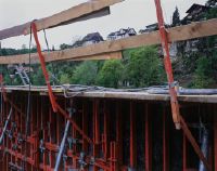
Title (German)
Bern BE, Blick (Südansicht) entlang des Strandweges mit Quartier Felsenau und Aare
Caption
South view along the beach path with residential houses, in the background the right bank (Bremgarten neighborhood), 1st follow-up shot during the construction of the seawall (04-2009), general view; coordinates (LV03) of the camera location: 600115/202595; keywords Documenta Natura: river engineering, city, neighborhood
Caption (German)
Südansicht entlang des Strandweges mit Wohnhäusern, im Hintergrund das rechte Ufer (Quartier Bremgarten), 1. Folgeaufnahme während dem Bau der Ufermauer (04-2009), Gesamtansicht; Koordinaten (LV03) des Kamerastandorts: 600115/202595; Schlagworte Documenta Natura: Flussverbauung, Stadt, Quartier
Record Name
Dia_303-16466

Title (German)
Bern BE, Blick (Südansicht) entlang des Strandweges mit Quartier Felsenau und Aare
Caption
South view along the beach path with residential houses, in the background the right bank (Bremgarten neighborhood), 2nd follow-up photo after the completion of the seawall (11-2009), general view; coordinates (LV03) of the camera location: 600115/202595; keywords Documenta Natura: river engineering, city, quarter
Caption (German)
Südansicht entlang des Strandweges mit Wohnhäusern, im Hintergrund das rechte Ufer (Quartier Bremgarten), 2. Folgeaufnahme nach der Fertigstellung der Ufermauer (11-2009), Gesamtansicht; Koordinaten (LV03) des Kamerastandorts: 600115/202595; Schlagworte Documenta Natura: Flussverbauung, Stadt, Quartier
Record Name
Dia_303-16476

Title (German)
Bern BE, Blick (Südansicht) entlang des Strandweges mit Quartier Felsenau und Aare
Caption
South view along the beach path with residential houses, in the background the right bank (Bremgarten neighborhood), 2nd follow-up photo after the completion of the seawall (11-2009), general view; coordinates (LV03) of the camera location: 600115/202595; keywords Documenta Natura: river engineering, city, quarter
Caption (German)
Südansicht entlang des Strandweges mit Wohnhäusern, im Hintergrund das rechte Ufer (Quartier Bremgarten), 2. Folgeaufnahme nach der Fertigstellung der Ufermauer (11-2009), Gesamtansicht; Koordinaten (LV03) des Kamerastandorts: 600115/202595; Schlagworte Documenta Natura: Flussverbauung, Stadt, Quartier
Record Name
Dia_303-16480

Title (German)
Bern BE, Blick (Südansicht) entlang des Strandweges mit Quartier Felsenau und Aare
Caption
South view along the beach path with residential houses, in the background the right bank (Bremgarten neighborhood), 2nd follow-up photo after the completion of the seawall (11-2009), general view; coordinates (LV03) of the camera location: 600115/202595; keywords Documenta Natura: river engineering, city, quarter
Caption (German)
Südansicht entlang des Strandweges mit Wohnhäusern, im Hintergrund das rechte Ufer (Quartier Bremgarten), 2. Folgeaufnahme nach der Fertigstellung der Ufermauer (11-2009), Gesamtansicht; Koordinaten (LV03) des Kamerastandorts: 600115/202595; Schlagworte Documenta Natura: Flussverbauung, Stadt, Quartier
Record Name
Dia_303-16484

Title (German)
Bern BE, Südansicht der Kreuzung Bernstrasse/Bethlehemstrasse mit der Haltestelle Unterführung
Caption
South view of the intersection Bernstrasse/Bethlehemstrasse with the underpass stop (BERNMOBIL), private traffic (cars, trucks), bus, pedestrians, first shot before the new construction trambernwest (2008), general view; coordinates (LV03) of the camera location: 597110/198990; keywords Documenta Natura: city, construction site, landscape change, rail traffic
Caption (German)
Südansicht der Kreuzung Bernstrasse/Bethlehemstrasse mit der Haltestelle Unterführung (BERNMOBIL), Privatverkehr (Autos, Lastwagen), Bus, Fussgänger, Erstaufnahme vor dem Neubau trambernwest (2008), Gesamtansicht; Koordinaten (LV03) des Kamerastandorts: 597110/198990; Schlagworte Documenta Natura: Stadt, Baustelle, Landschaftswandel, Schienenverkehr
Record Name
Dia_303-16494

Title (German)
Bern BE, Südansicht der Kreuzung Bernstrasse/Bethlehemstrasse mit der Haltestelle Unterführung
Caption
South view of the intersection Bernstrasse/Bethlehemstrasse with the underpass stop (BERNMOBIL), private traffic (cars, trucks), bus, pedestrians, first shot before the new construction trambernwest (2008), general view; coordinates (LV03) of the camera location: 597110/198990; keywords Documenta Natura: city, construction site, landscape change, rail traffic
Caption (German)
Südansicht der Kreuzung Bernstrasse/Bethlehemstrasse mit der Haltestelle Unterführung (BERNMOBIL), Privatverkehr (Autos, Lastwagen), Bus, Fussgänger, Erstaufnahme vor dem Neubau trambernwest (2008), Gesamtansicht; Koordinaten (LV03) des Kamerastandorts: 597110/198990; Schlagworte Documenta Natura: Stadt, Baustelle, Landschaftswandel, Schienenverkehr
Record Name
Dia_303-16498

Title (German)
Bern BE, Südansicht der Kreuzung Bernstrasse/Bethlehemstrasse mit der Haltestelle Unterführung
Caption
South view of the intersection Bernstrasse/Bethlehemstrasse with the underpass stop (BERNMOBIL), private traffic (cars, trucks), bus, pedestrians, first shot before the new construction trambernwest (2008), general view; coordinates (LV03) of the camera location: 597110/198990; keywords Documenta Natura: city, construction site, landscape change, rail traffic
Caption (German)
Südansicht der Kreuzung Bernstrasse/Bethlehemstrasse mit der Haltestelle Unterführung (BERNMOBIL), Privatverkehr (Autos, Lastwagen), Bus, Fussgänger, Erstaufnahme vor dem Neubau trambernwest (2008), Gesamtansicht; Koordinaten (LV03) des Kamerastandorts: 597110/198990; Schlagworte Documenta Natura: Stadt, Baustelle, Landschaftswandel, Schienenverkehr
Record Name
Dia_303-16502

Title (German)
Bern BE, Südansicht der Kreuzung Bernstrasse/Bethlehemstrasse mit der Haltestelle Unterführung
Caption
South view of the intersection Bernstrasse/Bethlehemstrasse with the underpass stop (BERNMOBIL), private traffic (cars, trucks), bus, pedestrians, first shot before the new construction trambernwest (2008), general view; coordinates (LV03) of the camera location: 597110/198990; keywords Documenta Natura: city, construction site, landscape change, rail traffic
Caption (German)
Südansicht der Kreuzung Bernstrasse/Bethlehemstrasse mit der Haltestelle Unterführung (BERNMOBIL), Privatverkehr (Autos, Lastwagen), Bus, Fussgänger, Erstaufnahme vor dem Neubau trambernwest (2008), Gesamtansicht; Koordinaten (LV03) des Kamerastandorts: 597110/198990; Schlagworte Documenta Natura: Stadt, Baustelle, Landschaftswandel, Schienenverkehr
Record Name
Dia_303-16506

Title (German)
Bern BE, Westansicht des Kreisels Bernstrasse beim Bienzgut in Bümpliz
Caption
West view of the traffic traffic circle Bernstrasse near Bienzgut, with cars and pedestrians, first shot before the new construction trambernwest (2008), general view; coordinates (LV03) of the camera location: 596480/198905; keywords Documenta Natura: city, construction site, landscape change, rail traffic
Caption (German)
Westansicht des Verkehrskreisel Bernstrasse beim Bienzgut, mit Autos und Fussgänger, Erstaufnahme vor dem Neubau trambernwest (2008), Gesamtansicht; Koordinaten (LV03) des Kamerastandorts: 596480/198905; Schlagworte Documenta Natura: Stadt, Baustelle, Landschaftswandel, Schienenverkehr
Record Name
Dia_303-16518

Title (German)
Bern BE, Westansicht des Kreisels Bernstrasse beim Bienzgut in Bümpliz
Caption
West view of the traffic traffic circle Bernstrasse near Bienzgut, with cars and pedestrians, first shot before the new construction trambernwest (2008), general view; coordinates (LV03) of the camera location: 596480/198905; keywords Documenta Natura: city, construction site, landscape change, rail traffic
Caption (German)
Westansicht des Verkehrskreisel Bernstrasse beim Bienzgut, mit Autos und Fussgänger, Erstaufnahme vor dem Neubau trambernwest (2008), Gesamtansicht; Koordinaten (LV03) des Kamerastandorts: 596480/198905; Schlagworte Documenta Natura: Stadt, Baustelle, Landschaftswandel, Schienenverkehr
Record Name
Dia_303-16522

Title (German)
Bern BE, Blick (Ostansicht) entlang der Schlossstrasse mit Haltestelle Schlossmatte
Caption
East view (central perspective) of Schlossstrasse with Schlossmatte stop (BERNMOBIL), with cars, trucks, bus, pedestrians, first shot before new construction trambernwest (2008), partial view; coordinates (LV03) of camera location: 598992/199378; keywords Documenta Natura: city, construction site, landscape change, rail traffic
Caption (German)
Ostansicht (Zentralperspektive) der Schlossstrasse mit der Haltestelle Schlossmatte (BERNMOBIL), mit Autos, Lastwagen, Bus, Fussgänger, Erstaufnahme vor dem Neubau trambernwest (2008), Teilansicht; Koordinaten (LV03) des Kamerastandorts: 598992/199378; Schlagworte Documenta Natura: Stadt, Baustelle, Landschaftswandel, Schienenverkehr
Record Name
Dia_303-16530

Title (German)
Bern BE, Südwestansicht des Loryplatzes
Caption
Southwest view of Loryplatz with barriers for construction works (electric, water, gas, district heating), with cars, pedestrians, first shot before the new construction of trambernwest (2008), general view; coordinates (LV03) of camera location: 598623/199267; keywords Documenta Natura: city, construction site, landscape change, rail traffic
Caption (German)
Südwestansicht des Loryplatzes mit Abschrankungen für Bauarbeiten (Elektro, Wasser, Gas, Fernwärme), mit Autos, Fussgänger, Erstaufnahme vor dem Neubau von trambernwest (2008), Gesamtansicht; Koordinaten (LV03) des Kamerastandorts: 598623/199267; Schlagworte Documenta Natura: Stadt, Baustelle, Landschaftswandel, Schienenverkehr
Record Name
Dia_303-16536

Title (German)
Bern BE, Südwestansicht des Loryplatzes
Caption
Southwest view of Loryplatz with barriers for construction works (electric, water, gas, district heating), with cars, pedestrians, first shot before the new construction of trambernwest (2008), general view; coordinates (LV03) of camera location: 598623/199267; keywords Documenta Natura: city, construction site, landscape change, rail traffic
Caption (German)
Südwestansicht des Loryplatzes mit Abschrankungen für Bauarbeiten (Elektro, Wasser, Gas, Fernwärme), mit Autos, Fussgänger, Erstaufnahme vor dem Neubau von trambernwest (2008), Gesamtansicht; Koordinaten (LV03) des Kamerastandorts: 598623/199267; Schlagworte Documenta Natura: Stadt, Baustelle, Landschaftswandel, Schienenverkehr
Record Name
Dia_303-16540

Title (German)
Bern BE, Südwestansicht des Europaplatzes
Caption
Southwest view of Europaplatz with parking lot, highway bridge A12, with cars, pedestrians, first shot before the new construction of trambernwest (2008), general view; coordinates (LV03) of camera location: 597520/199097; keywords Documenta Natura: city, construction site, landscape change, rail traffic
Caption (German)
Südwestansicht des Europaplatzes mit Parkplatz, Autobahnbrücke A12, mit Autos, Fussgänger, Erstaufnahme vor dem Neubau von trambernwest (2008), Gesamtansicht; Koordinaten (LV03) des Kamerastandorts: 597520/199097; Schlagworte Documenta Natura: Stadt, Baustelle, Landschaftswandel, Schienenverkehr
Record Name
Dia_303-16548

Title (German)
Bern BE, Südwestansicht des Europaplatzes
Caption
Southwest view of Europaplatz with parking lot, highway bridge A12, with cars, pedestrians, first shot before the new construction of trambernwest (2008), general view; coordinates (LV03) of camera location: 597520/199097; keywords Documenta Natura: city, construction site, landscape change, rail traffic
Caption (German)
Südwestansicht des Europaplatzes mit Parkplatz, Autobahnbrücke A12, mit Autos, Fussgänger, Erstaufnahme vor dem Neubau von trambernwest (2008), Gesamtansicht; Koordinaten (LV03) des Kamerastandorts: 597520/199097; Schlagworte Documenta Natura: Stadt, Baustelle, Landschaftswandel, Schienenverkehr
Record Name
Dia_303-16552

Title (German)
Bern BE, Südwestansicht des Europaplatzes
Caption
Southwest view of Europaplatz with parking lot, highway bridge A12, with cars, pedestrians, first shot before the new construction of trambernwest (2008), general view; coordinates (LV03) of camera location: 597520/199097; keywords Documenta Natura: city, construction site, landscape change, rail traffic
Caption (German)
Südwestansicht des Europaplatzes mit Parkplatz, Autobahnbrücke A12, mit Autos, Fussgänger, Erstaufnahme vor dem Neubau von trambernwest (2008), Gesamtansicht; Koordinaten (LV03) des Kamerastandorts: 597520/199097; Schlagworte Documenta Natura: Stadt, Baustelle, Landschaftswandel, Schienenverkehr
Record Name
Dia_303-16556

Title (German)
Bern BE, Westansicht des Bethlehemsparks mit der Waldmannstrasse
Caption
West view of Bethlehempark with footpath, Waldmannstrasse and Tscharnergut housing estate, with bus and pedestrians, first shot before the new trambernwest building (2008), general view; coordinates (LV03) of camera location: 596094/199777; keywords Documenta Natura: city, construction site, landscape change, rail traffic
Caption (German)
Westansicht des Bethlehemparks mit Fussweg, Waldmannstrasse und Wohnsiedlung Tscharnergut, mit Bus und Fussgänger, Erstaufnahme vor dem Neubau trambernwest (2008), Gesamtansicht; Koordinaten (LV03) des Kamerastandorts: 596094/199777; Schlagworte Documenta Natura: Stadt, Baustelle, Landschaftswandel, Schienenverkehr
Record Name
Dia_303-16566

Title (German)
Bern BE, Westansicht des Bethlehemsparks mit der Waldmannstrasse
Caption
West view of Bethlehempark with footpath, Waldmannstrasse and Tscharnergut housing estate, with bus and pedestrians, first shot before the new trambernwest building (2008), general view; coordinates (LV03) of camera location: 596094/199777; keywords Documenta Natura: city, construction site, landscape change, rail traffic
Caption (German)
Westansicht des Bethlehemparks mit Fussweg, Waldmannstrasse und Wohnsiedlung Tscharnergut, mit Bus und Fussgänger, Erstaufnahme vor dem Neubau trambernwest (2008), Gesamtansicht; Koordinaten (LV03) des Kamerastandorts: 596094/199777; Schlagworte Documenta Natura: Stadt, Baustelle, Landschaftswandel, Schienenverkehr
Record Name
Dia_303-16570

Title (German)
Bern BE, Blick (Ostansicht) entlang der Murtenstrasse mit Haltestelle Bethlehem Kirche
Caption
East view (central perspective) of Murtenstrasse with Bethlehem Church stop (BERNMOBIL), Bethlehem Church in the background, with cars, bus and pedestrians, first shot before the new trambernwest building (2008), general view; coordinates (LV03) of camera location: 596632/199793; keywords Documenta Natura: city, construction site, landscape change, rail traffic
Caption (German)
Ostansicht (Zentralperspektive) der Murtenstrasse mit der Haltestelle Bethlehem Kirche (BERNMOBIL), im Hintergrund die Kirche Bethlehem, mit Autos, Bus und Fussgänger, Erstaufnahme vor dem Neubau trambernwest (2008), Gesamtansicht; Koordinaten (LV03) des Kamerastandorts: 596632/199793; Schlagworte Documenta Natura: Stadt, Baustelle, Landschaftswandel, Schienenverkehr
Record Name
Dia_303-16578

Title (German)
Bern BE, Blick (Ostansicht) entlang der Murtenstrasse mit Haltestelle Bethlehem Kirche
Caption
East view (central perspective) of Murtenstrasse with Bethlehem Church stop (BERNMOBIL), Bethlehem Church in the background, with cars, bus and pedestrians, first shot before the new trambernwest building (2008), general view; coordinates (LV03) of camera location: 596632/199793; keywords Documenta Natura: city, construction site, landscape change, rail traffic
Caption (German)
Ostansicht (Zentralperspektive) der Murtenstrasse mit der Haltestelle Bethlehem Kirche (BERNMOBIL), im Hintergrund die Kirche Bethlehem, mit Autos, Bus und Fussgänger, Erstaufnahme vor dem Neubau trambernwest (2008), Gesamtansicht; Koordinaten (LV03) des Kamerastandorts: 596632/199793; Schlagworte Documenta Natura: Stadt, Baustelle, Landschaftswandel, Schienenverkehr
Record Name
Dia_303-16582
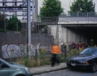
Title (German)
Bern BE, Blick (Westansicht) vom Untermattweg an die Bethlehembrücke
Caption
West view from Untermattweg to Bethlehem Bridge, with cars, bus and pedestrians, BLS railroad line in the left background, first shot before the new construction trambernwest (2008), general view; coordinates (LV03) of the camera location: 596829/199498; keywords Documenta Natura: city, construction site, landscape change, railroad traffic
Caption (German)
Westansicht vom Untermattweg an die Bethlehembrücke, mit Autos, Bus und Fussgänger, links im Hintergrund die Bahnlinie der BLS, Erstaufnahme vor dem Neubau trambernwest (2008), Gesamtansicht; Koordinaten (LV03) des Kamerastandorts: 596829/199498; Schlagworte Documenta Natura: Stadt, Baustelle, Landschaftswandel, Schienenverkehr
Record Name
Dia_303-16590

Title (German)
Bern BE, Blick (Westansicht) vom Untermattweg an die Bethlehembrücke
Caption
West view from Untermattweg to Bethlehem Bridge, with cars, bus and pedestrians, BLS railroad line in the left background, first shot before the new construction trambernwest (2008), general view; coordinates (LV03) of the camera location: 596829/199498; keywords Documenta Natura: city, construction site, landscape change, railroad traffic
Caption (German)
Westansicht vom Untermattweg an die Bethlehembrücke, mit Autos, Bus und Fussgänger, links im Hintergrund die Bahnlinie der BLS, Erstaufnahme vor dem Neubau trambernwest (2008), Gesamtansicht; Koordinaten (LV03) des Kamerastandorts: 596829/199498; Schlagworte Documenta Natura: Stadt, Baustelle, Landschaftswandel, Schienenverkehr
Record Name
Dia_303-16594

Title (German)
Bern BE, Blick (Südansicht) entlang der Bottigenstrasse mit Haltestelle Bachmätteli
Caption
South view along Bottigenstrasse with the Bachmätteli stop (BERNMOBIL), with cars, bus and pedestrians, first shot before the new construction trambernwest (2008), general view; coordinates (LV03) of the camera location: 596284/198707; keywords Documenta Natura: city, construction site, landscape change, rail traffic
Caption (German)
Südansicht entlang der Bottigenstrasse mit der Haltestelle Bachmätteli (BERNMOBIL), mit Autos, Bus und Fussgänger, Erstaufnahme vor dem Neubau trambernwest (2008), Gesamtansicht; Koordinaten (LV03) des Kamerastandorts: 596284/198707; Schlagworte Documenta Natura: Stadt, Baustelle, Landschaftswandel, Schienenverkehr
Record Name
Dia_303-16602

Title (German)
Bern BE, Blick (Südansicht) entlang der Bottigenstrasse mit Haltestelle Bachmätteli
Caption
South view along Bottigenstrasse with the Bachmätteli stop (BERNMOBIL), with cars, bus and pedestrians, first shot before the new construction trambernwest (2008), general view; coordinates (LV03) of the camera location: 596284/198707; keywords Documenta Natura: city, construction site, landscape change, rail traffic
Caption (German)
Südansicht entlang der Bottigenstrasse mit der Haltestelle Bachmätteli (BERNMOBIL), mit Autos, Bus und Fussgänger, Erstaufnahme vor dem Neubau trambernwest (2008), Gesamtansicht; Koordinaten (LV03) des Kamerastandorts: 596284/198707; Schlagworte Documenta Natura: Stadt, Baustelle, Landschaftswandel, Schienenverkehr
Record Name
Dia_303-16606

Title (German)
Bern BE, Blick (Südansicht) entlang der Bottigenstrasse mit Haltestelle Bachmätteli
Caption
South view along Bottigenstrasse with the Bachmätteli stop (BERNMOBIL), with cars, bus and pedestrians, first shot before the new construction trambernwest (2008), general view; coordinates (LV03) of the camera location: 596284/198707; keywords Documenta Natura: city, construction site, landscape change, rail traffic
Caption (German)
Südansicht entlang der Bottigenstrasse mit der Haltestelle Bachmätteli (BERNMOBIL), mit Autos, Bus und Fussgänger, Erstaufnahme vor dem Neubau trambernwest (2008), Gesamtansicht; Koordinaten (LV03) des Kamerastandorts: 596284/198707; Schlagworte Documenta Natura: Stadt, Baustelle, Landschaftswandel, Schienenverkehr
Record Name
Dia_303-16610

Title (German)
Bern BE, Blick (Nordansicht) entlang der Bottigenstrasse mit der Wendeschleife, Haltestelle Bümpliz
Caption
North view along Bottigenstrasse with the turning loop, Bümpliz stop (BERNMOBIL) and construction site (containers, barriers, construction material) with cars, bus, pedestrians, cyclists, first shot before the new construction trambernwest (2009), general view; coordinates (LV03) of the camera location: 595553/198512; keywords Documenta Natura: city, construction site, landscape change, rail traffic
Caption (German)
Nordansicht entlang der Bottigenstrasse mit der Wendeschleife, Haltestelle Bümpliz (BERNMOBIL) und Bauplatz (Container, Abschrankungen, Baumaterial) mit Autos, Bus, Fussgänger, Radfahrer, Erstaufnahme vor dem Neubau trambernwest (2009), Gesamtansicht; Koordinaten (LV03) des Kamerastandorts: 595553/198512; Schlagworte Documenta Natura: Stadt, Baustelle, Landschaftswandel, Schienenverkehr
Record Name
Dia_303-16620

Title (German)
Bern BE, Blick (Nordansicht) entlang der Bottigenstrasse mit der Wendeschleife, Haltestelle Bümpliz
Caption
North view along Bottigenstrasse with the turning loop, Bümpliz stop (BERNMOBIL) and construction site (containers, barriers, construction material) with cars, bus, pedestrians, cyclists, first shot before the new construction trambernwest (2009), general view; coordinates (LV03) of the camera location: 595553/198512; keywords Documenta Natura: city, construction site, landscape change, rail traffic
Caption (German)
Nordansicht entlang der Bottigenstrasse mit der Wendeschleife, Haltestelle Bümpliz (BERNMOBIL) und Bauplatz (Container, Abschrankungen, Baumaterial) mit Autos, Bus, Fussgänger, Radfahrer, Erstaufnahme vor dem Neubau trambernwest (2009), Gesamtansicht; Koordinaten (LV03) des Kamerastandorts: 595553/198512; Schlagworte Documenta Natura: Stadt, Baustelle, Landschaftswandel, Schienenverkehr
Record Name
Dia_303-16624

Title (German)
Bern BE, Blick (Nordansicht) entlang der Bottigenstrasse mit der Wendeschleife, Haltestelle Bümpliz
Caption
North view along Bottigenstrasse with the turning loop, Bümpliz stop (BERNMOBIL) and construction site (containers, barriers, construction material) with cars, bus, pedestrians, cyclists, first shot before the new construction trambernwest (2009), general view; coordinates (LV03) of the camera location: 595553/198512; keywords Documenta Natura: city, construction site, landscape change, rail traffic
Caption (German)
Nordansicht entlang der Bottigenstrasse mit der Wendeschleife, Haltestelle Bümpliz (BERNMOBIL) und Bauplatz (Container, Abschrankungen, Baumaterial) mit Autos, Bus, Fussgänger, Radfahrer, Erstaufnahme vor dem Neubau trambernwest (2009), Gesamtansicht; Koordinaten (LV03) des Kamerastandorts: 595553/198512; Schlagworte Documenta Natura: Stadt, Baustelle, Landschaftswandel, Schienenverkehr
Record Name
Dia_303-16628

Title (German)
Bern BE, Blick (Nordansicht) entlang der Bottigenstrasse mit der Wendeschleife, Haltestelle Bümpliz
Caption
North view along Bottigenstrasse with the turning loop, Bümpliz stop (BERNMOBIL) and construction site (containers, barriers, construction material) with cars, bus, pedestrians, cyclists, first shot before the new construction trambernwest (2009), general view; coordinates (LV03) of the camera location: 595553/198512; keywords Documenta Natura: city, construction site, landscape change, rail traffic
Caption (German)
Nordansicht entlang der Bottigenstrasse mit der Wendeschleife, Haltestelle Bümpliz (BERNMOBIL) und Bauplatz (Container, Abschrankungen, Baumaterial) mit Autos, Bus, Fussgänger, Radfahrer, Erstaufnahme vor dem Neubau trambernwest (2009), Gesamtansicht; Koordinaten (LV03) des Kamerastandorts: 595553/198512; Schlagworte Documenta Natura: Stadt, Baustelle, Landschaftswandel, Schienenverkehr
Record Name
Dia_303-16632

Bern BE, view (northeast view) from the roof balcony of the road traffic office to the Wankdorfplatz
Title (German)
Bern BE, Blick (Nordostansicht) vom Dachbalkon des Strassenverkehrsamtes auf den Wankdorfplatz
Caption
Northeast view from the road traffic office (Schermenweg 5) onto the traffic junction Wankdorfplatz with trees (plane tree avenue), cars and pedestrians, in the background the Stade de Suisse and sports hall Wankdorf, first shot before the start of construction (2008), general view; coordinates (LV03) of the camera location: 602328/201555; keywords Documenta Natura: square, city, landscape change
Caption (German)
Nordostansicht vom Strassenverkehrsamt (Schermenweg 5) auf den Verkehrsknoten Wankdorfplatz mit Bäumen (Platanen-Allee), Autos und Fussgängern, im Hintergrund das Stade de Suisse und Sporthalle Wankdorf, Erstaufnahme vor dem Baubeginn (2008), Gesamtansicht; Koordinaten (LV03) des Kamerastandorts: 602328/201555; Schlagworte Documenta Natura: Platz, Stadt, Landschaftswandel
Record Name
Dia_303-16644

Title (German)
Bern BE, Blick (Nordostansicht) vom Dachbalkon des Strassenverkhrsamtes auf den Wankdorfplatz
Caption
Northeast view from the road traffic office (Schermenweg 5) onto the traffic junction Wankdorfplatz with trees (plane tree avenue), cars and pedestrians, in the background the Stade de Suisse and sports hall Wankdorf, first shot before the start of construction (2008), general view; coordinates (LV03) of the camera location: 602328/201555; keywords Documenta Natura: square, city, landscape change
Caption (German)
Nordostansicht vom Strassenverkehrsamt (Schermenweg 5) auf den Verkehrsknoten Wankdorfplatz mit Bäumen (Platanen-Allee), Autos und Fussgängern, im Hintergrund das Stade de Suisse und Sporthalle Wankdorf, Erstaufnahme vor dem Baubeginn (2008), Gesamtansicht; Koordinaten (LV03) des Kamerastandorts: 602328/201555; Schlagworte Documenta Natura: Platz, Stadt, Landschaftswandel
Record Name
Dia_303-16648

Title (German)
Bern BE, Blick (Nordostansicht) vom Dachbalkon des Strassenverkhrsamtes auf den Wankdorfplatz
Caption
Northeast view from the road traffic office (Schermenweg 5) onto the traffic junction Wankdorfplatz with trees (plane tree avenue), cars, in the background the Stade de Suisse and sports hall Wankdorf, 1st follow-up shot during construction (2009), general view; coordinates (LV03) of the camera location: 602328/201555; keywords Documenta Natura: square, city, landscape change
Caption (German)
Nordostansicht vom Strassenverkehrsamt (Schermenweg 5) auf den Verkehrsknoten Wankdorfplatz mit Bäumen (Platanen-Allee), Autos, im Hintergrund das Stade de Suisse und Sporthalle Wankdorf, 1. Folgeaufnahme während dem Bau (2009), Gesamtansicht; Koordinaten (LV03) des Kamerastandorts: 602328/201555; Schlagworte Documenta Natura: Platz, Stadt, Landschaftswandel
Record Name
Dia_303-16656

Title (German)
Bern BE, Blick (Nordostansicht) vom Dachbalkon des Strassenverkhrsamtes auf den Wankdorfplatz
Caption
Northeast view from the road traffic office (Schermenweg 5) onto the traffic junction Wankdorfplatz with trees (plane tree avenue), cars, in the background the Stade de Suisse and sports hall Wankdorf, 1st follow-up shot during construction (2009), general view; coordinates (LV03) of the camera location: 602328/201555; keywords Documenta Natura: square, city, landscape change
Caption (German)
Nordostansicht vom Strassenverkehrsamt (Schermenweg 5) auf den Verkehrsknoten Wankdorfplatz mit Bäumen (Platanen-Allee), Autos, im Hintergrund das Stade de Suisse und Sporthalle Wankdorf, 1. Folgeaufnahme während dem Bau (2009), Gesamtansicht; Koordinaten (LV03) des Kamerastandorts: 602328/201555; Schlagworte Documenta Natura: Platz, Stadt, Landschaftswandel
Record Name
Dia_303-16660

Title (German)
Bern BE, Nordostansicht des Wankdorfplatzes
Caption
Northeast view of Wankdorfplatz (street corner Papiermühlestrasse/ Schermenweg), with traffic signs and traffic lights, trees (plane tree avenue), cars and pedestrians, taken before construction started, general view; coordinates (LV03) of camera location: 602281/201546; keywords Documenta Natura: square, city, landscape change
Caption (German)
Nordostansicht des Wankdorfplatzes (Strassenecke Papiermühlestrasse/ Schermenweg), mit Verkersschildern und Ampeln, Bäumen (Platanen-Allee), Autos und Fussgängern, Aufnahme vor dem Baubeginn, Gesamtansicht; Koordinaten (LV03) des Kamerastandorts: 602281/201546; Schlagworte Documenta Natura: Platz, Stadt, Landschaftswandel
Record Name
Dia_303-16668

Title (German)
Bern BE, Nordostansicht des Wankdorfplatzes
Caption
Northeast view of Wankdorfplatz (street corner Papiermühlestrasse/ Schermenweg), with traffic signs and traffic lights, trees (plane tree avenue), cars and pedestrians, taken before construction started, general view; coordinates (LV03) of camera location: 602281/201546; keywords Documenta Natura: square, city, landscape change
Caption (German)
Nordostansicht des Wankdorfplatzes (Strassenecke Papiermühlestrasse/ Schermenweg), mit Verkersschildern und Ampeln, Bäumen (Platanen-Allee), Autos und Fussgängern, Aufnahme vor dem Baubeginn, Gesamtansicht; Koordinaten (LV03) des Kamerastandorts: 602281/201546; Schlagworte Documenta Natura: Platz, Stadt, Landschaftswandel
Record Name
Dia_303-16672

Title (German)
Bern BE, Nordostansicht des Wankdorfplatzes
Caption
Northeast view of Wankdorfplatz (street corner Papiermühlestrasse/ Schermenweg), with traffic signs and traffic lights, trees (plane tree avenue), cars and pedestrians, taken before construction started, general view; coordinates (LV03) of camera location: 602281/201546; keywords Documenta Natura: square, city, landscape change
Caption (German)
Nordostansicht des Wankdorfplatzes (Strassenecke Papiermühlestrasse/ Schermenweg), mit Verkersschildern und Ampeln, Bäumen (Platanen-Allee), Autos und Fussgängern, Aufnahme vor dem Baubeginn, Gesamtansicht; Koordinaten (LV03) des Kamerastandorts: 602281/201546; Schlagworte Documenta Natura: Platz, Stadt, Landschaftswandel
Record Name
Dia_303-16676

Title (German)
Bern BE, Südwestansicht des Wankdorfplatzes
Caption
Southwest view of Wankdorfplatz (street corner Papiermühlestrasse/ Schermenweg), with traffic signs and traffic lights, trees (plane tree avenue), cars and pedestrians, in the background the road traffic office (Schermenweg 5), photograph taken before the start of construction, general view; coordinates (LV03) of camera location: 602202/201507; keywords Documenta Natura: square, city, landscape change
Caption (German)
Südwestansicht des Wankdorfplatzes (Strassenecke Papiermühlestrasse/ Schermenweg), mit Verkersschildern und Ampeln, Bäumen (Platanen-Allee), Autos und Fussgängern, im Hintergrund das Strassenverkehrsamt (Schermenweg 5), Aufnahme vor Baubeginn, Gesamtansicht; Koordinaten (LV03) des Kamerastandorts: 602202/201507; Schlagworte Documenta Natura: Platz, Stadt, Landschaftswandel
Record Name
Dia_303-16686

Title (German)
Bern BE, Südwestansicht des Wankdorfplatzes
Caption
Southwest view of Wankdorfplatz (street corner Papiermühlestrasse/ Schermenweg), with traffic signs and traffic lights, trees (plane tree avenue), cars and pedestrians, in the background the road traffic office (Schermenweg 5), photograph taken before the start of construction, general view; coordinates (LV03) of camera location: 602202/201507; keywords Documenta Natura: square, city, landscape change
Caption (German)
Südwestansicht des Wankdorfplatzes (Strassenecke Papiermühlestrasse/ Schermenweg), mit Verkersschildern und Ampeln, Bäumen (Platanen-Allee), Autos und Fussgängern, im Hintergrund das Strassenverkehrsamt (Schermenweg 5), Aufnahme vor Baubeginn, Gesamtansicht; Koordinaten (LV03) des Kamerastandorts: 602202/201507; Schlagworte Documenta Natura: Platz, Stadt, Landschaftswandel
Record Name
Dia_303-16690

Title (German)
Bern BE, Südwestansicht des Wankdorfplatzes
Caption
Southwest view of Wankdorfplatz (street corner Papiermühlestrasse/ Schermenweg), with traffic signs and traffic lights, trees (plane tree avenue), cars and pedestrians, in the background the road traffic office (Schermenweg 5), photograph taken before the start of construction, general view; coordinates (LV03) of the camera location: 602202/201507; keywords Documenta Natura: square, city, landscape change
Caption (German)
Südwestansicht des Wankdorfplatzes (Strassenecke Papiermühlestrasse/ Schermenweg), mit Verkersschildern und Ampeln, Bäumen (Platanen-Allee), Autos und Fussgängern, im Hintergrund das Strassenverkehrsamt (Schermenweg 5), Aufnahme vor Baubeginn, Gesamtansicht; Koordinaten (LV03) des Kamerastandorts: 602202/201507; Schlagworte Documenta Natura: Platz, Stadt, Landschaftswandel
Record Name
Dia_303-16694

Title (German)
Heimberg BE, Uttigen BE, Blick (Nordostansicht) vom Flurweg auf die Autobahn A6 und die Aare südlich von Thungschneit
Caption
Northeast view from the Flurweg (near Heimberg) onto the A6 freeway and the parallel Aare river with riparian woodland, riparian path with pedestrians, cyclists, photograph taken before the planned correction of the Aare river, general view; coordinates (LV03) of the camera location: 611454/182692; keywords Documenta Natura: river, river restoration, floods
Caption (German)
Nordostansicht vom Flurweg (bei Heimberg) auf die Autobahn A6 und die parallel verlaufende Aare mit Ufergehölz, Uferweg mit Fussgänger, Radfahrer, Aufnahme vor der geplanten Korrektion der Aare, Gesamtansicht; Koordinaten (LV03) des Kamerastandorts: 611454/182692; Schlagworte Documenta Natura: Fluss, Flussrenaturierung, Hochwasser
Record Name
Dia_303-16704

Title (German)
Heimberg BE, Uttigen BE, Blick (Nordostansicht) vom Flurweg auf die Autobahn A6 und die Aare südlich von Thungschneit
Caption
Northeast view from the Flurweg (near Heimberg) onto the A6 freeway and the parallel Aare river with riparian woodland, riparian path with pedestrians, cyclists, photograph taken before the planned correction of the Aare river, general view; coordinates (LV03) of the camera location: 611454/182692; keywords Documenta Natura: river, river restoration, floods
Caption (German)
Nordostansicht vom Flurweg (bei Heimberg) auf die Autobahn A6 und die parallel verlaufende Aare mit Ufergehölz, Uferweg mit Fussgänger, Radfahrer, Aufnahme vor der geplanten Korrektion der Aare, Gesamtansicht; Koordinaten (LV03) des Kamerastandorts: 611454/182692; Schlagworte Documenta Natura: Fluss, Flussrenaturierung, Hochwasser
Record Name
Dia_303-16708

Title (German)
Heimberg BE, Uttigen BE, Blick (Nordostansicht) vom Flurweg auf die Autobahn A6 und die Aare südlich von Thungschneit
Caption
Northeast view from the Flurweg (near Heimberg) onto the A6 freeway and the parallel Aare river with riparian woodland, riparian path with pedestrians, cyclists, photograph taken before the planned correction of the Aare river, general view; coordinates (LV03) of the camera location: 611454/182692; keywords Documenta Natura: river, river restoration, floods
Caption (German)
Nordostansicht vom Flurweg (bei Heimberg) auf die Autobahn A6 und die parallel verlaufende Aare mit Ufergehölz, Uferweg mit Fussgänger, Radfahrer, Aufnahme vor der geplanten Korrektion der Aare, Gesamtansicht; Koordinaten (LV03) des Kamerastandorts: 611454/182692; Schlagworte Documenta Natura: Fluss, Flussrenaturierung, Hochwasser
Record Name
Dia_303-16712

Title (German)
Heimberg BE, Uttigen BE, Blick (Nordostansicht) vom Flurweg auf die Autobahn A6 und die Aare südlich von Thungschneit
Caption
Northeast view from the Flurweg (near Heimberg) onto the A6 freeway and the parallel Aare river with riparian woodland, riparian path with pedestrians, cyclists, photograph taken before the planned correction of the Aare river, general view; coordinates (LV03) of the camera location: 611454/182692; keywords Documenta Natura: river, river restoration, floods
Caption (German)
Nordostansicht vom Flurweg (bei Heimberg) auf die Autobahn A6 und die parallel verlaufende Aare mit Ufergehölz, Uferweg mit Fussgänger, Radfahrer, Aufnahme vor der geplanten Korrektion der Aare, Gesamtansicht; Koordinaten (LV03) des Kamerastandorts: 611454/182692; Schlagworte Documenta Natura: Fluss, Flussrenaturierung, Hochwasser
Record Name
Dia_303-16716

Title (German)
Andermatt UR, Blick (Nordostansicht) von Altchilch auf den Talboden mit Kaserne, Strasse und Waffenplatz (Eiboden)
Caption
Northeast view from Altchilch onto the valley floor with barracks, road, and armory (Eiboden), taken before the construction of the Swiss Alps tourist resort, general view; coordinates (LV03) of the camera location: 688448/166177; keywords Documenta Natura: vacation home settlement, mountain area, landscape change, golf
Caption (German)
Nordostansicht von Altchilch auf den Talboden mit Kaserne, Strasse und Waffenplatz (Eiboden), Aufnahme vor dem Bau des Tourismus-Resorts Swiss Alps, Gesamtansicht; Koordinaten (LV03) des Kamerastandorts: 688448/166177; Schlagworte Documenta Natura: Ferienhaussiedlung, Berggebiet, Landschaftswandel, Golf
Record Name
Dia_303-16728

Title (German)
Andermatt UR, Blick (Nordostansicht) von Altchilch auf den Talboden mit Kaserne, Strasse und Waffenplatz (Eiboden)
Caption
Northeast view from Altchilch onto the valley floor with barracks, road, and armory (Eiboden), taken before the construction of the Swiss Alps tourist resort, general view; coordinates (LV03) of the camera location: 688448/166177; keywords Documenta Natura: vacation home settlement, mountain area, landscape change, golf
Caption (German)
Nordostansicht von Altchilch auf den Talboden mit Kaserne, Strasse und Waffenplatz (Eiboden), Aufnahme vor dem Bau des Tourismus-Resorts Swiss Alps, Gesamtansicht; Koordinaten (LV03) des Kamerastandorts: 688448/166177; Schlagworte Documenta Natura: Ferienhaussiedlung, Berggebiet, Landschaftswandel, Golf
Record Name
Dia_303-16732

Title (German)
Andermatt UR, Blick (Ostansicht) vom Dorfteil Wiler auf den Talboden mit Andermatt, Bahnhof und Kaserne
Caption
East view from the village of Wiler to the valley floor with the village of Andermatt, railroad station and barracks area, taken before the construction of the Swiss Alps tourist resort, general view; coordinates (LV03) of the camera location: 688847/165701; keywords Documenta Natura: vacation home settlement, mountain area, landscape change, golf
Caption (German)
Ostansicht vom Dorfteil Wiler auf den Talboden mit dem Dorf Andermatt, Bahnhof und Kasernenareal, Aufnahme vor dem Bau des Tourismus-Resorts Swiss Alps, Gesamtansicht; Koordinaten (LV03) des Kamerastandorts: 688847/165701; Schlagworte Documenta Natura: Ferienhaussiedlung, Berggebiet, Landschaftswandel, Golf
Record Name
Dia_303-16740

Title (German)
Andermatt UR, Blick (Ostansicht) vom Dorfteil Wiler auf den Talboden mit Andermatt, Bahnhof und Kaserne
Caption
East view from the village of Wiler to the valley floor with the village of Andermatt, railroad station and barracks area, taken before the construction of the Swiss Alps tourist resort, general view; coordinates (LV03) of the camera location: 688847/165701; keywords Documenta Natura: vacation home settlement, mountain area, landscape change, golf
Caption (German)
Ostansicht vom Dorfteil Wiler auf den Talboden mit dem Dorf Andermatt, Bahnhof und Kasernenareal, Aufnahme vor dem Bau des Tourismus-Resorts Swiss Alps, Gesamtansicht; Koordinaten (LV03) des Kamerastandorts: 688847/165701; Schlagworte Documenta Natura: Ferienhaussiedlung, Berggebiet, Landschaftswandel, Golf
Record Name
Dia_303-16744

Title (German)
Andermatt UR, Südostansicht des Waffenplatzes Eiboden mit Hangar, Strasse und Parkplatz
Caption
Southeast view of the Eiboden armory with hangar, road and parking lot, taken before the construction of the Swiss Alps tourist resort, general view; coordinates (LV03) of the camera location: 688287/165971; keywords Documenta Natura: vacation home development, mountain area, landscape change, golf
Caption (German)
Südostansicht des Waffenplatzes Eiboden mit Hangar, Strasse und Parkplatz, Aufnahme vor dem Bau des Tourismus-Resorts Swiss Alps, Gesamtansicht; Koordinaten (LV03) des Kamerastandorts: 688287/165971; Schlagworte Documenta Natura: Ferienhaussiedlung, Berggebiet, Landschaftswandel, Golf
Record Name
Dia_303-16752

Title (German)
Andermatt UR, Südostansicht des Waffenplatzes Eiboden mit Hangar, Strasse und Parkplatz
Caption
Southeast view of the Eiboden weapons range with hangar, road and parking lot, taken before the construction of the Swiss Alps tourist resort, general view; coordinates (LV03) of the camera location: 688287/165971; keywords Documenta Natura: vacation home development, mountain area, landscape change, golf
Caption (German)
Südostansicht des Waffenplatzes Eiboden mit Hangar, Strasse und Parkplatz, Aufnahme vor dem Bau des Tourismus-Resorts Swiss Alps, Gesamtansicht; Koordinaten (LV03) des Kamerastandorts: 688287/165971; Schlagworte Documenta Natura: Ferienhaussiedlung, Berggebiet, Landschaftswandel, Golf
Record Name
Dia_303-16756

Title (German)
Andermatt UR, Südostansicht des Waffenplatzes Eiboden mit Hangar, Strasse und Parkplatz
Caption
Southeast view of the Eiboden weapons range with hangar, road and parking lot, taken before the construction of the Swiss Alps tourist resort, general view; coordinates (LV03) of the camera location: 688287/165971; keywords Documenta Natura: vacation home development, mountain area, landscape change, golf
Caption (German)
Südostansicht des Waffenplatzes Eiboden mit Hangar, Strasse und Parkplatz, Aufnahme vor dem Bau des Tourismus-Resorts Swiss Alps, Gesamtansicht; Koordinaten (LV03) des Kamerastandorts: 688287/165971; Schlagworte Documenta Natura: Ferienhaussiedlung, Berggebiet, Landschaftswandel, Golf
Record Name
Dia_303-16760

Title (German)
Andermatt UR, Südansicht des Waffenplatzes Eiboden mit Kampfbahn und Gebäuden
Caption
South view of the Eiboden armory with military training facility (fighting track and buildings), in the background the barracks, photo taken before the construction of the Swiss Alps tourist resort, general view; coordinates (LV03) of the camera location: 688085/165774; keywords Documenta Natura: vacation home development, mountain area, landscape change, golf
Caption (German)
Südansicht des Waffenplatzes Eiboden mit militärischer Ausbildunganlage (Kampfbahn und Gebäuden), im Hintergrund die Kaserne, Aufnahme vor dem Bau des Tourismus-Resorts Swiss Alps, Gesamtansicht; Koordinaten (LV03) des Kamerastandorts: 688085/165774; Schlagworte Documenta Natura: Ferienhaussiedlung, Berggebiet, Landschaftswandel, Golf
Record Name
Dia_303-16770

Title (German)
Andermatt UR, Südansicht des Waffenplatzes Eiboden mit Kampfbahn und Gebäuden
Caption
South view of the Eiboden armory with military training facility (fighting track and buildings), in the background the barracks, photo taken before the construction of the Swiss Alps tourist resort, general view; coordinates (LV03) of the camera location: 688085/165774; keywords Documenta Natura: vacation home development, mountain area, landscape change, golf
Caption (German)
Südansicht des Waffenplatzes Eiboden mit militärischer Ausbildunganlage (Kampfbahn und Gebäuden), im Hintergrund die Kaserne, Aufnahme vor dem Bau des Tourismus-Resorts Swiss Alps, Gesamtansicht; Koordinaten (LV03) des Kamerastandorts: 688085/165774; Schlagworte Documenta Natura: Ferienhaussiedlung, Berggebiet, Landschaftswandel, Golf
Record Name
Dia_303-16774

Title (German)
Andermatt UR, Südansicht des Waffenplatzes Eiboden mit Kampfbahn und Gebäuden
Caption
South view of the Eiboden armory with military training facility (fighting track and buildings), in the background the barracks, photo taken before the construction of the Swiss Alps tourist resort, general view; coordinates (LV03) of the camera location: 688085/165774; keywords Documenta Natura: vacation home development, mountain area, landscape change, golf
Caption (German)
Südansicht des Waffenplatzes Eiboden mit militärischer Ausbildunganlage (Kampfbahn und Gebäuden), im Hintergrund die Kaserne, Aufnahme vor dem Bau des Tourismus-Resorts Swiss Alps, Gesamtansicht; Koordinaten (LV03) des Kamerastandorts: 688085/165774; Schlagworte Documenta Natura: Ferienhaussiedlung, Berggebiet, Landschaftswandel, Golf
Record Name
Dia_303-16778

Title (German)
Andermatt UR, Blick (Südansicht) entlang der Reuss auf den Waffenplatz Eiboden
Caption
South view along the Reuss River towards the Eiboden weapons range, in the background the southeast slope Bäxgand, photograph taken before the construction of the Swiss Alps resort, general view; coordinates (LV03) of the camera location: 687897/165925; keywords Documenta Natura: vacation home development, mountain area, landscape change, golf
Caption (German)
Südansicht entlang des Flusses Reuss auf den Waffenplatz Eiboden, im Hintergrund der Südosthang Bäxgand, Aufnahme vor dem Bau des Resorts Swiss Alps, Gesamtansicht; Koordinaten (LV03) des Kamerastandorts: 687897/165925; Schlagworte Documenta Natura: Ferienhaussiedlung, Berggebiet, Landschaftswandel, Golf
Record Name
Dia_303-16788

Title (German)
Andermatt UR, Blick (Südansicht) entlang der Reuss auf den Waffenplatz Eiboden
Caption
South view along the Reuss River towards the Eiboden weapons range, in the background the southeast slope Bäxgand, photograph taken before the construction of the Swiss Alps resort, general view; coordinates (LV03) of the camera location: 687897/165925; keywords Documenta Natura: vacation home development, mountain area, landscape change, golf
Caption (German)
Südansicht entlang des Flusses Reuss auf den Waffenplatz Eiboden, im Hintergrund der Südosthang Bäxgand, Aufnahme vor dem Bau des Resorts Swiss Alps, Gesamtansicht; Koordinaten (LV03) des Kamerastandorts: 687897/165925; Schlagworte Documenta Natura: Ferienhaussiedlung, Berggebiet, Landschaftswandel, Golf
Record Name
Dia_303-16792

Title (German)
Andermatt UR, Blick (Nordwestansicht) über den Talboden bei Meer und Rüssen
Caption
Northwest view of the valley floor near Meer with gun emplacement, Rüssen farm and meadowland, in the background on the left the village of Andermatt, photograph taken before the construction of Golf Course/ Resort Swiss Alps, general view; coordinates (LV03) of the camera location: 687370/165474; keywords Documenta Natura: vacation home development, mountain area, landscape change, golf
Caption (German)
Nordwestansicht auf den Talboden bei Meer mit Waffenplatz, Landwirtschaftsbetrieb Rüssen und Wiesland, im Hintergrund links das Dorf Andermatt, Aufnahme vor dem Bau Golfplatz/ Resort Swiss Alps, Gesamtansicht; Koordinaten (LV03) des Kamerastandorts: 687370/165474; Schlagworte Documenta Natura: Ferienhaussiedlung, Berggebiet, Landschaftswandel, Golf
Record Name
Dia_303-16800

Title (German)
Andermatt UR, Blick (Nordwestansicht) über den Talboden bei Meer und Rüssen
Caption
Northwest view of the valley floor near Meer with gun emplacement, Rüssen farm and meadowland, in the background on the left the village of Andermatt, photograph taken before the construction of Golf Course/ Resort Swiss Alps, general view; coordinates (LV03) of the camera location: 687370/165474; keywords Documenta Natura: vacation home development, mountain area, landscape change, golf
Caption (German)
Nordwestansicht auf den Talboden bei Meer mit Waffenplatz, Landwirtschaftsbetrieb Rüssen und Wiesland, im Hintergrund links das Dorf Andermatt, Aufnahme vor dem Bau Golfplatz/ Resort Swiss Alps, Gesamtansicht; Koordinaten (LV03) des Kamerastandorts: 687370/165474; Schlagworte Documenta Natura: Ferienhaussiedlung, Berggebiet, Landschaftswandel, Golf
Record Name
Dia_303-16804

Title (German)
Andermatt UR, Blick (Nordwestansicht) über den Talboden bei Meer und Rüssen
Caption
Northwest view of the valley floor near Meer with gun emplacement, Rüssen farm and meadowland, in the background on the left the village of Andermatt, photograph taken before the construction of Golf Course/ Resort Swiss Alps, general view; coordinates (LV03) of the camera location: 687370/165474; keywords Documenta Natura: vacation home development, mountain area, landscape change, golf
Caption (German)
Nordwestansicht auf den Talboden bei Meer mit Waffenplatz, Landwirtschaftsbetrieb Rüssen und Wiesland, im Hintergrund links das Dorf Andermatt, Aufnahme vor dem Bau Golfplatz/ Resort Swiss Alps, Gesamtansicht; Koordinaten (LV03) des Kamerastandorts: 687370/165474; Schlagworte Documenta Natura: Ferienhaussiedlung, Berggebiet, Landschaftswandel, Golf
Record Name
Dia_303-16808

Title (German)
Andermatt UR, Blick (Nordwestansicht) über den Talboden bei Meer und Rüssen
Caption
Northwest view of the valley floor near Meer with gun emplacement, Rüssen farm and meadowland, in the background on the left the village of Andermatt, photograph taken before the construction of Golf Course/ Resort Swiss Alps, general view; coordinates (LV03) of the camera location: 687370/165474; keywords Documenta Natura: vacation home development, mountain area, landscape change, golf
Caption (German)
Nordwestansicht auf den Talboden bei Meer mit Waffenplatz, Landwirtschaftsbetrieb Rüssen und Wiesland, im Hintergrund links das Dorf Andermatt, Aufnahme vor dem Bau Golfplatz/ Resort Swiss Alps, Gesamtansicht; Koordinaten (LV03) des Kamerastandorts: 687370/165474; Schlagworte Documenta Natura: Ferienhaussiedlung, Berggebiet, Landschaftswandel, Golf
Record Name
Dia_303-16812

Title (German)
Andermatt, Hospental UR, Nordostansicht des Talbodens bei Rüssen
Caption
Northeast view of the valley floor near Rüssen with driveway, meadowland and stream, photograph taken before the construction of Golf Course/ Resort Swiss Alps, general view; coordinates (LV03) of camera location: 687337/165172; keywords Documenta Natura: vacation home development, mountain area, landscape change, golf
Caption (German)
Nordostansicht des Talbodens bei Rüssen mit Fahrweg, Wiesland und Bach, Aufnahme vor dem Bau Golfplatz/ Resort Swiss Alps, Gesamtansicht; Koordinaten (LV03) des Kamerastandorts: 687337/165172; Schlagworte Documenta Natura: Ferienhaussiedlung, Berggebiet, Landschaftswandel, Golf
Record Name
Dia_303-16824

Title (German)
Andermatt, Hospental UR, Nordostansicht des Talbodens bei Rüssen
Caption
Northeast view of the valley floor near Rüssen with driveway, meadowland and stream, photograph taken before the construction of Golf Course/ Resort Swiss Alps, general view; coordinates (LV03) of camera location: 687337/165172; keywords Documenta Natura: vacation home development, mountain area, landscape change, golf
Caption (German)
Nordostansicht des Talbodens bei Rüssen mit Fahrweg, Wiesland und Bach, Aufnahme vor dem Bau Golfplatz/ Resort Swiss Alps, Gesamtansicht; Koordinaten (LV03) des Kamerastandorts: 687337/165172; Schlagworte Documenta Natura: Ferienhaussiedlung, Berggebiet, Landschaftswandel, Golf
Record Name
Dia_303-16828

Title (German)
Andermatt, Hospental UR, Nordostansicht des Talbodens mit Rüssenbiel
Caption
Northeast view of the valley floor with the hamlet of Rüssenbiel, meadowland and hills with copses, photograph taken before the construction of Golf Course/ Resort Swiss Alps, general view; coordinates (LV03) of the camera location: 687374/164832; keywords Documenta Natura: vacation home development, mountain area, landscape change, golf
Caption (German)
Nordostansicht des Talbodens mit dem Weiler Rüssenbiel, Wiesland und Hügeln mit Gehölz, Aufnahme vor dem Bau Golfplatz/ Resort Swiss Alps, Gesamtansicht; Koordinaten (LV03) des Kamerastandorts: 687374/164832; Schlagworte Documenta Natura: Ferienhaussiedlung, Berggebiet, Landschaftswandel, Golf
Record Name
Dia_303-16836

Title (German)
Andermatt, Hospental UR, Nordostansicht des Talbodens mit Rüssenbiel
Caption
Northeast view of the valley floor with the hamlet of Rüssenbiel, meadowland and hills with copses, photograph taken before the construction of Golf Course/ Resort Swiss Alps, general view; coordinates (LV03) of the camera location: 687374/164832; keywords Documenta Natura: vacation home development, mountain area, landscape change, golf
Caption (German)
Nordostansicht des Talbodens mit dem Weiler Rüssenbiel, Wiesland und Hügeln mit Gehölz, Aufnahme vor dem Bau Golfplatz/ Resort Swiss Alps, Gesamtansicht; Koordinaten (LV03) des Kamerastandorts: 687374/164832; Schlagworte Documenta Natura: Ferienhaussiedlung, Berggebiet, Landschaftswandel, Golf
Record Name
Dia_303-16840

Title (German)
Andermatt, Hospental UR, Nordostansicht des Talbodens mit Rüssenbiel
Caption
Northeast view of the valley floor with the hamlet of Rüssenbiel, meadowland and hills with copses, photograph taken before the construction of Golf Course/ Resort Swiss Alps, general view; coordinates (LV03) of the camera location: 687374/164832; keywords Documenta Natura: vacation home development, mountain area, landscape change, golf
Caption (German)
Nordostansicht des Talbodens mit dem Weiler Rüssenbiel, Wiesland und Hügeln mit Gehölz, Aufnahme vor dem Bau Golfplatz/ Resort Swiss Alps, Gesamtansicht; Koordinaten (LV03) des Kamerastandorts: 687374/164832; Schlagworte Documenta Natura: Ferienhaussiedlung, Berggebiet, Landschaftswandel, Golf
Record Name
Dia_303-16844

Title (German)
Hospental UR, Ostansicht des Talbodens bei den Weilern Bielti und Moos
Caption
East view of the valley floor near the hamlets of Bielti and Moos with meadowland and spruce (single tree), ball silos in the foreground, photograph taken before the construction of Golf Course/ Resort Swiss Alps, general view; coordinates (LV03) of the camera location: 686874/164449; keywords Documenta Natura: vacation home development, mountain area, landscape change, golf
Caption (German)
Ostansicht des Talbodens bei den Weilern Bielti und Moos mit Wiesland und Fichte (Einzelbaum), im Vordergrund Ballensilos, Aufnahme vor dem Bau Golfplatz/ Resort Swiss Alps, Gesamtansicht; Koordinaten (LV03) des Kamerastandorts: 686874/164449; Schlagworte Documenta Natura: Ferienhaussiedlung, Berggebiet, Landschaftswandel, Golf
Record Name
Dia_303-16854

Title (German)
Hospental UR, Ostansicht des Talbodens bei den Weilern Bielti und Moos
Caption
East view of the valley floor near the hamlets of Bielti and Moos with meadowland and spruce (single tree), ball silos in the foreground, photograph taken before the construction of Golf Course/ Resort Swiss Alps, general view; coordinates (LV03) of the camera location: 686874/164449; keywords Documenta Natura: vacation home development, mountain area, landscape change, golf
Caption (German)
Ostansicht des Talbodens bei den Weilern Bielti und Moos mit Wiesland und Fichte (Einzelbaum), im Vordergrund Ballensilos, Aufnahme vor dem Bau Golfplatz/ Resort Swiss Alps, Gesamtansicht; Koordinaten (LV03) des Kamerastandorts: 686874/164449; Schlagworte Documenta Natura: Ferienhaussiedlung, Berggebiet, Landschaftswandel, Golf
Record Name
Dia_303-16858

Title (German)
Andermatt UR, Südwestansicht des Kasernenareals mit Parkplatz und Truppenunterkunft
Caption
Southwest view of the barracks area with parking lot and troop accommodation, photograph taken before the construction Sport Center/ Resort Swiss Alps, general view; coordinates (LV03) of the camera location: 688300/165976; keywords Documenta Natura: vacation home development, mountain area, landscape change, golf
Caption (German)
Südwestansicht des Kasernenareals mit Parkplatz und Truppenunterkunft, Aufnahme vor dem Bau Sport Center/ Resort Swiss Alps, Gesamtansicht; Koordinaten (LV03) des Kamerastandorts: 688300/165976; Schlagworte Documenta Natura: Ferienhaussiedlung, Berggebiet, Landschaftswandel, Golf
Record Name
Dia_303-16866

Title (German)
Andermatt UR, Südwestansicht des Kasernenareals mit Parkplatz und Truppenunterkunft
Caption
Southwest view of the barracks area with parking lot and troop accommodation, photograph taken before the construction Sport Center/ Resort Swiss Alps, general view; coordinates (LV03) of the camera location: 688300/165976; keywords Documenta Natura: vacation home development, mountain area, landscape change, golf
Caption (German)
Südwestansicht des Kasernenareals mit Parkplatz und Truppenunterkunft, Aufnahme vor dem Bau Sport Center/ Resort Swiss Alps, Gesamtansicht; Koordinaten (LV03) des Kamerastandorts: 688300/165976; Schlagworte Documenta Natura: Ferienhaussiedlung, Berggebiet, Landschaftswandel, Golf
Record Name
Dia_303-16870

Title (German)
Andermatt, Hospental UR, Blick (Südwestansicht) von Neugaden auf den Talboden mit den Weilern Mülibach, Rüssen und Rüssenbiel
Caption
Southwest view from Neugalden onto the valley floor with the hamlets of Mülibach, Rüssen and Rüssenbiel, meadowland and hills with copses, in the background the village of Andermatt, photograph taken before the construction of Golf Course/ Resort Swiss Alps, general view; coordinates (LV03) of the camera location: 686877/164788; keywords Documenta Natura: vacation home development, mountain area, landscape change, golf
Caption (German)
Südwestansicht von Neugalden auf den Talboden mit den Weilern Mülibach, Rüssen und Rüssenbiel, Wiesland und Hügeln mit Gehölz, im Hintergrund das Dorf Andermatt, Aufnahme vor dem Bau Golfplatz/ Resort Swiss Alps, Gesamtansicht; Koordinaten (LV03) des Kamerastandorts: 686877/164788; Schlagworte Documenta Natura: Ferienhaussiedlung, Berggebiet, Landschaftswandel, Golf
Record Name
Dia_303-16878

Title (German)
Andermatt, Hospental UR, Blick (Südwestansicht) von Neugaden auf den Talboden mit den Weilern Mülibach, Rüssen und Rüssenbiel
Caption
Southwest view from Neugalden onto the valley floor with the hamlets of Mülibach, Rüssen and Rüssenbiel, meadowland and hills with copses, in the background the village of Andermatt, photograph taken before the construction of Golf Course/ Resort Swiss Alps, general view; coordinates (LV03) of the camera location: 686877/164788; keywords Documenta Natura: vacation home development, mountain area, landscape change, golf
Caption (German)
Südwestansicht von Neugalden auf den Talboden mit den Weilern Mülibach, Rüssen und Rüssenbiel, Wiesland und Hügeln mit Gehölz, im Hintergrund das Dorf Andermatt, Aufnahme vor dem Bau Golfplatz/ Resort Swiss Alps, Gesamtansicht; Koordinaten (LV03) des Kamerastandorts: 686877/164788; Schlagworte Documenta Natura: Ferienhaussiedlung, Berggebiet, Landschaftswandel, Golf
Record Name
Dia_303-16882

Title (German)
Bern BE, Blick (Nordansicht) von der Aarebrücke auf das Ufer der Aare und Quartier Felsenau
Caption
North view from the Aare bridge onto the riverbed and banks of the Aare, in the background the flood-prone Felsenau quarter, 3rd follow-up image during the vegetation phase, after completion of the bank wall, with first vegetation and gravel banks (09-2011), partial view; coordinates (LV03) of the camera location: 600120/202773; keywords Documenta Natura: river engineering, city, quarter.
Caption (German)
Nordansicht von der Aarebrücke auf das Flussbett und Ufer der Aare, im Hintergrund das hochwassergefährdete Quartier Felsenau, 3. Folgeaufnahme während der Vegetationsphase, nach der Fertigstellung der Ufermauer, mit erster Vegetation und Kiesbänken (09-2011), Teilansicht; Koordinaten (LV03) des Kamerastandorts: 600120/202773; Schlagworte Documenta Natura: Flussverbauung, Stadt, Quartier
Record Name
Dia_303-16892

Title (German)
Bern BE, Blick (Westansicht) vom rechten Ufer über die Aare auf das linke Ufer mit dem Quartier Felsenau
Caption
West view from the right bank across the riverbed of the Aare to the left bank, in the background the flood-prone Felsenau quarter with industry (Felsenau beer brewery), 3rd follow-up photo after completion of the riverbank wall with gravel bank (09-2011), general view; coordinates (LV03) of the camera location: 600049/202526; keywords Documenta Natura: river engineering, city, quarter
Caption (German)
Westansicht vom rechten Ufer über das Flussbett der Aare auf das linke Ufer, im Hintergrund das hochwassergefährdete Quartier Felsenau mit Industrie (Brauerei Felsenau Bier), 3. Folgeaufnahme nach der Fertigstellung der Ufermauer mit Kiesbank (09-2011), Gesamtansicht; Koordinaten (LV03) des Kamerastandorts: 600049/202526; Schlagworte Documenta Natura: Flussverbauung, Stadt, Quartier
Record Name
Dia_303-16895

Title (German)
Bern BE, Blick (Westansicht) vom rechten Ufer über die Aare auf das linke Ufer mit dem Quartier Felsenau
Caption
West view from the right bank across the riverbed of the Aare to the left bank, in the background the flood-prone Felsenau quarter with industry (Felsenau beer brewery), 3rd follow-up photo after completion of the riverbank wall with gravel bank (09-2011), general view; coordinates (LV03) of the camera location: 600049/202526; keywords Documenta Natura: river engineering, city, quarter
Caption (German)
Westansicht vom rechten Ufer über das Flussbett der Aare auf das linke Ufer, im Hintergrund das hochwassergefährdete Quartier Felsenau mit Industrie (Brauerei Felsenau Bier), 3. Folgeaufnahme nach der Fertigstellung der Ufermauer mit Kiesbank (09-2011), Gesamtansicht; Koordinaten (LV03) des Kamerastandorts: 600049/202526; Schlagworte Documenta Natura: Flussverbauung, Stadt, Quartier
Record Name
Dia_303-16898

Title (German)
Bern BE, Blick (Westansicht) vom rechten Ufer über die Aare auf das linke Ufer mit dem Quartier Felsenau
Caption
West view from the right bank across the riverbed of the Aare to the left bank, in the background the flood-prone Felsenau quarter with industry (Felsenau beer brewery), 3rd follow-up photo after completion of the riverbank wall with gravel bank (09-2011), general view; coordinates (LV03) of the camera location: 600049/202526; keywords Documenta Natura: river engineering, city, quarter
Caption (German)
Westansicht vom rechten Ufer über das Flussbett der Aare auf das linke Ufer, im Hintergrund das hochwassergefährdete Quartier Felsenau mit Industrie (Brauerei Felsenau Bier), 3. Folgeaufnahme nach der Fertigstellung der Ufermauer mit Kiesbank (09-2011), Gesamtansicht; Koordinaten (LV03) des Kamerastandorts: 600049/202526; Schlagworte Documenta Natura: Flussverbauung, Stadt, Quartier
Record Name
Dia_303-16902

Title (German)
Bern BE, Blick (Südansicht) entlang des Strandweges mit Quartier Felsenau und Aare
Caption
South view along the beach path with residential houses, in the background the right bank (Bremgarten neighborhood), 3rd follow-up photo after the completion of the seawall (09-2011), general view; coordinates (LV03) of the camera location: 600115/202595; keywords Documenta Natura: river engineering, city, neighborhood.
Caption (German)
Südansicht entlang des Strandweges mit Wohnhäusern, im Hintergrund das rechte Ufer (Quartier Bremgarten), 3. Folgeaufnahme nach der Fertigstellung der Ufermauer (09-2011), Gesamtansicht; Koordinaten (LV03) des Kamerastandorts: 600115/202595; Schlagworte Documenta Natura: Flussverbauung, Stadt, Quartier
Record Name
Dia_303-16904

Title (German)
Bern BE, Blick (Südansicht) entlang des Strandweges mit Quartier Felsenau und Aare
Caption
South view along the beach path with residential houses, in the background the right bank (Bremgarten neighborhood), 3rd follow-up photo after the completion of the seawall (09-2011), general view; coordinates (LV03) of the camera location: 600115/202595; keywords Documenta Natura: river engineering, city, neighborhood.
Caption (German)
Südansicht entlang des Strandweges mit Wohnhäusern, im Hintergrund das rechte Ufer (Quartier Bremgarten), 3. Folgeaufnahme nach der Fertigstellung der Ufermauer (09-2011), Gesamtansicht; Koordinaten (LV03) des Kamerastandorts: 600115/202595; Schlagworte Documenta Natura: Flussverbauung, Stadt, Quartier
Record Name
Dia_303-16907

Title (German)
Bern BE, Blick (Südansicht) entlang des Strandweges mit Quartier Felsenau und Aare
Caption
South view along the beach path with residential houses, in the background the right bank (Bremgarten neighborhood), 3rd follow-up photo after the completion of the seawall (09-2011), general view; coordinates (LV03) of the camera location: 600115/202595; keywords Documenta Natura: river engineering, city, neighborhood.
Caption (German)
Südansicht entlang des Strandweges mit Wohnhäusern, im Hintergrund das rechte Ufer (Quartier Bremgarten), 3. Folgeaufnahme nach der Fertigstellung der Ufermauer (09-2011), Gesamtansicht; Koordinaten (LV03) des Kamerastandorts: 600115/202595; Schlagworte Documenta Natura: Flussverbauung, Stadt, Quartier
Record Name
Dia_303-16910
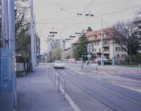
Title (German)
Bern BE, Südansicht der Kreuzung Bernstrasse/Bethlehemstrasse mit der Haltestelle Unterführung
Caption
South view of the intersection Bernstrasse/Bethlehemstrasse with the underpass stop (BERNMOBIL), private traffic (cars, trucks), bus, pedestrians, 1st follow-up photo after the new construction trambernwest (2011), general view; coordinates (LV03) of the camera location: 597110/198990; keywords Documenta Natura: city, construction site, landscape change, rail traffic
Caption (German)
Südansicht der Kreuzung Bernstrasse/Bethlehemstrasse mit der Haltestelle Unterführung (BERNMOBIL), Privatverkehr (Autos, Lastwagen), Bus, Fussgänger, 1. Folgeaufnahme nach dem Neubau trambernwest (2011), Gesamtansicht; Koordinaten (LV03) des Kamerastandorts: 597110/198990; Schlagworte Documenta Natura: Stadt, Baustelle, Landschaftswandel, Schienenverkehr
Record Name
Dia_303-16913

Title (German)
Bern BE, Südansicht der Kreuzung Bernstrasse/Bethlehemstrasse mit der Haltestelle Unterführung
Caption
South view of the intersection Bernstrasse/Bethlehemstrasse with the underpass stop (BERNMOBIL), private traffic (cars, trucks), bus, pedestrians, 1st follow-up photo after the new construction trambernwest (2011), general view; coordinates (LV03) of the camera location: 597110/198990; keywords Documenta Natura: city, construction site, landscape change, rail traffic
Caption (German)
Südansicht der Kreuzung Bernstrasse/Bethlehemstrasse mit der Haltestelle Unterführung (BERNMOBIL), Privatverkehr (Autos, Lastwagen), Bus, Fussgänger, 1. Folgeaufnahme nach dem Neubau trambernwest (2011), Gesamtansicht; Koordinaten (LV03) des Kamerastandorts: 597110/198990; Schlagworte Documenta Natura: Stadt, Baustelle, Landschaftswandel, Schienenverkehr
Record Name
Dia_303-16917

Title (German)
Bern BE, Südansicht der Kreuzung Bernstrasse/Bethlehemstrasse mit der Haltestelle Unterführung
Caption
South view of the intersection Bernstrasse/Bethlehemstrasse with the underpass stop (BERNMOBIL), private traffic (cars, trucks), bus, pedestrians, 1st follow-up photo after the new construction trambernwest (2011), general view; coordinates (LV03) of the camera location: 597110/198990; keywords Documenta Natura: city, construction site, landscape change, rail traffic
Caption (German)
Südansicht der Kreuzung Bernstrasse/Bethlehemstrasse mit der Haltestelle Unterführung (BERNMOBIL), Privatverkehr (Autos, Lastwagen), Bus, Fussgänger, 1. Folgeaufnahme nach dem Neubau trambernwest (2011), Gesamtansicht; Koordinaten (LV03) des Kamerastandorts: 597110/198990; Schlagworte Documenta Natura: Stadt, Baustelle, Landschaftswandel, Schienenverkehr
Record Name
Dia_303-16923

Title (German)
Bern BE, Südansicht der Kreuzung Bernstrasse/Bethlehemstrasse mit der Haltestelle Unterführung
Caption
South view of the intersection Bernstrasse/Bethlehemstrasse with the underpass stop (BERNMOBIL), private traffic (cars, trucks), bus, pedestrians, 1st follow-up photo after the new construction trambernwest (2011), general view; coordinates (LV03) of the camera location: 597110/198990; keywords Documenta Natura: city, construction site, landscape change, rail traffic
Caption (German)
Südansicht der Kreuzung Bernstrasse/Bethlehemstrasse mit der Haltestelle Unterführung (BERNMOBIL), Privatverkehr (Autos, Lastwagen), Bus, Fussgänger, 1. Folgeaufnahme nach dem Neubau trambernwest (2011), Gesamtansicht; Koordinaten (LV03) des Kamerastandorts: 597110/198990; Schlagworte Documenta Natura: Stadt, Baustelle, Landschaftswandel, Schienenverkehr
Record Name
Dia_303-16926
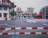
Title (German)
Bern BE, Westansicht des Kreisels Bernstrasse beim Bienzgut in Bümpliz
Caption
West view of the traffic traffic circle Bernstrasse near Bienzgut, with cars, streetcars and pedestrians, 1st follow-up photo after the new construction of trambernwest (2011), general view; coordinates (LV03) of the camera location: 596480/198905; keywords Documenta Natura: Project description: Documentation Der Durch Den Bau Der Neuen Tramlinien Nach Bümpliz Und Bern-Brünnen Ausgelösten Stadtveränderungen mittels Fotgrafischer Langzeitbeobachtung (Vorher/Nachher). Project start: 06.11.2008
Caption (German)
Westansicht des Verkehrskreisel Bernstrasse beim Bienzgut, mit Autos, Tram und Fussgänger, 1. Folgeaufnahme nach dem Neubau trambernwest (2011), Gesamtansicht; Koordinaten (LV03) des Kamerastandorts: 596480/198905; Schlagworte Documenta Natura: Projektbeschreibung: Dokumentation Der Durch Den Bau Der Neuen Tramlinien Nach Bümpliz Und Bern-Brünnen Ausgelösten Stadtveränderungen Mittels Fotgrafischer Langzeitbeobachtung (Vorher/Nachher). Projektbeginn: 06.11.2008
Record Name
Dia_303-16929

Title (German)
Bern BE, Westansicht des Kreisels Bernstrasse beim Bienzgut in Bümpliz
Caption
West view of the traffic traffic circle Bernstrasse near Bienzgut, with cars, streetcars and pedestrians, 1st follow-up photo after the new construction of trambernwest (2011), general view; coordinates (LV03) of the camera location: 596480/198905; keywords Documenta Natura: Project description: Documentation Der Durch Den Bau Der Neuen Tramlinien Nach Bümpliz Und Bern-Brünnen Ausgelösten Stadtveränderungen mittels Fotgrafischer Langzeitbeobachtung (Vorher/Nachher). Project start: 06.11.2008
Caption (German)
Westansicht des Verkehrskreisel Bernstrasse beim Bienzgut, mit Autos, Tram und Fussgänger, 1. Folgeaufnahme nach dem Neubau trambernwest (2011), Gesamtansicht; Koordinaten (LV03) des Kamerastandorts: 596480/198905; Schlagworte Documenta Natura: Projektbeschreibung: Dokumentation Der Durch Den Bau Der Neuen Tramlinien Nach Bümpliz Und Bern-Brünnen Ausgelösten Stadtveränderungen Mittels Fotgrafischer Langzeitbeobachtung (Vorher/Nachher). Projektbeginn: 06.11.2008
Record Name
Dia_303-16934

Title (German)
Bern BE, Blick (Ostansicht) entlang der Schlossstrasse mit Haltestelle Schlossmatte
Caption
East view (central perspective) of Schlossstrasse with Schlossmatte stop (BERNMOBIL), with cars, streetcar, pedestrians, 1st follow-up image after the new construction trambernwest (2011), partial view; coordinates (LV03) of the camera location: 598992/199378; keywords Documenta Natura: city, construction site, landscape change, rail traffic
Caption (German)
Ostansicht (Zentralperspektive) der Schlossstrasse mit der Haltestelle Schlossmatte (BERNMOBIL), mit Autos, Tram, Fussgänger, 1. Folgeaufnahme nach dem Neubau trambernwest (2011), Teilansicht; Koordinaten (LV03) des Kamerastandorts: 598992/199378; Schlagworte Documenta Natura: Stadt, Baustelle, Landschaftswandel, Schienenverkehr
Record Name
Dia_303-16937

Title (German)
Bern BE, Südwestansicht des Loryplatzes
Caption
Southwest view of Loryplatz with cars, pedestrians and streetcar, 1st follow-up shot after the new construction of trambernwest (2011), general view; coordinates (LV03) of the camera location: 598623/199267; keywords Documenta Natura: city, construction site, landscape change, rail traffic.
Caption (German)
Südwestansicht des Loryplatzes mit Autos, Fussgänger und Tram, 1. Folgeaufnahme nach dem Neubau von trambernwest (2011), Gesamtansicht; Koordinaten (LV03) des Kamerastandorts: 598623/199267; Schlagworte Documenta Natura: Stadt, Baustelle, Landschaftswandel, Schienenverkehr
Record Name
Dia_303-16940

Title (German)
Bern BE, Südwestansicht des Loryplatzes
Caption
Southwest view of Loryplatz with cars, pedestrians and streetcar, 1st follow-up shot after the new construction of trambernwest (2011), general view; coordinates (LV03) of the camera location: 598623/199267; keywords Documenta Natura: city, construction site, landscape change, rail traffic.
Caption (German)
Südwestansicht des Loryplatzes mit Autos, Fussgänger und Tram, 1. Folgeaufnahme nach dem Neubau von trambernwest (2011), Gesamtansicht; Koordinaten (LV03) des Kamerastandorts: 598623/199267; Schlagworte Documenta Natura: Stadt, Baustelle, Landschaftswandel, Schienenverkehr
Record Name
Dia_303-16943

Title (German)
Bern BE, Südwestansicht des Europaplatzes
Caption
Southwest view of Europaplatz with parking lot, highway bridge A12, with cars, pedestrians and streetcar, 1st follow-up shot after the new construction of trambernwest (2011), general view; coordinates (LV03) of camera location: 597520/199097; keywords Documenta Natura: city, construction site, landscape change, rail traffic
Caption (German)
Südwestansicht des Europaplatzes mit Parkplatz, Autobahnbrücke A12, mit Autos, Fussgänger und Tram, 1. Folgeaufnahme nach dem Neubau von trambernwest (2011), Gesamtansicht; Koordinaten (LV03) des Kamerastandorts: 597520/199097; Schlagworte Documenta Natura: Stadt, Baustelle, Landschaftswandel, Schienenverkehr
Record Name
Dia_303-16946

Title (German)
Bern BE, Südwestansicht des Europaplatzes
Caption
Southwest view of Europaplatz with parking lot, highway bridge A12, with cars, pedestrians and streetcar, 1st follow-up shot after the new construction of trambernwest (2011), general view; coordinates (LV03) of camera location: 597520/199097; keywords Documenta Natura: city, construction site, landscape change, rail traffic
Caption (German)
Südwestansicht des Europaplatzes mit Parkplatz, Autobahnbrücke A12, mit Autos, Fussgänger und Tram, 1. Folgeaufnahme nach dem Neubau von trambernwest (2011), Gesamtansicht; Koordinaten (LV03) des Kamerastandorts: 597520/199097; Schlagworte Documenta Natura: Stadt, Baustelle, Landschaftswandel, Schienenverkehr
Record Name
Dia_303-16949

Title (German)
Bern BE, Südwestansicht des Europaplatzes
Caption
Southwest view of Europaplatz with parking lot, highway bridge A12, with cars, pedestrians and streetcar, 1st follow-up shot after the new construction of trambernwest (2011), general view; coordinates (LV03) of camera location: 597520/199097; keywords Documenta Natura: city, construction site, landscape change, rail traffic
Caption (German)
Südwestansicht des Europaplatzes mit Parkplatz, Autobahnbrücke A12, mit Autos, Fussgänger und Tram, 1. Folgeaufnahme nach dem Neubau von trambernwest (2011), Gesamtansicht; Koordinaten (LV03) des Kamerastandorts: 597520/199097; Schlagworte Documenta Natura: Stadt, Baustelle, Landschaftswandel, Schienenverkehr
Record Name
Dia_303-16952

Title (German)
Bern BE, Westansicht des Bethlehemsparks mit der Waldmannstrasse
Caption
West view of Bethlehempark with footpath, Waldmannstrasse and Tscharnergut housing estate, with streetcar, 1st follow-up photograph after the new construction trambernwest (2011), general view; coordinates (LV03) of the camera location: 596094/199777; keywords Documenta Natura: city, construction site, landscape change, rail traffic
Caption (German)
Westansicht des Bethlehemparks mit Fussweg, Waldmannstrasse und Wohnsiedlung Tscharnergut, mit Tram, 1. Folgeaufnahme nach dem Neubau trambernwest (2011), Gesamtansicht; Koordinaten (LV03) des Kamerastandorts: 596094/199777; Schlagworte Documenta Natura: Stadt, Baustelle, Landschaftswandel, Schienenverkehr
Record Name
Dia_303-16955

Title (German)
Bern BE, Westansicht des Bethlehemsparks mit der Waldmannstrasse
Caption
West view of Bethlehempark with footpath, Waldmannstrasse and Tscharnergut housing estate, with streetcar, 1st follow-up photograph after the new construction trambernwest (2011), general view; coordinates (LV03) of the camera location: 596094/199777; keywords Documenta Natura: city, construction site, landscape change, rail traffic
Caption (German)
Westansicht des Bethlehemparks mit Fussweg, Waldmannstrasse und Wohnsiedlung Tscharnergut, mit Tram, 1. Folgeaufnahme nach dem Neubau trambernwest (2011), Gesamtansicht; Koordinaten (LV03) des Kamerastandorts: 596094/199777; Schlagworte Documenta Natura: Stadt, Baustelle, Landschaftswandel, Schienenverkehr
Record Name
Dia_303-16958

Title (German)
Bern BE, Blick (Ostansicht) entlang der Murtenstrasse mit Haltestelle Bethlehem Kirche
Caption
East view (central perspective) of Murtenstrasse with the Bethlehem Church stop (BERNMOBIL), in the background the Bethlehem Church, with cars, bus and pedestrians, 1st follow-up photograph after the new construction trambernwest (2011), general view; coordinates (LV03) of the camera location: 596094/199777; keywords Documenta Natura: city, construction site, landscape change, rail traffic
Caption (German)
Ostansicht (Zentralperspektive) der Murtenstrasse mit der Haltestelle Bethlehem Kirche (BERNMOBIL), im Hintergrund die Kirche Bethlehem, mit Autos, Bus und Fussgänger, 1. Folgeaaufnahme nach dem Neubau trambernwest (2011), Gesamtansicht; Koordinaten (LV03) des Kamerastandorts: 596094/199777; Schlagworte Documenta Natura: Stadt, Baustelle, Landschaftswandel, Schienenverkehr
Record Name
Dia_303-16961

Title (German)
Bern BE, Blick (Ostansicht) entlang der Murtenstrasse mit Haltestelle Bethlehem Kirche
Caption
East view (central perspective) of Murtenstrasse with the Bethlehem Church stop (BERNMOBIL), in the background the Bethlehem Church, with cars, bus and pedestrians, 1st follow-up photograph after the new construction trambernwest (2011), general view; coordinates (LV03) of the camera location: 596094/199777; keywords Documenta Natura: city, construction site, landscape change, rail traffic
Caption (German)
Ostansicht (Zentralperspektive) der Murtenstrasse mit der Haltestelle Bethlehem Kirche (BERNMOBIL), im Hintergrund die Kirche Bethlehem, mit Autos, Bus und Fussgänger, 1. Folgeaaufnahme nach dem Neubau trambernwest (2011), Gesamtansicht; Koordinaten (LV03) des Kamerastandorts: 596094/199777; Schlagworte Documenta Natura: Stadt, Baustelle, Landschaftswandel, Schienenverkehr
Record Name
Dia_303-16964

Title (German)
Bern BE, Blick (Westansicht) vom Untermattweg an die Bethlehembrücke
Caption
West view from Untermattweg to Bethlehem Bridge, with cars, BLS railroad line in the left background, 1st follow-up photo after the new construction trambernwest (2011), general view; coordinates (LV03) of the camera location: 596094/199777; keywords Documenta Natura: city, construction site, landscape change, rail traffic
Caption (German)
Westansicht vom Untermattweg an die Bethlehembrücke, mit Autos, links im Hintergrund die Bahnlinie der BLS, 1. Folgeaufnahme nach dem Neubau trambernwest (2011), Gesamtansicht; Koordinaten (LV03) des Kamerastandorts: 596094/199777; Schlagworte Documenta Natura: Stadt, Baustelle, Landschaftswandel, Schienenverkehr
Record Name
Dia_303-16968

Title (German)
Bern BE, Blick (Westansicht) vom Untermattweg an die Bethlehembrücke
Caption
West view from Untermattweg to Bethlehem Bridge, with cars, BLS railroad line in the left background, 1st follow-up photo after the new construction trambernwest (2011), general view; coordinates (LV03) of the camera location: 596094/199777; keywords Documenta Natura: city, construction site, landscape change, rail traffic
Caption (German)
Westansicht vom Untermattweg an die Bethlehembrücke, mit Autos, links im Hintergrund die Bahnlinie der BLS, 1. Folgeaufnahme nach dem Neubau trambernwest (2011), Gesamtansicht; Koordinaten (LV03) des Kamerastandorts: 596094/199777; Schlagworte Documenta Natura: Stadt, Baustelle, Landschaftswandel, Schienenverkehr
Record Name
Dia_303-16971

Title (German)
Bern BE, Blick (Südansicht) entlang der Bottigenstrasse mit Haltestelle Bachmätteli
Caption
South view along Bottigenstrasse with the Bachmätteli stop (BERNMOBIL), with cars, streetcars and pedestrians, 1st follow-up photograph after the new construction trambernwest (2011), general view; coordinates (LV03) of the camera location: 596094/199777; keywords Documenta Natura: city, construction site, landscape change, rail traffic
Caption (German)
Südansicht entlang der Bottigenstrasse mit der Haltestelle Bachmätteli (BERNMOBIL), mit Autos, Tram und Fussgänger, 1. Folgeaufnahme nach dem Neubau trambernwest (2011), Gesamtansicht; Koordinaten (LV03) des Kamerastandorts: 596094/199777; Schlagworte Documenta Natura: Stadt, Baustelle, Landschaftswandel, Schienenverkehr
Record Name
Dia_303-16976

Title (German)
Bern BE, Blick (Südansicht) entlang der Bottigenstrasse mit Haltestelle Bachmätteli
Caption
South view along Bottigenstrasse with the Bachmätteli stop (BERNMOBIL), with cars, streetcars and pedestrians, 1st follow-up photograph after the new construction trambernwest (2011), general view; coordinates (LV03) of the camera location: 596094/199777; keywords Documenta Natura: city, construction site, landscape change, rail traffic
Caption (German)
Südansicht entlang der Bottigenstrasse mit der Haltestelle Bachmätteli (BERNMOBIL), mit Autos, Tram und Fussgänger, 1. Folgeaufnahme nach dem Neubau trambernwest (2011), Gesamtansicht; Koordinaten (LV03) des Kamerastandorts: 596094/199777; Schlagworte Documenta Natura: Stadt, Baustelle, Landschaftswandel, Schienenverkehr
Record Name
Dia_303-16979
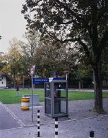
Title (German)
Bern BE, Blick (Südansicht) entlang der Bottigenstrasse mit Haltestelle Bachmätteli
Caption
South view along Bottigenstrasse with the Bachmätteli stop (BERNMOBIL), with cars, streetcars and pedestrians, 1st follow-up image after the new construction trambernwest (2011), general view, panoramic image 3-part; coordinates (LV03) of the camera location: 596094/199777; keywords Documenta Natura: city, construction site, landscape change, rail traffic
Caption (German)
Südansicht entlang der Bottigenstrasse mit der Haltestelle Bachmätteli (BERNMOBIL), mit Autos, Tram und Fussgänger, 1. Folgeaufnahme nach dem Neubau trambernwest (2011), Gesamtansicht, Panoramaaufnahme 3-teilig; Koordinaten (LV03) des Kamerastandorts: 596094/199777; Schlagworte Documenta Natura: Stadt, Baustelle, Landschaftswandel, Schienenverkehr
Record Name
Dia_303-16982

Title (German)
Bern BE, Blick (Nordansicht) entlang der Bottigenstrasse mit der Wendeschleife, Haltestelle Bümpliz
Caption
North view along Bottigenstrasse with the turning loop, Bümpliz stop (BERNMOBIL) with cars (parking lots), streetcar, pedestrians, 1st follow-up photo after the new construction trambernwest (2011), general view; coordinates (LV03) of the camera location: 596094/199777; keywords Documenta Natura: city, construction site, landscape change, rail traffic
Caption (German)
Nordansicht entlang der Bottigenstrasse mit der Wendeschleife, Haltestelle Bümpliz (BERNMOBIL) mit Autos (Parkplätze), Tram, Fussgänger, 1. Folgeaufnahme nach dem Neubau trambernwest (2011), Gesamtansicht; Koordinaten (LV03) des Kamerastandorts: 596094/199777; Schlagworte Documenta Natura: Stadt, Baustelle, Landschaftswandel, Schienenverkehr
Record Name
Dia_303-16985

Title (German)
Bern BE, Blick (Nordansicht) entlang der Bottigenstrasse mit der Wendeschleife, Haltestelle Bümpliz
Caption
North view along Bottigenstrasse with the turning loop, Bümpliz stop (BERNMOBIL) with cars (parking lots), streetcar, pedestrians, 1st follow-up photo after the new construction trambernwest (2011), general view; coordinates (LV03) of the camera location: 596094/199777; keywords Documenta Natura: city, construction site, landscape change, rail traffic
Caption (German)
Nordansicht entlang der Bottigenstrasse mit der Wendeschleife, Haltestelle Bümpliz (BERNMOBIL) mit Autos (Parkplätze), Tram, Fussgänger, 1. Folgeaufnahme nach dem Neubau trambernwest (2011), Gesamtansicht; Koordinaten (LV03) des Kamerastandorts: 596094/199777; Schlagworte Documenta Natura: Stadt, Baustelle, Landschaftswandel, Schienenverkehr
Record Name
Dia_303-16988

Title (German)
Bern BE, Blick (Nordansicht) entlang der Bottigenstrasse mit der Wendeschleife, Haltestelle Bümpliz
Caption
North view along Bottigenstrasse with the turning loop, Bümpliz stop (BERNMOBIL) with cars (parking lots), streetcar, pedestrians, 1st follow-up photo after the new construction trambernwest (2011), general view; coordinates (LV03) of the camera location: 596094/199777; keywords Documenta Natura: city, construction site, landscape change, rail traffic
Caption (German)
Nordansicht entlang der Bottigenstrasse mit der Wendeschleife, Haltestelle Bümpliz (BERNMOBIL) mit Autos (Parkplätze), Tram, Fussgänger, 1. Folgeaufnahme nach dem Neubau trambernwest (2011), Gesamtansicht; Koordinaten (LV03) des Kamerastandorts: 596094/199777; Schlagworte Documenta Natura: Stadt, Baustelle, Landschaftswandel, Schienenverkehr
Record Name
Dia_303-16991

Title (German)
Bern BE, Blick (Nordansicht) entlang der Bottigenstrasse mit der Wendeschleife, Haltestelle Bümpliz
Caption
North view along Bottigenstrasse with the turning loop, Bümpliz stop (BERNMOBIL) with cars (parking lots), streetcar, pedestrians, 1st follow-up photo after the new construction trambernwest (2011), general view; coordinates (LV03) of the camera location: 596094/199777; keywords Documenta Natura: city, construction site, landscape change, rail traffic
Caption (German)
Nordansicht entlang der Bottigenstrasse mit der Wendeschleife, Haltestelle Bümpliz (BERNMOBIL) mit Autos (Parkplätze), Tram, Fussgänger, 1. Folgeaufnahme nach dem Neubau trambernwest (2011), Gesamtansicht; Koordinaten (LV03) des Kamerastandorts: 596094/199777; Schlagworte Documenta Natura: Stadt, Baustelle, Landschaftswandel, Schienenverkehr
Record Name
Dia_303-16994

Title (German)
Wattenwil BE, Gürbe bei Forstsäge, Längmoos
Caption
Streambed of the Gürbe after storm, with a temporary crossing, clearing work, remains of the torn away bridge, general view and partial view, selection reportage; keywords Documenta Natura: storm, flood, landslide
Caption (German)
Bachbett der Gürbe nach Unwetter, mit einem provisorischen Übergang, Räumungsarbeiten, Überreste der weggerissenen Brücke, Gesamtansicht und Teilansicht, Auswahl Reportage; Schlagworte Documenta Natura: Unwetter, Hochwasser, Rutschung
Record Name
Dia_303-18000

Title (German)
Wattenwil BE, Gürbe bei Forstsäge, Längmoos
Caption
Streambed of the Gürbe after storm, with a temporary crossing, clearing work, remains of the torn away bridge, general view and partial view, selection reportage; keywords Documenta Natura: storm, flood, landslide
Caption (German)
Bachbett der Gürbe nach Unwetter, mit einem provisorischen Übergang, Räumungsarbeiten, Überreste der weggerissenen Brücke, Gesamtansicht und Teilansicht, Auswahl Reportage; Schlagworte Documenta Natura: Unwetter, Hochwasser, Rutschung
Record Name
Dia_303-18004

Title (German)
Wattenwil BE, Gürbe bei Forstsäge, Längmoos
Caption
Streambed of the Gürbe after storm, with a temporary crossing, clearing work, remains of the torn away bridge, general view and partial view, selection reportage; keywords Documenta Natura: storm, flood, landslide
Caption (German)
Bachbett der Gürbe nach Unwetter, mit einem provisorischen Übergang, Räumungsarbeiten, Überreste der weggerissenen Brücke, Gesamtansicht und Teilansicht, Auswahl Reportage; Schlagworte Documenta Natura: Unwetter, Hochwasser, Rutschung
Record Name
Dia_303-18007

Title (German)
Wattenwil BE, Gürbe bei Forstsäge, Längmoos
Caption
Streambed of the Gürbe after storm, with a temporary crossing, clearing work, remains of the torn away bridge, general view and partial view, selection reportage; keywords Documenta Natura: storm, flood, landslide
Caption (German)
Bachbett der Gürbe nach Unwetter, mit einem provisorischen Übergang, Räumungsarbeiten, Überreste der weggerissenen Brücke, Gesamtansicht und Teilansicht, Auswahl Reportage; Schlagworte Documenta Natura: Unwetter, Hochwasser, Rutschung
Record Name
Dia_303-18010

Title (German)
Wattenwil BE, Gürbe bei Forstsäge, Längmoos
Caption
Streambed of the Gürbe after storm, with a temporary crossing, clearing work, remains of the torn away bridge, general view and partial view, selection reportage; keywords Documenta Natura: storm, flood, landslide
Caption (German)
Bachbett der Gürbe nach Unwetter, mit einem provisorischen Übergang, Räumungsarbeiten, Überreste der weggerissenen Brücke, Gesamtansicht und Teilansicht, Auswahl Reportage; Schlagworte Documenta Natura: Unwetter, Hochwasser, Rutschung
Record Name
Dia_303-18011

Title (German)
Wattenwil BE, Gürbe bei Forstsäge, Längmoos
Caption
Streambed of the Gürbe after storm, with a temporary crossing, clearing work, remains of the torn away bridge, general view and partial view, selection reportage; keywords Documenta Natura: storm, flood, landslide
Caption (German)
Bachbett der Gürbe nach Unwetter, mit einem provisorischen Übergang, Räumungsarbeiten, Überreste der weggerissenen Brücke, Gesamtansicht und Teilansicht, Auswahl Reportage; Schlagworte Documenta Natura: Unwetter, Hochwasser, Rutschung
Record Name
Dia_303-18014
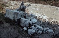
Title (German)
Wattenwil BE, Gürbe bei Forstsäge, Längmoos
Caption
Streambed of the Gürbe after storm, with a temporary crossing, clearing work, remains of the torn away bridge, general view and partial view, selection reportage; keywords Documenta Natura: storm, flood, landslide
Caption (German)
Bachbett der Gürbe nach Unwetter, mit einem provisorischen Übergang, Räumungsarbeiten, Überreste der weggerissenen Brücke, Gesamtansicht und Teilansicht, Auswahl Reportage; Schlagworte Documenta Natura: Unwetter, Hochwasser, Rutschung
Record Name
Dia_303-18016

Title (German)
Wattenwil BE, Blumenstein BE, Gürbe im Auwald
Caption
Streambed of the Gürbe with a temporary crossing, clearing work, remains of the torn away bridge, general view and partial view, selection reportage; keywords Documenta Natura: storm, flood, landslide
Caption (German)
Bachbett der Gürbe mit einem provisorischen Übergang, Räumungsarbeiten, Überreste der weggerissenen Brücke, Gesamtansicht und Teilansicht, Auswahl Reportage; Schlagworte Documenta Natura: Unwetter, Hochwasser, Rutschung
Record Name
Dia_303-18020

Title (German)
Wattenwil BE, Blumenstein BE, Gürbe im Auwald
Caption
Streambed of the Gürbe with a temporary crossing, clearing work, remains of the torn away bridge, general view and partial view, selection reportage; keywords Documenta Natura: storms, floods, landslide
Caption (German)
Bachbett der Gürbe mit einem provisorischen Übergang, Räumungsarbeiten, Überreste der weggerissenen Brücke, Gesamtansicht und Teilansicht, Auswahl Reportage; Schlagworte Documenta Natura: Unwetter, Hochwasser, Rutschung
Record Name
Dia_303-18023

Title (German)
Wattenwil BE, Blumenstein BE, Gürbe im Auwald
Caption
Streambed of the Gürbe with a temporary crossing, clearing work, remains of the torn away bridge, general view and partial view, selection reportage; keywords Documenta Natura: storms, floods, landslide
Caption (German)
Bachbett der Gürbe mit einem provisorischen Übergang, Räumungsarbeiten, Überreste der weggerissenen Brücke, Gesamtansicht und Teilansicht, Auswahl Reportage; Schlagworte Documenta Natura: Unwetter, Hochwasser, Rutschung
Record Name
Dia_303-18025

Title (German)
Wattenwil BE, Blumenstein BE, Gürbe im Auwald
Caption
Streambed of the Gürbe with a temporary crossing, clearing work, remains of the torn away bridge, general view and partial view, selection reportage; keywords Documenta Natura: storms, floods, landslide
Caption (German)
Bachbett der Gürbe mit einem provisorischen Übergang, Räumungsarbeiten, Überreste der weggerissenen Brücke, Gesamtansicht und Teilansicht, Auswahl Reportage; Schlagworte Documenta Natura: Unwetter, Hochwasser, Rutschung
Record Name
Dia_303-18029

Title (German)
Wattenwil BE, Blumenstein BE, Gürbe im Auwald
Caption
Streambed of the Gürbe with a temporary crossing, clearing work, remains of the torn away bridge, general view and partial view, selection reportage; keywords Documenta Natura: storm, flood, landslide
Caption (German)
Bachbett der Gürbe mit einem provisorischen Übergang, Räumungsarbeiten, Überreste der weggerissenen Brücke, Gesamtansicht und Teilansicht, Auswahl Reportage; Schlagworte Documenta Natura: Unwetter, Hochwasser, Rutschung
Record Name
Dia_303-18032

Title (German)
Wattenwil BE, Wohnhaus westlich der Gurzelenmatt
Caption
Dwelling house in a meadow flooded with water and mud, general view; keywords Documenta Natura: storm, flood, landslide
Caption (German)
Wohnhaus in einer mit Wasser und Schlamm überschwemmten Wiese, Gesamtansicht; Schlagworte Documenta Natura: Unwetter, Hochwasser, Rutschung
Record Name
Dia_303-18035

Title (German)
Wattenwil BE, Wohnhaus westlich der Gurzelenmatt
Caption
Meadow flooded with water and mud, swimming ducks,partial view; keywords Documenta Natura: storm, flood, landslide
Caption (German)
Mit Wasser und Schlamm überschwemmten Wiese, schwimmende Enten,Teilansicht; Schlagworte Documenta Natura: Unwetter, Hochwasser, Rutschung
Record Name
Dia_303-18037

Title (German)
Wattenwil BE, Auf dem Parkplatz der Garage Ren‚ Gyr
Caption
Interior view of a passenger car destroyed by flood and mud, partial view; keywords Documenta Natura: storm, flood, landslide
Caption (German)
Innenansicht eines durch Hochwasser und Schlamm zerstörten Personenwagens, Teilansicht; Schlagworte Documenta Natura: Unwetter, Hochwasser, Rutschung
Record Name
Dia_303-18040
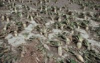
Title (German)
Wattenwil BE, Feld westlich der Gurzelenmatt
Caption
Because of a flood partially exposed sugar beets and therefore fruit unusable, partial view; keywords Documenta Natura: storm, flood, landslide.
Caption (German)
Wegen einer Überschwemmung teilweise freigelegte Zuckerrüben und daher Frucht unbrauchbar, Teilansicht; Schlagworte Documenta Natura: Unwetter, Hochwasser, Rutschung
Record Name
Dia_303-18042

Title (German)
Rüschegg BE, Nordansicht des Bürglen, Birehubel Bireberg mit Unterer Gantrischhütte und Birehütte
Caption
North view of Bürglen and Birehubel Bireberg with various landslides, Untere Gantrischhütte and Birehütte, road in foreground, general view; coordinates (LV03) of camera location: 600395/174668; keywords Documenta Natura: storm, flood, landslide
Caption (German)
Nordansicht des Bürglen und Birehubel Bireberg mit verschiedenen Rutschungen, Untere Gantrischhütte und Birehütte, im Vordergrund die Strasse, Gesamtansicht; Koordinaten (LV03) des Kamerastandorts: 600395/174668; Schlagworte Documenta Natura: Unwetter, Hochwasser, Rutschung
Record Name
Dia_303-18046

Title (German)
Muralto TI, Ostansichten des Wohnhauses Via dei Pescatori Nr. 22/24
Caption
East views of the old residential, commercial building Via dei Pescatori 22/24, first shot with the profiles for the new building, in the foreground the courtyard garden with palm trees (1999), exterior view, partial view; coordinates (LV03) of the camera location: 705690/114298; keywords Documenta Natura: single house
Caption (German)
Ostansichten des alten Wohnhauses, Gewerbehauses Via dei Pescatori 22/24, Erstaufnahme mit den Profilen für den Neubau, im Vordergrund der Hofgarten mit Palmen (1999), Aussenansicht, Teilansicht; Koordinaten (LV03) des Kamerastandorts: 705690/114298; Schlagworte Documenta Natura: Einzelhaus
Record Name
Dia_303-18052

Title (German)
Muralto TI, Ostansichten des Wohnhauses Via dei Pescatori Nr. 22/24
Caption
East views of the old residential, commercial building Via dei Pescatori 22/24, first shot with the profiles for the new building, in the foreground the courtyard garden with palm trees (1999), exterior view, partial view; coordinates (LV03) of the camera location: 705690/114298; keywords Documenta Natura: single house
Caption (German)
Ostansichten des alten Wohnhauses, Gewerbehauses Via dei Pescatori 22/24, Erstaufnahme mit den Profilen für den Neubau, im Vordergrund der Hofgarten mit Palmen (1999), Aussenansicht, Teilansicht; Koordinaten (LV03) des Kamerastandorts: 705690/114298; Schlagworte Documenta Natura: Einzelhaus
Record Name
Dia_303-18056

Title (German)
Muralto TI, Ostansichten des Wohnhauses Via dei Pescatori Nr. 22/24
Caption
East views of the old residential, commercial building Via dei Pescatori 22/24, 1st follow-up photo after demolition (2000), exterior view, partial view; coordinates (LV03) of the camera location: 705690/114298; keywords Documenta Natura: single house
Caption (German)
Ostansichten des alten Wohnhauses, Gewerbehauses Via dei Pescatori 22/24, 1. Folgeaufnahme nach dem Abbruch (2000), Aussenansicht, Teilansicht; Koordinaten (LV03) des Kamerastandorts: 705690/114298; Schlagworte Documenta Natura: Einzelhaus
Record Name
Dia_303-18061

Title (German)
Muralto TI, Ostansichten des Wohnhauses Via dei Pescatori Nr. 22/24
Caption
East views of the old residential, commercial building Via dei Pescatori 22/24, 1st follow-up photo after demolition (2000), exterior view, partial view; coordinates (LV03) of the camera location: 705690/114298; keywords Documenta Natura: single house
Caption (German)
Ostansichten des alten Wohnhauses, Gewerbehauses Via dei Pescatori 22/24, 1. Folgeaufnahme nach dem Abbruch (2000), Aussenansicht, Teilansicht; Koordinaten (LV03) des Kamerastandorts: 705690/114298; Schlagworte Documenta Natura: Einzelhaus
Record Name
Dia_303-18066

Title (German)
Muralto TI, Ostansichten des Wohnhauses Via dei Pescatori Nr. 22/24
Caption
East views of the old residential, commercial building Via dei Pescatori 22/24, 2nd follow-up shot with the new building (2003, after completion of construction), exterior view, partial view; coordinates (LV03) of the camera location: 705690/114298; keywords Documenta Natura: single house
Caption (German)
Ostansichten des alten Wohnhauses, Gewerbehauses Via dei Pescatori 22/24, 2. Folgeaufnahme mit dem Neubau (2003, nach Bauabschluss), Aussenansicht, Teilansicht; Koordinaten (LV03) des Kamerastandorts: 705690/114298; Schlagworte Documenta Natura: Einzelhaus
Record Name
Dia_303-18071
Title (German)
Muralto TI, Ostansichten des Wohnhauses Via dei Pescatori Nr. 22/24
Caption
East views of the old residential, commercial building Via dei Pescatori 22/24, 2nd follow-up shot with the new building (2003, after completion of construction), exterior view, partial view; coordinates (LV03) of the camera location: 705690/114298; keywords Documenta Natura: single house
Caption (German)
Ostansichten des alten Wohnhauses, Gewerbehauses Via dei Pescatori 22/24, 2. Folgeaufnahme mit dem Neubau (2003, nach Bauabschluss), Aussenansicht, Teilansicht; Koordinaten (LV03) des Kamerastandorts: 705690/114298; Schlagworte Documenta Natura: Einzelhaus
Record Name
Dia_303-18076

Title (German)
Quinto TI, Autobahn A2 nördlich von Piotta
Caption
View down the valley (west view) of the A2 freeway (northbound) at Piotta, dosing point for passage through the Gotthard tunnel, with waiting and moving trucks, partial view; keywords Documenta Natura: Straßenverkehr
Caption (German)
Blick talabwärts (Westansicht) auf die Autobahn A2 (Fahrtrichtung Norden)bei Piotta, Dosierstelle für Durchfahrt durch den Gotthardtunnel, mit wartenden und fahrenden Lastwagen, Teilansicht; Schlagworte Documenta Natura: Strassenverkehr
Record Name
Dia_303-18093

Title (German)
Quinto TI, Autobahn A2 nördlich von Piotta
Caption
View down the valley (west view) of the A2 freeway (northbound) at Piotta, dosing point for passage through the Gotthard tunnel, with waiting and moving trucks, partial view; keywords Documenta Natura: Straßenverkehr
Caption (German)
Blick talabwärts (Westansicht) auf die Autobahn A2 (Fahrtrichtung Norden)bei Piotta, Dosierstelle für Durchfahrt durch den Gotthardtunnel, mit wartenden und fahrenden Lastwagen, Teilansicht; Schlagworte Documenta Natura: Strassenverkehr
Record Name
Dia_303-18099

Title (German)
Quinto TI, Autobahn A2 nördlich von Piotta
Caption
View down the valley (west view) of the A2 freeway (northbound) near Piotta, dosing point for passage through the Gotthard tunnel, with waiting and moving trucks, partial view; keywords Documenta Natura: Strassenverkehr
Caption (German)
Blick talabwärts (Westansicht) auf die Autobahn A2 (Fahrtrichtung Norden)bei Piotta, Dosierstelle für Durchfahrt durch den Gotthardtunnel, mit wartenden und fahrenden Lastwagen, Teilansicht; Schlagworte Documenta Natura: Strassenverkehr
Record Name
Dia_303-18109

Title (German)
Bern BE, Im Quartier Matte, Gerberngasse, Mühlenplatz, Wasserwerkgasse
Caption
View from the opposite bank onto the Matte quarter flooded by the Aare: riverbed of the Aare with highest measured level (1999); keywords Documenta Natura: floods
Caption (German)
Ansicht vom Gegenufer auf das mit Hochwasser der Aare überflutete Quartier Matte: Flussbett der Aare mit höchstem gemessenem Pegel (1999); Schlagworte Documenta Natura: Hochwasser
Record Name
Dia_303-18113

Title (German)
Bern BE, Im Quartier Matte, Gerberngasse, Mühlenplatz, Wasserwerkgasse
Caption
View from the opposite bank onto the Matte quarter flooded by the Aare: riverbed of the Aare with highest measured level (1999); keywords Documenta Natura: floods
Caption (German)
Ansicht vom Gegenufer auf das mit Hochwasser der Aare überflutete Quartier Matte: Flussbett der Aare mit höchstem gemessenem Pegel (1999); Schlagworte Documenta Natura: Hochwasser
Record Name
Dia_303-18115

Title (German)
Bern BE, Im Quartier Matte, Gerberngasse, Mühlenplatz, Wasserwerkgasse
Caption
Gerberngasse flooded with high water of the Aare with civil protectors, rubber dinghy, water pumps, residents; keywords Documenta Natura: floods
Caption (German)
Mit Hochwasser der Aare überflutete Gerberngasse mit Zivilschützern, Schlauchboot, Wasserpumpen, Anwohner; Schlagworte Documenta Natura: Hochwasser
Record Name
Dia_303-18117

Title (German)
Bern BE, Im Quartier Matte, Gerberngasse, Mühlenplatz, Wasserwerkgasse
Caption
Gerberngasse flooded with high water of the Aare with civil protectors, rubber dinghy, water pumps, residents; keywords Documenta Natura: floods
Caption (German)
Mit Hochwasser der Aare überflutete Gerberngasse mit Zivilschützern, Schlauchboot, Wasserpumpen, Anwohner; Schlagworte Documenta Natura: Hochwasser
Record Name
Dia_303-18118

Title (German)
Bern BE, Im Quartier Matte, Gerberngasse, Mühlenplatz, Wasserwerkgasse
Caption
Gerberngasse flooded with high water of the Aare with civil protectors, rubber dinghy, water pumps, residents; keywords Documenta Natura: floods
Caption (German)
Mit Hochwasser der Aare überflutete Gerberngasse mit Zivilschützern, Schlauchboot, Wasserpumpen, Anwohner; Schlagworte Documenta Natura: Hochwasser
Record Name
Dia_303-18120

Title (German)
Bern BE, Im Quartier Matte, Gerberngasse, Mühlenplatz, Wasserwerkgasse
Caption
Gerberngasse flooded with high water of the Aare with civil protectors, rubber dinghy, water pumps, residents; keywords Documenta Natura: floods
Caption (German)
Mit Hochwasser der Aare überflutete Gerberngasse mit Zivilschützern, Schlauchboot, Wasserpumpen, Anwohner; Schlagworte Documenta Natura: Hochwasser
Record Name
Dia_303-18121

Title (German)
Bern BE, Im Quartier Matte, Gerberngasse, Mühlenplatz, Wasserwerkgasse
Caption
Wasserwerkgasse flooded with high water of the Aare river with temporary protective dam made of sandbags; keywords Documenta Natura: flood
Caption (German)
Mit Hochwasser der Aare überflutete Wasserwerkgasse mit provisorischem Schutzdamm aus Sandsäcken; Schlagworte Documenta Natura: Hochwasser
Record Name
Dia_303-18124

Title (German)
Bern BE, Im Quartier Matte, Gerberngasse, Mühlenplatz, Wasserwerkgasse
Caption
Wasserwerkgasse flooded with high water of the Aare river with temporary protective dam made of sandbags; keywords Documenta Natura: flood
Caption (German)
Mit Hochwasser der Aare überflutete Wasserwerkgasse mit provisorischem Schutzdamm aus Sandsäcken; Schlagworte Documenta Natura: Hochwasser
Record Name
Dia_303-18128

Title (German)
Bern BE, Im Quartier Matte, Gerberngasse, Mühlenplatz, Wasserwerkgasse
Caption
Mühlenplatz flooded with high water of the river Aare with inhabitants of the quarter and passers-by; keywords Documenta Natura: high water
Caption (German)
Mit Hochwasser der Aare überfluteter Mühlenplatz mit Quartierbewohner und Passanten; Schlagworte Documenta Natura: Hochwasser
Record Name
Dia_303-18134