 E-PICS - ETHBIB.Bildarchiv


The images presented on this page are part of E-Pics, a service provided by the ETH-Bibliothek of ETH Zurich. You find here static medium resolution images published under the creative commons
CC-BY-SA license or with the Public Domain Mark. This means that you are free to share, copy and redistribute the material in any medium or format; that you are free to remix, transform, and build upon the material for any purpose, even commercially, under the following conditions: You must give appropriate credit, provide a link to the license, and indicate if changes were made.
- More information about E-Pics is available at https://www.e-pics.ethz.ch
- This catalog can also be accessed at https://ba.e-pics.ethz.ch/ . There you can download the image in a higher resolution.

Title (German)
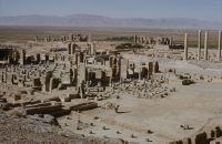
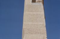
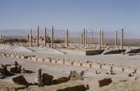
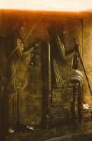
Persien, Shiraz, Parsagades, Persepolis
Record Name
Dia_301-07017

Title (German)
Persien, Shiraz, Parsagades, Persepolis
Record Name
Dia_301-07018

Title (German)
Persien, Shiraz, Parsagades, Persepolis
Record Name
Dia_301-07019

Title (German)
Persien, Shiraz, Parsagades, Persepolis
Record Name
Dia_301-07021

Title (German)
Persien, Shiraz, Parsagades, Persepolis
Record Name
Dia_301-07022
Title (German)
Persien, Shiraz, Parsagades, Persepolis
Record Name
Dia_301-07023


Title (German)
Persien, Shiraz, Parsagades, Persepolis
Record Name
Dia_301-07025

Title (German)
Persien, Shiraz, Parsagades, Persepolis
Record Name
Dia_301-07026
Title (German)
Persien, Shiraz, Parsagades, Persepolis
Record Name
Dia_301-07027

Title (German)
Persien, Shiraz, Parsagades, Persepolis
Record Name
Dia_301-07028

Title (German)
Persien, Shiraz, Parsagades, Persepolis
Record Name
Dia_301-07029

Title (German)
Persien, Shiraz, Parsagades, Persepolis
Record Name
Dia_301-07030

Title (German)
Persien, Shiraz, Parsagades, Persepolis
Record Name
Dia_301-07031

Title (German)
Persien, Shiraz, Parsagades, Persepolis
Record Name
Dia_301-07032

Title (German)
Persien, Shiraz, Parsagades, Persepolis
Record Name
Dia_301-07033

Title (German)
Persien, Shiraz, Parsagades, Persepolis
Record Name
Dia_301-07034

Title (German)
Persien, Shiraz, Parsagades, Persepolis
Record Name
Dia_301-07035

Title (German)
Persien, Shiraz, Parsagades, Persepolis
Record Name
Dia_301-07036

Title (German)
Persien, Shiraz, Parsagades, Persepolis
Record Name
Dia_301-07037

Title (German)
Persien, Shiraz, Parsagades, Persepolis
Record Name
Dia_301-07038

Title (German)
Persien, Shiraz, Parsagades, Persepolis
Record Name
Dia_301-07039

Title (German)
Persien, Shiraz, Parsagades, Persepolis
Record Name
Dia_301-07040

Title (German)
Persien, Shiraz, Parsagades, Persepolis
Record Name
Dia_301-07041

Title (German)
Persien, Shiraz, Parsagades, Persepolis
Record Name
Dia_301-07042

Title (German)
Persien, Shiraz, Parsagades, Persepolis
Record Name
Dia_301-07043

Title (German)
Persien, Shiraz, Parsagades, Persepolis
Record Name
Dia_301-07044

Title (German)
Persien, Shiraz, Parsagades, Persepolis
Record Name
Dia_301-07045

Title (German)
Persien, Shiraz, Parsagades, Persepolis
Record Name
Dia_301-07046

Title (German)
Persien, Shiraz, Parsagades, Persepolis
Record Name
Dia_301-07047

Title (German)
Persien, Shiraz, Parsagades, Persepolis
Record Name
Dia_301-07048

Title (German)
Persien, Shiraz, Parsagades, Persepolis
Record Name
Dia_301-07049

Title (German)
Persien, Shiraz, Parsagades, Persepolis
Record Name
Dia_301-07050


Title (German)
Persien, Shiraz, Parsagades, Persepolis
Record Name
Dia_301-07052

Title (German)
Persien, Shiraz, Parsagades, Persepolis
Record Name
Dia_301-07053

Title (German)
Persien, Shiraz, Parsagades, Persepolis
Record Name
Dia_301-07054


Title (German)
Persien, Shiraz, Parsagades, Persepolis
Record Name
Dia_301-07056


Title (German)
Persien, Shiraz, Parsagades, Persepolis
Record Name
Dia_301-07058

Title (German)
Persien, Shiraz, Parsagades, Persepolis
Record Name
Dia_301-07059

Title (German)
Persien, Shiraz, Parsagades, Persepolis
Record Name
Dia_301-07060

Title (German)
Persien, Shiraz, Parsagades, Persepolis
Record Name
Dia_301-07061

Title (German)
Persien, Shiraz, Parsagades, Persepolis
Record Name
Dia_301-07062

Title (German)
Persien, Shiraz, Parsagades, Persepolis
Record Name
Dia_301-07063

Title (German)
Persien, Shiraz, Parsagades, Persepolis
Record Name
Dia_301-07064

Title (German)
Persien, Shiraz, Parsagades, Persepolis
Record Name
Dia_301-07065
Title (German)
Persien, Shiraz, Parsagades, Persepolis
Record Name
Dia_301-07066

Title (German)
Persien, Shiraz, Parsagades, Persepolis
Record Name
Dia_301-07067

Title (German)
Persien, Shiraz, Parsagades, Persepolis
Record Name
Dia_301-07068

Title (German)
Persien, Shiraz, Parsagades, Persepolis
Record Name
Dia_301-07069

Title (German)
Persien, Shiraz, Parsagades, Persepolis
Record Name
Dia_301-07070

Title (German)
Persien, Shiraz, Parsagades, Persepolis
Record Name
Dia_301-07071

Title (German)
Persien, Shiraz, Parsagades, Persepolis
Record Name
Dia_301-07072

Title (German)
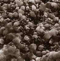
Raster-Elektronen-Mikroskopaufnahmen von Opalen
Caption
21216x
Caption (German)
21216x
Record Name
Dia_301-07073

Title (German)
Raster-Elektronen-Mikroskopaufnahmen von Opalen
Caption
21216x
Caption (German)
21216x
Record Name
Dia_301-07074

Title (German)
Raster-Elektronen-Mikroskopaufnahmen von Opalen
Caption
22400x
Caption (German)
22400x
Record Name
Dia_301-07075

Title (German)
Raster-Elektronen-Mikroskopaufnahmen von Opalen
Caption
11200x
Caption (German)
11200x
Record Name
Dia_301-07076
Title (German)
Raster-Elektronen-Mikroskopaufnahmen von Opalen
Caption
4928x
Caption (German)
4928x
Record Name
Dia_301-07077

Title (German)
Raster-Elektronen-Mikroskopaufnahmen von Opalen
Caption
15360x
Caption (German)
15360x
Record Name
Dia_301-07078

Title (German)
Raster-Elektronen-Mikroskopaufnahmen von Opalen
Caption
16800x
Caption (German)
16800x
Record Name
Dia_301-07079

Title (German)
Raster-Elektronen-Mikroskopaufnahmen von Opalen
Caption
36700x
Caption (German)
36700x
Record Name
Dia_301-07080

Title (German)
Raster-Elektronen-Mikroskopaufnahmen von Opalen
Caption
18350x
Caption (German)
18350x
Record Name
Dia_301-07081

Title (German)
Raster-Elektronen-Mikroskopaufnahmen von Opalen
Caption
18560x
Caption (German)
18560x
Record Name
Dia_301-07082

Title (German)
Raster-Elektronen-Mikroskopaufnahmen von Opalen
Caption
17150x
Caption (German)
17150x
Record Name
Dia_301-07083

Title (German)
Raster-Elektronen-Mikroskopaufnahmen von Opalen
Caption
3290x
Caption (German)
3290x
Record Name
Dia_301-07084
Title (German)
Raster-Elektronen-Mikroskopaufnahmen von Opalen
Caption
9180x
Caption (German)
9180x
Record Name
Dia_301-07085

Title (German)
Frau mit Edelstein-Kette, Ring und Armband
Record Name
Dia_301-07087


Title (German)
Eduard Gübelin, verschiedenfarbene Spinelle
Record Name
Dia_301-07093


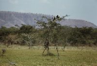
Title (German)
Äthiopien, Dreifarben-Glanzstar
Record Name
Dia_301-07120

Title (German)
Äthiopien, Schweifglanzstar (?)
Record Name
Dia_301-07121

Title (German)
Äthiopien, Schweifglanzstar (?)
Record Name
Dia_301-07122


Title (German)
Harar, Hyänen-Mann füttert eine Tüpfelhyäne
Record Name
Dia_301-07131

Title (German)
Harar, Hyänen-Mann füttert eine Tüpfelhyäne
Record Name
Dia_301-07132


Title (German)
Harar, Blick auf die Altstadt nach Norden (N)
Record Name
Dia_301-07144

Title (German)
Harar, Blick auf die Altstadt nach Norden (N)
Record Name
Dia_301-07145

Title (German)
Äthiopien, Addis Abeba, Stadthaus
Record Name
Dia_301-07146


Title (German)
Äthiopien, Äthiopische Handelsbank
Record Name
Dia_301-07148


Title (German)
Äthiopien, Blick nach Ostnordosten (ENE)
Record Name
Dia_301-07158

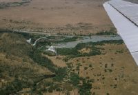
Title (German)
Äthiopien, Blauer Nil
Caption
These falls are known as Tisissat waterfalls and are considered a great tourist attraction
Caption (German)
Diese Fälle sind als Tisissat-Wasserfälle bekannt und gelten als grosse Touristenattraktion
Record Name
Dia_301-07159

Title (German)
Äthiopien, Blauer Nil, Tisissat-Wasserfälle
Record Name
Dia_301-07160

Title (German)
Äthiopien, Blauer Nil, Tisissat-Wasserfälle
Record Name
Dia_301-07161

Title (German)
Äthiopien, Blauer Nil, Tisissat-Wasserfälle
Record Name
Dia_301-07162

Title (German)
Äthiopien, Unterwegs zu den Tissiatfällen
Record Name
Dia_301-07163
Title (German)
Äthiopien, Blauer Nil, Tisissat-Wasserfälle
Record Name
Dia_301-07164

Title (German)
Äthiopien, Blauer Nil, etwas oberhalb der Tisissat-Wasserfälle
Record Name
Dia_301-07165

Title (German)
Äthiopien, Brücke über dem Blauen Nil
Record Name
Dia_301-07166


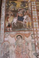
Title (German)
Illustrierte Handschrift des Klosters Kebran St. Gabriel
Record Name
Dia_301-07169

Title (German)
Äthiopien, Tanasee, Insel Dek
Caption
Little tower at jetty W of Narga Selassie
Caption (German)
Türmlein am Anleger W von Narga Selassie
Record Name
Dia_301-07170


Title (German)
Tanasee, Insel Dek, Wandmalerei in der Kirche Narga Selassie
Record Name
Dia_301-07172

Title (German)
Tanasee, Insel Dek, Wandmalerei in der Kirche Narga Selassie
Record Name
Dia_301-07173

Title (German)
Äthiopien, Tanasee, Fischer im Bambusboot
Record Name
Dia_301-07175

Title (German)
Äthiopien, Tanasee, Tana Cherkos, Fischer im Bambusboot
Record Name
Dia_301-07176

Title (German)
Äthiopien, Tanasee, Halbinsel Mandaba oder Mendaba
Record Name
Dia_301-07178

Title (German)
Äthiopien, Tanasee, die Mönche der Halbinsel Mandaba
Record Name
Dia_301-07179


Title (German)
Finnland, Lemmenpää bei Ylijärvi
Caption
Large blocks of rapakivigranite with spectrolite inclusions
Caption (German)
Grosse Blöcke aus Rapakivigranit mit Spektrolith-Einsprenglingen
Record Name
Dia_301-07182


Title (German)
Muralto TI, Südansicht (Seeseite) des Wohnhauses Via dei Pescatori Nr. 20 Vicolo dei Gatti, Casa Miralago
Caption
South view (lake side) of the old dwelling house Via dei Pescatori No. 20 Vicolo dei Gatti, Casa Miralago, first shot with the profiles for the new building, in the foreground parking lots and the garden with palm trees (1999), exterior view, general view; coordinates (LV03) of the camera location: 705663/114255; keywords Documenta Natura: views of the dwelling house Via dei Pescatori 20 before/after the new building (1999/2003), Muralto
Caption (German)
Südansicht (Seeseite) des alten Wohnhauses Via dei Pescatori Nr. 20 Vicolo dei Gatti, Casa Miralago, Erstaufnahme mit den Profilen für den Neubau, im Vordergrund Parkplätze und den Garten mit Palmen (1999), Aussenansicht, Gesamtansicht; Koordinaten (LV03) des Kamerastandorts: 705663/114255; Schlagworte Documenta Natura: Ansichten des Wohnhauses Via dei Pescatori 20 vor/nach dem Neubau (1999/2003), Muralto
Record Name
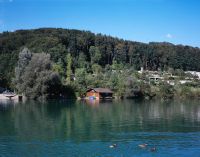
Dia_303-00038

Title (German)
Muralto TI, Südansicht (Seeseite) des Wohnhauses Via dei Pescatori Nr. 20 Vicolo dei Gatti, Casa Miralago
Caption
South view (lake side) of the old dwelling house Via dei Pescatori No. 20 Vicolo dei Gatti, Casa Miralago, 1st follow-up photo with the new building (2003, after completion of construction), exterior view, general view; coordinates (LV03) of the camera location: 705663/114255; keywords Documenta Natura: views of the dwelling house Via dei Pescatori 20 before/after the new building (1999/2003), Muralto.
Caption (German)
Südansicht (Seeseite) des alten Wohnhauses Via dei Pescatori Nr. 20 Vicolo dei Gatti, Casa Miralago, 1. Folgeaufnahme mit dem Neubau (2003, nach Bauabschluss), Aussenansicht, Gesamtansicht; Koordinaten (LV03) des Kamerastandorts: 705663/114255; Schlagworte Documenta Natura: Ansichten des Wohnhauses Via dei Pescatori 20 vor/nach dem Neubau (1999/2003), Muralto
Record Name
Dia_303-00046

Title (German)
Muralto TI, Blick (Westansicht) entlang der Via dei Pescatori
Caption
West view along Via dei Pescatori with old residential house No. 20 Vicolo dei Gatti, Casa Miralago, first shot with the profiles for the new building (1999), exterior view, general view; coordinates (LV03) of the camera location: 705628/114330; keywords Documenta Natura: west views of the residential house Via dei Pescatori 20 before/after the new building (1999/2003), Muralto.
Caption (German)
Westansicht entlang der Via dei Pescatori mit altem Wohnhaus Nr. 20 Vicolo dei Gatti, Casa Miralago, Erstaufnahme mit den Profilen für den Neubau (1999), Aussenansicht, Gesamtansicht; Koordinaten (LV03) des Kamerastandorts: 705628/114330; Schlagworte Documenta Natura: Westansichten des Wohnhauses Via dei Pescatori 20 vor/nach dem Neubau (1999/2003), Muralto
Record Name
Dia_303-00052

Title (German)
Muralto TI, Blick (Westansicht) entlang der Via dei Pescatori
Caption
West view along Via dei Pescatori with old residential house No. 20 Vicolo dei Gatti, Casa Miralago, 1st follow-up photo after 4 years with the new building (2003, after completion of construction), exterior view, general view; coordinates (LV03) of the camera location: 705628/114330; keywords Documenta Natura: West views of the residential house Via dei Pescatori 20 before/after the new building (1999/2003), Muralto.
Caption (German)
Westansicht entlang der Via dei Pescatori mit altem Wohnhaus Nr. 20 Vicolo dei Gatti, Casa Miralago, 1. Folgeaufnahme nach 4 Jahren mit dem Neubau (2003, nach Bauabschluss), Aussenansicht, Gesamtansicht; Koordinaten (LV03) des Kamerastandorts: 705628/114330; Schlagworte Documenta Natura: Westansichten des Wohnhauses Via dei Pescatori 20 vor/nach dem Neubau (1999/2003), Muralto
Record Name
Dia_303-00058

Title (German)
Bern BE, Nordwestansicht des Quartiers Schöngrün
Caption
Northwest view of the Schöngrün neighborhood, farmland and the A6 highway in the foreground, first photograph (2001), general view; coordinates (LV03) of the camera location: 602475/199895; keywords Documenta Natura: single house
Caption (German)
Nordwestansicht des Quartiers Schöngrün, im Vordergrund Ackerland und die Autobahn A6, Erstaufnahme (2001), Gesamtansicht; Koordinaten (LV03) des Kamerastandorts: 602475/199895; Schlagworte Documenta Natura: Einzelhaus
Record Name
Dia_303-00064

Title (German)
Bern BE, Nordwestansicht des Quartiers Schöngrün
Caption
Northwest view of the Schöngrün neighborhood, farmland and the A6 highway in the foreground, first photograph (2001), general view; coordinates (LV03) of the camera location: 602475/199895; keywords Documenta Natura: single house
Caption (German)
Nordwestansicht des Quartiers Schöngrün, im Vordergrund Ackerland und die Autobahn A6, Erstaufnahme (2001), Gesamtansicht; Koordinaten (LV03) des Kamerastandorts: 602475/199895; Schlagworte Documenta Natura: Einzelhaus
Record Name
Dia_303-00067

Title (German)
Bern BE, Nordwestansicht des Quartiers Schöngrün
Caption
Northwest view of the Schöngrün neighborhood, farmland and the A6 highway in the foreground, 1st follow-up photograph taken during the construction of the Zentrum Paul Klee (2003), general view; coordinates (LV03) of the camera location: 602475/199895; keywords Documenta Natura: single house
Caption (German)
Nordwestansicht des Quartiers Schöngrün, im Vordergrund Ackerland und die Autobahn A6, 1. Folgeaufnahme während dem Bau des Zentrum Paul Klee (2003), Gesamtansicht; Koordinaten (LV03) des Kamerastandorts: 602475/199895; Schlagworte Documenta Natura: Einzelhaus
Record Name
Dia_303-00076

Title (German)
Bern BE, Nordwestansicht des Quartiers Schöngrün
Caption
Northwest view of the Schöngrün quarter, in the foreground farmland and the A6 freeway, 1st follow-up photograph during the construction of the Zentrum Paul Klee (2003), general view; coordinates (LV03) of the camera location: 602475/199895; keywords Documenta Natura: quarter
Caption (German)
Nordwestansicht des Quartiers Schöngrün, im Vordergrund Ackerland und die Autobahn A6, 1. Folgeaufnahme während dem Bau des Zentrum Paul Klee (2003), Gesamtansicht; Koordinaten (LV03) des Kamerastandorts: 602475/199895; Schlagworte Documenta Natura: Quartier
Record Name
Dia_303-00080

Title (German)
Bern BE, Nordwestansicht des Quartiers Schöngrün
Caption
Northwest view of the Schöngrün neighborhood, farmland and the A6 freeway in the foreground, 2nd follow-up photo taken shortly before the center was completed (2004), general view; coordinates (LV03) of the camera location: 602475/199895; keywords Documenta Natura: road traffic
Caption (German)
Nordwestansicht des Quartiers Schöngrün, im Vordergrund Ackerland und die Autobahn A6, 2. Folgeaufnahme kurz vor der Fertigstellung des Zentrum (2004), Gesamtansicht; Koordinaten (LV03) des Kamerastandorts: 602475/199895; Schlagworte Documenta Natura: Strassenverkehr
Record Name
Dia_303-00089

Title (German)
Bern BE, Nordwestansicht des Quartiers Schöngrün
Caption
Northwest view of the Schöngrün neighborhood, farmland and the A6 freeway in the foreground, 2nd follow-up photo taken shortly before the center was completed (2004), general view; coordinates (LV03) of the camera location: 602475/199895; keywords Documenta Natura: road traffic
Caption (German)
Nordwestansicht des Quartiers Schöngrün, im Vordergrund Ackerland und die Autobahn A6, 2. Folgeaufnahme kurz vor der Fertigstellung des Zentrum (2004), Gesamtansicht; Koordinaten (LV03) des Kamerastandorts: 602475/199895; Schlagworte Documenta Natura: Strassenverkehr
Record Name
Dia_303-00093
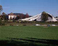
Title (German)
Bern BE, Nordwestansicht des Quartiers Schöngrün
Caption
Northwest view of the Schöngrün neighborhood, farmland and the A6 highway in the foreground, 3rd follow-up photo after the opening in June (2005), general view; coordinates (LV03) of the camera location: 602475/199895. Zentrum Paul Klee; keywords Documenta Natura: road traffic.
Caption (German)
Nordwestansicht des Quartiers Schöngrün, im Vordergrund Ackerland und die Autobahn A6, 3. Folgeaufnahme nach der Eröffnung im Juni (2005), Gesamtansicht; Koordinaten (LV03) des Kamerastandorts: 602475/199895. Zentrum Paul Klee; Schlagworte Documenta Natura: Strassenverkehr
Record Name
Dia_303-00101

Title (German)
Bern, Nordwestansicht des Quartiers Schöngrün
Caption
Northwest view of the Schöngrün neighborhood, farmland and the A6 highway in the foreground, 3rd follow-up photo after the opening in June (2005), general view; coordinates (LV03) of the camera location: 602475/199895. Zentrum Paul Klee; keywords Documenta Natura: road traffic.
Caption (German)
Nordwestansicht des Quartiers Schöngrün, im Vordergrund Ackerland und die Autobahn A6, 3. Folgeaufnahme nach der Eröffnung im Juni (2005), Gesamtansicht; Koordinaten (LV03) des Kamerastandorts: 602475/199895. Zentrum Paul Klee; Schlagworte Documenta Natura: Strassenverkehr
Record Name
Dia_303-00105

Title (German)
Bern BE, Blick (Südwestansicht) über die Autobahn A6 auf das Wiesland Schöngrün
Caption
Southwest view from the pedestrian bridge over the A6 freeway onto the meadow Schöngrün, first photograph (2001), general view; coordinates (LV03) of the camera location: 602600/199650; keywords Documenta Natura: floods
Caption (German)
Südwestansicht von der Fussgängerbrücke über die Autobahn A6 auf das Wiesland Schöngrün, Erstaufnahme (2001), Gesamtansicht; Koordinaten (LV03) des Kamerastandorts: 602600/199650; Schlagworte Documenta Natura: Hochwasser
Record Name
Dia_303-00112

Title (German)
Bern BE, Blick (Südwestansicht) über die Autobahn A6 auf das Wiesland Schöngrün
Caption
Southwest view from the pedestrian bridge over the A6 freeway onto the meadow Schöngrün, first photograph (2001), general view; coordinates (LV03) of the camera location: 602600/199650; keywords Documenta Natura: floods
Caption (German)
Südwestansicht von der Fussgängerbrücke über die Autobahn A6 auf das Wiesland Schöngrün, Erstaufnahme (2001), Gesamtansicht; Koordinaten (LV03) des Kamerastandorts: 602600/199650; Schlagworte Documenta Natura: Hochwasser
Record Name
Dia_303-00118

Title (German)
Bern BE, Blick (Südwestansicht) über die Autobahn A6 auf das Wiesland Schöngrün
Caption
Southwest view from the pedestrian bridge over the A6 freeway onto the meadow Schöngrün, 1st follow-up shot during the construction of the Zentrum Paul Klee (2003), general view; coordinates (LV03) of the camera location: 602600/199650; keywords Documenta Natura: floods
Caption (German)
Südwestansicht von der Fussgängerbrücke über die Autobahn A6 auf das Wiesland Schöngrün, 1. Folgeaufnahme während dem Bau des Zentrum Paul Klee (2003), Gesamtansicht; Koordinaten (LV03) des Kamerastandorts: 602600/199650; Schlagworte Documenta Natura: Hochwasser
Record Name
Dia_303-00127

Title (German)
Bern BE, Blick (Südwestansicht) über die Autobahn A6 auf das Wiesland Schöngrün
Caption
Southwest view from the pedestrian bridge over the A6 freeway onto the meadow Schöngrün, 1st follow-up shot during the construction of the Zentrum Paul Klee (2003), general view; coordinates (LV03) of the camera location: 602600/199650; keywords Documenta Natura: floods
Caption (German)
Südwestansicht von der Fussgängerbrücke über die Autobahn A6 auf das Wiesland Schöngrün, 1. Folgeaufnahme während dem Bau des Zentrum Paul Klee (2003), Gesamtansicht; Koordinaten (LV03) des Kamerastandorts: 602600/199650; Schlagworte Documenta Natura: Hochwasser
Record Name
Dia_303-00131

Title (German)
Bern BE, Blick (Südwestansicht) über die Autobahn A6 auf das Wiesland Schöngrün
Caption
Southwest view from the pedestrian bridge over the A6 freeway onto the meadow Schöngrün, 2nd follow-up shot shortly before the completion of the center (2004), general view; coordinates (LV03) of the camera location: 602600/199650; keywords Documenta Natura: floods
Caption (German)
Südwestansicht von der Fussgängerbrücke über die Autobahn A6 auf das Wiesland Schöngrün, 2. Folgeaufnahme kurz vor der Fertigstellung des Zentrum (2004), Gesamtansicht; Koordinaten (LV03) des Kamerastandorts: 602600/199650; Schlagworte Documenta Natura: Hochwasser
Record Name
Dia_303-00140

Title (German)
Bern BE, Blick (Südwestansicht) über die Autobahn A6 auf das Wiesland Schöngrün
Caption
Southwest view from the pedestrian bridge over the A6 freeway onto the meadow Schöngrün, 2nd follow-up shot shortly before the completion of the center (2004), general view; coordinates (LV03) of the camera location: 602600/199650; keywords Documenta Natura: variegated wasteland
Caption (German)
Südwestansicht von der Fussgängerbrücke über die Autobahn A6 auf das Wiesland Schöngrün, 2. Folgeaufnahme kurz vor der Fertigstellung des Zentrum (2004), Gesamtansicht; Koordinaten (LV03) des Kamerastandorts: 602600/199650; Schlagworte Documenta Natura: Buntbrache
Record Name
Dia_303-00144

Title (German)
Bern BE, Blick (Südwestansicht) über die Autobahn A6 auf das Wiesland Schöngrün
Caption
Southwest view from the pedestrian bridge over the A6 freeway, 3rd follow-up photograph after completion, during the operation of the Museum Paul Klee (2007), general view; coordinates (LV03) of the camera location: 602600/199650; keywords Documenta Natura: variegated wasteland
Caption (German)
Südwestansicht von der Fussgängerbrücke über die Autobahn A6, 3. Folgeaufnahme nach der Fertigstellung, während dem Betrieb des Museum Paul Klee (2007), Gesamtansicht; Koordinaten (LV03) des Kamerastandorts: 602600/199650; Schlagworte Documenta Natura: Buntbrache
Record Name
Dia_303-00151

Title (German)
Bern BE, Blick (Südwestansicht) über die Autobahn A6 auf das Wiesland Schöngrün
Caption
Southwest view from the pedestrian bridge over the A6 freeway, 3rd follow-up photograph after completion, during the operation of the Museum Paul Klee (2007), general view; coordinates (LV03) of the camera location: 602600/199650; keywords Documenta Natura: variegated wasteland
Caption (German)
Südwestansicht von der Fussgängerbrücke über die Autobahn A6, 3. Folgeaufnahme nach der Fertigstellung, während dem Betrieb des Museum Paul Klee (2007), Gesamtansicht; Koordinaten (LV03) des Kamerastandorts: 602600/199650; Schlagworte Documenta Natura: Buntbrache
Record Name
Dia_303-00155

Title (German)
Fusio TI, Südansicht des Dorfes Mogno, im Vordergrund die Kirche
Caption
South view of the village of Mogno, in the foreground the historical, old and new church designed by Mario Botta, partial view, reconstruction shot (1998); coordinates (LV03) of the camera location: 694150/142900; keywords Documenta Natura: power plant
Caption (German)
Südansicht des Dorfes Mogno, im Vordergrund die historische, alte und neue, von Mario Botta gestaltete Kirche, Teilansicht, Rekonstruktionsaufnahme (1998); Koordinaten (LV03) des Kamerastandorts: 694150/142900; Schlagworte Documenta Natura: Kraftwerk
Record Name
Dia_303-00167

Title (German)
Bern BE, Im Rosengarten, am Wegrand beim südlichen Ende der Kreuzallee
Caption
North view of newly planted lime tree, single tree, leafless, on the side of the cross avenue with shrubs, bench, general view; coordinates (LV03) of camera location: 601608/200063; keywords Documenta Natura: square
Caption (German)
Nordansicht der neu gepflanzten Linde, Einzelbaum, laublos, am Wegrand der Kreuzallee mit Sträucher, Sitzbank, Geamtansicht; Koordinaten (LV03) des Kamerastandorts: 601608/200063; Schlagworte Documenta Natura: Platz
Record Name
Dia_303-00172

Title (German)
Root LU, Bogenbrücke über die Reuss im Unterdorf bei der ARA
Caption
South view of the arch bridge N14-1.614 over the Reuss river with and without post bus, partial view; keywords Documenta Natura: square
Caption (German)
Südansicht der Bogenbrücke N14-1.614 über die Reuss mit und ohne Postauto, Teilansicht; Schlagworte Documenta Natura: Platz
Record Name
Dia_303-00179

Title (German)
Root LU, Bogenbrücke über die Reuss im Unterdorf bei der ARA
Caption
Southeast view of the arch bridge N14-1.614 over the Reuss river with and without post bus, partial view; keywords Documenta Natura: square
Caption (German)
Südostansicht der Bogenbrücke N14-1.614 über die Reuss mit und ohne Postauto, Teilansicht; Schlagworte Documenta Natura: Platz
Record Name
Dia_303-00195

Title (German)
Bern BE, Westansicht der Postgasse, obere und mittlere Teil
Caption
West view (central perspective) of the upper and middle Postgasse with scaffolding, parked cars and two-wheelers, partly with pedestrians, partial view; keywords Documenta Natura: Square
Caption (German)
Westansicht (Zentralperspektive) der oberen und mittleren Postgasse mit Baugerüst, parkierten Autos und Zweirädern, teilweise mit Fussgänger, Teilansicht; Schlagworte Documenta Natura: Platz
Record Name
Dia_303-00205

Title (German)
Bern BE, Westansicht der Postgasse, obere und mittlere Teil
Caption
West view (central perspective) of the upper and middle Postgasse with scaffolding, parked cars and two-wheelers, partly with pedestrians, partial view; keywords Documenta Natura: Square
Caption (German)
Westansicht (Zentralperspektive) der oberen und mittleren Postgasse mit Baugerüst, parkierten Autos und Zweirädern, teilweise mit Fussgänger, Teilansicht; Schlagworte Documenta Natura: Platz
Record Name
Dia_303-00211

Title (German)
Locarno TI, Blick (Südwestansicht) auf die Piazza Castello
Caption
Southwest view of Piazza Castello, first shot before construction began (03-1997), general view; coordinates (LV03) of camera location: 704465/113638; keywords Documenta Natura: square
Caption (German)
Südwestansicht auf die Piazza Castello, Erstaufnahme vor dem Baubeginn (03-1997), Gesamtansicht; Koordinaten (LV03) des Kamerastandorts: 704465/113638; Schlagworte Documenta Natura: Platz
Record Name
Dia_303-00215

Title (German)
Locarno TI, Blick (Südwestansicht) auf die Piazza Castello
Caption
Southwest view of Piazza Castello, first shot before construction began (03-1997), general view; coordinates (LV03) of camera location: 704465/113638; keywords Documenta Natura: square
Caption (German)
Südwestansicht auf die Piazza Castello, Erstaufnahme vor dem Baubeginn (03-1997), Gesamtansicht; Koordinaten (LV03) des Kamerastandorts: 704465/113638; Schlagworte Documenta Natura: Platz
Record Name
Dia_303-00219

Title (German)
Locarno TI, Blick (Südwestansicht) auf die Piazza Castello
Caption
Southwest view of Piazza Castello, 1st follow-up shot during remodeling (07-1997), general view; coordinates (LV03) of camera location: 704465/113638; keywords Documenta Natura: woodcutting.
Caption (German)
Südwestansicht auf die Piazza Castello, 1. Folgeaufnahme während der Umgestaltung (07-1997), Gesamtansicht; Koordinaten (LV03) des Kamerastandorts: 704465/113638; Schlagworte Documenta Natura: Holzhauerei
Record Name
Dia_303-00227

Title (German)
Locarno TI, Blick (Südwestansicht) auf die Piazza Castello
Caption
Southwest view of Piazza Castello, 1st follow-up shot during remodeling (07-1997), general view; coordinates (LV03) of camera location: 704465/113638; keywords Documenta Natura: woodcutting.
Caption (German)
Südwestansicht auf die Piazza Castello, 1. Folgeaufnahme während der Umgestaltung (07-1997), Gesamtansicht; Koordinaten (LV03) des Kamerastandorts: 704465/113638; Schlagworte Documenta Natura: Holzhauerei
Record Name
Dia_303-00232

Title (German)
Locarno TI, Blick (Südwestansicht) auf die Piazza Castello
Caption
Southwest view of Piazza Castello, 2nd follow-up shot during remodeling (1998), general view; coordinates (LV03) of camera location: 704465/113638; keywords Documenta Natura: woodcutting.
Caption (German)
Südwestansicht auf die Piazza Castello, 2. Folgeaufnahme während der Umgestaltung (1998), Gesamtansicht; Koordinaten (LV03) des Kamerastandorts: 704465/113638; Schlagworte Documenta Natura: Holzhauerei
Record Name
Dia_303-00239

Title (German)
Locarno TI, Blick (Südwestansicht) auf die Piazza Castello
Caption
Southwest view of Piazza Castello, 2nd follow-up shot during remodeling (1998), general view; coordinates (LV03) of camera location: 704465/113638; keywords Documenta Natura: woodcutting.
Caption (German)
Südwestansicht auf die Piazza Castello, 2. Folgeaufnahme während der Umgestaltung (1998), Gesamtansicht; Koordinaten (LV03) des Kamerastandorts: 704465/113638; Schlagworte Documenta Natura: Holzhauerei
Record Name
Dia_303-00243

Title (German)
Locarno TI, Blick (Südwestansicht) auf die Piazza Castello
Caption
Southwest view of Piazza Castello, 3rd follow-up shot during remodeling (1999), general view; coordinates (LV03) of camera location: 704465/113638; keywords Documenta Natura: woodcutting.
Caption (German)
Südwestansicht auf die Piazza Castello, 3. Folgeaufnahme während der Umgestaltung (1999), Gesamtansicht; Koordinaten (LV03) des Kamerastandorts: 704465/113638; Schlagworte Documenta Natura: Holzhauerei
Record Name
Dia_303-00251

Title (German)
Locarno TI, Blick (Südwestansicht) auf die Piazza Castello
Caption
Southwest view of Piazza Castello, 3rd follow-up shot during remodeling (1999), general view; coordinates (LV03) of camera location: 704465/113638; keywords Documenta Natura: woodcutting.
Caption (German)
Südwestansicht auf die Piazza Castello, 3. Folgeaufnahme während der Umgestaltung (1999), Gesamtansicht; Koordinaten (LV03) des Kamerastandorts: 704465/113638; Schlagworte Documenta Natura: Holzhauerei
Record Name
Dia_303-00255

Title (German)
Locarno TI, Blick (Südwestansicht) auf die Piazza Castello
Caption
Southwest view of Piazza Castello, 4th follow-up photograph after completion of construction of the remodeled Piazza Castello (2002), general view; coordinates (LV03) of camera location: 704465/113638; keywords Documenta Natura: wood carving
Caption (German)
Südwestansicht auf die Piazza Castello, 4. Folgeaufnahme nach Bauabschluss der umgestalteten Piazza Castello (2002), Gesamtansicht; Koordinaten (LV03) des Kamerastandorts: 704465/113638; Schlagworte Documenta Natura: Holzhauerei
Record Name
Dia_303-00263

Title (German)
Locarno TI, Blick (Südwestansicht) auf die Piazza Castello
Caption
Southwest view of Piazza Castello, 4th follow-up photograph after completion of construction of the remodeled Piazza Castello (2002), general view; coordinates (LV03) of camera location: 704465/113638; keywords Documenta Natura: wood carving
Caption (German)
Südwestansicht auf die Piazza Castello, 4. Folgeaufnahme nach Bauabschluss der umgestalteten Piazza Castello (2002), Gesamtansicht; Koordinaten (LV03) des Kamerastandorts: 704465/113638; Schlagworte Documenta Natura: Holzhauerei
Record Name
Dia_303-00267

Title (German)
Locarno TI, Blick (Südwestansicht) auf die Piazza Castello
Caption
Southwest view of Piazza Castello, 5th subsequent photograph after the construction of the parking garage and the subsequent extension of the footpath (2008), general view; coordinates (LV03) of the camera location: 704465/113638; keywords Documenta Natura: Holzhauerei
Caption (German)
Südwestansicht auf die Piazza Castello, 5. Folgeaufnahme nach dem Bau des Parkhauses und der nachträglichen Verlängerung des Fussweges (2008), Gesamtansicht; Koordinaten (LV03) des Kamerastandorts: 704465/113638; Schlagworte Documenta Natura: Holzhauerei
Record Name
Dia_303-00275

Title (German)
Locarno TI, Blick (Südwestansicht) auf die Piazza Castello
Caption
Southwest view of Piazza Castello, 5th subsequent photograph after the construction of the parking garage and the subsequent extension of the footpath (2008), general view; coordinates (LV03) of the camera location: 704465/113638; keywords Documenta Natura: Holzhauerei
Caption (German)
Südwestansicht auf die Piazza Castello, 5. Folgeaufnahme nach dem Bau des Parkhauses und der nachträglichen Verlängerung des Fussweges (2008), Gesamtansicht; Koordinaten (LV03) des Kamerastandorts: 704465/113638; Schlagworte Documenta Natura: Holzhauerei
Record Name
Dia_303-00281

Title (German)
Bern BE, Südansicht der Gewerbestrasse (12), vordere Teil
Caption
Photograph taken after the felling of the pyramid poplar for safety reasons (rot in the lower trunk area); coordinates (LV03) of the camera location: 599065/200475; keywords Documenta Natura: Holzhauerei
Caption (German)
Aufnahme nach der Fällung der Pyramidenpappel aus Sicherheitsgründen (Faulstelle im unteren Stammbereich); Koordinaten (LV03) des Kamerastandorts: 599065/200475; Schlagworte Documenta Natura: Holzhauerei
Record Name
Dia_303-00294

Title (German)
Schlans GR, Breil/Brigels GR, Südansicht des Val Plaunca mit Schlans und Capeder (z. T.) und der Gebirgskette mit Cavistrau Grond und Pign, Piz Tumpiv, Fuortga, Piz Dadens und Piz Dado, im Vordergrund In den Maiensässen
Caption
South view of Val Plaunca with Schlans and Capeder (partly) and the mountain range with Cavistrau Grond and Pign, Piz Tumpiv, Fuortga, Piz Dadens and Piz Dado, in the foreground the opposite slope with huts, snow-covered, opposite slope shot, general view; coordinates (LV03) of the camera location: 722175/177370; keywords Documenta Natura: lightning damage
Caption (German)
Südansicht des Val Plaunca mit Schlans und Capeder (z. T.) und der Gebirgskette mit dem Cavistrau Grond und Pign, Piz Tumpiv, Fuortga, Piz Dadens und Piz Dado, im Vordergrund der Gegenhang mit Hütten, schneebedeckt, Gegenhangaufnahme, Gesamtansicht; Koordinaten (LV03) des Kamerastandorts: 722175/177370; Schlagworte Documenta Natura: Blitzschaden
Record Name
Dia_303-00299

Title (German)
Diemerswil BE, Auf der Bärenriedwiese beim Scheibenstand der Schiessanlage Bärenried, z. T. im Hintergrund der Bärenriedwald
Caption
Artificially created biotope in existing wet meadow shortly after completion, partly with disc stand and in the background the Bärenriedwald, general view, partial view, detailed view; coordinates (LV03) of the camera location: 599013/208308; keywords Documenta Natura: lightning damage
Caption (German)
Künstlich angelegtes Biotop in bestehender Feuchtwiese kurz nach der Fertigstellung, z. T. mit Scheibenstand und im Hintergrund der Bärenriedwald, Gesamtansicht, Teilansicht, Detailansicht; Koordinaten (LV03) des Kamerastandorts: 599013/208308; Schlagworte Documenta Natura: Blitzschaden
Record Name
Dia_303-00306

Title (German)
Diemerswil BE, Auf der Bärenriedwiese beim Scheibenstand der Schiessanlage Bärenried, z. T. im Hintergrund der Bärenriedwald
Caption
Artificially created biotope in existing wet meadow shortly after completion, partly with disc stand and in the background the Bärenriedwald, general view, partial view, detailed view; coordinates (LV03) of the camera location: 59897f/20833f; keywords Documenta Natura: lightning damage
Caption (German)
Künstlich angelegtes Biotop in bestehender Feuchtwiese kurz nach der Fertigstellung, z. T. mit Scheibenstand und im Hintergrund der Bärenriedwald, Gesamtansicht, Teilansicht, Detailansicht; Koordinaten (LV03) des Kamerastandorts: 59897f/20833f; Schlagworte Documenta Natura: Blitzschaden
Record Name
Dia_303-00312

Title (German)
Wohlen b. Bern BE, Rechtes Wohlenseeufer bei der hinteren Aumatt in Hinterkappelen
Caption
View over the Wohlensee to the right shore with overaged poplars and boathouse, in the background the housing estate hintere Aumatt, first shot before the trees were cut down; coordinates (LV03) of the camera location: 595930/201665; keywords Documenta Natura: lightning damage
Caption (German)
Blick über den Wohlensee an das rechte Ufer mit überalterten Pappeln und Bootshaus, im Hintergrund die Wohnsiedlung hintere Aumatt, Erstaufnahme vor dem Fällen der Bäume; Koordinaten (LV03) des Kamerastandorts: 595930/201665; Schlagworte Documenta Natura: Blitzschaden
Record Name
Dia_303-00318

Title (German)
Wohlen b. Bern BE, Rechtes Wohlenseeufer bei der hinteren Aumatt in Hinterkappelen
Caption
View over the Wohlensee to the right shore with overaged poplars and boathouse, in the background the housing estate hintere Aumatt, first shot before the trees were cut down; coordinates (LV03) of the camera location: 595930/201665; keywords Documenta Natura: leisure facility
Caption (German)
Blick über den Wohlensee an das rechte Ufer mit überalterten Pappeln und Bootshaus, im Hintergrund die Wohnsiedlung hintere Aumatt, Erstaufnahme vor dem Fällen der Bäume; Koordinaten (LV03) des Kamerastandorts: 595930/201665; Schlagworte Documenta Natura: Freizeitanlage
Record Name
Dia_303-00322
Title (German)
Wohlen b. Bern BE, Rechtes Wohlenseeufer bei der hinteren Aumatt in Hinterkappelen
Caption
View across Lake Wohlensee to the right bank, 1st follow-up photograph after the poplars have been cut down, lakeside copse with individual high trunk trees, general view; coordinates (LV03) of camera location: 595930/201665; keywords Documenta Natura: leisure facility
Caption (German)
Blick über den Wohlensee an das rechte Ufer, 1. Folgeaufnahme nach dem Fällen der Pappeln, Ufergehölz mit einzelnen Hochstammbäumen, Gesamtansicht; Koordinaten (LV03) des Kamerastandorts: 595930/201665; Schlagworte Documenta Natura: Freizeitanlage
Record Name
Dia_303-00328

Title (German)
Wohlen b. Bern BE, Rechtes Wohlenseeufer bei der hinteren Aumatt in Hinterkappelen
Caption
View across Lake Wohlensee to the right bank, 1st follow-up photograph after the poplars have been cut down, lakeside copse with individual high trunk trees, general view; coordinates (LV03) of camera location: 595930/201665; keywords Documenta Natura: leisure facility
Caption (German)
Blick über den Wohlensee an das rechte Ufer, 1. Folgeaufnahme nach dem Fällen der Pappeln, Ufergehölz mit einzelnen Hochstammbäumen, Gesamtansicht; Koordinaten (LV03) des Kamerastandorts: 595930/201665; Schlagworte Documenta Natura: Freizeitanlage
Record Name
Dia_303-00332

Title (German)
Lugano TI, Im Parco Ciani, beim Kinderspielplatz
Caption
South view of newly planted oak tree, single tree, with autumn coloration, old trees all around, park lighting, partial children's playground with litter garbage can, bench, school building in the background, general view; coordinates (LV03) of camera location: 717900/095800; keywords Documenta Natura: leisure area
Caption (German)
Südansicht der neu gepflanzten Eiche, Einzelbaum, mit Herbstverfärbung, rundherum alter Baumbestand, Parkbeleuchtung, teilweise Kinderspielplatz mit Abfalleimer, Sitzbank, im Hintergrund Schulgebäude, Gesamtansicht; Koordinaten (LV03) des Kamerastandorts: 717900/095800; Schlagworte Documenta Natura: Freizeitanlage
Record Name
Dia_303-00340

Title (German)
Innertkirchen BE, Südwestansicht des Hotels, Kurhauses Engstlenalp auf der Engstlenalp, im Hintergrund der Berg Gwärtler
Caption
Southwest view of the hotel, spa house Engstlenalp with old wooden chalet (staff house), in the background the mountain Gwärtler, general view; coordinates (LV03) of the camera location: 669153/180948; keywords Documenta Natura: leisure facility
Caption (German)
Südwestansicht des Hotels, Kurhauses Engstlenalp mit altem Holzchalet (Personalhaus), im Hintergrund der Berg Gwärtler, Gesamtansicht; Koordinaten (LV03) des Kamerastandorts: 669153/180948; Schlagworte Documenta Natura: Freizeitanlage
Record Name
Dia_303-00345

Title (German)
Bern BE, Südwestansicht, Südostansicht der Alterssiedlung Dammweg am Dammweg 29
Caption
Southwest view of the south facade of the Dammweg retirement community with parked cars; coordinates (LV03) of the camera location: 600600/200700; keywords Documenta Natura: leisure facility
Caption (German)
Südwestansicht der Südfassade der Alterssiedlung Dammweg mit parkierten Autos; Koordinaten (LV03) des Kamerastandorts: 600600/200700; Schlagworte Documenta Natura: Freizeitanlage
Record Name
Dia_303-00350

Title (German)
Bern BE, Südwestansicht, Südostansicht der Alterssiedlung Dammweg am Dammweg 29
Caption
Southeast view of the south facade and east facade, partial view; coordinates (LV03) of the camera location: 600620/200700; keywords Documenta Natura: recreational facility.
Caption (German)
Südostansicht der Südfassade und Ostfassade, Teilansicht; Koordinaten (LV03) des Kamerastandorts: 600620/200700; Schlagworte Documenta Natura: Freizeitanlage
Record Name
Dia_303-00354

Title (German)
Gerra (Verzasca), Lavertezzo, Locarno TI Blick (Nordostansicht) von Montedato auf die Piano di Magadino
Caption
Northeast view from Montedato to Piano die Magadino, reconstruction shot (2008) with commercial zone, meadowland and farmland, forest, Lake Maggiore in the background; coordinates (LV03) of the camera location: 711778/115153; keywords Documenta Natura: leisure area
Caption (German)
Nordostansicht von Montedato auf die Piano die Magadino, Rekonstruktionsaufnahme (2008) mit Gewerbezone, Wiesland und Ackerland, Wald, im Hintergrund der Lago Maggiore; Koordinaten (LV03) des Kamerastandorts: 711778/115153; Schlagworte Documenta Natura: Freizeitanlage
Record Name
Dia_303-00364

Title (German)
Gerra (Verzasca), Lavertezzo, Locarno TI Blick (Nordostansicht) von Montedato auf die Piano di Magadino
Caption
Northeast view from Montedato to Piano die Magadino, reconstruction shot (2008) with commercial zone, meadowland and farmland, forest, Lake Maggiore in the background; coordinates (LV03) of the camera location: 711778/115153; keywords Documenta Natura: leisure area
Caption (German)
Nordostansicht von Montedato auf die Piano die Magadino, Rekonstruktionsaufnahme (2008) mit Gewerbezone, Wiesland und Ackerland, Wald, im Hintergrund der Lago Maggiore; Koordinaten (LV03) des Kamerastandorts: 711778/115153; Schlagworte Documenta Natura: Freizeitanlage
Record Name
Dia_303-00368
Title (German)
Mattstetten BE, Südansicht des Aespliwaldes, im Vordergrund die Autobahn N1
Caption
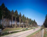
Southern views of the Aespli Forest before clearing for the new SBB railroad line (Bahn2000), in the foreground the A1 freeway, general view; coordinates (LV03) of the camera location: 606840/209160; keywords Documenta Natura: recreation area
Caption (German)
Südansichten des Aespliwaldes vor der Rodung für die SBB Neubaustrecke (Bahn2000), im Vordergrund die Autobahn A1, Gesamtansicht; Koordinaten (LV03) des Kamerastandorts: 606840/209160; Schlagworte Documenta Natura: Freizeitanlage
Record Name
Dia_303-00372

Title (German)
Mattstetten BE, Südansicht des Aespliwaldes, im Vordergrund die Autobahn N1
Caption
Southern views of the Aespli Forest, 1st follow-up photograph after clearing for the new SBB railroad line (Bahn2000), in the foreground the A1 freeway, general view; coordinates (LV03) of the camera location: 606840/209160; keywords Documenta Natura: deciduous tree
Caption (German)
Südansichten des Aespliwaldes, 1. Folgeaufnahme nach der Rodung für die SBB Neubaustrecke (Bahn2000), im Vordergrund die Autobahn A1, Gesamtansicht; Koordinaten (LV03) des Kamerastandorts: 606840/209160; Schlagworte Documenta Natura: Laubbaum
Record Name
Dia_303-00386

Title (German)
Mattstetten BE, Südansicht des Aespliwaldes, im Vordergrund die Autobahn N1
Caption
Southern views of the Aespli Forest, 1st follow-up photograph after clearing for the new SBB railroad line (Bahn2000), in the foreground the A1 freeway, general view; coordinates (LV03) of the camera location: 606840/209160; keywords Documenta Natura: deciduous tree
Caption (German)
Südansichten des Aespliwaldes, 1. Folgeaufnahme nach der Rodung für die SBB Neubaustrecke (Bahn2000), im Vordergrund die Autobahn A1, Gesamtansicht; Koordinaten (LV03) des Kamerastandorts: 606840/209160; Schlagworte Documenta Natura: Laubbaum
Record Name
Dia_303-00395

Title (German)
Mattstetten BE, Nordansicht des Aespliwaldes, im Vordergrund die Bahnlinie der SBB
Caption
North view of the cleared Aespliwald, in the foreground the SBB railroad line, in the background the construction site Bahn 2000 (Grauholz) with construction machines standing around, general view; coordinates (LV03) of the camera location: 606fff/209fff; keywords Documenta Natura: deciduous tree
Caption (German)
Nordansicht des gerodeten Aespliwaldes, im Vordergrund die SBB-Bahnlinie, im Hintergrund die Baustelle Bahn 2000 (Grauholz) mit herumstehenden Baumaschinen, Gesamtansicht; Koordinaten (LV03) des Kamerastandorts: 606fff/209fff; Schlagworte Documenta Natura: Laubbaum
Record Name
Dia_303-00404

Title (German)
Mattstetten BE, Nordansicht des Aespliwaldes, im Vordergrund die Bahnlinie der SBB
Caption
North view of the cleared Aespli forest, in the foreground the SBB railroad line, in the background the construction site Bahn 2000 (Grauholz) with construction machines standing around, general view; coordinates (LV03) of the camera location: 606fff/209fff; keywords Documenta Natura: valley
Caption (German)
Nordansicht des gerodeten Aespliwaldes, im Vordergrund die SBB-Bahnlinie, im Hintergrund die Baustelle Bahn 2000 (Grauholz) mit herumstehenden Baumaschinen, Gesamtansicht; Koordinaten (LV03) des Kamerastandorts: 606fff/209fff; Schlagworte Documenta Natura: Tal
Record Name
Dia_303-00408

Title (German)
Mattstetten BE, Nordansicht des Aespliwaldes, im Vordergrund die Bahnlinie der SBB
Caption
North view of the cleared Aespli forest, in the foreground the SBB railroad line, in the background the construction site Bahn 2000 (Grauholz) with construction machines standing around, general view; coordinates (LV03) of the camera location: 606fff/209fff; keywords Documenta Natura: valley
Caption (German)
Nordansicht des gerodeten Aespliwaldes, im Vordergrund die SBB-Bahnlinie, im Hintergrund die Baustelle Bahn 2000 (Grauholz) mit herumstehenden Baumaschinen, Gesamtansicht; Koordinaten (LV03) des Kamerastandorts: 606fff/209fff; Schlagworte Documenta Natura: Tal
Record Name
Dia_303-00412

Title (German)
Mattstetten BE, Westansicht des Aespliwaldes
Caption
West views of Aespliwald with clearing area and windthrow damage, in the foreground farmland and the SBB railroad line, general view; keywords Documenta Natura: wetland.
Caption (German)
Westansichten des Aespliwaldes mit Rodungsfläche und Windwurfflächenschaden, im Vordergrund Ackerland und die SBB-Bahnlinie, Gesamtansicht; Schlagworte Documenta Natura: Feuchtgebiet
Record Name
Dia_303-00422
Title (German)
Mattstetten BE, Westansicht des Aespliwaldes
Caption
West views of Aespliwald with clearing area and windthrow damage, in the foreground farmland and the SBB railroad line, general view; keywords Documenta Natura: wetland.
Caption (German)
Westansichten des Aespliwaldes mit Rodungsfläche und Windwurfflächenschaden, im Vordergrund Ackerland und die SBB-Bahnlinie, Gesamtansicht; Schlagworte Documenta Natura: Feuchtgebiet
Record Name
Dia_303-00425

Title (German)
Mattstetten BE, Westansicht des Aespliwaldes
Caption
West views of Aespliwald with clearing area and windthrow damage, in the foreground farmland and the SBB railroad line, general view; keywords Documenta Natura: wetland.
Caption (German)
Westansichten des Aespliwaldes mit Rodungsfläche und Windwurfflächenschaden, im Vordergrund Ackerland und die SBB-Bahnlinie, Gesamtansicht; Schlagworte Documenta Natura: Feuchtgebiet
Record Name
Dia_303-00428

Title (German)
Airolo TI, Südansicht von Airolo mit Südhang
Caption
South view of Airolo in autumn, with ban forest and avalanche control area, reverse slope view, general view; coordinates (LV03) of camera location: 689980/152850; keywords Documenta Natura: wetland
Caption (German)
Südansicht von Airolo im Herbst, mit Bannwald und Lawinenverbauungsgebiet, Gegenhangaufnahme, Gesamtansicht; Koordinaten (LV03) des Kamerastandorts: 689980/152850; Schlagworte Documenta Natura: Feuchtgebiet
Record Name
Dia_303-00448

Title (German)
Airolo TI, Südansicht von Airolo mit Südhang
Caption
South view of Airolo in autumn, with ban forest and avalanche control area, reverse slope view, general view; coordinates (LV03) of camera location: 689980/152850; keywords Documenta Natura: wetland
Caption (German)
Südansicht von Airolo im Herbst, mit Bannwald und Lawinenverbauungsgebiet, Gegenhangaufnahme, Gesamtansicht; Koordinaten (LV03) des Kamerastandorts: 689980/152850; Schlagworte Documenta Natura: Feuchtgebiet
Record Name
Dia_303-00451

Title (German)
Airolo TI, Felshang I Dragoni bei Pontino di fuori
Caption
Rock outcrop, detail view; keywords Documenta Natura: wetland
Caption (German)
Felsvorsprung, Detailansicht; Schlagworte Documenta Natura: Feuchtgebiet
Record Name
Dia_303-00455

Title (German)
Airolo TI, Südhang oberhalb des Schutzwaldes
Caption
Avalanche control area, partial view; coordinates (LV03) of camera location: 689293/155488; keywords Documenta Natura: wetland.
Caption (German)
Lawinenverbauungsgebiet, Teilansicht; Koordinaten (LV03) des Kamerastandorts: 689293/155488; Schlagworte Documenta Natura: Feuchtgebiet
Record Name
Dia_303-00457

Title (German)
Airolo TI, Südhang oberhalb des Schutzwaldes
Caption
Avalanche control area, partial view; coordinates (LV03) of camera location: 689695/155765; keywords Documenta Natura: shore.
Caption (German)
Lawinenverbauungsgebiet, Teilansicht; Koordinaten (LV03) des Kamerastandorts: 689695/155765; Schlagworte Documenta Natura: Ufer
Record Name
Dia_303-00463

Title (German)
Airolo TI, Südhang oberhalb des Schutzwaldes
Caption
Avalanche control area, partial view; coordinates (LV03) of camera location: 689300/155538; keywords Documenta Natura: shore.
Caption (German)
Lawinenverbauungsgebiet, Teilansicht; Koordinaten (LV03) des Kamerastandorts: 689300/155538; Schlagworte Documenta Natura: Ufer
Record Name
Dia_303-00468

Title (German)
Airolo TI, Südhang oberhalb des Schutzwaldes
Caption
Avalanche control area, partial view; coordinates (LV03) of camera location: 689450/155255; keywords Documenta Natura: shore.
Caption (German)
Lawinenverbauungsgebiet, Teilansicht; Koordinaten (LV03) des Kamerastandorts: 689450/155255; Schlagworte Documenta Natura: Ufer
Record Name
Dia_303-00474

Title (German)
Airolo TI, Südhang oberhalb des Schutzwaldes
Caption
Avalanche control area, partial view; coordinates (LV03) of camera location: 690310/156120; keywords Documenta Natura: shore.
Caption (German)
Lawinenverbauungsgebiet, Teilansicht; Koordinaten (LV03) des Kamerastandorts: 690310/156120; Schlagworte Documenta Natura: Ufer
Record Name
Dia_303-00481

Title (German)
Airolo TI, Südhang oberhalb des Schutzwaldes
Caption
Avalanche control area, partial view; coordinates (LV03) of camera location: 690310/156120; keywords Documenta Natura: woodcutting.
Caption (German)
Lawinenverbauungsgebiet, Teilansicht; Koordinaten (LV03) des Kamerastandorts: 690310/156120; Schlagworte Documenta Natura: Holzhauerei
Record Name
Dia_303-00484

Title (German)
Airolo TI, Blick (Ostansicht) von Brugnasco talaufwärts ins Valle Leventina auf den Talboden mit den Dörfern Airolo und Valle
Caption
East view, 1st reconstruction image (blurred at right edge) with A2 highway and Gotthard roads (1990); coordinates (LV03) of camera location: 692375/153215; keywords Documenta Natura: Holzhauerei
Caption (German)
Ostansicht, 1. Rekonstruktionsaufnahme (am rechten Rand unscharf) mit Autobahn A2 und Gotthardstrassen (1990); Koordinaten (LV03) des Kamerastandorts: 692375/153215; Schlagworte Documenta Natura: Holzhauerei
Record Name
Dia_303-00494

Title (German)
Airolo TI, Blick (Ostansicht) von Brugnasco talaufwärts ins Valle Leventina auf den Talboden mit den Dörfern Airolo und Valle
Caption
East view, 2nd reconstruction photograph (1991); coordinates (LV03) of camera location: 692375/153215; keywords Documenta Natura: woodcutting.
Caption (German)
Ostansicht, 2. Rekonstruktionsaufnahme (1991); Koordinaten (LV03) des Kamerastandorts: 692375/153215; Schlagworte Documenta Natura: Holzhauerei
Record Name
Dia_303-00501

Title (German)
Airolo TI, Blick (Westansicht) von der alten Gotthardstrasse talabwärts ins Valle Leventina auf das Dorf Airolo
Caption
West view, reconstruction photo (1990) with Gotthard road, power plant lake, A4 highway; coordinates (LV03) of camera location: 688300/154245; keywords Documenta Natura: Holzhauerei
Caption (German)
Westansicht, Rekonstruktionsaufnahme (1990) mit Gotthardstrasse, Kraftwerksee, Autobahn A4; Koordinaten (LV03) des Kamerastandorts: 688300/154245; Schlagworte Documenta Natura: Holzhauerei
Record Name
Dia_303-00507

Title (German)
Airolo TI, Blick (Westansicht) von der alten Gotthardstrasse talabwärts ins Valle Leventina auf das Dorf Airolo
Caption
West view, reconstruction shot with Gotthard road, power plant lake, A2 highway (2004); coordinates (LV03) of camera location: 688300/154095; keywords Documenta Natura: Holzhauerei
Caption (German)
Westansicht, Rekonstruktionsaufnahme mit Gotthardstrasse, Kraftwerksee, Autobahn A2 (2004); Koordinaten (LV03) des Kamerastandorts: 688300/154095; Schlagworte Documenta Natura: Holzhauerei
Record Name
Dia_303-00511

Airolo TI, northwest view of the landslide on the western slope of Val Canaria opposite Sotto Corte.
Title (German)
Airolo TI, Nordwestansicht der Rutschung im Westhang des Val Canaria gegenüber Sotto Corte
Caption
Northwest views of the landslide in the wooded escarpment, western slope of Val Canaria, in the foreground the valley floor with road, car and stable of Sotte Corte, counter-slope view, general view; coordinates (LV03) of the camera location: 691913/154805; keywords Documenta Natura: Berghuette
Caption (German)
Nordwestansichten der Rutschung im bewaldeten Steilhang, Westhang des Val Canaria, im Vordergrund der Talboden mit Strasse, Auto und Stall von Sotte Corte, Gegenhangaufnahme, Gesamtansicht; Koordinaten (LV03) des Kamerastandorts: 691913/154805; Schlagworte Documenta Natura: Berghuette
Record Name
Dia_303-00518

Airolo TI, northwest view of the landslide on the western slope of Val Canaria opposite Sotto Corte.
Title (German)
Airolo TI, Nordwestansicht der Rutschung im Westhang des Val Canaria gegenüber Sotto Corte
Caption
Northwest views of the landslide in the wooded escarpment, west slope of Val Canaria, in the foreground partly the valley floor with road, car and stable of Sotte Corte, counter-slope view, general view, partial view; coordinates (LV03) of the camera location: 691913/154805; keywords Documenta Natura: Berghuette
Caption (German)
Nordwestansichten der Rutschung im bewaldeten Steilhang, Westhang des Val Canaria, im Vordergrund z. T. der Talboden mit Strasse, Auto und Stall von Sotte Corte, Gegenhangaufnahme, Gesamtansicht, Teilansicht; Koordinaten (LV03) des Kamerastandorts: 691913/154805; Schlagworte Documenta Natura: Berghuette
Record Name
Dia_303-00528

Title (German)
Airolo TI, Nordostansicht und Ostansicht der Rutschung im Osthang des Val Canaria mit den Weilern Monti und z. T. Raied und Rütan dei Sassi
Caption
Northeast view and east view of the landslide in the forested eastern slope of Val Canaria with the hamlets of Monti, Raied and Rütan dei Sassi, in the foreground the forested counter-slope, in the background partly Pontino, counter-slope view, general view; coordinates (LV03) of the camera location: 692660/155250; keywords Documenta Natura: mountain bike
Caption (German)
Nordostansicht und Ostansicht der Rutschung im bewaldeten Osthang des Val Canaria mit den Weilern Monti, Raied und Rütan dei Sassi, im Vordergrund der bewaldete Gegenhang, im Hintergrund teilweise Pontino, Gegenhangaufnahme, Gesamtansicht; Koordinaten (LV03) des Kamerastandorts: 692660/155250; Schlagworte Documenta Natura: Mountainbike
Record Name
Dia_303-00533

Title (German)
Airolo TI, Nordostansicht und Ostansicht der Rutschung im Osthang des Val Canaria mit den Weilern Monti und z. T. Raied und Rütan dei Sassi
Caption
Northeast view and east view of the landslide in the forested eastern slope of Val Canaria with the hamlets of Monti, Raied and Rütan dei Sassi, in the foreground the forested counter-slope, in the background partly Pontino, counter-slope view, general view; coordinates (LV03) of the camera location: 692660/155250; keywords Documenta Natura: mountain bike
Caption (German)
Nordostansicht und Ostansicht der Rutschung im bewaldeten Osthang des Val Canaria mit den Weilern Monti, Raied und Rütan dei Sassi, im Vordergrund der bewaldete Gegenhang, im Hintergrund teilweise Pontino, Gegenhangaufnahme, Gesamtansicht; Koordinaten (LV03) des Kamerastandorts: 692660/155250; Schlagworte Documenta Natura: Mountainbike
Record Name
Dia_303-00536

Title (German)
Airolo TI, Nordostansicht und Ostansicht der Rutschung im Osthang des Val Canaria mit den Weilern Monti und z. T. Raied und Rütan dei Sassi
Caption
Northeast view and east view of the landslide in the forested eastern slope of Val Canaria with the hamlets of Monti, Raied and Rütan dei Sassi, in the foreground the forested counter-slope, in the background partly Pontino, counter-slope view, general view; coordinates (LV03) of the camera location: 692565/154880; keywords Documenta Natura: mountain biking
Caption (German)
Nordostansicht und Ostansicht der Rutschung im bewaldeten Osthang des Val Canaria mit den Weilern Monti, Raied und Rütan dei Sassi, im Vordergrund der bewaldete Gegenhang, im Hintergrund teilweise Pontino, Gegenhangaufnahme, Gesamtansicht; Koordinaten (LV03) des Kamerastandorts: 692565/154880; Schlagworte Documenta Natura: Mountainbike
Record Name
Dia_303-00543

Title (German)
Airolo TI, Nordostansicht und Ostansicht der Rutschung im Osthang des Val Canaria mit den Weilern Monti und z. T. Raied und Rütan dei Sassi
Caption
Northeast view and east view of the landslide in the forested eastern slope of Val Canaria with the hamlets of Monti, Raied and Rütan dei Sassi, in the foreground the forested counter-slope, in the background partly Pontino, counter-slope view, general view; coordinates (LV03) of the camera location: 692565/154880; keywords Documenta Natura: mountain biking
Caption (German)
Nordostansicht und Ostansicht der Rutschung im bewaldeten Osthang des Val Canaria mit den Weilern Monti, Raied und Rütan dei Sassi, im Vordergrund der bewaldete Gegenhang, im Hintergrund teilweise Pontino, Gegenhangaufnahme, Gesamtansicht; Koordinaten (LV03) des Kamerastandorts: 692565/154880; Schlagworte Documenta Natura: Mountainbike
Record Name
Dia_303-00546

Title (German)
Campo (Vallemaggia) TI, Ostansicht von Campo Vallemaggia
Caption
East view of Campo Vallemaggia with the two churches and the stations of the cross along the road, partial view; coordinates (LV03) of the camera location: 681325/126925; keywords Documenta Natura: deciduous tree
Caption (German)
Ostansicht von Campo Vallemaggia mit den beiden Kirchen und den Kreuzwegstationen entlang der Strasse, Teilansicht; Koordinaten (LV03) des Kamerastandorts: 681325/126925; Schlagworte Documenta Natura: Laubbaum
Record Name
Dia_303-00553

Title (German)
Campo (Vallemaggia) TI, Nordansicht von Cimalmotto
Caption
North view of Cimalmotto with the church, in the foreground vacation house not part of the scene, partial view; coordinates (LV03) of the camera location: 681020/126495; keywords Documenta Natura: Kurort
Caption (German)
Nordansicht von Cimalmotto mit der Kirche, im Vordergrund ortsbildfremdes Ferienhaus, Teilansicht; Koordinaten (LV03) des Kamerastandorts: 681020/126495; Schlagworte Documenta Natura: Kurort
Record Name
Dia_303-00560

Title (German)
Campo (Vallemaggia) TI, Südwestansicht von Campo mit Rutschung u
Caption
Southwest view of Campo with landslide and riverbed of the Rovana, in the background the Valle di Campo with Piano di Campo, general view; coordinates (LV03) of the camera location: 681138/126260; keywords Documenta Natura: health resort
Caption (German)
Südwestansicht von Campo mit Rutschung und Flussbett der Rovana, im Hintergrund das Valle di Campo mit Piano di Campo, Gesamtansicht; Koordinaten (LV03) des Kamerastandorts: 681138/126260; Schlagworte Documenta Natura: Kurort
Record Name
Dia_303-00566

Title (German)
Campo (Vallemaggia) TI, Südwestansicht von Campo mit Rutschung und Rovana, im Hintergrund das Valle di Campo mit Piano di Campo
Caption
Southwest view of Campo with landslide and riverbed of the Rovana, in the background the Valle di Campo with Piano di Campo, general view; coordinates (LV03) of the camera location: 681138/126260; keywords Documenta Natura: snail
Caption (German)
Südwestansicht von Campo mit Rutschung und Flussbett der Rovana, im Hintergrund das Valle di Campo mit Piano di Campo, Gesamtansicht; Koordinaten (LV03) des Kamerastandorts: 681138/126260; Schlagworte Documenta Natura: Schnecke
Record Name
Dia_303-00569

Title (German)
Campo (Vallemaggia) TI, Südansicht der Rutschung Aroina Frana mit Rovana, Campo, Südhang und z. T. Pizzo Bombögn
Caption
South view of the landslide with the Rovana stream, the village of Campo, the southern slope with Bannwald and Pizzo Bombögn, in the foreground the opposite slope, first photo taken in 1989, general view; coordinates (LV03) of the camera location: 681700/125913; keywords Documenta Natura: windthrow
Caption (German)
Südansicht der Rutschung mit dem Bach Rovana, dem Dorf Campo, dem Südhang mit Bannwald und dem Pizzo Bombögn, im Vordergrund der Gegenhang, Erstaufnahme 1989, Gesamtansicht; Koordinaten (LV03) des Kamerastandorts: 681700/125913; Schlagworte Documenta Natura: Windwurf
Record Name
Dia_303-00587

Title (German)
Campo (Vallemaggia) TI, Südansicht der Rutschung Aroina Frana mit Rovana, Campo, Südhang und z. T. Pizzo Bombögn
Caption
South view of the landslide with the Rovana stream, the village of Campo, the southern slope with Bannwald and partly Pizzo Bombögn, in the foreground the opposite slope, general view, 1st follow-up photo; coordinates (LV03) of the camera location: 681700/125913; keywords Documenta Natura: windthrow
Caption (German)
Südansicht der Rutschung mit dem Bach Rovana, dem Dorf Campo, dem Südhang mit Bannwald und z. T. dem Pizzo Bombögn, im Vordergrund der Gegenhang, Gesamtansicht, 1. Folgeaufnahme; Koordinaten (LV03) des Kamerastandorts: 681700/125913; Schlagworte Documenta Natura: Windwurf
Record Name
Dia_303-00594

Title (German)
Anzonico TI, Südwesthang oberhalb Anzonico
Caption
View upslope into the landslide defense with supporting structures made of stone baskets and a drainage channel, general view; keywords Documenta Natura: Windthrow.
Caption (German)
Blick hangaufwärts in die Rutschverbauung mit Stützwerken aus Steinkörben und einem Entwässerungskanal, Gesamtansicht; Schlagworte Documenta Natura: Windwurf
Record Name
Dia_303-00597

Title (German)
Anzonico TI, Südwesthang oberhalb Anzonico
Caption
View upslope into the landslide support structure with supporting structures made of stone baskets and a drainage channel, general view; keywords Documenta Natura: work
Caption (German)
Blick hangaufwärts in die Rutschverbauung mit Stützwerken aus Steinkörben und einem Entwässerungskanal, Gesamtansicht; Schlagworte Documenta Natura: Arbeit
Record Name
Dia_303-00601
Title (German)
Sigirino TI, Mezzovico-Vira TI, Camignolo TI, Bironico TI, Blick talaufwärts ins Valle del Vedeggio mit Sigirino, Mezzovico, Vira, Camignolo und Bironico, im Hintergrund der Cima di Medeglia
Caption
View from Monticello up the valley to Valle del Vedeggio with Sigirino, Mezzovico, Vira, Camignolo and Bironico, partly with Monte Bigorio, historical photo 1934, general view; coordinates (LV03) of the camera location: 713770/103318; keywords Documenta Natura: Ebene
Caption (German)
Blick von Monticello talaufwärts ins Valle del Vedeggio mit Sigirino, Mezzovico, Vira, Camignolo und Bironico, teilweise mit Monte Bigorio, historische Aufnahme 1934, Gesamtansicht; Koordinaten (LV03) des Kamerastandorts: 713770/103318; Schlagworte Documenta Natura: Ebene
Record Name
Dia_303-00609

Title (German)
Sigirino TI, Mezzovico-Vira TI, Camignolo TI, Bironico TI, Blick talaufwärts ins Valle del Vedeggio mit Sigirino, Mezzovico, Vira, Camignolo und Bironico, im Hintergrund der Cima di Medeglia
Caption
View from Monticello up the valley into the Valle del Vedeggio with Sigirino, Mezzovico, Vira, Camignolo and Bironico, industrial zone, highway, partly with Monte Bigorio, general view, reconstruction photo (1991); coordinates (LV03) of the camera location: 713755/103313; keywords Documenta Natura: high forest
Caption (German)
Blick von Monticello talaufwärts ins Valle del Vedeggio mit Sigirino, Mezzovico, Vira, Camignolo und Bironico, Industriezone, Autobahn, teilweise mit Monte Bigorio, Gesamtansicht, Rekonstruktionsaufnahme (1991); Koordinaten (LV03) des Kamerastandorts: 713755/103313; Schlagworte Documenta Natura: Hochwald
Record Name
Dia_303-00610

Title (German)
Sigirino TI, Mezzovico-Vira TI, Camignolo TI, Bironico TI, Blick talaufwärts ins Valle del Vedeggio mit Sigirino, Mezzovico, Vira, Camignolo und Bironico, im Hintergrund der Cima di Medeglia
Caption
View from Monticello up the valley into Valle del Vedeggio with Sigirino, Mezzovico, Vira, Camignolo and Bironico, industrial zone, highway, partly with Monte Bigorio, reconstruction photo (1991), general view; coordinates (LV03) of the camera location: 713755/103313; keywords Documenta Natura: high forest
Caption (German)
Blick von Monticello talaufwärts ins Valle del Vedeggio mit Sigirino, Mezzovico, Vira, Camignolo und Bironico, Industriezone, Autobahn, teilweise mit Monte Bigorio, Rekonstruktionsaufnahme (1991), Gesamtansicht; Koordinaten (LV03) des Kamerastandorts: 713755/103313; Schlagworte Documenta Natura: Hochwald
Record Name
Dia_303-00620

Title (German)
Sigirino TI, Mezzovico-Vira TI, Camignolo TI, Bironico TI, Blick talaufwärts ins Valle del Vedeggio mit Sigirino, Mezzovico, Vira, Camignolo und Bironico, im Hintergrund der Cima di Medeglia
Caption
View from Monticello up the valley into Valle del Vedeggio with Sigirino, Mezzovico, Vira, Camignolo and Bironico, industrial zone, highway, partly with Monte Bigorio, reconstruction photo (1991), general view; coordinates (LV03) of the camera location: 713755/103313; keywords Documenta Natura: high forest
Caption (German)
Blick von Monticello talaufwärts ins Valle del Vedeggio mit Sigirino, Mezzovico, Vira, Camignolo und Bironico, Industriezone, Autobahn, teilweise mit Monte Bigorio, Rekonstruktionsaufnahme (1991), Gesamtansicht; Koordinaten (LV03) des Kamerastandorts: 713755/103313; Schlagworte Documenta Natura: Hochwald
Record Name
Dia_303-00624

Title (German)
Luchsingen GL, Nordwestansicht der Risi oberhalb Hätzingen
Caption
Northwest views of the Risi clearcut area, with avalanche barriers in the uppermost part, general view. Observation and experimental plots after the hurricane "Viivian": Similarly situated areas were either left devastated or cleared, secured against snow slides and left to natural new growth, or cleared, secured against snow slides and planted. Afterwards, the areas were observed to see which method gave the best results; Keywords Documenta Natura: High Forest
Caption (German)
Nordwestansichten der Kahlfläche Risi, mit Lawinenverbauungen im obersten Teil, Gesamtansicht. Beobachtungs- und Versuchsflächen nach dem Orkan "Viivian": Gleichgelagerte Flächen wurden entweder verheert belassen oder ausgeräumt, gegen Schneerutsch gesichert und dem natürlichen Neubewuchs überlassen oder ausgeräumt, gegen Schneerutsch gesichert und angepflanzt. Danach wurden die Flächen beobachtet um zu sehen, welche Methode die besten Resultate ergibt; Schlagworte Documenta Natura: Hochwald
Record Name
Dia_303-00626

Title (German)
Luchsingen GL, Nordwestansicht der Risi oberhalb Hätzingen
Caption
Northwest views of the Risi clearcut area, with avalanche barriers in the uppermost part, general view. Observation and experimental plots after the hurricane "Viivian": Similarly situated areas were either left devastated or cleared, secured against snow slides and left to natural new growth, or cleared, secured against snow slides and planted. Afterwards, the areas were observed to see which method gave the best results; Keywords Documenta Natura: High Forest
Caption (German)
Nordwestansichten der Kahlfläche Risi, mit Lawinenverbauungen im obersten Teil, Gesamtansicht. Beobachtungs- und Versuchsflächen nach dem Orkan "Viivian": Gleichgelagerte Flächen wurden entweder verheert belassen oder ausgeräumt, gegen Schneerutsch gesichert und dem natürlichen Neubewuchs überlassen oder ausgeräumt, gegen Schneerutsch gesichert und angepflanzt. Danach wurden die Flächen beobachtet um zu sehen, welche Methode die besten Resultate ergibt; Schlagworte Documenta Natura: Hochwald
Record Name
Dia_303-00629

Title (German)
Luchsingen GL, Nordwestansicht des Nordwesthanges oberhalb Hätzingen mit dem Sellboden, Chatzenritt, der Kahlfläche Risi und der Rufizüg, im Vordergrund Luchsingen und Hätzingen
Caption
Northwest view of the northwest slope above Hätzingen with the bare Risi area (forced use due to windthrow), in the foreground the church of Luchsingen and Hätzingen, counter-slope view, general view; coordinates (LV03) of the camera location: 721338/203095. Observation and experimental areas after the hurricane "Viivian": Areas of the same location were either left devastated or cleared, secured against snow slide and left to natural new growth, or cleared, secured against snow slide and planted. Afterwards, the areas were observed to see which method gave the best results; Keywords Documenta Natura: High Forest
Caption (German)
Nordwestansicht des Nordwesthanges oberhalb Hätzingen mit der Kahlfläche Risi (Zwangsnutzung wegen Windwurf ), im Vordergrund die Kirche von Luchsingen und Hätzingen, Gegenhangaufnahme, Gesamtansicht; Koordinaten (LV03) des Kamerastandorts: 721338/203095. Beobachtungs- und Versuchsflächen nach dem Orkan "Viivian": Gleichgelagerte Flächen wurden entweder verheert belassen oder ausgeräumt, gegen Schneerutsch gesichert und dem natürlichen Neubewuchs überlassen oder ausgeräumt, gegen Schneerutsch gesichert und angepflanzt. Danach wurden die Flächen beobachtet um zu sehen, welche Methode die besten Resultate ergibt; Schlagworte Documenta Natura: Hochwald
Record Name
Dia_303-00639

Title (German)
Luchsingen GL, Nordwestansicht des Nordwesthanges oberhalb Hätzingen mit dem Sellboden, Chatzenritt, der Kahlfläche Risi und der Rufizüg, im Vordergrund Luchsingen und Hätzingen
Caption
Northwest view of the northwest slope above Hätzingen with the Risi clearing area (forced use due to windthrow), in the foreground the church of Luchsingen and Hätzingen, counter-slope view, general view; coordinates (LV03) of the camera location: 721338/203095. Observation and experimental areas after the hurricane "Viivian": Areas of the same location were either left devastated or cleared, secured against snow slide and left to natural new growth, or cleared, secured against snow slide and planted. Afterwards, the areas were observed to see which method gave the best results; Keywords Documenta Natura: clearing
Caption (German)
Nordwestansicht des Nordwesthanges oberhalb Hätzingen mit der Kahlfläche Risi (Zwangsnutzung wegen Windwurf), im Vordergrund die Kirche von Luchsingen und Hätzingen, Gegenhangaufnahme, Gesamtansicht; Koordinaten (LV03) des Kamerastandorts: 721338/203095. Beobachtungs- und Versuchsflächen nach dem Orkan "Viivian": Gleichgelagerte Flächen wurden entweder verheert belassen oder ausgeräumt, gegen Schneerutsch gesichert und dem natürlichen Neubewuchs überlassen oder ausgeräumt, gegen Schneerutsch gesichert und angepflanzt. Danach wurden die Flächen beobachtet um zu sehen, welche Methode die besten Resultate ergibt; Schlagworte Documenta Natura: Rodung
Record Name
Dia_303-00647

Title (German)
Därligen BE, Nordwestansicht des Nordwesthanges mit Gratwald, im Vordergrund der Hafenquai von Därligen und der Thunersee
Caption
Northwest view of northwest slope with ridge forest, 1st subsequent photograph (1992); coordinates (LV03) of camera location: 628260/168195; keywords Documenta Natura: clearing.
Caption (German)
Nordwestansicht des Nordwesthanges mit Gratwald, 1. Folgeaufnahme (1992); Koordinaten (LV03) des Kamerastandorts: 628260/168195; Schlagworte Documenta Natura: Rodung
Record Name
Dia_303-00651

Title (German)
Därligen BE, Nordwestansicht des Nordwesthanges mit Gratwald, im Vordergrund der Hafenquai von Därligen und der Thunersee
Caption
Northwestern view of the northwestern slope with ridge forest, 1st subsequent photograph (1992); coordinates (LV03) of camera location: 628260/168195; keywords Documenta Natura: high forest.
Caption (German)
Nordwestansicht des Nordwesthanges mit Gratwald, 1. Folgeaufnahme (1992); Koordinaten (LV03) des Kamerastandorts: 628260/168195; Schlagworte Documenta Natura: Hochwald
Record Name
Dia_303-00653
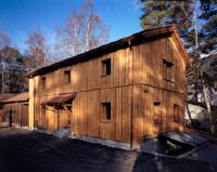
Title (German)
Rodels GR, Im Kantonalen Forstgarten und in der Waldsamenklenge
Caption
Various views of the operational buildings of the forest garden and the forest seed cycle, partial view; keywords Documenta Natura: high forest.
Caption (German)
Verschiedene Ansichten der Betriebsgebäude des Forstgartens und der Waldsamenklenge, Teilansicht; Schlagworte Documenta Natura: Hochwald
Record Name
Dia_303-00659

Title (German)
Rodels GR, Im Kantonalen Forstgarten und in der Waldsamenklenge
Caption
Various views of the farm buildings of the forest garden and the forest seed cycle, partial view; keywords Documenta Natura: windthrow.
Caption (German)
Verschiedene Ansichten der Betriebsgebäude des Forstgartens und der Waldsamenklenge, Teilansicht; Schlagworte Documenta Natura: Windwurf
Record Name
Dia_303-00665

Title (German)
Rodels GR, Im Kantonalen Forstgarten und in der Waldsamenklenge
Caption
Various views of the farm buildings of the forest garden and the forest seed cycle, partial view; keywords Documenta Natura: windthrow.
Caption (German)
Verschiedene Ansichten der Betriebsgebäude des Forstgartens und der Waldsamenklenge, Teilansicht; Schlagworte Documenta Natura: Windwurf
Record Name
Dia_303-00670

Title (German)
Rodels GR, Im Kantonalen Forstgarten und in der Waldsamenklenge
Caption
Various views of the farm buildings of the forest garden and the forest seed cycle, partial view; keywords Documenta Natura: windthrow.
Caption (German)
Verschiedene Ansichten der Betriebsgebäude des Forstgartens und der Waldsamenklenge, Teilansicht; Schlagworte Documenta Natura: Windwurf
Record Name
Dia_303-00676
Title (German)
Rodels GR, Im Betriebsleiterbüro des Forstgartens und der Waldsamenklenge
Caption
Office furnishing with new office furniture system "Impuls", desk combination with office chair and drawer container, double-door cabinet large and small, vertical cabinet with hanging file, meeting table with chairs; keywords Documenta Natura: office furniture system "Impuls", prototype in the office of the Forstgarten in Rodels, 1991.
Caption (German)
Büroeinrichtung mit neuem Büromöbelsystem "Impuls", Schreibtischkombination mit Bürostuhl und Schubladencontainer, Flügeltürschrank gross und klein, Vertikalschrank mit Hängeregistratur, Sitzungstisch mit Stühlen; Schlagworte Documenta Natura: Büromöbelsystem "Impuls", Prototyp im Büro des Forstgarten in Rodels, 1991
Record Name
Dia_303-00682

Title (German)
Rodels GR, Im Betriebsleiterbüro des Forstgartens und der Waldsamenklenge
Caption
Office furnishing with new office furniture system "Impuls", desk combination with office chair and drawer container, double-door cabinet large and small, vertical cabinet with hanging file, meeting table with chairs; keywords Documenta Natura: office furniture system "Impuls", prototype in the office of the Forstgarten in Rodels, 1991.
Caption (German)
Büroeinrichtung mit neuem Büromöbelsystem "Impuls", Schreibtischkombination mit Bürostuhl und Schubladencontainer, Flügeltürschrank gross und klein, Vertikalschrank mit Hängeregistratur, Sitzungstisch mit Stühlen; Schlagworte Documenta Natura: Büromöbelsystem "Impuls", Prototyp im Büro des Forstgarten in Rodels, 1991
Record Name
Dia_303-00689

Title (German)
Rodels GR, Im Betriebsleiterbüro des Forstgartens und der Waldsamenklenge
Caption
Office furnishing with new office furniture system "Impuls", desk combination with office chair and drawer container, double-door cabinet large and small, vertical cabinet with hanging file, meeting table with chairs; keywords Documenta Natura: office furniture system "Impuls", prototype in the office of the Forstgarten in Rodels, 1991.
Caption (German)
Büroeinrichtung mit neuem Büromöbelsystem "Impuls", Schreibtischkombination mit Bürostuhl und Schubladencontainer, Flügeltürschrank gross und klein, Vertikalschrank mit Hängeregistratur, Sitzungstisch mit Stühlen; Schlagworte Documenta Natura: Büromöbelsystem "Impuls", Prototyp im Büro des Forstgarten in Rodels, 1991
Record Name
Dia_303-00699

Title (German)
Rodels GR, Im Betriebsleiterbüro des Forstgartens und der Waldsamenklenge
Caption
Office furnishing with new office furniture system "Impuls", desk combination with office chair and drawer container, double-door cabinet large and small, vertical cabinet with hanging file, meeting table with chairs; keywords Documenta Natura: office furniture system "Impuls", prototype in the office of the Forstgarten in Rodels, 1991.
Caption (German)
Büroeinrichtung mit neuem Büromöbelsystem "Impuls", Schreibtischkombination mit Bürostuhl und Schubladencontainer, Flügeltürschrank gross und klein, Vertikalschrank mit Hängeregistratur, Sitzungstisch mit Stühlen; Schlagworte Documenta Natura: Büromöbelsystem "Impuls", Prototyp im Büro des Forstgarten in Rodels, 1991
Record Name
Dia_303-00704

Title (German)
Chur GR, Nordansicht des Nordwesthanges mit dem Schwarzwald, im Vordergrund die Gewerbezone Kleinbruggen
Caption
North view of the Black Forest with Kleinbruggen industrial zone, first photograph taken in 1992, general view; coordinates (LV03) of the camera location: 757760/191000; keywords Documenta Natura: mountain area
Caption (German)
Nordansicht des Schwarzwaldes mit Gewerbezone Kleinbruggen, Erstaufnahme 1992, Gesamtansicht; Koordinaten (LV03) des Kamerastandorts: 757760/191000; Schlagworte Documenta Natura: Berggebiet
Record Name
Dia_303-00709

Title (German)
Chur GR, Nordansicht des Nordwesthanges mit dem Schwarzwald, im Vordergrund die Gewerbezone Kleinbruggen
Caption
North view of the Black Forest with Kleinbruggen industrial zone, 1st follow-up photograph 1996, general view; coordinates (LV03) of camera location: 757760/191000; keywords Documenta Natura: alluvial forest.
Caption (German)
Nordansicht des Schwarzwaldes mit Gewerbezone Kleinbruggen, 1. Folgeaufnahme 1996, Gesamtansicht; Koordinaten (LV03) des Kamerastandorts: 757760/191000; Schlagworte Documenta Natura: Auenwald
Record Name
Dia_303-00715

Title (German)
Chur GR, Nordansicht des Nordwesthanges mit dem Schwarzwald, im Vordergrund die Gewerbezone Kleinbruggen
Caption
North view of the Black Forest with Kleinbruggen industrial zone, 1st follow-up photograph 1996, general view; coordinates (LV03) of camera location: 757760/191000; keywords Documenta Natura: Verwachsung
Caption (German)
Nordansicht des Schwarzwaldes mit Gewerbezone Kleinbruggen, 1. Folgeaufnahme 1996, Gesamtansicht; Koordinaten (LV03) des Kamerastandorts: 757760/191000; Schlagworte Documenta Natura: Verwachsung
Record Name
Dia_303-00719

Title (German)
Chur GR, Nordwestansicht des Nordwesthanges mit dem Schwarzwald, im Vordergrund die Weide Foral
Caption
Northwest view of the northwest slope with the black forest, in the foreground the pasture Foral with hedges and scrub forest, general view; coordinates (LV03) of the camera location: 757550/189950; keywords Documenta Natura: edge of the forest.
Caption (German)
Nordwestansicht des Nordwesthanges mit dem Schwarzwald, im Vordergrund die Weide Foral mit Hecken und Gebüschwald, Gesamtansicht; Koordinaten (LV03) des Kamerastandorts: 757550/189950; Schlagworte Documenta Natura: Waldrand
Record Name
Dia_303-00727

Title (German)
Chur GR, Nordwestansicht des Nordwesthanges mit dem Schwarzwald, im Vordergrund die Weide Foral
Caption
Northwest view of the northwest slope with the black forest, in the foreground the pasture Foral with hedges and scrub forest, general view; coordinates (LV03) of the camera location: 757550/189950; keywords Documenta Natura: edge of forest.
Caption (German)
Nordwestansicht des Nordwesthanges mit dem Schwarzwald, im Vordergrund die Weide Foral mit Hecken und Gebüschwald, Gesamtansicht; Koordinaten (LV03) des Kamerastandorts: 757550/189950; Schlagworte Documenta Natura: Waldrand
Record Name
Dia_303-00729

Title (German)
Chur GR, Nordwestansicht des Nordwesthanges mit dem Schwarzwald, im Vordergrund die Weide Foral
Caption
Northwest view of the northwest slope with the black forest, in the foreground the pasture Foral with hedges and scrub forest, partial view; coordinates (LV03) of the camera location: 757550/189950; keywords Documenta Natura: edge of forest.
Caption (German)
Nordwestansicht des Nordwesthanges mit dem Schwarzwald, im Vordergrund die Weide Foral mit Hecken und Gebüschwald, Teilansicht; Koordinaten (LV03) des Kamerastandorts: 757550/189950; Schlagworte Documenta Natura: Waldrand
Record Name
Dia_303-00735

Title (German)
Chur GR, Nordwestansicht des Nordwesthanges mit dem Schwarzwald, im Vordergrund Chur mit Talboden, Blick ins Schanfigg, Gebirgskette mit Weisshorn, Gürgaletsch und Furggabüel
Caption
Northwest view of the northwest slope with the Black Forest, in the foreground Chur with valley floor, view into Schanfigg, mountain range with the Weisshorn, Gürgaletsch and Furggabüel, first exposure 1992, reverse slope exposure, general view; coordinates (LV03) of the camera location: 756480/192500; keywords Documenta Natura: forest edge
Caption (German)
Nordwestansicht des Nordwesthanges mit dem Schwarzwald, im Vordergrund Chur mit Talboden, Blick ins Schanfigg, Gebirgskette mit dem Weisshorn, Gürgaletsch und Furggabüel, Erstaufnahme 1992, Gegenhangaufnahme, Gesamtansicht; Koordinaten (LV03) des Kamerastandorts: 756480/192500; Schlagworte Documenta Natura: Waldrand
Record Name
Dia_303-00740

Title (German)
Chur GR, Nordwestansicht des Nordwesthanges mit dem Schwarzwald, im Vordergrund Chur mit Talboden, Blick ins Schanfigg, Gebirgskette mit Weisshorn, Gürgaletsch und Furggabüel
Caption
Northwest view of the northwest slope with the Black Forest, in the foreground Chur with valley floor, view into Schanfigg, mountain range with the Weisshorn, Gürgaletsch and Furggabüel, first exposure 1992, reverse slope exposure, general view; coordinates (LV03) of the camera location: 756480/192500; keywords Documenta Natura: lake
Caption (German)
Nordwestansicht des Nordwesthanges mit dem Schwarzwald, im Vordergrund Chur mit Talboden, Blick ins Schanfigg, Gebirgskette mit dem Weisshorn, Gürgaletsch und Furggabüel, Erstaufnahme 1992, Gegenhangaufnahme, Gesamtansicht; Koordinaten (LV03) des Kamerastandorts: 756480/192500; Schlagworte Documenta Natura: See
Record Name
Dia_303-00742

Title (German)
Flims GR, Blick (Südansicht) über die Geröllhalde des Bergsturzes oberhalb des Waldes Uaul da Preuls
Caption
South view uphill over the scree of the landslide with boulders and conifers (spruce) lying around, in the background the Flimserstein with the demolition site (1998), partial view, 1st follow-up photograph after 2 years (2000); coordinates (LV03) of the camera location: 7402ff/19077f; keywords Documenta Natura: mountain forest
Caption (German)
Südansicht hangaufwärts über die Geröllhalde des Bergsturzes mit herumliegenden Felsblöcken und Nadelbäumen (Fichte), im Hintergrund der Flimserstein mit der Abrissstelle (1998), Teilansicht, 1. Folgeaufnahme nach 2 Jahren (2000); Koordinaten (LV03) des Kamerastandorts: 7402ff/19077f; Schlagworte Documenta Natura: Gebirgswald
Record Name
Dia_303-00768

Title (German)
Flims GR, Blick (Südwestansicht) von der Alp Tarschlims zum Flimserstein mit der Alp Cassons und Naraus
Caption
Southwestern view from Alp Tarschlims to Flimserstein with Alp Cassons and Naraus, first exposure 1997, reverse slope exposure, general view; coordinates (LV03) of camera location: 738450/190620; keywords Documenta Natura: Arable terrace
Caption (German)
Südwestansicht von der Alp Tarschlims zum Flimserstein mit der Alp Cassons und Naraus, Erstaufnahme 1997, Gegenhangaufnahme, Gesamtansicht; Koordinaten (LV03) des Kamerastandorts: 738450/190620; Schlagworte Documenta Natura: Ackerbauterrasse
Record Name
Dia_303-00778

Title (German)
Flims GR, Blick (Südwestansicht) von der Alp Tarschlims zum Flimserstein mit der Alp Cassons und Naraus
Caption
Southwest view from Alp Tarschlims to Flimserstein with Alp Cassons and Naraus, first exposure 1997, counter slope exposure, general view; coordinates (LV03) of the camera location: 738450/190620; keywords Documenta Natura: Avalanche Control
Caption (German)
Südwestansicht von der Alp Tarschlims zum Flimserstein mit der Alp Cassons und Naraus, Erstaufnahme 1997, Gegenhangaufnahme, Gesamtansicht; Koordinaten (LV03) des Kamerastandorts: 738450/190620; Schlagworte Documenta Natura: Lawinenverbauung
Record Name
Dia_303-00782

Title (German)
Flims GR, Blick (Südwestansicht) von der Alp Tarschlims zum Flimserstein mit der Alp Cassons und Naraus
Caption
Southwest view from Alp Tarschlims to Flimserstein with Alp Cassons and Naraus, first exposure 1997, counter slope exposure, general view; coordinates (LV03) of the camera location: 738450/190620; keywords Documenta Natura: Avalanche Control
Caption (German)
Südwestansicht von der Alp Tarschlims zum Flimserstein mit der Alp Cassons und Naraus, Erstaufnahme 1997, Gegenhangaufnahme, Gesamtansicht; Koordinaten (LV03) des Kamerastandorts: 738450/190620; Schlagworte Documenta Natura: Lawinenverbauung
Record Name
Dia_303-00786
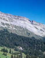
Title (German)
Flims GR, Blick (Südwestansicht) von der Alp Tarschlims zum Flimserstein mit der Alp Cassons und Naraus
Caption
Southwest view from Alp Tarschlims to Flimserstein with Alp Cassons and Naraus, first exposure 1997, counter slope exposure, general view; coordinates (LV03) of the camera location: 738450/190620; keywords Documenta Natura: Avalanche Control
Caption (German)
Südwestansicht von der Alp Tarschlims zum Flimserstein mit der Alp Cassons und Naraus, Erstaufnahme 1997, Gegenhangaufnahme, Gesamtansicht; Koordinaten (LV03) des Kamerastandorts: 738450/190620; Schlagworte Documenta Natura: Lawinenverbauung
Record Name
Dia_303-00790
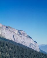
Title (German)
Flims GR, Blick (Südwestansicht) von der Alp Tarschlims zum Flimserstein mit der Alp Cassons und Naraus
Caption
Southwest view from Alp Tarschlims to Flimserstein with Alp Cassons and Naraus, first exposure 1997, counter slope exposure, general view; coordinates (LV03) of camera location: 738450/190620; keywords Documenta Natura: wood transport
Caption (German)
Südwestansicht von der Alp Tarschlims zum Flimserstein mit der Alp Cassons und Naraus, Erstaufnahme 1997, Gegenhangaufnahme, Gesamtansicht; Koordinaten (LV03) des Kamerastandorts: 738450/190620; Schlagworte Documenta Natura: Holztransport
Record Name
Dia_303-00794

Title (German)
Flims GR, Blick (Südwestansicht) von der Alp Tarschlims zum Flimserstein mit der Alp Cassons und Naraus
Caption
Southwest view from the alp Tarschlims to the Flimserstein with the alp Cassons and Naraus, 1st follow-up image 2003, reverse slope image, general view; coordinates (LV03) of the camera location: 738450/190620; keywords Documenta Natura: Alpine settlement
Caption (German)
Südwestansicht von der Alp Tarschlims zum Flimserstein mit der Alp Cassons und Naraus, 1. Folgeaufnahme 2003, Gegenhangaufnahme, Gesamtansicht; Koordinaten (LV03) des Kamerastandorts: 738450/190620; Schlagworte Documenta Natura: Alpsiedlung
Record Name
Dia_303-00811

Title (German)
Flims GR, Blick (Südwestansicht) von der Alp Tarschlims zum Flimserstein mit der Alp Cassons und Naraus
Caption
Southwest view from the alp Tarschlims to the Flimserstein with the alp Cassons and Naraus, 1st follow-up image 2003, reverse slope image, general view; coordinates (LV03) of the camera location: 738450/190620; keywords Documenta Natura: Alpine settlement
Caption (German)
Südwestansicht von der Alp Tarschlims zum Flimserstein mit der Alp Cassons und Naraus, 1. Folgeaufnahme 2003, Gegenhangaufnahme, Gesamtansicht; Koordinaten (LV03) des Kamerastandorts: 738450/190620; Schlagworte Documenta Natura: Alpsiedlung
Record Name
Dia_303-00815

Title (German)
Flims GR, Blick (Südwestansicht) von der Alp Tarschlims zum Flimserstein mit der Alp Cassons und Naraus
Caption
Southwest view from the alp Tarschlims to the Flimserstein with the alp Cassons and Naraus, 1st follow-up image 2003, reverse slope image, general view; coordinates (LV03) of the camera location: 738450/190620; keywords Documenta Natura: Alpine settlement
Caption (German)
Südwestansicht von der Alp Tarschlims zum Flimserstein mit der Alp Cassons und Naraus, 1. Folgeaufnahme 2003, Gegenhangaufnahme, Gesamtansicht; Koordinaten (LV03) des Kamerastandorts: 738450/190620; Schlagworte Documenta Natura: Alpsiedlung
Record Name
Dia_303-00819

Title (German)
Flims GR, Blick (Südwestansicht) von der Alp Tarschlims zum Flimserstein mit der Alp Cassons und Naraus
Caption
Southwest view from the alp Tarschlims to the Flimserstein with the alp Cassons and Naraus, 1st follow-up image 2003, reverse slope image, general view; coordinates (LV03) of the camera location: 738450/190620; keywords Documenta Natura: timber transport
Caption (German)
Südwestansicht von der Alp Tarschlims zum Flimserstein mit der Alp Cassons und Naraus, 1. Folgeaufnahme 2003, Gegenhangaufnahme, Gesamtansicht; Koordinaten (LV03) des Kamerastandorts: 738450/190620; Schlagworte Documenta Natura: Holztransport
Record Name
Dia_303-00823

Title (German)
Flims GR, Blick (Südwestansicht) von der Alp Tarschlims zum Flimserstein mit der Alp Cassons und Naraus
Caption
Southwest view from the alp Tarschlims to the Flimserstein with the alp Cassons and Naraus, 1st follow-up image 2003, reverse slope image, general view; coordinates (LV03) of the camera location: 738450/190620; keywords Documenta Natura: timber transport
Caption (German)
Südwestansicht von der Alp Tarschlims zum Flimserstein mit der Alp Cassons und Naraus, 1. Folgeaufnahme 2003, Gegenhangaufnahme, Gesamtansicht; Koordinaten (LV03) des Kamerastandorts: 738450/190620; Schlagworte Documenta Natura: Holztransport
Record Name
Dia_303-00827

Title (German)
Flims GR, Blick (Südwestansicht) von der Alp Foppa zum Flimserstein, im Vordergrund die Alp Preuls und Uaul Preuls
Caption
Southwest view from Alp Foppa to Flimserstein with demolition site and scree slope of the landslide, in the foreground Alp Preuls and the protective forest Uaul Preuls, first photograph 1997, general view; coordinates (LV03) of camera location: 739475/190270; keywords Documenta Natura: city
Caption (German)
Südwestansicht von der Alp Foppa zum Flimserstein mit Abrissstelle und Geröllhalde des Bergsturzes, im Vordergrund die Alp Preuls und der Schutzwald Uaul Preuls, Erstaufnahme 1997, Gesamtansicht; Koordinaten (LV03) des Kamerastandorts: 739475/190270; Schlagworte Documenta Natura: Stadt
Record Name
Dia_303-00840

Title (German)
Flims GR, Blick (Südwestansicht) von der Alp Foppa zum Flimserstein, im Vordergrund die Alp Preuls und Uaul Preuls
Caption
Southwest view from Alp Foppa to Flimserstein with demolition site and scree slope of the landslide, in the foreground Alp Preuls and the protective forest Uaul Preuls, 2nd follow-up image 2000, general view; coordinates (LV03) of the camera location: 739475/190270; keywords Documenta Natura: fire damage
Caption (German)
Südwestansicht von der Alp Foppa zum Flimserstein mit Abrissstelle und Geröllhalde des Bergsturzes, im Vordergrund die Alp Preuls und der Schutzwald Uaul Preuls, 2. Folgeaufnahme 2000, Gesamtansicht; Koordinaten (LV03) des Kamerastandorts: 739475/190270; Schlagworte Documenta Natura: Brandschaden
Record Name
Dia_303-00853

Title (German)
Flims GR, Blick (Südwestansicht) von der Alp Foppa zum Flimserstein, im Vordergrund die Alp Preuls und Uaul Preuls
Caption
Southwest view from Alp Foppa to Flimserstein with demolition site and scree slope of the landslide, in the foreground Alp Preuls and the protective forest Uaul Preuls, 3rd follow-up image 2003, general view; coordinates (LV03) of the camera location: 739475/190270; keywords Documenta Natura: fire damage
Caption (German)
Südwestansicht von der Alp Foppa zum Flimserstein mit Abrissstelle und Geröllhalde des Bergsturzes, im Vordergrund die Alp Preuls und der Schutzwald Uaul Preuls, 3. Folgeaufnahme 2003, Gesamtansicht; Koordinaten (LV03) des Kamerastandorts: 739475/190270; Schlagworte Documenta Natura: Brandschaden
Record Name
Dia_303-00861

Title (German)
Flims GR, Blick (Nordansicht) vom Crap da Vadels auf Geröllhalde und den Schutzwald Uaul Preuls, im Hintergrund Flims Dorf und Flims Waldhaus
Caption
North view from Crap da Vadels onto the protective forest Uaul Preuls with boulders and debris of the landslide lying around, in the background Flims Dorf and Flims Waldhaus, first photo 1997, partial view; coordinates (LV03) of the camera location: 740250/190845; keywords Documenta Natura: fire damage
Caption (German)
Nordansicht vom Crap da Vadels auf den Schutzwald Uaul Preuls mit herumliegenden Felsblöcken und Geröll des Bergsturzes, im Hintergrund Flims Dorf und Flims Waldhaus, Erstaufnahme 1997, Teilansicht; Koordinaten (LV03) des Kamerastandorts: 740250/190845; Schlagworte Documenta Natura: Brandschaden
Record Name
Dia_303-00866

Title (German)
Flims GR, Blick (Nordansicht) vom Crap da Vadels auf Geröllhalde und den Schutzwald Uaul Preuls, im Hintergrund Flims Dorf und Flims Waldhaus
Caption
North view from Crap da Vadels onto the protective forest Uaul Preuls with boulders and debris of the landslide lying around, in the background Flims Dorf and Flims Waldhaus, 2nd follow-up photo after 3 years (2000), partial view; coordinates (LV03) of the camera location: 740250/190845; keywords Documenta Natura: fire damage
Caption (German)
Nordansicht vom Crap da Vadels auf den Schutzwald Uaul Preuls mit herumliegenden Felsblöcken und Geröll des Bergsturzes, im Hintergrund Flims Dorf und Flims Waldhaus, 2. Folgeaufnahme nach 3 Jahren (2000), Teilansicht; Koordinaten (LV03) des Kamerastandorts: 740250/190845; Schlagworte Documenta Natura: Brandschaden
Record Name
Dia_303-00881

Title (German)
Flims GR, Bergsturz, Waldschneise im oberen Teil des Uaul Preuls
Caption
West views of the forest aisle caused by landslide with fallen spruces, scree gully and large boulder (approx. 10`000 t), in the background partly the Flimserstein (fog), first photo 1997, partial view across the slope and upslope; coordinates (LV03) of the camera location: 740364/190481; keywords Documenta Natura: valley bottom
Caption (German)
Westansichten der durch Bergsturz verursachten Waldschneise mit umgeworfenen Fichten, Geröllrinne und grossem Felsblock (ca. 10`000 t), im Hintergrund zum Teil der Flimserstein (Nebel), Erstaufnahme 1997, Teilansicht quer zum Hang und hangaufwärts; Koordinaten (LV03) des Kamerastandorts: 740364/190481; Schlagworte Documenta Natura: Talsohle
Record Name
Dia_303-00892

Title (German)
Flims GR, Bergsturz, Waldschneise im oberen Teil des Uaul Preuls
Caption
West views of the forest aisle caused by landslide with fallen spruces, debris channel and large boulder (approx. 10`000 t), in the background partly the Flimserstein (fog), first photo 1997, partial view across the slope and upslope; coordinates (LV03) of the camera location: 740364/190481; keywords Documenta Natura: fire damage
Caption (German)
Westansichten der durch Bergsturz verursachten Waldschneise mit umgeworfenen Fichten, Geröllrinne und grossem Felsblock (ca. 10`000 t), im Hintergrund zum Teil der Flimserstein (Nebel), Erstaufnahme 1997, Teilansicht quer zum Hang und hangaufwärts; Koordinaten (LV03) des Kamerastandorts: 740364/190481; Schlagworte Documenta Natura: Brandschaden
Record Name
Dia_303-00898

Title (German)
Flims GR, Bergsturz, Waldschneise im oberen Teil des Uaul Preuls
Caption
West view of the forest aisle caused by landslide with fallen spruces, debris channel and large boulder (approx. 10`000 t), in the background partly the Flimserstein (fog), first photo 1997, partial view across the slope and upslope; coordinates (LV03) of the camera location: 740360/190520; keywords Documenta Natura: fire damage
Caption (German)
Westansicht der durch Bergsturz verursachten Waldschneise mit umgeworfenen Fichten, Geröllrinne und grossem Felsblock (ca. 10`000 t), im Hintergrund zum Teil der Flimserstein (Nebel), Erstaufnahme 1997, Teilansicht quer zum Hang und hangaufwärts; Koordinaten (LV03) des Kamerastandorts: 740360/190520; Schlagworte Documenta Natura: Brandschaden
Record Name
Dia_303-00908

Title (German)
Flims GR, Bergsturz, Waldschneise im oberen Teil des Uaul Preuls
Caption
West views of the forest aisle caused by landslide with fallen spruces, scree gully and large boulder (approx. 10`000 t), in the background partly the Flimserstein (fog), 2nd follow-up photo after 3 years (2000), partial view across the slope and upslope; coordinates (LV03) of the camera location: 740364/190481; keywords Documenta Natura: tree grafting
Caption (German)
Westansichten der durch Bergsturz verursachten Waldschneise mit umgeworfenen Fichten, Geröllrinne und grossem Felsblock (ca. 10`000 t), im Hintergrund zum Teil der Flimserstein (Nebel), 2. Folgeaufnahme nach 3 Jahren (2000), Teilansicht quer zum Hang und hangaufwärts; Koordinaten (LV03) des Kamerastandorts: 740364/190481; Schlagworte Documenta Natura: Baumveredelung
Record Name
Dia_303-00935

Title (German)
Flims GR, Bergsturz, Waldschneise im oberen Teil des Uaul Preuls
Caption
West views of the forest aisle caused by landslide with fallen spruce trees, debris channel and large boulder (approx. 10`000 t), in the background partly the Flimserstein (fog), 2nd follow-up photo after 3 years (2000), partial view across the slope and upslope; coordinates (LV03) of the camera location: 740364/190481; keywords Documenta Natura: fire damage
Caption (German)
Westansichten der durch Bergsturz verursachten Waldschneise mit umgeworfenen Fichten, Geröllrinne und grossem Felsblock (ca. 10`000 t), im Hintergrund zum Teil der Flimserstein (Nebel), 2. Folgeaufnahme nach 3 Jahren (2000), Teilansicht quer zum Hang und hangaufwärts; Koordinaten (LV03) des Kamerastandorts: 740364/190481; Schlagworte Documenta Natura: Brandschaden
Record Name
Dia_303-00938

Title (German)
Flims GR, Bergsturz, Waldschneise im oberen Teil des Uaul Preuls
Caption
West view of the forest aisle caused by landslide with fallen spruces, scree gully and large boulder (ca. 10000 t), in the background partly the Flimserstein (fog), 2nd follow-up photo after 3 years (2000), partial view across the slope and upslope; coordinates (LV03) of the camera location: 740360/190520; keywords Documenta Natura: Forest aisle caused by landslide below the Flimserstein (1997-2005), near Flims/GR
Caption (German)
Westansicht der durch Bergsturz verursachten Waldschneise mit umgeworfenen Fichten, Geröllrinne und grossem Felsblock (ca. 10000 t), im Hintergrund teilweise der Flimserstein (Nebel), 2. Folgeaufnahme nach 3 Jahren (2000), Teilansicht quer zum Hang und hangaufwärts; Koordinaten (LV03) des Kamerastandorts: 740360/190520; Schlagworte Documenta Natura: Durch Bergsturz verursachte Waldschneise unterhalb des Flimsersteins (1997-2005), bei Flims/GR
Record Name
Dia_303-00946

Title (German)
Flims GR, Alpweide oberhalb des Weilers Flida
Caption
Steeply sloping alpine pasture with water channel created by erosion (dry at the time), scree cone and boulders, in the background the rocky band of Flimserstein, general view upslope; coordinates (LV03) of the camera location: 73997f/19105f; keywords Documenta Natura: fire damage
Caption (German)
Steil abfallende Alpweide mit durch Erosion entstandene Wasserrinne (zum Zeitpunkt trocken), Geröllkegel und Felsblöcken, im Hintergrund das Felsband des Flimsersteines, Gesamtansicht hangaufwärts; Koordinaten (LV03) des Kamerastandorts: 73997f/19105f; Schlagworte Documenta Natura: Brandschaden
Record Name
Dia_303-00970

Title (German)
Flims GR, Südsüdwestansicht von Flims Dorf mit Flimserstein, Piz Aulta
Caption
South-southwest view of Flims village with the Flimserstein, Piz Aulta, reconstruction photo 1994, general view; coordinates (LV03) of camera location: 740435/188520; keywords Documenta Natura: fire damage
Caption (German)
Südsüdwestansicht von Flims Dorf mit dem Flimserstein, Piz Aulta, Rekonstruktionsaufnahme 1994, Gesamtansicht; Koordinaten (LV03) des Kamerastandorts: 740435/188520; Schlagworte Documenta Natura: Brandschaden
Record Name
Dia_303-00976

Title (German)
Flims GR, Südsüdwestansicht von Flims Dorf mit Flimserstein, Piz Aulta
Caption
South-southwest view of Flims village with the Flimserstein, Piz Aulta, reconstruction photo 1994, general view; coordinates (LV03) of camera location: 740435/188520; keywords Documenta Natura: fire damage
Caption (German)
Südsüdwestansicht von Flims Dorf mit dem Flimserstein, Piz Aulta, Rekonstruktionsaufnahme 1994, Gesamtansicht; Koordinaten (LV03) des Kamerastandorts: 740435/188520; Schlagworte Documenta Natura: Brandschaden
Record Name
Dia_303-00980

Title (German)
Falera, Schleuis GR, Südwestansicht der Kahlfläche im Westhang des Val da Schluein, im Hintergrund der Weiler Clautras
Caption
Southwest view of the bare ground on the western slope of Val da Schluein, forest all around, the hamlet of Clautras in the background, first photograph taken in 1990, general view, reverse slope photograph; coordinates (LV03) of the camera location: 736500/184800; keywords Documenta Natura: fire damage
Caption (German)
Südwestansicht der Kahlfläche im Westhang des Val da Schluein, rundherum Wald, im Hintergrund der Weiler Clautras, Erstaufnahme 1990, Gesamtansicht, Gegenhangaufnahme; Koordinaten (LV03) des Kamerastandorts: 736500/184800; Schlagworte Documenta Natura: Brandschaden
Record Name
Dia_303-01005

Title (German)
Falera, Schleuis GR, Südwestansicht der Kahlfläche im Westhang des Val da Schluein, im Hintergrund der Weiler Clautras
Caption
Southwest view of the bare area on the western slope of Val da Schluein, forest all around, the hamlet of Clautras in the background, 1st follow-up image after 5 years (1995), general view, reverse slope image; coordinates (LV03) of the camera location: 736500/184800; keywords Documenta Natura: fire damage
Caption (German)
Südwestansicht der Kahlfläche im Westhang des Val da Schluein, rundherum Wald, im Hintergrund der Weiler Clautras, 1. Folgeaufnahme nach 5 Jahren (1995), Gesamtansicht, Gegenhangaufnahme; Koordinaten (LV03) des Kamerastandorts: 736500/184800; Schlagworte Documenta Natura: Brandschaden
Record Name
Dia_303-01012

Title (German)
Falera, Schleuis GR, Südwestansicht der Kahlfläche im Westhang des Val da Schluein, im Hintergrund der Weiler Clautras
Caption
Southwest view of the bare area on the western slope of Val da Schluein, forest all around, the hamlet of Clautras in the background, 1st follow-up image after 5 years (1995), general view, reverse slope image; coordinates (LV03) of the camera location: 736500/184800; keywords Documenta Natura: fire damage
Caption (German)
Südwestansicht der Kahlfläche im Westhang des Val da Schluein, rundherum Wald, im Hintergrund der Weiler Clautras, 1. Folgeaufnahme nach 5 Jahren (1995), Gesamtansicht, Gegenhangaufnahme; Koordinaten (LV03) des Kamerastandorts: 736500/184800; Schlagworte Documenta Natura: Brandschaden
Record Name
Dia_303-01018

Title (German)
Schleuis GR, Kahlfläche mit Pionierwald im Westhang des Val da Schluein
Caption
Structure of the ingrown bare area with pioneer forest, first photograph 1995, partial view; coordinates (LV03) of the camera location: 735678/184250; keywords Documenta Natura: fire damage.
Caption (German)
Struktur der eingewachsenen Kahlfläche mit Pionierwald, Erstaufnahme 1995, Teilansicht; Koordinaten (LV03) des Kamerastandorts: 735678/184250; Schlagworte Documenta Natura: Brandschaden
Record Name
Dia_303-01040

Title (German)
Schleuis GR, Kahlfläche mit Pionierwald im Westhang des Val da Schluein
Caption
Structure of the ingrown bare area with pioneer forest, 1st follow-up photograph after thinning (1997), partial view; coordinates (LV03) of camera location: 735678/184250; keywords Documenta Natura: fire damage.
Caption (German)
Struktur der eingewachsenen Kahlfläche mit Pionierwald, 1. Folgeaufnahme nach der Durchforstung (1997), Teilansicht; Koordinaten (LV03) des Kamerastandorts: 735678/184250; Schlagworte Documenta Natura: Brandschaden
Record Name
Dia_303-01047

Title (German)
Schleuis GR, Wald südlich von Schallas im Westhang des Val da Schluein
Caption
Structure of polewood stand (spruce), first photograph before thinning in 1997, partial view; coordinates (LV03) of camera location: 73517f/18460f; keywords Documenta Natura: fire damage.
Caption (German)
Struktur des Stangenholzbestandes (Fichte), Erstaufnahme vor der Durchforstung 1997, Teilansicht; Koordinaten (LV03) des Kamerastandorts: 73517f/18460f; Schlagworte Documenta Natura: Brandschaden
Record Name
Dia_303-01061

Title (German)
Schleuis GR, Wald südlich von Schallas im Westhang des Val da Schluein
Caption
Structure of polewood stand (spruce), first photograph before thinning in 1997, partial view; coordinates (LV03) of camera location: 73517f/18460f; keywords Documenta Natura: fire damage.
Caption (German)
Struktur des Stangenholzbestandes (Fichte), Erstaufnahme vor der Durchforstung 1997, Teilansicht; Koordinaten (LV03) des Kamerastandorts: 73517f/18460f; Schlagworte Documenta Natura: Brandschaden
Record Name
Dia_303-01067

Title (German)
Schleuis GR, Wald südlich von Schallas im Westhang des Val da Schluein
Caption
Structure of pole wood stand (spruce), first photograph before thinning in 1997, partial view; coordinates (LV03) of camera location: 73517f/18460f; keywords Documenta Natura: Plain.
Caption (German)
Struktur des Stangenholzbestandes (Fichte), Erstaufnahme vor der Durchforstung 1997, Teilansicht; Koordinaten (LV03) des Kamerastandorts: 73517f/18460f; Schlagworte Documenta Natura: Ebene
Record Name
Dia_303-01073

Title (German)
Brienz/Brinzauls GR, Südansicht des Südhanges mit dem Brienzer Rutsch oberhalb des Dorfes Brienz
Caption
South view of the southern slope with landslide (Brienzer Rutsch), in the foreground meadowland, stable, roads, protective dam and schoolhouse with playground, photograph taken in 2009, general view; coordinates (LV03) of the camera location: 764800/170900; keywords Documenta Natura: farm animal
Caption (German)
Südansicht des Südhanges mit Rutschung (Brienzer Rutsch), im Vordergrund Wiesland, Stall, Strassen, Schutzdamm und Schulhaus mit Spielplatz, Aufnahme 2009, Gesamtansicht; Koordinaten (LV03) des Kamerastandorts: 764800/170900; Schlagworte Documenta Natura: Nutztier
Record Name
Dia_303-01135

Title (German)
Brienz/Brinzauls GR, Südansicht des Südhanges mit dem Brienzer Rutsch oberhalb des Dorfes Brienz
Caption
South view of the southern slope with landslide (Brienzer Rutsch), in the foreground meadowland, stable, roads, protective dam and schoolhouse with playground, photograph taken in 2009, general view; coordinates (LV03) of the camera location: 764800/170900; keywords Documenta Natura: farm animal
Caption (German)
Südansicht des Südhanges mit Rutschung (Brienzer Rutsch), im Vordergrund Wiesland, Stall, Strassen, Schutzdamm und Schulhaus mit Spielplatz, Aufnahme 2009, Gesamtansicht; Koordinaten (LV03) des Kamerastandorts: 764800/170900; Schlagworte Documenta Natura: Nutztier
Record Name
Dia_303-01139

Title (German)
Brienz/Brinzauls GR, Südansicht des Südhanges mit dem Brienzer Rutsch oberhalb des Dorfes Brienz
Caption
South view of the southern slope with landslide (Brienzer Rutsch), in the foreground meadowland, stable, roads, protective embankment and schoolhouse with playground, photograph taken in 2009, general view; coordinates (LV03) of the camera location: 764800/170900; keywords Documenta Natura: rose bushes
Caption (German)
Südansicht des Südhanges mit Rutschung (Brienzer Rutsch), im Vordergrund Wiesland, Stall, Strassen, Schutzdamm und Schulhaus mit Spielplatz, Aufnahme 2009, Gesamtansicht; Koordinaten (LV03) des Kamerastandorts: 764800/170900; Schlagworte Documenta Natura: Rosengewaechse
Record Name
Dia_303-01143

Title (German)
Brienz/Brinzauls GR, Südansicht des Südhanges mit dem Brienzer Rutsch oberhalb des Dorfes Brienz
Caption
South view of the southern slope with landslide (Brienzer Rutsch), in the foreground meadowland, stable, roads, protective embankment and schoolhouse with playground, photograph taken in 2009, general view; coordinates (LV03) of the camera location: 764800/170900; keywords Documenta Natura: rose bushes
Caption (German)
Südansicht des Südhanges mit Rutschung (Brienzer Rutsch), im Vordergrund Wiesland, Stall, Strassen, Schutzdamm und Schulhaus mit Spielplatz, Aufnahme 2009, Gesamtansicht; Koordinaten (LV03) des Kamerastandorts: 764800/170900; Schlagworte Documenta Natura: Rosengewaechse
Record Name
Dia_303-01147

Title (German)
Brienz/Brinzauls GR, Südwestansicht des Südhanges mit dem Brienzer Rutsch und des Dorfes Brienz
Caption
Southwest view of the southern slope with landslide (Brienzer Rutsch) and the village of Brienz, in the foreground meadowland and protective dam (at the foot of the slope), first photograph 2005, general view; coordinates (LV03) of the camera location: 764570/170901; keywords Documenta Natura: planting
Caption (German)
Südwestansicht des Südhanges mit Rutschung (Brienzer Rutsch) und dem Dorf Brienz, im Vordergrund Wiesland und Schutzdamm (am Hangfuss), Erstaufnahme 2005, Gesamtansicht; Koordinaten (LV03) des Kamerastandorts: 764570/170901; Schlagworte Documenta Natura: Anpflanzung
Record Name
Dia_303-01159

Title (German)
Brienz/Brinzauls GR, Südwestansicht des Südhanges mit dem Brienzer Rutsch und des Dorfes Brienz
Caption
Southwest view of the southern slope with landslide (Brienzer Rutsch) and the village of Brienz, in the foreground meadowland and protective dam (at the foot of the slope), first photograph 2005, general view; coordinates (LV03) of the camera location: 764570/170901; keywords Documenta Natura: planting
Caption (German)
Südwestansicht des Südhanges mit Rutschung (Brienzer Rutsch) und dem Dorf Brienz, im Vordergrund Wiesland und Schutzdamm (am Hangfuss), Erstaufnahme 2005, Gesamtansicht; Koordinaten (LV03) des Kamerastandorts: 764570/170901; Schlagworte Documenta Natura: Anpflanzung
Record Name
Dia_303-01163

Title (German)
Brienz/Brinzauls GR, Südwestansicht des Südhanges mit dem Brienzer Rutsch und des Dorfes Brienz
Caption
Southwest view of the southern slope with landslide (Brienzer Rutsch) and the village of Brienz, in the foreground meadowland and protective dam (at the foot of the slope), first photograph 2005, general view; coordinates (LV03) of the camera location: 764570/170901; keywords Documenta Natura: mountain area
Caption (German)
Südwestansicht des Südhanges mit Rutschung (Brienzer Rutsch) und dem Dorf Brienz, im Vordergrund Wiesland und Schutzdamm (am Hangfuss), Erstaufnahme 2005, Gesamtansicht; Koordinaten (LV03) des Kamerastandorts: 764570/170901; Schlagworte Documenta Natura: Berggebiet
Record Name
Dia_303-01167

Title (German)
Brienz/Brinzauls GR, In der Rutschung Igl Rutsch im Südhang oberhalb Brienz
Caption
Debris pile (BA) of the Igl Rutsch landslide, partly with loose trees, partial view upslope; coordinates (LV03) of camera location: 765080/171500; keywords Documenta Natura: Boeschungsverbau
Caption (German)
Geröllhalde (BA) der Rutschung Igl Rutsch, zum Teil mit lockerem Baumbestand, Teilansicht hangaufwärts; Koordinaten (LV03) des Kamerastandorts: 765080/171500; Schlagworte Documenta Natura: Boeschungsverbau
Record Name
Dia_303-01195

Title (German)
Brienz/Brinzauls GR, In der Rutschung Igl Rutsch im Südhang oberhalb Brienz
Caption
Scree slope of the landslide Igl Rutsch, partly with loose trees, partial view upslope; coordinates (LV03) of the camera location: 765080/171500; keywords Documenta Natura: Monument
Caption (German)
Geröllhalde der Rutschung Igl Rutsch, zum Teil mit lockerem Baumbestand, Teilansicht hangaufwärts; Koordinaten (LV03) des Kamerastandorts: 765080/171500; Schlagworte Documenta Natura: Denkmal
Record Name
Dia_303-01200
Title (German)
Brienz/Brinzauls GR, Südansicht von Brienz mit Südhang und Piz Linard
Caption
South view of Brienz with pastureland, farmland, scrub forest, hedges, protective forest, the landslide Igl Rutsch, the alpine pastures Propissi Sot, Propissi Saura and Schautschen, the avalanche train Arsa Pintga, drainage canal and the Piz Linard, 1st follow-up image 1995, reverse slope image, general view; coordinates (LV03) of the camera location: 766080/169500; keywords Documenta Natura: Moos
Caption (German)
Südansicht von Brienz mit Weidland, Ackerland, Gebüschwald, Hecken, Schutzwald, der Rutschung Igl Rutsch, den Alpweiden Propissi Sot, Propissi Saura und Schautschen, des Lawinenzuges Arsa Pintga, Entwässerungskanal und dem Piz Linard, 1. Folgeaufnahme 1995, Gegenhangaufnahme, Gesamtansicht; Koordinaten (LV03) des Kamerastandorts: 766080/169500; Schlagworte Documenta Natura: Moos
Record Name
Dia_303-01211

Title (German)
Brienz/Brinzauls GR, Südansicht von Brienz mit Südhang und Piz Linard
Caption
South view of Brienz with pastureland, farmland, scrub forest, hedges, protective forest, the landslide Igl Rutsch, the alpine pastures Propissi Sot, Propissi Saura and Schautschen, the avalanche train Arsa Pintga, drainage canal and the Piz Linard, 1st follow-up image 1995, reverse slope image, general view, 2 part panorama image; coordinates (LV03) of the camera location: 766080/169500; keywords Documenta Natura: Moos
Caption (German)
Südansicht von Brienz mit Weidland, Ackerland, Gebüschwald, Hecken, Schutzwald, der Rutschung Igl Rutsch, den Alpweiden Propissi Sot, Propissi Saura und Schautschen, des Lawinenzuges Arsa Pintga, Entwässerungskanal und dem Piz Linard, 1. Folgeaufnahme 1995, Gegenhangaufnahme, Gesamtansicht, 2 tlg. Panoramaaufnahme; Koordinaten (LV03) des Kamerastandorts: 766080/169500; Schlagworte Documenta Natura: Moos
Record Name
Dia_303-01213

Title (German)
Brienz/Brinzauls GR, Südansicht des Südhangs des Piz Linard
Caption
South view of the southern slope of Piz Linard with the avalanche train Arsa Pintga, the ruin Belfort, the road Brienz - Alvaneu and the railroad line of the Rhaetian Railway (RhB), reverse slope view, general view; coordinates (LV03) of the camera location: 766350/169750; keywords Documenta Natura: Moos
Caption (German)
Südansicht des Südhangs des Piz Linard mit dem Lawinenzug Arsa Pintga, der Ruine Belfort, der Strasse Brienz - Alvaneu und der Bahnlinie der Rhätischen Bahn (RhB), Gegenhangaufnahme, Gesamtansicht; Koordinaten (LV03) des Kamerastandorts: 766350/169750; Schlagworte Documenta Natura: Moos
Record Name
Dia_303-01218

Title (German)
Brienz/Brinzauls GR, Südansicht des Südhanges mit dem Brienzer Rutsch oberhalb des Dorfes Brienz
Caption
South view of the southern slope with landslide (Brienzer Rutsch), in the foreground meadowland, stable and protective dam, first photograph 1990, general view; coordinates (LV03) of the camera location: 764800/170900; keywords Documenta Natura: Moos
Caption (German)
Südansicht des Südhanges mit Rutschung (Brienzer Rutsch), im Vordergrund Wiesland, Stall und Schutzdamm, Erstaufnahme 1990, Gesamtansicht; Koordinaten (LV03) des Kamerastandorts: 764800/170900; Schlagworte Documenta Natura: Moos
Record Name
Dia_303-01223

Title (German)
Brienz/Brinzauls GR, Blick (Südostansicht) auf das Dorf Brienz mit Wiesland Igl Plax und Rutschung Igl Rutsch
Caption
Southeast view of the village of Brienz with meadowland, hedges and scrub forest Igl Plax, protective forest and landslide Igl Rutsch, first photograph 1991, reverse slope photograph, general view; coordinates (LV03) of camera location: 766336/169761; keywords Documenta Natura: mountain forest
Caption (German)
Südostansicht auf das Dorf Brienz mit Wiesland, Hecken und Gebüschwald Igl Plax, Schutzwald und Rutschung Igl Rutsch, Erstaufnahme 1991, Gegenhangaufnahme, Gesamtansicht; Koordinaten (LV03) des Kamerastandorts: 766336/169761; Schlagworte Documenta Natura: Gebirgswald
Record Name
Dia_303-01241

Title (German)
Brienz/Brinzauls GR, Ostansicht des Südhanges mit dem Brienzer Rutsch, Igl Rutsch oberhalb des Dorfes Brienz
Caption
East view of the southern slope with the Brienzer Rutsch, Igl Rutsch, first photo taken in 1991, partial view across the slope; coordinates (LV03) of the camera location: 765420/171620; keywords Documenta Natura: wetland
Caption (German)
Ostansicht des Südhanges mit dem Brienzer Rutsch, Igl Rutsch, Erstaufnahme 1991, Teilansicht quer zum Hang; Koordinaten (LV03) des Kamerastandorts: 765420/171620; Schlagworte Documenta Natura: Feuchtgebiet
Record Name
Dia_303-01258
Title (German)
Brienz/Brinzauls GR, Wald und Rutschkegel nordnordöstlich von Brienz
Caption
Structure of protective forest, loose stand in slide cone with boulders and stones and boulder caught by trees, partial view downslope and upslope; coordinates (LV03) of camera location: 764920/171300; keywords Documenta Natura: wetland.
Caption (German)
Struktur des Schutzwaldes, lockeren Bestandes im Rutschkegel mit Geröll und Steinen und von Bäumen aufgefangener Felsblock, Teilansicht hangabwärts und hangaufwärts; Koordinaten (LV03) des Kamerastandorts: 764920/171300; Schlagworte Documenta Natura: Feuchtgebiet
Record Name
Dia_303-01275

Title (German)
Brienz/Brinzauls GR, Wald und Rutschkegel nordnordöstlich von Brienz
Caption
Structure of protective forest, loose stand in slide cone with boulders and stones and boulder caught by trees, partial view downslope and upslope; coordinates (LV03) of camera location: 764920/171400; keywords Documenta Natura: wetland.
Caption (German)
Struktur des Schutzwaldes, lockeren Bestandes im Rutschkegel mit Geröll und Steinen und von Bäumen aufgefangener Felsblock, Teilansicht hangabwärts und hangaufwärts; Koordinaten (LV03) des Kamerastandorts: 764920/171400; Schlagworte Documenta Natura: Feuchtgebiet
Record Name
Dia_303-01280

Title (German)
Brienz/Brinzauls GR, Wald und Rutschkegel nordnordöstlich von Brienz
Caption
Structure of protective forest, loose stand in slide cone with boulders and stones and boulder caught by trees, partial view downslope and upslope; coordinates (LV03) of camera location: 764920/171420; keywords Documenta Natura: wetland.
Caption (German)
Struktur des Schutzwaldes, lockeren Bestandes im Rutschkegel mit Geröll und Steinen und von Bäumen aufgefangener Felsblock, Teilansicht hangabwärts und hangaufwärts; Koordinaten (LV03) des Kamerastandorts: 764920/171420; Schlagworte Documenta Natura: Feuchtgebiet
Record Name
Dia_303-01284

Title (German)
Brienz/Brinzauls GR, Wald und Rutschkegel nordnordöstlich von Brienz
Caption
Structure of protective forest, loose stand in slide cone with boulders and stones and boulder caught by trees, partial view downslope and upslope; coordinates (LV03) of camera location: 764920/171420; keywords Documenta Natura: wetland.
Caption (German)
Struktur des Schutzwaldes, lockeren Bestandes im Rutschkegel mit Geröll und Steinen und von Bäumen aufgefangener Felsblock, Teilansicht hangabwärts und hangaufwärts; Koordinaten (LV03) des Kamerastandorts: 764920/171420; Schlagworte Documenta Natura: Feuchtgebiet
Record Name
Dia_303-01287

Title (German)
Brienz/Brinzauls GR, Wald und Rutschkegel nordnordöstlich von Brienz
Caption
Structure of protective forest, loose stand in slide cone with boulders and stones and boulder caught by trees, partial view downslope and upslope; coordinates (LV03) of camera location: 76492f/17142f; keywords Documenta Natura: wetland.
Caption (German)
Struktur des Schutzwaldes, lockeren Bestandes im Rutschkegel mit Geröll und Steinen und von Bäumen aufgefangener Felsblock, Teilansicht hangabwärts und hangaufwärts; Koordinaten (LV03) des Kamerastandorts: 76492f/17142f; Schlagworte Documenta Natura: Feuchtgebiet
Record Name
Dia_303-01294
Title (German)
Chur GR, Im Wald bei Unter Altenschutz
Caption
Mistletoe infested trees, fir; spruce trees with heavy cone cover, general view; coordinates (LV03) of camera location: 757485/189285; keywords Documenta Natura: wetland.
Caption (German)
Von Misteln befallener Baumbestand, Tanne; Fichten mit starkem Zapfenbehang, Gesamtansicht; Koordinaten (LV03) des Kamerastandorts: 757485/189285; Schlagworte Documenta Natura: Feuchtgebiet
Record Name
Dia_303-01297

Title (German)
Felsberg GR, Südansicht der Rutschung Gross Rüfi im Südosthang, im Vordergrund Föhrenbestand
Caption
South view of the Gross Rüfi landslide on the southeastern slope, in the foreground trees infested with mistletoe (pine), first photograph taken in 1993, general view; coordinates (LV03) of the camera location: 755450/190550; keywords Documenta Natura: wetland
Caption (German)
Südansicht der Rutschung Gross Rüfi im Südosthang, im Vordergrund von Misteln befallener Baumbestand (Föhre), Erstaufnahme 1993, Gesamtansicht; Koordinaten (LV03) des Kamerastandorts: 755450/190550; Schlagworte Documenta Natura: Feuchtgebiet
Record Name
Dia_303-01304

Title (German)
Münchenbuchsee BE, Bernstrasse 9, Studio Hans Kobi
Caption
Longitudinal section through trunk of a white fir, in the top area with traces of mistletoe infestation (sinker in cross section), with scale (cm) and color wedge (CP only), detailed view; keywords Documenta Natura: wetland
Caption (German)
Längsschnitt durch Stamm einer Weisstanne, im Wipfelbereich mit Spuren von Mistelbefall (Senker im Querschnitt), mit Massstab (cm) und Farbkeil (nur CP), Detailansicht; Schlagworte Documenta Natura: Feuchtgebiet
Record Name
Dia_303-01317
Title (German)
Felsberg GR, Südostansicht des Südosthanges mit Föhrenbestand, im Hintergrund die Rutschung Gross Rüfi
Caption
Southeast view of the southeast slope Gross Rüfi, with mistletoe infested trees (pine), in the background the landslide Gross Rüfi, first photo 1993, general view; coordinates (LV03) of the camera location: 755600/190750; keywords Documenta Natura: wetlands
Caption (German)
Südostansicht des Südosthanges Gross Rüfi, mit von Misteln befallenem Baumbestand (Föhre), im Hintergrund die Rutschung Gross Rüfi, Erstaufnahme 1993, Gesamtansicht; Koordinaten (LV03) des Kamerastandorts: 755600/190750; Schlagworte Documenta Natura: Feuchtgebiet
Record Name
Dia_303-01321

Title (German)
Felsberg GR, Südostansicht des Südosthanges mit Föhrenbestand, im Hintergrund die Rutschung Gross Rüfi
Caption
Southeast view of the southeast slope Gross Rüfi, with mistletoe infested trees (pine), in the background the landslide Gross Rüfi, first photo 1993, general view; coordinates (LV03) of the camera location: 755600/190750; keywords Documenta Natura: wetlands
Caption (German)
Südostansicht des Südosthanges Gross Rüfi, mit von Misteln befallenem Baumbestand (Föhre), im Hintergrund die Rutschung Gross Rüfi, Erstaufnahme 1993, Gesamtansicht; Koordinaten (LV03) des Kamerastandorts: 755600/190750; Schlagworte Documenta Natura: Feuchtgebiet
Record Name
Dia_303-01324

Title (German)
Felsberg GR, Südostansicht des Südosthanges mit Föhrenbestand, im Hintergrund die Rutschung Gross Rüfi
Caption
Southeast view of the southeast slope Gross Rüfi, with mistletoe infested trees (pine), in the background the landslide Gross Rüfi, 1st follow-up photograph 1997, general view; coordinates (LV03) of the camera location: 755600/190750; keywords Documenta Natura: wetland
Caption (German)
Südostansicht des Südosthanges Gross Rüfi, mit von Misteln befallenem Baumbestand (Föhre), im Hintergrund die Rutschung Gross Rüfi, 1. Folgeaufnahme 1997, Gesamtansicht; Koordinaten (LV03) des Kamerastandorts: 755600/190750; Schlagworte Documenta Natura: Feuchtgebiet
Record Name
Dia_303-01331

Title (German)
Felsberg GR, Südostansicht des Südosthanges mit Föhrenbestand, im Hintergrund die Rutschung Gross Rüfi
Caption
Southeast view of the southeast slope Gross Rüfi, with mistletoe infested trees (pine), in the background the landslide Gross Rüfi, 1st follow-up photograph 1997, general view; coordinates (LV03) of the camera location: 755600/190750; keywords Documenta Natura: wetland
Caption (German)
Südostansicht des Südosthanges Gross Rüfi, mit von Misteln befallenem Baumbestand (Föhre), im Hintergrund die Rutschung Gross Rüfi, 1. Folgeaufnahme 1997, Gesamtansicht; Koordinaten (LV03) des Kamerastandorts: 755600/190750; Schlagworte Documenta Natura: Feuchtgebiet
Record Name
Dia_303-01336

Title (German)
Felsberg GR, Im Wald am Fusse des Südosthanges unterhalb Gross Rüfi
Caption
Conifer/tree group (pine) infested with mistletoe, some with fruit, mock berries, first photograph 1993, general view; coordinates (LV03) of camera location: 75495f/19049f; keywords Documenta Natura: wetland.
Caption (German)
Von Misteln befallene Nadelbäume/Baumgruppe (Föhre), teilweise mit Frucht, Scheinbeeren, Erstaufnahme 1993, Gesamtansicht; Koordinaten (LV03) des Kamerastandorts: 75495f/19049f; Schlagworte Documenta Natura: Feuchtgebiet
Record Name
Dia_303-01346
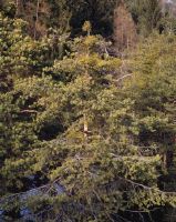
Title (German)
Felsberg GR, Im Wald am Fusse des Südosthanges unterhalb Gross Rüfi
Caption
Conifer/tree group (pine) infested with mistletoe, some with fruit, mock berries, first photograph 1993, general view; coordinates (LV03) of camera location: 75495f/19049f; keywords Documenta Natura: wetland.
Caption (German)
Von Misteln befallene Nadelbäume/Baumgruppe (Föhre), teilweise mit Frucht, Scheinbeeren, Erstaufnahme 1993, Gesamtansicht; Koordinaten (LV03) des Kamerastandorts: 75495f/19049f; Schlagworte Documenta Natura: Feuchtgebiet
Record Name
Dia_303-01352

Title (German)
Felsberg GR, Im Wald am Fusse des Südosthanges unterhalb Gross Rüfi
Caption
Conifer/tree group (pine) infested with mistletoe, some with fruit, mock berries, first photograph 1993, general view; coordinates (LV03) of camera location: 75495f/19049f; keywords Documenta Natura: wetland.
Caption (German)
Von Misteln befallene Nadelbäume/Baumgruppe (Föhre), teilweise mit Frucht, Scheinbeeren, Erstaufnahme 1993, Gesamtansicht; Koordinaten (LV03) des Kamerastandorts: 75495f/19049f; Schlagworte Documenta Natura: Feuchtgebiet
Record Name
Dia_303-01358

Title (German)
Felsberg GR, Im Wald am Fusse des Südosthanges unterhalb Gross Rüfi
Caption
Conifer/tree group (pine) infested with mistletoe, some with fruit, false berries, 1st follow-up photograph 1997, general view; coordinates (LV03) of camera location: 75495f/19049f; keywords Documenta Natura: wetland.
Caption (German)
Von Misteln befallene Nadelbäume/Baumgruppe (Föhre), teilweise mit Frucht, Scheinbeeren, 1. Folgeaufnahme 1997, Gesamtansicht; Koordinaten (LV03) des Kamerastandorts: 75495f/19049f; Schlagworte Documenta Natura: Feuchtgebiet
Record Name
Dia_303-01361

Title (German)
Felsberg GR, Im Wald am Fusse des Südosthanges unterhalb Gross Rüfi
Caption
Conifer/tree group (pine) infested with mistletoe, some with fruit, false berries, 1st follow-up photograph 1997, general view; coordinates (LV03) of camera location: 75495f/19049f; keywords Documenta Natura: wetland.
Caption (German)
Von Misteln befallene Nadelbäume/Baumgruppe (Föhre), teilweise mit Frucht, Scheinbeeren, 1. Folgeaufnahme 1997, Gesamtansicht; Koordinaten (LV03) des Kamerastandorts: 75495f/19049f; Schlagworte Documenta Natura: Feuchtgebiet
Record Name
Dia_303-01365

Title (German)
Sils im Engadin/Segl, Silvaplana GR, Südostansicht des Südosthanges mit dem Piz Polaschin, der Aufforstung Muttaun, Fratta sowie dem Piz Albana, im Vordergrund der Lej da Silvaplauna, 1899
Caption
Southeast view of the southeast slope with Piz Polaschin, the Muttaun and Fratta reforestation and Piz Albana, in the foreground the Sej da Silvaplauna with the north bank, historical photo Felix Schönenberger 1899, general view; coordinates (LV03) of the camera location: 781155/146385; keywords Documenta Natura: wetland
Caption (German)
Südostansicht des Südosthanges mit dem Piz Polaschin, der Aufforstung Muttaun und Fratta sowie dem Piz Albana, im Vordergrund der Sej da Silvaplauna mit dem Nordufer, historische Aufnahme Felix Schönenberger 1899, Gesamtansicht; Koordinaten (LV03) des Kamerastandorts: 781155/146385; Schlagworte Documenta Natura: Feuchtgebiet
Record Name
Dia_303-01371

Title (German)
Sils im Engadin/Segl, Silvaplana GR, Südostansicht des Südosthanges mit dem Piz Polaschin, der Aufforstung Muttaun, Fratta sowie dem Piz Albana, im Vordergrund der Lej da Silvaplauna
Caption
Southeast view of the southeast slope with Piz Polaschin, the Muttaun and Fratta reforestation and Piz Albana, in the foreground the Sej da Silvaplauna with the north bank, reconstruction photo 1996, general view; coordinates (LV03) of the camera location: 781155/146385; keywords Documenta Natura: wetland
Caption (German)
Südostansicht des Südosthanges mit dem Piz Polaschin, der Aufforstung Muttaun und Fratta sowie dem Piz Albana, im Vordergrund der Sej da Silvaplauna mit dem Nordufer, Rekonstruktionsaufnahme 1996, Gesamtansicht; Koordinaten (LV03) des Kamerastandorts: 781155/146385; Schlagworte Documenta Natura: Feuchtgebiet
Record Name
Dia_303-01373

Title (German)
Sils im Engadin/Segl, Silvaplana GR, Südostansicht des Südosthanges mit dem Piz Polaschin, der Aufforstung Muttaun, Fratta sowie dem Piz Albana, im Vordergrund der Lej da Silvaplauna
Caption
Southeast view of the southeast slope with Piz Polaschin, the Muttaun and Fratta reforestation and Piz Albana, in the foreground the Sej da Silvaplauna with the north bank, reconstruction photo 1996, general view; coordinates (LV03) of the camera location: 781155/146385; keywords Documenta Natura: wetland
Caption (German)
Südostansicht des Südosthanges mit dem Piz Polaschin, der Aufforstung Muttaun und Fratta sowie dem Piz Albana, im Vordergrund der Sej da Silvaplauna mit dem Nordufer, Rekonstruktionsaufnahme 1996, Gesamtansicht; Koordinaten (LV03) des Kamerastandorts: 781155/146385; Schlagworte Documenta Natura: Feuchtgebiet
Record Name
Dia_303-01377

Title (German)
Silvaplana GR, Südostansicht des Südosthanges mit der Aufforstung Muttaun, Fratta und dem Piz Albana sowie das Dorf Silvaplana, im Vordergrund der Lej da Silvaplauna, 1899
Caption
Southeast view of the southeast slope with the reforestation Muttaun, Fratta and the Piz Albana as well as the village Silvaplana, in the foreground the Sej da Silvaplauna with the north bank, historical photo Felix Schönenberger 1899, general view; coordinates (LV03) of the camera location: 781675/146655; keywords Documenta Natura: wetland
Caption (German)
Südostansicht des Südosthanges mit der Aufforstung Muttaun, Fratta und dem Piz Albana sowie das Dorf Silvaplana, im Vordergrund der Sej da Silvaplauna mit dem Nordufer, historische Aufnahme Felix Schönenberger 1899, Gesamtansicht; Koordinaten (LV03) des Kamerastandorts: 781675/146655; Schlagworte Documenta Natura: Feuchtgebiet
Record Name
Dia_303-01381
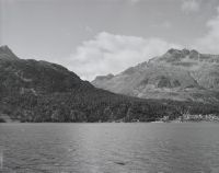
Title (German)
Silvaplana GR, Südostansicht des Südosthanges mit der Aufforstung Muttaun, Fratta und dem Piz Albana sowie das Dorf Silvaplana, im Vordergrund der Lej da Silvaplauna
Caption
Southeast view of the southeast slope with the reforestation Muttaun, Fratta and the Piz Albana as well as the village Silvaplana, in the foreground the Sej da Silvaplauna with the north bank, reconstruction photo 1996, general view; coordinates (LV03) of the camera location: 781675/146655; keywords Documenta Natura: wetlands
Caption (German)
Südostansicht des Südosthanges mit der Aufforstung Muttaun, Fratta und dem Piz Albana sowie das Dorf Silvaplana, im Vordergrund der Sej da Silvaplauna mit dem Nordufer, Rekonstruktionsaufnahme 1996, Gesamtansicht; Koordinaten (LV03) des Kamerastandorts: 781675/146655; Schlagworte Documenta Natura: Feuchtgebiet
Record Name
Dia_303-01383

Title (German)
Silvaplana GR, Südostansicht des Südosthanges mit der Aufforstung Muttaun, Fratta und dem Piz Albana sowie das Dorf Silvaplana, im Vordergrund der Lej da Silvaplauna
Caption
Southeast view of the southeast slope with the reforestation Muttaun, Fratta and the Piz Albana as well as the village Silvaplana, in the foreground the Sej da Silvaplauna with the north bank, reconstruction photo 1996, general view; coordinates (LV03) of the camera location: 781675/146655; keywords Documenta Natura: wetlands
Caption (German)
Südostansicht des Südosthanges mit der Aufforstung Muttaun, Fratta und dem Piz Albana sowie das Dorf Silvaplana, im Vordergrund der Sej da Silvaplauna mit dem Nordufer, Rekonstruktionsaufnahme 1996, Gesamtansicht; Koordinaten (LV03) des Kamerastandorts: 781675/146655; Schlagworte Documenta Natura: Feuchtgebiet
Record Name
Dia_303-01385

Title (German)
Silvaplana GR, Blick von Crastatscha (Nordostansicht) auf das Dorf Silvaplana mit dem Lej da Silvaplauna und Lej da Champfèr, im Hintergrund der Piz da la Margna (links) und Piz Polaschin (rechts), 1899
Caption
Northeast view from Crastatscha onto the delta and village of Silvaplana with the Lej da Silvaplauna and Lej da Champfèr, in the background the Piz da la Margna (left) and Piz Polaschin (right), historical photo Felix Schönenberger 1899, general view; coordinates (LV03) of the camera location: 781885/148825; keywords Documenta Natura: wetland
Caption (German)
Nordostansicht von Crastatscha auf das Delta und Dorf Silvaplana mit dem Lej da Silvaplauna und Lej da Champfèr, im Hintergrund der Piz da la Margna (links) und Piz Polaschin (rechts), historische Aufnahme Felix Schönenberger 1899, Gesamtansicht; Koordinaten (LV03) des Kamerastandorts: 781885/148825; Schlagworte Documenta Natura: Feuchtgebiet
Record Name
Dia_303-01390

Title (German)
Silvaplana GR, Blick von Crastatscha (Nordostansicht) auf das Dorf Silvaplana mit dem Lej da Silvaplauna und Lej da Champfèr, im Hintergrund der Piz da la Margna (links) und Piz Polaschin (rechts)
Caption
Northeast view from Crastatscha onto the delta and village of Silvaplana with the Lej da Silvaplauna and Lej da Champfèr, in the background the Piz da la Margna (left) and Piz Polaschin (right), reconstruction photo 1996, general view; coordinates (LV03) of the camera location: 781885/148825; keywords Documenta Natura: wetland
Caption (German)
Nordostansicht von Crastatscha auf das Delta und Dorf Silvaplana mit dem Lej da Silvaplauna und Lej da Champfèr, im Hintergrund der Piz da la Margna (links) und Piz Polaschin (rechts), Rekonstruktionsaufnahme 1996, Gesamtansicht; Koordinaten (LV03) des Kamerastandorts: 781885/148825; Schlagworte Documenta Natura: Feuchtgebiet
Record Name
Dia_303-01393

Title (German)
Silvaplana GR, Blick von Crastatscha (Nordostansicht) auf das Dorf Silvaplana mit dem Lej da Silvaplauna und Lej da Champfèr, im Hintergrund der Piz da la Margna (links) und Piz Polaschin (rechts)
Caption
Northeast view from Crastatscha onto the delta and village of Silvaplana with the Lej da Silvaplauna and Lej da Champfèr, in the background the Piz da la Margna (left) and Piz Polaschin (right), reconstruction photo 1996, general view; coordinates (LV03) of the camera location: 781885/148825; keywords Documenta Natura: wetland
Caption (German)
Nordostansicht von Crastatscha auf das Delta und Dorf Silvaplana mit dem Lej da Silvaplauna und Lej da Champfèr, im Hintergrund der Piz da la Margna (links) und Piz Polaschin (rechts), Rekonstruktionsaufnahme 1996, Gesamtansicht; Koordinaten (LV03) des Kamerastandorts: 781885/148825; Schlagworte Documenta Natura: Feuchtgebiet
Record Name
Dia_303-01395

Title (German)
Silvaplana GR, Blick von Crastatscha (Ostansicht) über den Lej da Champfèr auf den Südosthang mit dem Piz Albana, 1899
Caption
East view from Crastatscha over the Lej da Champfèr to the southeast slope with the Orchas forest, Albanella and Piz Albana, historical photo Felix Schönenberger 1899Partial view; coordinates (LV03) of the camera location: 781885/148865; keywords Documenta Natura: wetland
Caption (German)
Ostansicht von Crastatscha über den Lej da Champfèr auf den Südosthang mit dem Wald Orchas, Albanella und dem Piz Albana, historische Aufnahme Felix Schönenberger 1899Teilansicht; Koordinaten (LV03) des Kamerastandorts: 781885/148865; Schlagworte Documenta Natura: Feuchtgebiet
Record Name
Dia_303-01398

Title (German)
Silvaplana GR, Blick von Crastatscha (Ostansicht) über den Lej da Champfèr auf den Südosthang mit dem Piz Albana
Caption
East view from Crastatscha over the Lej da Champfèr to the southeast slope with the Orchas forest, Albanella and the Piz Albana, reconstruction photo 1996, partial view; coordinates (LV03) of the camera location: 781885/148865; keywords Documenta Natura: wetlands
Caption (German)
Ostansicht von Crastatscha über den Lej da Champfèr auf den Südosthang mit dem Wald Orchas, Albanella und dem Piz Albana, Rekonstruktionsaufnahme 1996, Teilansicht; Koordinaten (LV03) des Kamerastandorts: 781885/148865; Schlagworte Documenta Natura: Feuchtgebiet
Record Name
Dia_303-01400

Title (German)
Silvaplana GR, Blick von Crastatscha (Ostansicht) über den Lej da Champfèr auf den Südosthang mit dem Piz Albana
Caption
East view from Crastatscha over the Lej da Champfèr to the southeast slope with the Orchas forest, Albanella and the Piz Albana, reconstruction photo 1996, partial view; coordinates (LV03) of the camera location: 781885/148865; keywords Documenta Natura: wetlands
Caption (German)
Ostansicht von Crastatscha über den Lej da Champfèr auf den Südosthang mit dem Wald Orchas, Albanella und dem Piz Albana, Rekonstruktionsaufnahme 1996, Teilansicht; Koordinaten (LV03) des Kamerastandorts: 781885/148865; Schlagworte Documenta Natura: Feuchtgebiet
Record Name
Dia_303-01402

Title (German)
Sils im Engadin/Segl GR, Südwestansicht des Dorfes Sils/Segl Maria, ca. 1900
Caption
Southwest view of the village of Sils/Segl Maria, photographer R.Guler, historical photograph without date (probably around 1900), partial view; coordinates (LV03) of the camera location: 7855ff/1444ff; keywords Documenta Natura: wetland
Caption (German)
Südwestansicht auf das Dorf Sils/Segl Maria, Fotograf R.Guler, historische Aufnahme ohne Datum (wahrscheinlich um 1900), Teilansicht; Koordinaten (LV03) des Kamerastandorts: 7855ff/1444ff; Schlagworte Documenta Natura: Feuchtgebiet
Record Name
Dia_303-01405

Title (German)
Sils im Engadin/Segl GR, Südwestansicht des Dorfes Sils/Segl Maria
Caption
Southwest view of the village of Sils/Segl Maria, reconstruction photo after about 90 years (1996), partial view; coordinates (LV03) of the camera location: 7855ff/1444ff; keywords Documenta Natura: wetland
Caption (German)
Südwestansicht auf das Dorf Sils/Segl Maria, Rekonstruktionsaufnahme nach ca. 90 Jahren (1996), Teilansicht; Koordinaten (LV03) des Kamerastandorts: 7855ff/1444ff; Schlagworte Documenta Natura: Feuchtgebiet
Record Name
Dia_303-01407

Title (German)
Sils im Engadin/Segl GR, Südwestansicht des Dorfes Sils/Segl Maria
Caption
Southwest view of the village of Sils/Segl Maria, reconstruction photo after about 90 years (1996), partial view; coordinates (LV03) of the camera location: 7855ff/1444ff; keywords Documenta Natura: wetland
Caption (German)
Südwestansicht auf das Dorf Sils/Segl Maria, Rekonstruktionsaufnahme nach ca. 90 Jahren (1996), Teilansicht; Koordinaten (LV03) des Kamerastandorts: 7855ff/1444ff; Schlagworte Documenta Natura: Feuchtgebiet
Record Name
Dia_303-01410

Title (German)
Celerina/Schlarigna GR, Ostansicht des Dorfes Celerina/Schlarigna, im Hintergrund der Osthang und die Gebirgskette mit dem Piz Polaschin, Piz Güglia/Piz Julier, Sass Runzöl und Sass da Muottas, 1899
Caption
East view of the village of Celerina/Schlarigna, seen from the church of San Gian, in the background the eastern slope and the mountain range with Piz Polaschin, Piz Güglia/Piz Julier, Sass Runzöl and Sass da Muottas, historical photo Felix Schönenberger 1899, general view; coordinates (LV03) of the camera location: 786535/154210; keywords Documenta Natura: wetland
Caption (German)
Ostansicht des Dorfes Celerina/Schlarigna, von der Kirche San Gian aus gesehen, im Hintergrund der Osthang und die Gebirgskette mit dem Piz Polaschin, Piz Güglia/Piz Julier, Sass Runzöl und Sass da Muottas, historische Aufnahme Felix Schönenberger 1899, Gesamtansicht; Koordinaten (LV03) des Kamerastandorts: 786535/154210; Schlagworte Documenta Natura: Feuchtgebiet
Record Name
Dia_303-01419
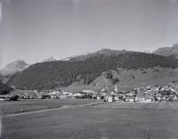
Title (German)
Celerina/Schlarigna GR, Ostansicht des Dorfes Celerina/Schlarigna, im Hintergrund der Osthang und die Gebirgskette mit dem Piz Polaschin, Piz Güglia/Piz Julier, Sass Runzöl und Sass da Muottas
Caption
East view of the village of Celerina/Schlarigna, seen from the church of San Gian, in the background the eastern slope and the mountain range with Piz Polaschin, Piz Güglia/Piz Julier, Sass Runzöl and Sass da Muottas, reconstruction photo 1996, general view; coordinates (LV03) of the camera location: 786535/154210; keywords Documenta Natura: wetland
Caption (German)
Ostansicht des Dorfes Celerina/Schlarigna, von der Kirche San Gian aus gesehen, im Hintergrund der Osthang und die Gebirgskette mit dem Piz Polaschin, Piz Güglia/Piz Julier, Sass Runzöl und Sass da Muottas, Rekonstruktionsaufnahme 1996, Gesamtansicht; Koordinaten (LV03) des Kamerastandorts: 786535/154210; Schlagworte Documenta Natura: Feuchtgebiet
Record Name
Dia_303-01421
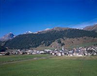
Title (German)
Celerina/Schlarigna GR, Ostansicht des Dorfes Celerina/Schlarigna, im Hintergrund der Osthang und die Gebirgskette mit dem Piz Polaschin, Piz Güglia/Piz Julier, Sass Runzöl und Sass da Muottas
Caption
East view of the village of Celerina/Schlarigna, seen from the church of San Gian, in the background the eastern slope and the mountain range with Piz Polaschin, Piz Güglia/Piz Julier, Sass Runzöl and Sass da Muottas, reconstruction photo 1996, general view; coordinates (LV03) of the camera location: 786535/154210; keywords Documenta Natura: wetland
Caption (German)
Ostansicht des Dorfes Celerina/Schlarigna, von der Kirche San Gian aus gesehen, im Hintergrund der Osthang und die Gebirgskette mit dem Piz Polaschin, Piz Güglia/Piz Julier, Sass Runzöl und Sass da Muottas, Rekonstruktionsaufnahme 1996, Gesamtansicht; Koordinaten (LV03) des Kamerastandorts: 786535/154210; Schlagworte Documenta Natura: Feuchtgebiet
Record Name
Dia_303-01424

Title (German)
Celerina/Schlarigna, St. Moritz GR, Südostansicht des Südosthanges mit der Aufforstung God da Blais, im Vordergrund die Streusiedlung Foppas, im Hintergrund der Piz Padella, 1899
Caption
Southeast view of the southeast slope with the reforestation God da Blaise, in the foreground the scattered settlement Foppas, in the background the Piz Padella (right), counter-slope photo, historical photo Felix Schönenberger 1899, general view; coordinates (LV03) of the camera location: 784910/152925; keywords Documenta Natura: wetland
Caption (German)
Südostansicht des Südosthanges mit der Aufforstung God da Blaise, im Vordergrund die Streusiedlung Foppas, im Hintergrund der Piz Padella (rechts), Gegenhangaufnahme, historische Aufnahme Felix Schönenberger 1899, Gesamtansicht; Koordinaten (LV03) des Kamerastandorts: 784910/152925; Schlagworte Documenta Natura: Feuchtgebiet
Record Name
Dia_303-01427

Title (German)
Celerina/Schlarigna, St. Moritz GR, Südostansicht des Südosthanges mit der Aufforstung God da Blais, im Vordergrund die Streusiedlung Foppas, im Hintergrund der Piz Padella
Caption
Southeast view of the southeast slope with the reforestation God da Blaise, in the foreground the scattered settlement Foppas, in the background the Piz Padella (right), counter-slope photo, reconstruction photo 1996, general view; coordinates (LV03) of the camera location: 784910/152925; keywords Documenta Natura: wetland
Caption (German)
Südostansicht des Südosthanges mit der Aufforstung God da Blaise, im Vordergrund die Streusiedlung Foppas, im Hintergrund der Piz Padella (rechts), Gegenhangaufnahme, Rekonstruktionsaufnahme 1996, Gesamtansicht; Koordinaten (LV03) des Kamerastandorts: 784910/152925; Schlagworte Documenta Natura: Feuchtgebiet
Record Name
Dia_303-01429

Title (German)
Celerina/Schlarigna, St. Moritz GR, Südostansicht des Südosthanges mit der Aufforstung God da Blais, im Vordergrund die Streusiedlung Foppas, im Hintergrund der Piz Padella
Caption
Southeast view of the southeast slope with the reforestation God da Blaise, in the foreground the scattered settlement Foppas, in the background the Piz Padella (right), counter-slope photo, reconstruction photo 1996, general view; coordinates (LV03) of the camera location: 784910/152925; keywords Documenta Natura: wetland
Caption (German)
Südostansicht des Südosthanges mit der Aufforstung God da Blaise, im Vordergrund die Streusiedlung Foppas, im Hintergrund der Piz Padella (rechts), Gegenhangaufnahme, Rekonstruktionsaufnahme 1996, Gesamtansicht; Koordinaten (LV03) des Kamerastandorts: 784910/152925; Schlagworte Documenta Natura: Feuchtgebiet
Record Name
Dia_303-01432

Title (German)
St. Moritz GR, Südostansicht des Dorfes St. Moritz, im Vordergrund der Lej da S. Murezzan, im Hintergrund die Gebirgskette mit Piz Nair, Sass Runzöl und Las Trais Fluors, 1899
Caption
Southeast view over the Lej da San Murezzan to the village of St. Moritz, in the background the mountain range with Piz Nair, Sass Runzöl and Las Trais Fluors, historical photograph Felix Schöneberger 1899, general view; coordinates (LV03) of the camera location: 785385/151925; keywords Documenta Natura: wetland
Caption (German)
Südostansicht über den Lej da San Murezzan auf das Dorf St. Moritz, im Hintergrund die Gebirgskette mit Piz Nair, Sass Runzöl und Las Trais Fluors, historische Aufnahme Felix Schöneberger 1899, Gesamtansicht; Koordinaten (LV03) des Kamerastandorts: 785385/151925; Schlagworte Documenta Natura: Feuchtgebiet
Record Name
Dia_303-01436

Title (German)
St. Moritz GR, Südostansicht des Dorfes St. Moritz, im Vordergrund der Lej da S. Murezzan, im Hintergrund die Gebirgskette mit Piz Nair, Sass Runzöl und Las Trais Fluors
Caption
Southeast view over the Lej da San Murezzan to the village of St. Moritz, in the background the mountain range with Piz Nair, Sass Runzöl and Las Trais Fluors, reconstruction photo after 97 years (1996), general view; coordinates (LV03) of the camera location: 785385/151925; keywords Documenta Natura: wetland
Caption (German)
Südostansicht über den Lej da San Murezzan auf das Dorf St. Moritz, im Hintergrund die Gebirgskette mit Piz Nair, Sass Runzöl und Las Trais Fluors, Rekonstruktionsaufnahme nach 97 Jahren (1996), Gesamtansicht; Koordinaten (LV03) des Kamerastandorts: 785385/151925; Schlagworte Documenta Natura: Feuchtgebiet
Record Name
Dia_303-01438

Title (German)
St. Moritz GR, Südostansicht des Dorfes St. Moritz, im Vordergrund der Lej da S. Murezzan, im Hintergrund die Gebirgskette mit Piz Nair, Sass Runzöl und Las Trais Fluors
Caption
Southeast view over the Lej da San Murezzan to the village of St. Moritz, in the background the mountain range with Piz Nair, Sass Runzöl and Las Trais Fluors, reconstruction photo after 97 years (1996), general view; coordinates (LV03) of the camera location: 785385/151925; keywords Documenta Natura: wetland
Caption (German)
Südostansicht über den Lej da San Murezzan auf das Dorf St. Moritz, im Hintergrund die Gebirgskette mit Piz Nair, Sass Runzöl und Las Trais Fluors, Rekonstruktionsaufnahme nach 97 Jahren (1996), Gesamtansicht; Koordinaten (LV03) des Kamerastandorts: 785385/151925; Schlagworte Documenta Natura: Feuchtgebiet
Record Name
Dia_303-01442

Title (German)
St. Moritz GR, Südansicht des Dorfes St. Moritz, im Vordergrund die Uferpromenade mit dem Lej da S. Murezzan, im Hintergrund der Südosthang mit dem Wald/God sur Chaunt Blaise, 1899
Caption
South view over the lake/Lej da San Murezzan to the village of St. Moritz, in the foreground the shore with district forester Christoffel, in the background the southeast slope with the forest/God sur Chaunt Blaise, historical photograph Felix Schönenberger 1899, general view; coordinates (LV03) of the camera location: 784300/151410; keywords Documenta Natura: wetland
Caption (German)
Südansicht über den See/Lej da San Murezzan auf das Dorf St. Moritz, im Vordergrund das Ufer mit Revierförster Christoffel, im Hintergrund der Südosthang mit dem Wald/God sur Chaunt Blaise, historische Aufnahme Felix Schönenberger 1899, Gesamtansicht; Koordinaten (LV03) des Kamerastandorts: 784300/151410; Schlagworte Documenta Natura: Feuchtgebiet
Record Name
Dia_303-01449

Title (German)
St. Moritz GR, Südansicht des Dorfes St. Moritz, im Vordergrund die Uferpromenade mit dem Lej da S. Murezzan, im Hintergrund der Südosthang mit dem Wald/God sur Chaunt Blaise
Caption
South view over the lake/Lej da San Murezzan to the village of St. Moritz, in the background the southeast slope with the forest/God sur Chaunt Blaise, reconstruction photo after 97 years (1996), general view; coordinates (LV03) of the camera location: 784300/151410; keywords Documenta Natura: wetland
Caption (German)
Südansicht über den See/Lej da San Murezzan auf das Dorf St. Moritz, im Hintergrund der Südosthang mit dem Wald/God sur Chaunt Blaise, Rekonstruktionsaufnahme nach 97 Jahren (1996), Gesamtansicht; Koordinaten (LV03) des Kamerastandorts: 784300/151410; Schlagworte Documenta Natura: Feuchtgebiet
Record Name
Dia_303-01451

Title (German)
St. Moritz GR, Südansicht des Dorfes St. Moritz, im Vordergrund die Uferpromenade mit dem Lej da S. Murezzan, im Hintergrund der Südosthang mit dem Wald/God sur Chaunt Blaise
Caption
South view over the lake/Lej da San Murezzan to the village of St. Moritz, in the background the southeast slope with the forest/God sur Chaunt Blaise, reconstruction photo after 97 years (1996), general view; coordinates (LV03) of the camera location: 784300/151410; keywords Documenta Natura: wetland
Caption (German)
Südansicht über den See/Lej da San Murezzan auf das Dorf St. Moritz, im Hintergrund der Südosthang mit dem Wald/God sur Chaunt Blaise, Rekonstruktionsaufnahme nach 97 Jahren (1996), Gesamtansicht; Koordinaten (LV03) des Kamerastandorts: 784300/151410; Schlagworte Documenta Natura: Feuchtgebiet
Record Name
Dia_303-01456

Title (German)
Silvaplana, St. Moritz GR, Südansicht des Dorfes Champfèr, im Vordergrund der Fluss Sela, im Hintergrund der Südosthang mit dem Piz Nair, 1899
Caption
South view over the river Sela to the village of Champfèr, in the background the southeast slope with the reforestation God Foppettas and the Piz Nair, historical photo Felix Schönenberger 1899, general view; coordinates (LV03) of the camera location: 782475/149565; keywords Documenta Natura: wetland
Caption (German)
Südansicht über den Fluss Sela auf das Dorf Champfèr, im Hintergrund der Südosthang mit der Aufforstung God Foppettas und dem Piz Nair, historische Aufnahme Felix Schönenberger 1899, Gesamtansicht; Koordinaten (LV03) des Kamerastandorts: 782475/149565; Schlagworte Documenta Natura: Feuchtgebiet
Record Name
Dia_303-01464
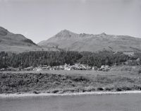
Title (German)
Silvaplana, St. Moritz GR, Südansicht des Dorfes Champfèr, im Vordergrund der Fluss Sela, im Hintergrund der Südosthang mit dem Piz Nair
Caption
South view over the river Sela to the village of Champfèr, in the background the southeast slope with God Foppettas and Piz Nair, reconstruction photo after 97 years (1996), general view; coordinates (LV03) of the camera location: 782475/149565; keywords Documenta Natura: wetland
Caption (German)
Südansicht über den Fluss Sela auf das Dorf Champfèr, im Hintergrund der Südosthang mit God Foppettas und dem Piz Nair, Rekonstruktionsaufnahme nach 97 Jahren (1996), Gesamtansicht; Koordinaten (LV03) des Kamerastandorts: 782475/149565; Schlagworte Documenta Natura: Feuchtgebiet
Record Name
Dia_303-01466

Title (German)
Silvaplana, St. Moritz GR, Südansicht des Dorfes Champfèr, im Vordergrund der Fluss Sela, im Hintergrund der Südosthang mit dem Piz Nair
Caption
South view over the river Sela to the village of Champfèr, in the background the southeast slope with God Foppettas and Piz Nair, reconstruction photo after 97 years (1996), general view; coordinates (LV03) of the camera location: 782475/149565; keywords Documenta Natura: wetland
Caption (German)
Südansicht über den Fluss Sela auf das Dorf Champfèr, im Hintergrund der Südosthang mit God Foppettas und dem Piz Nair, Rekonstruktionsaufnahme nach 97 Jahren (1996), Gesamtansicht; Koordinaten (LV03) des Kamerastandorts: 782475/149565; Schlagworte Documenta Natura: Feuchtgebiet
Record Name
Dia_303-01468

Title (German)
S-Chanf, Zuoz GR, Südansicht des Südosthanges mit der Aufforstung God Prosbierg und Laret, z. T. mit dem Dorf Zuoz (z. T.), 1899
Caption
South view of the southeast slope with the afforestation God Prosbierg and Laret, partly with the village of Zuoz, historical photograph Felix Schönenberger 1899, general view; coordinates (LV03) of the camera location: 793535/163800; keywords Documenta Natura: wetland
Caption (German)
Südansicht des Südosthanges mit der Aufforstung God Prosbierg und Laret, teilweise mit dem Dorf Zuoz, historische Aufnahme Felix Schönenberger 1899, Gesamtansicht; Koordinaten (LV03) des Kamerastandorts: 793535/163800; Schlagworte Documenta Natura: Feuchtgebiet
Record Name
Dia_303-01477

Title (German)
S-Chanf, Zuoz GR, Südansicht des Südosthanges mit der Aufforstung God Prosbierg und Laret, z. T. mit dem Dorf Zuoz (z. T.)
Caption
South view of the southeast slope with the afforestation God Prosbierg and Laret, partly with the village of Zuoz, reconstruction photo after 96 years (1995), general view; coordinates (LV03) of the camera location: 793535/163800; keywords Documenta Natura: wetlands
Caption (German)
Südansicht des Südosthanges mit der Aufforstung God Prosbierg und Laret, teilweise mit dem Dorf Zuoz, Rekonstruktionsaufnahme nach 96 Jahren (1995), Gesamtansicht; Koordinaten (LV03) des Kamerastandorts: 793535/163800; Schlagworte Documenta Natura: Feuchtgebiet
Record Name
Dia_303-01479

Title (German)
S-Chanf, Zuoz GR, Südansicht des Südosthanges mit der Aufforstung God Prosbierg und Laret, z. T. mit dem Dorf Zuoz (z. T.)
Caption
South view of the southeast slope with the afforestation God Prosbierg and Laret, partly with the village of Zuoz, reconstruction photo after 96 years (1995), general view; coordinates (LV03) of the camera location: 793535/163800; keywords Documenta Natura: wetlands
Caption (German)
Südansicht des Südosthanges mit der Aufforstung God Prosbierg und Laret, teilweise mit dem Dorf Zuoz, Rekonstruktionsaufnahme nach 96 Jahren (1995), Gesamtansicht; Koordinaten (LV03) des Kamerastandorts: 793535/163800; Schlagworte Documenta Natura: Feuchtgebiet
Record Name
Dia_303-01481

Title (German)
S-Chanf, Zuoz GR, Südansicht des Südosthanges mit der Aufforstung God Prosbierg und Laret, z. T. mit dem Dorf Zuoz (z. T.)
Caption
South view of the southeast slope with God Prosbierg and Laret, partly with the village of Zuoz, 1st follow-up photo (reconstruction photo) after 97 years (1996), general view; coordinates (LV03) of the camera location: 793535/163800; keywords Documenta Natura: wetland
Caption (German)
Südansicht des Südosthanges mit God Prosbierg und Laret, teilweise mit dem Dorf Zuoz, 1. Folgeaufnahme (Rekonstruktionsaufnahme) nach 97 Jahren (1996), Gesamtansicht; Koordinaten (LV03) des Kamerastandorts: 793535/163800; Schlagworte Documenta Natura: Feuchtgebiet
Record Name
Dia_303-01483

Title (German)
S-Chanf, Zuoz GR, Südansicht des Südosthanges mit der Aufforstung God Prosbierg und Laret, z. T. mit dem Dorf Zuoz (z. T.)
Caption
South view of the southeast slope with God Prosbierg and Laret, partly with the village of Zuoz, 1st follow-up photo (reconstruction photo) after 97 years (1996), general view; coordinates (LV03) of the camera location: 793535/163800; keywords Documenta Natura: wetland
Caption (German)
Südansicht des Südosthanges mit God Prosbierg und Laret, teilweise mit dem Dorf Zuoz, 1. Folgeaufnahme (Rekonstruktionsaufnahme) nach 97 Jahren (1996), Gesamtansicht; Koordinaten (LV03) des Kamerastandorts: 793535/163800; Schlagworte Documenta Natura: Feuchtgebiet
Record Name
Dia_303-01487

Title (German)
Zuoz GR, Südansicht des Dorfes Zuoz mit der Aufforstung im Südosthang und dem Piz Belvair, im Vordergrund der Fluss Inn (z. T.) und die Wiese Curtinatscha, 1899
Caption
South view of the village of Zuoz with the reforestation on the southeast slope and the Piz Belvair, in the foreground the river En/Inn and the meadow Curtinatscha, historical photograph Felix Schönenberger 1899, general view; coordinates (LV03) of the camera location: 793150/163400; keywords Documenta Natura: wetlands
Caption (German)
Südansicht des Dorfes Zuoz mit der Aufforstung im Südosthang und dem Piz Belvair, im Vordergrund der Fluss En/Inn und das Wiesland Curtinatscha, historische Aufnahme Felix Schönenberger 1899, Gesamtansicht; Koordinaten (LV03) des Kamerastandorts: 793150/163400; Schlagworte Documenta Natura: Feuchtgebiet
Record Name
Dia_303-01497

Title (German)
Zuoz GR, Südansicht des Dorfes Zuoz mit der Aufforstung im Südosthang und dem Piz Belvair, im Vordergrund der Fluss Inn (z. T.) und die Wiese Curtinatscha
Caption
South view of the village of Zuoz with Piz Belvair, in the foreground the river En/Inn and the meadow Curtinatscha, reconstruction photo after 97 years (1996), general view; coordinates (LV03) of the camera location: 793150/163400; keywords Documenta Natura: wetland
Caption (German)
Südansicht des Dorfes Zuoz mit dem Piz Belvair, im Vordergrund der Fluss En/Inn und das Wiesland Curtinatscha, Rekonstruktionsaufnahme nach 97 Jahren (1996), Gesamtansicht; Koordinaten (LV03) des Kamerastandorts: 793150/163400; Schlagworte Documenta Natura: Feuchtgebiet
Record Name
Dia_303-01499

Title (German)
Madulain GR, Südostansicht des Dorfes Madulain mit der Aufforstung im Südosthang, im Vordergrund die Weide Pradatsch, 1899
Caption
Southeast view of the village of Madulain with the reforestation and the ruins of Guardaval on the southeast slope and Piz Belvair (right), in the foreground the pasture Pradatsch with district forester Lorenz (with stick) in conversation with an unknown man, historical photograph Felix Schönenberger 1899, general view; coordinates (LV03) of the camera location: 791825/162235; keywords Documenta Natura: wetlands
Caption (German)
Südostansicht des Dorfes Madulain mit der Aufforstung und der Ruine Guardaval im Südosthang sowie dem Piz Belvair (rechts), im Vordergrund die Weide Pradatsch mit Kreisförster Lorenz (mit Stock) im Gespräch mit einem unbekannten Mann, historische Aufnahme Felix Schönenberger 1899, Gesamtansicht; Koordinaten (LV03) des Kamerastandorts: 791825/162235; Schlagworte Documenta Natura: Feuchtgebiet
Record Name
Dia_303-01512

Title (German)
Madulain GR, Südostansicht des Dorfes Madulain mit der Aufforstung im Südosthang, im Vordergrund die Weide Pradatsch
Caption
Southeast view of the village of Madulain with the former reforestation and the ruins of Guardaval on the southeast slope and Piz Belvair (right), in the foreground the pasture Pradatsch, reconstruction photo 1996, general view; coordinates (LV03) of the camera location: 791825/162235; keywords Documenta Natura: wetland
Caption (German)
Südostansicht des Dorfes Madulain mit der ehemaligen Aufforstung und der Ruine Guardaval im Südosthang sowie dem Piz Belvair (rechts), im Vordergrund die Weide Pradatsch, Rekonstruktionsaufnahme 1996, Gesamtansicht; Koordinaten (LV03) des Kamerastandorts: 791825/162235; Schlagworte Documenta Natura: Feuchtgebiet
Record Name
Dia_303-01514

Title (German)
Madulain GR, Südostansicht des Dorfes Madulain mit der Aufforstung im Südosthang, im Vordergrund die Weide Pradatsch
Caption
Southeast view of the village of Madulain with the former reforestation and the ruins of Guardaval on the southeast slope and Piz Belvair (right), in the foreground the pasture Pradatsch, reconstruction photo 1996, general view; coordinates (LV03) of the camera location: 791825/162235; keywords Documenta Natura: wetland
Caption (German)
Südostansicht des Dorfes Madulain mit der ehemaligen Aufforstung und der Ruine Guardaval im Südosthang sowie dem Piz Belvair (rechts), im Vordergrund die Weide Pradatsch, Rekonstruktionsaufnahme 1996, Gesamtansicht; Koordinaten (LV03) des Kamerastandorts: 791825/162235; Schlagworte Documenta Natura: Feuchtgebiet
Record Name
Dia_303-01516

Title (German)
Madulain GR, Südansicht des Dorfes Madulain mit der Aufforstung und der Ruina da Guardaval im Südosthang, im Vordergrund die Weide Pradatsch, 1899
Caption
South view of the village of Madulain (in part) with the reforestation and the ruins of Guardaval on the southeast slope as well as the alp and Piz Belvair, in the foreground the meadow Pradatsch with the district forester Lorenz, historical photograph Felix Schönenberger 1899, general view; coordinates (LV03) of the camera location: 791550/162075; keywords Documenta Natura: wetlands
Caption (German)
Südansicht des Dorfes Madulain (z. T.) mit der Aufforstung und der Ruine Guardaval im Südosthang sowie der Alp und dem Piz Belvair, im Vordergrund das Wiesland Pradatsch mit dem Kreisförster Lorenz, historische Aufnahme Felix Schönenberger 1899, Gesamtansicht; Koordinaten (LV03) des Kamerastandorts: 791550/162075; Schlagworte Documenta Natura: Feuchtgebiet
Record Name
Dia_303-01520

Title (German)
Madulain GR, Südansicht des Dorfes Madulain mit der Aufforstung und der Ruina da Guardaval im Südosthang, im Vordergrund die Weide Pradatsch
Caption
South view of the village of Madulain with the former reforestation and the ruins of Guardaval on the southeast slope as well as the alp and Piz Belvair, in the foreground the meadowland Pradatsch, reconstruction photo after 97 years (1996), general view; coordinates (LV03) of the camera location: 791550/162075; keywords Documenta Natura: wetlands
Caption (German)
Südansicht des Dorfes Madulain mit der ehemaligen Aufforstung und der Ruine Guardaval im Südosthang sowie der Alp und dem Piz Belvair, im Vordergrund das Wiesland Pradatsch, Rekonstruktionsaufnahme nach 97 Jahren (1996), Gesamtansicht; Koordinaten (LV03) des Kamerastandorts: 791550/162075; Schlagworte Documenta Natura: Feuchtgebiet
Record Name
Dia_303-01523

Title (German)
Madulain GR, Südansicht des Dorfes Madulain mit der Aufforstung und der Ruina da Guardaval im Südosthang, im Vordergrund die Weide Pradatsch
Caption
South view of the village of Madulain with the former reforestation and the ruins of Guardaval on the southeast slope as well as the alp and Piz Belvair, in the foreground the meadowland Pradatsch, reconstruction photo after 97 years (1996), general view; coordinates (LV03) of the camera location: 791550/162075; keywords Documenta Natura: wetlands
Caption (German)
Südansicht des Dorfes Madulain mit der ehemaligen Aufforstung und der Ruine Guardaval im Südosthang sowie der Alp und dem Piz Belvair, im Vordergrund das Wiesland Pradatsch, Rekonstruktionsaufnahme nach 97 Jahren (1996), Gesamtansicht; Koordinaten (LV03) des Kamerastandorts: 791550/162075; Schlagworte Documenta Natura: Feuchtgebiet
Record Name
Dia_303-01526

Title (German)
Madulain GR, Südansicht des Dorfes Madulain mit der Aufforstung und der Ruina da Guardaval im Südosthang, im Vordergrund die Weide Pradatsch
Caption
South view of the village of Madulain with the former reforestation and the ruins of Guardaval on the southeast slope as well as the alp and Piz Belvair, in the foreground the meadowland Pradatsch, 1st follow-up photo (reconstruction photo) after 12 years (2008), general view; coordinates (LV03) of the camera location: 791550/162075; keywords Documenta Natura: wetland
Caption (German)
Südansicht des Dorfes Madulain mit der ehemaligen Aufforstung und der Ruine Guardaval im Südosthang sowie der Alp und dem Piz Belvair, im Vordergrund das Wiesland Pradatsch, 1. Folgeaufnahme (Rekonstruktionsaufnahme) nach 12 Jahren (2008), Gesamtansicht; Koordinaten (LV03) des Kamerastandorts: 791550/162075; Schlagworte Documenta Natura: Feuchtgebiet
Record Name
Dia_303-01532

Title (German)
Bever GR, Südostansicht des Dorfes Bever mit der Aufforstung God dals Dschembers und God da Plaz, im Vordergrund die Weide Chasatschas, 1899
Caption
Southeast view of the village of Bever, partly with the afforestation God dals Dschembers and God da Plaz in the southeast slope, in the foreground the pasture Chasatschas, historical photograph Felix Schönenberger 1899, general view; coordinates (LV03) of the camera location: 788465/158330; keywords Documenta Natura: wetland
Caption (German)
Südostansicht des Dorfes Bever, zum Teil mit der Aufforstung God dals Dschembers und God da Plaz im Südosthang, im Vordergrund die Weide Chasatschas, historische Aufnahme Felix Schönenberger 1899, Gesamtansicht; Koordinaten (LV03) des Kamerastandorts: 788465/158330; Schlagworte Documenta Natura: Feuchtgebiet
Record Name
Dia_303-01535

Title (German)
Bever GR, Südostansicht des Dorfes Bever mit der Aufforstung God dals Dschembers und God da Plaz, im Vordergrund die Weide Chasatschas
Caption
Southeast view of the village Bever, with the former afforestation God dals Dschembers and God da Plaz in the southeast slope, in the foreground the pasture Chasatschas, reconstruction photo 1996, general view; coordinates (LV03) of the camera location: 788465/158330; keywords Documenta Natura: wetland
Caption (German)
Südostansicht des Dorfes Bever, mit der ehemaligen Aufforstung God dals Dschembers und God da Plaz im Südosthang, im Vordergrund die Weide Chasatschas, Rekonstruktionsaufnahme 1996, Gesamtansicht; Koordinaten (LV03) des Kamerastandorts: 788465/158330; Schlagworte Documenta Natura: Feuchtgebiet
Record Name
Dia_303-01537

Title (German)
Bever GR, Südostansicht des Dorfes Bever mit der Aufforstung God dals Dschembers und God da Plaz, im Vordergrund die Weide Chasatschas
Caption
Southeast view of the village Bever, with the former afforestation God dals Dschembers and God da Plaz in the southeast slope, in the foreground the pasture Chasatschas, reconstruction photo 1996, general view; coordinates (LV03) of the camera location: 788465/158330; keywords Documenta Natura: wetland
Caption (German)
Südostansicht des Dorfes Bever, mit der ehemaligen Aufforstung God dals Dschembers und God da Plaz im Südosthang, im Vordergrund die Weide Chasatschas, Rekonstruktionsaufnahme 1996, Gesamtansicht; Koordinaten (LV03) des Kamerastandorts: 788465/158330; Schlagworte Documenta Natura: Feuchtgebiet
Record Name
Dia_303-01541

Title (German)
Filisur GR, Nordwestansicht des Dorfes Filisur
Caption
Northwest view of the village of Filisur, in the foreground bushes and residential houses, in the background the railroad line of the Rhaetian Railway (RhB) and the Albula valley, reconstruction photograph 1997, general view; coordinates (LV03) of the camera location: 771800/171800; keywords Documenta Natura: wetlands
Caption (German)
Nordwestansicht des Dorfes Filisur, im Vordergrund Gebüsche und Wohnhäuser, im Hintergrund die Bahnlinie der Rhätischen Bahn (RhB) und das Albulatal, Rekonstruktionsaufnahme 1997, Gesamtansicht; Koordinaten (LV03) des Kamerastandorts: 771800/171800; Schlagworte Documenta Natura: Feuchtgebiet
Record Name
Dia_303-01546

Title (German)
Filisur GR, Nordwestansicht des Dorfes Filisur
Caption
Northwest view of the village of Filisur, in the foreground bushes and residential houses, in the background the railroad line of the Rhaetian Railway (RhB) and the Albula valley, reconstruction photograph 1997, general view; coordinates (LV03) of the camera location: 771800/171800; keywords Documenta Natura: wetlands
Caption (German)
Nordwestansicht des Dorfes Filisur, im Vordergrund Gebüsche und Wohnhäuser, im Hintergrund die Bahnlinie der Rhätischen Bahn (RhB) und das Albulatal, Rekonstruktionsaufnahme 1997, Gesamtansicht; Koordinaten (LV03) des Kamerastandorts: 771800/171800; Schlagworte Documenta Natura: Feuchtgebiet
Record Name
Dia_303-01547

Title (German)
Landschaft Davos GR, Südansicht des Dorfes Frauenkirch
Caption
South view of the village Davos-Frauenkirch, in the foreground pasture with group of trees (spruce) and with relocated and electrified railroad line , in the background the chapel, reconstruction photo 1997, general view; coordinates (LV03) of the camera location: 780180/182020; keywords Documenta Natura: wetland
Caption (German)
Südansicht des Dorfes Davos-Frauenkirch, im Vordergrund Weide mit Baumgruppe (Fichte) und mit verlegter und elektrifizierter Bahnlinie , im Hintergrund die Kapelle, Rekonstruktionsaufnahme 1997, Gesamtansicht; Koordinaten (LV03) des Kamerastandorts: 780180/182020; Schlagworte Documenta Natura: Feuchtgebiet
Record Name
Dia_303-01553

Title (German)
Landschaft Davos GR, Südansicht des Dorfes Frauenkirch
Caption
South view of the village Davos-Frauenkirch, in the foreground pasture with group of trees (spruce) and with relocated and electrified railroad line , in the background the chapel, reconstruction photo 1997, general view; coordinates (LV03) of the camera location: 780180/182020; keywords Documenta Natura: wetland
Caption (German)
Südansicht des Dorfes Davos-Frauenkirch, im Vordergrund Weide mit Baumgruppe (Fichte) und mit verlegter und elektrifizierter Bahnlinie , im Hintergrund die Kapelle, Rekonstruktionsaufnahme 1997, Gesamtansicht; Koordinaten (LV03) des Kamerastandorts: 780180/182020; Schlagworte Documenta Natura: Feuchtgebiet
Record Name
Dia_303-01557

Title (German)
Zernez GR, Südansicht des Dorfes Zernez, im Vordergrund der Talboden Rasto Sax
Caption
South view of the village of Zernez, in the foreground the valley floor Rasto Sax with tall spruce trees at the edge of the picture, reconstruction photograph 1997, general view; coordinates (LV03) of the camera location: 803420/174615; keywords Documenta Natura: Wetland
Caption (German)
Südansicht des Dorfes Zernez, im Vordergrund der Talboden Rasto Sax mit hochgewachsenen Fichten am Bildrand, Rekonstruktionsaufnahme 1997, Gesamtansicht; Koordinaten (LV03) des Kamerastandorts: 803420/174615; Schlagworte Documenta Natura: Feuchtgebiet
Record Name
Dia_303-01565

Title (German)
Zernez GR, Südansicht des Dorfes Zernez, im Vordergrund der Talboden Rasto Sax
Caption
South view of the village of Zernez, in the foreground the valley floor Rasto Sax with tall spruce trees at the edge of the picture, reconstruction photograph 1997, general view; coordinates (LV03) of the camera location: 803420/174615; keywords Documenta Natura: Wetland
Caption (German)
Südansicht des Dorfes Zernez, im Vordergrund der Talboden Rasto Sax mit hochgewachsenen Fichten am Bildrand, Rekonstruktionsaufnahme 1997, Gesamtansicht; Koordinaten (LV03) des Kamerastandorts: 803420/174615; Schlagworte Documenta Natura: Feuchtgebiet
Record Name
Dia_303-01568

Title (German)
Ardez GR, Südsüdostansicht des Dorfes Ardez
Caption
South-southeast view of the village of Ardez, in the foreground the newly built railroad line of the Rhaetian Railway (RhB), reconstruction photograph 1997, general view; coordinates (LV03) of the camera location: 811150/183805; keywords Documenta Natura: railroad station
Caption (German)
Südsüdostansicht des Dorfes Ardez, im Vordergrund die neu gebaute Bahnlinie der Rhätischen Bahn (RhB), Rekonstruktionsaufnahme 1997, Gesamtansicht; Koordinaten (LV03) des Kamerastandorts: 811150/183805; Schlagworte Documenta Natura: Bahnhof
Record Name
Dia_303-01573

Title (German)
Ardez GR, Südsüdostansicht des Dorfes Ardez
Caption
South-southeast view of the village of Ardez, in the foreground the newly built railroad line of the Rhaetian Railway (RhB), reconstruction photograph 1997, general view; coordinates (LV03) of the camera location: 811150/183805; keywords Documenta Natura: railroad station
Caption (German)
Südsüdostansicht des Dorfes Ardez, im Vordergrund die neu gebaute Bahnlinie der Rhätischen Bahn (RhB), Rekonstruktionsaufnahme 1997, Gesamtansicht; Koordinaten (LV03) des Kamerastandorts: 811150/183805; Schlagworte Documenta Natura: Bahnhof
Record Name
Dia_303-01575

Title (German)
Alvaneu, Filisur, Schmitten GR, Westansicht des Südhanges unterhalb Schmitten
Caption
West view of the southern slope below Schmitten with track and viaducts of the railroad line of the Rhaetian Railway (RhB), with ingrown and reforested slope, reconstruction photo 1997, partial view across the slope; coordinates (LV03) of the camera location: 770700/172200; keywords Documenta Natura: railroad station
Caption (German)
Westansicht des Südhanges unterhalb Schmitten mit Trassee und Viadukten der Bahnlinie der Rhätischen Bahn (RhB), mit eingewachsenen und aufgeforstetem Hang, Rekonstruktionsaufnahme 1997, Teilansicht quer zum Hang; Koordinaten (LV03) des Kamerastandorts: 770700/172200; Schlagworte Documenta Natura: Bahnhof
Record Name
Dia_303-01587

Title (German)
Alvaneu, Filisur, Schmitten GR, Westansicht des Südhanges unterhalb Schmitten
Caption
West view of the southern slope below Schmitten with track and viaducts of the railroad line of the Rhaetian Railway (RhB), with ingrown and reforested slope, reconstruction photo 1997, partial view across the slope; coordinates (LV03) of the camera location: 770700/172200; keywords Documenta Natura: railroad station
Caption (German)
Westansicht des Südhanges unterhalb Schmitten mit Trassee und Viadukten der Bahnlinie der Rhätischen Bahn (RhB), mit eingewachsenen und aufgeforstetem Hang, Rekonstruktionsaufnahme 1997, Teilansicht quer zum Hang; Koordinaten (LV03) des Kamerastandorts: 770700/172200; Schlagworte Documenta Natura: Bahnhof
Record Name
Dia_303-01588

Title (German)
Bergün/Bravuogn GR, Blick (Südwestansicht) auf den Talboden bei Punt Ota
Caption
Southwest view of the valley floor at Punt Ota with loop and viaduct of the railroad line of the Rhaetian Railway (RhB), with overgrown and reforested valley floor, gallery buildings and pipeline network, reconstruction photo 1996, reverse slope photo, partial view; coordinates (LV03) of the camera location: 777500/162960; keywords Documenta Natura: railroad station
Caption (German)
Südwestansicht des Talbodens bei Punt Ota mit Schleife und Viadukt der Bahnlinie der Rhätischen Bahn (RhB), mit eingewachsenem und aufgeforstetem Talboden, Galeriebauten und Leitungsnetz, Rekonstruktionsaufnahme 1996, Gegenhangaufnahme, Teilansicht; Koordinaten (LV03) des Kamerastandorts: 777500/162960; Schlagworte Documenta Natura: Bahnhof
Record Name
Dia_303-01595

Title (German)
Bergün/Bravuogn GR, Blick (Südwestansicht) auf den Talboden bei Punt Ota
Caption
Southwest view of the valley floor at Punt Ota with loop and viaduct of the railroad line of the Rhaetian Railway (RhB), with overgrown and reforested valley floor, gallery buildings and pipeline network, reconstruction photo 1996, reverse slope photo, partial view; coordinates (LV03) of the camera location: 777500/162960; keywords Documenta Natura: railroad station
Caption (German)
Südwestansicht des Talbodens bei Punt Ota mit Schleife und Viadukt der Bahnlinie der Rhätischen Bahn (RhB), mit eingewachsenem und aufgeforstetem Talboden, Galeriebauten und Leitungsnetz, Rekonstruktionsaufnahme 1996, Gegenhangaufnahme, Teilansicht; Koordinaten (LV03) des Kamerastandorts: 777500/162960; Schlagworte Documenta Natura: Bahnhof
Record Name
Dia_303-01597

Title (German)
Landschaft Davos GR, Blick (Nordansicht) talaufwärts auf das Dorf Sertig Dörfli und Sertigtal
Caption
North view up the valley towards the village of Sertig Dörfli and Sertig valley, in the background the hamlets of Sand, Chleinalp and Grossalp as well as the mountain range with Mittaghorn, Plattenflue and Hoch Ducan, reconstruction photograph 1997, general view; coordinates (LV03) of the camera location: 784070/178045; keywords Documenta Natura: railroad station
Caption (German)
Nordansicht talaufwärts auf das Dorf Sertig Dörfli und Sertigtal, im Hintergrund die Weiler Sand, Chleinalp und Grossalp sowie die Gebirgskette mit Mittaghorn, Plattenflue und Hoch Ducan, Rekonstruktionsaufnahme 1997, Gesamtansicht; Koordinaten (LV03) des Kamerastandorts: 784070/178045; Schlagworte Documenta Natura: Bahnhof
Record Name
Dia_303-01602

Title (German)
Landschaft Davos GR, Blick (Nordansicht) talaufwärts auf das Dorf Sertig Dörfli und Sertigtal
Caption
North view up the valley towards the village of Sertig Dörfli and Sertig valley, in the background the hamlets of Sand, Chleinalp and Grossalp as well as the mountain range with Mittaghorn, Plattenflue and Hoch Ducan, reconstruction photograph 1997, general view; coordinates (LV03) of the camera location: 784070/178045; keywords Documenta Natura: railroad station
Caption (German)
Nordansicht talaufwärts auf das Dorf Sertig Dörfli und Sertigtal, im Hintergrund die Weiler Sand, Chleinalp und Grossalp sowie die Gebirgskette mit Mittaghorn, Plattenflue und Hoch Ducan, Rekonstruktionsaufnahme 1997, Gesamtansicht; Koordinaten (LV03) des Kamerastandorts: 784070/178045; Schlagworte Documenta Natura: Bahnhof
Record Name
Dia_303-01604

Title (German)
Alvaneu GR, Südansicht von Alvaneu Bad und Dorf mit Südhang und Gebirgskette mit dem Pizza Naira und Guggernell
Caption
South view of the southern slope with the Albula river (partially), Alvaneu Bad, the railroad line of the Rhaetian Railway (RhB), farmland, pastureland, Alvaneu village, protective forest and the mountain range with the Pizza Naira (partially) and Guggernell, reconstruction shot 1991, reverse slope shot, general view; coordinates (LV03) of the camera location: 769050/170080; keywords Documenta Natura: railroad station
Caption (German)
Südansicht des Südhanges mit dem Fluss Albula (teilweise), Alvaneu Bad, der Bahnlinie der Rhätischen Bahn (RhB), Ackerland, Weidland, Alvaneu Dorf, Schutzwald und der Gebirgskette mit dem Pizza Naira (teilweise) und Guggernell, Rekonstruktionsaufnahme 1991, Gegenhangaufnahme, Gesamtansicht; Koordinaten (LV03) des Kamerastandorts: 769050/170080; Schlagworte Documenta Natura: Bahnhof
Record Name
Dia_303-01606

Title (German)
Alvaneu GR, Südansicht von Alvaneu Bad und Dorf mit Südhang und Gebirgskette mit dem Pizza Naira und Guggernell
Caption
South view of the southern slope with the Albula river (partially), Alvaneu Bad, the railroad line of the Rhaetian Railway (RhB), farmland, pastureland, Alvaneu village, protective forest and the mountain range with the Pizza Naira (partially) and Guggernell, reconstruction shot 1991, reverse slope shot, general view; coordinates (LV03) of the camera location: 769050/170080; keywords Documenta Natura: railroad station
Caption (German)
Südansicht des Südhanges mit dem Fluss Albula (teilweise), Alvaneu Bad, der Bahnlinie der Rhätischen Bahn (RhB), Ackerland, Weidland, Alvaneu Dorf, Schutzwald und der Gebirgskette mit dem Pizza Naira (teilweise) und Guggernell, Rekonstruktionsaufnahme 1991, Gegenhangaufnahme, Gesamtansicht; Koordinaten (LV03) des Kamerastandorts: 769050/170080; Schlagworte Documenta Natura: Bahnhof
Record Name
Dia_303-01607

Title (German)
Alvaneu GR, Südansicht von Alvaneu Bad und Dorf mit Südhang und Gebirgskette mit dem Pizza Naira und Guggernell
Caption
South view of the southern slope with the Albula river (partially), Alvaneu Bad, the railroad line of the Rhaetian Railway (RhB), farmland, pastureland, Alvaneu village, protective forest and the mountain range with the Pizza Naira (partially) and Guggernell, reconstruction shot 1991, reverse slope shot, general view; coordinates (LV03) of the camera location: 769050/170080; keywords Documenta Natura: railroad station
Caption (German)
Südansicht des Südhanges mit dem Fluss Albula (teilweise), Alvaneu Bad, der Bahnlinie der Rhätischen Bahn (RhB), Ackerland, Weidland, Alvaneu Dorf, Schutzwald und der Gebirgskette mit dem Pizza Naira (teilweise) und Guggernell, Rekonstruktionsaufnahme 1991, Gegenhangaufnahme, Gesamtansicht; Koordinaten (LV03) des Kamerastandorts: 769050/170080; Schlagworte Documenta Natura: Bahnhof
Record Name
Dia_303-01609

Title (German)
Alvaneu GR, Südansicht und Südwestansicht von Alvaneu Dorf und Umgebung mit Schutzwald im Südhang
Caption
South and southwest view of Alvaneu and the surrounding area with the protective forest on the southern slope, photo taken in 1991, general view; coordinates (LV03) of the camera location: 768580/171535; keywords Documenta Natura: recreation area
Caption (German)
Südansicht und Südwestansicht von Alvaneu und der Umgebung mit dem Schutzwald im Südhang, Aufnahme 1991, Gesamtansicht; Koordinaten (LV03) des Kamerastandorts: 768580/171535; Schlagworte Documenta Natura: Erholungsgebiet
Record Name
Dia_303-01612

Title (German)
Alvaneu GR, Südansicht und Südwestansicht von Alvaneu Dorf und Umgebung mit Schutzwald im Südhang
Caption
South and southwest view of Alvaneu and the surrounding area with the protective forest on the southern slope, photo taken in 1991, general view; coordinates (LV03) of the camera location: 768580/171535; keywords Documenta Natura: recreation area
Caption (German)
Südansicht und Südwestansicht von Alvaneu und der Umgebung mit dem Schutzwald im Südhang, Aufnahme 1991, Gesamtansicht; Koordinaten (LV03) des Kamerastandorts: 768580/171535; Schlagworte Documenta Natura: Erholungsgebiet
Record Name
Dia_303-01614

Title (German)
Alvaneu GR, Ostansicht des Weilers Arvadi
Caption
East view of Arvadi hamlet with pasture, driveway and forest edges, partial view; coordinates (LV03) of camera location: 769000/170520; keywords Documenta Natura: recreation area.
Caption (German)
Ostansicht des Weilers Arvadi mit Weide, Fahrweg und Waldränder, Teilansicht; Koordinaten (LV03) des Kamerastandorts: 769000/170520; Schlagworte Documenta Natura: Erholungsgebiet
Record Name
Dia_303-01615

Title (German)
Alvaneu GR, Blick (Nordansicht) über Alvaneu Bad (z. T.) auf den Talboden mit dem Bach Albula und der Weide Arvadi
Caption
North view over Alvaneu Bad (partially) downhill to the valley floor with road, Albula stream, forest strip and Arvadi pasture, partial view; coordinates (LV03) of camera location: 768820/171060; keywords Documenta Natura: exhibition
Caption (German)
Nordansicht über Alvaneu Bad (teilweise) hangabwärts auf den Talboden mit Strasse, dem Bach Albula, Waldstreifen und der Weide Arvadi, Teilansicht; Koordinaten (LV03) des Kamerastandorts: 768820/171060; Schlagworte Documenta Natura: Ausstellung
Record Name
Dia_303-01620

Title (German)
Alvaneu GR, Nordwestansicht der Weide La San‚ östlich von Alvaneu Bad
Caption
Northwest view of the pasture La San' with cows grazing, in the background the mountain Machetta, partial view; coordinates (LV03) of the camera location: 769600/171210; keywords Documenta Natura: exhibition
Caption (German)
Nordwestansicht der Weide La San‚ mit Kühen beim Weiden, im Hintergrund der Berg Machetta, Teilansicht; Koordinaten (LV03) des Kamerastandorts: 769600/171210; Schlagworte Documenta Natura: Ausstellung
Record Name
Dia_303-01625

Title (German)
Alvaneu, Filisur GR, Blick (Westansicht) talaufwärts über Alvaneu Bad (z. T.) auf den Talboden, im Hintergrund Filisur (z. T.) und Machetta
Caption
West view up the valley over the railroad line of the Rhaetian Railway (RhB) and Alvaneu Bad (partially) onto the valley floor with pasture La San' and forest strip, in the background the village Filisur and the mountain Muchetta, general view; coordinates (LV03) of the camera location: 768820/171060; keywords Documenta Natura: exhibition
Caption (German)
Westansicht talaufwärts über die Bahnlinie der Rhätischen Bahn (RhB) und Alvaneu Bad (teilweise) auf den Talboden mit Weide La San‚ und Waldstreifen, im Hintergrund das Dorf Filisur und der Berg Muchetta, Gesamtansicht; Koordinaten (LV03) des Kamerastandorts: 768820/171060; Schlagworte Documenta Natura: Ausstellung
Record Name
Dia_303-01632

Title (German)
Alvaneu, Filisur GR, Blick (Westansicht) talaufwärts über Alvaneu Bad (z. T.) auf den Talboden, im Hintergrund Filisur (z. T.) und Machetta
Caption
West view up the valley over the railroad line of the Rhaetian Railway (RhB) and Alvaneu Bad (partially) onto the valley floor with pasture La San' and forest strip, in the background the village Filisur and the mountain Muchetta, general view; coordinates (LV03) of the camera location: 768820/171060; keywords Documenta Natura: exhibition
Caption (German)
Westansicht talaufwärts über die Bahnlinie der Rhätischen Bahn (RhB) und Alvaneu Bad (teilweise) auf den Talboden mit Weide La San‚ und Waldstreifen, im Hintergrund das Dorf Filisur und der Berg Muchetta, Gesamtansicht; Koordinaten (LV03) des Kamerastandorts: 768820/171060; Schlagworte Documenta Natura: Ausstellung
Record Name
Dia_303-01638

Title (German)
Alvaneu GR, Talboden östlich von Alvaneu Bad mit Kantonsstrasse und Weide La San‚, im Hintergrund Muchetta
Caption
West view of the valley floor east of Alvaneu Bad with cantonal road, pasture La San' and forest, in the background the mountain Muchetta, general view; coordinates (LV03) of the camera location: 769150/171060; keywords Documenta Natura: exhibition
Caption (German)
Westansicht des Talbodens östlich von Alvaneu Bad mit Kantonsstrasse, Weide La San‚ und Wald, im Hintergrund der Berg Muchetta, Gesamtansicht; Koordinaten (LV03) des Kamerastandorts: 769150/171060; Schlagworte Documenta Natura: Ausstellung
Record Name
Dia_303-01642

Title (German)
Alvaneu GR, Talboden östlich von Alvaneu Bad mit Kantonsstrasse und Weide La San‚, im Hintergrund Muchetta
Caption
West view of the valley floor east of Alvaneu Bad with cantonal road, pasture La San' and forest, in the background the mountain Muchetta, general view; coordinates (LV03) of the camera location: 769150/171060; keywords Documenta Natura: exhibition
Caption (German)
Westansicht des Talbodens östlich von Alvaneu Bad mit Kantonsstrasse, Weide La San‚ und Wald, im Hintergrund der Berg Muchetta, Gesamtansicht; Koordinaten (LV03) des Kamerastandorts: 769150/171060; Schlagworte Documenta Natura: Ausstellung
Record Name
Dia_303-01645

Title (German)
Alvaneu GR, Talboden östlich von Alvaneu Bad mit Kantonsstrasse und Weide La San‚, im Hintergrund Muchetta
Caption
West view of the valley floor east of Alvaneu Bad with cantonal road, pasture La San' and forest, in the background the mountain Muchetta, general view; coordinates (LV03) of the camera location: 769150/171060; keywords Documenta Natura: exhibition
Caption (German)
Westansicht des Talbodens östlich von Alvaneu Bad mit Kantonsstrasse, Weide La San‚ und Wald, im Hintergrund der Berg Muchetta, Gesamtansicht; Koordinaten (LV03) des Kamerastandorts: 769150/171060; Schlagworte Documenta Natura: Ausstellung
Record Name
Dia_303-01649

Title (German)
Alvaneu GR, Südansicht des Föhrenwaldes im Südhang bei Pro Farrér
Caption
South view of thinned pine forest, in the foreground farmland and the railroad line with bridge of the Rhaetian Railway (RhB), general view; coordinates (LV03) of the camera location: 767900/170630; keywords Documenta Natura: road
Caption (German)
Südansicht des durchforsteten Föhrenwaldes, im Vordergrund Ackerland und die Bahnlinie mit Brücke der Rhätischen Bahn (RhB), Gesamtansicht; Koordinaten (LV03) des Kamerastandorts: 767900/170630; Schlagworte Documenta Natura: Strasse
Record Name
Dia_303-01659

Title (German)
Alvaneu GR, Südansicht der Weidelandschaft, Ackerlandschaft Bual mit der Kapelle Sontg Antoni, im Hintergrund die Gebirgskette mit Alp Manuir, Guggernell (felsig), Rumbetel und Muchetta (z. T.)
Caption
South views of the cultivated land Bual with hedges and scrub forest, church Sontg Antoni on the horizon, general view; coordinates (LV03) of the camera location: 768150/171150; keywords Documenta Natura: street
Caption (German)
Südansichten des Kulturland Bual mit Hecken und Gebüschwald, Kirche Sontg Antoni am Horizont, Gesamtansicht; Koordinaten (LV03) des Kamerastandorts: 768150/171150; Schlagworte Documenta Natura: Strasse
Record Name
Dia_303-01663

Title (German)
Alvaneu GR, Südansicht der Weidelandschaft, Ackerlandschaft Bual mit der Kapelle Sontg Antoni, im Hintergrund die Gebirgskette mit Alp Manuir, Guggernell (felsig), Rumbetel und Muchetta (z. T.)
Caption
South views of the cultivated land Bual with hedges and scrub forest, church Sontg Antoni on the horizon, general view; coordinates (LV03) of the camera location: 768150/171150; keywords Documenta Natura: street
Caption (German)
Südansichten des Kulturland Bual mit Hecken und Gebüschwald, Kirche Sontg Antoni am Horizont, Gesamtansicht; Koordinaten (LV03) des Kamerastandorts: 768150/171150; Schlagworte Documenta Natura: Strasse
Record Name
Dia_303-01667

Title (German)
Alvaneu GR, Südansicht der Weidelandschaft, Ackerlandschaft Bual mit der Kapelle Sontg Antoni, im Hintergrund die Gebirgskette mit Alp Manuir, Guggernell (felsig), Rumbetel und Muchetta (z. T.)
Caption
South views of the cultivated land Bual with hedges and scrub forest, church Sontg Antoni on the horizon, general view; coordinates (LV03) of the camera location: 768150/171150; keywords Documenta Natura: street
Caption (German)
Südansichten des Kulturland Bual mit Hecken und Gebüschwald, Kirche Sontg Antoni am Horizont, Gesamtansicht; Koordinaten (LV03) des Kamerastandorts: 768150/171150; Schlagworte Documenta Natura: Strasse
Record Name
Dia_303-01671

Title (German)
Alvaneu GR, Südansicht der Weidelandschaft, Ackerlandschaft Bual mit der Kapelle Sontg Antoni, im Hintergrund die Gebirgskette mit Alp Manuir, Guggernell (felsig), Rumbetel und Muchetta (z. T.)
Caption
South views of the cultivated land Bual with hedges and scrub forest, church Sontg Antoni on the horizon, partial view; coordinates (LV03) of the camera location: 768150/171230; keywords Documenta Natura: Weiler
Caption (German)
Südansichten des Kulturland Bual mit Hecken und Gebüschwald, Kirche Sontg Antoni am Horizont, Teilansicht; Koordinaten (LV03) des Kamerastandorts: 768150/171230; Schlagworte Documenta Natura: Weiler
Record Name
Dia_303-01682

Title (German)
Alvaneu GR, Filisur GR, Nordansichten des Mündungsgebietes des Schaftobelbaches in den Fluss Albula, im Vordergrund z. T. das Dorf Alvaneu Bad
Caption
View of the mouth of the Schaftobelbach stream into the Albula river with forest, in the foreground partly the village of Alvaneu Bad and pasture, reverse slope view, general view, partial view; coordinates (LV03) of the camera location: 768820/171060; keywords Documenta Natura: hamlets
Caption (German)
Blick auf das Mündungsgebiet des Schaftobelbaches in den Fluss Albula mit Wald, im Vordergrund zum Teil das Dorf Alvaneu Bad und Weide, Gegenhangaufnahme, Gesamtansicht, Teilansicht; Koordinaten (LV03) des Kamerastandorts: 768820/171060; Schlagworte Documenta Natura: Weiler
Record Name
Dia_303-01685

Title (German)
Alvaneu GR, Filisur GR, Nordansichten des Mündungsgebietes des Schaftobelbaches in den Fluss Albula, im Vordergrund z. T. das Dorf Alvaneu Bad
Caption
View of the mouth of the Schaftobelbach stream into the Albula river with forest, in the foreground partly the village of Alvaneu Bad and pasture, reverse slope shot, general view, partial view; coordinates (LV03) of the camera location: 768940/170820; keywords Documenta Natura: human representation
Caption (German)
Blick auf das Mündungsgebiet des Schaftobelbaches in den Fluss Albula mit Wald, im Vordergrund zum Teil das Dorf Alvaneu Bad und Weide, Gegenhangaufnahme, Gesamtansicht, Teilansicht; Koordinaten (LV03) des Kamerastandorts: 768940/170820; Schlagworte Documenta Natura: Menschendarstellung
Record Name
Dia_303-01690

Title (German)
Alvaneu GR, Bergweidelandschaft Aclas d'Alvagni und Wald Got Davains und Davains und Rumbetel, z. T. mit Weiler Aclas Davains
Caption
Mountain pasture landscape Aclas d'Alvagni with open pasture, forest pasture and closed forest, partly with Aclas Davains, general view; coordinates (LV03) of the camera location: 768425/174100; keywords Documenta Natura: human depiction.
Caption (German)
Bergweidelandschaft Aclas d'Alvagni mit offener Weide, Waldweide und geschlossenem Wald, zum Teil mit Aclas Davains, Gesamtansicht; Koordinaten (LV03) des Kamerastandorts: 768425/174100; Schlagworte Documenta Natura: Menschendarstellung
Record Name
Dia_303-01694

Title (German)
Alvaneu GR, Bergweidelandschaft Aclas d'Alvagni und Wald Got Davains und Davains und Rumbetel, z. T. mit Weiler Aclas Davains
Caption
Mountain pasture landscape Aclas d'Alvagni with open pasture, forest pasture and closed forest, partly with Aclas Davains, general view; coordinates (LV03) of the camera location: 768425/174100; keywords Documenta Natura: human depiction.
Caption (German)
Bergweidelandschaft Aclas d'Alvagni mit offener Weide, Waldweide und geschlossenem Wald, zum Teil mit Aclas Davains, Gesamtansicht; Koordinaten (LV03) des Kamerastandorts: 768425/174100; Schlagworte Documenta Natura: Menschendarstellung
Record Name
Dia_303-01696

Title (German)
Chur GR, Haldenstein GR, Südostansicht der Stadt Chur, im Hintergrund der Südosthang Calanda
Caption
Southeast view of the city of Chur, in the background the southeast slope Calanda with various reforestation areas, reconstruction shot 1992, counter slope shot, general view; coordinates (LV03) of the camera location: 760470/190180; keywords Documenta Natura: city
Caption (German)
Südostansicht der Stadt Chur, im Hintergrund der Südosthang Calanda mit verschiedenen Aufforstungsflächen, Rekonstruktionsaufnahme 1992, Gegenhangaufnahme, Gesamtansicht; Koordinaten (LV03) des Kamerastandorts: 760470/190180; Schlagworte Documenta Natura: Stadt
Record Name
Dia_303-01703

Title (German)
Chur GR, Haldenstein GR, Südostansicht des Südosthanges Calanda, im Vordergrund der nördliche Stadtteil von Chur
Caption
Southeast view of the southeast slope Calanda with various reforestation areas, photograph taken in autumn, in the foreground the northern part of Chur, general view; keywords Documenta Natura: city
Caption (German)
Südostansicht des Südosthanges Calanda mit verschiedenen Aufforstungsflächen, Aufnahme im Herbst, im Vordergrund der nördliche Stadtteil von Chur, Gesamtansicht; Schlagworte Documenta Natura: Stadt
Record Name
Dia_303-01711

Title (German)
Chur GR, Haldenstein GR, Südostansicht des Südosthanges Calanda, im Vordergrund der nördliche Stadtteil von Chur
Caption
Southeast view of the southeast slope Calanda with various reforestation areas, photograph taken in autumn, in the foreground the northern part of Chur, general view; keywords Documenta Natura: city
Caption (German)
Südostansicht des Südosthanges Calanda mit verschiedenen Aufforstungsflächen, Aufnahme im Herbst, im Vordergrund der nördliche Stadtteil von Chur, Gesamtansicht; Schlagworte Documenta Natura: Stadt
Record Name
Dia_303-01714

Title (German)
Chur GR, Haldenstein GR, Südostansicht des Südosthanges Calanda, im Vordergrund der nördliche Stadtteil von Chur
Caption
Southeast view of the southeast slope Calanda with various reforestation areas, photograph taken in autumn, in the foreground the northern part of Chur, general view; keywords Documenta Natura: city
Caption (German)
Südostansicht des Südosthanges Calanda mit verschiedenen Aufforstungsflächen, Aufnahme im Herbst, im Vordergrund der nördliche Stadtteil von Chur, Gesamtansicht; Schlagworte Documenta Natura: Stadt
Record Name
Dia_303-01717

Title (German)
Fideris GR, Nordwestansicht des Badwaldes im Nordwesthang des Arieschtobels, im Vordergrund der Weiler Travischina, im Hintergrund der Malanser Bach
Caption
Northwest view of the Badwald forest on the northwest slope of the Arieschtobel, the hamlet of Travischina in the foreground, the Malanser Bach stream in the background, 1st follow-up photograph in 1991, reverse slope photograph, general view; coordinates (LV03) of the camera location: 775540/196853; keywords Documenta Natura: city
Caption (German)
Nordwestansicht des Badwaldes im Nordwesthang des Arieschtobels, im Vordergrund der Weiler Travischina, im Hintergrund der Malanser Bach, 1. Folgeaufnahme 1991, Gegenhangaufnahme, Gesamtansicht; Koordinaten (LV03) des Kamerastandorts: 775540/196853; Schlagworte Documenta Natura: Stadt
Record Name
Dia_303-01723

Title (German)
Fideris GR, Blick (Nordansicht) von Eggen auf den Nordhang mit Malanser Bach und Bergbach, im Hintergrund die Gebirgskette mit Girenspitz und Höch Stelli
Caption
North view from Eggen onto the north slope with the Malanser Bach and Bergbach, in the foreground the south slope and the Arieschbach, in the background partly the mountain range with the Girenspitz and Höch Stelli, first exposure 1996, reverse slope exposure, general view; coordinates (LV03) of the camera location: 775382/196982; keywords Documenta Natura: city
Caption (German)
Nordansicht von Eggen auf den Nordhang mit dem Malanser Bach und Bergbach, im Vordergrund der Südhang und der Arieschbach, im Hintergrund zum Teil die Gebirgskette mit dem Girenspitz und Höch Stelli, Erstaufnahme 1996, Gegenhangaufnahme, Gesamtansicht; Koordinaten (LV03) des Kamerastandorts: 775382/196982; Schlagworte Documenta Natura: Stadt
Record Name
Dia_303-01728
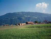
Title (German)
Fideris GR, Südsüdwestansicht der Gemeindesägerei
Caption
South-southwest view of the sawmill at the edge of the village, in the foreground meadow, farmland and road, first view before reconstruction (1990), general view; coordinates (LV03) of the camera location: 775230/198470; keywords Documenta Natura: recreation area
Caption (German)
Südsüdwestansicht der Sägerei am Dorfrand, im Vordergrund Wiese, Ackerlandschaft und Strasse, Erstauaufnahme vor dem Umbau (1990), Gesamtansicht; Koordinaten (LV03) des Kamerastandorts: 775230/198470; Schlagworte Documenta Natura: Erholungsgebiet
Record Name
Dia_303-01744

Title (German)
Fideris GR, Südsüdwestansicht der Gemeindesägerei
Caption
South-southwest view of the sawmill at the edge of the village, in the foreground meadow, farmland and road, photograph taken after reconstruction (1991), general view; coordinates (LV03) of camera location: 775230/198470; keywords Documenta Natura: recreation area
Caption (German)
Südsüdwestansicht der Sägerei am Dorfrand, im Vordergrund Wiese, Ackerlandschaft und Strasse, Aufnahme nach dem Umbau (1991), Gesamtansicht; Koordinaten (LV03) des Kamerastandorts: 775230/198470; Schlagworte Documenta Natura: Erholungsgebiet
Record Name
Dia_303-01752

Title (German)
Ramosch GR, Im oberen Teil des Schutzwaldes Jürada oberhalb Vn…
Caption
Thinned tree stand, clearing cut with game fence, first photograph (1994), partial view downslope; coordinates (LV03) of camera location: 823100/193050; keywords Documenta Natura: recreation area.
Caption (German)
Durchforsteter Baumbestand, Lichtungshieb mit Wildschutzzaun, Erstaufnahme (1994), Teilansicht hangabwärts; Koordinaten (LV03) des Kamerastandorts: 823100/193050; Schlagworte Documenta Natura: Erholungsgebiet
Record Name
Dia_303-01761

Title (German)
Ramosch GR, Im oberen Teil des Schutzwaldes Jürada oberhalb Vn…
Caption
Thinned tree stand, clearing cut with game fence, 1st follow-up photograph after 1 year (1995), partial view downslope; coordinates (LV03) of camera location: 823100/193050; keywords Documenta Natura: recreation area.
Caption (German)
Durchforsteter Baumbestand, Lichtungshieb mit Wildschutzzaun, 1. Folgeaufnahme nach 1 Jahr (1995), Teilansicht hangabwärts; Koordinaten (LV03) des Kamerastandorts: 823100/193050; Schlagworte Documenta Natura: Erholungsgebiet
Record Name
Dia_303-01765

Title (German)
Ramosch GR, Bei Höhenkote 1949 im Schutzwald Jürada oberhalb Vn…
Caption
Young growth in rotten structure (spruce), in the background high forest with spruce and larch, first photograph (1995), general view; coordinates (LV03) of camera location: 823925/192900; keywords Documenta Natura: recreation area.
Caption (German)
Jungwuchs in Rottenstruktur (Fichte), im Hintergrund Hochwald mit Fichte und Lärche, Erstaufnahme (1995), Gesamtansicht; Koordinaten (LV03) des Kamerastandorts: 823925/192900; Schlagworte Documenta Natura: Erholungsgebiet
Record Name
Dia_303-01769

Title (German)
Ramosch GR, Bei Höhenkote 1949 im Schutzwald Jürada oberhalb Vn…
Caption
Young growth in rotten structure (spruce), in the background high forest with spruce and larch, 1st follow-up photograph (1996), general view; coordinates (LV03) of camera location: 823880/192900; keywords Documenta Natura: recreation area.
Caption (German)
Jungwuchs in Rottenstruktur (Fichte), im Hintergrund Hochwald mit Fichte und Lärche, 1. Folgeaufnahme (1996), Gesamtansicht; Koordinaten (LV03) des Kamerastandorts: 823880/192900; Schlagworte Documenta Natura: Erholungsgebiet
Record Name
Dia_303-01775
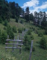
Title (German)
Ramosch GR, Bei Höhenkote 2156 an der oberen Waldgrenze des Schutzwaldes Jürada oberhalb Vn…
Caption
Tree stand at the upper forest boundary with young growth, spruce inside and outside game fences, partial view upslope; coordinates (LV03) of camera location: 823375/193175; keywords Documenta Natura: recreation area.
Caption (German)
Baumbestand an der oberen Waldgrenze mit Jungwuchs, Fichte innerhalb und ausserhalb von Wildschutzzäunen, Teilansicht hangaufwärts; Koordinaten (LV03) des Kamerastandorts: 823375/193175; Schlagworte Documenta Natura: Erholungsgebiet
Record Name
Dia_303-01782

Title (German)
Ramosch GR, Im Schutzwald Jürada bei Costa Tulai
Caption
Thinned tree stand, high forest, spruce, with game fence (still under construction), rootstocks and branches lying around, first photograph (1995), partial view; coordinates (LV03) of camera location: 823855/192575; keywords Documenta Natura: recreation area.
Caption (German)
Durchforsteter Baumbestand, Hochwald, Fichte, mit Wildschutzzaun (noch im Bau), Wurzelstöcke und herumliegende Aeste, Erstaufnahme (1995), Teilansicht; Koordinaten (LV03) des Kamerastandorts: 823855/192575; Schlagworte Documenta Natura: Erholungsgebiet
Record Name
Dia_303-01787

Title (German)
Ramosch GR, Im Schutzwald Jürada bei Costa Tulai
Caption
Thinned tree stand, high forest, spruce, with game fence, rootstocks and branches lying around, 1st follow-up photograph after 1 year (1996), partial view; coordinates (LV03) of camera location: 823855/192575; keywords Documenta Natura: recreation area.
Caption (German)
Durchforsteter Baumbestand, Hochwald, Fichte, mit Wildschutzzaun, Wurzelstöcke und herumliegende Aeste, 1. Folgeaufnahme nach 1 Jahr (1996), Teilansicht; Koordinaten (LV03) des Kamerastandorts: 823855/192575; Schlagworte Documenta Natura: Erholungsgebiet
Record Name
Dia_303-01791

Title (German)
Ramosch GR, Obere Waldgrenze bei Munt Tanter Alps oberhalb Vn…
Caption
Structure of the Jürada protection forest at the upper timberline, with young growth (silver fir, silver pine, Swiss stone pine and larch), partly with game fence, in the background partly with avalanche works, steelworks, concrete works VOBAG (bridge construction), partial view upslope; coordinates (LV03) of the camera location: 823400/193170; keywords Documenta Natura: recreation area
Caption (German)
Struktur des Schutzwaldes Jürada an der oberen Waldgrenze, mit Jungwuchs (Weisstanne, Legföhre, Arve und Lärche), zum Teil mit Wildschutzzaun, im Hintergrund teilweise mit Lawinenwerken, Stahlwerk, Betonwerk VOBAG (Brückenkonstruktion), Teilansicht hangaufwärts; Koordinaten (LV03) des Kamerastandorts: 823400/193170; Schlagworte Documenta Natura: Erholungsgebiet
Record Name
Dia_303-01798

Title (German)
Ramosch GR, Obere Waldgrenze bei Munt Tanter Alps oberhalb Vn…
Caption
Structure of the Jürada protection forest at the upper timberline, with young growth (silver fir, silver pine, Swiss stone pine and larch), partly with game protection fence, in the background partly with avalanche works, steelworks, concrete works VOBAG (bridge construction), partial view upslope; coordinates (LV03) of the camera location: 823360/193175; keywords Documenta Natura: city
Caption (German)
Struktur des Schutzwaldes Jürada an der oberen Waldgrenze, mit Jungwuchs (Weisstanne, Legföhre, Arve und Lärche), zum Teil mit Wildschutzzaun, im Hintergrund teilweise mit Lawinenwerken, Stahlwerk, Betonwerk VOBAG (Brückenkonstruktion), Teilansicht hangaufwärts; Koordinaten (LV03) des Kamerastandorts: 823360/193175; Schlagworte Documenta Natura: Stadt
Record Name
Dia_303-01805

Title (German)
Ramosch GR, Im mittleren Teil des Schutzwaldes Jürada oberhalb Vn…
Caption
Browsing damage to young spruce with already dead, brown needles, in open forest pasture, general view; coordinates (LV03) of camera location: 823930/192775; keywords Documenta Natura: city
Caption (German)
Verbissschäden an junger Fichte mit bereits abgestorbenen, braunen Nadeln, in offener Waldweide, Gesamtansicht; Koordinaten (LV03) des Kamerastandorts: 823930/192775; Schlagworte Documenta Natura: Stadt
Record Name
Dia_303-01811

Title (German)
Ramosch GR, Im oberen Teil des Schutzwaldes Jürada oberhalb Vn…
Caption
Avalanche works, steel works (bridge construction) in the Jürada protection forest with game fences, photo taken in 1995, partial view; coordinates (LV03) of camera location: 823245/192950; keywords Documenta Natura: city
Caption (German)
Lawinenwerke, Stahlwerk (Brückenkonstruktion) im Schutzwald Jürada mit Wildschutzzäunen, Aufnahme 1995, Teilansicht; Koordinaten (LV03) des Kamerastandorts: 823245/192950; Schlagworte Documenta Natura: Stadt
Record Name
Dia_303-01815

Title (German)
Ramosch GR, Im oberen Teil des Schutzwaldes Jürada oberhalb Vn…
Caption
Avalanche works, woodwork (rake construction) in the Jürada protection forest with game protection fences, photograph taken in 1996, partial view; coordinates (LV03) of camera location: 823395/192660; keywords Documenta Natura: windthrow
Caption (German)
Lawinenwerke, Holzwerk (Rechenkonstruktion) im Schutzwald Jürada mit Wildschutzzäunen, Aufnahme 1996, Teilansicht; Koordinaten (LV03) des Kamerastandorts: 823395/192660; Schlagworte Documenta Natura: Windwurf
Record Name
Dia_303-01820
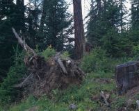
Title (German)
Ramosch GR, Im Schutzwald Jürada oberhalb Vn…
Caption
Structure of the Jürada protection forest, natural regeneration of larch and spruce on overturned, upgraded rootstocks, photograph taken in 1995, general view; coordinates (LV03) of camera location: 823460/192825; keywords Documenta Natura: Schloss
Caption (German)
Struktur des Schutzwaldes Jürada, Naturverjüngung von Lärche und Fichte auf umgeworfenen, aufgerüsteten Wurzelstöcken, Aufnahme 1995, Gesamtansicht; Koordinaten (LV03) des Kamerastandorts: 823460/192825; Schlagworte Documenta Natura: Schloss
Record Name
Dia_303-01826

Title (German)
Ramosch GR, Im Schutzwald Jürada oberhalb Vn…
Caption
Structure of the Jürada protection forest, natural regeneration of larch and spruce on overturned, upgraded rootstocks, photograph taken in 1996, general view; coordinates (LV03) of camera location: 823650/192150; keywords Documenta Natura: Schloss
Caption (German)
Struktur des Schutzwaldes Jürada, Naturverjüngung von Lärche und Fichte auf umgeworfenen, aufgerüsteten Wurzelstöcken, Aufnahme 1996, Gesamtansicht; Koordinaten (LV03) des Kamerastandorts: 823650/192150; Schlagworte Documenta Natura: Schloss
Record Name
Dia_303-01832

Title (German)
Ramosch GR, Im oberen Teil des Schutzwaldes Jürada oberhalb Vn…
Caption
Structure of the protection forest Jürada, with fallen conifers /single tree, spruce, in the background young growth (spruce), partly avalanche works, steelworks (bridge construction); partial view; coordinates (LV03) of the camera location: 823355/193035; keywords Documenta Natura: castle
Caption (German)
Struktur des Schutzwaldes Jürada, mit umgeworfenen Nadelbäumen /Einzelbaum, Fichte, im Hintergrund Jungwuchs (Fichte), zum Teil Lawinenwerke, Stahlwerk (Brückenkonstruktion); Teilansicht; Koordinaten (LV03) des Kamerastandorts: 823355/193035; Schlagworte Documenta Natura: Schloss
Record Name
Dia_303-01836

Title (German)
Ramosch GR, Im oberen Teil des Schutzwaldes Jürada oberhalb Vn…
Caption
Structure of the protection forest Jürada, with fallen conifers /single tree, spruce, in the background young growth (spruce), partly avalanche works, steelworks (bridge construction); partial view; coordinates (LV03) of the camera location: 823355/193035; keywords Documenta Natura: castle
Caption (German)
Struktur des Schutzwaldes Jürada, mit umgeworfenen Nadelbäumen /Einzelbaum, Fichte, im Hintergrund Jungwuchs (Fichte), zum Teil Lawinenwerke, Stahlwerk (Brückenkonstruktion); Teilansicht; Koordinaten (LV03) des Kamerastandorts: 823355/193035; Schlagworte Documenta Natura: Schloss
Record Name
Dia_303-01840

Title (German)
Ramosch GR, Im oberen Teil des Schutzwaldes Jürada oberhalb Vn…
Caption
Structure of the protection forest Jürada, with fallen conifers /single tree, spruce, in the background young growth (spruce), partly avalanche works, steelworks (bridge construction); partial view; coordinates (LV03) of the camera location: 823355/193035; keywords Documenta Natura: castle
Caption (German)
Struktur des Schutzwaldes Jürada, mit umgeworfenen Nadelbäumen /Einzelbaum, Fichte, im Hintergrund Jungwuchs (Fichte), zum Teil Lawinenwerke, Stahlwerk (Brückenkonstruktion); Teilansicht; Koordinaten (LV03) des Kamerastandorts: 823355/193035; Schlagworte Documenta Natura: Schloss
Record Name
Dia_303-01844
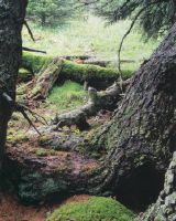
Title (German)
Ramosch GR, Im oberen Teil des Schutzwaldes Jürada oberhalb Vn…
Caption
Structure of the protection forest Jürada, with fallen conifers /single tree, spruce, in the background young growth (spruce), partly avalanche works, steelworks (bridge construction); partial view; coordinates (LV03) of the camera location: 823355/193035; keywords Documenta Natura: castle
Caption (German)
Struktur des Schutzwaldes Jürada, mit umgeworfenen Nadelbäumen /Einzelbaum, Fichte, im Hintergrund Jungwuchs (Fichte), zum Teil Lawinenwerke, Stahlwerk (Brückenkonstruktion); Teilansicht; Koordinaten (LV03) des Kamerastandorts: 823355/193035; Schlagworte Documenta Natura: Schloss
Record Name
Dia_303-01848

Title (German)
Ramosch GR, Im oberen Teil des Schutzwaldes Jürada oberhalb Vn…
Caption
Structure of the Jürada protection forest, forest floor overgrown with moss, rootstock, drought wood, lichen, detailed view; coordinates (LV03) of the camera location: 823275/192950; keywords Documenta Natura: road.
Caption (German)
Struktur des Schutzwaldes Jürada, mit Moos bewachsener Waldboden, Wurzelstock, Dürrholz, Flechte, Detailansicht; Koordinaten (LV03) des Kamerastandorts: 823275/192950; Schlagworte Documenta Natura: Strasse
Record Name
Dia_303-01860

Title (German)
Ramosch GR, Südwestansicht des Südwesthanges im Val Sinestra mit Vn…, dem Schutzwald Jürada und dem Piz Arina
Caption
Southwest view of the southwest slope in Val Sinestra with the village of Vnà, the Val Fermusa avalanche train, the Jürada protection forest and Piz Arina, photograph taken in 1992, reverse slope photograph, general view; coordinates (LV03) of the camera location: 822675/191250; keywords Documenta Natura: hamlets
Caption (German)
Südwestansicht des Südwesthanges im Val Sinestra mit dem Dorf Vnà, dem Lawinenzug Val Fermusa, dem Schutzwald Jürada und dem Piz Arina, Aufnahme 1992, Gegenhangaufnahme, Gesamtansicht; Koordinaten (LV03) des Kamerastandorts: 822675/191250; Schlagworte Documenta Natura: Weiler
Record Name
Dia_303-01867

Title (German)
Ramosch GR, Südwestansicht des Südwesthanges im Val Sinestra mit Vn…, dem Schutzwald Jürada und dem Piz Arina
Caption
Southwest view of the southwest slope in Val Sinestra with the village of Vn..., the Val Fermusa avalanche train, the Jürada protection forest and Piz Arina, photo taken in 1993, reverse slope photo, general view; coordinates (LV03) of the camera location: 822675/191250; keywords Documenta Natura: hamlets
Caption (German)
Südwestansicht des Südwesthanges im Val Sinestra mit dem Dorf Vn…, dem Lawinenzug Val Fermusa, dem Schutzwald Jürada und dem Piz Arina, Aufnahme 1993, Gegenhangaufnahme, Gesamtansicht; Koordinaten (LV03) des Kamerastandorts: 822675/191250; Schlagworte Documenta Natura: Weiler
Record Name
Dia_303-01872

Title (German)
Pontresina GR, Südwestansicht des Dorfes Pontresina mit dem Südwesthang Schafberg und dem Piz Muragl
Caption
Southwest view of the station with tracks, platforms, station building and two railcars of the series ABe 4/4 No. 30-34, built in 1908, in the background Pontresina with the hotels and the southwest slope Schafberg with Piz Muragl, first photo summer 1992, general view; coordinates (LV03) of the camera location: 788575/151700; keywords Documenta Natura: Weiler
Caption (German)
Südwestansicht des Bahnhofes mit Gleisanlagen, Perrons, Bahnhofgebäude und zwei Triebwagen der Serie ABe 4/4 Nr. 30–34, erbaut 1908, im Hintergrund Pontresina mit den Hotels und der Südwesthang Schafberg mit dem Piz Muragl, Erstaufnahme Sommer 1992, Gesamtansicht; Koordinaten (LV03) des Kamerastandorts: 788575/151700; Schlagworte Documenta Natura: Weiler
Record Name
Dia_303-01877

Title (German)
Pontresina GR, Südwestansicht des Dorfes Pontresina mit dem Südwesthang Schafberg und dem Piz Muragl
Caption
Southwest view of the railroad station with tracks, platforms and station building, in the background Pontresina with the hotels and the southwest slope Schafberg with Piz Muragl, first photo summer 1992, general view; coordinates (LV03) of the camera location: 788575/151700; keywords Documenta Natura: Weiler
Caption (German)
Südwestansicht des Bahnhofes mit Gleisanlagen, Perrons und Bahnhofgebäude, im Hintergrund Pontresina mit den Hotels und der Südwesthang Schafberg mit dem Piz Muragl, Erstaufnahme Sommer 1992, Gesamtansicht; Koordinaten (LV03) des Kamerastandorts: 788575/151700; Schlagworte Documenta Natura: Weiler
Record Name
Dia_303-01881

Title (German)
Pontresina GR, Südwestansicht des Dorfes Pontresina mit dem Südwesthang Schafberg und dem Piz Muragl
Caption
Southwest view of the railroad station with tracks, platforms and station building, in the background Pontresina with the hotels and the southwest slope Schafberg with Piz Muragl, first photo summer 1992, general view; coordinates (LV03) of the camera location: 788575/151700; keywords Documenta Natura: road
Caption (German)
Südwestansicht des Bahnhofes mit Gleisanlagen, Perrons und Bahnhofgebäude, im Hintergrund Pontresina mit den Hotels und der Südwesthang Schafberg mit dem Piz Muragl, Erstaufnahme Sommer 1992, Gesamtansicht; Koordinaten (LV03) des Kamerastandorts: 788575/151700; Schlagworte Documenta Natura: Strasse
Record Name
Dia_303-01885
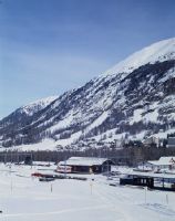
Title (German)
Pontresina GR, Südwestansicht des Dorfes Pontresina mit dem Südwesthang Schafberg und dem Piz Muragl
Caption
Southwest view of the railroad station with tracks, platforms and station building, in the background Pontresina with the hotels and the southwest slope Schafberg with Piz Muragl, 1st follow-up image winter 1995, general view; coordinates (LV03) of the camera location: 788575/151700; keywords Documenta Natura: exhibition
Caption (German)
Südwestansicht des Bahnhofes mit Gleisanlagen, Perrons und Bahnhofgebäude, im Hintergrund Pontresina mit den Hotels und der Südwesthang Schafberg mit dem Piz Muragl, 1. Folgeaufnahme Winter 1995, Gesamtansicht; Koordinaten (LV03) des Kamerastandorts: 788575/151700; Schlagworte Documenta Natura: Ausstellung
Record Name
Dia_303-01894

Title (German)
Pontresina GR, Südwestansicht des Dorfes Pontresina mit dem Südwesthang Schafberg und dem Piz Muragl
Caption
Southwest view of the railroad station with tracks, platforms and station building, in the background Pontresina with the hotels and the southwest slope Schafberg with Piz Muragl, 1st follow-up image winter 1995, general view; coordinates (LV03) of the camera location: 788575/151700; keywords Documenta Natura: exhibition
Caption (German)
Südwestansicht des Bahnhofes mit Gleisanlagen, Perrons und Bahnhofgebäude, im Hintergrund Pontresina mit den Hotels und der Südwesthang Schafberg mit dem Piz Muragl, 1. Folgeaufnahme Winter 1995, Gesamtansicht; Koordinaten (LV03) des Kamerastandorts: 788575/151700; Schlagworte Documenta Natura: Ausstellung
Record Name
Dia_303-01896

Title (German)
Pontresina GR, Südwestansicht des Dorfes Pontresina mit dem Südwesthang Schafberg und dem Piz Muragl
Caption
Southwest view of the railroad station with tracks, platforms and station building, in the background Pontresina with the hotels and the southwest slope Schafberg with Piz Muragl, 1st follow-up image winter 1995, general view; coordinates (LV03) of the camera location: 788575/151700; keywords Documenta Natura: exhibition
Caption (German)
Südwestansicht des Bahnhofes mit Gleisanlagen, Perrons und Bahnhofgebäude, im Hintergrund Pontresina mit den Hotels und der Südwesthang Schafberg mit dem Piz Muragl, 1. Folgeaufnahme Winter 1995, Gesamtansicht; Koordinaten (LV03) des Kamerastandorts: 788575/151700; Schlagworte Documenta Natura: Ausstellung
Record Name
Dia_303-01899

Title (German)
Pontresina GR, Westansicht der Alp da Staz, im Hintergrund der Schafberg mit Las Sours und Piz Muragl
Caption
West view of the Alp da Staz pasture with forest edge, in the background the Schafberg with Las Sours and Piz Muragl, partial view; coordinates (LV03) of the camera location: 786590/151520; keywords Documenta Natura: exhibition
Caption (German)
Westansicht der Weide Alp da Staz mit Waldrand, im Hintergrund der Schafberg mit Las Sours und Piz Muragl, Teilansicht; Koordinaten (LV03) des Kamerastandorts: 786590/151520; Schlagworte Documenta Natura: Ausstellung
Record Name
Dia_303-01908

Title (German)
Pontresina GR, Nordwestansicht des Südwesthanges mit der Geröllhalde Foura da l' Amd Ursina und dem Muot da Barba Peider
Caption
Scree slope Four da l' Amd'Ursina with permafrost, in the background the Muot da Barba Peider and the Bernina mountain range with the Vadret da Morteratsch, general view across the slope; coordinates (LV03) of the camera location: 790795/152840; keywords Documenta Natura: road
Caption (German)
Geröllhalde Four da l' Amd'Ursina mit Permafrost, im Hintergrund der Muot da Barba Peider und die Gebirgskette Bernina mit dem Vadret da Morteratsch, Gesamtansicht quer zum Hang; Koordinaten (LV03) des Kamerastandorts: 790795/152840; Schlagworte Documenta Natura: Strasse
Record Name
Dia_303-01914

Title (German)
Pontresina GR, Nordwestansicht des Südwesthanges mit der Geröllhalde Foura da l' Amd Ursina und dem Muot da Barba Peider
Caption
Scree slope Four da l' Amd'Ursina with permafrost, in the background the Muot da Barba Peider and the Bernina mountain range with the Vadret da Morteratsch, general view across the slope; coordinates (LV03) of the camera location: 790795/152840; keywords Documenta Natura: human representation
Caption (German)
Geröllhalde Four da l' Amd'Ursina mit Permafrost, im Hintergrund der Muot da Barba Peider und die Gebirgskette Bernina mit dem Vadret da Morteratsch, Gesamtansicht quer zum Hang; Koordinaten (LV03) des Kamerastandorts: 790795/152840; Schlagworte Documenta Natura: Menschendarstellung
Record Name
Dia_303-01916

Title (German)
Pontresina GR, Nordwestansicht des Südwesthanges mit der Geröllhalde Foura da l' Amd Ursina und dem Muot da Barba Peider
Caption
Scree slope Four da l' Amd'Ursina with permafrost, in the background the Muot da Barba Peider and the Bernina mountain range with the Vadret da Morteratsch, general view across the slope; coordinates (LV03) of the camera location: 790795/152840; keywords Documenta Natura: human representation
Caption (German)
Geröllhalde Four da l' Amd'Ursina mit Permafrost, im Hintergrund der Muot da Barba Peider und die Gebirgskette Bernina mit dem Vadret da Morteratsch, Gesamtansicht quer zum Hang; Koordinaten (LV03) des Kamerastandorts: 790795/152840; Schlagworte Documenta Natura: Menschendarstellung
Record Name
Dia_303-01918

Title (German)
Pontresina GR, Westansicht des Südwesthanges Schafberg bei Laviner Giandains
Caption
Southwestern slope Schafberg with avalanche works, concrete plant VOBAG (bridge construction), first photograph 1995, general view upslope to across slope; coordinates (LV03) of camera location: 790340/152525; keywords Documenta Natura: meadowland
Caption (German)
Südwesthang Schafberg mit Lawinenwerken, Betonwerk VOBAG (Brückenkonstruktion), Erstaufnahme 1995, Gesamtansicht hangaufwärts bis quer zum Hang; Koordinaten (LV03) des Kamerastandorts: 790340/152525; Schlagworte Documenta Natura: Wiesland
Record Name
Dia_303-01923

Title (German)
Pontresina GR, Westansicht des Südwesthanges Schafberg bei Laviner Giandains
Caption
Southwestern slope Schafberg with avalanche works, concrete plant VOBAG (bridge construction), first photograph 1995, general view upslope to across slope; coordinates (LV03) of camera location: 790340/152525; keywords Documenta Natura: meadowland
Caption (German)
Südwesthang Schafberg mit Lawinenwerken, Betonwerk VOBAG (Brückenkonstruktion), Erstaufnahme 1995, Gesamtansicht hangaufwärts bis quer zum Hang; Koordinaten (LV03) des Kamerastandorts: 790340/152525; Schlagworte Documenta Natura: Wiesland
Record Name
Dia_303-01926

Title (German)
Pontresina GR, Westansicht des Südwesthanges Schafberg bei Laviner Giandains
Caption
Southwestern slope Schafberg with avalanche works, concrete plant VOBAG (bridge construction), first photograph 1995, general view upslope to across slope; coordinates (LV03) of camera location: 790340/152525; keywords Documenta Natura: meadowland
Caption (German)
Südwesthang Schafberg mit Lawinenwerken, Betonwerk VOBAG (Brückenkonstruktion), Erstaufnahme 1995, Gesamtansicht hangaufwärts bis quer zum Hang; Koordinaten (LV03) des Kamerastandorts: 790340/152525; Schlagworte Documenta Natura: Wiesland
Record Name
Dia_303-01929

Title (German)
Pontresina GR, Südwestansicht des Südwesthanges mit dem Clüxtobeltrichter oberhalb der Alp Languard
Caption
Southwest view of the southwest slope with the Clüxtobel funnel, with landslides and rehabilitated dry stone walls, erosion areas, hiking trail, first photo taken in 1995, partial view; coordinates (LV03) of camera location: 790630/152160; keywords Documenta Natura: wetland.
Caption (German)
Südwestansicht des Südwesthanges mit dem Clüxtobeltrichter, mit Rutschungen und sanierten Trockenmauern, Erosionsflächen, Wanderweg, Erstaufnahme 1995, Teilansicht; Koordinaten (LV03) des Kamerastandorts: 790630/152160; Schlagworte Documenta Natura: Feuchtgebiet
Record Name
Dia_303-01936

Title (German)
Pontresina GR, Südwestansicht des Südwesthanges mit dem Clüxtobeltrichter oberhalb der Alp Languard
Caption
Southwest view of the southwest slope with the Clüxtobel funnel, with landslides and rehabilitated dry stone walls, erosion areas, hiking trail, first photo taken in 1995, partial view; coordinates (LV03) of camera location: 790630/152160; keywords Documenta Natura: wetland.
Caption (German)
Südwestansicht des Südwesthanges mit dem Clüxtobeltrichter, mit Rutschungen und sanierten Trockenmauern, Erosionsflächen, Wanderweg, Erstaufnahme 1995, Teilansicht; Koordinaten (LV03) des Kamerastandorts: 790630/152160; Schlagworte Documenta Natura: Feuchtgebiet
Record Name
Dia_303-01939

Title (German)
Pontresina GR, Südostansicht des Südwesthanges Schafberg
Caption
Southeast view of the southwest slope from Schafberg with the avalanche control area, in the foreground steel works (bridge construction), in the background dry stone walls, first photo taken in 1995, partial view across the slope; coordinates (LV03) of the camera location: 790675/152470; keywords Documenta Natura: wetland
Caption (German)
Südostansicht des Südwesthang vom Schafberg mit dem Lawinenverbauungsgebiet, im Vordergrund Stahlwerke (Brückenkonstruktion), im Hintergrund Trockenmauern, Erstaufnahme 1995, Teilansicht quer zum Hang; Koordinaten (LV03) des Kamerastandorts: 790675/152470; Schlagworte Documenta Natura: Feuchtgebiet
Record Name
Dia_303-01944

Title (German)
Pontresina GR, Nordwestansicht des Südwesthanges Schafberg oberhalb der Alp Languard
Caption
Steep southwestern slope on Schafberg with erosion areas and meadow, Piz Albris in the background, partial view across the slope; coordinates (LV03) of camera location: 790740/151965; keywords Documenta Natura: wetland
Caption (German)
Steiler Südwesthang am Schafberg mit Erosionsflächen und Wiese, im Hintergrund der Piz Albris, Teilansicht quer zum Hang; Koordinaten (LV03) des Kamerastandorts: 790740/151965; Schlagworte Documenta Natura: Feuchtgebiet
Record Name
Dia_303-01948

Title (German)
Pontresina GR, Westansicht des Südwesthanges Schafberg unterhalb Laviner Giandains
Caption
Southwestern slope Schafberg with avalanche works, concrete works VOBAG (bridge construction), in the foreground an old dry stone wall and loose tree population (pine, larch), partial view upslope; coordinates (LV03) of the camera location: 790195/152470; keywords Documenta Natura: wetland
Caption (German)
Südwesthang Schafberg mit Lawinenwerken, Betonwerk VOBAG (Brückenkonstruktion), im Vordergrund eine alte Trockenmauer und lockerer Baumbestand (Föhre, Lärche), Teilansicht hangaufwärts; Koordinaten (LV03) des Kamerastandorts: 790195/152470; Schlagworte Documenta Natura: Feuchtgebiet
Record Name
Dia_303-01953

Title (German)
Pontresina GR, Südansicht des Südwesthanges Giandains
Caption
Southwestern slope of Giandains with wildlife fence and mast of chairlift, forest road, loose tree population (pine, larch), avalanche barriers in the background, partial view upslope; coordinates (LV03) of camera location: 790230/151590; keywords Documenta Natura: wetland
Caption (German)
Südwesthang Giandains mit Wildschutzzaun und Mast des Sesselliftes, Forststrasse, lockerer Baumbestand (Föhre, Lärche), im Hintergrund Lawinenverbauungen, Teilansicht hangaufwärts; Koordinaten (LV03) des Kamerastandorts: 790230/151590; Schlagworte Documenta Natura: Feuchtgebiet
Record Name
Dia_303-01957

Title (German)
Pontresina GR, Blick (Südansicht) von der Alp Languard auf den Südwesthang Schafberg
Caption
South view from Alp Languard to the southwest slope Schafberg with the avalanche control area, first photo snow-covered (1995), general view across the slope; coordinates (LV03) of the camera location: 790562/151562; keywords Documenta Natura: wetland
Caption (German)
Südansicht von der Alp Languard auf den Südwesthang Schafberg mit dem Lawinenverbauungsgebiet, Erstaufnahme schneebedeckt (1995), Gesamtansicht quer zum Hang; Koordinaten (LV03) des Kamerastandorts: 790562/151562; Schlagworte Documenta Natura: Feuchtgebiet
Record Name
Dia_303-01964

Title (German)
Pontresina GR, Blick (Südansicht) von der Alp Languard auf den Südwesthang Schafberg
Caption
South view from Alp Languard onto the southwest slope Schafberg with the avalanche control area, 1st subsequent photograph free of snow (1997), general view across the slope; coordinates (LV03) of the camera location: 790562/151562; keywords Documenta Natura: wetland
Caption (German)
Südansicht von der Alp Languard auf den Südwesthang Schafberg mit dem Lawinenverbauungsgebiet, 1. Folgeaufnahme schneefrei (1997), Gesamtansicht quer zum Hang; Koordinaten (LV03) des Kamerastandorts: 790562/151562; Schlagworte Documenta Natura: Feuchtgebiet
Record Name
Dia_303-01969

Title (German)
Pontresina GR, Nordwestansicht des oberen Clüxtobeltrichter oberhalb der Alp Languard
Caption
Northwest view of west slope from upper Clüxtobelt funnel, rehabilitated dry stone wall, erosion area with nets and logs, partial view across southwest slope; coordinates (LV03) of camera location: 790665/152420; keywords Documenta Natura: wetland.
Caption (German)
Nordwestansicht des Westhang vom oberen Clüxtobeltrichter, sanierter Trockenmauer, Erosionsfläche mit Netzen und Rundhölzern, Teilansicht quer zum Südwesthang; Koordinaten (LV03) des Kamerastandorts: 790665/152420; Schlagworte Documenta Natura: Feuchtgebiet
Record Name
Dia_303-01974

Title (German)
Pontresina GR, Blick (Südsüdostansicht) von Tais auf das Dorf Pontresina, 1922
Caption
South-southeast view from Tais to the village of Pontresina, historical photograph taken in 1922, general view; coordinates (LV03) of the camera location: 789710/150820; keywords Documenta Natura: wetland
Caption (German)
Südsüdostansicht von Tais auf das Dorf Pontresina, historische Aufnahme 1922, Gesamtansicht; Koordinaten (LV03) des Kamerastandorts: 789710/150820; Schlagworte Documenta Natura: Feuchtgebiet
Record Name
Dia_303-01977

Title (German)
Pontresina GR, Blick (Südsüdostansicht) von Tais auf das Dorf Pontresina
Caption
South-southeast view from Tais to the village of Pontresina, reconstruction photo 1998, general view; coordinates (LV03) of the camera location: 789710/150820; keywords Documenta Natura: wetland
Caption (German)
Südsüdostansicht von Tais auf das Dorf Pontresina, Rekonstruktionsaufnahme 1998, Gesamtansicht; Koordinaten (LV03) des Kamerastandorts: 789710/150820; Schlagworte Documenta Natura: Feuchtgebiet
Record Name
Dia_303-01978

Title (German)
Pontresina GR, Blick (Südsüdostansicht) von Tais auf das Dorf Pontresina
Caption
South-southeast view from Tais to the village of Pontresina, reconstruction photo 1998, general view; coordinates (LV03) of the camera location: 789710/150820; keywords Documenta Natura: wetland
Caption (German)
Südsüdostansicht von Tais auf das Dorf Pontresina, Rekonstruktionsaufnahme 1998, Gesamtansicht; Koordinaten (LV03) des Kamerastandorts: 789710/150820; Schlagworte Documenta Natura: Feuchtgebiet
Record Name
Dia_303-01981

Title (German)
Castasegna GR, Südostansicht von Castasegna mit dem Bach Mera
Caption
Southeast view of the village of Castasegna, in the foreground the Mera stream and the old stone bridge, first photo taken in 1996, general view; coordinates (LV03) of the camera location: 760245/133490; keywords Documenta Natura: hamlets
Caption (German)
Südostansicht des Dorfes Castasegna, im Vordergrund der Bach Mera und die alte Steinbrücke, Erstaufnahme 1996, Gesamtansicht; Koordinaten (LV03) des Kamerastandorts: 760245/133490; Schlagworte Documenta Natura: Weiler
Record Name
Dia_303-02303

Title (German)
Castasegna GR, Südostansicht von Castasegna mit dem Bach Mera
Caption
Southeast view of the village of Castasegna, in the foreground the Mera stream and the old stone bridge, first photo taken in 1996, general view; coordinates (LV03) of the camera location: 760245/133490; keywords Documenta Natura: street
Caption (German)
Südostansicht des Dorfes Castasegna, im Vordergrund der Bach Mera und die alte Steinbrücke, Erstaufnahme 1996, Gesamtansicht; Koordinaten (LV03) des Kamerastandorts: 760245/133490; Schlagworte Documenta Natura: Strasse
Record Name
Dia_303-02307

Title (German)
Castasegna GR, Südostansicht von Castasegna mit dem Bach Mera
Caption
Southeast view of the village of Castasegna, in the foreground the Mera stream and the old stone bridge, first photo taken in 1996, general view; coordinates (LV03) of the camera location: 760245/133490; keywords Documenta Natura: exhibition
Caption (German)
Südostansicht des Dorfes Castasegna, im Vordergrund der Bach Mera und die alte Steinbrücke, Erstaufnahme 1996, Gesamtansicht; Koordinaten (LV03) des Kamerastandorts: 760245/133490; Schlagworte Documenta Natura: Ausstellung
Record Name
Dia_303-02311

Title (German)
Castasegna GR, Südostansicht von Castasegna mit dem Bach Mera
Caption
Southeast view of the village of Castasegna, in the foreground the Mera stream and the old stone bridge, 1st follow-up photograph after the start of construction of the bypass road, with excavated material and construction machinery (1997), general view; coordinates (LV03) of the camera location: 760245/133490; keywords Documenta Natura: exhibition
Caption (German)
Südostansicht des Dorfes Castasegna, im Vordergrund der Bach Mera und die alte Steinbrücke, 1. Folgeaufnahme nach Baubeginn der Umfahrungsstrasse, mit Aushubmaterial und Baumaschinen (1997), Gesamtansicht; Koordinaten (LV03) des Kamerastandorts: 760245/133490; Schlagworte Documenta Natura: Ausstellung
Record Name
Dia_303-02317
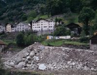
Title (German)
Castasegna GR, Südostansicht von Castasegna mit dem Bach Mera
Caption
Southeast view of the village of Castasegna, in the foreground the Mera stream and the old stone bridge, 1st follow-up photograph after the start of construction of the bypass road, with excavated material and construction machinery (1997), general view; coordinates (LV03) of the camera location: 760245/133490; keywords Documenta Natura: exhibition
Caption (German)
Südostansicht des Dorfes Castasegna, im Vordergrund der Bach Mera und die alte Steinbrücke, 1. Folgeaufnahme nach Baubeginn der Umfahrungsstrasse, mit Aushubmaterial und Baumaschinen (1997), Gesamtansicht; Koordinaten (LV03) des Kamerastandorts: 760245/133490; Schlagworte Documenta Natura: Ausstellung
Record Name
Dia_303-02323

Title (German)
Castasegna GR, Südostansicht von Castasegna mit dem Bach Mera
Caption
Southeast view of the village of Castasegna, in the foreground the Mera stream and the old stone bridge, 1st follow-up photograph after the start of construction of the bypass road, with excavated material and construction machinery (1997), general view; coordinates (LV03) of the camera location: 760245/133490; keywords Documenta Natura: exhibition
Caption (German)
Südostansicht des Dorfes Castasegna, im Vordergrund der Bach Mera und die alte Steinbrücke, 1. Folgeaufnahme nach Baubeginn der Umfahrungsstrasse, mit Aushubmaterial und Baumaschinen (1997), Gesamtansicht; Koordinaten (LV03) des Kamerastandorts: 760245/133490; Schlagworte Documenta Natura: Ausstellung
Record Name
Dia_303-02327

Title (German)
Castasegna GR, Südostansicht von Castasegna mit dem Bach Mera
Caption
Southeast view of the village of Castasegna, in the foreground the Mera stream and the old stone bridge, general view, 3rd follow-up shot shortly before completion (1999); coordinates (LV03) of the camera location: 760245/133490; keywords Documenta Natura: Selve, chestnut cultivation, deciduous tree
Caption (German)
Südostansicht des Dorfes Castasegna, im Vordergrund der Bach Mera und die alte Steinbrücke, Gesamtansicht, 3. Folgeaufnahme kurz vor der Fertigstellung (1999); Koordinaten (LV03) des Kamerastandorts: 760245/133490; Schlagworte Documenta Natura: Selve, Kastanienanbau, Laubbaum
Record Name
Dia_303-02350

Title (German)
Castasegna GR, Südostansicht von Castasegna mit dem Bach Mera
Caption
Southeast view of the village of Castasegna, in the foreground the Mera stream and the old stone bridge, general view, 3rd follow-up shot shortly before completion (1999); coordinates (LV03) of the camera location: 760245/133490; keywords Documenta Natura: Selve, chestnut cultivation, deciduous tree
Caption (German)
Südostansicht des Dorfes Castasegna, im Vordergrund der Bach Mera und die alte Steinbrücke, Gesamtansicht, 3. Folgeaufnahme kurz vor der Fertigstellung (1999); Koordinaten (LV03) des Kamerastandorts: 760245/133490; Schlagworte Documenta Natura: Selve, Kastanienanbau, Laubbaum
Record Name
Dia_303-02353

Title (German)
Castasegna GR, Südostansicht von Castasegna mit dem Bach Mera
Caption
Southeast view of the village of Castasegna, in the foreground the Mera stream and the old stone bridge, general view, 3rd follow-up shot shortly before completion (1999); coordinates (LV03) of the camera location: 760245/133490; keywords Documenta Natura: Selve, chestnut cultivation, deciduous tree
Caption (German)
Südostansicht des Dorfes Castasegna, im Vordergrund der Bach Mera und die alte Steinbrücke, Gesamtansicht, 3. Folgeaufnahme kurz vor der Fertigstellung (1999); Koordinaten (LV03) des Kamerastandorts: 760245/133490; Schlagworte Documenta Natura: Selve, Kastanienanbau, Laubbaum
Record Name
Dia_303-02357

Title (German)
Castasegna GR, In der Kastanienselve Brentan
Caption
Flowering uncut meadows in Brentan chestnut selve, partly with footpath, overgrown cairn, partial view; keywords Documenta Natura: Selve, chestnut cultivation, deciduous tree
Caption (German)
Blühende, ungeschnittene Wiesen in der Kastanienselve Brentan, zum Teil mit Fussweg, überwachsenem Steinhaufen, Teilansicht; Schlagworte Documenta Natura: Selve, Kastanienanbau, Laubbaum
Record Name
Dia_303-02369

Title (German)
Castasegna GR, In der Kastanienselve Brentan
Caption
Flowering uncut meadows in Brentan chestnut selve, partly with footpath, overgrown cairn, partial view; keywords Documenta Natura: Selve, chestnut cultivation, deciduous tree
Caption (German)
Blühende, ungeschnittene Wiesen in der Kastanienselve Brentan, zum Teil mit Fussweg, überwachsenem Steinhaufen, Teilansicht; Schlagworte Documenta Natura: Selve, Kastanienanbau, Laubbaum
Record Name
Dia_303-02371

Title (German)
Castasegna GR, In der Kastanienselve Brentan
Caption
Flowering uncut meadows in Brentan chestnut selve, partly with footpath, overgrown cairn, partial view; keywords Documenta Natura: Selve, chestnut cultivation, deciduous tree
Caption (German)
Blühende, ungeschnittene Wiesen in der Kastanienselve Brentan, zum Teil mit Fussweg, überwachsenem Steinhaufen, Teilansicht; Schlagworte Documenta Natura: Selve, Kastanienanbau, Laubbaum
Record Name
Dia_303-02373
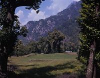
Title (German)
Castasegna GR, In der Kastanienselve Brentan
Caption
Chestnut Selve ( sweet chestnut) Brentan in midsummer, with dry stone walls/stone piles, photograph 1991, partial view; keywords Documenta Natura: Selve, chestnut cultivation, deciduous tree.
Caption (German)
Kastanienselve ( Edelkastanie) Brentan im Hochsommer, mit Trockenmauern/ Steinhaufen, Aufnahme 1991, Teilansicht; Schlagworte Documenta Natura: Selve, Kastanienanbau, Laubbaum
Record Name
Dia_303-02375

Title (German)
Castasegna GR, In der Kastanienselve Brentan
Caption
Chestnut Selve (sweet chestnut) Brentan in midsummer, Silvio Cortalatti and his sister making hay", photograph 1994, partial view"; Keywords Documenta Natura: Selve, chestnut cultivation, deciduous tree
Caption (German)
Kastanienselve (Edelkastanie) Brentan im Hochsommer, Silvio Cortalatti und seiner Schwester beim Heuen", Aufnahme 1994, Teilansicht"; Schlagworte Documenta Natura: Selve, Kastanienanbau, Laubbaum
Record Name
Dia_303-02381

Title (German)
Castasegna GR, In der Kastanienselve Brentan
Caption
Branch of sweet chestnut with inflorescence, partial view; keywords Documenta Natura: Selve, chestnut cultivation, deciduous tree
Caption (German)
Zweig der Edelkastanie mit Blütenstand, Teilansicht; Schlagworte Documenta Natura: Selve, Kastanienanbau, Laubbaum
Record Name
Dia_303-02387

Title (German)
Castasegna GR, In der Kastanienselve Brentan
Caption
Branch of sweet chestnut with inflorescence, partial view; keywords Documenta Natura: Selve, chestnut cultivation, deciduous tree
Caption (German)
Zweig der Edelkastanie mit Blütenstand, Teilansicht; Schlagworte Documenta Natura: Selve, Kastanienanbau, Laubbaum
Record Name
Dia_303-02388

Title (German)
Castasegna GR, In der Kastanienselve Brentan
Caption
Chestnut Selve Brentan, partly with the village Castasegna and with mountain range, photograph taken during the vegetation break in winter 1991, partial view; coordinates (LV03) of the camera location: 760500/133775; keywords Documenta Natura: Selve, chestnut cultivation, deciduous tree
Caption (German)
Kastanienselve Brentan, zum Teil mit dem Dorf Castasegna und mit Gebirgskette, Aufnahme während der Vegetationpause im Winter 1991, Teilansicht; Koordinaten (LV03) des Kamerastandorts: 760500/133775; Schlagworte Documenta Natura: Selve, Kastanienanbau, Laubbaum
Record Name
Dia_303-02393

Title (German)
Castasegna GR, In der Kastanienselve Brentan
Caption
Chestnut Selve Brentan, partly with the village Castasegna and with mountain range, photograph taken during the vegetation break in winter 1991, partial view; coordinates (LV03) of the camera location: 760590/133685; keywords Documenta Natura: Selve, chestnut cultivation, deciduous tree
Caption (German)
Kastanienselve Brentan, zum Teil mit dem Dorf Castasegna und mit Gebirgskette, Aufnahme während der Vegetationpause im Winter 1991, Teilansicht; Koordinaten (LV03) des Kamerastandorts: 760590/133685; Schlagworte Documenta Natura: Selve, Kastanienanbau, Laubbaum
Record Name
Dia_303-02398

Title (German)
Castasegna GR, In der Kastanienselve Brentan
Caption
Chestnut Selve Brentan, partly with the village Castasegna and with mountain range, photograph taken during the vegetation break in winter 1991, partial view; coordinates (LV03) of the camera location: 760345/133665; keywords Documenta Natura: Selve, chestnut cultivation, deciduous tree
Caption (German)
Kastanienselve Brentan, zum Teil mit dem Dorf Castasegna und mit Gebirgskette, Aufnahme während der Vegetationpause im Winter 1991, Teilansicht; Koordinaten (LV03) des Kamerastandorts: 760345/133665; Schlagworte Documenta Natura: Selve, Kastanienanbau, Laubbaum
Record Name
Dia_303-02404

Title (German)
Castasegna GR, In der Kastanienselve Brentan
Caption
Chestnut Selve Brentan, 1st follow-up photograph, during the vegetation phase in summer 1996, partial view; coordinates (LV03) of camera location: 760500/133775; keywords Documenta Natura: Selve, chestnut cultivation, deciduous tree.
Caption (German)
Kastanienselve Brentan, 1. Folgeaufnahme, während der Vegetationsphase im Sommer 1996, Teilansicht; Koordinaten (LV03) des Kamerastandorts: 760500/133775; Schlagworte Documenta Natura: Selve, Kastanienanbau, Laubbaum
Record Name
Dia_303-02409