 E-PICS - ETHBIB.Bildarchiv


The images presented on this page are part of E-Pics, a service provided by the ETH-Bibliothek of ETH Zurich. You find here static medium resolution images published under the creative commons
CC-BY-SA license or with the Public Domain Mark. This means that you are free to share, copy and redistribute the material in any medium or format; that you are free to remix, transform, and build upon the material for any purpose, even commercially, under the following conditions: You must give appropriate credit, provide a link to the license, and indicate if changes were made.
- More information about E-Pics is available at https://www.e-pics.ethz.ch
- This catalog can also be accessed at https://ba.e-pics.ethz.ch/ . There you can download the image in a higher resolution.

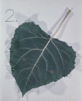
Title (German)
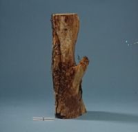
Rostbefall an Zuchtpappeln
Caption
Catalog tab: 101.2 Trials
Caption (German)
Reiter Katalog: 101.2 Versuche
Record Name
Dia_292-5164
Title (German)
Rostbefall an Zuchtpappeln
Caption
Catalog tab: 101.2 Trials
Caption (German)
Reiter Katalog: 101.2 Versuche
Record Name
Dia_292-5165

Title (German)
Rostbefall an Zuchtpappeln
Caption
Catalog tab: 101.2 Trials
Caption (German)
Reiter Katalog: 101.2 Versuche
Record Name
Dia_292-5166

Title (German)
Rostbefall an Zuchtpappeln
Caption
Catalog tab: 101.2 Trials
Caption (German)
Reiter Katalog: 101.2 Versuche
Record Name
Dia_292-5167

Title (German)
Lindenpfropfgarten
Caption
Catalog tab: 101.2 Trials
Caption (German)
Reiter Katalog: 101.2 Versuche
Record Name
Dia_292-5168

Title (German)
Lindenpfropfgarten
Caption
Catalog tab: 101.2 Trials
Caption (German)
Reiter Katalog: 101.2 Versuche
Record Name
Dia_292-5169

Title (German)
Grundwasserversuch mit Schwarzerle
Caption
Catalog tab: 101.2 Trials
Caption (German)
Reiter Katalog: 101.2 Versuche
Record Name
Dia_292-5170

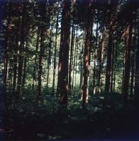
Title (German)
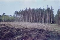
Stark durchforstete Fläche im Breitenacker
Caption
Catalog tab: 101.2 Trials
Caption (German)
Reiter Katalog: 101.2 Versuche
Record Name
Dia_292-5171

Title (German)
Stark durchforstete Fläche im Breitenacker
Caption
Catalog tab: 101.2 Trials
Caption (German)
Reiter Katalog: 101.2 Versuche
Record Name
Dia_292-5172

Title (German)
Stark durchforstete Fläche im Breitenacker
Caption
Catalog tab: 101.2 Trials
Caption (German)
Reiter Katalog: 101.2 Versuche
Record Name
Dia_292-5173

Title (German)
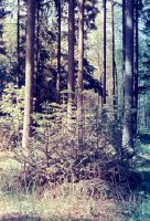
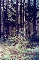
Schwach durchforstete Fläche im Breitenacker
Caption
Catalog tab: 101.2 Trials
Caption (German)
Reiter Katalog: 101.2 Versuche
Record Name
Dia_292-5174
Title (German)
Stark durchforstete Fläche im Breitenacker
Caption
Catalog tab: 101.2 Trials
Caption (German)
Reiter Katalog: 101.2 Versuche
Record Name
Dia_292-5175

Title (German)
Schwach durchforstete Fläche im Breitenacker
Caption
Catalog tab: 101.2 Trials
Caption (German)
Reiter Katalog: 101.2 Versuche
Record Name
Dia_292-5176

Title (German)
Stark durchforstete Fläche im Breitenacker
Caption
Catalog tab: 101.2 Trials
Caption (German)
Reiter Katalog: 101.2 Versuche
Record Name
Dia_292-5177

Title (German)
Schwach durchforstete Fläche im Breitenacker
Caption
Catalog tab: 101.2 Trials
Caption (German)
Reiter Katalog: 101.2 Versuche
Record Name
Dia_292-5178

Title (German)
Schwach durchforstete Fläche im Breitenacker
Caption
Catalog tab: 101.2 Trials
Caption (German)
Reiter Katalog: 101.2 Versuche
Record Name
Dia_292-5179

Title (German)
Eiche in Mischwaldfläche
Caption
Catalog tab: 101.2 Trials
Caption (German)
Reiter Katalog: 101.2 Versuche
Record Name
Dia_292-5180

Title (German)
Birkenbestand Versuchsfläche, Moos bei Birmensdorf
Caption
Catalog tab: 101.2 Trials
Caption (German)
Reiter Katalog: 101.2 Versuche
Record Name
Dia_292-5181

Title (German)
Ohne Titel
Caption
Catalog tab: 101.2 Trials
Caption (German)
Reiter Katalog: 101.2 Versuche
Record Name
Dia_292-5182

Title (German)
Schläfer (hier Siebenschläfer)/ Gliridae (hier Glis glis)/ Ringelung
Record Name
Dia_292-5183

Title (German)
Schermaus/ Arvicola terrestris/ Nagelschaden an Wurzel
Record Name
Dia_292-5184

Title (German)
Schermaus/ Arvicola terrestris/ Nagelschaden an Wurzeln
Record Name
Dia_292-5185

Title (German)
Haselmaus/ Muscardinus avellanarius/ Ringelung
Record Name
Dia_292-5186
Title (German)
Buntspecht/ Picidae/ Anschläge an Föhre
Record Name
Dia_292-5187

Title (German)
Buntspecht/ Picidae/ Spechtschmiede
Record Name
Dia_292-5188
Title (German)
Eichhörnchen/ Sciurus vulgaris/ Schalschäden
Record Name
Dia_292-5189
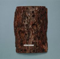
Title (German)
Hallimasch (= Honigschwamm)/ Armillaria mellea (=Armillariella m. )/ Weiss- und Lochfäule
Record Name
Dia_292-5190

Title (German)
Rotpustel-Pilz/ Nectria cinnabarina/ Rotpustelkrankheit
Record Name
Dia_292-5191

Title (German)
Buchenkrebs-Pilz/ Nectria ditissima/ Buchenkrebs
Record Name
Dia_292-5192

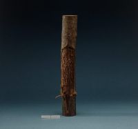
Title (German)
Eschenbastkäfer/ Leperesinus varius = Hylesinus fraxini/ Brutgänge
Record Name
Dia_292-5193

Title (German)
Eschenbastkäfer/ Leperesinus varius/ = Hylesinus fraxini/ Eschenrose
Record Name
Dia_292-5194

Title (German)
Eschenbastkäfer/ Leperesinus varius/ = Hylesinus fraxini/ Eschenrose
Record Name
Dia_292-5195


Title (German)
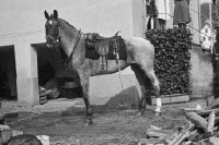
Pferde: Schimmel und Ordonnanzen beim Défilé in Bülach ; Pontonierwagen/Fouriere
Caption
Inscription original box: horse portraits
Caption (German)
Beschriftug Originalschachtel: Pferdeportraits
Record Name
Dia_293-02-001-01
Title (German)
Pferde: Schimmel und Ordonnanzen beim Défilé in Bülach ; Pontonierwagen/Fouriere
Caption
Inscription original box: horse portraits
Caption (German)
Beschriftug Originalschachtel: Pferdeportraits
Record Name
Dia_293-02-001-02

Title (German)
Pferde: Schimmel und Ordonnanzen beim Défilé in Bülach ; Pontonierwagen/Fouriere
Caption
Inscription original box: horse portraits
Caption (German)
Beschriftug Originalschachtel: Pferdeportraits
Record Name
Dia_293-02-001-03

Title (German)
Pferde: Schimmel und Ordonnanzen beim Défilé in Bülach ; Pontonierwagen/Fouriere
Caption
Inscription original box: horse portraits
Caption (German)
Beschriftug Originalschachtel: Pferdeportraits
Record Name
Dia_293-02-001-04

Title (German)
Pferde: Schimmel und Ordonnanzen beim Défilé in Bülach ; Pontonierwagen/Fouriere
Caption
Inscription original box: horse portraits
Caption (German)
Beschriftug Originalschachtel: Pferdeportraits
Record Name
Dia_293-02-001-05

Title (German)
Pferde: Schimmel und Ordonnanzen beim Défilé in Bülach ; Pontonierwagen/Fouriere
Caption
Inscription original box: horse portraits
Caption (German)
Beschriftug Originalschachtel: Pferdeportraits
Record Name
Dia_293-02-001-06

Title (German)
Pferde: Schimmel und Ordonnanzen beim Défilé in Bülach ; Pontonierwagen/Fouriere
Caption
Inscription original box: horse portraits
Caption (German)
Beschriftug Originalschachtel: Pferdeportraits
Record Name
Dia_293-02-001-07

Title (German)
Pferde: Schimmel und Ordonnanzen beim Défilé in Bülach ; Pontonierwagen/Fouriere
Caption
Inscription original box: horse portraits
Caption (German)
Beschriftug Originalschachtel: Pferdeportraits
Record Name
Dia_293-02-001-08

Title (German)
Pferde: Schimmel und Ordonnanzen beim Défilé in Bülach ; Pontonierwagen/Fouriere
Caption
Inscription original box: horse portraits
Caption (German)
Beschriftug Originalschachtel: Pferdeportraits
Record Name
Dia_293-02-001-09

Title (German)
Pferde: Schimmel und Ordonnanzen beim Défilé in Bülach ; Pontonierwagen/Fouriere
Caption
Inscription original box: horse portraits
Caption (German)
Beschriftug Originalschachtel: Pferdeportraits
Record Name
Dia_293-02-001-10

Title (German)
Pferde: Schimmel und Ordonnanzen beim Défilé in Bülach ; Pontonierwagen/Fouriere
Caption
Inscription original box: horse portraits
Caption (German)
Beschriftug Originalschachtel: Pferdeportraits
Record Name
Dia_293-02-001-11

Title (German)
Pferde: Schimmel und Ordonnanzen beim Défilé in Bülach ; Pontonierwagen/Fouriere
Caption
Inscription original box: horse portraits
Caption (German)
Beschriftug Originalschachtel: Pferdeportraits
Record Name
Dia_293-02-001-12

Title (German)
Pferde: Schimmel und Ordonnanzen beim Défilé in Bülach ; Pontonierwagen/Fouriere
Caption
Inscription original box: horse portraits
Caption (German)
Beschriftug Originalschachtel: Pferdeportraits
Record Name
Dia_293-02-001-13

Title (German)
Pferde: Schimmel und Ordonnanzen beim Défilé in Bülach ; Pontonierwagen/Fouriere
Caption
Inscription original box: horse portraits
Caption (German)
Beschriftug Originalschachtel: Pferdeportraits
Record Name
Dia_293-02-001-14

Title (German)
Pferde: Schimmel und Ordonnanzen beim Défilé in Bülach ; Pontonierwagen/Fouriere
Caption
Inscription original box: horse portraits
Caption (German)
Beschriftug Originalschachtel: Pferdeportraits
Record Name
Dia_293-02-001-15

Title (German)
Pferde: Schimmel und Ordonnanzen beim Défilé in Bülach ; Pontonierwagen/Fouriere
Caption
Inscription original box: horse portraits
Caption (German)
Beschriftug Originalschachtel: Pferdeportraits
Record Name
Dia_293-02-001-16

Title (German)
Pferde: Schimmel und Ordonnanzen beim Défilé in Bülach ; Pontonierwagen/Fouriere
Caption
Inscription original box: horse portraits
Caption (German)
Beschriftug Originalschachtel: Pferdeportraits
Record Name
Dia_293-02-001-17

Title (German)
Pferde: Schimmel und Ordonnanzen beim Défilé in Bülach ; Pontonierwagen/Fouriere
Caption
Inscription original box: horse portraits
Caption (German)
Beschriftug Originalschachtel: Pferdeportraits
Record Name
Dia_293-02-001-18

Title (German)
Robert Staub mit "Patrizier"
Caption
Inscription original box: horse portraits
Caption (German)
Beschriftug Originalschachtel: Pferdeportraits
Record Name
Dia_293-02-002-01

Title (German)
Robert Staub mit "Patrizier"
Caption
Inscription original box: horse portraits
Caption (German)
Beschriftug Originalschachtel: Pferdeportraits
Record Name
Dia_293-02-002-02

Title (German)
Robert Staub mit "Patrizier"
Caption
Inscription original box: horse portraits
Caption (German)
Beschriftug Originalschachtel: Pferdeportraits
Record Name
Dia_293-02-002-03

Title (German)
Robert Staub mit "Patrizier"
Caption
Inscription original box: horse portraits
Caption (German)
Beschriftug Originalschachtel: Pferdeportraits
Record Name
Dia_293-02-002-04

Title (German)
Robert Staub mit "Patrizier"
Caption
Inscription original box: horse portraits
Caption (German)
Beschriftug Originalschachtel: Pferdeportraits
Record Name
Dia_293-02-002-05

Title (German)
Robert Staub mit "Patrizier"
Caption
Inscription original box: horse portraits
Caption (German)
Beschriftug Originalschachtel: Pferdeportraits
Record Name
Dia_293-02-002-06

Title (German)
Robert Staub mit "Patrizier"
Caption
Inscription original box: horse portraits
Caption (German)
Beschriftug Originalschachtel: Pferdeportraits
Record Name
Dia_293-02-002-07

Title (German)
Robert Staub mit "Patrizier"
Caption
Inscription original box: horse portraits
Caption (German)
Beschriftug Originalschachtel: Pferdeportraits
Record Name
Dia_293-02-002-08
Title (German)
Robert Staub mit "Patrizier"
Caption
Inscription original box: horse portraits
Caption (German)
Beschriftug Originalschachtel: Pferdeportraits
Record Name
Dia_293-02-002-09

Title (German)
Robert Staub mit "Patrizier"
Caption
Inscription original box: horse portraits
Caption (German)
Beschriftug Originalschachtel: Pferdeportraits
Record Name
Dia_293-02-002-10

Title (German)
Robert Staub mit "Patrizier"
Caption
Inscription original box: horse portraits
Caption (German)
Beschriftug Originalschachtel: Pferdeportraits
Record Name
Dia_293-02-002-11

Title (German)
Robert Staub mit "Patrizier"
Caption
Inscription original box: horse portraits
Caption (German)
Beschriftug Originalschachtel: Pferdeportraits
Record Name
Dia_293-02-002-12

Title (German)
Robert Staub mit "Patrizier"
Caption
Inscription original box: horse portraits
Caption (German)
Beschriftug Originalschachtel: Pferdeportraits
Record Name
Dia_293-02-002-13

Title (German)
Robert Staub mit "Patrizier"
Caption
Inscription original box: horse portraits
Caption (German)
Beschriftug Originalschachtel: Pferdeportraits
Record Name
Dia_293-02-002-14

Title (German)
Robert Staub mit "Patrizier"
Caption
Inscription original box: horse portraits
Caption (German)
Beschriftug Originalschachtel: Pferdeportraits
Record Name
Dia_293-02-002-15

Title (German)
Robert Staub mit "Patrizier"
Caption
Inscription original box: horse portraits
Caption (German)
Beschriftug Originalschachtel: Pferdeportraits
Record Name
Dia_293-02-002-16
Title (German)
Robert Staub mit "Patrizier"
Caption
Inscription original box: horse portraits
Caption (German)
Beschriftug Originalschachtel: Pferdeportraits
Record Name
Dia_293-02-002-17

Title (German)
Robert Staub mit "Patrizier"
Caption
Inscription original box: horse portraits
Caption (German)
Beschriftug Originalschachtel: Pferdeportraits
Record Name
Dia_293-02-002-18

Title (German)
Robert Staub mit "Patrizier"
Caption (German)
Beschriftug Originalschachtel: Pferdeportraits
Record Name
Dia_293-02-002-19

Title (German)
Robert Staub mit "Patrizier"
Caption (German)
Beschriftug Originalschachtel: Pferdeportraits
Record Name
Dia_293-02-002-20

Title (German)
Robert Staub mit "Patrizier"
Caption (German)
Beschriftug Originalschachtel: Pferdeportraits
Record Name
Dia_293-02-002-21

Title (German)
Robert Staub mit "Patrizier"
Caption (German)
Beschriftug Originalschachtel: Pferdeportraits
Record Name
Dia_293-02-002-22

Title (German)
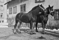
Schwere Pferde bei Heinrich Guggenheim in der Brunau
Caption
Inscription original box: horse portraits
Caption (German)
Beschriftug Originalschachtel: Pferdeportraits
Record Name
Dia_293-02-003-01

Title (German)
Schwere Pferde bei Heinrich Guggenheim in der Brunau
Caption
Inscription original box: horse portraits
Caption (German)
Beschriftug Originalschachtel: Pferdeportraits
Record Name
Dia_293-02-003-02

Title (German)
Schwere Pferde bei Heinrich Guggenheim in der Brunau
Caption
Inscription original box: horse portraits
Caption (German)
Beschriftug Originalschachtel: Pferdeportraits
Record Name
Dia_293-02-003-03

Title (German)
Schwere Pferde bei Heinrich Guggenheim in der Brunau
Caption
Inscription original box: horse portraits
Caption (German)
Beschriftug Originalschachtel: Pferdeportraits
Record Name
Dia_293-02-003-04
Title (German)
Schwere Pferde bei Heinrich Guggenheim in der Brunau
Caption
Inscription original box: horse portraits
Caption (German)
Beschriftug Originalschachtel: Pferdeportraits
Record Name
Dia_293-02-003-05

Title (German)
Schwere Pferde bei Heinrich Guggenheim in der Brunau
Caption (German)
Beschriftug Originalschachtel: Pferdeportraits
Record Name
Dia_293-02-003-06

Title (German)
Schwere Pferde bei Heinrich Guggenheim in der Brunau
Caption (German)
Beschriftug Originalschachtel: Pferdeportraits
Record Name
Dia_293-02-003-07

Title (German)
Schwere Pferde bei Heinrich Guggenheim in der Brunau
Caption (German)
Beschriftug Originalschachtel: Pferdeportraits
Record Name
Dia_293-02-003-08

Title (German)
Schwere Pferde bei Heinrich Guggenheim in der Brunau
Caption (German)
Beschriftug Originalschachtel: Pferdeportraits
Record Name
Dia_293-02-003-09

Title (German)
Schwere Pferde bei Heinrich Guggenheim in der Brunau
Caption
Inscription original box: horse portraits
Caption (German)
Beschriftug Originalschachtel: Pferdeportraits
Record Name
Dia_293-02-003-10

Title (German)
Schwere Pferde bei Heinrich Guggenheim in der Brunau
Caption
Inscription original box: horse portraits
Caption (German)
Beschriftug Originalschachtel: Pferdeportraits
Record Name
Dia_293-02-003-11

Title (German)
Schwere Pferde bei Heinrich Guggenheim in der Brunau
Caption
Inscription original box: horse portraits
Caption (German)
Beschriftug Originalschachtel: Pferdeportraits
Record Name
Dia_293-02-003-12
Title (German)
Schwere Pferde bei Heinrich Guggenheim in der Brunau
Caption
Inscription original box: horse portraits
Caption (German)
Beschriftug Originalschachtel: Pferdeportraits
Record Name
Dia_293-02-003-13

Title (German)
Schwere Pferde bei Heinrich Guggenheim in der Brunau
Caption
Inscription original box: horse portraits
Caption (German)
Beschriftug Originalschachtel: Pferdeportraits
Record Name
Dia_293-02-003-14

Title (German)
Schwere Pferde bei Heinrich Guggenheim in der Brunau
Caption
Inscription original box: horse portraits
Caption (German)
Beschriftug Originalschachtel: Pferdeportraits
Record Name
Dia_293-02-003-15

Title (German)
Schwere Pferde bei Heinrich Guggenheim in der Brunau
Caption
Inscription original box: horse portraits
Caption (German)
Beschriftug Originalschachtel: Pferdeportraits
Record Name
Dia_293-02-003-16

Title (German)
August Fröhlich und Ernst Renggli zu Pferde bei Witikon
Caption
Inscription original box: horse portraits
Caption (German)
Beschriftug Originalschachtel: Pferdeportraits
Record Name
Dia_293-02-004-01

Title (German)
August Fröhlich und Ernst Renggli zu Pferde bei Witikon
Caption
Inscription original box: horse portraits
Caption (German)
Beschriftug Originalschachtel: Pferdeportraits
Record Name
Dia_293-02-004-02

Title (German)
August Fröhlich und Ernst Renggli zu Pferde bei Witikon
Caption
Inscription original box: horse portraits
Caption (German)
Beschriftug Originalschachtel: Pferdeportraits
Record Name
Dia_293-02-004-03

Title (German)
August Fröhlich und Ernst Renggli zu Pferde bei Witikon
Caption
Inscription original box: horse portraits
Caption (German)
Beschriftug Originalschachtel: Pferdeportraits
Record Name
Dia_293-02-004-04

Title (German)
August Fröhlich und Ernst Renggli zu Pferde bei Witikon
Caption
Inscription original box: horse portraits
Caption (German)
Beschriftug Originalschachtel: Pferdeportraits
Record Name
Dia_293-02-004-05

Title (German)
August Fröhlich und Ernst Renggli zu Pferde bei Witikon
Caption
Inscription original box: horse portraits
Caption (German)
Beschriftug Originalschachtel: Pferdeportraits
Record Name
Dia_293-02-004-06

Title (German)
August Fröhlich und Ernst Renggli zu Pferde bei Witikon
Caption
Inscription original box: horse portraits
Caption (German)
Beschriftug Originalschachtel: Pferdeportraits
Record Name
Dia_293-02-004-07

Title (German)
August Fröhlich und Ernst Renggli zu Pferde bei Witikon
Caption
Inscription original box: horse portraits
Caption (German)
Beschriftug Originalschachtel: Pferdeportraits
Record Name
Dia_293-02-004-08

Title (German)
August Fröhlich und Ernst Renggli zu Pferde bei Witikon
Caption
Inscription original box: horse portraits
Caption (German)
Beschriftug Originalschachtel: Pferdeportraits
Record Name
Dia_293-02-004-09

Title (German)
August Fröhlich und Ernst Renggli zu Pferde bei Witikon
Caption
Inscription original box: horse portraits
Caption (German)
Beschriftug Originalschachtel: Pferdeportraits
Record Name
Dia_293-02-004-10

Title (German)
August Fröhlich und Ernst Renggli zu Pferde bei Witikon
Caption
Inscription original box: horse portraits
Caption (German)
Beschriftug Originalschachtel: Pferdeportraits
Record Name
Dia_293-02-004-11

Title (German)
August Fröhlich und Ernst Renggli zu Pferde bei Witikon
Caption
Inscription original box: horse portraits
Caption (German)
Beschriftug Originalschachtel: Pferdeportraits
Record Name
Dia_293-02-004-12

Title (German)
August Fröhlich und Ernst Renggli zu Pferde bei Witikon
Caption
Inscription original box: horse portraits
Caption (German)
Beschriftug Originalschachtel: Pferdeportraits
Record Name
Dia_293-02-004-13

Title (German)
August Fröhlich und Ernst Renggli zu Pferde bei Witikon
Caption
Inscription original box: horse portraits
Caption (German)
Beschriftug Originalschachtel: Pferdeportraits
Record Name
Dia_293-02-004-14

Title (German)
August Fröhlich und Ernst Renggli zu Pferde bei Witikon
Caption
Inscription original box: horse portraits
Caption (German)
Beschriftug Originalschachtel: Pferdeportraits
Record Name
Dia_293-02-004-15

Title (German)
August Fröhlich und Ernst Renggli zu Pferde bei Witikon
Caption
Inscription original box: horse portraits
Caption (German)
Beschriftug Originalschachtel: Pferdeportraits
Record Name
Dia_293-02-004-16

Title (German)
August Fröhlich und Ernst Renggli zu Pferde bei Witikon
Caption
Inscription original box: horse portraits
Caption (German)
Beschriftug Originalschachtel: Pferdeportraits
Record Name
Dia_293-02-004-17

Title (German)
Pferde: Major Keller "York", Major Alex. Schreck, Aarau, Oberstl. v. Wattenwyl-Modestie mit IH. ; Veterinär mit Schimmel
Caption
Inscription original box: horse portraits
Caption (German)
Beschriftug Originalschachtel: Pferdeportraits
Record Name
Dia_293-02-005-01

Title (German)
Pferde: Major Keller "York", Major Alex. Schreck, Aarau, Oberstl. v. Wattenwyl-Modestie mit IH. ; Veterinär mit Schimmel
Caption
Inscription original box: horse portraits
Caption (German)
Beschriftug Originalschachtel: Pferdeportraits
Record Name
Dia_293-02-005-02

Title (German)
Pferde: Major Keller "York", Major Alex. Schreck, Aarau, Oberstl. v. Wattenwyl-Modestie mit IH. ; Veterinär mit Schimmel
Caption
Inscription original box: horse portraits
Caption (German)
Beschriftug Originalschachtel: Pferdeportraits
Record Name
Dia_293-02-005-03

Title (German)
Pferde: Major Keller "York", Major Alex. Schreck, Aarau, Oberstl. v. Wattenwyl-Modestie mit IH. ; Veterinär mit Schimmel
Caption
Inscription original box: horse portraits
Caption (German)
Beschriftug Originalschachtel: Pferdeportraits
Record Name
Dia_293-02-005-04

Title (German)
Pferde: Major Keller "York", Major Alex. Schreck, Aarau, Oberstl. v. Wattenwyl-Modestie mit IH. ; Veterinär mit Schimmel
Caption
Inscription original box: horse portraits
Caption (German)
Beschriftug Originalschachtel: Pferdeportraits
Record Name
Dia_293-02-005-05

Title (German)
Pferde: Major Keller "York", Major Alex. Schreck, Aarau, Oberstl. v. Wattenwyl-Modestie mit IH. ; Veterinär mit Schimmel
Caption
Inscription original box: horse portraits
Caption (German)
Beschriftug Originalschachtel: Pferdeportraits
Record Name
Dia_293-02-005-06

Title (German)
Pferde: Major Keller "York", Major Alex. Schreck, Aarau, Oberstl. v. Wattenwyl-Modestie mit IH. ; Veterinär mit Schimmel
Caption
Inscription original box: horse portraits
Caption (German)
Beschriftug Originalschachtel: Pferdeportraits
Record Name
Dia_293-02-005-07

Title (German)
Pferde: Major Keller "York", Major Alex. Schreck, Aarau, Oberstl. v. Wattenwyl-Modestie mit IH. ; Veterinär mit Schimmel
Caption
Inscription original box: horse portraits
Caption (German)
Beschriftug Originalschachtel: Pferdeportraits
Record Name
Dia_293-02-005-08

Title (German)
Pferde: Major Keller "York", Major Alex. Schreck, Aarau, Oberstl. v. Wattenwyl-Modestie mit IH. ; Veterinär mit Schimmel
Caption
Inscription original box: horse portraits
Caption (German)
Beschriftug Originalschachtel: Pferdeportraits
Record Name
Dia_293-02-005-09

Title (German)
Pferde: Major Keller "York", Major Alex. Schreck, Aarau, Oberstl. v. Wattenwyl-Modestie mit IH. ; Veterinär mit Schimmel
Caption
Inscription original box: horse portraits
Caption (German)
Beschriftug Originalschachtel: Pferdeportraits
Record Name
Dia_293-02-005-10

Title (German)
Pferde: Major Keller "York", Major Alex. Schreck, Aarau, Oberstl. v. Wattenwyl-Modestie mit IH. ; Veterinär mit Schimmel
Caption
Inscription original box: horse portraits
Caption (German)
Beschriftug Originalschachtel: Pferdeportraits
Record Name
Dia_293-02-005-11

Title (German)
Pferde: Major Keller "York", Major Alex. Schreck, Aarau, Oberstl. v. Wattenwyl-Modestie mit IH. ; Veterinär mit Schimmel
Caption
Inscription original box: horse portraits
Caption (German)
Beschriftug Originalschachtel: Pferdeportraits
Record Name
Dia_293-02-005-12

Title (German)
Pferde: Major Keller "York", Major Alex. Schreck, Aarau, Oberstl. v. Wattenwyl-Modestie mit IH. ; Veterinär mit Schimmel
Caption
Inscription original box: horse portraits
Caption (German)
Beschriftug Originalschachtel: Pferdeportraits
Record Name
Dia_293-02-005-13

Title (German)
Pferde: Major Keller "York", Major Alex. Schreck, Aarau, Oberstl. v. Wattenwyl-Modestie mit IH. ; Veterinär mit Schimmel
Caption
Inscription original box: horse portraits
Caption (German)
Beschriftug Originalschachtel: Pferdeportraits
Record Name
Dia_293-02-005-14

Title (German)
Pferde: Major Keller "York", Major Alex. Schreck, Aarau, Oberstl. v. Wattenwyl-Modestie mit IH. ; Veterinär mit Schimmel
Caption
Inscription original box: horse portraits
Caption (German)
Beschriftug Originalschachtel: Pferdeportraits
Record Name
Dia_293-02-005-15

Title (German)
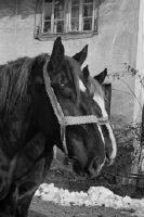
Heinrich Guggenheim zu Pferde a/d Wollishofer Allmend
Caption
Inscription original box: horse portraits
Caption (German)
Beschriftug Originalschachtel: Pferdeportraits
Record Name
Dia_293-02-006-01

Title (German)
Heinrich Guggenheim zu Pferde a/d Wollishofer Allmend
Caption
Inscription original box: horse portraits
Caption (German)
Beschriftug Originalschachtel: Pferdeportraits
Record Name
Dia_293-02-006-02

Title (German)
Heinrich Guggenheim zu Pferde a/d Wollishofer Allmend
Caption
Inscription original box: horse portraits
Caption (German)
Beschriftug Originalschachtel: Pferdeportraits
Record Name
Dia_293-02-006-03

Title (German)
Heinrich Guggenheim zu Pferde a/d Wollishofer Allmend
Caption
Inscription original box: horse portraits
Caption (German)
Beschriftug Originalschachtel: Pferdeportraits
Record Name
Dia_293-02-006-04

Title (German)
Heinrich Guggenheim zu Pferde a/d Wollishofer Allmend
Caption
Inscription original box: horse portraits
Caption (German)
Beschriftug Originalschachtel: Pferdeportraits
Record Name
Dia_293-02-006-05

Title (German)
Heinrich Guggenheim zu Pferde a/d Wollishofer Allmend
Caption
Inscription original box: horse portraits
Caption (German)
Beschriftug Originalschachtel: Pferdeportraits
Record Name
Dia_293-02-006-06
Title (German)
Heinrich Guggenheim zu Pferde a/d Wollishofer Allmend
Caption
Inscription original box: horse portraits
Caption (German)
Beschriftug Originalschachtel: Pferdeportraits
Record Name
Dia_293-02-006-07

Title (German)
Heinrich Guggenheim zu Pferde a/d Wollishofer Allmend
Caption
Inscription original box: horse portraits
Caption (German)
Beschriftug Originalschachtel: Pferdeportraits
Record Name
Dia_293-02-006-08

Title (German)
Heinrich Guggenheim zu Pferde a/d Wollishofer Allmend
Caption
Inscription original box: horse portraits
Caption (German)
Beschriftug Originalschachtel: Pferdeportraits
Record Name
Dia_293-02-006-09

Title (German)
Heinrich Guggenheim zu Pferde a/d Wollishofer Allmend
Caption
Inscription original box: horse portraits
Caption (German)
Beschriftug Originalschachtel: Pferdeportraits
Record Name
Dia_293-02-006-10

Title (German)
Heinrich Guggenheim zu Pferde auf der Wollishofer Allmend ; Grädel Fritz mit weidendem Pferde
Caption
Inscription original box: horse portraits
Caption (German)
Beschriftug Originalschachtel: Pferdeportraits
Record Name
Dia_293-02-007-01

Title (German)
Heinrich Guggenheim zu Pferde auf der Wollishofer Allmend ; Grädel Fritz mit weidendem Pferde
Caption
Inscription original box: horse portraits
Caption (German)
Beschriftug Originalschachtel: Pferdeportraits
Record Name
Dia_293-02-007-02

Title (German)
Heinrich Guggenheim zu Pferde auf der Wollishofer Allmend ; Grädel Fritz mit weidendem Pferde
Caption
Inscription original box: horse portraits
Caption (German)
Beschriftug Originalschachtel: Pferdeportraits
Record Name
Dia_293-02-007-03

Title (German)
Heinrich Guggenheim zu Pferde auf der Wollishofer Allmend ; Grädel Fritz mit weidendem Pferde
Caption
Inscription original box: horse portraits
Caption (German)
Beschriftug Originalschachtel: Pferdeportraits
Record Name
Dia_293-02-007-04

Title (German)
Heinrich Guggenheim zu Pferde auf der Wollishofer Allmend ; Grädel Fritz mit weidendem Pferde
Caption
Inscription original box: horse portraits
Caption (German)
Beschriftug Originalschachtel: Pferdeportraits
Record Name
Dia_293-02-007-05

Title (German)
Heinrich Guggenheim zu Pferde auf der Wollishofer Allmend ; Grädel Fritz mit weidendem Pferde
Caption
Inscription original box: horse portraits
Caption (German)
Beschriftug Originalschachtel: Pferdeportraits
Record Name
Dia_293-02-007-06

Title (German)
Heinrich Guggenheim zu Pferde auf der Wollishofer Allmend ; Grädel Fritz mit weidendem Pferde
Caption
Inscription original box: horse portraits
Caption (German)
Beschriftug Originalschachtel: Pferdeportraits
Record Name
Dia_293-02-007-07

Title (German)
Heinrich Guggenheim zu Pferde auf der Wollishofer Allmend ; Grädel Fritz mit weidendem Pferde
Caption
Inscription original box: horse portraits
Caption (German)
Beschriftug Originalschachtel: Pferdeportraits
Record Name
Dia_293-02-007-08

Title (German)
Heinrich Guggenheim zu Pferde auf der Wollishofer Allmend ; Grädel Fritz mit weidendem Pferde
Caption
Inscription original box: horse portraits
Caption (German)
Beschriftug Originalschachtel: Pferdeportraits
Record Name
Dia_293-02-007-09

Title (German)
Auf dem Gestüt Dr. Dubs in Rümlang
Caption
Inscription original box: horse portraits
Caption (German)
Beschriftug Originalschachtel: Pferdeportraits
Record Name
Dia_293-02-008-01

Title (German)
Auf dem Gestüt Dr. Dubs in Rümlang
Caption
Inscription original box: horse portraits
Caption (German)
Beschriftug Originalschachtel: Pferdeportraits
Record Name
Dia_293-02-008-02

Title (German)
Auf dem Gestüt Dr. Dubs in Rümlang
Caption
Inscription original box: horse portraits
Caption (German)
Beschriftug Originalschachtel: Pferdeportraits
Record Name
Dia_293-02-008-03

Title (German)
Auf dem Gestüt Dr. Dubs in Rümlang
Caption
Inscription original box: horse portraits
Caption (German)
Beschriftug Originalschachtel: Pferdeportraits
Record Name
Dia_293-02-008-04

Title (German)
Auf dem Gestüt Dr. Dubs in Rümlang
Caption
Inscription original box: horse portraits
Caption (German)
Beschriftug Originalschachtel: Pferdeportraits
Record Name
Dia_293-02-008-05

Title (German)
Auf dem Gestüt Dr. Dubs in Rümlang
Caption
Inscription original box: horse portraits
Caption (German)
Beschriftug Originalschachtel: Pferdeportraits
Record Name
Dia_293-02-008-06

Title (German)
Auf dem Gestüt Dr. Dubs in Rümlang
Caption
Inscription original box: horse portraits
Caption (German)
Beschriftug Originalschachtel: Pferdeportraits
Record Name
Dia_293-02-008-07

Title (German)
Auf dem Gestüt Dr. Dubs in Rümlang
Caption
Inscription original box: horse portraits
Caption (German)
Beschriftug Originalschachtel: Pferdeportraits
Record Name
Dia_293-02-008-08

Title (German)
Auf dem Gestüt Dr. Dubs in Rümlang
Caption
Inscription original box: horse portraits
Caption (German)
Beschriftug Originalschachtel: Pferdeportraits
Record Name
Dia_293-02-008-09

Title (German)
Auf dem Gestüt Dr. Dubs in Rümlang
Caption
Inscription original box: horse portraits
Caption (German)
Beschriftug Originalschachtel: Pferdeportraits
Record Name
Dia_293-02-008-10

Title (German)
Auf dem Gestüt Dr. Dubs in Rümlang
Caption
Inscription original box: horse portraits
Caption (German)
Beschriftug Originalschachtel: Pferdeportraits
Record Name
Dia_293-02-008-11

Title (German)
Auf dem Gestüt Dr. Dubs in Rümlang
Caption
Inscription original box: horse portraits
Caption (German)
Beschriftug Originalschachtel: Pferdeportraits
Record Name
Dia_293-02-008-12

Title (German)
Pétrarque/Pferd von Max Honegger Wetzikon
Caption
Inscription original box: horse portraits
Caption (German)
Beschriftug Originalschachtel: Pferdeportraits
Record Name
Dia_293-02-009-01

Title (German)
Pétrarque/Pferd von Max Honegger Wetzikon
Caption
Inscription original box: horse portraits
Caption (German)
Beschriftug Originalschachtel: Pferdeportraits
Record Name
Dia_293-02-009-02

Title (German)
Pétrarque/Pferd von Max Honegger Wetzikon
Caption
Inscription original box: horse portraits
Caption (German)
Beschriftug Originalschachtel: Pferdeportraits
Record Name
Dia_293-02-009-03

Title (German)
Pétrarque/Pferd von Max Honegger Wetzikon
Caption
Inscription original box: horse portraits
Caption (German)
Beschriftug Originalschachtel: Pferdeportraits
Record Name
Dia_293-02-009-04

Title (German)
Pétrarque/Pferd von Max Honegger Wetzikon
Caption
Inscription original box: horse portraits
Caption (German)
Beschriftug Originalschachtel: Pferdeportraits
Record Name
Dia_293-02-009-05

Title (German)
Pétrarque/Pferd von Max Honegger Wetzikon
Caption
Inscription original box: horse portraits
Caption (German)
Beschriftug Originalschachtel: Pferdeportraits
Record Name
Dia_293-02-009-06

Title (German)
Pétrarque/Pferd von Max Honegger Wetzikon
Caption
Inscription original box: horse portraits
Caption (German)
Beschriftug Originalschachtel: Pferdeportraits
Record Name
Dia_293-02-009-07

Title (German)
Pétrarque/Pferd von Max Honegger Wetzikon
Caption
Inscription original box: horse portraits
Caption (German)
Beschriftug Originalschachtel: Pferdeportraits
Record Name
Dia_293-02-009-08

Title (German)
Pétrarque/Pferd von Max Honegger Wetzikon
Caption
Inscription original box: horse portraits
Caption (German)
Beschriftug Originalschachtel: Pferdeportraits
Record Name
Dia_293-02-009-09

Title (German)
Wittstock-Bally- ; Mutter und Kind/Pony's
Caption
Inscription original box: horse portraits
Caption (German)
Beschriftug Originalschachtel: Pferdeportraits
Record Name
Dia_293-02-010-01

Title (German)
Wittstock-Bally- ; Mutter und Kind/Pony's
Caption
Inscription original box: horse portraits
Caption (German)
Beschriftug Originalschachtel: Pferdeportraits
Record Name
Dia_293-02-010-02
Title (German)
Wittstock-Bally- ; Mutter und Kind/Pony's
Caption
Inscription original box: horse portraits
Caption (German)
Beschriftug Originalschachtel: Pferdeportraits
Record Name
Dia_293-02-010-03

Title (German)
Wittstock-Bally- ; Mutter und Kind/Pony's
Caption
Inscription original box: horse portraits
Caption (German)
Beschriftug Originalschachtel: Pferdeportraits
Record Name
Dia_293-02-010-04

Title (German)
Wittstock-Bally- ; Mutter und Kind/Pony's
Caption
Inscription original box: horse portraits
Caption (German)
Beschriftug Originalschachtel: Pferdeportraits
Record Name
Dia_293-02-010-05

Title (German)
Wittstock-Bally- ; Mutter und Kind/Pony's
Caption
Inscription original box: horse portraits
Caption (German)
Beschriftug Originalschachtel: Pferdeportraits
Record Name
Dia_293-02-010-06

Title (German)
Wittstock-Bally- ; Mutter und Kind/Pony's
Caption
Inscription original box: horse portraits
Caption (German)
Beschriftug Originalschachtel: Pferdeportraits
Record Name
Dia_293-02-010-07

Title (German)
Wittstock-Bally- ; Mutter und Kind/Pony's
Caption
Inscription original box: horse portraits
Caption (German)
Beschriftug Originalschachtel: Pferdeportraits
Record Name
Dia_293-02-010-08

Title (German)
Wittstock-Bally- ; Mutter und Kind/Pony's
Caption
Inscription original box: horse portraits
Caption (German)
Beschriftug Originalschachtel: Pferdeportraits
Record Name
Dia_293-02-010-09

Title (German)
Wittstock-Bally- ; Mutter und Kind/Pony's
Caption
Inscription original box: horse portraits
Caption (German)
Beschriftug Originalschachtel: Pferdeportraits
Record Name
Dia_293-02-010-10

Title (German)
Wittstock-Bally- ; Mutter und Kind/Pony's
Caption
Inscription original box: horse portraits
Caption (German)
Beschriftug Originalschachtel: Pferdeportraits
Record Name
Dia_293-02-010-11

Title (German)
Wittstock-Bally- ; Mutter und Kind/Pony's
Caption
Inscription original box: horse portraits
Caption (German)
Beschriftug Originalschachtel: Pferdeportraits
Record Name
Dia_293-02-010-12

Title (German)
Wittstock-Bally- ; Mutter und Kind/Pony's
Caption
Inscription original box: horse portraits
Caption (German)
Beschriftug Originalschachtel: Pferdeportraits
Record Name
Dia_293-02-010-13

Title (German)
Pferd "Hippika" des Herrn Aug. Fröhlich ; Herbst 1939 Wollishofer Allmend Pferd "Betty" des Herrn Oberst Siegrist ; 31. März 1940 in Nieder-Gösgen
Caption
Inscription original box: horse portraits
Caption (German)
Beschriftug Originalschachtel: Pferdeportraits
Record Name
Dia_293-02-011-01

Title (German)
Pferd "Hippika" des Herrn Aug. Fröhlich ; Herbst 1939 Wollishofer Allmend Pferd "Betty" des Herrn Oberst Siegrist ; 31. März 1940 in Nieder-Gösgen
Caption
Inscription original box: horse portraits
Caption (German)
Beschriftug Originalschachtel: Pferdeportraits
Record Name
Dia_293-02-011-02

Title (German)
Pferd "Hippika" des Herrn Aug. Fröhlich ; Herbst 1939 Wollishofer Allmend Pferd "Betty" des Herrn Oberst Siegrist ; 31. März 1940 in Nieder-Gösgen
Caption
Inscription original box: horse portraits
Caption (German)
Beschriftug Originalschachtel: Pferdeportraits
Record Name
Dia_293-02-011-03

Title (German)
Pferd "Hippika" des Herrn Aug. Fröhlich ; Herbst 1939 Wollishofer Allmend Pferd "Betty" des Herrn Oberst Siegrist ; 31. März 1940 in Nieder-Gösgen
Caption
Inscription original box: horse portraits
Caption (German)
Beschriftug Originalschachtel: Pferdeportraits
Record Name
Dia_293-02-011-04

Title (German)
Pferd "Hippika" des Herrn Aug. Fröhlich ; Herbst 1939 Wollishofer Allmend Pferd "Betty" des Herrn Oberst Siegrist ; 31. März 1940 in Nieder-Gösgen
Caption
Inscription original box: horse portraits
Caption (German)
Beschriftug Originalschachtel: Pferdeportraits
Record Name
Dia_293-02-011-05

Title (German)
Pferd "Hippika" des Herrn Aug. Fröhlich ; Herbst 1939 Wollishofer Allmend Pferd "Betty" des Herrn Oberst Siegrist ; 31. März 1940 in Nieder-Gösgen
Caption
Inscription original box: horse portraits
Caption (German)
Beschriftug Originalschachtel: Pferdeportraits
Record Name
Dia_293-02-011-06

Title (German)
Pferd "Hippika" des Herrn Aug. Fröhlich ; Herbst 1939 Wollishofer Allmend Pferd "Betty" des Herrn Oberst Siegrist ; 31. März 1940 in Nieder-Gösgen
Caption
Inscription original box: horse portraits
Caption (German)
Beschriftug Originalschachtel: Pferdeportraits
Record Name
Dia_293-02-011-07

Title (German)
Pferd "Hippika" des Herrn Aug. Fröhlich ; Herbst 1939 Wollishofer Allmend Pferd "Betty" des Herrn Oberst Siegrist ; 31. März 1940 in Nieder-Gösgen
Caption
Inscription original box: horse portraits
Caption (German)
Beschriftug Originalschachtel: Pferdeportraits
Record Name
Dia_293-02-011-08

Title (German)
Pferd "Hippika" des Herrn Aug. Fröhlich ; Herbst 1939 Wollishofer Allmend Pferd "Betty" des Herrn Oberst Siegrist ; 31. März 1940 in Nieder-Gösgen
Caption
Inscription original box: horse portraits
Caption (German)
Beschriftug Originalschachtel: Pferdeportraits
Record Name
Dia_293-02-011-09

Title (German)
Pferd "Hippika" des Herrn Aug. Fröhlich ; Herbst 1939 Wollishofer Allmend Pferd "Betty" des Herrn Oberst Siegrist ; 31. März 1940 in Nieder-Gösgen
Caption
Inscription original box: horse portraits
Caption (German)
Beschriftug Originalschachtel: Pferdeportraits
Record Name
Dia_293-02-011-10

Title (German)
Pferd "Hippika" des Herrn Aug. Fröhlich ; Herbst 1939 Wollishofer Allmend Pferd "Betty" des Herrn Oberst Siegrist ; 31. März 1940 in Nieder-Gösgen
Caption
Inscription original box: horse portraits
Caption (German)
Beschriftug Originalschachtel: Pferdeportraits
Record Name
Dia_293-02-011-11

Title (German)
Pferd "Hippika" des Herrn Aug. Fröhlich ; Herbst 1939 Wollishofer Allmend Pferd "Betty" des Herrn Oberst Siegrist ; 31. März 1940 in Nieder-Gösgen
Caption
Inscription original box: horse portraits
Caption (German)
Beschriftug Originalschachtel: Pferdeportraits
Record Name
Dia_293-02-011-12

Title (German)
Pferd "Hippika" des Herrn Aug. Fröhlich ; Herbst 1939 Wollishofer Allmend Pferd "Betty" des Herrn Oberst Siegrist ; 31. März 1940 in Nieder-Gösgen
Caption
Inscription original box: horse portraits
Caption (German)
Beschriftug Originalschachtel: Pferdeportraits
Record Name
Dia_293-02-011-13

Title (German)
Pferd "Hippika" des Herrn Aug. Fröhlich ; Herbst 1939 Wollishofer Allmend Pferd "Betty" des Herrn Oberst Siegrist ; 31. März 1940 in Nieder-Gösgen
Caption
Inscription original box: horse portraits
Caption (German)
Beschriftug Originalschachtel: Pferdeportraits
Record Name
Dia_293-02-011-14
Title (German)
Pferd "Hippika" des Herrn Aug. Fröhlich ; Herbst 1939 Wollishofer Allmend Pferd "Betty" des Herrn Oberst Siegrist ; 31. März 1940 in Nieder-Gösgen
Caption
Inscription original box: horse portraits
Caption (German)
Beschriftug Originalschachtel: Pferdeportraits
Record Name
Dia_293-02-011-15

Title (German)
Pferd "Hippika" des Herrn Aug. Fröhlich ; Herbst 1939 Wollishofer Allmend Pferd "Betty" des Herrn Oberst Siegrist ; 31. März 1940 in Nieder-Gösgen
Caption
Inscription original box: horse portraits
Caption (German)
Beschriftug Originalschachtel: Pferdeportraits
Record Name
Dia_293-02-011-16

Title (German)
Pferd "Hippika" des Herrn Aug. Fröhlich ; Herbst 1939 Wollishofer Allmend Pferd "Betty" des Herrn Oberst Siegrist ; 31. März 1940 in Nieder-Gösgen
Caption
Inscription original box: horse portraits
Caption (German)
Beschriftug Originalschachtel: Pferdeportraits
Record Name
Dia_293-02-011-17

Title (German)
Pferd "Hippika" des Herrn Aug. Fröhlich ; Herbst 1939 Wollishofer Allmend Pferd "Betty" des Herrn Oberst Siegrist ; 31. März 1940 in Nieder-Gösgen
Caption
Inscription original box: horse portraits
Caption (German)
Beschriftug Originalschachtel: Pferdeportraits
Record Name
Dia_293-02-011-18

Title (German)
Pferd "Hippika" des Herrn Aug. Fröhlich ; Herbst 1939 Wollishofer Allmend Pferd "Betty" des Herrn Oberst Siegrist ; 31. März 1940 in Nieder-Gösgen
Caption
Inscription original box: horse portraits
Caption (German)
Beschriftug Originalschachtel: Pferdeportraits
Record Name
Dia_293-02-011-19

Title (German)
Pferd "Hippika" des Herrn Aug. Fröhlich ; Herbst 1939 Wollishofer Allmend Pferd "Betty" des Herrn Oberst Siegrist ; 31. März 1940 in Nieder-Gösgen
Caption
Inscription original box: horse portraits
Caption (German)
Beschriftug Originalschachtel: Pferdeportraits
Record Name
Dia_293-02-011-20

Title (German)
Pferd "Hippika" des Herrn Aug. Fröhlich ; Herbst 1939 Wollishofer Allmend Pferd "Betty" des Herrn Oberst Siegrist ; 31. März 1940 in Nieder-Gösgen
Caption
Inscription original box: horse portraits
Caption (German)
Beschriftug Originalschachtel: Pferdeportraits
Record Name
Dia_293-02-011-21

Title (German)
Pferd "Hippika" des Herrn Aug. Fröhlich ; Herbst 1939 Wollishofer Allmend Pferd "Betty" des Herrn Oberst Siegrist ; 31. März 1940 in Nieder-Gösgen
Caption
Inscription original box: horse portraits
Caption (German)
Beschriftug Originalschachtel: Pferdeportraits
Record Name
Dia_293-02-011-22

Title (German)
Ernst Renggli-Stuckert mit Pferd, Allmend September
Caption
Inscription original box: horse portraits
Caption (German)
Beschriftug Originalschachtel: Pferdeportraits
Record Name
Dia_293-02-012-01
Title (German)
Ernst Renggli-Stuckert mit Pferd, Allmend September
Caption
Inscription original box: horse portraits
Caption (German)
Beschriftug Originalschachtel: Pferdeportraits
Record Name
Dia_293-02-012-02

Title (German)
Ernst Renggli-Stuckert mit Pferd, Allmend September
Caption
Inscription original box: horse portraits
Caption (German)
Beschriftug Originalschachtel: Pferdeportraits
Record Name
Dia_293-02-012-03

Title (German)
Ernst Renggli-Stuckert mit Pferd, Allmend September
Caption
Inscription original box: horse portraits
Caption (German)
Beschriftug Originalschachtel: Pferdeportraits
Record Name
Dia_293-02-012-04

Title (German)
Ernst Renggli-Stuckert mit Pferd, Allmend September
Caption
Inscription original box: horse portraits
Caption (German)
Beschriftug Originalschachtel: Pferdeportraits
Record Name
Dia_293-02-012-05

Title (German)
Ernst Renggli-Stuckert mit Pferd, Allmend September
Caption
Inscription original box: horse portraits
Caption (German)
Beschriftug Originalschachtel: Pferdeportraits
Record Name
Dia_293-02-012-06

Title (German)
Ernst Renggli-Stuckert mit Pferd, Allmend September
Caption
Inscription original box: horse portraits
Caption (German)
Beschriftug Originalschachtel: Pferdeportraits
Record Name
Dia_293-02-012-07

Title (German)
Ernst Renggli-Stuckert mit Pferd, Allmend September
Caption
Inscription original box: horse portraits
Caption (German)
Beschriftug Originalschachtel: Pferdeportraits
Record Name
Dia_293-02-012-08

Title (German)
Ernst Renggli-Stuckert mit Pferd, Allmend September
Caption
Inscription original box: horse portraits
Caption (German)
Beschriftug Originalschachtel: Pferdeportraits
Record Name
Dia_293-02-012-09

Title (German)
Ernst Renggli-Stuckert mit Pferd, Allmend September
Caption
Inscription original box: horse portraits
Caption (German)
Beschriftug Originalschachtel: Pferdeportraits
Record Name
Dia_293-02-012-10

Title (German)
Ernst Renggli-Stuckert mit Pferd, Allmend September
Caption
Inscription original box: horse portraits
Caption (German)
Beschriftug Originalschachtel: Pferdeportraits
Record Name
Dia_293-02-012-11

Title (German)
Ernst Renggli-Stuckert mit Pferd, Allmend September
Caption
Inscription original box: horse portraits
Caption (German)
Beschriftug Originalschachtel: Pferdeportraits
Record Name
Dia_293-02-012-12

Title (German)
Ernst Renggli-Stuckert mit Pferd, Allmend September
Caption
Inscription original box: horse portraits
Caption (German)
Beschriftug Originalschachtel: Pferdeportraits
Record Name
Dia_293-02-012-13

Title (German)
Ernst Renggli-Stuckert mit Pferd, Allmend September
Caption
Inscription original box: horse portraits
Caption (German)
Beschriftug Originalschachtel: Pferdeportraits
Record Name
Dia_293-02-012-14

Title (German)
Ernst Renggli-Stuckert mit Pferd, Allmend September
Caption
Inscription original box: horse portraits
Caption (German)
Beschriftug Originalschachtel: Pferdeportraits
Record Name
Dia_293-02-012-15

Title (German)
Ernst Renggli-Stuckert mit Pferd, Allmend September
Caption
Inscription original box: horse portraits
Caption (German)
Beschriftug Originalschachtel: Pferdeportraits
Record Name
Dia_293-02-012-16

Title (German)
Hptm. Willy Grundbacher in Frick Dezember ; Dragoner Schwadron 9
Caption
Inscription original box: horse portraits
Caption (German)
Beschriftug Originalschachtel: Pferdeportraits
Record Name
Dia_293-02-013-01

Title (German)
Hptm. Willy Grundbacher in Frick Dezember ; Dragoner Schwadron 9
Caption
Inscription original box: horse portraits
Caption (German)
Beschriftug Originalschachtel: Pferdeportraits
Record Name
Dia_293-02-013-02

Title (German)
Hptm. Willy Grundbacher in Frick Dezember ; Dragoner Schwadron 9
Caption
Inscription original box: horse portraits
Caption (German)
Beschriftug Originalschachtel: Pferdeportraits
Record Name
Dia_293-02-013-03

Title (German)
Hptm. Willy Grundbacher in Frick Dezember ; Dragoner Schwadron 9
Caption
Inscription original box: horse portraits
Caption (German)
Beschriftug Originalschachtel: Pferdeportraits
Record Name
Dia_293-02-013-04

Title (German)
Hptm. Willy Grundbacher in Frick Dezember ; Dragoner Schwadron 9
Caption
Inscription original box: horse portraits
Caption (German)
Beschriftug Originalschachtel: Pferdeportraits
Record Name
Dia_293-02-013-05

Title (German)
Hptm. Willy Grundbacher in Frick Dezember ; Dragoner Schwadron 9
Caption
Inscription original box: horse portraits
Caption (German)
Beschriftug Originalschachtel: Pferdeportraits
Record Name
Dia_293-02-013-06

Title (German)
Hptm. Willy Grundbacher in Frick Dezember ; Dragoner Schwadron 9
Caption
Inscription original box: horse portraits
Caption (German)
Beschriftug Originalschachtel: Pferdeportraits
Record Name
Dia_293-02-013-07

Title (German)
Hptm. Willy Grundbacher in Frick Dezember ; Dragoner Schwadron 9
Caption
Inscription original box: horse portraits
Caption (German)
Beschriftug Originalschachtel: Pferdeportraits
Record Name
Dia_293-02-013-08

Title (German)
Hptm. Willy Grundbacher in Frick Dezember ; Dragoner Schwadron 9
Caption
Inscription original box: horse portraits
Caption (German)
Beschriftug Originalschachtel: Pferdeportraits
Record Name
Dia_293-02-013-09

Title (German)
Hptm. Willy Grundbacher in Frick Dezember ; Dragoner Schwadron 9
Caption
Inscription original box: horse portraits
Caption (German)
Beschriftug Originalschachtel: Pferdeportraits
Record Name
Dia_293-02-013-10

Title (German)
Hptm. Willy Grundbacher in Frick Dezember ; Dragoner Schwadron 9
Caption
Inscription original box: horse portraits
Caption (German)
Beschriftug Originalschachtel: Pferdeportraits
Record Name
Dia_293-02-013-11

Title (German)
Hptm. Willy Grundbacher in Frick Dezember ; Dragoner Schwadron 9
Caption
Inscription original box: horse portraits
Caption (German)
Beschriftug Originalschachtel: Pferdeportraits
Record Name
Dia_293-02-013-12

Title (German)
Hptm. Willy Grundbacher in Frick Dezember ; Dragoner Schwadron 9
Caption
Inscription original box: horse portraits
Caption (German)
Beschriftug Originalschachtel: Pferdeportraits
Record Name
Dia_293-02-013-13

Title (German)
Hptm. Willy Grundbacher in Frick Dezember ; Dragoner Schwadron 9
Caption
Inscription original box: horse portraits
Caption (German)
Beschriftug Originalschachtel: Pferdeportraits
Record Name
Dia_293-02-013-14

Title (German)
Hptm. Willy Grundbacher in Frick Dezember ; Dragoner Schwadron 9
Caption
Inscription original box: horse portraits
Caption (German)
Beschriftug Originalschachtel: Pferdeportraits
Record Name
Dia_293-02-013-15

Title (German)
Hptm. Willy Grundbacher in Frick Dezember ; Dragoner Schwadron 9
Caption
Inscription original box: horse portraits
Caption (German)
Beschriftug Originalschachtel: Pferdeportraits
Record Name
Dia_293-02-013-16

Title (German)
Pferdeportrait: "Emilia" 1016 38, Lt. Frey, Richterswil ; Pferdeportrait: "Peter" des Herrn Art. Hptm. Meier, Zug
Caption
Inscription original box: horse portraits
Caption (German)
Beschriftug Originalschachtel: Pferdeportraits
Record Name
Dia_293-02-014-01

Title (German)
Pferdeportrait: "Emilia" 1016 38, Lt. Frey, Richterswil ; Pferdeportrait: "Peter" des Herrn Art. Hptm. Meier, Zug
Caption
Inscription original box: horse portraits
Caption (German)
Beschriftug Originalschachtel: Pferdeportraits
Record Name
Dia_293-02-014-02

Title (German)
Pferdeportrait: "Emilia" 1016 38, Lt. Frey, Richterswil ; Pferdeportrait: "Peter" des Herrn Art. Hptm. Meier, Zug
Caption
Inscription original box: horse portraits
Caption (German)
Beschriftug Originalschachtel: Pferdeportraits
Record Name
Dia_293-02-014-03

Title (German)
Pferdeportrait: "Emilia" 1016 38, Lt. Frey, Richterswil ; Pferdeportrait: "Peter" des Herrn Art. Hptm. Meier, Zug
Caption
Inscription original box: horse portraits
Caption (German)
Beschriftug Originalschachtel: Pferdeportraits
Record Name
Dia_293-02-014-04

Title (German)
Pferdeportrait: "Emilia" 1016 38, Lt. Frey, Richterswil ; Pferdeportrait: "Peter" des Herrn Art. Hptm. Meier, Zug
Caption
Inscription original box: horse portraits
Caption (German)
Beschriftug Originalschachtel: Pferdeportraits
Record Name
Dia_293-02-014-05

Title (German)
Pferdeportrait: "Emilia" 1016 38, Lt. Frey, Richterswil ; Pferdeportrait: "Peter" des Herrn Art. Hptm. Meier, Zug
Caption
Inscription original box: horse portraits
Caption (German)
Beschriftug Originalschachtel: Pferdeportraits
Record Name
Dia_293-02-014-06

Title (German)
Pferdeportrait: "Emilia" 1016 38, Lt. Frey, Richterswil ; Pferdeportrait: "Peter" des Herrn Art. Hptm. Meier, Zug
Caption
Inscription original box: horse portraits
Caption (German)
Beschriftug Originalschachtel: Pferdeportraits
Record Name
Dia_293-02-014-07

Title (German)
Pferdeportrait: "Emilia" 1016 38, Lt. Frey, Richterswil ; Pferdeportrait: "Peter" des Herrn Art. Hptm. Meier, Zug
Caption
Inscription original box: horse portraits
Caption (German)
Beschriftug Originalschachtel: Pferdeportraits
Record Name
Dia_293-02-014-08

Title (German)
Pferdeportrait: "Emilia" 1016 38, Lt. Frey, Richterswil ; Pferdeportrait: "Peter" des Herrn Art. Hptm. Meier, Zug
Caption
Inscription original box: horse portraits
Caption (German)
Beschriftug Originalschachtel: Pferdeportraits
Record Name
Dia_293-02-014-09

Title (German)
Pferdeportrait: "Emilia" 1016 38, Lt. Frey, Richterswil ; Pferdeportrait: "Peter" des Herrn Art. Hptm. Meier, Zug
Caption
Inscription original box: horse portraits
Caption (German)
Beschriftug Originalschachtel: Pferdeportraits
Record Name
Dia_293-02-014-10

Title (German)
"Peter" Dienstpferd des Herrn Art. Hptm. Meier, Bönnimann in Zug/Oberwil, Juni
Caption
Inscription original box: horse portraits
Caption (German)
Beschriftug Originalschachtel: Pferdeportraits
Record Name
Dia_293-02-015-01

Title (German)
"Peter" Dienstpferd des Herrn Art. Hptm. Meier, Bönnimann in Zug/Oberwil, Juni
Caption
Inscription original box: horse portraits
Caption (German)
Beschriftug Originalschachtel: Pferdeportraits
Record Name
Dia_293-02-015-02

Title (German)
"Peter" Dienstpferd des Herrn Art. Hptm. Meier, Bönnimann in Zug/Oberwil, Juni
Caption
Inscription original box: horse portraits
Caption (German)
Beschriftug Originalschachtel: Pferdeportraits
Record Name
Dia_293-02-015-03

Title (German)
"Peter" Dienstpferd des Herrn Art. Hptm. Meier, Bönnimann in Zug/Oberwil, Juni
Caption
Inscription original box: horse portraits
Caption (German)
Beschriftug Originalschachtel: Pferdeportraits
Record Name
Dia_293-02-015-04

Title (German)
"Peter" Dienstpferd des Herrn Art. Hptm. Meier, Bönnimann in Zug/Oberwil, Juni
Caption
Inscription original box: horse portraits
Caption (German)
Beschriftug Originalschachtel: Pferdeportraits
Record Name
Dia_293-02-015-05

Title (German)
"Peter" Dienstpferd des Herrn Art. Hptm. Meier, Bönnimann in Zug/Oberwil, Juni
Caption
Inscription original box: horse portraits
Caption (German)
Beschriftug Originalschachtel: Pferdeportraits
Record Name
Dia_293-02-015-06

Title (German)
"Peter" Dienstpferd des Herrn Art. Hptm. Meier, Bönnimann in Zug/Oberwil, Juni
Caption
Inscription original box: horse portraits
Caption (German)
Beschriftug Originalschachtel: Pferdeportraits
Record Name
Dia_293-02-015-07

Title (German)
"Peter" Dienstpferd des Herrn Art. Hptm. Meier, Bönnimann in Zug/Oberwil, Juni
Caption
Inscription original box: horse portraits
Caption (German)
Beschriftug Originalschachtel: Pferdeportraits
Record Name
Dia_293-02-015-08

Title (German)
"Peter" Dienstpferd des Herrn Art. Hptm. Meier, Bönnimann in Zug/Oberwil, Juni
Caption
Inscription original box: horse portraits
Caption (German)
Beschriftug Originalschachtel: Pferdeportraits
Record Name
Dia_293-02-015-09

Title (German)
"Peter" Dienstpferd des Herrn Art. Hptm. Meier, Bönnimann in Zug/Oberwil, Juni
Caption
Inscription original box: horse portraits
Caption (German)
Beschriftug Originalschachtel: Pferdeportraits
Record Name
Dia_293-02-015-10

Title (German)
"Peter" Dienstpferd des Herrn Art. Hptm. Meier, Bönnimann in Zug/Oberwil, Juni
Caption
Inscription original box: horse portraits
Caption (German)
Beschriftug Originalschachtel: Pferdeportraits
Record Name
Dia_293-02-015-11

Title (German)
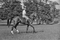
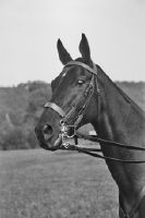
Pferd des Herrn Kav. Oblt. Rud. Brunner, Zürich ; Aufnahmen September
Caption
Inscription original box: horse portraits
Caption (German)
Beschriftug Originalschachtel: Pferdeportraits
Record Name
Dia_293-02-016-01
Title (German)
Pferd des Herrn Kav. Oblt. Rud. Brunner, Zürich ; Aufnahmen September
Caption
Inscription original box: horse portraits
Caption (German)
Beschriftug Originalschachtel: Pferdeportraits
Record Name
Dia_293-02-016-02

Title (German)
Pferd des Herrn Kav. Oblt. Rud. Brunner, Zürich ; Aufnahmen September
Caption
Inscription original box: horse portraits
Caption (German)
Beschriftug Originalschachtel: Pferdeportraits
Record Name
Dia_293-02-016-03

Title (German)
Pferd des Herrn Kav. Oblt. Rud. Brunner, Zürich ; Aufnahmen September
Caption
Inscription original box: horse portraits
Caption (German)
Beschriftug Originalschachtel: Pferdeportraits
Record Name
Dia_293-02-016-04
Title (German)
Pferd des Herrn Kav. Oblt. Rud. Brunner, Zürich ; Aufnahmen September
Caption
Inscription original box: horse portraits
Caption (German)
Beschriftug Originalschachtel: Pferdeportraits
Record Name
Dia_293-02-016-05

Title (German)
Pferd des Herrn Kav. Oblt. Rud. Brunner, Zürich ; Aufnahmen September
Caption
Inscription original box: horse portraits
Caption (German)
Beschriftug Originalschachtel: Pferdeportraits
Record Name
Dia_293-02-016-06

Title (German)
Pferd des Herrn Kav. Oblt. Rud. Brunner, Zürich ; Aufnahmen September
Caption
Inscription original box: horse portraits
Caption (German)
Beschriftug Originalschachtel: Pferdeportraits
Record Name
Dia_293-02-016-07

Title (German)
Pferd des Herrn Kav. Oblt. Rud. Brunner, Zürich ; Aufnahmen September
Caption
Inscription original box: horse portraits
Caption (German)
Beschriftug Originalschachtel: Pferdeportraits
Record Name
Dia_293-02-016-08

Title (German)
Pferd des Herrn Kav. Oblt. Rud. Brunner, Zürich ; Aufnahmen September
Caption
Inscription original box: horse portraits
Caption (German)
Beschriftug Originalschachtel: Pferdeportraits
Record Name
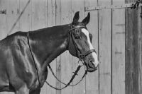
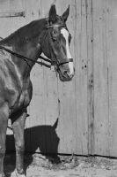
Dia_293-02-016-09

Title (German)
"Mullinger" (Vollbluthengst) des Herrn Dr. Dubs ; Stall Dubs bei Rümlang/September
Caption
Inscription original box: horse portraits
Caption (German)
Beschriftug Originalschachtel: Pferdeportraits
Record Name
Dia_293-02-017-01

Title (German)
"Mullinger" (Vollbluthengst) des Herrn Dr. Dubs ; Stall Dubs bei Rümlang/September
Caption
Inscription original box: horse portraits
Caption (German)
Beschriftug Originalschachtel: Pferdeportraits
Record Name
Dia_293-02-017-02

Title (German)
"Mullinger" (Vollbluthengst) des Herrn Dr. Dubs ; Stall Dubs bei Rümlang/September
Caption
Inscription original box: horse portraits
Caption (German)
Beschriftug Originalschachtel: Pferdeportraits
Record Name
Dia_293-02-017-03

Title (German)
"Mullinger" (Vollbluthengst) des Herrn Dr. Dubs ; Stall Dubs bei Rümlang/September
Caption
Inscription original box: horse portraits
Caption (German)
Beschriftug Originalschachtel: Pferdeportraits
Record Name
Dia_293-02-017-04

Title (German)
"Mullinger" (Vollbluthengst) des Herrn Dr. Dubs ; Stall Dubs bei Rümlang/September
Caption
Inscription original box: horse portraits
Caption (German)
Beschriftug Originalschachtel: Pferdeportraits
Record Name
Dia_293-02-017-05
Title (German)
"Mullinger" (Vollbluthengst) des Herrn Dr. Dubs ; Stall Dubs bei Rümlang/September
Caption
Inscription original box: horse portraits
Caption (German)
Beschriftug Originalschachtel: Pferdeportraits
Record Name
Dia_293-02-017-06

Title (German)
"Mullinger" (Vollbluthengst) des Herrn Dr. Dubs ; Stall Dubs bei Rümlang/September
Caption
Inscription original box: horse portraits
Caption (German)
Beschriftug Originalschachtel: Pferdeportraits
Record Name
Dia_293-02-017-07

Title (German)
"Mullinger" (Vollbluthengst) des Herrn Dr. Dubs ; Stall Dubs bei Rümlang/September
Caption
Inscription original box: horse portraits
Caption (German)
Beschriftug Originalschachtel: Pferdeportraits
Record Name
Dia_293-02-017-08

Title (German)
"Mullinger" (Vollbluthengst) des Herrn Dr. Dubs ; Stall Dubs bei Rümlang/September
Caption
Inscription original box: horse portraits
Caption (German)
Beschriftug Originalschachtel: Pferdeportraits
Record Name
Dia_293-02-017-09

Title (German)
"Mullinger" (Vollbluthengst) des Herrn Dr. Dubs ; Stall Dubs bei Rümlang/September
Caption
Inscription original box: horse portraits
Caption (German)
Beschriftug Originalschachtel: Pferdeportraits
Record Name
Dia_293-02-017-10

Title (German)
"Mullinger" (Vollbluthengst) des Herrn Dr. Dubs ; Stall Dubs bei Rümlang/September
Caption
Inscription original box: horse portraits
Caption (German)
Beschriftug Originalschachtel: Pferdeportraits
Record Name
Dia_293-02-017-11

Title (German)
"Mullinger" (Vollbluthengst) des Herrn Dr. Dubs ; Stall Dubs bei Rümlang/September
Caption
Inscription original box: horse portraits
Caption (German)
Beschriftug Originalschachtel: Pferdeportraits
Record Name
Dia_293-02-017-12

Title (German)
"Mullinger" (Vollbluthengst) des Herrn Dr. Dubs ; Stall Dubs bei Rümlang/September
Caption
Inscription original box: horse portraits
Caption (German)
Beschriftug Originalschachtel: Pferdeportraits
Record Name
Dia_293-02-017-13

Title (German)
"Mullinger" (Vollbluthengst) des Herrn Dr. Dubs ; Stall Dubs bei Rümlang/September
Caption
Inscription original box: horse portraits
Caption (German)
Beschriftug Originalschachtel: Pferdeportraits
Record Name
Dia_293-02-017-14

Title (German)
"Mullinger" (Vollbluthengst) des Herrn Dr. Dubs ; Stall Dubs bei Rümlang/September
Caption
Inscription original box: horse portraits
Caption (German)
Beschriftug Originalschachtel: Pferdeportraits
Record Name
Dia_293-02-017-15

Title (German)
"Mullinger" (Vollbluthengst) des Herrn Dr. Dubs ; Stall Dubs bei Rümlang/September
Caption
Inscription original box: horse portraits
Caption (German)
Beschriftug Originalschachtel: Pferdeportraits
Record Name
Dia_293-02-017-16

Title (German)
"Mullinger" (Vollbluthengst) des Herrn Dr. Dubs ; Stall Dubs bei Rümlang/September
Caption
Inscription original box: horse portraits
Caption (German)
Beschriftug Originalschachtel: Pferdeportraits
Record Name
Dia_293-02-017-17

Title (German)
"Mullinger" (Vollbluthengst) des Herrn Dr. Dubs ; Stall Dubs bei Rümlang/September
Caption
Inscription original box: horse portraits
Caption (German)
Beschriftug Originalschachtel: Pferdeportraits
Record Name
Dia_293-02-017-18

Title (German)
"Mullinger" (Vollbluthengst) des Herrn Dr. Dubs ; Stall Dubs bei Rümlang/September
Caption
Inscription original box: horse portraits
Caption (German)
Beschriftug Originalschachtel: Pferdeportraits
Record Name
Dia_293-02-017-19
Title (German)
"Mullinger" (Vollbluthengst) des Herrn Dr. Dubs ; Stall Dubs bei Rümlang/September
Caption
Inscription original box: horse portraits
Caption (German)
Beschriftug Originalschachtel: Pferdeportraits
Record Name
Dia_293-02-017-20

Title (German)
"Mullinger" (Vollbluthengst) des Herrn Dr. Dubs ; Stall Dubs bei Rümlang/September
Caption
Inscription original box: horse portraits
Caption (German)
Beschriftug Originalschachtel: Pferdeportraits
Record Name
Dia_293-02-017-21

Title (German)
"Mullinger" (Vollbluthengst) des Herrn Dr. Dubs ; Stall Dubs bei Rümlang/September
Caption
Inscription original box: horse portraits
Caption (German)
Beschriftug Originalschachtel: Pferdeportraits
Record Name
Dia_293-02-017-22

Title (German)
"Mullinger" (Vollbluthengst) des Herrn Dr. Dubs ; Stall Dubs bei Rümlang/September
Caption
Inscription original box: horse portraits
Caption (German)
Beschriftug Originalschachtel: Pferdeportraits
Record Name
Dia_293-02-017-23

Title (German)
"Mullinger" (Vollbluthengst) des Herrn Dr. Dubs ; Stall Dubs bei Rümlang/September
Caption
Inscription original box: horse portraits
Caption (German)
Beschriftug Originalschachtel: Pferdeportraits
Record Name
Dia_293-02-017-24
Title (German)
Hptm. Oscar Frank à la Guérinière 1700 Zollikon ; Major Müller/Oblt. Moser "Pasde Deux" Zollikon
Caption
Inscription original box: horse portraits
Caption (German)
Beschriftug Originalschachtel: Pferdeportraits
Record Name
Dia_293-02-018-01

Title (German)
Hptm. Oscar Frank à la Guérinière 1700 Zollikon ; Major Müller/Oblt. Moser "Pasde Deux" Zollikon
Caption
Inscription original box: horse portraits
Caption (German)
Beschriftug Originalschachtel: Pferdeportraits
Record Name
Dia_293-02-018-02

Title (German)
Hptm. Oscar Frank à la Guérinière 1700 Zollikon ; Major Müller/Oblt. Moser "Pasde Deux" Zollikon
Caption
Inscription original box: horse portraits
Caption (German)
Beschriftug Originalschachtel: Pferdeportraits
Record Name
Dia_293-02-018-03

Title (German)
Hptm. Oscar Frank à la Guérinière 1700 Zollikon ; Major Müller/Oblt. Moser "Pasde Deux" Zollikon
Caption
Inscription original box: horse portraits
Caption (German)
Beschriftug Originalschachtel: Pferdeportraits
Record Name
Dia_293-02-018-04

Title (German)
Hptm. Oscar Frank à la Guérinière 1700 Zollikon ; Major Müller/Oblt. Moser "Pasde Deux" Zollikon
Caption
Inscription original box: horse portraits
Caption (German)
Beschriftug Originalschachtel: Pferdeportraits
Record Name
Dia_293-02-018-05

Title (German)
Hptm. Oscar Frank à la Guérinière 1700 Zollikon ; Major Müller/Oblt. Moser "Pasde Deux" Zollikon
Caption
Inscription original box: horse portraits
Caption (German)
Beschriftug Originalschachtel: Pferdeportraits
Record Name
Dia_293-02-018-06

Title (German)
Hptm. Oscar Frank à la Guérinière 1700 Zollikon ; Major Müller/Oblt. Moser "Pasde Deux" Zollikon
Caption
Inscription original box: horse portraits
Caption (German)
Beschriftug Originalschachtel: Pferdeportraits
Record Name
Dia_293-02-018-07

Title (German)
Hptm. Oscar Frank à la Guérinière 1700 Zollikon ; Major Müller/Oblt. Moser "Pasde Deux" Zollikon
Caption
Inscription original box: horse portraits
Caption (German)
Beschriftug Originalschachtel: Pferdeportraits
Record Name
Dia_293-02-018-08

Title (German)
Hptm. Oscar Frank à la Guérinière 1700 Zollikon ; Major Müller/Oblt. Moser "Pasde Deux" Zollikon
Caption
Inscription original box: horse portraits
Caption (German)
Beschriftug Originalschachtel: Pferdeportraits
Record Name
Dia_293-02-018-09

Title (German)
Hptm. Oscar Frank à la Guérinière 1700 Zollikon ; Major Müller/Oblt. Moser "Pasde Deux" Zollikon
Caption
Inscription original box: horse portraits
Caption (German)
Beschriftug Originalschachtel: Pferdeportraits
Record Name
Dia_293-02-018-10

Title (German)
Hptm. Oscar Frank à la Guérinière 1700 Zollikon ; Major Müller/Oblt. Moser "Pasde Deux" Zollikon
Caption
Inscription original box: horse portraits
Caption (German)
Beschriftug Originalschachtel: Pferdeportraits
Record Name
Dia_293-02-018-11

Title (German)
Hptm. Oscar Frank à la Guérinière 1700 Zollikon ; Major Müller/Oblt. Moser "Pasde Deux" Zollikon
Caption
Inscription original box: horse portraits
Caption (German)
Beschriftug Originalschachtel: Pferdeportraits
Record Name
Dia_293-02-018-12

Title (German)
Hptm. Oscar Frank à la Guérinière 1700 Zollikon ; Major Müller/Oblt. Moser "Pasde Deux" Zollikon
Caption
Inscription original box: horse portraits
Caption (German)
Beschriftug Originalschachtel: Pferdeportraits
Record Name
Dia_293-02-018-13

Title (German)
Hptm. Oscar Frank à la Guérinière 1700 Zollikon ; Major Müller/Oblt. Moser "Pasde Deux" Zollikon
Caption
Inscription original box: horse portraits
Caption (German)
Beschriftug Originalschachtel: Pferdeportraits
Record Name
Dia_293-02-018-14

Title (German)
Hptm. Oscar Frank à la Guérinière 1700 Zollikon ; Major Müller/Oblt. Moser "Pasde Deux" Zollikon
Caption
Inscription original box: horse portraits
Caption (German)
Beschriftug Originalschachtel: Pferdeportraits
Record Name
Dia_293-02-018-15

Title (German)
Hptm. Oscar Frank à la Guérinière 1700 Zollikon ; Major Müller/Oblt. Moser "Pasde Deux" Zollikon
Caption
Inscription original box: horse portraits
Caption (German)
Beschriftug Originalschachtel: Pferdeportraits
Record Name
Dia_293-02-018-16

Title (German)
Hptm. Oscar Frank à la Guérinière 1700 Zollikon ; Major Müller/Oblt. Moser "Pasde Deux" Zollikon
Caption
Inscription original box: horse portraits
Caption (German)
Beschriftug Originalschachtel: Pferdeportraits
Record Name
Dia_293-02-018-17

Title (German)
Hptm. Oscar Frank à la Guérinière 1700 Zollikon ; Major Müller/Oblt. Moser "Pasde Deux" Zollikon
Caption
Inscription original box: horse portraits
Caption (German)
Beschriftug Originalschachtel: Pferdeportraits
Record Name
Dia_293-02-018-18

Title (German)
Hptm. Oscar Frank à la Guérinière 1700 Zollikon ; Major Müller/Oblt. Moser "Pasde Deux" Zollikon
Caption
Inscription original box: horse portraits
Caption (German)
Beschriftug Originalschachtel: Pferdeportraits
Record Name
Dia_293-02-018-19

Title (German)
Hptm. Oscar Frank à la Guérinière 1700 Zollikon ; Major Müller/Oblt. Moser "Pasde Deux" Zollikon
Caption
Inscription original box: horse portraits
Caption (German)
Beschriftug Originalschachtel: Pferdeportraits
Record Name
Dia_293-02-018-20

Title (German)
Hptm. Oscar Frank à la Guérinière 1700 Zollikon ; Major Müller/Oblt. Moser "Pasde Deux" Zollikon
Caption
Inscription original box: horse portraits
Caption (German)
Beschriftug Originalschachtel: Pferdeportraits
Record Name
Dia_293-02-018-21

Title (German)
Hptm. Oscar Frank à la Guérinière 1700 Zollikon ; Major Müller/Oblt. Moser "Pasde Deux" Zollikon
Caption
Inscription original box: horse portraits
Caption (German)
Beschriftug Originalschachtel: Pferdeportraits
Record Name
Dia_293-02-018-22

Title (German)
Hptm. Oscar Frank à la Guérinière 1700 Zollikon ; Major Müller/Oblt. Moser "Pasde Deux" Zollikon
Caption
Inscription original box: horse portraits
Caption (German)
Beschriftug Originalschachtel: Pferdeportraits
Record Name
Dia_293-02-018-23

Title (German)
"Peter" Reitpferd (Irländer) des Herrn Züllig St. Gallen ; "Colette" Reitpferd des Herrn Frischknecht in St. Gallen
Caption
Inscription original box: horse portraits
Caption (German)
Beschriftug Originalschachtel: Pferdeportraits
Record Name
Dia_293-02-019-01

Title (German)
"Peter" Reitpferd (Irländer) des Herrn Züllig St. Gallen ; "Colette" Reitpferd des Herrn Frischknecht in St. Gallen
Caption
Inscription original box: horse portraits
Caption (German)
Beschriftug Originalschachtel: Pferdeportraits
Record Name
Dia_293-02-019-02

Title (German)
"Peter" Reitpferd (Irländer) des Herrn Züllig St. Gallen ; "Colette" Reitpferd des Herrn Frischknecht in St. Gallen
Caption
Inscription original box: horse portraits
Caption (German)
Beschriftug Originalschachtel: Pferdeportraits
Record Name
Dia_293-02-019-03

Title (German)
"Peter" Reitpferd (Irländer) des Herrn Züllig St. Gallen ; "Colette" Reitpferd des Herrn Frischknecht in St. Gallen
Caption
Inscription original box: horse portraits
Caption (German)
Beschriftug Originalschachtel: Pferdeportraits
Record Name
Dia_293-02-019-04

Title (German)
"Peter" Reitpferd (Irländer) des Herrn Züllig St. Gallen ; "Colette" Reitpferd des Herrn Frischknecht in St. Gallen
Caption
Inscription original box: horse portraits
Caption (German)
Beschriftug Originalschachtel: Pferdeportraits
Record Name
Dia_293-02-019-05
Title (German)
"Peter" Reitpferd (Irländer) des Herrn Züllig St. Gallen ; "Colette" Reitpferd des Herrn Frischknecht in St. Gallen
Caption
Inscription original box: horse portraits
Caption (German)
Beschriftug Originalschachtel: Pferdeportraits
Record Name
Dia_293-02-019-06

Title (German)
"Peter" Reitpferd (Irländer) des Herrn Züllig St. Gallen ; "Colette" Reitpferd des Herrn Frischknecht in St. Gallen
Caption
Inscription original box: horse portraits
Caption (German)
Beschriftug Originalschachtel: Pferdeportraits
Record Name
Dia_293-02-019-07

Title (German)
"Peter" Reitpferd (Irländer) des Herrn Züllig St. Gallen ; "Colette" Reitpferd des Herrn Frischknecht in St. Gallen
Caption
Inscription original box: horse portraits
Caption (German)
Beschriftug Originalschachtel: Pferdeportraits
Record Name
Dia_293-02-019-08

Title (German)
"Peter" Reitpferd (Irländer) des Herrn Züllig St. Gallen ; "Colette" Reitpferd des Herrn Frischknecht in St. Gallen
Caption
Inscription original box: horse portraits
Caption (German)
Beschriftug Originalschachtel: Pferdeportraits
Record Name
Dia_293-02-019-09

Title (German)
"Peter" Reitpferd (Irländer) des Herrn Züllig St. Gallen ; "Colette" Reitpferd des Herrn Frischknecht in St. Gallen
Caption
Inscription original box: horse portraits
Caption (German)
Beschriftug Originalschachtel: Pferdeportraits
Record Name
Dia_293-02-019-10

Title (German)
"Peter" Reitpferd (Irländer) des Herrn Züllig St. Gallen ; "Colette" Reitpferd des Herrn Frischknecht in St. Gallen
Caption
Inscription original box: horse portraits
Caption (German)
Beschriftug Originalschachtel: Pferdeportraits
Record Name
Dia_293-02-019-11

Title (German)
"Peter" Reitpferd (Irländer) des Herrn Züllig St. Gallen ; "Colette" Reitpferd des Herrn Frischknecht in St. Gallen
Caption
Inscription original box: horse portraits
Caption (German)
Beschriftug Originalschachtel: Pferdeportraits
Record Name
Dia_293-02-019-12

Title (German)
"Peter" Reitpferd (Irländer) des Herrn Züllig St. Gallen ; "Colette" Reitpferd des Herrn Frischknecht in St. Gallen
Caption
Inscription original box: horse portraits
Caption (German)
Beschriftug Originalschachtel: Pferdeportraits
Record Name
Dia_293-02-019-13

Title (German)
"Peter" Reitpferd (Irländer) des Herrn Züllig St. Gallen ; "Colette" Reitpferd des Herrn Frischknecht in St. Gallen
Caption
Inscription original box: horse portraits
Caption (German)
Beschriftug Originalschachtel: Pferdeportraits
Record Name
Dia_293-02-019-14

Title (German)
"Peter" Reitpferd (Irländer) des Herrn Züllig St. Gallen ; "Colette" Reitpferd des Herrn Frischknecht in St. Gallen
Caption
Inscription original box: horse portraits
Caption (German)
Beschriftug Originalschachtel: Pferdeportraits
Record Name
Dia_293-02-019-15

Title (German)
"Peter" Reitpferd (Irländer) des Herrn Züllig St. Gallen ; "Colette" Reitpferd des Herrn Frischknecht in St. Gallen
Caption
Inscription original box: horse portraits
Caption (German)
Beschriftug Originalschachtel: Pferdeportraits
Record Name
Dia_293-02-019-16

Title (German)
"Peter" Reitpferd (Irländer) des Herrn Züllig St. Gallen ; "Colette" Reitpferd des Herrn Frischknecht in St. Gallen
Caption
Inscription original box: horse portraits
Caption (German)
Beschriftug Originalschachtel: Pferdeportraits
Record Name
Dia_293-02-019-17

Title (German)
Pferd: "Bück" von Kav. Oberstlt. E. Spoerri in Würenlingen
Caption
Inscription original box: horse portraits
Caption (German)
Beschriftug Originalschachtel: Pferdeportraits
Record Name
Dia_293-02-020-01

Title (German)
Pferd: "Bück" von Kav. Oberstlt. E. Spoerri in Würenlingen
Caption
Inscription original box: horse portraits
Caption (German)
Beschriftug Originalschachtel: Pferdeportraits
Record Name
Dia_293-02-020-02

Title (German)
Pferd: "Bück" von Kav. Oberstlt. E. Spoerri in Würenlingen
Caption
Inscription original box: horse portraits
Caption (German)
Beschriftug Originalschachtel: Pferdeportraits
Record Name
Dia_293-02-020-03

Title (German)
Pferd: "Bück" von Kav. Oberstlt. E. Spoerri in Würenlingen
Caption
Inscription original box: horse portraits
Caption (German)
Beschriftug Originalschachtel: Pferdeportraits
Record Name
Dia_293-02-020-04

Title (German)
Pferd: "Bück" von Kav. Oberstlt. E. Spoerri in Würenlingen
Caption
Inscription original box: horse portraits
Caption (German)
Beschriftug Originalschachtel: Pferdeportraits
Record Name
Dia_293-02-020-05

Title (German)
Pferd: "Bück" von Kav. Oberstlt. E. Spoerri in Würenlingen
Caption
Inscription original box: horse portraits
Caption (German)
Beschriftug Originalschachtel: Pferdeportraits
Record Name
Dia_293-02-020-06

Title (German)
Pferd: "Bück" von Kav. Oberstlt. E. Spoerri in Würenlingen
Caption
Inscription original box: horse portraits
Caption (German)
Beschriftug Originalschachtel: Pferdeportraits
Record Name
Dia_293-02-020-07

Title (German)
Pferd: "Bück" von Kav. Oberstlt. E. Spoerri in Würenlingen
Caption
Inscription original box: horse portraits
Caption (German)
Beschriftug Originalschachtel: Pferdeportraits
Record Name
Dia_293-02-020-08

Title (German)
Pferd: "Bück" von Kav. Oberstlt. E. Spoerri in Würenlingen
Caption
Inscription original box: horse portraits
Caption (German)
Beschriftug Originalschachtel: Pferdeportraits
Record Name
Dia_293-02-020-09

Title (German)
Pferd: "Bück" von Kav. Oberstlt. E. Spoerri in Würenlingen
Caption
Inscription original box: horse portraits
Caption (German)
Beschriftug Originalschachtel: Pferdeportraits
Record Name
Dia_293-02-020-10

Title (German)
Pferd: "Bück" von Kav. Oberstlt. E. Spoerri in Würenlingen
Caption
Inscription original box: horse portraits
Caption (German)
Beschriftug Originalschachtel: Pferdeportraits
Record Name
Dia_293-02-020-11

Title (German)
Pferd: "Bück" von Kav. Oberstlt. E. Spoerri in Würenlingen
Caption
Inscription original box: horse portraits
Caption (German)
Beschriftug Originalschachtel: Pferdeportraits
Record Name
Dia_293-02-020-12

Title (German)
Pferd: "Bück" von Kav. Oberstlt. E. Spoerri in Würenlingen
Caption
Inscription original box: horse portraits
Caption (German)
Beschriftug Originalschachtel: Pferdeportraits
Record Name
Dia_293-02-020-13

Title (German)
Pferde: "Tory" und "Papageno" 1215 - 31 des Herrn Kav. Hptm. Otto Walther, Bolligen
Caption
Inscription original box: horse portraits
Caption (German)
Beschriftug Originalschachtel: Pferdeportraits
Record Name
Dia_293-02-021-01

Title (German)
Pferde: "Tory" und "Papageno" 1215 - 31 des Herrn Kav. Hptm. Otto Walther, Bolligen
Caption
Inscription original box: horse portraits
Caption (German)
Beschriftug Originalschachtel: Pferdeportraits
Record Name
Dia_293-02-021-02

Title (German)
Pferde: "Tory" und "Papageno" 1215 - 31 des Herrn Kav. Hptm. Otto Walther, Bolligen
Caption
Inscription original box: horse portraits
Caption (German)
Beschriftug Originalschachtel: Pferdeportraits
Record Name
Dia_293-02-021-03

Title (German)
Pferde: "Tory" und "Papageno" 1215 - 31 des Herrn Kav. Hptm. Otto Walther, Bolligen
Caption
Inscription original box: horse portraits
Caption (German)
Beschriftug Originalschachtel: Pferdeportraits
Record Name
Dia_293-02-021-04

Title (German)
Pferde: "Tory" und "Papageno" 1215 - 31 des Herrn Kav. Hptm. Otto Walther, Bolligen
Caption
Inscription original box: horse portraits
Caption (German)
Beschriftug Originalschachtel: Pferdeportraits
Record Name
Dia_293-02-021-05

Title (German)
Pferde: "Tory" und "Papageno" 1215 - 31 des Herrn Kav. Hptm. Otto Walther, Bolligen
Caption
Inscription original box: horse portraits
Caption (German)
Beschriftug Originalschachtel: Pferdeportraits
Record Name
Dia_293-02-021-06

Title (German)
Pferde: "Tory" und "Papageno" 1215 - 31 des Herrn Kav. Hptm. Otto Walther, Bolligen
Caption
Inscription original box: horse portraits
Caption (German)
Beschriftug Originalschachtel: Pferdeportraits
Record Name
Dia_293-02-021-07

Title (German)
Pferde: "Tory" und "Papageno" 1215 - 31 des Herrn Kav. Hptm. Otto Walther, Bolligen
Caption
Inscription original box: horse portraits
Caption (German)
Beschriftug Originalschachtel: Pferdeportraits
Record Name
Dia_293-02-021-08

Title (German)
Pferde: "Tory" und "Papageno" 1215 - 31 des Herrn Kav. Hptm. Otto Walther, Bolligen
Caption
Inscription original box: horse portraits
Caption (German)
Beschriftug Originalschachtel: Pferdeportraits
Record Name
Dia_293-02-021-09

Title (German)
Pferde: "Tory" und "Papageno" 1215 - 31 des Herrn Kav. Hptm. Otto Walther, Bolligen
Caption
Inscription original box: horse portraits
Caption (German)
Beschriftug Originalschachtel: Pferdeportraits
Record Name
Dia_293-02-021-10

Title (German)
Pferde: "Tory" und "Papageno" 1215 - 31 des Herrn Kav. Hptm. Otto Walther, Bolligen
Caption
Inscription original box: horse portraits
Caption (German)
Beschriftug Originalschachtel: Pferdeportraits
Record Name
Dia_293-02-021-11

Title (German)
Pferde: "Tory" und "Papageno" 1215 - 31 des Herrn Kav. Hptm. Otto Walther, Bolligen
Caption
Inscription original box: horse portraits
Caption (German)
Beschriftug Originalschachtel: Pferdeportraits
Record Name
Dia_293-02-021-12

Title (German)
Pferde: "Tory" und "Papageno" 1215 - 31 des Herrn Kav. Hptm. Otto Walther, Bolligen
Caption
Inscription original box: horse portraits
Caption (German)
Beschriftug Originalschachtel: Pferdeportraits
Record Name
Dia_293-02-021-13

Title (German)
Pferde "Tory" und "Papageno" 1215-31 des Herrn Kav. Hptm. Otto Walther Bolligen Gen. Dir. Hegnauer Lausanne
Caption
Inscription original box: horse portraits
Caption (German)
Beschriftug Originalschachtel: Pferdeportraits
Record Name
Dia_293-02-022-01

Title (German)
Pferde "Tory" und "Papageno" 1215-31 des Herrn Kav. Hptm. Otto Walther Bolligen Gen. Dir. Hegnauer Lausanne
Caption
Inscription original box: horse portraits
Caption (German)
Beschriftug Originalschachtel: Pferdeportraits
Record Name
Dia_293-02-022-02

Title (German)
Pferde "Tory" und "Papageno" 1215-31 des Herrn Kav. Hptm. Otto Walther Bolligen Gen. Dir. Hegnauer Lausanne
Caption
Inscription original box: horse portraits
Caption (German)
Beschriftug Originalschachtel: Pferdeportraits
Record Name
Dia_293-02-022-03

Title (German)
Pferde "Tory" und "Papageno" 1215-31 des Herrn Kav. Hptm. Otto Walther Bolligen Gen. Dir. Hegnauer Lausanne
Caption
Inscription original box: horse portraits
Caption (German)
Beschriftug Originalschachtel: Pferdeportraits
Record Name
Dia_293-02-022-04

Title (German)
Pferde "Tory" und "Papageno" 1215-31 des Herrn Kav. Hptm. Otto Walther Bolligen Gen. Dir. Hegnauer Lausanne
Caption
Inscription original box: horse portraits
Caption (German)
Beschriftug Originalschachtel: Pferdeportraits
Record Name
Dia_293-02-022-05
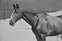
Title (German)
Pferde "Tory" und "Papageno" 1215-31 des Herrn Kav. Hptm. Otto Walther Bolligen Gen. Dir. Hegnauer Lausanne
Caption
Inscription original box: horse portraits
Caption (German)
Beschriftug Originalschachtel: Pferdeportraits
Record Name
Dia_293-02-022-06

Title (German)
Pferde "Tory" und "Papageno" 1215-31 des Herrn Kav. Hptm. Otto Walther Bolligen Gen. Dir. Hegnauer Lausanne
Caption
Inscription original box: horse portraits
Caption (German)
Beschriftug Originalschachtel: Pferdeportraits
Record Name
Dia_293-02-022-07

Title (German)
Pferde "Tory" und "Papageno" 1215-31 des Herrn Kav. Hptm. Otto Walther Bolligen Gen. Dir. Hegnauer Lausanne
Caption
Inscription original box: horse portraits
Caption (German)
Beschriftug Originalschachtel: Pferdeportraits
Record Name
Dia_293-02-022-08

Title (German)
Pferde "Tory" und "Papageno" 1215-31 des Herrn Kav. Hptm. Otto Walther Bolligen Gen. Dir. Hegnauer Lausanne
Caption
Inscription original box: horse portraits
Caption (German)
Beschriftug Originalschachtel: Pferdeportraits
Record Name
Dia_293-02-022-09

Title (German)
Pferde "Tory" und "Papageno" 1215-31 des Herrn Kav. Hptm. Otto Walther Bolligen Gen. Dir. Hegnauer Lausanne
Caption
Inscription original box: horse portraits
Caption (German)
Beschriftug Originalschachtel: Pferdeportraits
Record Name
Dia_293-02-022-10

Title (German)
Pferde "Tory" und "Papageno" 1215-31 des Herrn Kav. Hptm. Otto Walther Bolligen Gen. Dir. Hegnauer Lausanne
Caption
Inscription original box: horse portraits
Caption (German)
Beschriftug Originalschachtel: Pferdeportraits
Record Name
Dia_293-02-022-11

Title (German)
Pferde "Tory" und "Papageno" 1215-31 des Herrn Kav. Hptm. Otto Walther Bolligen Gen. Dir. Hegnauer Lausanne
Caption
Inscription original box: horse portraits
Caption (German)
Beschriftug Originalschachtel: Pferdeportraits
Record Name
Dia_293-02-022-12

Title (German)
Pferde "Tory" und "Papageno" 1215-31 des Herrn Kav. Hptm. Otto Walther Bolligen Gen. Dir. Hegnauer Lausanne
Caption
Inscription original box: horse portraits
Caption (German)
Beschriftug Originalschachtel: Pferdeportraits
Record Name
Dia_293-02-022-13

Title (German)
Pferde "Tory" und "Papageno" 1215-31 des Herrn Kav. Hptm. Otto Walther Bolligen Gen. Dir. Hegnauer Lausanne
Caption
Inscription original box: horse portraits
Caption (German)
Beschriftug Originalschachtel: Pferdeportraits
Record Name
Dia_293-02-022-14

Title (German)
Pferde "Tory" und "Papageno" 1215-31 des Herrn Kav. Hptm. Otto Walther Bolligen Gen. Dir. Hegnauer Lausanne
Caption
Inscription original box: horse portraits
Caption (German)
Beschriftug Originalschachtel: Pferdeportraits
Record Name
Dia_293-02-022-15
Title (German)
Pferde/Fohlen auf der Frutt
Caption
Inscription original box: horse portraits
Caption (German)
Beschriftug Originalschachtel: Pferdeportraits
Record Name
Dia_293-02-023-01

Title (German)
Pferde/Fohlen auf der Frutt
Caption
Inscription original box: horse portraits
Caption (German)
Beschriftug Originalschachtel: Pferdeportraits
Record Name
Dia_293-02-023-02

Title (German)
Pferde/Fohlen auf der Frutt
Caption
Inscription original box: horse portraits
Caption (German)
Beschriftug Originalschachtel: Pferdeportraits
Record Name
Dia_293-02-023-03

Title (German)
Pferde/Fohlen auf der Frutt
Caption
Inscription original box: horse portraits
Caption (German)
Beschriftug Originalschachtel: Pferdeportraits
Record Name
Dia_293-02-023-04

Title (German)
Pferde/Fohlen auf der Frutt
Caption
Inscription original box: horse portraits
Caption (German)
Beschriftug Originalschachtel: Pferdeportraits
Record Name
Dia_293-02-023-05

Title (German)
Pferde/Fohlen auf der Frutt
Caption
Inscription original box: horse portraits
Caption (German)
Beschriftug Originalschachtel: Pferdeportraits
Record Name
Dia_293-02-023-06

Title (German)
Pferde/Fohlen auf der Frutt
Caption
Inscription original box: horse portraits
Caption (German)
Beschriftug Originalschachtel: Pferdeportraits
Record Name
Dia_293-02-023-07

Title (German)
Pferde/Fohlen auf der Frutt
Caption
Inscription original box: horse portraits
Caption (German)
Beschriftug Originalschachtel: Pferdeportraits
Record Name
Dia_293-02-023-08

Title (German)
Pferde/Fohlen auf der Frutt
Caption
Inscription original box: horse portraits
Caption (German)
Beschriftug Originalschachtel: Pferdeportraits
Record Name
Dia_293-02-023-09

Title (German)
Pferde/Fohlen auf der Frutt
Caption
Inscription original box: horse portraits
Caption (German)
Beschriftug Originalschachtel: Pferdeportraits
Record Name
Dia_293-02-023-10

Title (German)
Pferde/Fohlen auf der Frutt
Caption
Inscription original box: horse portraits
Caption (German)
Beschriftug Originalschachtel: Pferdeportraits
Record Name
Dia_293-02-023-11

Title (German)
Pferde/Fohlen auf der Frutt
Caption
Inscription original box: horse portraits
Caption (German)
Beschriftug Originalschachtel: Pferdeportraits
Record Name
Dia_293-02-023-12

Title (German)
Pferde/Fohlen auf der Frutt
Caption
Inscription original box: horse portraits
Caption (German)
Beschriftug Originalschachtel: Pferdeportraits
Record Name
Dia_293-02-023-13

Title (German)
Pferde/Fohlen auf der Frutt
Caption
Inscription original box: horse portraits
Caption (German)
Beschriftug Originalschachtel: Pferdeportraits
Record Name
Dia_293-02-023-14

Title (German)
Pferde/Fohlen auf der Frutt
Caption
Inscription original box: horse portraits
Caption (German)
Beschriftug Originalschachtel: Pferdeportraits
Record Name
Dia_293-02-023-15

Title (German)
Pferde/Fohlen auf der Frutt
Caption
Inscription original box: horse portraits
Caption (German)
Beschriftug Originalschachtel: Pferdeportraits
Record Name
Dia_293-02-023-16

Title (German)
Pferde/Fohlen auf der Frutt
Caption
Inscription original box: horse portraits
Caption (German)
Beschriftug Originalschachtel: Pferdeportraits
Record Name
Dia_293-02-023-17

Title (German)
Pferde/Fohlen auf der Frutt
Caption
Inscription original box: horse portraits
Caption (German)
Beschriftug Originalschachtel: Pferdeportraits
Record Name
Dia_293-02-023-18

Title (German)
Pferde/Fohlen auf der Frutt
Caption
Inscription original box: horse portraits
Caption (German)
Beschriftug Originalschachtel: Pferdeportraits
Record Name
Dia_293-02-023-19

Title (German)
Pferde/Fohlen auf der Frutt
Caption
Inscription original box: horse portraits
Caption (German)
Beschriftug Originalschachtel: Pferdeportraits
Record Name
Dia_293-02-023-20
Title (German)
Pferde/Fohlen auf der Frutt
Caption
Inscription original box: horse portraits
Caption (German)
Beschriftug Originalschachtel: Pferdeportraits
Record Name
Dia_293-02-023-21

Title (German)
Pferde/Fohlen auf der Frutt
Caption
Inscription original box: horse portraits
Caption (German)
Beschriftug Originalschachtel: Pferdeportraits
Record Name
Dia_293-02-023-22

Title (German)
Pferde/Fohlen auf der Frutt
Caption
Inscription original box: horse portraits
Caption (German)
Beschriftug Originalschachtel: Pferdeportraits
Record Name
Dia_293-02-023-23

Title (German)
Pferde/Fohlen auf der Frutt
Caption
Inscription original box: horse portraits
Caption (German)
Beschriftug Originalschachtel: Pferdeportraits
Record Name
Dia_293-02-023-24

Title (German)
Pferde/Fohlen auf der Frutt
Caption
Inscription original box: horse portraits
Caption (German)
Beschriftug Originalschachtel: Pferdeportraits
Record Name
Dia_293-02-023-25

Title (German)
Pferde/Fohlen auf der Frutt
Caption
Inscription original box: horse portraits
Caption (German)
Beschriftug Originalschachtel: Pferdeportraits
Record Name
Dia_293-02-023-26

Title (German)
Pferde/Fohlen auf der Frutt
Caption
Inscription original box: horse portraits
Caption (German)
Beschriftug Originalschachtel: Pferdeportraits
Record Name
Dia_293-02-023-27

Title (German)
Pferde/Fohlen auf der Frutt
Caption
Inscription original box: horse portraits
Caption (German)
Beschriftug Originalschachtel: Pferdeportraits
Record Name
Dia_293-02-023-28

Title (German)
Pferde/Fohlen auf der Frutt
Caption
Inscription original box: horse portraits
Caption (German)
Beschriftug Originalschachtel: Pferdeportraits
Record Name
Dia_293-02-023-29

Title (German)
Pferde/Fohlen auf der Frutt
Caption
Inscription original box: horse portraits
Caption (German)
Beschriftug Originalschachtel: Pferdeportraits
Record Name
Dia_293-02-023-30

Title (German)
Pferde/Fohlen auf der Frutt
Caption
Inscription original box: horse portraits
Caption (German)
Beschriftug Originalschachtel: Pferdeportraits
Record Name
Dia_293-02-023-31

Title (German)
Pferde/Fohlen auf der Frutt
Caption
Inscription original box: horse portraits
Caption (German)
Beschriftug Originalschachtel: Pferdeportraits
Record Name
Dia_293-02-023-32

Title (German)
Pferde/Fohlen auf der Frutt
Caption
Inscription original box: horse portraits
Caption (German)
Beschriftug Originalschachtel: Pferdeportraits
Record Name
Dia_293-02-023-33

Title (German)
Pferde/Fohlen auf der Frutt
Caption
Inscription original box: horse portraits
Caption (German)
Beschriftug Originalschachtel: Pferdeportraits
Record Name
Dia_293-02-023-34

Title (German)
Pferde/Fohlen auf der Frutt
Caption
Inscription original box: horse portraits
Caption (German)
Beschriftug Originalschachtel: Pferdeportraits
Record Name
Dia_293-02-024-01

Title (German)
Pferde/Fohlen auf der Frutt
Caption
Inscription original box: horse portraits
Caption (German)
Beschriftug Originalschachtel: Pferdeportraits
Record Name
Dia_293-02-024-02

Title (German)
Pferde/Fohlen auf der Frutt
Caption
Inscription original box: horse portraits
Caption (German)
Beschriftug Originalschachtel: Pferdeportraits
Record Name
Dia_293-02-024-03

Title (German)
Pferde/Fohlen auf der Frutt
Caption
Inscription original box: horse portraits
Caption (German)
Beschriftug Originalschachtel: Pferdeportraits
Record Name
Dia_293-02-024-04

Title (German)
Pferde/Fohlen auf der Frutt
Caption
Inscription original box: horse portraits
Caption (German)
Beschriftug Originalschachtel: Pferdeportraits
Record Name
Dia_293-02-024-05

Title (German)
Pferde/Fohlen auf der Frutt
Caption
Inscription original box: horse portraits
Caption (German)
Beschriftug Originalschachtel: Pferdeportraits
Record Name
Dia_293-02-024-06

Title (German)
Pferde/Fohlen auf der Frutt
Caption
Inscription original box: horse portraits
Caption (German)
Beschriftug Originalschachtel: Pferdeportraits
Record Name
Dia_293-02-024-07

Title (German)
Pferde/Fohlen auf der Frutt
Caption
Inscription original box: horse portraits
Caption (German)
Beschriftug Originalschachtel: Pferdeportraits
Record Name
Dia_293-02-024-08

Title (German)
Pferde/Fohlen auf der Frutt
Caption
Inscription original box: horse portraits
Caption (German)
Beschriftug Originalschachtel: Pferdeportraits
Record Name
Dia_293-02-024-09

Title (German)
Pferde/Fohlen auf der Frutt
Caption
Inscription original box: horse portraits
Caption (German)
Beschriftug Originalschachtel: Pferdeportraits
Record Name
Dia_293-02-024-10

Title (German)
Pferde/Fohlen auf der Frutt
Caption
Inscription original box: horse portraits
Caption (German)
Beschriftug Originalschachtel: Pferdeportraits
Record Name
Dia_293-02-024-11

Title (German)
Pferde/Fohlen auf der Frutt
Caption
Inscription original box: horse portraits
Caption (German)
Beschriftug Originalschachtel: Pferdeportraits
Record Name
Dia_293-02-024-12

Title (German)
Pferde/Fohlen auf der Frutt
Caption
Inscription original box: horse portraits
Caption (German)
Beschriftug Originalschachtel: Pferdeportraits
Record Name
Dia_293-02-024-13

Title (German)
Pferde/Fohlen auf der Frutt
Caption
Inscription original box: horse portraits
Caption (German)
Beschriftug Originalschachtel: Pferdeportraits
Record Name
Dia_293-02-024-14

Title (German)
Pferde/Fohlen auf der Frutt
Caption
Inscription original box: horse portraits
Caption (German)
Beschriftug Originalschachtel: Pferdeportraits
Record Name
Dia_293-02-024-15

Title (German)
Pferde/Fohlen auf der Frutt
Caption
Inscription original box: horse portraits
Caption (German)
Beschriftug Originalschachtel: Pferdeportraits
Record Name
Dia_293-02-024-16

Title (German)
Pferde/Fohlen auf der Frutt
Caption
Inscription original box: horse portraits
Caption (German)
Beschriftug Originalschachtel: Pferdeportraits
Record Name
Dia_293-02-024-17

Title (German)
Pferde/Fohlen auf der Frutt
Caption
Inscription original box: horse portraits
Caption (German)
Beschriftug Originalschachtel: Pferdeportraits
Record Name
Dia_293-02-024-18

Title (German)
Pferde/Fohlen auf der Frutt
Caption
Inscription original box: horse portraits
Caption (German)
Beschriftug Originalschachtel: Pferdeportraits
Record Name
Dia_293-02-024-19

Title (German)
Pferde/Fohlen auf der Frutt
Caption
Inscription original box: horse portraits
Caption (German)
Beschriftug Originalschachtel: Pferdeportraits
Record Name
Dia_293-02-024-20

Title (German)
Pferde/Fohlen auf der Frutt
Caption
Inscription original box: horse portraits
Caption (German)
Beschriftug Originalschachtel: Pferdeportraits
Record Name
Dia_293-02-024-21

Title (German)
Pferde/Fohlen auf der Frutt
Caption
Inscription original box: horse portraits
Caption (German)
Beschriftug Originalschachtel: Pferdeportraits
Record Name
Dia_293-02-024-22

Title (German)
Pferd: "Lor" Major Alfr. Disch/Otmarsingen ; Pferd: "Pal" Dr. Lörtscher, Zürich
Caption
Inscription original box: horse portraits
Caption (German)
Beschriftug Originalschachtel: Pferdeportraits
Record Name
Dia_293-02-025-01

Title (German)
Pferd: "Lor" Major Alfr. Disch/Otmarsingen ; Pferd: "Pal" Dr. Lörtscher, Zürich
Caption
Inscription original box: horse portraits
Caption (German)
Beschriftug Originalschachtel: Pferdeportraits
Record Name
Dia_293-02-025-02

Title (German)
Pferd: "Lor" Major Alfr. Disch/Otmarsingen ; Pferd: "Pal" Dr. Lörtscher, Zürich
Caption
Inscription original box: horse portraits
Caption (German)
Beschriftug Originalschachtel: Pferdeportraits
Record Name
Dia_293-02-025-03

Title (German)
Pferd: "Lor" Major Alfr. Disch/Otmarsingen ; Pferd: "Pal" Dr. Lörtscher, Zürich
Caption
Inscription original box: horse portraits
Caption (German)
Beschriftug Originalschachtel: Pferdeportraits
Record Name
Dia_293-02-025-04

Title (German)
Pferd: "Lor" Major Alfr. Disch/Otmarsingen ; Pferd: "Pal" Dr. Lörtscher, Zürich
Caption
Inscription original box: horse portraits
Caption (German)
Beschriftug Originalschachtel: Pferdeportraits
Record Name
Dia_293-02-025-05

Title (German)
Pferd: "Lor" Major Alfr. Disch/Otmarsingen ; Pferd: "Pal" Dr. Lörtscher, Zürich
Caption
Inscription original box: horse portraits
Caption (German)
Beschriftug Originalschachtel: Pferdeportraits
Record Name
Dia_293-02-025-06

Title (German)
Pferd: "Lor" Major Alfr. Disch/Otmarsingen ; Pferd: "Pal" Dr. Lörtscher, Zürich
Caption
Inscription original box: horse portraits
Caption (German)
Beschriftug Originalschachtel: Pferdeportraits
Record Name
Dia_293-02-025-07

Title (German)
Pferd: "Lor" Major Alfr. Disch/Otmarsingen ; Pferd: "Pal" Dr. Lörtscher, Zürich
Caption
Inscription original box: horse portraits
Caption (German)
Beschriftug Originalschachtel: Pferdeportraits
Record Name
Dia_293-02-025-08

Title (German)
Pferd: "Lor" Major Alfr. Disch/Otmarsingen ; Pferd: "Pal" Dr. Lörtscher, Zürich
Caption
Inscription original box: horse portraits
Caption (German)
Beschriftug Originalschachtel: Pferdeportraits
Record Name
Dia_293-02-025-09

Title (German)
Pferd: "Lor" Major Alfr. Disch/Otmarsingen ; Pferd: "Pal" Dr. Lörtscher, Zürich
Caption
Inscription original box: horse portraits
Caption (German)
Beschriftug Originalschachtel: Pferdeportraits
Record Name
Dia_293-02-025-10

Title (German)
Pferd: "Lor" Major Alfr. Disch/Otmarsingen ; Pferd: "Pal" Dr. Lörtscher, Zürich
Caption
Inscription original box: horse portraits
Caption (German)
Beschriftug Originalschachtel: Pferdeportraits
Record Name
Dia_293-02-025-11

Title (German)
Pferd: "Lor" Major Alfr. Disch/Otmarsingen ; Pferd: "Pal" Dr. Lörtscher, Zürich
Caption
Inscription original box: horse portraits
Caption (German)
Beschriftug Originalschachtel: Pferdeportraits
Record Name
Dia_293-02-025-12

Title (German)
Pferd: "Lor" Major Alfr. Disch/Otmarsingen ; Pferd: "Pal" Dr. Lörtscher, Zürich
Caption
Inscription original box: horse portraits
Caption (German)
Beschriftug Originalschachtel: Pferdeportraits
Record Name
Dia_293-02-025-13

Title (German)
Pferd: "Lor" Major Alfr. Disch/Otmarsingen ; Pferd: "Pal" Dr. Lörtscher, Zürich
Caption
Inscription original box: horse portraits
Caption (German)
Beschriftug Originalschachtel: Pferdeportraits
Record Name
Dia_293-02-025-14

Title (German)
Pferd: "Lor" Major Alfr. Disch/Otmarsingen ; Pferd: "Pal" Dr. Lörtscher, Zürich
Caption
Inscription original box: horse portraits
Caption (German)
Beschriftug Originalschachtel: Pferdeportraits
Record Name
Dia_293-02-025-15

Title (German)
Pferd: "Lor" Major Alfr. Disch/Otmarsingen ; Pferd: "Pal" Dr. Lörtscher, Zürich
Caption
Inscription original box: horse portraits
Caption (German)
Beschriftug Originalschachtel: Pferdeportraits
Record Name
Dia_293-02-025-16

Title (German)
Pferd: "Lor" Major Alfr. Disch/Otmarsingen ; Pferd: "Pal" Dr. Lörtscher, Zürich
Caption
Inscription original box: horse portraits
Caption (German)
Beschriftug Originalschachtel: Pferdeportraits
Record Name
Dia_293-02-025-17

Title (German)
Pferd: "Lor" Major Alfr. Disch/Otmarsingen ; Pferd: "Pal" Dr. Lörtscher, Zürich
Caption
Inscription original box: horse portraits
Caption (German)
Beschriftug Originalschachtel: Pferdeportraits
Record Name
Dia_293-02-025-18

Title (German)
Pferd: "Lor" Major Alfr. Disch/Otmarsingen ; Pferd: "Pal" Dr. Lörtscher, Zürich
Caption
Inscription original box: horse portraits
Caption (German)
Beschriftug Originalschachtel: Pferdeportraits
Record Name
Dia_293-02-025-19

Title (German)
Pferd: "Kolibri" Th. Schatzmann-Buchmann, Lenzburg ; Pferd: "Pou Du Ciel" Frl. Notz Zürich
Caption
Inscription original box: horse portraits
Caption (German)
Beschriftug Originalschachtel: Pferdeportraits
Record Name
Dia_293-02-026-01
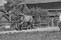
Title (German)
Pferd: "Kolibri" Th. Schatzmann-Buchmann, Lenzburg ; Pferd: "Pou Du Ciel" Frl. Notz Zürich
Caption
Inscription original box: horse portraits
Caption (German)
Beschriftug Originalschachtel: Pferdeportraits
Record Name
Dia_293-02-026-02

Title (German)
Pferd: "Kolibri" Th. Schatzmann-Buchmann, Lenzburg ; Pferd: "Pou Du Ciel" Frl. Notz Zürich
Caption
Inscription original box: horse portraits
Caption (German)
Beschriftug Originalschachtel: Pferdeportraits
Record Name
Dia_293-02-026-03

Title (German)
Pferd: "Kolibri" Th. Schatzmann-Buchmann, Lenzburg ; Pferd: "Pou Du Ciel" Frl. Notz Zürich
Caption
Inscription original box: horse portraits
Caption (German)
Beschriftug Originalschachtel: Pferdeportraits
Record Name
Dia_293-02-026-04

Title (German)
Pferd: "Kolibri" Th. Schatzmann-Buchmann, Lenzburg ; Pferd: "Pou Du Ciel" Frl. Notz Zürich
Caption
Inscription original box: horse portraits
Caption (German)
Beschriftug Originalschachtel: Pferdeportraits
Record Name
Dia_293-02-026-05

Title (German)
Pferd: "Kolibri" Th. Schatzmann-Buchmann, Lenzburg ; Pferd: "Pou Du Ciel" Frl. Notz Zürich
Caption
Inscription original box: horse portraits
Caption (German)
Beschriftug Originalschachtel: Pferdeportraits
Record Name
Dia_293-02-026-06

Title (German)
Pferd: "Kolibri" Th. Schatzmann-Buchmann, Lenzburg ; Pferd: "Pou Du Ciel" Frl. Notz Zürich
Caption
Inscription original box: horse portraits
Caption (German)
Beschriftug Originalschachtel: Pferdeportraits
Record Name
Dia_293-02-026-07
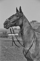
Title (German)
Pferd: "Kolibri" Th. Schatzmann-Buchmann, Lenzburg ; Pferd: "Pou Du Ciel" Frl. Notz Zürich
Caption
Inscription original box: horse portraits
Caption (German)
Beschriftug Originalschachtel: Pferdeportraits
Record Name
Dia_293-02-026-08

Title (German)
Pferd: "Kolibri" Th. Schatzmann-Buchmann, Lenzburg ; Pferd: "Pou Du Ciel" Frl. Notz Zürich
Caption
Inscription original box: horse portraits
Caption (German)
Beschriftug Originalschachtel: Pferdeportraits
Record Name
Dia_293-02-026-09

Title (German)
Pferd: "Kolibri" Th. Schatzmann-Buchmann, Lenzburg ; Pferd: "Pou Du Ciel" Frl. Notz Zürich
Caption
Inscription original box: horse portraits
Caption (German)
Beschriftug Originalschachtel: Pferdeportraits
Record Name
Dia_293-02-026-10

Title (German)
Pferd: "Kolibri" Th. Schatzmann-Buchmann, Lenzburg ; Pferd: "Pou Du Ciel" Frl. Notz Zürich
Caption
Inscription original box: horse portraits
Caption (German)
Beschriftug Originalschachtel: Pferdeportraits
Record Name
Dia_293-02-026-11

Title (German)
Pferd: "Kolibri" Th. Schatzmann-Buchmann, Lenzburg ; Pferd: "Pou Du Ciel" Frl. Notz Zürich
Caption
Inscription original box: horse portraits
Caption (German)
Beschriftug Originalschachtel: Pferdeportraits
Record Name
Dia_293-02-026-12

Title (German)
Pferd: "Kolibri" Th. Schatzmann-Buchmann, Lenzburg ; Pferd: "Pou Du Ciel" Frl. Notz Zürich
Caption
Inscription original box: horse portraits
Caption (German)
Beschriftug Originalschachtel: Pferdeportraits
Record Name
Dia_293-02-026-13

Title (German)
Pferd: "Kolibri" Th. Schatzmann-Buchmann, Lenzburg ; Pferd: "Pou Du Ciel" Frl. Notz Zürich
Caption
Inscription original box: horse portraits
Caption (German)
Beschriftug Originalschachtel: Pferdeportraits
Record Name
Dia_293-02-026-14

Title (German)
Pferd: Lecoubre 401 - 42 des Hr. Otto Walther/Bolligen
Caption
Inscription original box: horse portraits
Caption (German)
Beschriftug Originalschachtel: Pferdeportraits
Record Name
Dia_293-02-027-01

Title (German)
Pferd: Lecoubre 401 - 42 des Hr. Otto Walther/Bolligen
Caption
Inscription original box: horse portraits
Caption (German)
Beschriftug Originalschachtel: Pferdeportraits
Record Name
Dia_293-02-027-02

Title (German)
Pferd: Lecoubre 401 - 42 des Hr. Otto Walther/Bolligen
Caption
Inscription original box: Portraits of horses. Blurred shot
Caption (German)
Beschriftug Originalschachtel: Pferdeportraits. Unscharfe Aufnahme
Record Name
Dia_293-02-027-03

Title (German)
Pferd: Lecoubre 401 - 42 des Hr. Otto Walther/Bolligen
Caption
Inscription original box: horse portraits
Caption (German)
Beschriftug Originalschachtel: Pferdeportraits
Record Name
Dia_293-02-027-04

Title (German)
Pferd: Lecoubre 401 - 42 des Hr. Otto Walther/Bolligen
Caption
Inscription original box: horse portraits
Caption (German)
Beschriftug Originalschachtel: Pferdeportraits
Record Name
Dia_293-02-027-05

Title (German)
Pferde: Kav. Oblt. Künzli Murgenthal
Caption
Inscription original box: horse portraits
Caption (German)
Beschriftug Originalschachtel: Pferdeportraits
Record Name
Dia_293-02-028-01

Title (German)
Pferde: Kav. Oblt. Künzli Murgenthal
Caption
Inscription original box: horse portraits
Caption (German)
Beschriftug Originalschachtel: Pferdeportraits
Record Name
Dia_293-02-028-02

Title (German)
Pferde: Kav. Oblt. Künzli Murgenthal
Caption
Inscription original box: horse portraits
Caption (German)
Beschriftug Originalschachtel: Pferdeportraits
Record Name
Dia_293-02-028-03

Title (German)
Pferde: Kav. Oblt. Künzli Murgenthal
Caption
Inscription original box: horse portraits
Caption (German)
Beschriftug Originalschachtel: Pferdeportraits
Record Name
Dia_293-02-028-04

Title (German)
Pferde: Kav. Oblt. Künzli Murgenthal
Caption
Inscription original box: horse portraits
Caption (German)
Beschriftug Originalschachtel: Pferdeportraits
Record Name
Dia_293-02-028-05

Title (German)
Pferde: Kav. Oblt. Künzli Murgenthal
Caption
Inscription original box: horse portraits
Caption (German)
Beschriftug Originalschachtel: Pferdeportraits
Record Name
Dia_293-02-028-06

Title (German)
Pferde: Kav. Oblt. Künzli Murgenthal
Caption
Inscription original box: horse portraits
Caption (German)
Beschriftug Originalschachtel: Pferdeportraits
Record Name
Dia_293-02-028-07

Title (German)
Pferde: Kav. Oblt. Künzli Murgenthal
Caption
Inscription original box: horse portraits
Caption (German)
Beschriftug Originalschachtel: Pferdeportraits
Record Name
Dia_293-02-028-08

Title (German)
Pferde: Kav. Oblt. Künzli Murgenthal
Caption
Inscription original box: horse portraits
Caption (German)
Beschriftug Originalschachtel: Pferdeportraits
Record Name
Dia_293-02-028-09

Title (German)
Pferde: Kav. Oblt. Künzli Murgenthal
Caption
Inscription original box: horse portraits
Caption (German)
Beschriftug Originalschachtel: Pferdeportraits
Record Name
Dia_293-02-028-10
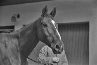
Title (German)
Pferde: Kav. Oblt. Künzli Murgenthal
Caption
Inscription original box: horse portraits
Caption (German)
Beschriftug Originalschachtel: Pferdeportraits
Record Name
Dia_293-02-028-11

Title (German)
Pferde: Kav. Oblt. Künzli Murgenthal
Caption
Inscription original box: horse portraits
Caption (German)
Beschriftug Originalschachtel: Pferdeportraits
Record Name
Dia_293-02-028-12

Title (German)
Pferde: Kav. Oblt. Künzli Murgenthal
Caption
Inscription original box: horse portraits
Caption (German)
Beschriftug Originalschachtel: Pferdeportraits
Record Name
Dia_293-02-028-13

Title (German)
Pferde: Kav. Oblt. Künzli Murgenthal
Caption
Inscription original box: horse portraits
Caption (German)
Beschriftug Originalschachtel: Pferdeportraits
Record Name
Dia_293-02-028-14

Title (German)
Pferde: Kav. Oblt. Künzli Murgenthal
Caption
Inscription original box: horse portraits
Caption (German)
Beschriftug Originalschachtel: Pferdeportraits
Record Name
Dia_293-02-028-15

Title (German)
Pferde: Kav. Oblt. Künzli Murgenthal
Caption
Inscription original box: horse portraits
Caption (German)
Beschriftug Originalschachtel: Pferdeportraits
Record Name
Dia_293-02-028-16

Title (German)
Pferde: Kav. Oblt. Künzli Murgenthal
Caption
Inscription original box: horse portraits
Caption (German)
Beschriftug Originalschachtel: Pferdeportraits
Record Name
Dia_293-02-029-01

Title (German)
Pferde: Kav. Oblt. Künzli Murgenthal
Caption
Inscription original box: horse portraits
Caption (German)
Beschriftug Originalschachtel: Pferdeportraits
Record Name
Dia_293-02-029-02

Title (German)
Pferde: Kav. Oblt. Künzli Murgenthal
Caption
Inscription original box: horse portraits
Caption (German)
Beschriftug Originalschachtel: Pferdeportraits
Record Name
Dia_293-02-029-03

Title (German)
Pferde: Kav. Oblt. Künzli Murgenthal
Caption
Inscription original box: horse portraits
Caption (German)
Beschriftug Originalschachtel: Pferdeportraits
Record Name
Dia_293-02-029-04
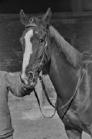
Title (German)
Pferde: Kav. Oblt. Künzli Murgenthal
Caption
Inscription original box: horse portraits
Caption (German)
Beschriftug Originalschachtel: Pferdeportraits
Record Name
Dia_293-02-029-05

Title (German)
"Napf" Hengst Zuchtgenossenschaft Lilienthal/Frauenfeld
Caption
Inscription original box: horse portraits
Caption (German)
Beschriftug Originalschachtel: Pferdeportraits
Record Name
Dia_293-02-030-01