 E-PICS - ETHBIB.Bildarchiv


The images presented on this page are part of E-Pics, a service provided by the ETH-Bibliothek of ETH Zurich. You find here static medium resolution images published under the creative commons
CC-BY-SA license or with the Public Domain Mark. This means that you are free to share, copy and redistribute the material in any medium or format; that you are free to remix, transform, and build upon the material for any purpose, even commercially, under the following conditions: You must give appropriate credit, provide a link to the license, and indicate if changes were made.
- More information about E-Pics is available at https://www.e-pics.ethz.ch
- This catalog can also be accessed at https://ba.e-pics.ethz.ch/ . There you can download the image in a higher resolution.

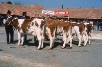
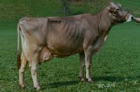
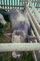
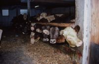
Title (German)
Stiere mit Rassecode 72 und 73, Fichte
Caption
Spruce 6336.2561.73 Gerzensee, V: Magic. Title section: bulls with breed code 72 and 73
Caption (German)
Fichte 6336.2561.73 Gerzensee, V: Zauber
Record Name
Dia_288-4325

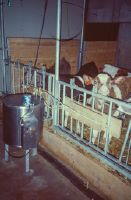
Title (German)
Stiere mit Rassecode 72 und 73, Borke
Caption
Borke 311.3826.73 Worb, V: Spell. Title section: bulls with breed code 72 and 73
Caption (German)
Borke 311.3826.73 Worb, V: Zauber
Record Name
Dia_288-4326

Title (German)
Nachzuchtgeprüfte Red Holstein-Stiere, Tochter von Caveman
Caption
Daughter of Caveman, Sire: Caveman 2371.806.75 Red Holstein (Cavalier/Triple), positive: milk (highest ZW), Mbk, size, length, depth, udder and teats, negative: muscling, foundation, teat shape. Title Section: Progeny tested Red Holstein bulls
Caption (German)
Tochter von Caveman, V: Caveman 2371.806.75 Red Holstein (Cavalier/Triple), positv: Milch (höchster ZW), Mbk, Grösse, Länge, Tiefe, Tiefe, Euter und Zitzen, negativ: Bemusekleung, Fundament, Zitzenform
Record Name
Dia_288-4327

Title (German)
Nachzuchtgeprüfte Red Holstein-Stiere, Fink
Caption
Fink 8105.4582.74 Plaffeien, V: Creation 6808.806.75 Red Holstein (Chief Charlie/Telstar), positive: milk, fat, Mbk, size, depth, udder, easy births, negative: muscling, foundation, teat shape. Title Section: Progeny tested Red Holstein bulls.
Caption (German)
Fink 8105.4582.74 Plaffeien, V: Creation 6808.806.75 Red Holstein (Chief Charlie/Telstar), positiv: Milch, Fett, Mbk, Grösse, Tiefe, Euter, leichte Geburten, negativ: Bemuskelung, Fundament, Zitzenform
Record Name
Dia_288-4328

Title (German)
Nachzuchtgeprüfte Red Holstein-Stiere, Idole
Caption
Idole 11419.4810.74 Schmitten 1, Sire: Dean 919.806.75 Red Holstein (Nugget/Starlite), positive: milk, udder, Mbk, teats, size, negative: muscling, leg position (front), fat, protein. Title Section: Progeny tested Red Holstein bulls
Caption (German)
Idole 11419.4810.74 Schmitten 1, V: Dean 919.806.75 Red Holstein (Nugget/Starlite), positv: Milch, Euter, Mbk, Zitzen, Grösse, negativ: Bemuskelung, Beinstellung (vorn), Fett, Eiweiss
Record Name
Dia_288-4329

Title (German)
Nachzuchtgeprüfte Red Holstein-Stiere, NZP-Resultate von Scotch
Caption
NZP results of Scotch 79125.806.75 Red Holstein, V: Jetstar, MV: Citation R Maple, positive: milk, Mbk, light. Title Section: Progeny tested Red Holstein bulls
Caption (German)
NZP-Resultate von Scotch 79125.806.75 Red Holstein, V: Jetstar, MV: Citation R Maple, positiv: Milch, Mbk, leichte
Record Name
Dia_288-4330

Title (German)
Nachzuchtgeprüfte Red Holstein-Stiere, NZ-Beschreibung von Scotch
Caption
NZ description of Scotch, positive: size, length, udder and teats, negative: muscling, foundation. Title Section: Progeny tested Red Holstein bulls
Caption (German)
NZ-Beschreibung von Scotch, positiv: Grösse, Länge, Euter und Zitzen, negativ: Bemuskelung, Fundament
Record Name
Dia_288-4331

Title (German)
Nachzuchtgeprüfte Red Holstein-Stiere, Sennerin
Caption
Dairy 8763.4385.74 Gurmels, V: Scotch. Title Section: Progeny tested Red Holstein bulls
Caption (German)
Sennerin 8763.4385.74 Gurmels, V: Scotch
Record Name
Dia_288-4332

Title (German)
Nachzuchtgeprüfte Red Holstein-Stiere, NZP-Resultate von von Tony
Caption
NZP results of by Tony 4227.806.74 Red Holstein, V: Shaveside Elevation Zachary, MV: Fond Matt, positv: milk, Mbk, neg: fat, protein. Title Section: Progeny tested Red Holstein bulls
Caption (German)
NZP-Resultate von von Tony 4227.806.74 Red Holstein, V: Shaveside Elevation Zachary, MV: Fond Matt, positv: Milch, Mbk, negativ: Fett, Eiweiss
Record Name
Dia_288-4333

Title (German)
Nachzuchtgeprüfte Red Holstein-Stiere, NZ-Beschreibung von Tony
Caption
NZ description of Tony, positive: size, mass, length, depth, udder and teats, negative: rear leg position. Title section: Progeny tested Red Holstein bulls
Caption (German)
NZ-Beschreibung von Tony, positiv: grösse, Masse, Länge, Tiefe, Euter und Zitzen, negativ: Beinstellung hinten
Record Name
Dia_288-4334

Title (German)
Nachzuchtgeprüfte Red Holstein-Stiere, Gemschi
Caption
Gemschi 3721.4812.74 Schmitten 3, V: Tony. Title section: Progeny tested Red Holstein bulls
Caption (German)
Gemschi 3721.4812.74 Schmitten 3, V: Tony
Record Name
Dia_288-4335

Title (German)
Nachzuchtgeprüfte Red Holstein-Stiere, Rita
Caption
Rita 7468.6870.73 Thierrens, V: Tony. Title Section: Progeny tested Red Holstein bulls.
Caption (German)
Rita 7468.6870.73 Thierrens, V: Tony
Record Name
Dia_288-4336

Title (German)
Nachzuchtgeprüfte Red Holstein-Stiere, Tony-Tochter in USA
Caption
Title Section: Progeny tested Red Holstein bulls
Record Name
Dia_288-4337
Title (German)
Nachzuchtgeprüfte Red Holstein-Stiere, Tochtergruppe von Tonto
Caption
Daughter group of Tonto 2235.806.75 Red Holstein (Cavalier/Majority), positive: milk, fat, size, depth, udder and teats, negative: front leg position. Title Section: Progeny tested Red Holstein bulls
Caption (German)
Tochtergruppe von Tonto 2235.806.75 Red Holstein (Cavalier/Majority), positiv: Milch, Fett, Grösse, Tiefe, Euter und Zitzen, negativ: Beinstellung vorn
Record Name
Dia_288-4338

Title (German)
Red Holstein-Jungstiere, welche im Prüfeinsatz stehen, Flame-ET
Caption
Flame-ET 82110.806.75 Red Holstein, V: Triple, MV: Starlite, dam average 6 lactations 8'206 kg milk, 4.6% fat. Title section: Red Holstein young bulls in test use
Caption (German)
Flame-ET 82110.806.75 Red Holstein, V: Triple, MV: Starlite, Mutter Durchschnitt 6 Laktationen 8'206 kg Milch, 4.6% Fett
Record Name
Dia_288-4339

Title (German)
Red Holstein-Jungstiere, welche im Prüfeinsatz stehen, Formation-ET
Caption
Formation-ET 72976.806.75 Red Holstetin, V: Triple, MV: Robthom Premier, dam average 3 lactations 9'406 kg. Title section: Red Holstein young bulls in test use
Caption (German)
Formation-ET 72976.806.75 Red Holstetin, V: Triple, MV: Robthom Premier, Mutter Duchschnitt 3 Laktationen 9'406 kg
Record Name
Dia_288-4340

Title (German)
Red Holstein-Jungstiere, welche im Prüfeinsatz stehen, Horizon-ET
Caption
Horizon-ET 92524.0806.75 Red Holstein, V: Jon, MV: Marshfield Elevation Tony, dam average 2 lactations 8'961 kg milk, 4.0% fat. Title section: Red Holstein young bulls in test use
Caption (German)
Horizon-ET 92524.0806.75 Red Holstein, V: Jon, MV: Marshfield Elevation Tony, Mutter Durchschnitt 2 Laktationen 8'961 kg Milch, 4.0% Fett
Record Name
Dia_288-4341

Title (German)
Red Holstein-Jungstiere, welche im Prüfeinsatz stehen, Luck-ET
Caption
Luck-ET 81967.0806.75 Red Holstein, V: Wileeda Citation R, MV: Citation R Maple, dam average 5 lactations 7'171 kg milk, 4.5% fat. Title section: Red Holstein young bulls in test use
Caption (German)
Luck-ET 81967.0806.75 Red Holstein, V: Wileeda Citation R, MV: Citation R Maple, Mutter Durschnitt 5 Laktationen 7'171 kg Milch, 4.5% Fett
Record Name
Dia_288-4342

Title (German)
Red Holstein-Jungstiere, welche im Prüfeinsatz stehen, Titanic-ET
Caption
Titanic-ET 83361.0806.75 Red Holstein, V: Triple, MV: Fond Matt, dam average 5 lactations 7'171 kg milk, 4.5% fat. Title section: Red Holstein young bulls in test use
Caption (German)
Titanic-ET 83361.0806.75 Red Holstein, V: Triple, MV: Fond Matt, Mutter Durchschnitt 5 Laktationen 7'171 kg Milch, 4.5% Fett
Record Name
Dia_288-4343

Title (German)
Red Holstein-Jungstiere, welche im Prüfeinsatz stehen, Jetset
Caption
Jetset 26110.806.75 Red Holstein, V: Milkmaker, MV: Jetstar. Title section: Red Holstein young bulls, which are in test use.
Caption (German)
Jetset 26110.806.75 Red Holstein, V: Milkmaker, MV: Jetstar
Record Name
Dia_288-4344

Title (German)
Red Holstein-Jungstiere, welche im Prüfeinsatz stehen, Richmond-ET
Caption
Richmond-ET 12106.806.75, V: Joà "l, MV: Ingholm Tondra. Title section: Red Holstein young bulls, which are in test use
Caption (German)
Richmond-ET 12106.806.75, V: Joël, MV: Ingholm Tondra
Record Name
Dia_288-4346

Title (German)
Red Holstein-Jungstiere, welche im Prüfeinsatz stehen, Mutter von Richmond-ET
Caption
Dam of Richmond-ET: Val Brillant Rina-Red, average 5 lactations 8'704 kg milk, 4.1% fat. Title section: Red Holstein young bulls in test use
Caption (German)
Mutter von Richmond-ET: Val Brillant Rina-Red, Durchschnitt 5 Laktationen 8'704 kg Milch, 4.1% Fett
Record Name
Dia_288-4347

Title (German)
Red Holstein-Jungstiere, welche im Prüfeinsatz stehen, Halbschwester von Richmond, junge Enhancer-Tochter
Caption
Half-sister to Richmond, young Enhancer daughter, 2 months after calving with over 35 kg daily milk. Title section: Red Holstein young bulls in test use
Caption (German)
Halbschwester von Richmond, junge Enhancer-Tochter, 2 Monate nach dem Abkalben mit über 35 kg Tagesmilch
Record Name
Dia_288-4348

Title (German)
Wertvolle ausländische Stiere in der Gezielten Paarung, Orkan-Tochter
Caption
Orkan daughter, Orkan 46346.806.75 red factor carrier, V: Sexation, VV: Elevation, MV: Kemp, positive: -milk, content, average performance of first milking in BRD (Osnabrück), 1st lactation 6'068 kg milk, 4.22% fat, 3.28% protein, -format, udder, teats, use only in targeted mating, it is recommended to use ORKAN mainly via embryo transfer, description KB-Mitteilungen No. 3, September 1988, page 48. Title section: Valuable foreign bulls in targeted mating.
Caption (German)
Orkan-Tochter, Orkan 46346.806.75 Rotfaktorträger, V: Sexation, VV: Elevation, MV: Kemp, positiv: -Milch, Gehalt, Durchschnitt Leistung der Erstmelke in BRD (Osnabrück), 1. Laktation 6'068 kg Milch, 4.22% fett, 3.28% Eiweiss, -Format, Euter, Zitzen, Einsatz nur in der Gezielten Paarung, es wird empfohlen, ORKAN vorallem via Embryotransfer einzusetzen, Beschreibung KB-Mitteilungen Nr. 3, September 1988, Seite 48
Record Name
Dia_288-4349

Title (German)
Wertvolle ausländische Stiere in der Gezielten Paarung, Orkan-Tochter
Caption
Title Section: Valuable Foreign Bulls in Targeted Mating
Record Name
Dia_288-4350

Title (German)
Wertvolle ausländische Stiere in der Gezielten Paarung, Orkan-Tochter
Caption
Title Section: Valuable Foreign Bulls in Targeted Mating
Record Name
Dia_288-4351

Title (German)
Wertvolle ausländische Stiere in der Gezielten Paarung, Orkan-Tochter
Caption
Title Section: Valuable Foreign Bulls in Targeted Mating
Record Name
Dia_288-4352

Title (German)
Wertvolle ausländische Stiere in der Gezielten Paarung, Tochter von Nicholas in Holland, Kreuzungsprodukt mit der holländischen Rotbuntstrasse
Caption
Daughter of Nicholas in Holland, cross product with Dutch Red Holstein, Nicholas 1805.806.75 Red Holstein, V: Triple, MV: Elevation, use only in Targeted Mating or for embryo transfer, positive: milk, fat, Minuntegemelk, size, flank depth, long middle hand, well muscled, front stance, udder (after udder), distribution and position of teats, negative: pelvis not too wide, hock rear often somewhat strongly angulated, description KB-Mitteilungen" No. 3, September 1988, page 47. Title section: "Valuable foreign bulls in Targeted Mating.
Caption (German)
Tochter von Nicholas in Holland, Kreuzungsprodukt mit der holländischen Rotbuntstrasse, Nicholas 1805.806.75 Red Holstein, V: Triple, MV: Elevation, Einsatz nur in der Gezielten Paarung oder für Embryotransfer, positiv: Milch, Fett, Minuntegemelk, Grösse, Flankentiefe, lange Mittelhand, gut bemuskelt, Vorderstand, Euter (Nacheuter), Verteilung und Stellung der Zitzen, negativ: Becken nicht allzu breit, Sprunggelenk hinten oft etwas stark gewinkelt, Beschreibung KB-Mitteilungen Nr. 3, September 1988, Seite 47
Record Name
Dia_288-4353

Title (German)
Gutshof Chamau: Alter Zustand
Caption
Title Section: Chamau Manor: Old Condition
Record Name
Dia_288-4362

Title (German)
Gutshof Chamau: Alter Zustand
Caption
Title Section: Chamau Manor: Old Condition
Record Name
Dia_288-4365

Title (German)
Gutshof Chamau: Alter Zustand
Caption
Title Section: Chamau Manor: Old Condition
Record Name
Dia_288-4366

Title (German)
Gutshof Chamau: Alter Zustand
Caption
Title Section: Chamau Manor: Old Condition
Record Name
Dia_288-4367
Title (German)
Gutshof Chamau: Alter Zustand
Caption
Title Section: Chamau Manor: Old Condition
Record Name
Dia_288-4368

Title (German)
Gutshof Chamau: Alter Zustand
Caption
Title Section: Chamau Manor: Old Condition
Record Name
Dia_288-4373

Title (German)
Gutshof Chamau: Alter Zustand
Caption
Title Section: Chamau Manor: Old Condition
Record Name
Dia_288-4374

Title (German)
Gutshof Chamau, Alter Zustand, ETH: Cha x Was
Caption
Title Section: Chamau Manor: Old Condition
Record Name
Dia_288-4375

Title (German)
Gutshof Chamau: Alter Zustand
Caption
Title Section: Chamau Manor: Old Condition
Record Name
Dia_288-4376

Title (German)
Gutshof Chamau: Alter Zustand
Caption
Title Section: Chamau Manor: Old Condition
Record Name
Dia_288-4383

Title (German)
Gutshof Chamau: Alter Zustand
Caption
Title Section: Chamau Manor: Old Condition
Record Name
Dia_288-4384

Title (German)
Gutshof Chamau: Alter Zustand
Caption
Title Section: Chamau Manor: Old Condition
Record Name
Dia_288-4385

Title (German)
Gutshof Chamau: Alter Zustand
Caption
Title Section: Chamau Manor: Old Condition
Record Name
Dia_288-4386

Title (German)
Gutshof Chamau: Alter Zustand
Caption
Title Section: Chamau Manor: Old Condition
Record Name
Dia_288-4387

Title (German)
Gutshof Chamau: Alter Zustand
Caption
Title Section: Chamau Manor: Old Condition
Record Name
Dia_288-4388

Title (German)
Gutshof Chamau, Alter Zustand, Holzzaun
Caption
Title Section: Chamau Manor: Old Condition
Record Name
Dia_288-4389

Title (German)
Gutshof Chamau: Alter Zustand
Caption
Title Section: Chamau Manor: Old Condition
Record Name
Dia_288-4390

Title (German)
Gutshof Chamau: Alter Zustand
Caption
Title Section: Chamau Manor: Old Condition
Record Name
Dia_288-4391

Title (German)
Gutshof Chamau: Alter Zustand
Caption
Title Section: Chamau Manor: Old Condition
Record Name
Dia_288-4392

Title (German)
Gutshof Chamau: Alter Zustand
Caption
Title Section: Chamau Manor: Old Condition
Record Name
Dia_288-4393

Title (German)
Gutshof Chamau: Alter Zustand
Caption
Title Section: Chamau Manor: Old Condition
Record Name
Dia_288-4394

Title (German)
Gutshof Chamau: Alter Zustand
Caption
Title Section: Chamau Manor: Old Condition
Record Name
Dia_288-4395

Title (German)
Gutshof Chamau: Alter Zustand
Caption
Title Section: Chamau Manor: Old Condition
Record Name
Dia_288-4396

Title (German)
Gutshof Chamau, Alter Zustand, Holzzaun
Caption
Title Section: Chamau Manor: Old Condition
Record Name
Dia_288-4397

Title (German)
Gutshof Chamau: Alter Zustand
Caption
Title Section: Chamau Manor: Old Condition
Record Name
Dia_288-4398

Title (German)
Gutshof Chamau: Alter Zustand
Caption
Title Section: Chamau Manor: Old Condition
Record Name
Dia_288-4399

Title (German)
Gutshof Chamau: Alter Zustand
Caption
Title Section: Chamau Manor: Old Condition
Record Name
Dia_288-4400

Title (German)
Gutshof Chamau: Alter Zustand
Caption
Title Section: Chamau Manor: Old Condition
Record Name
Dia_288-4401

Title (German)
Gutshof Chamau, Alter Zustand, Holzzaun
Caption
Title Section: Chamau Manor: Old Condition
Record Name
Dia_288-4402

Title (German)
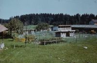
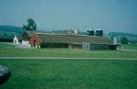
Gutshof Chamau, Gebäude, Haus
Caption
Title Section: Chamau Manor: Buildings
Record Name
Dia_288-4403

Title (German)
Gutshof Chamau: Gebäude
Caption
Title Section: Chamau Manor: Buildings
Record Name
Dia_288-4404

Title (German)
Gutshof Chamau: Gebäude
Caption
Title Section: Chamau Manor: Buildings
Record Name
Dia_288-4405

Title (German)
Gutshof Chamau: Gebäude
Caption
Title Section: Chamau Manor: Buildings
Record Name
Dia_288-4406

Title (German)
ETH-Zürich, Institut für Agrarwissenschaften
Caption
Title Section: Chamau Manor: Buildings
Record Name
Dia_288-4407

Title (German)
Gutshof Chamau: Gebäude
Caption
Title Section: Chamau Manor: Buildings
Record Name
Dia_288-4408

Title (German)
Gutshof Chamau: Gebäude
Caption
Title Section: Chamau Manor: Buildings
Record Name
Dia_288-4409

Title (German)
Gutshof Chamau: Gebäude
Caption
Title Section: Chamau Manor: Buildings
Record Name
Dia_288-4410

Title (German)
Chamau, im Gebiet Unterhünenberg, Armee-Helikopter Alouette II
Caption
Title Section: Chamau Manor: Buildings
Record Name
Dia_288-4411

Title (German)
Gutshof Chamau, Gebäude, ETH-Betrieb Chamau
Caption
Title Section: Chamau Manor: Buildings
Record Name
Dia_288-4412

Title (German)
Gutshof Chamau, Gebäude, ETH-Betrieb Chamau
Caption
Title Section: Chamau Manor: Buildings
Record Name
Dia_288-4413

Title (German)
Gutshof Chamau, Gebäude, ETH-Betrieb Chamau
Caption
Title Section: Chamau Manor: Buildings
Record Name
Dia_288-4414

Title (German)
Gutshof Chamau, Gebäude, ETH-Betrieb Chamau
Caption
Title Section: Chamau Manor: Buildings
Record Name
Dia_288-4415

Title (German)
Walchwil, ETH-Betrieb Früebüel
Caption
Title Section: Chamau Manor: Buildings
Record Name
Dia_288-4416

Title (German)
Walchwil, ETH-Betrieb Früebüel
Caption
Title Section: Chamau Manor: Buildings
Record Name
Dia_288-4417

Title (German)
Walchwil, ETH-Betrieb Früebüel
Caption
Title Section: Chamau Manor: Buildings
Record Name
Dia_288-4418

Title (German)
Walchwil, ETH-Betrieb Früebüel
Caption
Title Section: Chamau Manor: Buildings
Record Name
Dia_288-4419

Title (German)
Winterthur, ETH-Betrieb Rossberg
Caption
Title Section: Chamau Manor: Buildings
Record Name
Dia_288-4420

Title (German)
Winterthur, ETH-Betrieb Rossberg
Caption
Title Section: Chamau Manor: Buildings
Record Name
Dia_288-4421

Title (German)
Winterthur, ETH-Betrieb Rossberg
Caption
Title Section: Chamau Manor: Buildings
Record Name
Dia_288-4422

Title (German)
Walchwil, ETH-Betrieb Früebüel
Caption
Title Section: Chamau Manor: Buildings
Record Name
Dia_288-4423

Title (German)
Oberhof-Rossberg, ETH-Betrieb Alp Mandeschs
Caption
Title Section: Chamau Manor: Buildings
Caption (German)
Alp Mandeschs: Teil des Versuchsguts Rossberg
Record Name
Dia_288-4424

Title (German)
Oberhof-Rossberg, ETH-Betrieb Alp Mandeschs
Caption
Title Section: Chamau Manor: Buildings
Caption (German)
Alp Mandeschs: Teil des Versuchsguts Rossberg
Record Name
Dia_288-4425

Title (German)
Gutshof Chamau, Gebäude, ETH-Betrieb Alp Mandesch
Caption
Title Section: Chamau Manor: Buildings
Record Name
Dia_288-4426

Title (German)
Winterthur, ETH-Betrieb Rossberg
Caption
Title Section: Chamau Manor: Buildings
Record Name
Dia_288-4427

Title (German)
Gutshof Chamau, Chamau, 09/1970
Caption
Title Section: Chamau Manor
Record Name
Dia_288-4428

Title (German)
Gutshof Chamau, Chamau: Offenstallversuch 53/54
Caption
Title Section: Chamau Manor
Record Name
Dia_288-4429

Title (German)
Gutshof Chamau, Chamau: Offenstallversuch 53/54
Caption
Title Section: Chamau Manor
Record Name
Dia_288-4430

Title (German)
Gutshof Chamau
Caption
Title Section: Chamau Manor
Record Name
Dia_288-4431

Title (German)
Gutshof Chamau
Caption
Title Section: Chamau Manor
Record Name
Dia_288-4432
Title (German)
Gutshof Chamau
Caption
Title Section: Chamau Manor
Record Name
Dia_288-4433

Title (German)
Gutshof Chamau
Caption
Title Section: Chamau Manor
Record Name
Dia_288-4434
Title (German)
Gutshof Chamau, Versuchsstall Chamau, 06/1963
Caption
Title Section: Chamau Manor
Record Name
Dia_288-4435

Title (German)
Gutshof Chamau
Caption
Title Section: Chamau Manor
Record Name
Dia_288-4436

Title (German)
Gutshof Chamau
Caption
Title Section: Chamau Manor
Record Name
Dia_288-4437

Title (German)
Gutshof Chamau
Caption
Title Section: Chamau Manor
Record Name
Dia_288-4438

Title (German)
Gutshof Chamau
Caption
Title Section: Chamau Manor
Record Name
Dia_288-4439
Title (German)
Gutshof Chamau
Caption
Title Section: Chamau Manor
Record Name
Dia_288-4440

Title (German)
Gutshof Chamau
Caption
Title Section: Chamau Manor
Record Name
Dia_288-4441

Title (German)
Gutshof Chamau
Caption
Title Section: Chamau Manor
Record Name
Dia_288-4442

Title (German)
Gutshof Chamau
Caption
Title Section: Chamau Manor
Record Name
Dia_288-4443

Title (German)
Gutshof Chamau
Caption
Title Section: Chamau Manor
Record Name
Dia_288-4444

Title (German)
Gutshof Chamau
Caption
Title Section: Chamau Manor
Record Name
Dia_288-4445

Title (German)
Gutshof Chamau
Caption
Title Section: Chamau Manor
Record Name
Dia_288-4446

Title (German)
Gutshof Chamau
Caption
Title Section: Chamau Manor
Record Name
Dia_288-4447

Title (German)
Gutshof Chamau
Caption
Title Section: Chamau Manor
Record Name
Dia_288-4448

Title (German)
Gutshof Chamau
Caption
Title Section: Chamau Manor
Record Name
Dia_288-4449

Title (German)
Gutshof Chamau
Caption
Title Section: Chamau Manor
Record Name
Dia_288-4450

Title (German)
Gutshof Chamau
Caption
Title Section: Chamau Manor
Record Name
Dia_288-4451

Title (German)
Gutshof Chamau
Caption
Title Section: Chamau Manor
Record Name
Dia_288-4452

Title (German)
Gutshof Chamau
Caption
Title Section: Chamau Manor
Record Name
Dia_288-4453

Title (German)
Gutshof Chamau
Caption
Title Section: Chamau Manor
Record Name
Dia_288-4454

Title (German)
Gutshof Chamau
Caption
Title Section: Chamau Manor
Record Name
Dia_288-4455

Title (German)
Gutshof Chamau
Caption
Title Section: Chamau Manor
Record Name
Dia_288-4456
Title (German)
Gutshof Chamau
Caption
Title Section: Chamau Manor
Record Name
Dia_288-4457

Title (German)
Gutshof Chamau
Caption
10, D: 2: Bi: 3, Gr: , Ro: 1. title section: Chamau Manor
Caption (German)
10, D: 2: Bi: 3, Gr: , Ro: 1
Record Name
Dia_288-4458

Title (German)
Gutshof Chamau
Caption
10, D: 1, Bi: 3, Gr: , Ro: 1. title section: Chamau Manor
Caption (German)
10, D: 1, Bi: 3, Gr: , Ro: 1
Record Name
Dia_288-4459

Title (German)
Gutshof Chamau
Caption
10, D: 2, Bi: 3, Gr: , Ro: 1. Title Section: Chamau Manor
Caption (German)
10, D: 2, Bi: 3, Gr: , Ro: 1
Record Name
Dia_288-4460

Title (German)
Gutshof Chamau
Caption
Title Section: Chamau Manor
Record Name
Dia_288-4461

Title (German)
Gutshof Chamau
Caption
Title Section: Chamau Manor
Record Name
Dia_288-4462

Title (German)
Chamau: Allgemein
Caption
Title Section: Chamau: General
Record Name
Dia_288-4463

Title (German)
Chamau: Allgemein
Caption
Title Section: Chamau: General
Record Name
Dia_288-4464

Title (German)
Chamau: Allgemein
Caption
Title Section: Chamau: General
Record Name
Dia_288-4465

Title (German)
Chamau: Allgemein
Caption
Title Section: Chamau: General
Record Name
Dia_288-4466

Title (German)
Chamau: Allgemein
Caption
Title Section: Chamau: General
Record Name
Dia_288-4467

Title (German)
Chamau, Allgemein, Versuchseinrichtung
Caption
Title Section: Chamau: General
Record Name
Dia_288-4468

Title (German)
Chamau: Allgemein
Caption
Title Section: Chamau: General
Record Name
Dia_288-4469

Title (German)
Chamau: Allgemein
Caption
Title Section: Chamau: General
Record Name
Dia_288-4470

Title (German)
Chamau: Allgemein
Caption
Title Section: Chamau: General
Record Name
Dia_288-4472

Title (German)
Chamau: Allgemein
Caption
2.608. Title Section: Chamau: General
Caption (German)
2.608
Record Name
Dia_288-4473

Title (German)
Chamau, Allgemein, Soling?-Versuchsanstalt
Caption
Title Section: Chamau: General
Record Name
Dia_288-4474

Title (German)
Chamau, Allgemein, Feb. 84: HF: 1115
Caption
Title Section: Chamau: General
Record Name
Dia_288-4475

Title (German)
Chamau, Allgemein, 1 x Sennerin
Caption
Title Section: Chamau: General
Record Name
Dia_288-4476

Title (German)
Chamau, Allgemein, Kürzer: 1/4
Caption
Title Section: Chamau: General
Record Name
Dia_288-4477

Title (German)
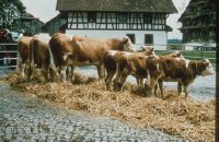
Chamau: Rindertypenversuch
Caption
Title Section: Chamau: Cattle Type Trial
Record Name
Dia_288-4478

Title (German)
Chamau: Rindertypenversuch
Caption
Title Section: Chamau: Cattle Type Trial
Record Name
Dia_288-4479

Title (German)
Chamau: Rindertypenversuch
Caption
Title Section: Chamau: Cattle Type Trial
Record Name
Dia_288-4480

Title (German)
Chamau, Rindertypenversuch, T211
Caption
Title Section: Chamau: Cattle Type Trial
Record Name
Dia_288-4481

Title (German)
Chamau: Rindertypenversuch
Caption
Title Section: Chamau: Cattle Type Trial
Record Name
Dia_288-4482

Title (German)
Chamau: Rindertypenversuch
Caption
Title Section: Chamau: Cattle Type Trial
Record Name
Dia_288-4483

Title (German)
Chamau: Rindertypenversuch
Caption
Title Section: Chamau: Cattle Type Trial
Record Name
Dia_288-4484

Title (German)
Chamau: Rindertypenversuch
Caption
Title Section: Chamau: Cattle Type Trial
Record Name
Dia_288-4485

Title (German)
Chamau: Rindertypenversuch
Caption
Title Section: Chamau: Cattle Type Trial
Record Name
Dia_288-4486

Title (German)
Chamau: Rindertypenversuch
Caption
Title Section: Chamau: Cattle Type Trial
Record Name
Dia_288-4487

Title (German)
Chamau: Rindertypenversuch
Caption
Title Section: Chamau: Cattle Type Trial
Record Name
Dia_288-4488
Title (German)
Alp Weissenstein: Rindertypenversuch
Caption
Title Section: Chamau: Cattle Type Trial
Record Name
Dia_288-4489

Title (German)
Chamau: Rindertypenversuch
Caption
Title Section: Chamau: Cattle Type Trial
Record Name
Dia_288-4490

Title (German)
Chamau: Rindertypenversuch
Caption
Title Section: Chamau: Cattle Type Trial
Record Name
Dia_288-4491

Title (German)
Chamau: Rindertypenversuch
Caption
Title Section: Chamau: Cattle Type Trial
Record Name
Dia_288-4492

Title (German)
Chamau: Rindertypenversuch
Caption
Title Section: Chamau: Cattle Type Trial
Record Name
Dia_288-4493

Title (German)
Chamau: Rindertypenversuch
Caption
Title Section: Chamau: Cattle Type Trial
Record Name
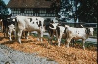
Dia_288-4494

Title (German)
Chamau, Kühe, Chamau 1961: Hereford-Kuh Honey
Caption
Title section: Chamau: cows
Record Name
Dia_288-4495

Title (German)
Chamau, Kühe, Chamau 1961
Caption
Title section: Chamau: cows
Record Name
Dia_288-4496

Title (German)
Chamau, Kühe, Chamau 1961: Ayrshire-Kuh Happy
Caption
Title section: Chamau: cows
Record Name
Dia_288-4497

Title (German)
Chamau, Kühe, Chamau 64: Tierzuchtübungen
Caption
Title section: Chamau: cows
Record Name
Dia_288-4499

Title (German)
Chamau, Kühe, Chamau 64, Tierzuchtübungen: Hella / Trinelli / Veiel
Caption
Title section: Chamau: cows
Record Name
Dia_288-4500

Title (German)
Chamau, Kühe, Chamau 63
Caption
Title section: Chamau: cows
Record Name
Dia_288-4501

Title (German)
Chamau, Kühe, Si-Chamau (Si = Simmentaler) 64
Caption
Title section: Chamau: cows
Record Name
Dia_288-4502

Title (German)
Chamau, Kühe, Chamau 64
Caption
Title section: Chamau: cows
Record Name
Dia_288-4503

Title (German)
Chamau, Kühe, Chamau 64
Caption
Title section: Chamau: cows
Record Name
Dia_288-4504

Title (German)
Chamau, Kühe, Chamau 64
Caption
Title section: Chamau: cows
Record Name
Dia_288-4505

Title (German)
Chamau, Kühe, Chamau 64
Caption
Title section: Chamau: cows
Record Name
Dia_288-4506

Title (German)
Chamau, Kühe, Schafe
Caption
Title section: Chamau: cows
Record Name
Dia_288-4508

Title (German)
Chamau: Alpungsversuche
Caption
Title section: Chamau: alpine trials
Record Name
Dia_288-4509

Title (German)
Chamau: Alpungsversuche
Caption
Title section: Chamau: alpine trials
Record Name
Dia_288-4510

Title (German)
Chamau: Alpungsversuche
Caption
Title section: Chamau: alpine trials
Record Name
Dia_288-4511

Title (German)
Chamau, Alpungsversuche, Gute Futtergrundlage Alp
Caption
Title section: Chamau: alpine trials
Record Name
Dia_288-4512

Title (German)
Chamau: Alpungsversuche
Caption
Title section: Chamau: alpine trials
Record Name
Dia_288-4513

Title (German)
Chamau: Alpungsversuche
Caption
Title section: Chamau: alpine trials
Record Name
Dia_288-4514

Title (German)
Chamau: Alpungsversuche
Caption
Title section: Chamau: alpine trials
Record Name
Dia_288-4515

Title (German)
Chamau, Alpungsversuche, Rinder-Aufzuchtversuch
Caption
Title section: Chamau: alpine trials
Record Name
Dia_288-4516

Title (German)
Chamau: Alpungsversuche
Caption
Title section: Chamau: alpine trials
Record Name
Dia_288-4517
Title (German)
Chamau: Alpungsversuche
Caption
Title section: Chamau: alpine trials
Record Name
Dia_288-4518

Title (German)
Chamau: Alpungsversuche
Caption
Title section: Chamau: alpine trials
Record Name
Dia_288-4519

Title (German)
Chamau: Alpungsversuche
Caption
Title section: Chamau: alpine trials
Record Name
Dia_288-4520

Title (German)
Chamau: Alpungsversuche
Caption
Title section: Chamau: alpine trials
Record Name
Dia_288-4521

Title (German)
Chamau: Alpungsversuche
Caption
Title section: Chamau: alpine trials
Record Name
Dia_288-4522

Title (German)
Alpungsversuche, Alpung in der Schweiz
Record Name
Dia_288-4525

Title (German)
Alpungsversuche, Einfluss des Höhenklimas
Record Name
Dia_288-4526

Title (German)
Alpungsversuche, Drei Möglichkeiten zur Untersuchung von Alpungseinflüssen
Record Name
Dia_288-4527

Title (German)
Alpungsversuche, Einfluss der Alpung von Jungrindern auf die spätere Leistung und Lebensdauer
Record Name
Dia_288-4528

Title (German)
Alpungsversuche, Aufzuchtversuch mit Alpung
Record Name
Dia_288-4529

Title (German)
Alpungsversuche, Plan für den Versuch mit Aufzuchtindern
Record Name
Dia_288-4530

Title (German)
Alpungsversuche, Tageszuwachs von Rindern, Crap Alv
Record Name
Dia_288-4531

Title (German)
Alpungsversuche, Tageszuwachs von Rindern, Crap Alv
Record Name
Dia_288-4532

Title (German)
Alpungsversuche, Milchleistung, 305 Tage, 1. Laktation (1978-83)
Record Name
Dia_288-4533

Title (German)
Alpungsversuche, Alpungsversuch mit Kühen
Record Name
Dia_288-4534

Title (German)
Alpungsversuche, Anzahl Kühe im Alpversuch
Record Name
Dia_288-4535

Title (German)
Alpungsversuche, Gewichtskurven 1982 / 83
Record Name
Dia_288-4536

Title (German)
Alpungsversuche, 26HL, Laktationskurven Leistungsgruppen 1983
Record Name
Dia_288-4537

Title (German)
Alpungsversuche, 28HL, Laktationskurven 1982 / 83
Record Name
Dia_288-4538

Title (German)
Alpungsversuche, 27HL, Laktationskurven Leistungsruppen 1982
Record Name
Dia_288-4539

Title (German)
Alpungsversuche, 25HL, Einsatzleistung und Alpleistung von 3 Leistungsgruppen
Record Name
Dia_288-4540

Title (German)
Alpungsversuche, 29HL, Laktationsleistungen (305 Tage) Alpversuch 1982 und 1983
Record Name
Dia_288-4541

Title (German)
Alpungsversuche, Zellzahl Alpkühe 1982/83
Record Name
Dia_288-4542

Title (German)
Alpungsversuche, Chamau: Kühe und Kälber
Record Name
Dia_288-4545


Title (German)
Bildserie Chamau 1984 - 1997, Chamau, Weide: Aufzuchtkälber auf Vorweide
Caption
Title section: Image series Chamau 1984 - 1997
Record Name
Dia_288-4563

Title (German)
Bildserie Chamau 1984 - 1997, Chamau, Weide: Aufzuchtkälber auf Vorweide
Caption
Title section: Image series Chamau 1984 - 1997
Record Name
Dia_288-4564

Title (German)
Bildserie Chamau 1984 - 1997, Chamau, Weide: Aufzuchtkälber auf Vorweide
Caption
Title section: Image series Chamau 1984 - 1997
Record Name
Dia_288-4565

Title (German)
Bildserie Chamau 1984 - 1997, Ankunft der Jersey-Herde in Basel
Caption
Title section: Image series Chamau 1984 - 1997
Record Name
Dia_288-4566
Title (German)
Bildserie Chamau 1984 - 1997
Caption
Title section: Image series Chamau 1984 - 1997
Record Name
Dia_288-4567

Title (German)
Bildserie Chamau 1984 - 1997
Caption
Title section: Image series Chamau 1984 - 1997
Record Name
Dia_288-4568

Title (German)
Bildserie Chamau 1984 - 1997
Caption
Title section: Image series Chamau 1984 - 1997
Record Name
Dia_288-4569

Title (German)
Bildserie Chamau 1984 - 1997
Caption
Title section: Image series Chamau 1984 - 1997
Record Name
Dia_288-4570

Title (German)
Bildserie Chamau 1984 - 1997
Caption
Title section: Image series Chamau 1984 - 1997
Record Name
Dia_288-4571

Title (German)
Bildserie Chamau 1984 - 1997
Caption
Title section: Image series Chamau 1984 - 1997
Record Name
Dia_288-4572

Title (German)
Bildserie Chamau 1984 - 1997
Caption
Title section: Image series Chamau 1984 - 1997
Record Name
Dia_288-4573

Title (German)
Bildserie Chamau 1984 - 1997
Caption
Title section: Image series Chamau 1984 - 1997
Record Name
Dia_288-4574

Title (German)
Bildserie Chamau 1984 - 1997
Caption
Title section: Image series Chamau 1984 - 1997
Record Name
Dia_288-4575

Title (German)
Bildserie Chamau 1984 - 1997
Caption
Title section: Image series Chamau 1984 - 1997
Record Name
Dia_288-4576
Title (German)
Bildserie Chamau 1984 - 1997
Caption
Title section: Image series Chamau 1984 - 1997
Record Name
Dia_288-4577
Title (German)
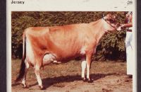
Rindertypen
Caption
Title section: types of cattle
Record Name
Dia_288-4578

Title (German)
Rindertypen
Caption
Title section: types of cattle
Record Name
Dia_288-4579

Title (German)
Rindertypen
Caption
Title section: types of cattle
Record Name
Dia_288-4580

Title (German)
Rindertypen, 5; 33 B: IS (vorn), EF (hinten)
Caption
Title section: types of cattle
Record Name
Dia_288-4581

Title (German)
Rindertypen, 4; 13 B: Sennerin 15 587 x Rind Tulpe EF 533
Caption
Title section: types of cattle
Record Name
Dia_288-4582

Title (German)
Rindertypen, 6: Nihel?
Caption
Title section: types of cattle
Record Name
Dia_288-4583

Title (German)
Rindertypen
Caption
Title section: types of cattle
Record Name
Dia_288-4584

Title (German)
Rindertypen
Caption
Title section: types of cattle
Record Name
Dia_288-4585

Title (German)
Rindertypen
Caption
Title section: types of cattle
Record Name
Dia_288-4586

Title (German)
Rindertypen
Caption
Title section: types of cattle
Record Name
Dia_288-4587

Title (German)
Ohne Titel, Kuh Corli 1164-229 Häggenschwil, V. Craftsman
Caption
Cow Corli" 1164-229 Häggenschwil, V. Craftsman 81972-1900, Roland Eberle, 9308 Lömmnenschwil, Signature: Ru. Title section: Untitled"
Caption (German)
Kuh Corli 1164-229 Häggenschwil, V. Craftsman 81972-1900, Roland Eberle, 9308 Lömmnenschwil, Signatur: Ru
Record Name
Dia_288-4588

Title (German)
Ohne Titel, Kuh Zita
Caption
Cow Zita" 10319-226 Gossau, V. Jargon-ET 82143-1900, Gerbrüder Lötscher, 7414 Fürstenau, Signature: Ru. Title section: Untitled"
Caption (German)
Kuh Zita 10319-226 Gossau, V. Jargon-ET 82143-1900, Gerbrüder Lötscher, 7414 Fürstenau, Signatur: Ru
Record Name
Dia_288-4589

Title (German)
Ohne Titel, Kuh Zauber
Caption
Cow magic" 10513-407 Seewis i.P., V. Jinxon-ET 82043-1900, Jann Salzgeber, 7076 Parpan, Signature: Ru. Title section: Untitled"
Caption (German)
Kuh Zauber 10513-407 Seewis i.P., V. Jinxon-ET 82043-1900, Jann Salzgeber, 7076 Parpan, Signatur: Ru
Record Name
Dia_288-4590
Title (German)
Ohne Titel, Kuh Boni
Caption
Cow Boni" 21809-280 Wattwil, V. Regal 72230-1900, Emil Zwingli 9630 Wattwil, Signatur: Ru. Title section: Untitled"
Caption (German)
Kuh Boni 21809-280 Wattwil, V. Regal 72230-1900, Emil Zwingli 9630 Wattwil, Signatur: Ru
Record Name
Dia_288-4591

Title (German)
1, Nihel?, 3W
Caption
Title section: Untitled
Record Name
Dia_288-4605


Title (German)
Leistung Nutztiere: Mai 1995, Milchleistung Schw. Rindviehrassen
Caption
Title Section: Performance Farm Animals: May 1995
Record Name
Dia_288-4622

Title (German)
Leistung Nutztiere: Mai 1995, Fettgehalt Schw. Rindviehrassen
Caption
Title Section: Performance Farm Animals: May 1995
Record Name
Dia_288-4623

Title (German)
Leistung Nutztiere: Mai 1995, Eiweissgehalt Schw. Rindviehrassen
Caption
Title Section: Performance Farm Animals: May 1995
Record Name
Dia_288-4624

Title (German)
EUROP, U
Caption
Title Section: Untitled: EUROP
Record Name
Dia_288-4658


Title (German)
Ohne Titel: EUROP
Caption
Title Section: Untitled: EUROP
Record Name
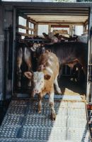
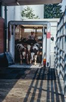
Dia_288-4662

Title (German)
Transport
Caption
Title Section: Transportation
Record Name
Dia_288-4663

Title (German)
Transport
Caption
Title Section: Transportation
Record Name
Dia_288-4664
Title (German)
Transport
Caption
Title Section: Transportation
Record Name
Dia_288-4665

Title (German)
Transport
Caption
Title Section: Transportation
Record Name
Dia_288-4666

Title (German)
Transport
Caption
Title Section: Transportation
Record Name
Dia_288-4667

Title (German)
Transport
Caption
Title Section: Transportation
Record Name
Dia_288-4668

Title (German)
Transport
Caption
Title Section: Transportation
Record Name
Dia_288-4669

Title (German)
Transport
Caption
Title Section: Transportation
Record Name
Dia_288-4670

Title (German)
Transport
Caption
Title Section: Transportation
Record Name
Dia_288-4671

Title (German)
Transport
Caption
Title Section: Transportation
Record Name
Dia_288-4672

Title (German)
Transport
Caption
Title Section: Transportation
Record Name
Dia_288-4673

Title (German)
Transport
Caption
Title Section: Transportation
Record Name
Dia_288-4674

Title (German)
Transport
Caption
Title Section: Transportation
Record Name
Dia_288-4675

Title (German)
Transport
Caption
Title Section: Transportation
Record Name
Dia_288-4676

Title (German)
Transport
Caption
Title Section: Transportation
Record Name
Dia_288-4677

Title (German)
Transport
Caption
Title Section: Transportation
Record Name
Dia_288-4678

Title (German)
Transport
Caption
Title Section: Transportation
Record Name
Dia_288-4679

Title (German)
Transport
Caption
Title Section: Transportation
Record Name
Dia_288-4680

Title (German)
Transport, Micarna reception
Caption
Title Section: Transportation
Record Name
Dia_288-4681

Title (German)
Transport
Caption
Title Section: Transportation
Record Name
Dia_288-4682

Title (German)
Transport
Caption
Title Section: Transportation
Record Name
Dia_288-4683

Title (German)
Transport
Caption
Title Section: Transportation
Record Name
Dia_288-4684

Title (German)
Transport
Caption
Title Section: Transportation
Record Name
Dia_288-4685
Title (German)
Transport
Caption
Title Section: Transportation
Record Name
Dia_288-4686
Title (German)
Transport
Caption
Title Section: Transportation
Record Name
Dia_288-4687

Title (German)
Transport
Caption
Title Section: Transportation
Record Name
Dia_288-4688
Title (German)
Transport
Caption
Title Section: Transportation
Record Name
Dia_288-4689

Title (German)
Transport
Caption
Title Section: Transportation
Record Name
Dia_288-4690

Title (German)
Transport
Caption
Title Section: Transportation
Record Name
Dia_288-4691

Title (German)
Transport
Caption
Title Section: Transportation
Record Name
Dia_288-4692

Title (German)
Transport
Caption
Title Section: Transportation
Record Name
Dia_288-4693
Title (German)
Transport
Caption
Title Section: Transportation
Record Name
Dia_288-4694

Title (German)
Transport
Caption
Title Section: Transportation
Record Name
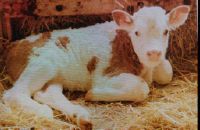
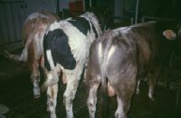
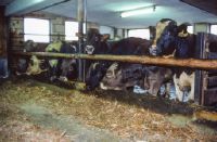
Dia_288-4695

Title (German)
Kälber / Muni
Caption
Title Section: Calves / Muni
Record Name
Dia_288-4696

Title (German)
Kälber / Muni
Caption
Title Section: Calves / Muni
Record Name
Dia_288-4697

Title (German)
Kälber / Muni
Caption
Title Section: Calves / Muni
Record Name
Dia_288-4698
Title (German)
Kälber / Muni
Caption
Title Section: Calves / Muni
Record Name
Dia_288-4699

Title (German)
Kälber / Muni
Caption
Title Section: Calves / Muni
Record Name
Dia_288-4700
Title (German)
Kälber / Muni, FAG, 3 Rassen
Caption
Title Section: Calves / Muni
Record Name
Dia_288-4701

Title (German)
Kälber / Muni, Kälbermast
Caption
Title Section: Calves / Muni
Record Name
Dia_288-4702

Title (German)
Kälber / Muni, Kälber FAG
Caption
Title Section: Calves / Muni
Record Name
Dia_288-4703

Title (German)
Kälber / Muni, FAG Kälber Gruppe
Caption
Title Section: Calves / Muni
Record Name
Dia_288-4704

Title (German)
Kälber / Muni, Muni
Caption
Title Section: Calves / Muni
Record Name
Dia_288-4705

Title (German)
Kälber / Muni, 19.2.
Caption
Title Section: Calves / Muni
Record Name
Dia_288-4706

Title (German)
Kälber / Muni
Caption
Title Section: Calves / Muni
Record Name
Dia_288-4707

Title (German)
Kälber / Muni
Caption
Title Section: Calves / Muni
Record Name
Dia_288-4708

Title (German)
Kälber / Muni
Caption
Title Section: Calves / Muni
Record Name
Dia_288-4709

Title (German)
Kälber / Muni
Caption
Title Section: Calves / Muni
Record Name
Dia_288-4710
Title (German)
Kälber / Muni, Muni
Caption
Title Section: Calves / Muni
Record Name
Dia_288-4711

Title (German)
Kälber / Muni
Caption
Title Section: Calves / Muni
Record Name
Dia_288-4712

Title (German)
Kälber / Muni
Caption
Title Section: Calves / Muni
Record Name
Dia_288-4713

Title (German)
Kälber / Muni
Caption
Title Section: Calves / Muni
Record Name
Dia_288-4714

Title (German)
Kälber / Muni
Caption
Title Section: Calves / Muni
Record Name
Dia_288-4715
Title (German)
Kälber / Muni
Caption
Title Section: Calves / Muni
Record Name
Dia_288-4716

Title (German)
Kälber / Muni, Fag, 3 Rassen
Caption
Title Section: Calves / Muni
Record Name
Dia_288-4717

Title (German)
Kälber / Muni
Caption
Title Section: Calves / Muni
Record Name
Dia_288-4718

Title (German)
Kälber / Muni, FAG Schwarz
Caption
Title Section: Calves / Muni
Record Name
Dia_288-4719

Title (German)
Kälber / Muni
Caption
Title Section: Calves / Muni
Record Name
Dia_288-4720

Title (German)
Kälber / Muni, 8, 32
Caption
Title Section: Calves / Muni
Record Name
Dia_288-4721

Title (German)
Kälber / Muni
Caption
Title Section: Calves / Muni
Record Name
Dia_288-4722

Title (German)
Kälber / Muni
Caption
Title Section: Calves / Muni
Record Name
Dia_288-4723
Title (German)
Kälber / Muni, FAG Kälbermast
Caption
Title Section: Calves / Muni
Record Name
Dia_288-4724

Title (German)
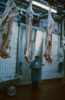
Kälber / Muni, 0 6: Schlachtvieh
Caption
Title Section: Calves / Muni
Record Name
Dia_288-4725

Title (German)
Kälber / Muni, Wägung Muni
Caption
Title Section: Calves / Muni
Record Name
Dia_288-4727

Title (German)
Kälber / Muni
Caption
Title Section: Calves / Muni
Record Name
Dia_288-4728
Title (German)
Kälber / Muni, Schlachtvieh
Caption
Title Section: Calves / Muni
Record Name
Dia_288-4729

Title (German)
Kälber / Muni, Schlachtvieh
Caption
Title Section: Calves / Muni
Record Name
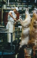
Dia_288-4730

Title (German)
Projekt Rindfleisch / Kälberschlachtungen: Ablauf, Tierankunft Schlachthof
Record Name
Dia_288-4731

Title (German)
Projekt Rindfleisch / Kälberschlachtungen: Ablauf
Record Name
Dia_288-4732

Title (German)
Projekt Rindfleisch / Kälberschlachtungen: Ablauf
Record Name
Dia_288-4733

Title (German)
Projekt Rindfleisch / Kälberschlachtungen: Ablauf, Ausladen (Kälber)
Record Name
Dia_288-4734

Title (German)
Projekt Rindfleisch / Kälberschlachtungen: Ablauf
Record Name
Dia_288-4735

Title (German)
Projekt Rindfleisch / Kälberschlachtungen: Ablauf
Record Name
Dia_288-4736

Title (German)
Projekt Rindfleisch / Kälberschlachtungen: Ablauf
Record Name
Dia_288-4737

Title (German)
Projekt Rindfleisch / Kälberschlachtungen: Ablauf, Ausladen Kälber
Record Name
Dia_288-4738

Title (German)
Projekt Rindfleisch / Kälberschlachtungen: Ablauf
Record Name
Dia_288-4739

Title (German)
Projekt Rindfleisch / Kälberschlachtungen: Ablauf, Tierwägen
Record Name
Dia_288-4740

Title (German)
Projekt Rindfleisch / Kälberschlachtungen: Ablauf, Farbe Experte (Kalb)
Record Name
Dia_288-4741

Title (German)
Projekt Rindfleisch / Kälberschlachtungen: Ablauf, Entfernen Beckenhöhlen (Fett)
Record Name
Dia_288-4742
Title (German)
Projekt Rindfleisch / Kälberschlachtungen: Ablauf
Record Name
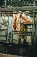
Dia_288-4743

Title (German)
Projekt Rindfleisch / Kälberschlachtungen: Ablauf
Record Name
Dia_288-4744

Title (German)
Projekt Rindfleisch / Kälberschlachtungen: Ablauf
Record Name
Dia_288-4745

Title (German)
Projekt Rindfleisch / Kälberschlachtungen: Ablauf
Record Name
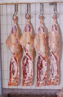
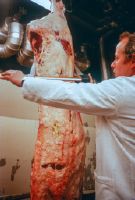
Dia_288-4746

Title (German)
Zerlegen Schnittführung: Fleischigkeit / EUROP, Simmentaler (Sim): 19.4.
Caption
Title Section: Cutting Cutting: Meatiness / EUROP
Record Name
Dia_288-4748
Title (German)
Zerlegen Schnittführung: Fleischigkeit / EUROP, PW 1 . Kälber
Caption
Title Section: Cutting Cutting: Meatiness / EUROP
Record Name
Dia_288-4749

Title (German)
Zerlegen Schnittführung: Fleischigkeit / EUROP, Schlachtkörper
Caption
Title Section: Cutting Cutting: Meatiness / EUROP
Record Name
Dia_288-4750

Title (German)
Zerlegen Schnittführung: Fleischigkeit / EUROP, Fett 1-5
Caption
Title Section: Cutting Cutting: Meatiness / EUROP
Record Name
Dia_288-4752
Title (German)
Zerlegen Schnittführung: Fleischigkeit / EUROP, Braun(vieh)
Caption
Title Section: Cutting Cutting: Meatiness / EUROP
Record Name
Dia_288-4753

Title (German)
Zerlegen Schnittführung: Fleischigkeit / EUROP, Klassierung Siedfleisch
Caption
Title Section: Cutting Cutting: Meatiness / EUROP
Record Name
Dia_288-4755

Title (German)
Zerlegen Schnittführung: Fleischigkeit / EUROP, Fett 1-5 Holstein-Rotbunt (HR)
Caption
Title Section: Cutting Cutting: Meatiness / EUROP
Record Name
Dia_288-4756

Title (German)
Zerlegen Schnittführung: Fleischigkeit / EUROP, Vollfleischig / Leerfleischig
Caption
Title Section: Cutting Cutting: Meatiness / EUROP
Record Name
Dia_288-4757

Title (German)
Schlachtablauf: Muni, EUROP - Fleischigkeit E-P
Caption
Title section: Battle sequence: Muni
Record Name
Dia_288-4758

Title (German)
Schlachtablauf: Muni, Fettklassen 1-5
Caption
Title section: Battle sequence: Muni
Record Name
Dia_288-4759

Title (German)
Schlachtablauf: Muni, Beurteilung Muni
Caption
Title section: Battle sequence: Muni
Record Name
Dia_288-4760

Title (German)
Schlachtablauf: Muni
Caption
Title section: Battle sequence: Muni
Record Name
Dia_288-4761

Title (German)
Schlachtablauf: Muni, Transport Muni
Caption
Title section: Battle sequence: Muni
Record Name
Dia_288-4762

Title (German)
Schlachtablauf: Muni, Beckenhöhlenfett
Caption
Title section: Battle sequence: Muni
Record Name
Dia_288-4763

Title (German)
Schlachtablauf: Muni, Kuh Leerfl.
Caption
Title section: Battle sequence: Muni
Record Name
Dia_288-4764

Title (German)
Schlachtablauf: Muni, Wägen SK Ware
Caption
Title section: Battle sequence: Muni
Record Name
Dia_288-4765

Title (German)
Schlachtablauf: Muni
Caption
Title section: Battle sequence: Muni
Record Name
Dia_288-4766
Title (German)
Schlachtablauf: Muni, Kuh Fleckvieh (Fl) Leer?
Caption
Title section: Battle sequence: Muni
Record Name
Dia_288-4767

Title (German)
Schlachtablauf: Muni, Kälber
Caption
Title section: Battle sequence: Muni
Record Name
Dia_288-4768

Title (German)
Schlachtablauf: Muni, Linke Hälfte aufbewahren
Caption
Title section: Battle sequence: Muni
Record Name
Dia_288-4769

Title (German)
Schlachtablauf: Muni, Stotzen
Caption
Title section: Battle sequence: Muni
Record Name
Dia_288-4770

Title (German)
Schlachtablauf: Muni, Kuh
Caption
Title section: Battle sequence: Muni
Record Name
Dia_288-4771

Title (German)
Schlachtablauf: Muni, Kuh
Caption
Title section: Battle sequence: Muni
Record Name
Dia_288-4772

Title (German)
Schlachtablauf: Muni, Kuh
Caption
Title section: Battle sequence: Muni
Record Name
Dia_288-4773

Title (German)
Schlachtablauf: Muni, Haut / Fell nummerieren
Caption
Title section: Battle sequence: Muni
Record Name
Dia_288-4774

Title (German)
Schlachtablauf: Muni, Schwartige Teile entfernen
Caption
Title section: Battle sequence: Muni
Record Name
Dia_288-4775

Title (German)
Schlachtablauf: Muni
Caption
Title section: Battle sequence: Muni
Record Name
Dia_288-4776

Title (German)
Qualitätsanforderungen, KBM
Caption
Title Section: Quality Requirements
Record Name
Dia_288-4777

Title (German)
Qualitätsanforderungen, Digitizer-Messung
Caption
Title Section: Quality Requirements
Record Name
Dia_288-4778

Title (German)
Qualitätsanforderungen
Caption
Title Section: Quality Requirements
Record Name
Dia_288-4779

Title (German)
Qualitätsanforderungen, pH.1 M. long dorsi
Caption
Title Section: Quality Requirements
Record Name
Dia_288-4780

Title (German)
Qualitätsanforderungen, Messen Umfang
Caption
Title Section: Quality Requirements
Record Name
Dia_288-4781

Title (German)
Qualitätsanforderungen, Masse
Caption
Title Section: Quality Requirements
Record Name
Dia_288-4782

Title (German)
Qualitätsanforderungen
Caption
Title Section: Quality Requirements
Record Name
Dia_288-4783

Title (German)
Qualitätsanforderungen, Gitter Nordfleisch
Caption
Title Section: Quality Requirements
Record Name
Dia_288-4784

Title (German)
Qualitätsanforderungen, Entnahme Probe
Caption
Title Section: Quality Requirements
Record Name
Dia_288-4785

Title (German)
Qualitätsanforderungen, Grill Degustation
Caption
Title Section: Quality Requirements
Record Name
Dia_288-4786

Title (German)
Qualitätsanforderungen, Leerfleischig
Caption
Title Section: Quality Requirements
Record Name
Dia_288-4787

Title (German)
Qualitätsanforderungen, Zu Fett
Caption
Title Section: Quality Requirements
Record Name
Dia_288-4788

Title (German)
Qualitätsanforderungen, Normal
Caption
Title Section: Quality Requirements
Record Name
Dia_288-4789

Title (German)
Qualitätsanforderungen, 29, 2
Caption
Title Section: Quality Requirements
Record Name
Dia_288-4790

Title (German)
Qualitätsanforderungen, Zu fett?
Caption
Title Section: Quality Requirements
Record Name
Dia_288-4791

Title (German)
Qualitätsanforderungen, Normal
Caption
Title Section: Quality Requirements
Record Name
Dia_288-4792

Title (German)
Qualitätsanforderungen
Caption
Title Section: Quality Requirements
Record Name
Dia_288-4793

Title (German)
Qualitätsanforderungen, Schlachtkörper, M2, 8
Caption
Title Section: Quality Requirements
Record Name
Dia_288-4794

Title (German)
Qualitätsanforderungen, Roastbeef KF. LF
Caption
Title Section: Quality Requirements
Record Name
Dia_288-4795

Title (German)
Qualitätsanforderungen
Caption
Title Section: Quality Requirements
Record Name
Dia_288-4796

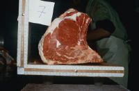
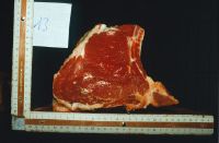
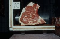
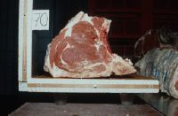
Title (German)
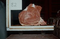
Abmessung Rindsfleisch-Stücke (T-Bone-Form) 1, Exemplar 1
Caption
Title Section: Dimension Beef Pieces (T-Bone Shape) 1
Record Name
Dia_288-4797

Title (German)
Abmessung Rindsfleisch-Stücke (T-Bone-Form) 1, Exemplar 1
Caption
Title Section: Dimension Beef Pieces (T-Bone Shape) 1
Record Name
Dia_288-4798

Title (German)
Abmessung Rindsfleisch-Stücke (T-Bone-Form) 1, Exemplar 2
Caption
Title Section: Dimension Beef Pieces (T-Bone Shape) 1
Record Name
Dia_288-4799
Title (German)
Abmessung Rindsfleisch-Stücke (T-Bone-Form) 1, Exemplar 2
Caption
Title Section: Dimension Beef Pieces (T-Bone Shape) 1
Record Name
Dia_288-4800

Title (German)
Abmessung Rindsfleisch-Stücke (T-Bone-Form) 1, Exemplar 3
Caption
Title Section: Dimension Beef Pieces (T-Bone Shape) 1
Record Name
Dia_288-4801

Title (German)
Abmessung Rindsfleisch-Stücke (T-Bone-Form) 1, Exemplar 4
Caption
Title Section: Dimension Beef Pieces (T-Bone Shape) 1
Record Name
Dia_288-4802

Title (German)
Abmessung Rindsfleisch-Stücke (T-Bone-Form) 1, Exemplar 4
Caption
Title Section: Dimension Beef Pieces (T-Bone Shape) 1
Record Name
Dia_288-4803

Title (German)
Abmessung Rindsfleisch-Stücke (T-Bone-Form) 1, Exemplar 5
Caption
Title Section: Dimension Beef Pieces (T-Bone Shape) 1
Record Name
Dia_288-4804

Title (German)
Abmessung Rindsfleisch-Stücke (T-Bone-Form) 1, Exemplar 5
Caption
Title Section: Dimension Beef Pieces (T-Bone Shape) 1
Record Name
Dia_288-4805

Title (German)
Abmessung Rindsfleisch-Stücke (T-Bone-Form) 1, Exemplar 6
Caption
Title Section: Dimension Beef Pieces (T-Bone Shape) 1
Record Name
Dia_288-4806
Title (German)
Abmessung Rindsfleisch-Stücke (T-Bone-Form) 1, Exemplar 7
Caption
Title Section: Dimension Beef Pieces (T-Bone Shape) 1
Record Name
Dia_288-4807

Title (German)
Abmessung Rindsfleisch-Stücke (T-Bone-Form) 1, Exemplar 8
Caption
Title Section: Dimension Beef Pieces (T-Bone Shape) 1
Record Name
Dia_288-4808

Title (German)
Abmessung Rindsfleisch-Stücke (T-Bone-Form) 1, Exemplar 8
Caption
Title Section: Dimension Beef Pieces (T-Bone Shape) 1
Record Name
Dia_288-4809

Title (German)
Abmessung Rindsfleisch-Stücke (T-Bone-Form) 1, Exemplar 9
Caption
Title Section: Dimension Beef Pieces (T-Bone Shape) 1
Record Name
Dia_288-4810

Title (German)
Abmessung Rindsfleisch-Stücke (T-Bone-Form) 1, Exemplar 9
Caption
Title Section: Dimension Beef Pieces (T-Bone Shape) 1
Record Name
Dia_288-4811

Title (German)
Abmessung Rindsfleisch-Stücke (T-Bone-Form) 1, Exemplar 10
Caption
Title Section: Dimension Beef Pieces (T-Bone Shape) 1
Record Name
Dia_288-4812

Title (German)
Abmessung Rindsfleisch-Stücke (T-Bone-Form) 1, Exemplar 11
Caption
Title Section: Dimension Beef Pieces (T-Bone Shape) 1
Record Name
Dia_288-4813

Title (German)
Abmessung Rindsfleisch-Stücke (T-Bone-Form) 1, Exemplar 12
Caption
Title Section: Dimension Beef Pieces (T-Bone Shape) 1
Record Name
Dia_288-4814
Title (German)
Abmessung Rindsfleisch-Stücke (T-Bone-Form) 1, Exemplar 13
Caption
Title Section: Dimension Beef Pieces (T-Bone Shape) 1
Record Name
Dia_288-4815

Title (German)
Abmessung Rindsfleisch-Stücke (T-Bone-Form) 1, Exemplar 14
Caption
Title Section: Dimension Beef Pieces (T-Bone Shape) 1
Record Name
Dia_288-4816

Title (German)
Abmessung Rindsfleisch-Stücke (T-Bone-Form) 1, Exemplar 65
Caption
Title Section: Dimension Beef Pieces (T-Bone Shape) 1
Record Name
Dia_288-4817

Title (German)
Abmessung Rindsfleisch-Stücke (T-Bone-Form) 1, Exemplar 69
Caption
Title Section: Dimension Beef Pieces (T-Bone Shape) 1
Record Name
Dia_288-4818
Title (German)
Abmessung Rindsfleisch-Stücke (T-Bone-Form) 1, Exemplar 66
Caption
Title Section: Dimension Beef Pieces (T-Bone Shape) 1
Record Name
Dia_288-4819

Title (German)
Abmessung Rindsfleisch-Stücke (T-Bone-Form) 1, Exemplar 67
Caption
Title Section: Dimension Beef Pieces (T-Bone Shape) 1
Record Name
Dia_288-4820

Title (German)
Abmessung Rindsfleisch-Stücke (T-Bone-Form) 1, Exemplar 68
Caption
Title Section: Dimension Beef Pieces (T-Bone Shape) 1
Record Name
Dia_288-4821
Title (German)
Abmessung Rindsfleisch-Stücke (T-Bone-Form) 1, Exemplar 70
Caption
Title Section: Dimension Beef Pieces (T-Bone Shape) 1
Record Name
Dia_288-4822

Title (German)
Abmessung Rindsfleisch-Stücke (T-Bone-Form) 1, Exemplar 71
Caption
Title Section: Dimension Beef Pieces (T-Bone Shape) 1
Record Name
Dia_288-4823

Title (German)
Abmessung Rindsfleisch-Stücke (T-Bone-Form) 1, Exemplar 72
Caption
Title Section: Dimension Beef Pieces (T-Bone Shape) 1
Record Name
Dia_288-4824

Title (German)
Abmessung Rindsfleisch-Stücke (T-Bone-Form) 1, Exemplar 73
Caption
Title Section: Dimension Beef Pieces (T-Bone Shape) 1
Record Name
Dia_288-4825

Title (German)
Abmessung Rindsfleisch-Stücke (T-Bone-Form) 1, Exemplar 74
Caption
Title Section: Dimension Beef Pieces (T-Bone Shape) 1
Record Name
Dia_288-4826

Title (German)
Abmessung Rindsfleisch-Stücke (T-Bone-Form) 1, Exemplar 75
Caption
Title Section: Dimension Beef Pieces (T-Bone Shape) 1
Record Name
Dia_288-4827

Title (German)
Abmessung Rindsfleisch-Stücke (T-Bone-Form) 1, Exemplar 76
Caption
Title Section: Dimension Beef Pieces (T-Bone Shape) 1
Record Name
Dia_288-4828

Title (German)
Abmessung Rindsfleisch-Stücke (T-Bone-Form) 1, Exemplar 77
Caption
Title Section: Dimension Beef Pieces (T-Bone Shape) 1
Record Name
Dia_288-4829

Title (German)
Abmessung Rindsfleisch-Stücke (T-Bone-Form) 1, Exemplar 78
Caption
Title Section: Dimension Beef Pieces (T-Bone Shape) 1
Record Name
Dia_288-4830

Title (German)
Abmessung Rindsfleisch-Stücke (T-Bone-Form) 1, Exemplar 79
Caption
Title Section: Dimension Beef Pieces (T-Bone Shape) 1
Record Name
Dia_288-4831

Title (German)
Abmessung Rindsfleisch-Stücke (T-Bone-Form) 1, Exemplar 80
Caption
Title Section: Dimension Beef Pieces (T-Bone Shape) 1
Record Name
Dia_288-4832

Title (German)
Abmessung Rindsfleisch-Stücke (T-Bone-Form) 1, Exemplar 81
Caption
Title Section: Dimension Beef Pieces (T-Bone Shape) 1
Record Name
Dia_288-4833
Title (German)
Abmessung Rindsfleisch-Stücke (T-Bone-Form) 1, Exemplar 82
Caption
Title Section: Dimension Beef Pieces (T-Bone Shape) 1
Record Name
Dia_288-4834

Title (German)
Abmessung Rindsfleisch-Stücke (T-Bone-Form) 1, Exemplar 83
Caption
Title Section: Dimension Beef Pieces (T-Bone Shape) 1
Record Name
Dia_288-4835

Title (German)
Abmessung Rindsfleisch-Stücke (T-Bone-Form) 1, Exemplar 84
Caption
Title Section: Dimension Beef Pieces (T-Bone Shape) 1
Record Name
Dia_288-4836
Title (German)
EUROP-System, Schlachtkörpermessungen
Caption
Title section: EUROP system, carcass measurements
Record Name
Dia_288-4837
Title (German)
EUROP-System, Schlachtkörpermessungen, Stotzenbreite: 187%
Caption
Title section: EUROP system, carcass measurements
Record Name
Dia_288-4838

Title (German)
EUROP-System, Schlachtkörpermessungen, Schlachtkörperlänge:187%
Caption
Title section: EUROP system, carcass measurements
Record Name
Dia_288-4839

Title (German)
EUROP-System, Schlachtkörpermessungen, Stotzenlänge
Caption
Title section: EUROP system, carcass measurements
Record Name
Dia_288-4840

Title (German)
EUROP-System, Schlachtkörpermessungen
Caption
Title section: EUROP system, carcass measurements
Record Name
Dia_288-4841

Title (German)
EUROP-System, Schlachtkörpermessungen
Caption
Title section: EUROP system, carcass measurements
Record Name
Dia_288-4842

Title (German)
EUROP-System, Schlachtkörpermessungen, 20, Carte d'appreciation des carcasses
Caption
Title section: EUROP system, carcass measurements
Record Name
Dia_288-4843

Title (German)
EUROP-System, Schlachtkörpermessungen, Vollfleischig / Leerfleischig
Caption
Title section: EUROP system, carcass measurements
Record Name
Dia_288-4844
Title (German)
EUROP-System, Schlachtkörpermessungen
Caption
Title section: EUROP system, carcass measurements
Record Name
Dia_288-4845

Title (German)
Schnittführungen, Kalb-Schnittführungen
Caption
Title Section: Cutting Guides
Record Name
Dia_288-4846

Title (German)
Schnittführungen, Muni, 88 cm, 444
Caption
Title Section: Cutting Guides
Record Name
Dia_288-4847

Title (German)
Schnittführungen, 2, 11, oben 1
Caption
Title Section: Cutting Guides
Record Name
Dia_288-4848

Title (German)
Schnittführungen, Grob Kuh, 280 / Kunzi?, Kalb
Caption
Title Section: Cutting Guides
Record Name
Dia_288-4849
Title (German)
Schnittführungen, 13 / 30
Caption
Title Section: Cutting Guides
Record Name
Dia_288-4850

Title (German)
Schnittführungen, Kuh leer
Caption
Title Section: Cutting Guides
Record Name
Dia_288-4851

Title (German)
Schnittführungen, Entnahme Spalten
Caption
Title Section: Cutting Guides
Record Name
Dia_288-4852

Title (German)
Schnittführungen, 24: Schnitt Kalbsbrust
Caption
Title Section: Cutting Guides
Record Name
Dia_288-4853

Title (German)
Schnittführungen, Kalb mit Nierenfett
Caption
Title Section: Cutting Guides
Record Name
Dia_288-4854

Title (German)
Schnittführungen
Caption
Title Section: Cutting Guides
Record Name
Dia_288-4855

Title (German)
Schnittführungen, Leerfleisch / Vollfleisch
Caption
Title Section: Cutting Guides
Record Name
Dia_288-4856

Title (German)
Schnittführungen, Schnitt Schulter, 3 oben
Caption
Title Section: Cutting Guides
Record Name
Dia_288-4857

Title (German)
Schnittführungen, Braunvieh (Br) 75, Simmentaler (Si) 75, Holstein-Friese (HF) 75
Caption
Title Section: Cutting Guides
Record Name
Dia_288-4858
Title (German)
Schnittführungen, 26, 4 Simmentaler (Sim) rein, 50, 75
Caption
Title Section: Cutting Guides
Record Name
Dia_288-4859

Title (German)
Schnittführungen, Schnittführung Lempen
Caption
Title Section: Cutting Guides
Record Name
Dia_288-4860

Title (German)
Schnittführungen, Schnittführung Muni
Caption
Title Section: Cutting Guides
Record Name
Dia_288-4861

Title (German)
Schnittführungen, 88 cm lang, oben 3
Caption
Title Section: Cutting Guides
Record Name
Dia_288-4862

Title (German)
Schnittführungen, 0
Caption
Title Section: Cutting Guides
Record Name
Dia_288-4863

Title (German)
Projekt Rindfleisch 1: Kälberschlachtung 14.-16.07.1986, Innerein warm gewogen
Record Name
Dia_288-4864

Title (German)
Projekt Rindfleisch 1: Kälberschlachtung 14.-16.07.1986
Record Name
Dia_288-4865

Title (German)
Projekt Rindfleisch 1: Kälberschlachtung 14.-16.07.1986
Record Name
Dia_288-4866

Title (German)
Projekt Rindfleisch 1: Kälberschlachtung 14.-16.07.1986, pH-Mesung (Kälber)
Record Name
Dia_288-4867

Title (German)
Projekt Rindfleisch 1: Kälberschlachtung 14.-16.07.1986
Record Name
Dia_288-4868

Title (German)
Projekt Rindfleisch 1: Kälberschlachtung 14.-16.07.1986
Record Name
Dia_288-4869

Title (German)
Projekt Rindfleisch 1: Kälberschlachtung 14.-16.07.1986, Schlachtbeginn
Record Name
Dia_288-4870

Title (German)
Projekt Rindfleisch 1: Kälberschlachtung 14.-16.07.1986
Record Name
Dia_288-4871
Title (German)
Projekt Rindfleisch 1: Kälberschlachtung 14.-16.07.1986
Record Name
Dia_288-4872
Title (German)
Projekt Rindfleisch 1: Kälberschlachtung 14.-16.07.1986
Record Name
Dia_288-4873

Title (German)
Projekt Rindfleisch 1: Kälberschlachtung 14.-16.07.1986, Masse
Record Name
Dia_288-4874

Title (German)
Projekt Rindfleisch 1: Kälberschlachtung 14.-16.07.1986
Record Name
Dia_288-4875

Title (German)
Projekt Rindfleisch 1: Kälberschlachtung 14.-16.07.1986
Record Name
Dia_288-4876

Title (German)
Projekt Rindfleisch 1: Kälberschlachtung 14.-16.07.1986
Record Name
Dia_288-4877

Title (German)
Projekt Rindfleisch 1: Kälberschlachtung 14.-16.07.1986, Dressur
Record Name
Dia_288-4878

Title (German)
Projekt Rindfleisch 1: Kälberschlachtung 14.-16.07.1986
Record Name
Dia_288-4879

Title (German)
Projekt Rindfleisch 1: Kälberschlachtung 14.-16.07.1986, Wägen Fleisch Mechanisch
Record Name
Dia_288-4880

Title (German)
Projekt Rindfleisch 1: Kälberschlachtung 14.-16.07.1986, Schulter
Record Name
Dia_288-4881

Title (German)
Projekt Rindfleisch 1: Kälberschlachtung 14.-16.07.1986
Record Name
Dia_288-4882
Title (German)
Projekt Rindfleisch 1: Kälberschlachtung 14.-16.07.1986
Record Name
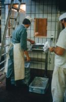
Dia_288-4883

Title (German)
Zerlegung
Caption
Title Section: Decomposition
Record Name
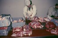
Dia_288-4884

Title (German)
Zerlegung
Caption
Title Section: Decomposition
Record Name
Dia_288-4885
Title (German)
Zerlegung, 2. Schnitt
Caption
Title Section: Decomposition
Record Name
Dia_288-4886

Title (German)
Zerlegung, 2. Schnitt
Caption
Title Section: Decomposition
Record Name
Dia_288-4887

Title (German)
Zerlegung
Caption
Title Section: Decomposition
Record Name
Dia_288-4888

Title (German)
Zerlegung
Caption
Title Section: Decomposition
Record Name
Dia_288-4889

Title (German)
Zerlegung, Schulter
Caption
Title Section: Decomposition
Record Name
Dia_288-4890

Title (German)
Zerlegung
Caption
Title Section: Decomposition
Record Name
Dia_288-4891

Title (German)
Zerlegung, Ausbeinen
Caption
Title Section: Decomposition
Record Name
Dia_288-4892

Title (German)
Zerlegung
Caption
Title Section: Decomposition
Record Name
Dia_288-4893

Title (German)
Zerlegung, Nierenstück?
Caption
Title Section: Decomposition
Record Name
Dia_288-4894

Title (German)
Zerlegung, Ausbeinen
Caption
Title Section: Decomposition
Record Name
Dia_288-4895

Title (German)
Zerlegung, Equipe, 1. Schnitt
Caption
Title Section: Decomposition
Record Name
Dia_288-4896

Title (German)
Zerlegung, Dressur
Caption
Title Section: Decomposition
Record Name
Dia_288-4897

Title (German)
Zerlegung, Kuh Fl los
Caption
Title Section: Decomposition
Record Name
Dia_288-4898

Title (German)
Zerlegung, Nierenstück
Caption
Title Section: Decomposition
Record Name
Dia_288-4899

Title (German)
Zerlegung, Nierenstück
Caption
Title Section: Decomposition
Record Name
Dia_288-4900

Title (German)
Zerlegung, Wägen
Caption
Title Section: Decomposition
Record Name
Dia_288-4901