 E-PICS - ETHBIB.Bildarchiv


The images presented on this page are part of E-Pics, a service provided by the ETH-Bibliothek of ETH Zurich. You find here static medium resolution images published under the creative commons
CC-BY-SA license or with the Public Domain Mark. This means that you are free to share, copy and redistribute the material in any medium or format; that you are free to remix, transform, and build upon the material for any purpose, even commercially, under the following conditions: You must give appropriate credit, provide a link to the license, and indicate if changes were made.
- More information about E-Pics is available at https://www.e-pics.ethz.ch
- This catalog can also be accessed at https://ba.e-pics.ethz.ch/ . There you can download the image in a higher resolution.

Title (German)
Kopenhagen, Ballerup, Egebjerggard-Projekt
Caption
Photographer keyword: new building
Caption (German)
Schlagwort Bestandsbildner: Neubau
Record Name
Dia_287-33845

Title (German)
Kopenhagen, Ballerup, Egebjerggard-Projekt
Caption
Photographer keyword: new building
Caption (German)
Schlagwort Bestandsbildner: Neubau
Record Name
Dia_287-33846

Title (German)
Kopenhagen, Ballerup, Egebjerggard-Projekt
Caption
Photographer keyword: new building
Caption (German)
Schlagwort Bestandsbildner: Neubau
Record Name
Dia_287-33847

Title (German)
Kopenhagen, Ballerup, Egebjerggard-Projekt
Caption
Photographer keyword: new building
Caption (German)
Schlagwort Bestandsbildner: Neubau
Record Name
Dia_287-33848

Title (German)
Kopenhagen, Ballerup, Egebjerggard-Projekt
Caption
Photographer keyword: new building
Caption (German)
Schlagwort Bestandsbildner: Neubau
Record Name
Dia_287-33849

Title (German)
Kopenhagen, Ballerup, Egebjerggard-Projekt
Caption
Photographer keyword: new building
Caption (German)
Schlagwort Bestandsbildner: Neubau
Record Name
Dia_287-33850

Title (German)
Kopenhagen, Ballerup, Egebjerggard-Projekt
Caption
Photographer keyword: new building
Caption (German)
Schlagwort Bestandsbildner: Neubau
Record Name
Dia_287-33851

Title (German)
Kopenhagen, Rathausplatz, Neubau
Caption
Photographer keyword: old and new
Caption (German)
Schlagwort Bestandsbildner: alt und neu
Record Name
Dia_287-33852

Title (German)
Kopenhagen, Store Sondervoldstraede 11, Architekt van Kunsten
Caption
Photographer keyword: old and new
Caption (German)
Schlagwort Bestandsbildner: alt und neu
Record Name
Dia_287-33853
Title (German)
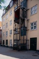
Kopenhagen, Wildersgade, Warenlift
Caption
Photographer keyword: old and new
Caption (German)
Schlagwort Bestandsbildner: alt und neu
Record Name
Dia_287-33854

Title (German)
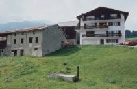
Korschenbroich, Altenteiler-Haus
Caption
Photographer keyword: new building
Caption (German)
Schlagwort Bestandsbildner: Neubau
Record Name
Dia_287-33855

Title (German)
Kronenburg, Neue Tür
Caption
Photographer keyword: old and new
Caption (German)
Schlagwort Bestandsbildner: alt und neu
Record Name
Dia_287-33856

Title (German)
Kronenburg, Historismus
Caption
Photographer keyword: old and new
Caption (German)
Schlagwort Bestandsbildner: alt und neu
Record Name
Dia_287-33857

Title (German)
Kronenburgerhütte, Abbruch
Caption
Photographer keyword: new building
Caption (German)
Schlagwort Bestandsbildner: Neubau
Record Name
Dia_287-33858

Title (German)
Landenhausen-Lauterbach, Kathedrale K. W. Buschulte, Fenster neu
Caption
Photographer keyword: new building
Caption (German)
Schlagwort Bestandsbildner: Neubau
Record Name
Dia_287-33859

Title (German)
Landenhausen-Lauterbach, Kathedrale K. W. Buschulte, Fenster neu
Caption
Photographer keyword: new building
Caption (German)
Schlagwort Bestandsbildner: Neubau
Record Name
Dia_287-33860

Title (German)
Larochette, Treppe zur Burg
Caption
Photographer keyword: old and new
Caption (German)
Schlagwort Bestandsbildner: alt und neu
Record Name
Dia_287-33861
Title (German)
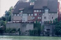
Laufenburg, Altstadt
Caption
Photographer keyword: new building
Caption (German)
Schlagwort Bestandsbildner: Neubau
Record Name
Dia_287-33862

Title (German)
Laufenburg, Altstadt
Caption
Photographer keyword: new building
Caption (German)
Schlagwort Bestandsbildner: Neubau
Record Name
Dia_287-33863

Title (German)
Laufenburg, Altstadt
Caption
Photographer keyword: new building
Caption (German)
Schlagwort Bestandsbildner: Neubau
Record Name
Dia_287-33864

Title (German)
Laufenburg, Altstadt
Caption
Photographer keyword: new building
Caption (German)
Schlagwort Bestandsbildner: Neubau
Record Name
Dia_287-33865

Title (German)
Laufenburg, Altstadt
Caption
Photographer keyword: new building
Caption (German)
Schlagwort Bestandsbildner: Neubau
Record Name
Dia_287-33866

Title (German)
Laufenburg, Altstadt
Caption
Photographer keyword: new building
Caption (German)
Schlagwort Bestandsbildner: Neubau
Record Name
Dia_287-33867

Title (German)
Laufenburg, Altstadt
Caption
Photographer keyword: new building
Caption (German)
Schlagwort Bestandsbildner: Neubau
Record Name
Dia_287-33868

Title (German)
Laufenburg, Altstadt
Caption
Photographer keyword: new building
Caption (German)
Schlagwort Bestandsbildner: Neubau
Record Name
Dia_287-33869

Title (German)
Lauingen, St. Martin, moderner Zelebrationsaltar
Caption
Photographer keyword: old and new
Caption (German)
Schlagwort Bestandsbildner: alt und neu
Record Name
Dia_287-33870

Title (German)
Lauingen, St. Martin, Kanzel
Caption
Photographer keyword: old and new
Caption (German)
Schlagwort Bestandsbildner: alt und neu
Record Name
Dia_287-33871

Title (German)
Lauingen, St. Martin, Kanzel
Caption
Photographer keyword: old and new
Caption (German)
Schlagwort Bestandsbildner: alt und neu
Record Name
Dia_287-33872

Title (German)
Lausanne, Vor der Kathedrale
Caption
Photographer keyword: old and new
Caption (German)
Schlagwort Bestandsbildner: alt und neu
Record Name
Dia_287-33873

Title (German)
Lausanne, Bankeinbau
Caption
Photographer keyword: old and new
Caption (German)
Schlagwort Bestandsbildner: alt und neu
Record Name
Dia_287-33874

Title (German)
Lautenbach, Kathedrale K. W. Buschulte, Fenster neu
Caption
Photographer keyword: new building
Caption (German)
Schlagwort Bestandsbildner: Neubau
Record Name
Dia_287-33875

Title (German)
Lautenbach, Kathedrale K. W. Buschulte, Fenster neu
Caption
Photographer keyword: new building
Caption (German)
Schlagwort Bestandsbildner: Neubau
Record Name
Dia_287-33876
Title (German)
Bonn-Lengsdorf, Kindergarten bei katholischer Kirche
Caption
Photographer keyword: old and new
Caption (German)
Schlagwort Bestandsbildner: alt und neu
Record Name
Dia_287-33877

Title (German)
Lenz, Pfarrkirche Umgebung
Caption
Photographer keyword: old and new
Caption (German)
Schlagwort Bestandsbildner: alt und neu
Record Name
Dia_287-33878

Title (German)
Lenz, Lenz
Caption
Photographer keyword: old and new
Caption (German)
Schlagwort Bestandsbildner: alt und neu
Record Name
Dia_287-33879

Title (German)
Lenz, Schuppen und Garage
Caption
Photographer keyword: old and new
Caption (German)
Schlagwort Bestandsbildner: alt und neu
Record Name
Dia_287-33880

Title (German)
Lenz, Garage
Caption
Photographer keyword: old and new
Caption (German)
Schlagwort Bestandsbildner: alt und neu
Record Name
Dia_287-33881

Title (German)
Lenz, Lenz
Caption
Photographer keyword: new building
Caption (German)
Schlagwort Bestandsbildner: Neubau
Record Name
Dia_287-33882

Title (German)
Lenzburg, Hendschiker Kirchweg, Südseite
Caption
Photographer keyword: new building
Caption (German)
Schlagwort Bestandsbildner: Neubau
Record Name
Dia_287-33883

Title (German)
Lenzburg, Hendschiker Kirchweg, Südseite
Caption
Photographer keyword: new building
Caption (German)
Schlagwort Bestandsbildner: Neubau
Record Name
Dia_287-33884

Title (German)
Lenzerheide
Caption
Photographer keyword: old and new
Caption (German)
Schlagwort Bestandsbildner: alt und neu
Record Name
Dia_287-33885

Title (German)
Lenzerheide
Caption
Photographer keyword: old and new
Caption (German)
Schlagwort Bestandsbildner: alt und neu
Record Name
Dia_287-33886
Title (German)
Lenzerheide
Caption
Photographer keyword: old and new
Caption (German)
Schlagwort Bestandsbildner: alt und neu
Record Name
Dia_287-33887

Title (German)
Lenzerheide, Abbruchkanditat
Caption
Photographer keyword: old and new
Caption (German)
Schlagwort Bestandsbildner: alt und neu
Record Name
Dia_287-33888

Title (German)
Lenzerheide, Neubausiedlung, Regionalismus
Caption
Photographer keyword: old and new
Caption (German)
Schlagwort Bestandsbildner: alt und neu
Record Name
Dia_287-33889

Title (German)
Lenzerheide, Am See
Caption
Photographer keyword: new building
Caption (German)
Schlagwort Bestandsbildner: Neubau
Record Name
Dia_287-33890

Title (German)
Lenzerheide, Am See
Caption
Photographer keyword: new building
Caption (German)
Schlagwort Bestandsbildner: Neubau
Record Name
Dia_287-33891

Title (German)
Lenzerheide, Am See
Caption
Photographer keyword: new building
Caption (German)
Schlagwort Bestandsbildner: Neubau
Record Name
Dia_287-33892

Title (German)
Lenzerheide, Am See
Caption
Photographer keyword: new building
Caption (German)
Schlagwort Bestandsbildner: Neubau
Record Name
Dia_287-33893

Title (German)
Lenzerheide, Am See
Caption
Photographer keyword: new building
Caption (German)
Schlagwort Bestandsbildner: Neubau
Record Name
Dia_287-33894

Title (German)
Lenzerheide, Am See, Ferienhäuser 60er Jahre
Caption
Photographer keyword: new building
Caption (German)
Schlagwort Bestandsbildner: Neubau
Record Name
Dia_287-33895

Title (German)
Lenzerheide, Am See, Ferienhäuser 60er Jahre
Caption
Photographer keyword: new building
Caption (German)
Schlagwort Bestandsbildner: Neubau
Record Name
Dia_287-33896

Title (German)
Lenzerheide, Soleval, 60er Jahre
Caption
Photographer keyword: new building
Caption (German)
Schlagwort Bestandsbildner: Neubau
Record Name
Dia_287-33897

Title (German)
Lenzerheide, Soleval, 60er Jahre
Caption
Photographer keyword: new building
Caption (German)
Schlagwort Bestandsbildner: Neubau
Record Name
Dia_287-33898

Title (German)
Lenzerheide, Soleval, 60er Jahre
Caption
Photographer keyword: new building
Caption (German)
Schlagwort Bestandsbildner: Neubau
Record Name
Dia_287-33899

Title (German)
Lenzerheide, Soleval, 60er Jahre
Caption
Photographer keyword: new building
Caption (German)
Schlagwort Bestandsbildner: Neubau
Record Name
Dia_287-33900

Title (German)
Lenzerheide, Soleval, 60er Jahre
Caption
Photographer keyword: new building
Caption (German)
Schlagwort Bestandsbildner: Neubau
Record Name
Dia_287-33901

Title (German)
Lenzerheide, Soleval, 60er Jahre
Caption
Photographer keyword: new building
Caption (German)
Schlagwort Bestandsbildner: Neubau
Record Name
Dia_287-33902

Title (German)
Lenzerheide, Neubauten "geklont"
Caption
Photographer keyword: new building
Caption (German)
Schlagwort Bestandsbildner: Neubau
Record Name
Dia_287-33903

Title (German)
Lenzerheide, Lenzerheide
Caption
Photographer keyword: new building
Caption (German)
Schlagwort Bestandsbildner: Neubau
Record Name
Dia_287-33904

Title (German)
Lenzerheide, Tourismusarchitektur
Caption
Photographer keyword: new building
Caption (German)
Schlagwort Bestandsbildner: Neubau
Record Name
Dia_287-33905

Title (German)
Lenzerheide, Tourismusarchitektur
Caption
Photographer keyword: new building
Caption (German)
Schlagwort Bestandsbildner: Neubau
Record Name
Dia_287-33906

Title (German)
Lenzerheide, Tourismusarchitektur
Caption
Photographer keyword: new building
Caption (German)
Schlagwort Bestandsbildner: Neubau
Record Name
Dia_287-33907

Title (German)
Lenzerheide, Tourismusarchitektur
Caption
Photographer keyword: new building
Caption (German)
Schlagwort Bestandsbildner: Neubau
Record Name
Dia_287-33908

Title (German)
Lenzerheide, Post
Caption
Photographer keyword: new building
Caption (German)
Schlagwort Bestandsbildner: Neubau
Record Name
Dia_287-33909

Title (German)
Lenzerheide, Post
Caption
Photographer keyword: new building
Caption (German)
Schlagwort Bestandsbildner: Neubau
Record Name
Dia_287-33910

Title (German)
Lenzerheide, Post
Caption
Photographer keyword: new building
Caption (German)
Schlagwort Bestandsbildner: Neubau
Record Name
Dia_287-33911

Title (German)
Lenzerheide, Post
Caption
Photographer keyword: new building
Caption (German)
Schlagwort Bestandsbildner: Neubau
Record Name
Dia_287-33912

Title (German)
Lenzerheide, Post
Caption
Photographer keyword: new building
Caption (German)
Schlagwort Bestandsbildner: Neubau
Record Name
Dia_287-33913

Title (German)
Lenzerheide, Hotel Schweizerhof
Caption
Photographer keyword: new building
Caption (German)
Schlagwort Bestandsbildner: Neubau
Record Name
Dia_287-33914

Title (German)
Leverkusen, Verdichtung
Caption
Photographer keyword: old and new
Caption (German)
Schlagwort Bestandsbildner: alt und neu
Record Name
Dia_287-33915

Title (German)
Leverkusen, Verdichtung
Caption
Photographer keyword: old and new
Caption (German)
Schlagwort Bestandsbildner: alt und neu
Record Name
Dia_287-33916

Title (German)
Leverkusen, Verdichtung
Caption
Photographer keyword: old and new
Caption (German)
Schlagwort Bestandsbildner: alt und neu
Record Name
Dia_287-33917

Title (German)
Leverkusen, Verdichtung
Caption
Photographer keyword: old and new
Caption (German)
Schlagwort Bestandsbildner: alt und neu
Record Name
Dia_287-33918

Title (German)
Leverkusen, Küppersteg, Christ König P. Weigmann, Fenster neu
Caption
Photographer keyword: new building
Caption (German)
Schlagwort Bestandsbildner: Neubau
Record Name
Dia_287-33919

Title (German)
Mendrisio-Ligornetto, Haus von Mario Botta
Caption
Photographer keyword: new building
Caption (German)
Schlagwort Bestandsbildner: Neubau
Record Name
Dia_287-33920

Title (German)
Mendrisio-Ligornetto, Haus von Mario Botta
Caption
Photographer keyword: new building
Caption (German)
Schlagwort Bestandsbildner: Neubau
Record Name
Dia_287-33921

Title (German)
Mendrisio-Ligornetto, Haus von Mario Botta
Caption
Photographer keyword: new building
Caption (German)
Schlagwort Bestandsbildner: Neubau
Record Name
Dia_287-33922

Title (German)
Mendrisio-Ligornetto, Haus von Mario Botta
Caption
Photographer keyword: new building
Caption (German)
Schlagwort Bestandsbildner: Neubau
Record Name
Dia_287-33923

Title (German)
Mendrisio-Ligornetto, Haus von Mario Botta
Caption
Photographer keyword: new building
Caption (German)
Schlagwort Bestandsbildner: Neubau
Record Name
Dia_287-33924

Title (German)
Mendrisio-Ligornetto, Haus von Mario Botta
Caption
Photographer keyword: new building
Caption (German)
Schlagwort Bestandsbildner: Neubau
Record Name
Dia_287-33925

Title (German)
Mendrisio-Ligornetto, Haus von Mario Botta
Caption
Photographer keyword: new building
Caption (German)
Schlagwort Bestandsbildner: Neubau
Record Name
Dia_287-33926
Title (German)
Mendrisio-Ligornetto, Haus von Mario Botta
Caption
Photographer keyword: new building
Caption (German)
Schlagwort Bestandsbildner: Neubau
Record Name
Dia_287-33927

Title (German)
Mendrisio-Ligornetto, Haus von Mario Botta
Caption
Photographer keyword: new building
Caption (German)
Schlagwort Bestandsbildner: Neubau
Record Name
Dia_287-33928

Title (German)
Lille, Bahnhof Flanche + Eurolille
Caption
Photographer keyword: old and new
Caption (German)
Schlagwort Bestandsbildner: alt und neu
Record Name
Dia_287-33929

Title (German)
Lille, Europe Bahnhof
Caption
Photographer keyword: new building
Caption (German)
Schlagwort Bestandsbildner: Neubau
Record Name
Dia_287-33930

Title (German)
Lille, Euralille
Caption
Photographer keyword: new building
Caption (German)
Schlagwort Bestandsbildner: Neubau
Record Name
Dia_287-33931

Title (German)
Lille, Euralille
Caption
Photographer keyword: new building
Caption (German)
Schlagwort Bestandsbildner: Neubau
Record Name
Dia_287-33932

Title (German)
Lille, Euralille
Caption
Photographer keyword: new building
Caption (German)
Schlagwort Bestandsbildner: Neubau
Record Name
Dia_287-33933

Title (German)
Lille, Rue du Vieux, Fanbourg
Caption
Photographer keyword: old and new
Caption (German)
Schlagwort Bestandsbildner: alt und neu
Record Name
Dia_287-33934

Title (German)
Linnich, St. Martin, W. Buschulte, Fenster neu
Caption
Photographer keyword: new building
Caption (German)
Schlagwort Bestandsbildner: Neubau
Record Name
Dia_287-33935

Title (German)
Linnich, St. Martin, W. Buschulte, Fenster neu
Caption
Photographer keyword: new building
Caption (German)
Schlagwort Bestandsbildner: Neubau
Record Name
Dia_287-33936

Title (German)
Lisseweghe, Neubebauung Architekt d'Hespeel
Caption
Photographer keyword: old and new
Caption (German)
Schlagwort Bestandsbildner: alt und neu
Record Name
Dia_287-33937

Title (German)
Lisseweghe, Neubebauung Architekt d'Hespeel
Caption
Photographer keyword: new building
Caption (German)
Schlagwort Bestandsbildner: Neubau
Record Name
Dia_287-33938

Title (German)
Lisseweghe, Neubebauung Architekt d'Hespeel
Caption
Photographer keyword: new building
Caption (German)
Schlagwort Bestandsbildner: Neubau
Record Name
Dia_287-33939

Title (German)
Lisseweghe, Neubebauung Architekt d'Hespeel
Caption
Photographer keyword: new building
Caption (German)
Schlagwort Bestandsbildner: Neubau
Record Name
Dia_287-33940

Title (German)
Locarno, Altstadt Eingang
Caption
Photographer keyword: old and new
Caption (German)
Schlagwort Bestandsbildner: alt und neu
Record Name
Dia_287-33941

Title (German)
Locarno, Altstadt Sanierung
Caption
Photographer keyword: old and new
Caption (German)
Schlagwort Bestandsbildner: alt und neu
Record Name
Dia_287-33942

Title (German)
Locarno, Altstadt Innenhof
Caption
Photographer keyword: old and new
Caption (German)
Schlagwort Bestandsbildner: alt und neu
Record Name
Dia_287-33943

Title (German)
Locarno, Altstadt, neuer Innenhof
Caption
Photographer keyword: old and new
Caption (German)
Schlagwort Bestandsbildner: alt und neu
Record Name
Dia_287-33944

Title (German)
Locarno, Neubau in der Altstadt
Caption
Photographer keyword: old and new
Caption (German)
Schlagwort Bestandsbildner: alt und neu
Record Name
Dia_287-33945

Title (German)
Locarno, Neubau in der Altstadt
Caption
Photographer keyword: old and new
Caption (German)
Schlagwort Bestandsbildner: alt und neu
Record Name
Dia_287-33946

Title (German)
Locarno, Locarno
Caption
Photographer keyword: new building
Caption (German)
Schlagwort Bestandsbildner: Neubau
Record Name
Dia_287-33947

Title (German)
Locarno, Regionalismus
Caption
Photographer keyword: new building
Caption (German)
Schlagwort Bestandsbildner: Neubau
Record Name
Dia_287-33948

Title (German)
Loderio, Oratorio della Noctività di Maria
Caption
Photographer keyword: old and new
Caption (German)
Schlagwort Bestandsbildner: alt und neu
Record Name
Dia_287-33949

Title (German)
Loderio, Oratorio della Noctività di Maria
Caption
Photographer keyword: old and new
Caption (German)
Schlagwort Bestandsbildner: alt und neu
Record Name
Dia_287-33950

Title (German)
Loderio, Oratorio della Noctività di Maria
Caption
Photographer keyword: old and new
Caption (German)
Schlagwort Bestandsbildner: alt und neu
Record Name
Dia_287-33951

Title (German)
Loderio, Oratorio della Noctività di Maria
Caption
Photographer keyword: old and new
Caption (German)
Schlagwort Bestandsbildner: alt und neu
Record Name
Dia_287-33952

Title (German)
Loderio, Oratorio della Noctività di Maria
Caption
Photographer keyword: old and new
Caption (German)
Schlagwort Bestandsbildner: alt und neu
Record Name
Dia_287-33953

Title (German)
Loderio, Oratorio della Noctività di Maria
Caption
Photographer keyword: old and new
Caption (German)
Schlagwort Bestandsbildner: alt und neu
Record Name
Dia_287-33954

Title (German)
Loderio, Oratorio della Noctività di Maria
Caption
Photographer keyword: old and new
Caption (German)
Schlagwort Bestandsbildner: alt und neu
Record Name
Dia_287-33955

Title (German)
Löwen, Vismarkt Postgebäude
Caption
Photographer keyword: new building
Caption (German)
Schlagwort Bestandsbildner: Neubau
Record Name
Dia_287-33956

Title (German)
Löwen, Schule neben Groot Begijnhof
Caption
Photographer keyword: new building
Caption (German)
Schlagwort Bestandsbildner: Neubau
Record Name
Dia_287-33957

Title (German)
Löwen, Groot Begijnhof, Nachbarbebauung, Mühle und Schule
Caption
Photographer keyword: new building
Caption (German)
Schlagwort Bestandsbildner: Neubau
Record Name
Dia_287-33958

Title (German)
Löwen, Groot Begijnhof
Caption
Photographer keyword: new building
Caption (German)
Schlagwort Bestandsbildner: Neubau
Record Name
Dia_287-33959

Title (German)
Löwen, Groot Begijnhof
Caption
Photographer keyword: old and new
Caption (German)
Schlagwort Bestandsbildner: alt und neu
Record Name
Dia_287-33960

Title (German)
Löwen, Anbau im Groot Begijnhof
Caption
Photographer keyword: old and new
Caption (German)
Schlagwort Bestandsbildner: alt und neu
Record Name
Dia_287-33961

Title (German)
Löwen, Groot Begijnhof
Caption
Photographer keyword: new building
Caption (German)
Schlagwort Bestandsbildner: Neubau
Record Name
Dia_287-33962

Title (German)
Löwen, Logumkloster
Caption
Photographer keyword: old and new
Caption (German)
Schlagwort Bestandsbildner: alt und neu
Record Name
Dia_287-33963

Title (German)
Löwen, Logumkloster
Caption
Photographer keyword: old and new
Caption (German)
Schlagwort Bestandsbildner: alt und neu
Record Name
Dia_287-33964

Title (German)
Löwen, Katholische Kirche, W. Buschulte, Fenster neu
Caption
Photographer keyword: new building
Caption (German)
Schlagwort Bestandsbildner: Neubau
Record Name
Dia_287-33965

Title (German)
Logumkloster, Kloster Løgum
Caption
Photographer keyword: old and new
Caption (German)
Schlagwort Bestandsbildner: alt und neu
Record Name
Dia_287-33966

Title (German)
Logumkloster, Kloster Løgum
Caption
Photographer keyword: old and new
Caption (German)
Schlagwort Bestandsbildner: alt und neu
Record Name
Dia_287-33967

Title (German)
Logumkloster, Kloster Løgum
Caption
Photographer keyword: old and new
Caption (German)
Schlagwort Bestandsbildner: alt und neu
Record Name
Dia_287-33968

Title (German)
London, Neue Stadtsilhouette
Caption
Photographer keyword: new building
Caption (German)
Schlagwort Bestandsbildner: Neubau
Record Name
Dia_287-33969

Title (German)
London, Towerbridge + Neubau, Silhouette
Caption
Photographer keyword: new building
Caption (German)
Schlagwort Bestandsbildner: Neubau
Record Name
Dia_287-33970

Title (German)
London, Towerbridge, techn. Denkmal
Caption
Photographer keyword: new building
Caption (German)
Schlagwort Bestandsbildner: Neubau
Record Name
Dia_287-33971

Title (German)
London, Vor Westminster Abbey
Caption
Photographer keyword: new building
Caption (German)
Schlagwort Bestandsbildner: Neubau
Record Name
Dia_287-33972

Title (German)
London, Guildhall
Caption
Photographer keyword: old and new
Caption (German)
Schlagwort Bestandsbildner: alt und neu
Record Name
Dia_287-33973

Title (German)
London, Strand, Bankumbau
Caption
Photographer keyword: old and new
Caption (German)
Schlagwort Bestandsbildner: alt und neu
Record Name
Dia_287-33974

Title (German)
London, Strand, Umbau
Caption
Photographer keyword: new building
Caption (German)
Schlagwort Bestandsbildner: Neubau
Record Name
Dia_287-33975

Title (German)
London, Covent Garden High holborn, Sanierung
Caption
Photographer keyword: old and new
Caption (German)
Schlagwort Bestandsbildner: alt und neu
Record Name
Dia_287-33976

Title (German)
Humlebaek, Louisiana Museum of Modern Art, Holzhaus
Caption
Photographer keyword: new building
Caption (German)
Schlagwort Bestandsbildner: Neubau
Record Name
Dia_287-33977

Title (German)
Humlebaek, Louisiana Museum of Modern Art, Holzhaus
Caption
Photographer keyword: new building
Caption (German)
Schlagwort Bestandsbildner: Neubau
Record Name
Dia_287-33978

Title (German)
Louvain-la-Neuve, Umbau Scheune
Caption
Photographer keyword: old and new
Caption (German)
Schlagwort Bestandsbildner: alt und neu
Record Name
Dia_287-33979

Title (German)
Louvain-la-Neuve, K. Kirche
Caption
Photographer keyword: new building
Caption (German)
Schlagwort Bestandsbildner: Neubau
Record Name
Dia_287-33980

Title (German)
Louvain-la-Neuve, Kollegiengebäude
Caption
Photographer keyword: new building
Caption (German)
Schlagwort Bestandsbildner: Neubau
Record Name
Dia_287-33981

Title (German)
Louvain-la-Neuve, Quartier l'Hocaille
Caption
Photographer keyword: new building
Caption (German)
Schlagwort Bestandsbildner: Neubau
Record Name
Dia_287-33982

Title (German)
Louvain-la-Neuve, Quartier l'Hocaille
Caption
Photographer keyword: new building
Caption (German)
Schlagwort Bestandsbildner: Neubau
Record Name
Dia_287-33983

Title (German)
Louvain-la-Neuve, Quartier l'Hocaille, Pflaster
Caption
Photographer keyword: new building
Caption (German)
Schlagwort Bestandsbildner: Neubau
Record Name
Dia_287-33984

Title (German)
Louvain-la-Neuve, Quartier l'Hocaille
Caption
Photographer keyword: new building
Caption (German)
Schlagwort Bestandsbildner: Neubau
Record Name
Dia_287-33985

Title (German)
Louvain-la-Neuve, Platz for Unikollegium
Caption
Photographer keyword: new building
Caption (German)
Schlagwort Bestandsbildner: Neubau
Record Name
Dia_287-33986

Title (German)
Louvain-la-Neuve, Quartier l'Hocaille
Caption
Photographer keyword: new building
Caption (German)
Schlagwort Bestandsbildner: Neubau
Record Name
Dia_287-33987

Title (German)
Louvain-la-Neuve, Altbau und Schwimmhalle im Quartier l'Hocaille
Caption
Photographer keyword: old and new
Caption (German)
Schlagwort Bestandsbildner: alt und neu
Record Name
Dia_287-33988

Title (German)
Louvain-la-Neuve, Altbau und Schwimmhalle im Quartier l'Hocaille
Caption
Photographer keyword: old and new
Caption (German)
Schlagwort Bestandsbildner: alt und neu
Record Name
Dia_287-33989

Title (German)
Louvain-la-Neuve, Quartier l'Hocaille
Caption
Photographer keyword: new building
Caption (German)
Schlagwort Bestandsbildner: Neubau
Record Name
Dia_287-33990

Title (German)
Louvain-la-Neuve, Ensemble
Caption
Photographer keyword: new building
Caption (German)
Schlagwort Bestandsbildner: Neubau
Record Name
Dia_287-33991

Title (German)
Louvain-la-Neuve, Centre Universitaire
Caption
Photographer keyword: new building
Caption (German)
Schlagwort Bestandsbildner: Neubau
Record Name
Dia_287-33992

Title (German)
Louvain-la-Neuve, Centre Urbain
Caption
Photographer keyword: new building
Caption (German)
Schlagwort Bestandsbildner: Neubau
Record Name
Dia_287-33993

Title (German)
Louvain-la-Neuve, Neubauten im Centre Urbain
Caption
Photographer keyword: new building
Caption (German)
Schlagwort Bestandsbildner: Neubau
Record Name
Dia_287-33994

Title (German)
Louvain-la-Neuve, Centre Urbain
Caption
Photographer keyword: new building
Caption (German)
Schlagwort Bestandsbildner: Neubau
Record Name
Dia_287-33995

Title (German)
Louvain-la-Neuve, Viertel "Bruyere"
Caption
Photographer keyword: new building
Caption (German)
Schlagwort Bestandsbildner: Neubau
Record Name
Dia_287-33996

Title (German)
Louvain-la-Neuve, Reihenhäuser von Samyn und de Donche (aus AC 97)
Caption
Photographer keyword: new building
Caption (German)
Schlagwort Bestandsbildner: Neubau
Record Name
Dia_287-33997

Title (German)
Louvain-la-Neuve, Louvain-la-Neuve
Caption
Photographer keyword: new building
Caption (German)
Schlagwort Bestandsbildner: Neubau
Record Name
Dia_287-33998

Title (German)
Louvain-la-Neuve, Symmetrie Briefkästen
Caption
Photographer keyword: new building
Caption (German)
Schlagwort Bestandsbildner: Neubau
Record Name
Dia_287-33999

Title (German)
Louvain-la-Neuve, Ensemble
Caption
Photographer keyword: new building
Caption (German)
Schlagwort Bestandsbildner: Neubau
Record Name
Dia_287-34000

Title (German)
Louvain-la-Neuve, Ensemble
Caption
Photographer keyword: new building
Caption (German)
Schlagwort Bestandsbildner: Neubau
Record Name
Dia_287-34001

Title (German)
Louvain-la-Neuve, Louvain-la-Neuve
Caption
Photographer keyword: new building
Caption (German)
Schlagwort Bestandsbildner: Neubau
Record Name
Dia_287-34002

Title (German)
Louvain-la-Neuve, Marktstände
Caption
Photographer keyword: new building
Caption (German)
Schlagwort Bestandsbildner: Neubau
Record Name
Dia_287-34003

Title (German)
Louvain-la-Neuve, Louvain-la-Neuve
Caption
Photographer keyword: new building
Caption (German)
Schlagwort Bestandsbildner: Neubau
Record Name
Dia_287-34004

Title (German)
Louvain-la-Neuve, Zentralbau und Quartier de l'Hocaille
Caption
Photographer keyword: new building
Caption (German)
Schlagwort Bestandsbildner: Neubau
Record Name
Dia_287-34005

Title (German)
Ludendorf, Bei Bonn, St. Peter und Paul, Erweiterung, Fenster
Caption
Photographer keyword: old and new
Caption (German)
Schlagwort Bestandsbildner: alt und neu
Record Name
Dia_287-34006

Title (German)
Ludendorf, Bei Bonn, St. Peter und Paul, Erweiterung, Fenster
Caption
Photographer keyword: old and new
Caption (German)
Schlagwort Bestandsbildner: alt und neu
Record Name
Dia_287-34007

Title (German)
Ludwigshafen, "Fregatte", 1979/80, Architekt Reinhardt und Zohner
Caption
Photographer keyword: new building
Caption (German)
Schlagwort Bestandsbildner: Neubau
Record Name
Dia_287-34008

Title (German)
Ludwigshafen, "Fregatte", 1979/80, Architekt Reinhardt und Zohner
Caption
Photographer keyword: new building
Caption (German)
Schlagwort Bestandsbildner: Neubau
Record Name
Dia_287-34009

Title (German)
Ludwigshafen, "Fregatte", 1979/80, Architekt Reinhardt und Zohner
Caption
Photographer keyword: new building
Caption (German)
Schlagwort Bestandsbildner: Neubau
Record Name
Dia_287-34010

Title (German)
Ludwigshafen, "Fregatte", 1979/80, Architekt Reinhardt und Zohner
Caption
Photographer keyword: new building
Caption (German)
Schlagwort Bestandsbildner: Neubau
Record Name
Dia_287-34011

Title (German)
Ludwigshafen, "Fregatte", 1979/80, Architekt Reinhardt und Zohner
Caption
Photographer keyword: new building
Caption (German)
Schlagwort Bestandsbildner: Neubau
Record Name
Dia_287-34012

Title (German)
Lübeck, Marienkirche, Chor
Caption
Photographer keyword: old and new
Caption (German)
Schlagwort Bestandsbildner: alt und neu
Record Name
Dia_287-34013

Title (German)
Lübeck, Marienkirche, Türgriffe
Caption
Photographer keyword: old and new
Caption (German)
Schlagwort Bestandsbildner: alt und neu
Record Name
Dia_287-34014

Title (German)
Lübeck, Glaswand zum Chor
Caption
Photographer keyword: old and new
Caption (German)
Schlagwort Bestandsbildner: alt und neu
Record Name
Dia_287-34015

Title (German)
Lübeck, marienkirche, Portal
Caption
Photographer keyword: old and new
Caption (German)
Schlagwort Bestandsbildner: alt und neu
Record Name
Dia_287-34016

Title (German)
Lübeck, St. Marien, Chorgestaltung
Caption
Photographer keyword: old and new
Caption (German)
Schlagwort Bestandsbildner: alt und neu
Record Name
Dia_287-34017

Title (German)
Lübeck, St. Katharinen mit Figuren von Ernst Barlach
Caption
Photographer keyword: old and new
Caption (German)
Schlagwort Bestandsbildner: alt und neu
Record Name
Dia_287-34018

Title (German)
Lübeck, St. Katharinen mit Figuren von Ernst Barlach
Caption
Photographer keyword: old and new
Caption (German)
Schlagwort Bestandsbildner: alt und neu
Record Name
Dia_287-34019

Title (German)
Lübeck, Rathaus, Anbau
Caption
Photographer keyword: old and new
Caption (German)
Schlagwort Bestandsbildner: alt und neu
Record Name
Dia_287-34020

Title (German)
Lübeck, Burgkloster
Caption
Photographer keyword: old and new
Caption (German)
Schlagwort Bestandsbildner: alt und neu
Record Name
Dia_287-34021

Title (German)
Lübeck, Burgkloster
Caption
Photographer keyword: old and new
Caption (German)
Schlagwort Bestandsbildner: alt und neu
Record Name
Dia_287-34022

Title (German)
Lübeck, HausChlumsky
Caption
Photographer keyword: old and new
Caption (German)
Schlagwort Bestandsbildner: alt und neu
Record Name
Dia_287-34023

Title (German)
Lübeck, HausChlumsky
Caption
Photographer keyword: old and new
Caption (German)
Schlagwort Bestandsbildner: alt und neu
Record Name
Dia_287-34024

Title (German)
Lübeck, Huns Chlumsky, Gartenhaus
Caption
Photographer keyword: old and new
Caption (German)
Schlagwort Bestandsbildner: alt und neu
Record Name
Dia_287-34025

Title (German)
Lübeck, Dänenpavillon
Caption
Photographer keyword: old and new
Caption (German)
Schlagwort Bestandsbildner: alt und neu
Record Name
Dia_287-34026

Title (German)
Lübeck, Dänenpavillon
Caption
Photographer keyword: old and new
Caption (German)
Schlagwort Bestandsbildner: alt und neu
Record Name
Dia_287-34027

Title (German)
Lübeck, Engelsgrube Nr. 74
Caption
Photographer keyword: old and new
Caption (German)
Schlagwort Bestandsbildner: alt und neu
Record Name
Dia_287-34028

Title (German)
Lübeck, Engelsgrube Nr. 76
Caption
Photographer keyword: old and new
Caption (German)
Schlagwort Bestandsbildner: alt und neu
Record Name
Dia_287-34029

Title (German)
Lübeck, Engelsgrube Nr. 80
Caption
Photographer keyword: new building
Caption (German)
Schlagwort Bestandsbildner: Neubau
Record Name
Dia_287-34030

Title (German)
Lübeck, Engelsgrube Nr. 80
Caption
Photographer keyword: new building
Caption (German)
Schlagwort Bestandsbildner: Neubau
Record Name
Dia_287-34031

Title (German)
Lübeck, Engelswisch
Caption
Photographer keyword: old and new
Caption (German)
Schlagwort Bestandsbildner: alt und neu
Record Name
Dia_287-34032

Title (German)
Lübeck, Engelswisch
Caption
Photographer keyword: old and new
Caption (German)
Schlagwort Bestandsbildner: alt und neu
Record Name
Dia_287-34033

Title (German)
Lübeck, Engelswisch
Caption
Photographer keyword: old and new
Caption (German)
Schlagwort Bestandsbildner: alt und neu
Record Name
Dia_287-34034

Title (German)
Lübeck, Engelswisch
Caption
Photographer keyword: old and new
Caption (German)
Schlagwort Bestandsbildner: alt und neu
Record Name
Dia_287-34035

Title (German)
Lübeck, Engelswisch
Caption
Photographer keyword: old and new
Caption (German)
Schlagwort Bestandsbildner: alt und neu
Record Name
Dia_287-34037

Title (German)
Lübeck, Engelswisch
Caption
Photographer keyword: old and new
Caption (German)
Schlagwort Bestandsbildner: alt und neu
Record Name
Dia_287-34038

Title (German)
Lübeck, Engelswisch
Caption
Photographer keyword: old and new
Caption (German)
Schlagwort Bestandsbildner: alt und neu
Record Name
Dia_287-34039

Title (German)
Lübeck, Engelswisch
Caption
Photographer keyword: old and new
Caption (German)
Schlagwort Bestandsbildner: alt und neu
Record Name
Dia_287-34040

Title (German)
Lübeck, Engelswisch
Caption
Photographer keyword: old and new
Caption (German)
Schlagwort Bestandsbildner: alt und neu
Record Name
Dia_287-34042

Title (German)
Lübeck, Engelswisch
Caption
Photographer keyword: old and new
Caption (German)
Schlagwort Bestandsbildner: alt und neu
Record Name
Dia_287-34043

Title (German)
Lübeck, Engelswisch
Caption
Photographer keyword: old and new
Caption (German)
Schlagwort Bestandsbildner: alt und neu
Record Name
Dia_287-34044

Title (German)
Lübeck, Ernestinenschule
Caption
Photographer keyword: new building
Caption (German)
Schlagwort Bestandsbildner: Neubau
Record Name
Dia_287-34045

Title (German)
Lübeck, Holstentorhalle mit Zelt
Caption
Photographer keyword: old and new
Caption (German)
Schlagwort Bestandsbildner: alt und neu
Record Name
Dia_287-34046

Title (German)
Lübeck, Holstentorhalle mit Zelt
Caption
Photographer keyword: old and new
Caption (German)
Schlagwort Bestandsbildner: alt und neu
Record Name
Dia_287-34047

Title (German)
Lübeck, Holstentorhalle mit Zelt
Caption
Photographer keyword: old and new
Caption (German)
Schlagwort Bestandsbildner: alt und neu
Record Name
Dia_287-34048

Title (German)
Lübeck, Holstentorhalle mit Zelt
Caption
Photographer keyword: old and new
Caption (German)
Schlagwort Bestandsbildner: alt und neu
Record Name
Dia_287-34049

Title (German)
Lübeck, Holstentorhalle, Vorzelt
Caption
Photographer keyword: old and new
Caption (German)
Schlagwort Bestandsbildner: alt und neu
Record Name
Dia_287-34050

Title (German)
Lübeck, Holstentorhalle, nach Umbau d. Ivan Chlumkyy, Nutzung
Caption
Photographer keyword: old and new
Caption (German)
Schlagwort Bestandsbildner: alt und neu
Record Name
Dia_287-34051

Title (German)
Lübeck, Holstentorhalle, Umbau u Konzerthalle v. l. Chlumsky
Caption
Photographer keyword: old and new
Caption (German)
Schlagwort Bestandsbildner: alt und neu
Record Name
Dia_287-34052

Title (German)
Lübeck, Holstentorplatz, 30er Jahre bis 90er Jahre
Caption
Photographer keyword: old and new
Caption (German)
Schlagwort Bestandsbildner: alt und neu
Record Name
Dia_287-34053

Title (German)
Lübeck, Holstentorplatz, 30er Jahre bis 90er Jahre
Caption
Photographer keyword: old and new
Caption (German)
Schlagwort Bestandsbildner: alt und neu
Record Name
Dia_287-34054

Title (German)
Lübeck, Holstentorplatz, 30er Jahre bis 90er Jahre
Caption
Photographer keyword: old and new
Caption (German)
Schlagwort Bestandsbildner: alt und neu
Record Name
Dia_287-34055

Title (German)
Lübeck, Holstentorplatz, Erweiterungsbau zu 30er Jahre bis 80er Jahre
Caption
Photographer keyword: old and new
Caption (German)
Schlagwort Bestandsbildner: alt und neu
Record Name
Dia_287-34056

Title (German)
Lübeck, Holstentorplatz, 90er Jahre; Erweiterung zu Bau 30er Jahre
Caption
Photographer keyword: old and new
Caption (German)
Schlagwort Bestandsbildner: alt und neu
Record Name
Dia_287-34057

Title (German)
Lübeck, Holstentorplatz, 30er Jahre bis 90er Jahre
Caption
Photographer keyword: old and new
Caption (German)
Schlagwort Bestandsbildner: alt und neu
Record Name
Dia_287-34058

Title (German)
Lübeck, Holstentorplatz, 30er Jahre bis 90er Jahre
Caption
Photographer keyword: old and new
Caption (German)
Schlagwort Bestandsbildner: alt und neu
Record Name
Dia_287-34059

Title (German)
Lübeck, Huadestrasse 76
Caption
Photographer keyword: old and new
Caption (German)
Schlagwort Bestandsbildner: alt und neu
Record Name
Dia_287-34060

Title (German)
Lübeck, Huadestrasse 76
Caption
Photographer keyword: old and new
Caption (German)
Schlagwort Bestandsbildner: alt und neu
Record Name
Dia_287-34061

Title (German)
Lübeck, Huadestrasse 76
Caption
Photographer keyword: old and new
Caption (German)
Schlagwort Bestandsbildner: alt und neu
Record Name
Dia_287-34062

Title (German)
Lübeck, Huadestrasse 76
Caption
Photographer keyword: old and new
Caption (German)
Schlagwort Bestandsbildner: alt und neu
Record Name
Dia_287-34063

Title (German)
Lübeck, Huadestrasse, Stadtbibliothek
Caption
Photographer keyword: old and new
Caption (German)
Schlagwort Bestandsbildner: alt und neu
Record Name
Dia_287-34064

Title (German)
Lübeck, Hundestrasse 76, Architekt Klaus Mai
Caption
Photographer keyword: old and new
Caption (German)
Schlagwort Bestandsbildner: alt und neu
Record Name
Dia_287-34065

Title (German)
Lübeck, Hundestrasse 76, Architekt Klaus Mai
Caption
Photographer keyword: old and new
Caption (German)
Schlagwort Bestandsbildner: alt und neu
Record Name
Dia_287-34066

Title (German)
Lübeck, Hundestrasse 76, Fenstergriff
Caption
Photographer keyword: old and new
Caption (German)
Schlagwort Bestandsbildner: alt und neu
Record Name
Dia_287-34067

Title (German)
Lübeck, Hundestrasse 76, Architekt Klaus Mai
Caption
Photographer keyword: old and new
Caption (German)
Schlagwort Bestandsbildner: alt und neu
Record Name
Dia_287-34068

Title (German)
Lübeck, Hundestrasse 76, Architekt Klaus Mai
Caption
Photographer keyword: old and new
Caption (German)
Schlagwort Bestandsbildner: alt und neu
Record Name
Dia_287-34069

Title (German)
Lübeck, Hundestrasse 76, Architekt Klaus Mai
Caption
Photographer keyword: old and new
Caption (German)
Schlagwort Bestandsbildner: alt und neu
Record Name
Dia_287-34070

Title (German)
Lübeck, Hundestrasse 76, Architekt Klaus Mai
Caption
Photographer keyword: old and new
Caption (German)
Schlagwort Bestandsbildner: alt und neu
Record Name
Dia_287-34071

Title (German)
Lübeck, Hundestrasse 76, Architekt Klaus Mai
Caption
Photographer keyword: old and new
Caption (German)
Schlagwort Bestandsbildner: alt und neu
Record Name
Dia_287-34072

Title (German)
Lübeck, Hundestrasse 76, Architekt Klaus Mai
Caption
Photographer keyword: old and new
Caption (German)
Schlagwort Bestandsbildner: alt und neu
Record Name
Dia_287-34073

Title (German)
Lübeck, Hundestrasse 76, Architekt Klaus Mai
Caption
Photographer keyword: old and new
Caption (German)
Schlagwort Bestandsbildner: alt und neu
Record Name
Dia_287-34074

Title (German)
Lübeck, Hundestrasse 76, Architekt Klaus Mai
Caption
Photographer keyword: old and new
Caption (German)
Schlagwort Bestandsbildner: alt und neu
Record Name
Dia_287-34075

Title (German)
Lübeck, Hundestrasse 76, Architekt Klaus Mai
Caption
Photographer keyword: old and new
Caption (German)
Schlagwort Bestandsbildner: alt und neu
Record Name
Dia_287-34079

Title (German)
Lübeck, Hundestrasse 76, Architekt Klaus Mai
Caption
Photographer keyword: old and new
Caption (German)
Schlagwort Bestandsbildner: alt und neu
Record Name
Dia_287-34080

Title (German)
Lübeck, Hundestrasse 76, Architekt Klaus Mai
Caption
Photographer keyword: old and new
Caption (German)
Schlagwort Bestandsbildner: alt und neu
Record Name
Dia_287-34081

Title (German)
Lübeck, Hüxstrasse, Hof mit neuer Treppe
Caption
Photographer keyword: old and new
Caption (German)
Schlagwort Bestandsbildner: alt und neu
Record Name
Dia_287-34082

Title (German)
Lübeck, Hüxstrasse, moderne Treppe
Caption
Photographer keyword: old and new
Caption (German)
Schlagwort Bestandsbildner: alt und neu
Record Name
Dia_287-34083

Title (German)
Lübeck, Julius-Leberstrasse, 46 - 48
Caption
Photographer keyword: old and new
Caption (German)
Schlagwort Bestandsbildner: alt und neu
Record Name
Dia_287-34084

Title (German)
Lübeck, Julius-Leberstrasse, 46 - 48
Caption
Photographer keyword: old and new
Caption (German)
Schlagwort Bestandsbildner: alt und neu
Record Name
Dia_287-34085

Title (German)
Lübeck, Julius-Leberstrasse, 46 - 48
Caption
Photographer keyword: old and new
Caption (German)
Schlagwort Bestandsbildner: alt und neu
Record Name
Dia_287-34086

Title (German)
Lübeck, Julius-Leberstrasse, 46 - 48
Caption
Photographer keyword: old and new
Caption (German)
Schlagwort Bestandsbildner: alt und neu
Record Name
Dia_287-34087

Title (German)
Lübeck, Julius-Leberstrasse 58, Haus Klaus Mai, Umbau
Caption
Photographer keyword: old and new
Caption (German)
Schlagwort Bestandsbildner: alt und neu
Record Name
Dia_287-34088

Title (German)
Lübeck, Julius-Leberstrasse 58, Haus Klaus Mai, Umbau
Caption
Photographer keyword: old and new
Caption (German)
Schlagwort Bestandsbildner: alt und neu
Record Name
Dia_287-34089

Title (German)
Lübeck, Julius-Leberstrasse 58, Haus Klaus Mai, Umbau
Caption
Photographer keyword: old and new
Caption (German)
Schlagwort Bestandsbildner: alt und neu
Record Name
Dia_287-34090

Title (German)
Lübeck, Julius-Leberstrasse 58, Haus Klaus Mai, Umbau
Caption
Photographer keyword: old and new
Caption (German)
Schlagwort Bestandsbildner: alt und neu
Record Name
Dia_287-34091

Title (German)
Lübeck, Schrangen, Kaufhäuser, Karstaat
Caption
Photographer keyword: old and new
Caption (German)
Schlagwort Bestandsbildner: alt und neu
Record Name
Dia_287-34092

Title (German)
Lübeck, Koberg / kleine Burgstrasse, Ernestinenschule
Caption
Photographer keyword: new building
Caption (German)
Schlagwort Bestandsbildner: Neubau
Record Name
Dia_287-34093

Title (German)
Lübeck, MUK, Architekt Gehrkau etc.
Caption
Photographer keyword: old and new
Caption (German)
Schlagwort Bestandsbildner: alt und neu
Record Name
Dia_287-34094

Title (German)
Lübeck, MUK aus der Altstadt
Caption
Photographer keyword: old and new
Caption (German)
Schlagwort Bestandsbildner: alt und neu
Record Name
Dia_287-34095

Title (German)
Lübeck, MUK aus der Altstadt
Caption
Photographer keyword: old and new
Caption (German)
Schlagwort Bestandsbildner: alt und neu
Record Name
Dia_287-34096

Title (German)
Lübeck, MUK aus der Altstadt
Caption
Photographer keyword: old and new
Caption (German)
Schlagwort Bestandsbildner: alt und neu
Record Name
Dia_287-34097

Title (German)
Lübeck, Oberstrave
Caption
Photographer keyword: old and new
Caption (German)
Schlagwort Bestandsbildner: alt und neu
Record Name
Dia_287-34098

Title (German)
Lübeck, Oberstrave
Caption
Photographer keyword: new building
Caption (German)
Schlagwort Bestandsbildner: Neubau
Record Name
Dia_287-34099

Title (German)
Lübeck, Oberstrave
Caption
Photographer keyword: new building
Caption (German)
Schlagwort Bestandsbildner: Neubau
Record Name
Dia_287-34100

Title (German)
Lübeck, Oberstrave 39
Caption
Photographer keyword: old and new
Caption (German)
Schlagwort Bestandsbildner: alt und neu
Record Name
Dia_287-34101

Title (German)
Lübeck, An der Oberstrave 39, Renovierung
Caption
Photographer keyword: old and new
Caption (German)
Schlagwort Bestandsbildner: alt und neu
Record Name
Dia_287-34102

Title (German)
Lübeck, Parade, Gesellenschaus
Caption
Photographer keyword: old and new
Caption (German)
Schlagwort Bestandsbildner: alt und neu
Record Name
Dia_287-34103

Title (German)
Lübeck, Parade, Gesellenschaus
Caption
Photographer keyword: old and new
Caption (German)
Schlagwort Bestandsbildner: alt und neu
Record Name
Dia_287-34104

Title (German)
Lübeck, Parkhaus in der Schmiedestrasse
Caption
Photographer keyword: old and new
Caption (German)
Schlagwort Bestandsbildner: alt und neu
Record Name
Dia_287-34105

Title (German)
Lübeck, Post, Schlüsselbuden
Caption
Photographer keyword: new building
Caption (German)
Schlagwort Bestandsbildner: Neubau
Record Name
Dia_287-34106

Title (German)
Lübeck, Gr. Petersgrube, Neubau 1910
Caption
Photographer keyword: old and new
Caption (German)
Schlagwort Bestandsbildner: alt und neu
Record Name
Dia_287-34107

Title (German)
Lübeck, Gr. Petersgrube, Nr. 76
Caption
Photographer keyword: old and new
Caption (German)
Schlagwort Bestandsbildner: alt und neu
Record Name
Dia_287-34108

Title (German)
Lübeck, Gr. Petersgrube, Neubau 1910
Caption
Photographer keyword: old and new
Caption (German)
Schlagwort Bestandsbildner: alt und neu
Record Name
Dia_287-34109

Title (German)
Lübeck, Rathaushof und St. Marien
Caption
Photographer keyword: old and new
Caption (German)
Schlagwort Bestandsbildner: alt und neu
Record Name
Dia_287-34110

Title (German)
Lübeck, Rathaushof
Caption
Photographer keyword: old and new
Caption (German)
Schlagwort Bestandsbildner: alt und neu
Record Name
Dia_287-34111

Title (German)
Lübeck, Sandstrasse, Kaufhaus
Caption
Photographer keyword: old and new
Caption (German)
Schlagwort Bestandsbildner: alt und neu
Record Name
Dia_287-34112

Title (German)
Lübeck, Sandstrasse, Kaufhaus
Caption
Photographer keyword: old and new
Caption (German)
Schlagwort Bestandsbildner: alt und neu
Record Name
Dia_287-34113

Title (German)
Lübeck, Sandstrasse, Kaufhaus
Caption
Photographer keyword: old and new
Caption (German)
Schlagwort Bestandsbildner: alt und neu
Record Name
Dia_287-34114

Title (German)
Lübeck, Sandstrasse, Kaufhaus
Caption
Photographer keyword: old and new
Caption (German)
Schlagwort Bestandsbildner: alt und neu
Record Name
Dia_287-34115

Title (German)
Lübeck, Schrangen
Caption
Photographer keyword: old and new
Caption (German)
Schlagwort Bestandsbildner: alt und neu
Record Name
Dia_287-34116

Title (German)
Lübeck, Schrangen
Caption
Photographer keyword: old and new
Caption (German)
Schlagwort Bestandsbildner: alt und neu
Record Name
Dia_287-34117

Title (German)
Lübeck, Schrangen
Caption
Photographer keyword: old and new
Caption (German)
Schlagwort Bestandsbildner: alt und neu
Record Name
Dia_287-34118

Title (German)
Lübeck, Schrangen, Baustelle Karstadt
Caption
Photographer keyword: old and new
Caption (German)
Schlagwort Bestandsbildner: alt und neu
Record Name
Dia_287-34119

Title (German)
Lübeck, Schrangen
Caption
Photographer keyword: old and new
Caption (German)
Schlagwort Bestandsbildner: alt und neu
Record Name
Dia_287-34120

Title (German)
Lübeck, Schrangen, Kaufhäuser
Caption
Photographer keyword: old and new
Caption (German)
Schlagwort Bestandsbildner: alt und neu
Record Name
Dia_287-34121

Title (German)
Lübeck, Schrangen
Caption
Photographer keyword: old and new
Caption (German)
Schlagwort Bestandsbildner: alt und neu
Record Name
Dia_287-34122

Title (German)
Lübeck, Schrangen
Caption
Photographer keyword: old and new
Caption (German)
Schlagwort Bestandsbildner: alt und neu
Record Name
Dia_287-34123

Title (German)
Lübeck, Schrangen
Caption
Photographer keyword: old and new
Caption (German)
Schlagwort Bestandsbildner: alt und neu
Record Name
Dia_287-34124

Title (German)
Lübeck, Schrangen
Caption
Photographer keyword: old and new
Caption (German)
Schlagwort Bestandsbildner: alt und neu
Record Name
Dia_287-34125

Title (German)
Lübeck, Schrangen
Caption
Photographer keyword: old and new
Caption (German)
Schlagwort Bestandsbildner: alt und neu
Record Name
Dia_287-34126

Title (German)
Lübeck, Schrangen
Caption
Photographer keyword: old and new
Caption (German)
Schlagwort Bestandsbildner: alt und neu
Record Name
Dia_287-34127

Title (German)
Lübeck, Schrangen
Caption
Photographer keyword: old and new
Caption (German)
Schlagwort Bestandsbildner: alt und neu
Record Name
Dia_287-34128

Title (German)
Lübeck, Schrangen
Caption
Photographer keyword: old and new
Caption (German)
Schlagwort Bestandsbildner: alt und neu
Record Name
Dia_287-34129

Title (German)
Lübeck, Schrangen
Caption
Photographer keyword: old and new
Caption (German)
Schlagwort Bestandsbildner: alt und neu
Record Name
Dia_287-34130

Title (German)
Lübeck, Schrangen, Karstadt 2x
Caption
Photographer keyword: new building
Caption (German)
Schlagwort Bestandsbildner: Neubau
Record Name
Dia_287-34131

Title (German)
Lübeck, Breitestrasse / Schrangen, nördlicher Karstadt
Caption
Photographer keyword: new building
Caption (German)
Schlagwort Bestandsbildner: Neubau
Record Name
Dia_287-34132

Title (German)
Lübeck, Schrangen, nördlicher Karstadt
Caption
Photographer keyword: new building
Caption (German)
Schlagwort Bestandsbildner: Neubau
Record Name
Dia_287-34133

Title (German)
Lübeck, Schrangen, Karstadt-Neubauten
Caption
Photographer keyword: new building
Caption (German)
Schlagwort Bestandsbildner: Neubau
Record Name
Dia_287-34134
Title (German)
Lübeck, Schrangen, nördlicher Karstadt
Caption
Photographer keyword: new building
Caption (German)
Schlagwort Bestandsbildner: Neubau
Record Name
Dia_287-34135

Title (German)
Lübeck, An der Untertrave, Haus von 1876
Caption
Photographer keyword: new building
Caption (German)
Schlagwort Bestandsbildner: Neubau
Record Name
Dia_287-34136

Title (German)
Lübeck, An der Untertrave, Nr. 113-115, Erdgeschoss
Caption
Photographer keyword: old and new
Caption (German)
Schlagwort Bestandsbildner: alt und neu
Record Name
Dia_287-34137

Title (German)
Lübeck, Untertrave, 113-115, Erdgeschoss
Caption
Photographer keyword: old and new
Caption (German)
Schlagwort Bestandsbildner: alt und neu
Record Name
Dia_287-34138

Title (German)
Lübeck, Wallhalbinsel
Caption
Photographer keyword: old and new
Caption (German)
Schlagwort Bestandsbildner: alt und neu
Record Name
Dia_287-34139

Title (German)
Lübeck, Rest. Haus mit neuer Tür
Caption
Photographer keyword: old and new
Caption (German)
Schlagwort Bestandsbildner: alt und neu
Record Name
Dia_287-34140

Title (German)
Lübeck, Rest. Haus mit neuer Tür
Caption
Photographer keyword: old and new
Caption (German)
Schlagwort Bestandsbildner: alt und neu
Record Name
Dia_287-34141

Title (German)
Lübeck, Rest. Haus mit neuer Tür
Caption
Photographer keyword: old and new
Caption (German)
Schlagwort Bestandsbildner: alt und neu
Record Name
Dia_287-34142

Title (German)
Lucca, Piazza S. Giovanni, Portale
Caption
Photographer keyword: old and new
Caption (German)
Schlagwort Bestandsbildner: alt und neu
Record Name
Dia_287-34143

Title (German)
Lucca, Piazza S. Giovanni, Portal
Caption
Photographer keyword: old and new
Caption (German)
Schlagwort Bestandsbildner: alt und neu
Record Name
Dia_287-34144

Title (German)
Lucca, Piazza S. Giovanni, neues Portal
Caption
Photographer keyword: old and new
Caption (German)
Schlagwort Bestandsbildner: alt und neu
Record Name
Dia_287-34145

Title (German)
Lugano, S. M. degli Angioli
Caption
Photographer keyword: old and new
Caption (German)
Schlagwort Bestandsbildner: alt und neu
Record Name
Dia_287-34146

Title (German)
Lugano, Banca del Gottardo
Caption
Photographer keyword: new building
Caption (German)
Schlagwort Bestandsbildner: Neubau
Record Name
Dia_287-34147

Title (German)
Lugano, Lugano
Caption
Photographer keyword: new building
Caption (German)
Schlagwort Bestandsbildner: Neubau
Record Name
Dia_287-34148

Title (German)
Lugano, Lugano
Caption
Photographer keyword: new building
Caption (German)
Schlagwort Bestandsbildner: Neubau
Record Name
Dia_287-34149

Title (German)
Lugano, Via Nissa
Caption
Photographer keyword: old and new
Caption (German)
Schlagwort Bestandsbildner: alt und neu
Record Name
Dia_287-34150

Title (German)
Lugano, Via Nissa
Caption
Photographer keyword: old and new
Caption (German)
Schlagwort Bestandsbildner: alt und neu
Record Name
Dia_287-34151

Title (German)
Lugano, Via Nassa
Caption
Photographer keyword: old and new
Caption (German)
Schlagwort Bestandsbildner: alt und neu
Record Name
Dia_287-34152

Title (German)
Lugano, Lugano
Caption
Photographer keyword: old and new
Caption (German)
Schlagwort Bestandsbildner: alt und neu
Record Name
Dia_287-34153

Title (German)
Lugano, Lugano
Caption
Photographer keyword: old and new
Caption (German)
Schlagwort Bestandsbildner: alt und neu
Record Name
Dia_287-34154

Title (German)
Luino, Kirmes "Scheinwelt"
Caption
Photographer keyword: new building
Caption (German)
Schlagwort Bestandsbildner: Neubau
Record Name
Dia_287-34155

Title (German)
Luino, Kirmes, ephemere Architektur
Caption
Photographer keyword: new building
Caption (German)
Schlagwort Bestandsbildner: Neubau
Record Name
Dia_287-34156

Title (German)
Lüneburg, Altstadt, Vorbauten
Caption
Photographer keyword: old and new
Caption (German)
Schlagwort Bestandsbildner: alt und neu
Record Name
Dia_287-34157

Title (German)
Lüneburg, Haus
Caption
Photographer keyword: old and new
Caption (German)
Schlagwort Bestandsbildner: alt und neu
Record Name
Dia_287-34158

Title (German)
Lüneburg, Parkhaus
Caption
Photographer keyword: old and new
Caption (German)
Schlagwort Bestandsbildner: alt und neu
Record Name
Dia_287-34159

Title (German)
Lüneburg, Parkhaus Altstadt
Caption
Photographer keyword: old and new
Caption (German)
Schlagwort Bestandsbildner: alt und neu
Record Name
Dia_287-34160

Title (German)
Lüneburg, Lüneburg
Caption
Photographer keyword: new building
Caption (German)
Schlagwort Bestandsbildner: Neubau
Record Name
Dia_287-34161

Title (German)
Lüneburg, Lüneburg
Caption
Photographer keyword: new building
Caption (German)
Schlagwort Bestandsbildner: Neubau
Record Name
Dia_287-34162

Title (German)
Lüneburg, Lüneburg
Caption
Photographer keyword: new building
Caption (German)
Schlagwort Bestandsbildner: Neubau
Record Name
Dia_287-34163

Title (German)
Lünen, Theater
Caption
Photographer keyword: new building
Caption (German)
Schlagwort Bestandsbildner: Neubau
Record Name
Dia_287-34164

Title (German)
Lüttich, Sanierung, Neubau im Hof
Caption
Photographer keyword: new building
Caption (German)
Schlagwort Bestandsbildner: Neubau
Record Name
Dia_287-34165

Title (German)
Lüttich, Neubau in Sanierungsgebiet
Caption
Photographer keyword: new building
Caption (German)
Schlagwort Bestandsbildner: Neubau
Record Name
Dia_287-34166

Title (German)
Lüttich, Sanierungsgebiet
Caption
Photographer keyword: old and new
Caption (German)
Schlagwort Bestandsbildner: alt und neu
Record Name
Dia_287-34167

Title (German)
Lüttich, Sanierung
Caption
Photographer keyword: old and new
Caption (German)
Schlagwort Bestandsbildner: alt und neu
Record Name
Dia_287-34168

Title (German)
Lüttich, Sanierung
Caption
Photographer keyword: new building
Caption (German)
Schlagwort Bestandsbildner: Neubau
Record Name
Dia_287-34169

Title (German)
Lüttich, Sanierungsgebiet
Caption
Photographer keyword: new building
Caption (German)
Schlagwort Bestandsbildner: Neubau
Record Name
Dia_287-34170

Title (German)
Lüttich, Sanierungsgebiet
Caption
Photographer keyword: old and new
Caption (German)
Schlagwort Bestandsbildner: alt und neu
Record Name
Dia_287-34171

Title (German)
Lüttich, Sanierung
Caption
Photographer keyword: old and new
Caption (German)
Schlagwort Bestandsbildner: alt und neu
Record Name
Dia_287-34172

Title (German)
Lüttich, Sanierungsgebiet
Caption
Photographer keyword: old and new
Caption (German)
Schlagwort Bestandsbildner: alt und neu
Record Name
Dia_287-34173

Title (German)
Lüttich, Fenster, Sanierungsgebiet
Caption
Photographer keyword: old and new
Caption (German)
Schlagwort Bestandsbildner: alt und neu
Record Name
Dia_287-34174

Title (German)
Lüttich, Sanierung
Caption
Photographer keyword: old and new
Caption (German)
Schlagwort Bestandsbildner: alt und neu
Record Name
Dia_287-34175

Title (German)
Lüttich, Sanierung, Passage
Caption
Photographer keyword: old and new
Caption (German)
Schlagwort Bestandsbildner: alt und neu
Record Name
Dia_287-34176

Title (German)
Lüttich, Sanierungsgebiet
Caption
Photographer keyword: old and new
Caption (German)
Schlagwort Bestandsbildner: alt und neu
Record Name
Dia_287-34177

Title (German)
Lüttich, Sanierung
Caption
Photographer keyword: old and new
Caption (German)
Schlagwort Bestandsbildner: alt und neu
Record Name
Dia_287-34178

Title (German)
Lüttich, Fenster, Sanierungsgebiet
Caption
Photographer keyword: old and new
Caption (German)
Schlagwort Bestandsbildner: alt und neu
Record Name
Dia_287-34179

Title (German)
Lüttich, Fenster, Sanierungsgebiet
Caption
Photographer keyword: old and new
Caption (German)
Schlagwort Bestandsbildner: alt und neu
Record Name
Dia_287-34180

Title (German)
Lüttich, Sanierungsgebiet
Caption
Photographer keyword: old and new
Caption (German)
Schlagwort Bestandsbildner: alt und neu
Record Name
Dia_287-34181

Title (German)
Luxemburg, Altstadt, Haus 30er Jahre
Caption
Photographer keyword: old and new
Caption (German)
Schlagwort Bestandsbildner: alt und neu
Record Name
Dia_287-34182

Title (German)
Luxor, Tempel und Moschee
Caption
Photographer keyword: old and new
Caption (German)
Schlagwort Bestandsbildner: alt und neu
Record Name
Dia_287-34183

Title (German)
Luzern, Altstadt, Neubau Loden Fery
Caption
Photographer keyword: new building
Caption (German)
Schlagwort Bestandsbildner: Neubau
Record Name
Dia_287-34184

Title (German)
Luzern, Altstadt
Caption
Photographer keyword: old and new
Caption (German)
Schlagwort Bestandsbildner: alt und neu
Record Name
Dia_287-34185

Title (German)
Luzern, Altstadt, Massstäblichkeit
Caption
Photographer keyword: old and new
Caption (German)
Schlagwort Bestandsbildner: alt und neu
Record Name
Dia_287-34186

Title (German)
Luzern, Bahnhof
Caption
Photographer keyword: old and new
Caption (German)
Schlagwort Bestandsbildner: alt und neu
Record Name
Dia_287-34187

Title (German)
Luzern, Bahnhof, ehemaliges Hauptportal
Caption
Photographer keyword: old and new
Caption (German)
Schlagwort Bestandsbildner: alt und neu
Record Name
Dia_287-34188

Title (German)
Luzern, Bahnhof, ehemaliges Hauptportal
Caption
Photographer keyword: old and new
Caption (German)
Schlagwort Bestandsbildner: alt und neu
Record Name
Dia_287-34189

Title (German)
Luzern, Bahnhof, ehemaliges Hauptportal
Caption
Photographer keyword: old and new
Caption (German)
Schlagwort Bestandsbildner: alt und neu
Record Name
Dia_287-34190

Title (German)
Luzern, Bahnhof, ehemaliges Hauptportal
Caption
Photographer keyword: old and new
Caption (German)
Schlagwort Bestandsbildner: alt und neu
Record Name
Dia_287-34191

Title (German)
Luzern, Bahnhof, ehemaliges Hauptportal
Caption
Photographer keyword: old and new
Caption (German)
Schlagwort Bestandsbildner: alt und neu
Record Name
Dia_287-34192

Title (German)
Luzern, Bahnhof, Eingang
Caption
Photographer keyword: old and new
Caption (German)
Schlagwort Bestandsbildner: alt und neu
Record Name
Dia_287-34193

Title (German)
Luzern, Bahnhof, Neubauteil
Caption
Photographer keyword: old and new
Caption (German)
Schlagwort Bestandsbildner: alt und neu
Record Name
Dia_287-34194

Title (German)
Luzern, Bahnhof
Caption
Photographer keyword: old and new
Caption (German)
Schlagwort Bestandsbildner: alt und neu
Record Name
Dia_287-34195

Title (German)
Luzern, Altstadt, Neubau rechts
Caption
Photographer keyword: old and new
Caption (German)
Schlagwort Bestandsbildner: alt und neu
Record Name
Dia_287-34196

Title (German)
Luzern, Kesselturm, Parkhaus
Caption
Photographer keyword: old and new
Caption (German)
Schlagwort Bestandsbildner: alt und neu
Record Name
Dia_287-34197

Title (German)
Luzern, Musikhalle von Jean Nouvel
Caption
Photographer keyword: new building
Caption (German)
Schlagwort Bestandsbildner: Neubau
Record Name
Dia_287-34198

Title (German)
Luzern, Musikhalle von Jean Nouvel
Caption
Photographer keyword: new building
Caption (German)
Schlagwort Bestandsbildner: Neubau
Record Name
Dia_287-34199
Title (German)
Luzern, Verkehrshaus, Parkplatz
Caption
Photographer keyword: old and new
Caption (German)
Schlagwort Bestandsbildner: alt und neu
Record Name
Dia_287-34200
Title (German)
Luzern, Neubau Spengler
Caption
Photographer keyword: old and new
Caption (German)
Schlagwort Bestandsbildner: alt und neu
Record Name
Dia_287-34201

Title (German)
Luzern, Ladengeschoss, Foto Britschgi
Caption
Photographer keyword: old and new
Caption (German)
Schlagwort Bestandsbildner: alt und neu
Record Name
Dia_287-34202

Title (German)
Luzern, Ladengeschoss, Foto Britschgi
Caption
Photographer keyword: old and new
Caption (German)
Schlagwort Bestandsbildner: alt und neu
Record Name
Dia_287-34203

Title (German)
Luzern, Hirschengraben 15, Repro aus "Werk, Bauen + Wohnen+, 12/90"
Caption
Photographer keyword: old and new
Caption (German)
Schlagwort Bestandsbildner: alt und neu
Record Name
Dia_287-34204

Title (German)
Luzern, Hirschengraben 15, Architekt Peter Erni, Hofseite
Caption
Photographer keyword: old and new
Caption (German)
Schlagwort Bestandsbildner: alt und neu
Record Name
Dia_287-34205

Title (German)
Luzern, Hirschengraben 15, Architekt Peter Erni, Strassenseite
Caption
Photographer keyword: old and new
Caption (German)
Schlagwort Bestandsbildner: alt und neu
Record Name
Dia_287-34206

Title (German)
Luzern, Hirschengraben 15, Architekt Peter Erni, Hofseite
Caption
Photographer keyword: old and new
Caption (German)
Schlagwort Bestandsbildner: alt und neu
Record Name
Dia_287-34207

Title (German)
Luzern, Hirschengraben
Caption
Photographer keyword: old and new
Caption (German)
Schlagwort Bestandsbildner: alt und neu
Record Name
Dia_287-34208

Title (German)
Luzern, Hirschengraben
Caption
Photographer keyword: old and new
Caption (German)
Schlagwort Bestandsbildner: alt und neu
Record Name
Dia_287-34209
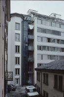
Title (German)
Luzern, Hirschengraben 15, Architekt Peter Erni, Hofseite
Caption
Photographer keyword: old and new
Caption (German)
Schlagwort Bestandsbildner: alt und neu
Record Name
Dia_287-34210

Title (German)
Luzern, Hirschengraben 15, Repro aus "Werk, Bauen + Wohnen+, 12/90"
Caption
Photographer keyword: old and new
Caption (German)
Schlagwort Bestandsbildner: alt und neu
Record Name
Dia_287-34211

Title (German)
Luzern, Hirschengraben 15, Architekt Peter Erni, Hofseite
Caption
Photographer keyword: old and new
Caption (German)
Schlagwort Bestandsbildner: alt und neu
Record Name
Dia_287-34212

Title (German)
Luzern, Hirschengraben 15, Architekt Peter Erni, Hofseite
Caption
Photographer keyword: old and new
Caption (German)
Schlagwort Bestandsbildner: alt und neu
Record Name
Dia_287-34213

Title (German)
Luzern, Pilatusstrasse
Caption
Photographer keyword: new building
Caption (German)
Schlagwort Bestandsbildner: Neubau
Record Name
Dia_287-34214

Title (German)
Luzern, Pilatusstrasse
Caption
Photographer keyword: old and new
Caption (German)
Schlagwort Bestandsbildner: alt und neu
Record Name
Dia_287-34215

Title (German)
Luzern, Pilatusstrasse, Schw. Bankgesellschaft
Caption
Photographer keyword: new building
Caption (German)
Schlagwort Bestandsbildner: Neubau
Record Name
Dia_287-34216

Title (German)
Luzern, Pilatusstrasse
Caption
Photographer keyword: old and new
Caption (German)
Schlagwort Bestandsbildner: alt und neu
Record Name
Dia_287-34217

Title (German)
Luzern, Theaterstrasse
Caption
Photographer keyword: old and new
Caption (German)
Schlagwort Bestandsbildner: alt und neu
Record Name
Dia_287-34218

Title (German)
Luzern, Theaterstrasse
Caption
Photographer keyword: old and new
Caption (German)
Schlagwort Bestandsbildner: alt und neu
Record Name
Dia_287-34219

Title (German)
Luzern, Theaterstrasse
Caption
Photographer keyword: new building
Caption (German)
Schlagwort Bestandsbildner: Neubau
Record Name
Dia_287-34220

Title (German)
Luzern, Theaterstrasse
Caption
Photographer keyword: new building
Caption (German)
Schlagwort Bestandsbildner: Neubau
Record Name
Dia_287-34221

Title (German)
Luzern, Winkelriedstrasse
Caption
Photographer keyword: old and new
Caption (German)
Schlagwort Bestandsbildner: alt und neu
Record Name
Dia_287-34222

Title (German)
Luzern, Reussbrücke und Hotelkanten
Caption
Photographer keyword: new building
Caption (German)
Schlagwort Bestandsbildner: Neubau
Record Name
Dia_287-34223

Title (German)
Maastricht, An der südlichen Stadtmauer
Caption
Photographer keyword: old and new
Caption (German)
Schlagwort Bestandsbildner: alt und neu. Unscharfe Aufnahme
Record Name
Dia_287-34224

Title (German)
Maastricht, "Wunde" für Stadtmauer
Caption
Photographer keyword: old and new
Caption (German)
Schlagwort Bestandsbildner: alt und neu
Record Name
Dia_287-34225

Title (German)
Maastricht, Academic voor Schoone Kunsten
Caption
Photographer keyword: old and new
Caption (German)
Schlagwort Bestandsbildner: alt und neu
Record Name
Dia_287-34226

Title (German)
Maastricht, Academic voor schoone Kunsten
Caption
Photographer keyword: old and new
Caption (German)
Schlagwort Bestandsbildner: alt und neu
Record Name
Dia_287-34227

Title (German)
Maastricht, Academic voor schoone Kunsten
Caption
Photographer keyword: old and new
Caption (German)
Schlagwort Bestandsbildner: alt und neu
Record Name
Dia_287-34228

Title (German)
Maastricht, Academic voor schoone Kunsten
Caption
Photographer keyword: new building
Caption (German)
Schlagwort Bestandsbildner: Neubau
Record Name
Dia_287-34229

Title (German)
Maastricht, Academic voor schoone Kunsten
Caption
Photographer keyword: new building
Caption (German)
Schlagwort Bestandsbildner: Neubau
Record Name
Dia_287-34230

Title (German)
Maastricht, Academic voor schoone Kunsten
Caption
Photographer keyword: old and new
Caption (German)
Schlagwort Bestandsbildner: alt und neu
Record Name
Dia_287-34231

Title (German)
Maastricht, Aula, Jo Coenen, unterirdisch
Caption
Photographer keyword: new building
Caption (German)
Schlagwort Bestandsbildner: Neubau
Record Name
Dia_287-34232

Title (German)
Maastricht, Aula, Jo Coenen, unterirdisch
Caption
Photographer keyword: new building
Caption (German)
Schlagwort Bestandsbildner: Neubau
Record Name
Dia_287-34233

Title (German)
Maastricht, Aula, Jo Coenen, unterirdisch
Caption
Photographer keyword: new building
Caption (German)
Schlagwort Bestandsbildner: Neubau
Record Name
Dia_287-34234

Title (German)
Maastricht, Aula, Jo Coenen, unterirdisch
Caption
Photographer keyword: new building
Caption (German)
Schlagwort Bestandsbildner: Neubau
Record Name
Dia_287-34235

Title (German)
Maastricht, Aula, Jo Coenen, unterirdisch
Caption
Photographer keyword: new building
Caption (German)
Schlagwort Bestandsbildner: Neubau
Record Name
Dia_287-34236

Title (German)
Maastricht, Aula, Jo Coenen, unterirdisch
Caption
Photographer keyword: new building
Caption (German)
Schlagwort Bestandsbildner: Neubau
Record Name
Dia_287-34237

Title (German)
Maastricht, Aula, Jo Coenen, unterirdisch
Caption
Photographer keyword: new building
Caption (German)
Schlagwort Bestandsbildner: Neubau
Record Name
Dia_287-34238

Title (German)
Maastricht, Aula, Jo Coenen, unterirdisch
Caption
Photographer keyword: new building
Caption (German)
Schlagwort Bestandsbildner: Neubau
Record Name
Dia_287-34239

Title (German)
Maastricht, Bassin 120
Caption
Photographer keyword: old and new
Caption (German)
Schlagwort Bestandsbildner: alt und neu
Record Name
Dia_287-34240

Title (German)
Maastricht, Bassin 120
Caption
Photographer keyword: old and new
Caption (German)
Schlagwort Bestandsbildner: alt und neu
Record Name
Dia_287-34241

Title (German)
Maastricht, Bonnefantenmuseum Aldo Rossi
Caption
Photographer keyword: new building
Caption (German)
Schlagwort Bestandsbildner: Neubau
Record Name
Dia_287-34242

Title (German)
Maastricht, Capuzijnerstraat, Charles Vandenhove
Caption
Photographer keyword: old and new
Caption (German)
Schlagwort Bestandsbildner: alt und neu
Record Name
Dia_287-34243

Title (German)
Maastricht, Capuzijnerstraat, Charles Vandenhove
Caption
Photographer keyword: old and new
Caption (German)
Schlagwort Bestandsbildner: alt und neu
Record Name
Dia_287-34244

Title (German)
Maastricht, Céramique-Gelände, Bonefantenmuseum von Aldo Rossi
Caption
Photographer keyword: new building
Caption (German)
Schlagwort Bestandsbildner: Neubau
Record Name
Dia_287-34245

Title (German)
Maastricht, Céramique
Caption
Photographer keyword: new building
Caption (German)
Schlagwort Bestandsbildner: Neubau
Record Name
Dia_287-34246

Title (German)
Maastricht, Céramique
Caption
Photographer keyword: new building
Caption (German)
Schlagwort Bestandsbildner: Neubau
Record Name
Dia_287-34247

Title (German)
Maastricht, Céramique Modelle von d. Maas aus nach Osten
Caption
Photographer keyword: new building
Caption (German)
Schlagwort Bestandsbildner: Neubau
Record Name
Dia_287-34248

Title (German)
Maastricht, Céramique Modell, Blick nach Norden
Caption
Photographer keyword: new building
Caption (German)
Schlagwort Bestandsbildner: Neubau
Record Name
Dia_287-34249

Title (German)
Maastricht, Céramique Modell von Westen nach Osten
Caption
Photographer keyword: new building
Caption (German)
Schlagwort Bestandsbildner: Neubau
Record Name
Dia_287-34250

Title (German)
Maastricht, Céramique
Caption
Photographer keyword: new building
Caption (German)
Schlagwort Bestandsbildner: Neubau
Record Name
Dia_287-34251

Title (German)
Maastricht, Céramique
Caption
Photographer keyword: new building
Caption (German)
Schlagwort Bestandsbildner: Neubau
Record Name
Dia_287-34252

Title (German)
Maastricht, Céramique
Caption
Photographer keyword: new building
Caption (German)
Schlagwort Bestandsbildner: Neubau
Record Name
Dia_287-34253

Title (German)
Maastricht, Céramique
Caption
Photographer keyword: new building
Caption (German)
Schlagwort Bestandsbildner: Neubau
Record Name
Dia_287-34254

Title (German)
Maastricht, Céramique
Caption
Photographer keyword: new building
Caption (German)
Schlagwort Bestandsbildner: Neubau
Record Name
Dia_287-34255

Title (German)
Maastricht, Céramique
Caption
Photographer keyword: new building
Caption (German)
Schlagwort Bestandsbildner: Neubau
Record Name
Dia_287-34256

Title (German)
Maastricht, Céramique
Caption
Photographer keyword: new building
Caption (German)
Schlagwort Bestandsbildner: Neubau
Record Name
Dia_287-34257

Title (German)
Maastricht, Céramique
Caption
Photographer keyword: new building
Caption (German)
Schlagwort Bestandsbildner: Neubau
Record Name
Dia_287-34258


Title (German)
Maastricht, Céramique
Caption
Photographer keyword: new building
Caption (German)
Schlagwort Bestandsbildner: Neubau
Record Name
Dia_287-34259

Title (German)
Maastricht, Céramique
Caption
Photographer keyword: old and new
Caption (German)
Schlagwort Bestandsbildner: alt und neu
Record Name
Dia_287-34260

Title (German)
Maastricht, Céramique, alte Halle
Caption
Photographer keyword: old and new
Caption (German)
Schlagwort Bestandsbildner: alt und neu
Record Name
Dia_287-34261

Title (German)
Maastricht, Céramique, Turm an der Maas
Caption
Photographer keyword: old and new
Caption (German)
Schlagwort Bestandsbildner: alt und neu
Record Name
Dia_287-34262

Title (German)
Maastricht, Céramique, alte Halle
Caption
Photographer keyword: old and new
Caption (German)
Schlagwort Bestandsbildner: alt und neu
Record Name
Dia_287-34263

Title (German)
Maastricht, Céramique, alte Halle
Caption
Photographer keyword: old and new
Caption (German)
Schlagwort Bestandsbildner: alt und neu
Record Name
Dia_287-34264

Title (German)
Maastricht, Céramique, altes Haus an der Maas
Caption
Photographer keyword: old and new
Caption (German)
Schlagwort Bestandsbildner: alt und neu
Record Name
Dia_287-34265

Title (German)
Maastricht, Groote Gracht, reparierter Giebel
Caption
Photographer keyword: old and new
Caption (German)
Schlagwort Bestandsbildner: alt und neu
Record Name
Dia_287-34266

Title (German)
Maastricht, Groote Gracht, reparierter Giebel
Caption
Photographer keyword: old and new
Caption (German)
Schlagwort Bestandsbildner: alt und neu
Record Name
Dia_287-34267

Title (German)
Maastricht, Herdenkingsplein
Caption
Photographer keyword: new building
Caption (German)
Schlagwort Bestandsbildner: Neubau
Record Name
Dia_287-34268

Title (German)
Maastricht, Herdenkingsplein
Caption
Photographer keyword: new building
Caption (German)
Schlagwort Bestandsbildner: Neubau
Record Name
Dia_287-34269

Title (German)
Maastricht, Herdenkingsplein
Caption
Photographer keyword: new building
Caption (German)
Schlagwort Bestandsbildner: Neubau
Record Name
Dia_287-34270

Title (German)
Maastricht, Herdenkingsplein
Caption
Photographer keyword: new building
Caption (German)
Schlagwort Bestandsbildner: Neubau
Record Name
Dia_287-34271

Title (German)
Maastricht, Hochschule für Bildende Kunst
Caption
Photographer keyword: old and new
Caption (German)
Schlagwort Bestandsbildner: alt und neu
Record Name
Dia_287-34272

Title (German)
Maastricht, Hochschule für Bildende Kunst
Caption
Photographer keyword: old and new
Caption (German)
Schlagwort Bestandsbildner: alt und neu
Record Name
Dia_287-34273

Title (German)
Maastricht, Hooghfrankrijk-Noord
Caption
Photographer keyword: new building
Caption (German)
Schlagwort Bestandsbildner: Neubau
Record Name
Dia_287-34274

Title (German)
Maastricht, Hooghfrankrijk-Noord
Caption
Photographer keyword: new building
Caption (German)
Schlagwort Bestandsbildner: Neubau
Record Name
Dia_287-34275

Title (German)
Maastricht, Hooghfrankrijk-Noord, Ch. Vandenhove
Caption
Photographer keyword: new building
Caption (German)
Schlagwort Bestandsbildner: Neubau
Record Name
Dia_287-34276

Title (German)
Maastricht, Hooghfrankrijk-Noord
Caption
Photographer keyword: new building
Caption (German)
Schlagwort Bestandsbildner: Neubau
Record Name
Dia_287-34277

Title (German)
Maastricht, Hooghfrankrijk-Noord, Ch. Vandenhove
Caption
Photographer keyword: new building
Caption (German)
Schlagwort Bestandsbildner: Neubau
Record Name
Dia_287-34278

Title (German)
Maastricht, Hooghfrankrijk-Noord
Caption
Photographer keyword: new building
Caption (German)
Schlagwort Bestandsbildner: Neubau
Record Name
Dia_287-34279

Title (German)
Maastricht, Kamer von Koophandel
Caption
Photographer keyword: new building
Caption (German)
Schlagwort Bestandsbildner: Neubau
Record Name
Dia_287-34280

Title (German)
Maastricht, Kamer von Koophandel, Architekt Jo Coenen
Caption
Photographer keyword: new building
Caption (German)
Schlagwort Bestandsbildner: Neubau
Record Name
Dia_287-34281

Title (German)
Maastricht, Kamer von Koophandel, Architekt Jo Coenen
Caption
Photographer keyword: new building
Caption (German)
Schlagwort Bestandsbildner: Neubau
Record Name
Dia_287-34282

Title (German)
Maastricht, Kamer von Koophandel, Architekt Jo Coenen
Caption
Photographer keyword: new building
Caption (German)
Schlagwort Bestandsbildner: Neubau
Record Name
Dia_287-34283

Title (German)
Maastricht, Kamer von Koophandel, Architekt Jo Coenen
Caption
Photographer keyword: new building
Caption (German)
Schlagwort Bestandsbildner: Neubau
Record Name
Dia_287-34284

Title (German)
Maastricht, Kamer von Koophandel, Architekt Jo Coenen
Caption
Photographer keyword: new building
Caption (German)
Schlagwort Bestandsbildner: Neubau
Record Name
Dia_287-34285

Title (German)
Maastricht, Kamer von Koophandel, Architekt Jo Coenen
Caption
Photographer keyword: new building
Caption (German)
Schlagwort Bestandsbildner: Neubau
Record Name
Dia_287-34286

Title (German)
Maastricht, Kamer von Koophandel, Architekt Jo Coenen
Caption
Photographer keyword: new building
Caption (German)
Schlagwort Bestandsbildner: Neubau
Record Name
Dia_287-34287

Title (German)
Maastricht, Kunstschule, Architekt Aerts…
Caption
Photographer keyword: new building
Caption (German)
Schlagwort Bestandsbildner: Neubau
Record Name
Dia_287-34288

Title (German)
Maastricht, Kunstschule, Architekt Aerts…
Caption
Photographer keyword: new building
Caption (German)
Schlagwort Bestandsbildner: Neubau
Record Name
Dia_287-34289

Title (German)
Maastricht, Misericordeplatz
Caption
Photographer keyword: old and new
Caption (German)
Schlagwort Bestandsbildner: alt und neu
Record Name
Dia_287-34290

Title (German)
Maastricht, Misericordeplein
Caption
Photographer keyword: old and new
Caption (German)
Schlagwort Bestandsbildner: alt und neu
Record Name
Dia_287-34291

Title (German)
Maastricht, Misericordeplein
Caption
Photographer keyword: old and new
Caption (German)
Schlagwort Bestandsbildner: alt und neu
Record Name
Dia_287-34292
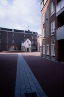
Title (German)
Maastricht, Misericordeplein
Caption
Photographer keyword: old and new
Caption (German)
Schlagwort Bestandsbildner: alt und neu
Record Name
Dia_287-34293

Title (German)
Maastricht, Misericordeplein
Caption
Photographer keyword: old and new
Caption (German)
Schlagwort Bestandsbildner: alt und neu
Record Name
Dia_287-34294

Title (German)
Maastricht, Misericordeplein
Caption
Photographer keyword: old and new
Caption (German)
Schlagwort Bestandsbildner: alt und neu
Record Name
Dia_287-34295

Title (German)
Maastricht, Misericordeplatz
Caption
Photographer keyword: old and new
Caption (German)
Schlagwort Bestandsbildner: alt und neu
Record Name
Dia_287-34296

Title (German)
Maastricht, Misericordeplein
Caption
Photographer keyword: old and new
Caption (German)
Schlagwort Bestandsbildner: alt und neu
Record Name
Dia_287-34297

Title (German)
Maastricht, Misericordeplein
Caption
Photographer keyword: old and new
Caption (German)
Schlagwort Bestandsbildner: alt und neu
Record Name
Dia_287-34298

Title (German)
Maastricht, Misericordeplein
Caption
Photographer keyword: old and new
Caption (German)
Schlagwort Bestandsbildner: alt und neu
Record Name
Dia_287-34299

Title (German)
Maastricht, Misericordeplein
Caption
Photographer keyword: old and new
Caption (German)
Schlagwort Bestandsbildner: alt und neu
Record Name
Dia_287-34300

Title (German)
Maastricht, Misericordeplein
Caption
Photographer keyword: old and new
Caption (German)
Schlagwort Bestandsbildner: alt und neu
Record Name
Dia_287-34301

Title (German)
Maastricht, Anbau Hotel Pauw
Caption
Photographer keyword: old and new
Caption (German)
Schlagwort Bestandsbildner: alt und neu
Record Name
Dia_287-34302

Title (German)
Maastricht, Stochstraatviertel
Caption
Photographer keyword: old and new
Caption (German)
Schlagwort Bestandsbildner: alt und neu
Record Name
Dia_287-34303

Title (German)
Maastricht, Stochstraatviertel
Caption
Photographer keyword: old and new
Caption (German)
Schlagwort Bestandsbildner: alt und neu
Record Name
Dia_287-34304

Title (German)
Maastricht, Neubauten in der Altstadt
Caption
Photographer keyword: old and new
Caption (German)
Schlagwort Bestandsbildner: alt und neu
Record Name
Dia_287-34305

Title (German)
Maastricht, Maastricht
Caption
Photographer keyword: old and new
Caption (German)
Schlagwort Bestandsbildner: alt und neu
Record Name
Dia_287-34306

Title (German)
Maastricht, Neubauten in der Altstadt
Caption
Photographer keyword: new building
Caption (German)
Schlagwort Bestandsbildner: Neubau
Record Name
Dia_287-34307

Title (German)
Maastricht, Neubauten in der Altstadt
Caption
Photographer keyword: new building
Caption (German)
Schlagwort Bestandsbildner: Neubau
Record Name
Dia_287-34308

Title (German)
Maastricht, Maaskahn, festgemacht bei Kamer von Koophandel
Caption
Photographer keyword: old and new
Caption (German)
Schlagwort Bestandsbildner: alt und neu
Record Name
Dia_287-34309

Title (German)
Madra, Valmagila Gesamtansicht, Ensemble
Caption
Photographer keyword: old and new
Caption (German)
Schlagwort Bestandsbildner: alt und neu
Record Name
Dia_287-34310

Title (German)
Madra, Valmaglia
Caption
Photographer keyword: new building
Caption (German)
Schlagwort Bestandsbildner: Neubau
Record Name
Dia_287-34311

Title (German)
Magdeburg, Dom Vorhallenportal (Jungfrauenportal), Parisurteil (Apel)
Caption
Photographer keyword: old and new
Caption (German)
Schlagwort Bestandsbildner: alt und neu
Record Name
Dia_287-34312

Title (German)
Magdeburg, Dom, Tor und Appel, Vogel füttert
Caption
Photographer keyword: old and new
Caption (German)
Schlagwort Bestandsbildner: alt und neu
Record Name
Dia_287-34313

Title (German)
Magdeburg, Dom, Kluge Jungfrauen
Caption
Photographer keyword: old and new
Caption (German)
Schlagwort Bestandsbildner: alt und neu
Record Name
Dia_287-34314

Title (German)
Magdeburg, U. L. Frauenkloster, Bronzetür von Apel, Renovierung
Caption
Photographer keyword: old and new
Caption (German)
Schlagwort Bestandsbildner: alt und neu
Record Name
Dia_287-34315

Title (German)
Magdeburg, Dom, Tor von Appel
Caption
Photographer keyword: old and new
Caption (German)
Schlagwort Bestandsbildner: alt und neu
Record Name
Dia_287-34316

Title (German)
Magdeburg, Dom, Portal der Klugen und törrichten Jungfrauen, Tür von Appel; Parisurteil
Caption
Photographer keyword: old and new
Caption (German)
Schlagwort Bestandsbildner: alt und neu
Record Name
Dia_287-34317

Title (German)
Magdeburg, Dom, Parisurteil, Broncetür von Appel
Caption
Photographer keyword: old and new
Caption (German)
Schlagwort Bestandsbildner: alt und neu
Record Name
Dia_287-34318

Title (German)
Magdeburg, Liebfrauenkloster, Wiederaufbau
Caption
Photographer keyword: old and new
Caption (German)
Schlagwort Bestandsbildner: alt und neu
Record Name
Dia_287-34319

Title (German)
Mailand, Porta Nuova
Caption
Photographer keyword: old and new
Caption (German)
Schlagwort Bestandsbildner: alt und neu
Record Name
Dia_287-34320

Title (German)
Mailand, Porta Nuova
Caption
Photographer keyword: old and new
Caption (German)
Schlagwort Bestandsbildner: alt und neu
Record Name
Dia_287-34321

Title (German)
Mailand, Porta Nuova
Caption
Photographer keyword: old and new
Caption (German)
Schlagwort Bestandsbildner: alt und neu
Record Name
Dia_287-34322
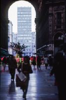
Title (German)
Mailand, Gall. Vittorio Emanuele, nach Süden
Caption
Photographer keyword: old and new
Caption (German)
Schlagwort Bestandsbildner: alt und neu
Record Name
Dia_287-34323

Title (German)
Mailand, Gall. Vittorio Emanuele, nach Süden
Caption
Photographer keyword: new building
Caption (German)
Schlagwort Bestandsbildner: Neubau
Record Name
Dia_287-34324

Title (German)
Mainz, Rathausterrasse
Caption
Photographer keyword: old and new
Caption (German)
Schlagwort Bestandsbildner: alt und neu
Record Name
Dia_287-34325

Title (German)
Mainz, Rathausviertel
Caption
Photographer keyword: old and new
Caption (German)
Schlagwort Bestandsbildner: alt und neu
Record Name
Dia_287-34326

Title (German)
Mainz, Sanierungsgebiet, südlich vom Dom
Caption
Photographer keyword: old and new
Caption (German)
Schlagwort Bestandsbildner: alt und neu
Record Name
Dia_287-34327

Title (German)
Mainz, Rathaus, Stadttor
Caption
Photographer keyword: old and new
Caption (German)
Schlagwort Bestandsbildner: alt und neu
Record Name
Dia_287-34328

Title (German)
Mainz, Rathausviertel
Caption
Photographer keyword: old and new
Caption (German)
Schlagwort Bestandsbildner: alt und neu
Record Name
Dia_287-34329

Title (German)
Mainz, Rathausviertel
Caption
Photographer keyword: new building
Caption (German)
Schlagwort Bestandsbildner: Neubau
Record Name
Dia_287-34330

Title (German)
Malix, Kinderrutsche, Nutzung
Caption
Photographer keyword: old and new
Caption (German)
Schlagwort Bestandsbildner: alt und neu
Record Name
Dia_287-34331

Title (German)
Malix, Kinderrutsche
Caption
Photographer keyword: old and new
Caption (German)
Schlagwort Bestandsbildner: alt und neu
Record Name
Dia_287-34332

Title (German)
Malmedy, Stadtbild, Dachlandschaft
Caption
Photographer keyword: new building
Caption (German)
Schlagwort Bestandsbildner: Neubau
Record Name
Dia_287-34333

Title (German)
Mariastern, Ausstellung, Vitrinen (Filz)
Caption
Photographer keyword: old and new
Caption (German)
Schlagwort Bestandsbildner: alt und neu
Record Name
Dia_287-34334

Title (German)
Mariastern, Ausstellung, Vitrinen (Filz)
Caption
Photographer keyword: old and new
Caption (German)
Schlagwort Bestandsbildner: alt und neu
Record Name
Dia_287-34335

Title (German)
Markdorf, Altes Schloss
Caption
Photographer keyword: old and new
Caption (German)
Schlagwort Bestandsbildner: alt und neu
Record Name
Dia_287-34336

Title (German)
Markdorf, Ensemble
Caption
Photographer keyword: new building
Caption (German)
Schlagwort Bestandsbildner: Neubau
Record Name
Dia_287-34337

Title (German)
Markdorf, Markdorf
Caption
Photographer keyword: new building
Caption (German)
Schlagwort Bestandsbildner: Neubau
Record Name
Dia_287-34338

Title (German)
Markdorf, Neubauten im Zentrum
Caption
Photographer keyword: new building
Caption (German)
Schlagwort Bestandsbildner: Neubau
Record Name
Dia_287-34339

Title (German)
Markdorf, Ensemble
Caption
Photographer keyword: new building
Caption (German)
Schlagwort Bestandsbildner: Neubau
Record Name
Dia_287-34340

Title (German)
Markdorf, Garage, Dachmaterialien
Caption
Photographer keyword: new building
Caption (German)
Schlagwort Bestandsbildner: Neubau
Record Name
Dia_287-34341

Title (German)
Markdorf, Garage und Turm
Caption
Photographer keyword: new building
Caption (German)
Schlagwort Bestandsbildner: Neubau
Record Name
Dia_287-34342

Title (German)
Marl
Caption
Photographer keyword: new building
Caption (German)
Schlagwort Bestandsbildner: Neubau
Record Name
Dia_287-34343

Title (German)
Marne-la-Vallée, R. Bofill, Historismus/Stadtplanung
Caption
Photographer keyword: new building
Caption (German)
Schlagwort Bestandsbildner: Neubau
Record Name
Dia_287-34344

Title (German)
Marne-la-Vallée, R. Bofill, Historismus/Stadtplanung
Caption
Photographer keyword: new building
Caption (German)
Schlagwort Bestandsbildner: Neubau
Record Name
Dia_287-34345

Title (German)
Marne-la-Vallée, R. Bofill, Historismus/Stadtplanung
Caption
Photographer keyword: new building
Caption (German)
Schlagwort Bestandsbildner: Neubau
Record Name
Dia_287-34346

Title (German)
Marne-la-Vallée, R. Bofill, Historismus/Stadtplanung
Caption
Photographer keyword: new building
Caption (German)
Schlagwort Bestandsbildner: Neubau
Record Name
Dia_287-34347

Title (German)
Marne-la-Vallée, R. Bofill, Historismus/Stadtplanung
Caption
Photographer keyword: new building
Caption (German)
Schlagwort Bestandsbildner: Neubau
Record Name
Dia_287-34348