 E-PICS - ETHBIB.Bildarchiv


The images presented on this page are part of E-Pics, a service provided by the ETH-Bibliothek of ETH Zurich. You find here static medium resolution images published under the creative commons
CC-BY-SA license or with the Public Domain Mark. This means that you are free to share, copy and redistribute the material in any medium or format; that you are free to remix, transform, and build upon the material for any purpose, even commercially, under the following conditions: You must give appropriate credit, provide a link to the license, and indicate if changes were made.
- More information about E-Pics is available at https://www.e-pics.ethz.ch
- This catalog can also be accessed at https://ba.e-pics.ethz.ch/ . There you can download the image in a higher resolution.

Title (German)
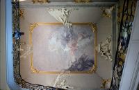
Bensberg, Ratshaus, Schloss frühes Holzmodell
Caption
Photographer keyword: old and new
Caption (German)
Schlagwort Bestandsbildner: alt und neu
Record Name
Dia_287-31832

Title (German)
Bensberg, Ratshaus, Schloss, Modell bei Gottfried Böhm
Caption
Photographer keyword: old and new
Caption (German)
Schlagwort Bestandsbildner: alt und neu
Record Name
Dia_287-31833

Title (German)
Bensberg, Ratshaus, aussen
Caption
Photographer keyword: new building
Caption (German)
Schlagwort Bestandsbildner: Neubau
Record Name
Dia_287-31834

Title (German)
Bensberg, Ratshaus, aussen
Caption
Photographer keyword: new building
Caption (German)
Schlagwort Bestandsbildner: Neubau
Record Name
Dia_287-31835

Title (German)
Bensberg, Ratshaus, aussen, Rathaus von Gottfried Böhm
Caption
Photographer keyword: new building
Caption (German)
Schlagwort Bestandsbildner: Neubau
Record Name
Dia_287-31836

Title (German)
Bensberg, Ratshaus, aussen, Rathaus von Gottfried Böhm
Caption
Photographer keyword: new building
Caption (German)
Schlagwort Bestandsbildner: Neubau
Record Name
Dia_287-31837

Title (German)
Bensberg, Ratshaus, aussen, Rathaus von Gottfried Böhm
Caption
Photographer keyword: old and new
Caption (German)
Schlagwort Bestandsbildner: alt und neu
Record Name
Dia_287-31838

Title (German)
Bensberg, Ratshaus, aussen, Rathaus von Gottfried Böhm
Caption
Photographer keyword: old and new
Caption (German)
Schlagwort Bestandsbildner: alt und neu
Record Name
Dia_287-31839

Title (German)
Bensberg, Ratshaus, aussen, Rathaus von Gottfried Böhm
Caption
Photographer keyword: new building
Caption (German)
Schlagwort Bestandsbildner: Neubau
Record Name
Dia_287-31840

Title (German)
Bensberg, Ratshaus, aussen, Rathaus von Gottfried Böhm
Caption
Photographer keyword: new building
Caption (German)
Schlagwort Bestandsbildner: Neubau
Record Name
Dia_287-31841

Title (German)
Bensberg, Ratshaus, aussen, Rathaus von Gottfried Böhm
Caption
Photographer keyword: old and new
Caption (German)
Schlagwort Bestandsbildner: alt und neu
Record Name
Dia_287-31842

Title (German)
Bensberg, Ratshaus, aussen, Rathaus von Gottfried Böhm
Caption
Photographer keyword: old and new
Caption (German)
Schlagwort Bestandsbildner: alt und neu
Record Name
Dia_287-31843

Title (German)
Bensberg, Ratshaus, aussen, Rathaus von Gottfried Böhm, Hof und Turm
Caption
Photographer keyword: new building
Caption (German)
Schlagwort Bestandsbildner: Neubau
Record Name
Dia_287-31844

Title (German)
Bensberg, Ratshaus, innen, Rathaus von Gottfried Böhm
Caption
Photographer keyword: new building
Caption (German)
Schlagwort Bestandsbildner: Neubau
Record Name
Dia_287-31845

Title (German)
Bensberg, Ratshaus, innen, Rathaus von Gottfried Böhm
Caption
Photographer keyword: new building
Caption (German)
Schlagwort Bestandsbildner: Neubau
Record Name
Dia_287-31846

Title (German)
Bensberg, Ratshaus, innen, Rathaus von Gottfried Böhm
Caption
Photographer keyword: new building
Caption (German)
Schlagwort Bestandsbildner: Neubau
Record Name
Dia_287-31847

Title (German)
Bensberg, Ratshaus, innen, Rathaus von Gottfried Böhm
Caption
Photographer keyword: new building
Caption (German)
Schlagwort Bestandsbildner: Neubau
Record Name
Dia_287-31848

Title (German)
Bensberg, Ratshaus, innen, Rathaus von Gottfried Böhm, Ratssaal
Caption
Photographer keyword: old and new
Caption (German)
Schlagwort Bestandsbildner: alt und neu
Record Name
Dia_287-31849

Title (German)
Bensberg, Ratshaus, innen, Rathaus von Gottfried Böhm, Ratssaal
Caption
Photographer keyword: old and new
Caption (German)
Schlagwort Bestandsbildner: alt und neu
Record Name
Dia_287-31850

Title (German)
Bensberg, Ratshaus, Kapitelle, Rathaus Palas, neue Kapitelle von Binding
Caption
Photographer keyword: old and new
Caption (German)
Schlagwort Bestandsbildner: alt und neu
Record Name
Dia_287-31851

Title (German)
Bensberg, Ratshaus, Kapitelle, Rathaus Palas, neue Kapitelle von Binding
Caption
Photographer keyword: old and new
Caption (German)
Schlagwort Bestandsbildner: alt und neu
Record Name
Dia_287-31852

Title (German)
Bensberg, Ratshaus, Kapitelle, Rathaus Palas, neue Kapitelle von Binding
Caption
Photographer keyword: old and new
Caption (German)
Schlagwort Bestandsbildner: alt und neu
Record Name
Dia_287-31853

Title (German)
Bensberg, Ratshaus, Kapitelle, Rathaus Palas, neue Kapitelle von Binding
Caption
Photographer keyword: old and new
Caption (German)
Schlagwort Bestandsbildner: alt und neu
Record Name
Dia_287-31854

Title (German)
Bensberg-Refrath, Kinderdorf Bethanien von Gottfried Böhm
Caption
Photographer keyword: new building
Caption (German)
Schlagwort Bestandsbildner: Neubau
Record Name
Dia_287-31855

Title (German)
Bensberg-Refrath, Kinderdorf Bethanien von Gottfried Böhm
Caption
Photographer keyword: new building
Caption (German)
Schlagwort Bestandsbildner: Neubau
Record Name
Dia_287-31856

Title (German)
Bensberg-Refrath, Kinderdorf Bethanien von Gottfried Böhm
Caption
Photographer keyword: new building
Caption (German)
Schlagwort Bestandsbildner: Neubau
Record Name
Dia_287-31857

Title (German)
Bensberg-Refrath, Kinderdorf Bethanien von Gottfried Böhm
Caption
Photographer keyword: new building
Caption (German)
Schlagwort Bestandsbildner: Neubau
Record Name
Dia_287-31858

Title (German)
Bensberg-Refrath, Kinderdorf Bethanien von Gottfried Böhm
Caption
Photographer keyword: new building
Caption (German)
Schlagwort Bestandsbildner: Neubau
Record Name
Dia_287-31859

Title (German)
Bensberg-Refrath, Kinderdorf Bethanien von Gottfried Böhm
Caption
Photographer keyword: new building
Caption (German)
Schlagwort Bestandsbildner: Neubau
Record Name
Dia_287-31860

Title (German)
Bensberg-Refrath, Kinderdorf Bethanien von Gottfried Böhm
Caption
Photographer keyword: new building
Caption (German)
Schlagwort Bestandsbildner: Neubau
Record Name
Dia_287-31861

Title (German)
Bensberg-Refrath, Kinderdorf Bethanien von Gottfried Böhm
Caption
Photographer keyword: new building
Caption (German)
Schlagwort Bestandsbildner: Neubau
Record Name
Dia_287-31862

Title (German)
Bensberg-Refrath, Kinderdorf Bethanien von Gottfried Böhm
Caption
Photographer keyword: new building
Caption (German)
Schlagwort Bestandsbildner: Neubau
Record Name
Dia_287-31863

Title (German)
Bensberg-Refrath, Kinderdorf Bethanien von Gottfried Böhm
Caption
Photographer keyword: new building
Caption (German)
Schlagwort Bestandsbildner: Neubau
Record Name
Dia_287-31864

Title (German)
Bensberg-Refrath, Kinderdorf Bethanien von Gottfried Böhm
Caption
Photographer keyword: new building
Caption (German)
Schlagwort Bestandsbildner: Neubau
Record Name
Dia_287-31866

Title (German)
Bensberg-Refrath, Kinderdorf Bethanien von Gottfried Böhm
Caption
Photographer keyword: new building
Caption (German)
Schlagwort Bestandsbildner: Neubau
Record Name
Dia_287-31867

Title (German)
Bensberg-Refrath, Kinderdorf Bethanien von Gottfried Böhm
Caption
Photographer keyword: new building
Caption (German)
Schlagwort Bestandsbildner: Neubau
Record Name
Dia_287-31868

Title (German)
Bensberg-Refrath, Kinderdorf Bethanien von Gottfried Böhm
Caption
Photographer keyword: new building
Caption (German)
Schlagwort Bestandsbildner: Neubau
Record Name
Dia_287-31869

Title (German)
Bensberg-Refrath, Kinderdorf Bethanien von Gottfried Böhm
Caption
Photographer keyword: new building
Caption (German)
Schlagwort Bestandsbildner: Neubau
Record Name
Dia_287-31870

Title (German)
Bensberg-Refrath, Kinderdorf Bethanien von Gottfried Böhm
Caption
Photographer keyword: new building
Caption (German)
Schlagwort Bestandsbildner: Neubau
Record Name
Dia_287-31871

Title (German)
Bensberg-Refrath, Kinderdorf Bethanien von Gottfried Böhm
Caption
Photographer keyword: new building
Caption (German)
Schlagwort Bestandsbildner: Neubau
Record Name
Dia_287-31872

Title (German)
Bensberg-Refrath, Kinderdorf Bethanien von Gottfried Böhm
Caption
Photographer keyword: new building
Caption (German)
Schlagwort Bestandsbildner: Neubau
Record Name
Dia_287-31873

Title (German)
Bensberg-Refrath, Kinderdorf Bethanien von Gottfried Böhm
Caption
Photographer keyword: new building
Caption (German)
Schlagwort Bestandsbildner: Neubau
Record Name
Dia_287-31874

Title (German)
Bensberg-Refrath, Kinderdorf Bethanien von Gottfried Böhm
Caption
Photographer keyword: new building
Caption (German)
Schlagwort Bestandsbildner: Neubau
Record Name
Dia_287-31875

Title (German)
Bensberg-Refrath, Kinderdorf Bethanien von Gottfried Böhm
Caption
Photographer keyword: new building
Caption (German)
Schlagwort Bestandsbildner: Neubau
Record Name
Dia_287-31876

Title (German)
Bensberg-Refrath, Kinderdorf Bethanien von Gottfried Böhm
Caption
Photographer keyword: new building
Caption (German)
Schlagwort Bestandsbildner: Neubau
Record Name
Dia_287-31877

Title (German)
Berg am Irchel, Baulücke
Caption
Photographer keyword: new building
Caption (German)
Schlagwort Bestandsbildner: Neubau
Record Name
Dia_287-31878

Title (German)
Berg am Irchel, Haus von der Landi, 1939
Caption
Photographer keyword: new building
Caption (German)
Schlagwort Bestandsbildner: Neubau
Record Name
Dia_287-31879

Title (German)
Berg am Irchel, Baustelle
Caption
Photographer keyword: new building
Caption (German)
Schlagwort Bestandsbildner: Neubau
Record Name
Dia_287-31880

Title (German)
Berg am Irchel, Ausbau, Nutzung
Caption
Photographer keyword: old and new
Caption (German)
Schlagwort Bestandsbildner: alt und neu
Record Name
Dia_287-31881

Title (German)
Berg am Irchel, Ausbau, Nutzung
Caption
Photographer keyword: new building
Caption (German)
Schlagwort Bestandsbildner: Neubau
Record Name
Dia_287-31882

Title (German)
Bergisch Gladbach, Krankenhaus D. Hartmann, Fenster neu
Caption
Photographer keyword: new building
Caption (German)
Schlagwort Bestandsbildner: Neubau
Record Name
Dia_287-31883

Title (German)
Bergisch Gladbach, Krankenhaus D. Hartmann, Fenster neu
Caption
Photographer keyword: new building
Caption (German)
Schlagwort Bestandsbildner: Neubau
Record Name
Dia_287-31884

Title (German)
Bergün, Neubau in Stall, ganz hinten Haus, Marques-Zurkirchen
Caption
Photographer keyword: old and new
Caption (German)
Schlagwort Bestandsbildner: alt und neu
Record Name
Dia_287-31885

Title (German)
Bergün, Neubau von Marques-Zurkirchen
Caption
Photographer keyword: old and new
Caption (German)
Schlagwort Bestandsbildner: alt und neu
Record Name
Dia_287-31886

Title (German)
Bergün, Neubau von Marques-Zurkirchen
Caption
Photographer keyword: old and new
Caption (German)
Schlagwort Bestandsbildner: alt und neu
Record Name
Dia_287-31887

Title (German)
Bergün, Neubau von Marques-Zurkirchen
Caption
Photographer keyword: old and new
Caption (German)
Schlagwort Bestandsbildner: alt und neu
Record Name
Dia_287-31888

Title (German)
Bergün, Neubau von Marques-Zurkirchen
Caption
Photographer keyword: old and new
Caption (German)
Schlagwort Bestandsbildner: alt und neu
Record Name
Dia_287-31889

Title (German)
Bergün, Neubau von Marques-Zurkirchen
Caption
Photographer keyword: old and new
Caption (German)
Schlagwort Bestandsbildner: alt und neu
Record Name
Dia_287-31890

Title (German)
Bergün, Neubau von Marques-Zurkirchen
Caption
Photographer keyword: old and new
Caption (German)
Schlagwort Bestandsbildner: alt und neu
Record Name
Dia_287-31891

Title (German)
Bergün, Neubau von Marques-Zurkirchen
Caption
Photographer keyword: old and new
Caption (German)
Schlagwort Bestandsbildner: alt und neu
Record Name
Dia_287-31892

Title (German)
Bergün, Neubau von Marques-Zurkirchen
Caption
Photographer keyword: old and new
Caption (German)
Schlagwort Bestandsbildner: alt und neu
Record Name
Dia_287-31893

Title (German)
Bergün, Neubau von Marques-Zurkirchen
Caption
Photographer keyword: old and new
Caption (German)
Schlagwort Bestandsbildner: alt und neu
Record Name
Dia_287-31894

Title (German)
Bergün, Neubau von Marques-Zurkirchen
Caption
Photographer keyword: old and new
Caption (German)
Schlagwort Bestandsbildner: alt und neu
Record Name
Dia_287-31895

Title (German)
Bergün, Neue Brücke
Caption
Photographer keyword: new building
Caption (German)
Schlagwort Bestandsbildner: Neubau
Record Name
Dia_287-31896

Title (German)
Berlin, Gedäcthniskirche
Caption
Photographer keyword: old and new
Caption (German)
Schlagwort Bestandsbildner: alt und neu
Record Name
Dia_287-31897

Title (German)
Berlin, Ruine, Gedächtniskirche
Caption
Photographer keyword: old and new
Caption (German)
Schlagwort Bestandsbildner: alt und neu
Record Name
Dia_287-31898

Title (German)
Berlin, Gedäcthniskirche
Caption
Photographer keyword: old and new
Caption (German)
Schlagwort Bestandsbildner: alt und neu
Record Name
Dia_287-31899

Title (German)
Berlin, Gedäcthniskirche
Caption
Photographer keyword: old and new
Caption (German)
Schlagwort Bestandsbildner: alt und neu
Record Name
Dia_287-31900

Title (German)
Berlin, Anhalter Bahnhof, Ruine
Caption
Photographer keyword: old and new
Caption (German)
Schlagwort Bestandsbildner: alt und neu
Record Name
Dia_287-31901

Title (German)
Berlin, Anhalter Bahnhof
Caption
Photographer keyword: old and new
Caption (German)
Schlagwort Bestandsbildner: alt und neu
Record Name
Dia_287-31902

Title (German)
Berlin, Anhalter Bahnhof
Caption
Photographer keyword: old and new
Caption (German)
Schlagwort Bestandsbildner: alt und neu
Record Name
Dia_287-31903

Title (German)
Berlin, Auswärtiges Amt
Caption
Photographer keyword: old and new
Caption (German)
Schlagwort Bestandsbildner: alt und neu
Record Name
Dia_287-31904

Title (German)
Berlin, Behrenstrasse, Kräne
Caption
Photographer keyword: new building
Caption (German)
Schlagwort Bestandsbildner: Neubau
Record Name
Dia_287-31905

Title (German)
Berlin, Behrenstrasse 28, Verkleidung
Caption
Photographer keyword: new building
Caption (German)
Schlagwort Bestandsbildner: Neubau
Record Name
Dia_287-31906

Title (German)
Berlin, Behrenstrasse 28, Steinverkleidung
Caption
Photographer keyword: new building
Caption (German)
Schlagwort Bestandsbildner: Neubau
Record Name
Dia_287-31907

Title (German)
Berlin, Behrenstrasse 28, Plattenverkleidung
Caption
Photographer keyword: new building
Caption (German)
Schlagwort Bestandsbildner: Neubau
Record Name
Dia_287-31908
Title (German)
Berlin, Schloss Charlottenburg, Treppenhaus
Caption
Photographer keyword: old and new
Caption (German)
Schlagwort Bestandsbildner: alt und neu
Record Name
Dia_287-31910

Title (German)
Berlin, Charlottenburg, Orangerie, neue Fresken
Caption
Photographer keyword: old and new
Caption (German)
Schlagwort Bestandsbildner: alt und neu
Record Name
Dia_287-31911

Title (German)
Berlin, Charlottenburg, Orangerie, neue Fresken
Caption
Photographer keyword: old and new
Caption (German)
Schlagwort Bestandsbildner: alt und neu
Record Name
Dia_287-31912

Title (German)
Berlin, Dahlem, Museum frühchristliche Sammlung
Caption
Photographer keyword: old and new
Caption (German)
Schlagwort Bestandsbildner: alt und neu
Record Name
Dia_287-31913

Title (German)
Berlin-Mitte, Dircksenstrasse
Caption
Photographer keyword: old and new
Caption (German)
Schlagwort Bestandsbildner: alt und neu
Record Name
Dia_287-31914

Title (German)
Berlin-Mitte, Dircksenstrasse
Caption
Photographer keyword: new building
Caption (German)
Schlagwort Bestandsbildner: Neubau
Record Name
Dia_287-31915

Title (German)
Berlin-Mitte, Dorotheenstrasse, Rekonstruktion nach Umbau
Caption
Photographer keyword: old and new
Caption (German)
Schlagwort Bestandsbildner: alt und neu
Record Name
Dia_287-31916

Title (German)
Berlin-Mitte, Dorotheenstrasse, Umbau Plattenbau
Caption
Photographer keyword: old and new
Caption (German)
Schlagwort Bestandsbildner: alt und neu
Record Name
Dia_287-31917

Title (German)
Berlin-Mitte, Dorotheenstrasse, Bundespresseamt, Anbau
Caption
Photographer keyword: old and new
Caption (German)
Schlagwort Bestandsbildner: alt und neu
Record Name
Dia_287-31918

Title (German)
Berlin-Mitte, Dorotheenstrasse, Bundespresseamt, Anbau
Caption
Photographer keyword: old and new
Caption (German)
Schlagwort Bestandsbildner: alt und neu
Record Name
Dia_287-31919

Title (German)
Berlin-Mitte, Dorotheenstrasse, Umbau Plattenbau
Caption
Photographer keyword: old and new
Caption (German)
Schlagwort Bestandsbildner: alt und neu
Record Name
Dia_287-31920

Title (German)
Berlin, Französische Strasse, Hotel 4 Jahreszeiten
Caption
Photographer keyword: new building
Caption (German)
Schlagwort Bestandsbildner: Neubau
Record Name
Dia_287-31921

Title (German)
Berlin, Französische Strasse 48, Architekt Sawade
Caption
Photographer keyword: new building
Caption (German)
Schlagwort Bestandsbildner: Neubau
Record Name
Dia_287-31922

Title (German)
Berlin, Französische Strasse, Fassadenbemusterung
Caption
Photographer keyword: old and new
Caption (German)
Schlagwort Bestandsbildner: alt und neu
Record Name
Dia_287-31923

Title (German)
Berlin-Friedenau, Wiesbadenerstrasse, internationale Begenungsstrasse
Caption
Photographer keyword: new building
Caption (German)
Schlagwort Bestandsbildner: Neubau
Record Name
Dia_287-31924

Title (German)
Berlin-Friedenau, Wiesbadenerstrasse, internationale Begenungsstrasse
Caption
Photographer keyword: new building
Caption (German)
Schlagwort Bestandsbildner: Neubau
Record Name
Dia_287-31925

Title (German)
Berlin, Friedrichsstrasse
Caption
Photographer keyword: new building
Caption (German)
Schlagwort Bestandsbildner: Neubau
Record Name
Dia_287-31926

Title (German)
Berlin, Friedrichsstrasse, 8FG-Bank
Caption
Photographer keyword: new building
Caption (German)
Schlagwort Bestandsbildner: Neubau
Record Name
Dia_287-31927

Title (German)
Berlin, Friedrichsstrasse, Eckbau
Caption
Photographer keyword: new building
Caption (German)
Schlagwort Bestandsbildner: Neubau
Record Name
Dia_287-31928

Title (German)
Berlin, Friedrichsstrasse, Passage
Caption
Photographer keyword: new building
Caption (German)
Schlagwort Bestandsbildner: Neubau
Record Name
Dia_287-31929
Title (German)
Berlin, Friedrichsstrasse, passage
Caption
Photographer keyword: new building
Caption (German)
Schlagwort Bestandsbildner: Neubau
Record Name
Dia_287-31930

Title (German)
Berlin, Friedrichsstrasse, Lafayette, Jean Nouvel
Caption
Photographer keyword: new building
Caption (German)
Schlagwort Bestandsbildner: Neubau
Record Name
Dia_287-31931

Title (German)
Berlin, Friedrichsstrasse, Kaufhaus Lafayette, Jean Nouvel
Caption
Photographer keyword: new building
Caption (German)
Schlagwort Bestandsbildner: Neubau
Record Name
Dia_287-31932

Title (German)
Berlin, Friedrichsstrasse, Kaufhaus Lafayette, Jean Nouvel
Caption
Photographer keyword: new building
Caption (German)
Schlagwort Bestandsbildner: Neubau
Record Name
Dia_287-31933

Title (German)
Berlin, U-Bahnhof, Friedrichsstrasse, Fassadenclemente f. d. Friedrichsstrasse
Caption
Photographer keyword: new building
Caption (German)
Schlagwort Bestandsbildner: Neubau
Record Name
Dia_287-31934
Title (German)
Berlin, Friedrichsstrasse, Verkleidungssteine
Caption
Photographer keyword: new building
Caption (German)
Schlagwort Bestandsbildner: Neubau
Record Name
Dia_287-31935

Title (German)
Berlin, Friedrichsstrasse / Franzstrasse, Haus Kollhoff
Caption
Photographer keyword: new building
Caption (German)
Schlagwort Bestandsbildner: Neubau
Record Name
Dia_287-31936

Title (German)
Berlin, Friedrichsstrasse / Franzstrasse, Haus Kollhoff
Caption
Photographer keyword: new building
Caption (German)
Schlagwort Bestandsbildner: Neubau
Record Name
Dia_287-31937

Title (German)
Berlin, Friedrichsstrasse / Franzstrasse, Haus Kollhoff
Caption
Photographer keyword: new building
Caption (German)
Schlagwort Bestandsbildner: Neubau
Record Name
Dia_287-31938

Title (German)
Berlin, Friedrichsstrasse / Franzstrasse, Haus Kollhoff
Caption
Photographer keyword: new building
Caption (German)
Schlagwort Bestandsbildner: Neubau
Record Name
Dia_287-31939

Title (German)
Berlin, Ecke Friedrichstrasse / Mohrenstrasse
Caption
Photographer keyword: new building
Caption (German)
Schlagwort Bestandsbildner: Neubau
Record Name
Dia_287-31940

Title (German)
Berlin, Ecke Friedrichstrasse / Mohrenstrasse
Caption
Photographer keyword: new building
Caption (German)
Schlagwort Bestandsbildner: Neubau
Record Name
Dia_287-31941

Title (German)
Berlin, Ehemaliges Ost, Karl-Liebknechtstrasse
Caption
Photographer keyword: new building
Caption (German)
Schlagwort Bestandsbildner: Neubau
Record Name
Dia_287-31942

Title (German)
Berlin, Ehemaliges Ost, Karl-Liebknechtstrasse
Caption
Photographer keyword: new building
Caption (German)
Schlagwort Bestandsbildner: Neubau
Record Name
Dia_287-31943

Title (German)
Berlin-Kreuzberg, Alte Jakobstrasse, Ritterstrasse, Reichsschuldenverwaltung von Bestelmayr 1919
Caption
Photographer keyword: old and new
Caption (German)
Schlagwort Bestandsbildner: alt und neu
Record Name
Dia_287-31944

Title (German)
Berlin-Kreuzberg, Alte Jakobstrasse
Caption
Photographer keyword: new building
Caption (German)
Schlagwort Bestandsbildner: Neubau
Record Name
Dia_287-31945

Title (German)
Berlin-Kreuzberg, Bethaniendamm, Baracke
Caption
Photographer keyword: new building
Caption (German)
Schlagwort Bestandsbildner: Neubau
Record Name
Dia_287-31946

Title (German)
Berlin-Kreuzberg, Feilnerstrasse, Schinkelfassade Rob Keier
Caption
Photographer keyword: new building
Caption (German)
Schlagwort Bestandsbildner: Neubau
Record Name
Dia_287-31947

Title (German)
Berlin-Kreuzberg, Hallesches Ufer, Eklektizismus
Caption
Photographer keyword: new building
Caption (German)
Schlagwort Bestandsbildner: Neubau
Record Name
Dia_287-31948

Title (German)
Berlin-Kreuzberg, Hallesches Ufer, Eklektizismus
Caption
Photographer keyword: new building
Caption (German)
Schlagwort Bestandsbildner: Neubau
Record Name
Dia_287-31949

Title (German)
Berlin-Kreuzberg, Hallesches Ufer, Eklektizismus
Caption
Photographer keyword: new building
Caption (German)
Schlagwort Bestandsbildner: Neubau
Record Name
Dia_287-31950

Title (German)
Berlin-Kreuzberg, Hallesches Ufer, Eklektizismus
Caption
Photographer keyword: new building
Caption (German)
Schlagwort Bestandsbildner: Neubau
Record Name
Dia_287-31951

Title (German)
Berlin-Kreuzberg, Hallesches Ufer, Eklektizismus
Caption
Photographer keyword: new building
Caption (German)
Schlagwort Bestandsbildner: Neubau
Record Name
Dia_287-31952

Title (German)
Berlin-Kreuzberg, Hallesches Ufer, Eklektizismus
Caption
Photographer keyword: new building
Caption (German)
Schlagwort Bestandsbildner: Neubau
Record Name
Dia_287-31953

Title (German)
Berlin-Kreuzberg, Hasenheide, Eckberg
Caption
Photographer keyword: new building
Caption (German)
Schlagwort Bestandsbildner: Neubau
Record Name
Dia_287-31954

Title (German)
Berlin-Kreuzberg, Hasenheide, Eckberg, Blockrandbebauung
Caption
Photographer keyword: new building
Caption (German)
Schlagwort Bestandsbildner: Neubau
Record Name
Dia_287-31955

Title (German)
Berlin-Kreuzberg, Feilnerstrasse, Schinkelfassade Rob Keier, Historismus, Kopie
Caption
Photographer keyword: new building
Caption (German)
Schlagwort Bestandsbildner: Neubau
Record Name
Dia_287-31956

Title (German)
Berlin-Kreuzberg, Jüdisches Museum
Caption
Photographer keyword: old and new
Caption (German)
Schlagwort Bestandsbildner: alt und neu
Record Name
Dia_287-31957

Title (German)
Berlin-Kreuzberg, Kottbusserstrasse, Ostseite
Caption
Photographer keyword: old and new
Caption (German)
Schlagwort Bestandsbildner: alt und neu
Record Name
Dia_287-31958

Title (German)
Berlin-Kreuzberg, Kottbusserstrasse, Ostseite
Caption
Photographer keyword: old and new
Caption (German)
Schlagwort Bestandsbildner: alt und neu
Record Name
Dia_287-31959

Title (German)
Berlin-Kreuzberg, Kottbusserstrasse, Ostseite
Caption
Photographer keyword: old and new
Caption (German)
Schlagwort Bestandsbildner: alt und neu
Record Name
Dia_287-31960

Title (German)
Berlin-Kreuzberg, Kottbusserstrasse, Ostseite
Caption
Photographer keyword: old and new
Caption (German)
Schlagwort Bestandsbildner: alt und neu
Record Name
Dia_287-31961

Title (German)
Berlin-Kreuzberg, Lindenstrasse
Caption
Photographer keyword: new building
Caption (German)
Schlagwort Bestandsbildner: Neubau
Record Name
Dia_287-31962

Title (German)
Berlin-Kreuzberg, Lindenstrasse
Caption
Photographer keyword: old and new
Caption (German)
Schlagwort Bestandsbildner: alt und neu
Record Name
Dia_287-31963

Title (German)
Berlin-Kreuzberg, Mehringplatz, Ensemble, Denkmalbegriff
Caption
Photographer keyword: old and new
Caption (German)
Schlagwort Bestandsbildner: alt und neu
Record Name
Dia_287-31964

Title (German)
Berlin-Kreuzberg, Mehringplatz, Ensemble, Denkmalbegriff
Caption
Photographer keyword: old and new
Caption (German)
Schlagwort Bestandsbildner: alt und neu
Record Name
Dia_287-31965

Title (German)
Berlin-Kreuzberg, Mehringplatz, Ensemble, Denkmalbegriff
Caption
Photographer keyword: old and new
Caption (German)
Schlagwort Bestandsbildner: alt und neu
Record Name
Dia_287-31966

Title (German)
Berlin-Kreuzberg, Nannijnstrasse
Caption
Photographer keyword: old and new
Caption (German)
Schlagwort Bestandsbildner: alt und neu
Record Name
Dia_287-31967

Title (German)
Berlin-Kreuzberg, Ritterstrasse
Caption
Photographer keyword: new building
Caption (German)
Schlagwort Bestandsbildner: Neubau
Record Name
Dia_287-31968

Title (German)
Berlin-Kreuzberg, Ritterstrasse
Caption
Photographer keyword: new building
Caption (German)
Schlagwort Bestandsbildner: Neubau
Record Name
Dia_287-31969

Title (German)
Berlin-Kreuzberg, Ritterstrasse
Caption
Photographer keyword: new building
Caption (German)
Schlagwort Bestandsbildner: Neubau
Record Name
Dia_287-31970

Title (German)
Berlin-Kreuzberg, Ritterstrasse / Alte Jakobstrasse
Caption
Photographer keyword: old and new
Caption (German)
Schlagwort Bestandsbildner: alt und neu
Record Name
Dia_287-31971

Title (German)
Berlin-Kreuzberg, Schlesische Strasse, Falkensteinstrasse, Architekt Alvaro Siza
Caption
Photographer keyword: new building
Caption (German)
Schlagwort Bestandsbildner: Neubau
Record Name
Dia_287-31972

Title (German)
Berlin-Kreuzberg, Schlesische Strasse, Falkensteinstrasse, Architekt Alvaro Siza
Caption
Photographer keyword: old and new
Caption (German)
Schlagwort Bestandsbildner: alt und neu
Record Name
Dia_287-31973

Title (German)
Berlin-Kreuzberg, Schlesische Strasse, Falkensteinstrasse, Architekt Alvaro Siza
Caption
Photographer keyword: new building
Caption (German)
Schlagwort Bestandsbildner: Neubau
Record Name
Dia_287-31974

Title (German)
Berlin-Kreuzberg, Schlesisches Tor, Neubau von Alvaro Siza
Caption
Photographer keyword: new building
Caption (German)
Schlagwort Bestandsbildner: Neubau
Record Name
Dia_287-31975

Title (German)
Berlin-Kreuzberg, Schlesisches Tor, Neubau von Alvaro Siza
Caption
Photographer keyword: old and new
Caption (German)
Schlagwort Bestandsbildner: alt und neu
Record Name
Dia_287-31976

Title (German)
Berlin-Kreuzberg, Yorkstrasse, Riemershof
Caption
Photographer keyword: old and new
Caption (German)
Schlagwort Bestandsbildner: alt und neu
Record Name
Dia_287-31977

Title (German)
Berlin-Kreuzberg, Yorkstrasse, Riemershof
Caption
Photographer keyword: old and new
Caption (German)
Schlagwort Bestandsbildner: alt und neu
Record Name
Dia_287-31978

Title (German)
Berlin-Kreuzberg, Yorkstrasse, Riemershof
Caption
Photographer keyword: old and new
Caption (German)
Schlagwort Bestandsbildner: alt und neu
Record Name
Dia_287-31979

Title (German)
Berlin, Ku-Damm, Hotel am Zoo mit Anf-Stockg. Von Baumgarten
Caption
Photographer keyword: old and new
Caption (German)
Schlagwort Bestandsbildner: alt und neu
Record Name
Dia_287-31980

Title (German)
Berlin, Kurfürstenstrasse 26 / 27
Caption
Photographer keyword: old and new
Caption (German)
Schlagwort Bestandsbildner: alt und neu
Record Name
Dia_287-31981

Title (German)
Berlin, Kurfürstenstrasse 26
Caption
Photographer keyword: old and new
Caption (German)
Schlagwort Bestandsbildner: alt und neu
Record Name
Dia_287-31982

Title (German)
Berlin, Kurfürstendamm, Café Kranzler
Caption
Photographer keyword: old and new
Caption (German)
Schlagwort Bestandsbildner: alt und neu
Record Name
Dia_287-31983

Title (German)
Berlin, Kurfürstendamm, Café Kranzler
Caption
Photographer keyword: old and new
Caption (German)
Schlagwort Bestandsbildner: alt und neu
Record Name
Dia_287-31984

Title (German)
Berlin, Kurfürstendamm, Hotel am Zoo
Caption
Photographer keyword: old and new
Caption (German)
Schlagwort Bestandsbildner: alt und neu
Record Name
Dia_287-31985

Title (German)
Berlin, Kurfürstendamm, Hotel am Zoo
Caption
Photographer keyword: old and new
Caption (German)
Schlagwort Bestandsbildner: alt und neu
Record Name
Dia_287-31986

Title (German)
Berlin, Ost, Leipziger Strasse
Caption
Photographer keyword: new building
Caption (German)
Schlagwort Bestandsbildner: Neubau
Record Name
Dia_287-31987

Title (German)
Berlin, Lindenstrasse, Berlinmuseum / Jüdisches Museum
Caption
Photographer keyword: old and new
Caption (German)
Schlagwort Bestandsbildner: alt und neu
Record Name
Dia_287-31988

Title (German)
Berlin, Märkisches Viertel
Caption
Photographer keyword: new building
Caption (German)
Schlagwort Bestandsbildner: Neubau
Record Name
Dia_287-31989

Title (German)
Berlin, Märkisches Viertel
Caption
Photographer keyword: new building
Caption (German)
Schlagwort Bestandsbildner: Neubau
Record Name
Dia_287-31990

Title (German)
Berlin, Märkisches Viertel
Caption
Photographer keyword: new building
Caption (German)
Schlagwort Bestandsbildner: Neubau
Record Name
Dia_287-31991

Title (German)
Berlin, Märkisches Viertel
Caption
Photographer keyword: new building
Caption (German)
Schlagwort Bestandsbildner: Neubau
Record Name
Dia_287-31992

Title (German)
Berlin, Märkisches Viertel
Caption
Photographer keyword: new building
Caption (German)
Schlagwort Bestandsbildner: Neubau
Record Name
Dia_287-31993

Title (German)
Berlin, Mitte, S-Bahnhof, Alexanderplatz
Caption
Photographer keyword: old and new
Caption (German)
Schlagwort Bestandsbildner: alt und neu
Record Name
Dia_287-31994

Title (German)
Berlin, Mitte, S-Bahnhof, Alexanderplatz
Caption
Photographer keyword: old and new
Caption (German)
Schlagwort Bestandsbildner: alt und neu
Record Name
Dia_287-31995

Title (German)
Berlin, Mitte, Charlottenstrasse, Rossibauten
Caption
Photographer keyword: new building
Caption (German)
Schlagwort Bestandsbildner: Neubau
Record Name
Dia_287-31996

Title (German)
Berlin, Mitte, Charlottenstrasse, Rossibauten
Caption
Photographer keyword: new building
Caption (German)
Schlagwort Bestandsbildner: Neubau
Record Name
Dia_287-31997

Title (German)
Berlin, Mitte, Charlottenstrasse, Aldo Rossi 48
Caption
Photographer keyword: new building
Caption (German)
Schlagwort Bestandsbildner: Neubau
Record Name
Dia_287-31998

Title (German)
Berlin, Mitte, Charlottenstrasse, Hof, Rossibauten
Caption
Photographer keyword: new building
Caption (German)
Schlagwort Bestandsbildner: Neubau
Record Name
Dia_287-31999

Title (German)
Berlin, Mitte, Charlottenstrasse, Aldo Rossi, Hof
Caption
Photographer keyword: new building
Caption (German)
Schlagwort Bestandsbildner: Neubau
Record Name
Dia_287-32000
Title (German)
Berlin, Mitte, Charlottenstrasse, Rossibauten, Hof
Caption
Photographer keyword: new building
Caption (German)
Schlagwort Bestandsbildner: Neubau
Record Name
Dia_287-32001

Title (German)
Berlin, Mitte, Gipsstrasse
Caption
Photographer keyword: old and new
Caption (German)
Schlagwort Bestandsbildner: alt und neu
Record Name
Dia_287-32002

Title (German)
Berlin, Mitte, Gipsstrasse
Caption
Photographer keyword: old and new
Caption (German)
Schlagwort Bestandsbildner: alt und neu
Record Name
Dia_287-32003

Title (German)
Berlin, Mitte, Gipsstrasse, Sophie-Gipshöfe, Aussenanlagen
Caption
Photographer keyword: old and new
Caption (German)
Schlagwort Bestandsbildner: alt und neu
Record Name
Dia_287-32004

Title (German)
Berlin, Mitte, Lindenstrasse um 1984, Siedlung von H. Kollhoff
Caption
Photographer keyword: new building
Caption (German)
Schlagwort Bestandsbildner: Neubau
Record Name
Dia_287-32005

Title (German)
Berlin, Mitte, Lindenstrasse um 1984, Siedlung von H. Kollhoff
Caption
Photographer keyword: new building
Caption (German)
Schlagwort Bestandsbildner: Neubau
Record Name
Dia_287-32006

Title (German)
Berlin, Mitte, Potsdamerplatz
Caption
Photographer keyword: new building
Caption (German)
Schlagwort Bestandsbildner: Neubau
Record Name
Dia_287-32007

Title (German)
Berlin, Pariser Platz, Hotel Adlon
Caption
Photographer keyword: old and new
Caption (German)
Schlagwort Bestandsbildner: alt und neu
Record Name
Dia_287-32008

Title (German)
Berlin, Pariser Platz, Liebermannhaus (Kleihnes)
Caption
Photographer keyword: old and new
Caption (German)
Schlagwort Bestandsbildner: alt und neu
Record Name
Dia_287-32009

Title (German)
Berlin, Pariser Platz, Liebermannhaus (J. Kleihnes)
Caption
Photographer keyword: new building
Caption (German)
Schlagwort Bestandsbildner: Neubau
Record Name
Dia_287-32010

Title (German)
Berlin, Potsdamer Platz, Sony-Center
Caption
Photographer keyword: old and new
Caption (German)
Schlagwort Bestandsbildner: alt und neu
Record Name
Dia_287-32011

Title (German)
Berlin, Potsdamer Platz, Sony-Center
Caption
Photographer keyword: new building
Caption (German)
Schlagwort Bestandsbildner: Neubau
Record Name
Dia_287-32012

Title (German)
Berlin, Potsdamer Platz, Sony-Center
Caption
Photographer keyword: new building
Caption (German)
Schlagwort Bestandsbildner: Neubau
Record Name
Dia_287-32013

Title (German)
Berlin, Potsdamer Platz, Sony-Center
Caption
Photographer keyword: new building
Caption (German)
Schlagwort Bestandsbildner: Neubau
Record Name
Dia_287-32014

Title (German)
Berlin, Potsdamer Platz, Sony-Center
Caption
Photographer keyword: new building
Caption (German)
Schlagwort Bestandsbildner: Neubau
Record Name
Dia_287-32015

Title (German)
Berlin, Potsdamer Platz, Sony-Center
Caption
Photographer keyword: new building
Caption (German)
Schlagwort Bestandsbildner: Neubau
Record Name
Dia_287-32016

Title (German)
Berlin, Berlinmuseum und Jüdisches Museum
Caption
Photographer keyword: old and new
Caption (German)
Schlagwort Bestandsbildner: alt und neu
Record Name
Dia_287-32017

Title (German)
Berlin, Lindenstrasse, Berlinermuseum
Caption
Photographer keyword: old and new
Caption (German)
Schlagwort Bestandsbildner: alt und neu
Record Name
Dia_287-32018

Title (German)
Berlin, Berlinermuseum
Caption
Photographer keyword: old and new
Caption (German)
Schlagwort Bestandsbildner: alt und neu
Record Name
Dia_287-32019

Title (German)
Berlin, Berlinmuseum und Jüdisches Museum
Caption
Photographer keyword: old and new
Caption (German)
Schlagwort Bestandsbildner: alt und neu
Record Name
Dia_287-32020

Title (German)
Berlin, Berlinmuseum und Jüdisches Museum
Caption
Photographer keyword: old and new
Caption (German)
Schlagwort Bestandsbildner: alt und neu
Record Name
Dia_287-32021

Title (German)
Berlin, Lindenstrasse, Berlinmuseum / Jüdisches Museum
Caption
Photographer keyword: old and new
Caption (German)
Schlagwort Bestandsbildner: alt und neu
Record Name
Dia_287-32022

Title (German)
Berlin, Jüdisches Museum
Caption
Photographer keyword: new building
Caption (German)
Schlagwort Bestandsbildner: Neubau
Record Name
Dia_287-32023

Title (German)
Berlin, Jüdisches Museum, Lindenstrasse
Caption
Photographer keyword: new building
Caption (German)
Schlagwort Bestandsbildner: Neubau
Record Name
Dia_287-32024

Title (German)
Berlin, Jüdisches Museum, Lindenstrasse
Caption
Photographer keyword: new building
Caption (German)
Schlagwort Bestandsbildner: Neubau
Record Name
Dia_287-32025

Title (German)
Berlin, Jüdisches Museum, Lindenstrasse
Caption
Photographer keyword: new building
Caption (German)
Schlagwort Bestandsbildner: Neubau
Record Name
Dia_287-32026

Title (German)
Berlin, Jüdisches Museum, Lindenstrasse
Caption
Photographer keyword: new building
Caption (German)
Schlagwort Bestandsbildner: Neubau
Record Name
Dia_287-32027

Title (German)
Berlin, Jüdisches Museum, Lindenstrasse
Caption
Photographer keyword: new building
Caption (German)
Schlagwort Bestandsbildner: Neubau
Record Name
Dia_287-32028

Title (German)
Berlin, Jüdisches Museum, Lindenstrasse
Caption
Photographer keyword: new building
Caption (German)
Schlagwort Bestandsbildner: Neubau
Record Name
Dia_287-32029

Title (German)
Berlin, Jüdisches Museum
Caption
Photographer keyword: new building
Caption (German)
Schlagwort Bestandsbildner: Neubau
Record Name
Dia_287-32030

Title (German)
Berlin, Jüdisches Museum, Garten
Caption
Photographer keyword: new building
Caption (German)
Schlagwort Bestandsbildner: Neubau
Record Name
Dia_287-32031

Title (German)
Berlin, Neues Museum, Treppenhaus, Plg. Chipperfield
Caption
Photographer keyword: old and new
Caption (German)
Schlagwort Bestandsbildner: alt und neu
Record Name
Dia_287-32032

Title (German)
Berlin, Neues Museum, Treppenhaus von Chipperfield
Caption
Photographer keyword: old and new
Caption (German)
Schlagwort Bestandsbildner: alt und neu
Record Name
Dia_287-32033

Title (German)
Berlin, Museumsinsel, Neues Museum
Caption
Photographer keyword: old and new
Caption (German)
Schlagwort Bestandsbildner: alt und neu
Record Name
Dia_287-32034

Title (German)
Berlin, Neues Museum, ehemaliges Treppenhaus
Caption
Photographer keyword: old and new
Caption (German)
Schlagwort Bestandsbildner: alt und neu
Record Name
Dia_287-32035

Title (German)
Berlin, Neues Museum, ehemaliges Treppenhaus
Caption
Photographer keyword: old and new
Caption (German)
Schlagwort Bestandsbildner: alt und neu
Record Name
Dia_287-32036

Title (German)
Berlin, Neues Museum, ehemaliges Treppenhaus
Caption
Photographer keyword: old and new
Caption (German)
Schlagwort Bestandsbildner: alt und neu
Record Name
Dia_287-32037

Title (German)
Berlin, Museumsinsel, Wettbewerb, Nr. 1055
Caption
Photographer keyword: old and new
Caption (German)
Schlagwort Bestandsbildner: alt und neu
Record Name
Dia_287-32038

Title (German)
Berlin, Museumsinsel, Wettbewerb, Nr. 1545
Caption
Photographer keyword: old and new
Caption (German)
Schlagwort Bestandsbildner: alt und neu
Record Name
Dia_287-32039

Title (German)
Berlin, Museumsinsel, Wettbewerb, Nr. 2100
Caption
Photographer keyword: old and new
Caption (German)
Schlagwort Bestandsbildner: alt und neu
Record Name
Dia_287-32040

Title (German)
Berlin, Museumsinsel, Wettbewerb, Nr. 2362
Caption
Photographer keyword: old and new
Caption (German)
Schlagwort Bestandsbildner: alt und neu
Record Name
Dia_287-32041

Title (German)
Berlin, Museumsinsel, Wettbewerb, Nr. 3049
Caption
Photographer keyword: old and new
Caption (German)
Schlagwort Bestandsbildner: alt und neu
Record Name
Dia_287-32042

Title (German)
Berlin, Museumsinsel, Wettbewerb, Nr. 2855
Caption
Photographer keyword: old and new
Caption (German)
Schlagwort Bestandsbildner: alt und neu
Record Name
Dia_287-32043

Title (German)
Berlin, Museumsinsel, Wettbewerb, Nr. 4459
Caption
Photographer keyword: old and new
Caption (German)
Schlagwort Bestandsbildner: alt und neu
Record Name
Dia_287-32044

Title (German)
Berlin, Museumsinsel, Wettbewerb, Nr. 4834
Caption
Photographer keyword: old and new
Caption (German)
Schlagwort Bestandsbildner: alt und neu
Record Name
Dia_287-32045

Title (German)
Berlin, Museumsinsel, Wettbewerb, Nr. 6106
Caption
Photographer keyword: old and new
Caption (German)
Schlagwort Bestandsbildner: alt und neu
Record Name
Dia_287-32046

Title (German)
Berlin, Museumsinsel, Wettbewerb, Nr. 6626
Caption
Photographer keyword: old and new
Caption (German)
Schlagwort Bestandsbildner: alt und neu
Record Name
Dia_287-32047

Title (German)
Berlin, Museumsinsel, Wettbewerb, Nr. 6933
Caption
Photographer keyword: old and new
Caption (German)
Schlagwort Bestandsbildner: alt und neu
Record Name
Dia_287-32048

Title (German)
Berlin, Museumsinsel, Wettbewerb, Nr. 7201
Caption
Photographer keyword: old and new
Caption (German)
Schlagwort Bestandsbildner: alt und neu
Record Name
Dia_287-32049

Title (German)
Berlin, Museumsinsel, Wettbewerb, Nr. 8174
Caption
Photographer keyword: old and new
Caption (German)
Schlagwort Bestandsbildner: alt und neu
Record Name
Dia_287-32050

Title (German)
Berlin, Museumsinsel, Wettbewerb, Nr. 8485
Caption
Photographer keyword: old and new
Caption (German)
Schlagwort Bestandsbildner: alt und neu
Record Name
Dia_287-32051

Title (German)
Berlin, Museumsinsel, Wettbewerb, Nr. 9231
Caption
Photographer keyword: old and new
Caption (German)
Schlagwort Bestandsbildner: alt und neu
Record Name
Dia_287-32052

Title (German)
Berlin, Museumsinsel, Wettbewerb, Nr. 9784
Caption
Photographer keyword: old and new
Caption (German)
Schlagwort Bestandsbildner: alt und neu
Record Name
Dia_287-32053

Title (German)
Berlin, Museumsinsel, Probe von David Chipperfield
Caption
Photographer keyword: old and new
Caption (German)
Schlagwort Bestandsbildner: alt und neu
Record Name
Dia_287-32054

Title (German)
Berlin, Nationalgalerie, M. u. d. Rke, Dachaufbauten
Caption
Photographer keyword: new building
Caption (German)
Schlagwort Bestandsbildner: Neubau
Record Name
Dia_287-32055

Title (German)
Berlin, Nationalgalerie, Fenster
Caption
Photographer keyword: new building
Caption (German)
Schlagwort Bestandsbildner: Neubau
Record Name
Dia_287-32056

Title (German)
Berlin, Nationalgalerie
Caption
Photographer keyword: new building
Caption (German)
Schlagwort Bestandsbildner: Neubau
Record Name
Dia_287-32057

Title (German)
Berlin, Neues Museum, Ergänzungsprobe Chippenfield
Caption
Photographer keyword: old and new
Caption (German)
Schlagwort Bestandsbildner: alt und neu
Record Name
Dia_287-32058

Title (German)
Berlin, Neues Museum, Ergänzungsprobe Chippenfield
Caption
Photographer keyword: old and new
Caption (German)
Schlagwort Bestandsbildner: alt und neu
Record Name
Dia_287-32059

Title (German)
Berlin, Oberschöneweide, Wilhelminahof, japanischer Garten
Caption
Photographer keyword: old and new
Caption (German)
Schlagwort Bestandsbildner: alt und neu
Record Name
Dia_287-32060

Title (German)
Berlin, Olympiastadion
Caption
Photographer keyword: old and new
Caption (German)
Schlagwort Bestandsbildner: alt und neu
Record Name
Dia_287-32061

Title (German)
Berlin, Olympiastadion
Caption
Photographer keyword: old and new
Caption (German)
Schlagwort Bestandsbildner: alt und neu
Record Name
Dia_287-32062

Title (German)
Berlin, Olympiaviertel, Corbusierhaus
Caption
Photographer keyword: new building
Caption (German)
Schlagwort Bestandsbildner: Neubau
Record Name
Dia_287-32063

Title (German)
Berlin, Pariser Platz
Caption
Photographer keyword: old and new
Caption (German)
Schlagwort Bestandsbildner: alt und neu
Record Name
Dia_287-32064

Title (German)
Berlin, Pariser Platz
Caption
Photographer keyword: old and new
Caption (German)
Schlagwort Bestandsbildner: alt und neu
Record Name
Dia_287-32065

Title (German)
Berlin, Pariser Platz
Caption
Photographer keyword: old and new
Caption (German)
Schlagwort Bestandsbildner: alt und neu
Record Name
Dia_287-32066

Title (German)
Berlin, Pariser Platz, Französische Botschaft von Portzenpourt
Caption
Photographer keyword: new building
Caption (German)
Schlagwort Bestandsbildner: Neubau
Record Name
Dia_287-32067

Title (German)
Berlin, Berliner Platz, Französische Botschaft
Caption
Photographer keyword: new building
Caption (German)
Schlagwort Bestandsbildner: Neubau
Record Name
Dia_287-32068

Title (German)
Berlin, Philharmonie H. Scharam
Caption
Photographer keyword: new building
Caption (German)
Schlagwort Bestandsbildner: Neubau
Record Name
Dia_287-32069

Title (German)
Berlin, Philharmonie H. Scharam
Caption
Photographer keyword: new building
Caption (German)
Schlagwort Bestandsbildner: Neubau
Record Name
Dia_287-32070

Title (German)
Berlin, Prenzlauer Berg, Fraunstrasse, neue Balkone
Caption
Photographer keyword: old and new
Caption (German)
Schlagwort Bestandsbildner: alt und neu
Record Name
Dia_287-32071

Title (German)
Berlin, Prenzlauerberg, Metzerstrasse
Caption
Photographer keyword: old and new
Caption (German)
Schlagwort Bestandsbildner: alt und neu
Record Name
Dia_287-32072

Title (German)
Berlin, Schweizer Botschaft, Kopie
Caption
Photographer keyword: old and new
Caption (German)
Schlagwort Bestandsbildner: alt und neu
Record Name
Dia_287-32073

Title (German)
Berlin, Schweizer Botschaft
Caption
Photographer keyword: old and new
Caption (German)
Schlagwort Bestandsbildner: alt und neu
Record Name
Dia_287-32074

Title (German)
Berlin, Schweizer Botschaft, Kopie
Caption
Photographer keyword: old and new
Caption (German)
Schlagwort Bestandsbildner: alt und neu
Record Name
Dia_287-32075

Title (German)
Berlin, Schweizer Botschaft
Caption
Photographer keyword: old and new
Caption (German)
Schlagwort Bestandsbildner: alt und neu
Record Name
Dia_287-32076

Title (German)
Berlin, Schweizer Botschaft, Kopie
Caption
Photographer keyword: old and new
Caption (German)
Schlagwort Bestandsbildner: alt und neu
Record Name
Dia_287-32077

Title (German)
Berlin, Schweizer Botschaft
Caption
Photographer keyword: old and new
Caption (German)
Schlagwort Bestandsbildner: alt und neu. Unscharfe Aufnahme
Record Name
Dia_287-32078

Title (German)
Berlin, Schweizer Botschaft, Kopie
Caption
Photographer keyword: old and new
Caption (German)
Schlagwort Bestandsbildner: alt und neu. Unscharfe Aufnahme
Record Name
Dia_287-32079

Title (German)
Berlin, Schweizer Botschaft, Kopie
Caption
Photographer keyword: old and new
Caption (German)
Schlagwort Bestandsbildner: alt und neu
Record Name
Dia_287-32080

Title (German)
Berlin, Schweizer Botschaft
Caption
Photographer keyword: old and new
Caption (German)
Schlagwort Bestandsbildner: alt und neu
Record Name
Dia_287-32081

Title (German)
Berlin, Schweizer Botschaft
Caption
Photographer keyword: old and new
Caption (German)
Schlagwort Bestandsbildner: alt und neu
Record Name
Dia_287-32082

Title (German)
Berlin, Schweizer Botschaft
Caption
Photographer keyword: old and new
Caption (German)
Schlagwort Bestandsbildner: alt und neu
Record Name
Dia_287-32083

Title (German)
Berlin, Schweizer Botschaft, Kopie
Caption
Photographer keyword: old and new
Caption (German)
Schlagwort Bestandsbildner: alt und neu
Record Name
Dia_287-32084

Title (German)
Berlin, Schweizer Botschaft
Caption
Photographer keyword: old and new
Caption (German)
Schlagwort Bestandsbildner: alt und neu
Record Name
Dia_287-32085

Title (German)
Berlin, Schweizer Botschaft, Kopie
Caption
Photographer keyword: old and new
Caption (German)
Schlagwort Bestandsbildner: alt und neu
Record Name
Dia_287-32086

Title (German)
Berlin, Schweizer Botschaft
Caption
Photographer keyword: old and new
Caption (German)
Schlagwort Bestandsbildner: alt und neu
Record Name
Dia_287-32087

Title (German)
Berlin, Schweizer Botschaft, Kopie
Caption
Photographer keyword: old and new
Caption (German)
Schlagwort Bestandsbildner: alt und neu
Record Name
Dia_287-32088

Title (German)
Berlin, Reichsluftfahrtministerium, Flur mit neuer Bel. (Merz)
Caption
Photographer keyword: old and new
Caption (German)
Schlagwort Bestandsbildner: alt und neu
Record Name
Dia_287-32089

Title (German)
Berlin, Reichsluftfahrtministerium, Flur
Caption
Photographer keyword: old and new
Caption (German)
Schlagwort Bestandsbildner: alt und neu
Record Name
Dia_287-32090

Title (German)
Berlin, Reichstag, Kuppel
Caption
Photographer keyword: old and new
Caption (German)
Schlagwort Bestandsbildner: alt und neu
Record Name
Dia_287-32091

Title (German)
Berlin, Reichstag, Kuppel
Caption
Photographer keyword: old and new
Caption (German)
Schlagwort Bestandsbildner: alt und neu
Record Name
Dia_287-32092

Title (German)
Berlin, Reichstag, Kuppel
Caption
Photographer keyword: old and new
Caption (German)
Schlagwort Bestandsbildner: alt und neu
Record Name
Dia_287-32093

Title (German)
Berlin, Reichstag
Caption
Photographer keyword: old and new
Caption (German)
Schlagwort Bestandsbildner: alt und neu
Record Name
Dia_287-32094

Title (German)
Berlin, Reichstag
Caption
Photographer keyword: old and new
Caption (German)
Schlagwort Bestandsbildner: alt und neu
Record Name
Dia_287-32095

Title (German)
Berlin, Reichstag
Caption
Photographer keyword: old and new
Caption (German)
Schlagwort Bestandsbildner: alt und neu
Record Name
Dia_287-32096

Title (German)
Berlin, Baustelle Reichstag
Caption
Photographer keyword: new building
Caption (German)
Schlagwort Bestandsbildner: Neubau
Record Name
Dia_287-32097

Title (German)
Berlin, Reichstag
Caption
Photographer keyword: old and new
Caption (German)
Schlagwort Bestandsbildner: alt und neu
Record Name
Dia_287-32098

Title (German)
Berlin, Reichstag
Caption
Photographer keyword: old and new
Caption (German)
Schlagwort Bestandsbildner: alt und neu
Record Name
Dia_287-32099

Title (German)
Berlin, Unter den Linden, Steinverkleidung
Caption
Photographer keyword: new building
Caption (German)
Schlagwort Bestandsbildner: Neubau
Record Name
Dia_287-32100

Title (German)
Berlin, Rummelsburg, Industriegelände, neu genutzt
Caption
Photographer keyword: old and new
Caption (German)
Schlagwort Bestandsbildner: alt und neu
Record Name
Dia_287-32101

Title (German)
Berlin, Rummelsburg, Industriegelände, neu genutzt
Caption
Photographer keyword: old and new
Caption (German)
Schlagwort Bestandsbildner: alt und neu
Record Name
Dia_287-32102

Title (German)
Berlin-Wedding, Seestrasse, Brandmauer
Caption
Photographer keyword: old and new
Caption (German)
Schlagwort Bestandsbildner: alt und neu
Record Name
Dia_287-32103

Title (German)
Berlin-Charlottenburg, Schlossstrasse, Altersheim
Caption
Photographer keyword: new building
Caption (German)
Schlagwort Bestandsbildner: Neubau
Record Name
Dia_287-32104

Title (German)
Bern, Altstadt, Altstadt, Denkmäler
Caption
Photographer keyword: old and new
Caption (German)
Schlagwort Bestandsbildner: alt und neu
Record Name
Dia_287-32105

Title (German)
Bern, Amtshaus
Caption
Photographer keyword: old and new
Caption (German)
Schlagwort Bestandsbildner: alt und neu
Record Name
Dia_287-32106

Title (German)
Bern, Amtshaus, Amtshaus, Atelier 5
Caption
Photographer keyword: old and new
Caption (German)
Schlagwort Bestandsbildner: alt und neu
Record Name
Dia_287-32107

Title (German)
Bern, Amtshaus, Amtshaus, Atelier 5
Caption
Photographer keyword: old and new
Caption (German)
Schlagwort Bestandsbildner: alt und neu
Record Name
Dia_287-32108

Title (German)
Bern, Amtshaus, Amtshaus, Haupteingang, Glas in Nut
Caption
Photographer keyword: old and new
Caption (German)
Schlagwort Bestandsbildner: alt und neu
Record Name
Dia_287-32109

Title (German)
Bern, Amtshaus, Amtshaus, Atelier 5
Caption
Photographer keyword: old and new
Caption (German)
Schlagwort Bestandsbildner: alt und neu
Record Name
Dia_287-32110

Title (German)
Bern, Amtshaus, Amtshaus, Architekt Atelier 5
Caption
Photographer keyword: old and new
Caption (German)
Schlagwort Bestandsbildner: alt und neu
Record Name
Dia_287-32111

Title (German)
Bern, Amtshaus, Amtshaus, Architekt Atelier 5
Caption
Photographer keyword: old and new
Caption (German)
Schlagwort Bestandsbildner: alt und neu
Record Name
Dia_287-32112

Title (German)
Bern, Amtshaus, Amtshaus, Architekt Atelier 5
Caption
Photographer keyword: old and new
Caption (German)
Schlagwort Bestandsbildner: alt und neu
Record Name
Dia_287-32113

Title (German)
Bern, Amtshaus, Amtshaus, Treppe Atelier 5
Caption
Photographer keyword: old and new
Caption (German)
Schlagwort Bestandsbildner: alt und neu
Record Name
Dia_287-32114

Title (German)
Bern, Amtshaus, Amtshaus, Treppe Atelier 5
Caption
Photographer keyword: old and new
Caption (German)
Schlagwort Bestandsbildner: alt und neu
Record Name
Dia_287-32115

Title (German)
Bern, Amtshaus, Amtshaus, Architekt Atelier 5
Caption
Photographer keyword: old and new
Caption (German)
Schlagwort Bestandsbildner: alt und neu
Record Name
Dia_287-32116

Title (German)
Bern, Amtshaus, Amtshaus, Atelier 5
Caption
Photographer keyword: old and new
Caption (German)
Schlagwort Bestandsbildner: alt und neu
Record Name
Dia_287-32117

Title (German)
Bern, Amtshaus, Amtshaus, Atelier 5
Caption
Photographer keyword: old and new
Caption (German)
Schlagwort Bestandsbildner: alt und neu
Record Name
Dia_287-32118

Title (German)
Bern, Amtshaus, Amtshaus, Atelier 5
Caption
Photographer keyword: old and new
Caption (German)
Schlagwort Bestandsbildner: alt und neu
Record Name
Dia_287-32119

Title (German)
Bern, Amtshaus, Amtshaus, Atelier 5
Caption
Photographer keyword: old and new
Caption (German)
Schlagwort Bestandsbildner: alt und neu
Record Name
Dia_287-32120

Title (German)
Bern, Bahnhof, Hauptbahnhof
Caption
Photographer keyword: new building
Caption (German)
Schlagwort Bestandsbildner: Neubau
Record Name
Dia_287-32121

Title (German)
Bern, Bahnhof, Hauptbahnhof
Caption
Photographer keyword: new building
Caption (German)
Schlagwort Bestandsbildner: Neubau
Record Name
Dia_287-32122

Title (German)
Bern, Bahnhof, Hauptbahnhof
Caption
Photographer keyword: new building
Caption (German)
Schlagwort Bestandsbildner: Neubau
Record Name
Dia_287-32123

Title (German)
Bern, Kunstmuseum, Kunstmuseum, Atelier 5
Caption
Photographer keyword: old and new
Caption (German)
Schlagwort Bestandsbildner: alt und neu
Record Name
Dia_287-32124

Title (German)
Bern, Kunstmuseum, Kunstmuseum, Atelier 5
Caption
Photographer keyword: old and new
Caption (German)
Schlagwort Bestandsbildner: alt und neu
Record Name
Dia_287-32125

Title (German)
Bern, Kunstmuseum, Kunstmuseum, Atelier 5
Caption
Photographer keyword: old and new
Caption (German)
Schlagwort Bestandsbildner: alt und neu
Record Name
Dia_287-32126

Title (German)
Bern, Kunstmuseum, Kunstmuseum, Atelier 5
Caption
Photographer keyword: old and new
Caption (German)
Schlagwort Bestandsbildner: alt und neu
Record Name
Dia_287-32127

Title (German)
Bern, Kunstmuseum, Kunstmuseum, Atelier 5
Caption
Photographer keyword: old and new
Caption (German)
Schlagwort Bestandsbildner: alt und neu
Record Name
Dia_287-32129

Title (German)
Bern, Kunstmuseum, Kunstmuseum, Atelier 5
Caption
Photographer keyword: old and new
Caption (German)
Schlagwort Bestandsbildner: alt und neu
Record Name
Dia_287-32130

Title (German)
Bern, Kunstmuseum, Kunstmuseum, Atelier 5
Caption
Photographer keyword: old and new
Caption (German)
Schlagwort Bestandsbildner: alt und neu
Record Name
Dia_287-32131

Title (German)
Bern, Kunstmuseum, Spar- und Leihkasse, Umbau Atelier 5
Caption
Photographer keyword: old and new
Caption (German)
Schlagwort Bestandsbildner: alt und neu
Record Name
Dia_287-32132

Title (German)
Bern, Kunstmuseum, Spar- und Leihkasse, Umbau Atelier 5
Caption
Photographer keyword: old and new
Caption (German)
Schlagwort Bestandsbildner: alt und neu
Record Name
Dia_287-32133

Title (German)
Bern, Kunstmuseum, Spar- und Leihkasse, Umbau Atelier 5
Caption
Photographer keyword: old and new
Caption (German)
Schlagwort Bestandsbildner: alt und neu
Record Name
Dia_287-32134

Title (German)
Bern, Kunstmuseum, Spar- und Leihkasse, Umbau Atelier 5
Caption
Photographer keyword: old and new
Caption (German)
Schlagwort Bestandsbildner: alt und neu
Record Name
Dia_287-32135

Title (German)
Bern, Kunstmuseum, Spar- und Leihkasse, Umbau Atelier 5
Caption
Photographer keyword: old and new
Caption (German)
Schlagwort Bestandsbildner: alt und neu
Record Name
Dia_287-32136

Title (German)
Bern, Kunstmuseum, Spar- und Leihkasse, Umbau Atelier 5
Caption
Photographer keyword: old and new
Caption (German)
Schlagwort Bestandsbildner: alt und neu
Record Name
Dia_287-32137

Title (German)
Bern, Kunstmuseum, Spar- und Leihkasse, Umbau Atelier 5
Caption
Photographer keyword: old and new
Caption (German)
Schlagwort Bestandsbildner: alt und neu
Record Name
Dia_287-32138

Title (German)
Bern, Kunstmuseum, Spar- und Leihkasse, Umbau Atelier 5
Caption
Photographer keyword: old and new
Caption (German)
Schlagwort Bestandsbildner: alt und neu
Record Name
Dia_287-32139

Title (German)
Bern, Kunstmuseum, Nähe Pavillonweg
Caption
Photographer keyword: old and new
Caption (German)
Schlagwort Bestandsbildner: alt und neu
Record Name
Dia_287-32140

Title (German)
Bern, Kunstmuseum, Nähe Pavillonweg
Caption
Photographer keyword: old and new
Caption (German)
Schlagwort Bestandsbildner: alt und neu
Record Name
Dia_287-32141

Title (German)
Bern, Kunstmuseum, Nähe Pavillonweg
Caption
Photographer keyword: old and new
Caption (German)
Schlagwort Bestandsbildner: alt und neu
Record Name
Dia_287-32142

Title (German)
Bern, Postgasse, Postgasse, Apothekerinnenschule
Caption
Photographer keyword: old and new
Caption (German)
Schlagwort Bestandsbildner: alt und neu
Record Name
Dia_287-32143

Title (German)
Bern, Postgasse, Postgasse, Apothekerinnenschule
Caption
Photographer keyword: old and new
Caption (German)
Schlagwort Bestandsbildner: alt und neu
Record Name
Dia_287-32144

Title (German)
Bern, Postgasse, Postgasse, Apothekerinnenschule
Caption
Photographer keyword: old and new
Caption (German)
Schlagwort Bestandsbildner: alt und neu
Record Name
Dia_287-32145

Title (German)
Bern, Postgasse, Postgasse, Apothekerinnenschule
Caption
Photographer keyword: old and new
Caption (German)
Schlagwort Bestandsbildner: alt und neu
Record Name
Dia_287-32146

Title (German)
Bern, Postgasse, Postgasse, Apothekerinnenschule
Caption
Photographer keyword: old and new
Caption (German)
Schlagwort Bestandsbildner: alt und neu
Record Name
Dia_287-32147

Title (German)
Bern, Postgasse, Postgasse, Apothekerinnenschule
Caption
Photographer keyword: old and new
Caption (German)
Schlagwort Bestandsbildner: alt und neu
Record Name
Dia_287-32148

Title (German)
Bern, Postgasse, Postgasse, Apothekerinnenschule
Caption
Photographer keyword: old and new
Caption (German)
Schlagwort Bestandsbildner: alt und neu
Record Name
Dia_287-32149

Title (German)
Bern, Rathausplatz, Rathausplatz, Theater, Temporärarchitekt
Caption
Photographer keyword: old and new
Caption (German)
Schlagwort Bestandsbildner: alt und neu
Record Name
Dia_287-32150

Title (German)
Bern, Rathausplatz, Rathausplatz, Strassentheater
Caption
Photographer keyword: old and new
Caption (German)
Schlagwort Bestandsbildner: alt und neu
Record Name
Dia_287-32151

Title (German)
Bern, Rathausplatz, Rathaus und Theaterkulisse
Caption
Photographer keyword: old and new
Caption (German)
Schlagwort Bestandsbildner: alt und neu
Record Name
Dia_287-32152

Title (German)
Biasca, Palazzo, Umbau B. Reichlin
Caption
Photographer keyword: old and new
Caption (German)
Schlagwort Bestandsbildner: alt und neu
Record Name
Dia_287-32153

Title (German)
Biel, Uhrmacherschule, Aufstockung
Caption
Photographer keyword: old and new
Caption (German)
Schlagwort Bestandsbildner: alt und neu
Record Name
Dia_287-32154

Title (German)
Biel, Hochbauamt, Zentralstrasse
Caption
Photographer keyword: old and new
Caption (German)
Schlagwort Bestandsbildner: alt und neu
Record Name
Dia_287-32155

Title (German)
Birmensdorf, Ortserweiterung
Caption
Photographer keyword: old and new
Caption (German)
Schlagwort Bestandsbildner: alt und neu
Record Name
Dia_287-32156

Title (German)
Birmensdorf, Birmensdorf Zürich
Caption
Photographer keyword: new building
Caption (German)
Schlagwort Bestandsbildner: Neubau
Record Name
Dia_287-32157

Title (German)
Bivio, Altes Dorf
Caption
Photographer keyword: old and new
Caption (German)
Schlagwort Bestandsbildner: alt und neu
Record Name
Dia_287-32158

Title (German)
Bivio, Altes Dorf
Caption
Photographer keyword: old and new
Caption (German)
Schlagwort Bestandsbildner: alt und neu
Record Name
Dia_287-32159

Title (German)
Bivio, Dorf von der neuen Touristensiedlung aus
Caption
Photographer keyword: old and new
Caption (German)
Schlagwort Bestandsbildner: alt und neu
Record Name
Dia_287-32160

Title (German)
Bivio, Bivio
Caption
Photographer keyword: new building
Caption (German)
Schlagwort Bestandsbildner: Neubau
Record Name
Dia_287-32161

Title (German)
Bivio, Tourismussiedlung
Caption
Photographer keyword: new building
Caption (German)
Schlagwort Bestandsbildner: Neubau
Record Name
Dia_287-32162

Title (German)
Bivio, Tourismussiedlung
Caption
Photographer keyword: new building
Caption (German)
Schlagwort Bestandsbildner: Neubau
Record Name
Dia_287-32163

Title (German)
Bivio, Tourismussiedlung
Caption
Photographer keyword: new building
Caption (German)
Schlagwort Bestandsbildner: Neubau
Record Name
Dia_287-32164

Title (German)
Bivio, Tourismussiedlung
Caption
Photographer keyword: new building
Caption (German)
Schlagwort Bestandsbildner: Neubau
Record Name
Dia_287-32165

Title (German)
Bivio, Tourismussiedlung
Caption
Photographer keyword: new building
Caption (German)
Schlagwort Bestandsbildner: Neubau
Record Name
Dia_287-32166

Title (German)
Bivio, Tourismussiedlung
Caption
Photographer keyword: new building
Caption (German)
Schlagwort Bestandsbildner: Neubau
Record Name
Dia_287-32167

Title (German)
Bivio, Tourismussiedlung
Caption
Photographer keyword: new building
Caption (German)
Schlagwort Bestandsbildner: Neubau
Record Name
Dia_287-32168

Title (German)
Bivio, Tourismussiedlung
Caption
Photographer keyword: new building
Caption (German)
Schlagwort Bestandsbildner: Neubau
Record Name
Dia_287-32169

Title (German)
Bivio, Tourismussiedlung
Caption
Photographer keyword: new building
Caption (German)
Schlagwort Bestandsbildner: Neubau
Record Name
Dia_287-32170

Title (German)
Bivio, Tourismussiedlung
Caption
Photographer keyword: new building
Caption (German)
Schlagwort Bestandsbildner: Neubau
Record Name
Dia_287-32171

Title (German)
Bivio, Tourismussiedlung
Caption
Photographer keyword: new building
Caption (German)
Schlagwort Bestandsbildner: Neubau
Record Name
Dia_287-32172

Title (German)
Bivio, Tourismussiedlung
Caption
Photographer keyword: new building
Caption (German)
Schlagwort Bestandsbildner: Neubau
Record Name
Dia_287-32173

Title (German)
Bivio, Tourismussiedlung
Caption
Photographer keyword: new building
Caption (German)
Schlagwort Bestandsbildner: Neubau
Record Name
Dia_287-32174

Title (German)
Bivio, Tourismussiedlung
Caption
Photographer keyword: new building
Caption (German)
Schlagwort Bestandsbildner: Neubau
Record Name
Dia_287-32175

Title (German)
Bivio, Tourismussiedlung
Caption
Photographer keyword: new building
Caption (German)
Schlagwort Bestandsbildner: Neubau
Record Name
Dia_287-32176

Title (German)
Bivio, Tourismussiedlung
Caption
Photographer keyword: new building
Caption (German)
Schlagwort Bestandsbildner: Neubau
Record Name
Dia_287-32177

Title (German)
Blankenberg, Haustür von Bildhauer Saul
Caption
Photographer keyword: old and new
Caption (German)
Schlagwort Bestandsbildner: alt und neu
Record Name
Dia_287-32178

Title (German)
Blankenberg, Neue Türe im Haus Saul
Caption
Photographer keyword: old and new
Caption (German)
Schlagwort Bestandsbildner: alt und neu
Record Name
Dia_287-32179

Title (German)
Blankenberg, Blankenberg
Caption
Photographer keyword: new building
Caption (German)
Schlagwort Bestandsbildner: Neubau
Record Name
Dia_287-32180

Title (German)
Blankenberg, De Trooz-Laan
Caption
Photographer keyword: new building
Caption (German)
Schlagwort Bestandsbildner: Neubau
Record Name
Dia_287-32181

Title (German)
Blankenberg, Hafen
Caption
Photographer keyword: new building
Caption (German)
Schlagwort Bestandsbildner: Neubau
Record Name
Dia_287-32182

Title (German)
Blankenberg, Weiner
Caption
Photographer keyword: old and new
Caption (German)
Schlagwort Bestandsbildner: alt und neu
Record Name
Dia_287-32183

Title (German)
Blankenberg, Architekt Daheim/Heimach, Weihnachtskarte 1979
Caption
Photographer keyword: new building
Caption (German)
Schlagwort Bestandsbildner: Neubau
Record Name
Dia_287-32184

Title (German)
Blankenberg, Stützmauer
Caption
Photographer keyword: new building
Caption (German)
Schlagwort Bestandsbildner: Neubau
Record Name
Dia_287-32185

Title (German)
Blankenberg, Teichanlage
Caption
Photographer keyword: old and new
Caption (German)
Schlagwort Bestandsbildner: alt und neu
Record Name
Dia_287-32186

Title (German)
Blankenberg, Weiner-Anlage
Caption
Photographer keyword: old and new
Caption (German)
Schlagwort Bestandsbildner: alt und neu
Record Name
Dia_287-32187

Title (German)
Blankenberg, Rathaus
Caption
Photographer keyword: new building
Caption (German)
Schlagwort Bestandsbildner: Neubau
Record Name
Dia_287-32188

Title (German)
Blankenberg, Blankenheim
Caption
Photographer keyword: new building
Caption (German)
Schlagwort Bestandsbildner: Neubau
Record Name
Dia_287-32189

Title (German)
Blankenberg, Architekt Daheim/Heimach, Weihnachtskarte 1979
Caption
Photographer keyword: new building
Caption (German)
Schlagwort Bestandsbildner: Neubau
Record Name
Dia_287-32190

Title (German)
Blankenberg, St. Brig W. Buschulte
Caption
Photographer keyword: new building
Caption (German)
Schlagwort Bestandsbildner: Neubau
Record Name
Dia_287-32191

Title (German)
Blankenberg, St. Brig W. Buschulte
Caption
Photographer keyword: new building
Caption (German)
Schlagwort Bestandsbildner: Neubau
Record Name
Dia_287-32192

Title (German)
Blankenberg, Chiesa di S. Lucia
Caption
Photographer keyword: new building
Caption (German)
Schlagwort Bestandsbildner: Neubau
Record Name
Dia_287-32193

Title (German)
Bologna, Exkirche S. Lucia
Caption
Photographer keyword: old and new
Caption (German)
Schlagwort Bestandsbildner: alt und neu
Record Name
Dia_287-32194

Title (German)
Bologna, Am Hauptbahnhof
Caption
Photographer keyword: old and new
Caption (German)
Schlagwort Bestandsbildner: alt und neu
Record Name
Dia_287-32195

Title (German)
Bologna, Geschäftshof, Nähe Bahnhof
Caption
Photographer keyword: old and new
Caption (German)
Schlagwort Bestandsbildner: alt und neu
Record Name
Dia_287-32196

Title (German)
Bologna, Geschäftshof, Nähe Bahnhof
Caption
Photographer keyword: old and new
Caption (German)
Schlagwort Bestandsbildner: alt und neu
Record Name
Dia_287-32197

Title (German)
Bologna, Geschäftshof, Nähe Bahnhof
Caption
Photographer keyword: old and new
Caption (German)
Schlagwort Bestandsbildner: alt und neu
Record Name
Dia_287-32198

Title (German)
Bologna, Pinacoteca Nazionale
Caption
Photographer keyword: old and new
Caption (German)
Schlagwort Bestandsbildner: alt und neu
Record Name
Dia_287-32199

Title (German)
Bologna, Bäume und Mast
Caption
Photographer keyword: old and new
Caption (German)
Schlagwort Bestandsbildner: alt und neu
Record Name
Dia_287-32200
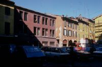
Title (German)
Bologna, Neubau auf neuer Bauflucht
Caption
Photographer keyword: old and new
Caption (German)
Schlagwort Bestandsbildner: alt und neu
Record Name
Dia_287-32201

Title (German)
Bologna, Pal. Fava, Stadthistorisches Museum
Caption
Photographer keyword: old and new
Caption (German)
Schlagwort Bestandsbildner: alt und neu
Record Name
Dia_287-32202

Title (German)
Bologna, Pal. Fava, Stadthistorisches Museum
Caption
Photographer keyword: old and new
Caption (German)
Schlagwort Bestandsbildner: alt und neu
Record Name
Dia_287-32203

Title (German)
Bologna, Scarpa-Laden
Caption
Photographer keyword: old and new
Caption (German)
Schlagwort Bestandsbildner: alt und neu
Record Name
Dia_287-32204

Title (German)
Bologna, Scarpa-Laden
Caption
Photographer keyword: old and new
Caption (German)
Schlagwort Bestandsbildner: alt und neu
Record Name
Dia_287-32205

Title (German)
Bologna, Via delle Belle Arte
Caption
Photographer keyword: old and new
Caption (German)
Schlagwort Bestandsbildner: alt und neu
Record Name
Dia_287-32206

Title (German)
Bologna, Via delle Belle Arte
Caption
Photographer keyword: old and new
Caption (German)
Schlagwort Bestandsbildner: alt und neu
Record Name
Dia_287-32207

Title (German)
Bologna, Via delle Belle Arte
Caption
Photographer keyword: old and new
Caption (German)
Schlagwort Bestandsbildner: alt und neu
Record Name
Dia_287-32208

Title (German)
Bologna, Via Martelli
Caption
Photographer keyword: new building
Caption (German)
Schlagwort Bestandsbildner: Neubau
Record Name
Dia_287-32209

Title (German)
Bologna, Via Martelli
Caption
Photographer keyword: new building
Caption (German)
Schlagwort Bestandsbildner: Neubau
Record Name
Dia_287-32210

Title (German)
Bologna, Via Martelli
Caption
Photographer keyword: new building
Caption (German)
Schlagwort Bestandsbildner: Neubau
Record Name
Dia_287-32211

Title (German)
Bologna, Via Martelli
Caption
Photographer keyword: new building
Caption (German)
Schlagwort Bestandsbildner: Neubau
Record Name
Dia_287-32212

Title (German)
Bologna, Via Martelli
Caption
Photographer keyword: new building
Caption (German)
Schlagwort Bestandsbildner: Neubau
Record Name
Dia_287-32213

Title (German)
Bologna, Via Martelli
Caption
Photographer keyword: new building
Caption (German)
Schlagwort Bestandsbildner: Neubau
Record Name
Dia_287-32214

Title (German)
Bologna, Via Martelli
Caption
Photographer keyword: new building
Caption (German)
Schlagwort Bestandsbildner: Neubau
Record Name
Dia_287-32215

Title (German)
Bologna, Via Martelli
Caption
Photographer keyword: new building
Caption (German)
Schlagwort Bestandsbildner: Neubau
Record Name
Dia_287-32216

Title (German)
Bologna, Via Martelli
Caption
Photographer keyword: new building
Caption (German)
Schlagwort Bestandsbildner: Neubau
Record Name
Dia_287-32217

Title (German)
Bologna, Via Martelli
Caption
Photographer keyword: new building
Caption (German)
Schlagwort Bestandsbildner: Neubau
Record Name
Dia_287-32218

Title (German)
Bologna, Via Martelli
Caption
Photographer keyword: new building
Caption (German)
Schlagwort Bestandsbildner: Neubau
Record Name
Dia_287-32219

Title (German)
Bologna, Via Martelli
Caption
Photographer keyword: new building
Caption (German)
Schlagwort Bestandsbildner: Neubau
Record Name
Dia_287-32220

Title (German)
Bologna, Via Martelli
Caption
Photographer keyword: new building
Caption (German)
Schlagwort Bestandsbildner: Neubau
Record Name
Dia_287-32221

Title (German)
Bologna, Via Martelli
Caption
Photographer keyword: new building
Caption (German)
Schlagwort Bestandsbildner: Neubau
Record Name
Dia_287-32222

Title (German)
Bologna, Via Martelli
Caption
Photographer keyword: new building
Caption (German)
Schlagwort Bestandsbildner: Neubau
Record Name
Dia_287-32223

Title (German)
Bologna, Via Martelli
Caption
Photographer keyword: new building
Caption (German)
Schlagwort Bestandsbildner: Neubau
Record Name
Dia_287-32224

Title (German)
Bologna, Via Martelli
Caption
Photographer keyword: new building
Caption (German)
Schlagwort Bestandsbildner: Neubau
Record Name
Dia_287-32225

Title (German)
Bologna, Via Martelli
Caption
Photographer keyword: new building
Caption (German)
Schlagwort Bestandsbildner: Neubau
Record Name
Dia_287-32226

Title (German)
Bologna, Via Martelli
Caption
Photographer keyword: new building
Caption (German)
Schlagwort Bestandsbildner: Neubau
Record Name
Dia_287-32226-A

Title (German)
Bologna, Via Martelli
Caption
Photographer keyword: new building
Caption (German)
Schlagwort Bestandsbildner: Neubau
Record Name
Dia_287-32227

Title (German)
Bologna, Via Martelli
Caption
Photographer keyword: new building
Caption (German)
Schlagwort Bestandsbildner: Neubau
Record Name
Dia_287-32228

Title (German)
Bologna, Via Zamboni, Universitätsbibliothek
Caption
Photographer keyword: old and new
Caption (German)
Schlagwort Bestandsbildner: alt und neu
Record Name
Dia_287-32229

Title (German)
Bologna, Via Zamboni, Universitätsbibliothek
Caption
Photographer keyword: old and new
Caption (German)
Schlagwort Bestandsbildner: alt und neu
Record Name
Dia_287-32230

Title (German)
Bonn, Münster, Eingang Kreuzgang
Caption
Photographer keyword: old and new
Caption (German)
Schlagwort Bestandsbildner: alt und neu
Record Name
Dia_287-32231

Title (German)
Bonn, Münster, Tür in den Kreuzgang, Bildhauer Gerhof
Caption
Photographer keyword: old and new
Caption (German)
Schlagwort Bestandsbildner: alt und neu
Record Name
Dia_287-32232

Title (German)
Bonn, Münster, Puppenkönig, neues Bauen
Caption
Photographer keyword: old and new
Caption (German)
Schlagwort Bestandsbildner: alt und neu
Record Name
Dia_287-32233

Title (German)
Bonn, Münster und Puppenkönig, neues Bauen Volksbank
Caption
Photographer keyword: old and new
Caption (German)
Schlagwort Bestandsbildner: alt und neu
Record Name
Dia_287-32234
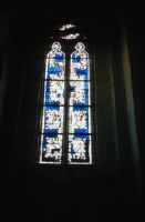
Title (German)
Bonn, St. Remigius Paul Weigmann
Caption
Photographer keyword: new building
Caption (German)
Schlagwort Bestandsbildner: Neubau
Record Name
Dia_287-32235

Title (German)
Bonn, St. Remigius Paul Weigmann
Caption
Photographer keyword: new building
Caption (German)
Schlagwort Bestandsbildner: Neubau
Record Name
Dia_287-32236

Title (German)
Bonn, Argelanderstrasse Südstadt
Caption
Photographer keyword: old and new
Caption (German)
Schlagwort Bestandsbildner: alt und neu
Record Name
Dia_287-32237

Title (German)
Bonn, Bahnhof und Bonner Loch
Caption
Photographer keyword: old and new
Caption (German)
Schlagwort Bestandsbildner: alt und neu
Record Name
Dia_287-32238

Title (German)
Bonn, Bahnhof und Bonner Loch
Caption
Photographer keyword: old and new
Caption (German)
Schlagwort Bestandsbildner: alt und neu
Record Name
Dia_287-32239

Title (German)
Bonn, Bahnhof und Bonner Loch
Caption
Photographer keyword: old and new
Caption (German)
Schlagwort Bestandsbildner: alt und neu
Record Name
Dia_287-32240

Title (German)
Bonn, Bahnhofsvorplatz mit Xenahis-Zelt
Caption
Photographer keyword: old and new
Caption (German)
Schlagwort Bestandsbildner: alt und neu
Record Name
Dia_287-32241

Title (German)
Bonn, Beethovenstrasse, Haus Wildemann
Caption
Photographer keyword: old and new
Caption (German)
Schlagwort Bestandsbildner: alt und neu
Record Name
Dia_287-32242

Title (German)
Bonn, Cassiusgraben gefüllte Lücke
Caption
Photographer keyword: old and new
Caption (German)
Schlagwort Bestandsbildner: alt und neu
Record Name
Dia_287-32243

Title (German)
Bonn, Am Dreieck
Caption
Photographer keyword: old and new
Caption (German)
Schlagwort Bestandsbildner: alt und neu
Record Name
Dia_287-32244

Title (German)
Bonn, Dresdner Bank
Caption
Photographer keyword: old and new
Caption (German)
Schlagwort Bestandsbildner: alt und neu
Record Name
Dia_287-32245

Title (German)
Bonn, Eurobau
Caption
Photographer keyword: new building
Caption (German)
Schlagwort Bestandsbildner: Neubau
Record Name
Dia_287-32246

Title (German)
Bonn, Eurobau, Renowabau
Caption
Photographer keyword: new building
Caption (German)
Schlagwort Bestandsbildner: Neubau
Record Name
Dia_287-32247

Title (German)
Bonn, Eurobau, Renowabau
Caption
Photographer keyword: new building
Caption (German)
Schlagwort Bestandsbildner: Neubau
Record Name
Dia_287-32248

Title (German)
Bonn, Eurobau, Historismus
Caption
Photographer keyword: new building
Caption (German)
Schlagwort Bestandsbildner: Neubau
Record Name
Dia_287-32249

Title (German)
Bonn, Eurobau, Historismus
Caption
Photographer keyword: new building
Caption (German)
Schlagwort Bestandsbildner: Neubau
Record Name
Dia_287-32250

Title (German)
Bonn, Eurobau
Caption
Photographer keyword: new building
Caption (German)
Schlagwort Bestandsbildner: Neubau
Record Name
Dia_287-32251

Title (German)
Bonn, Eurobau
Caption
Photographer keyword: new building
Caption (German)
Schlagwort Bestandsbildner: Neubau
Record Name
Dia_287-32252

Title (German)
Bonn, Eurobau, Verkleidung
Caption
Photographer keyword: new building
Caption (German)
Schlagwort Bestandsbildner: Neubau
Record Name
Dia_287-32253

Title (German)
Bonn, Eurobau
Caption
Photographer keyword: new building
Caption (German)
Schlagwort Bestandsbildner: Neubau
Record Name
Dia_287-32254

Title (German)
Bonn, Eurobau
Caption
Photographer keyword: new building
Caption (German)
Schlagwort Bestandsbildner: Neubau
Record Name
Dia_287-32255

Title (German)
Bonn, Friedrichstrasse
Caption
Photographer keyword: old and new
Caption (German)
Schlagwort Bestandsbildner: alt und neu
Record Name
Dia_287-32256

Title (German)
Bonn, Hardtberg
Caption
Photographer keyword: new building
Caption (German)
Schlagwort Bestandsbildner: Neubau
Record Name
Dia_287-32257

Title (German)
Bonn, Hundsgasse
Caption
Photographer keyword: new building
Caption (German)
Schlagwort Bestandsbildner: Neubau
Record Name
Dia_287-32258

Title (German)
Bonn, Kaiserpassage
Caption
Photographer keyword: new building
Caption (German)
Schlagwort Bestandsbildner: Neubau
Record Name
Dia_287-32259

Title (German)
Bonn, Kaiserpassage
Caption
Photographer keyword: new building
Caption (German)
Schlagwort Bestandsbildner: Neubau
Record Name
Dia_287-32260

Title (German)
Bonn, Kaiserpassage
Caption
Photographer keyword: new building
Caption (German)
Schlagwort Bestandsbildner: Neubau
Record Name
Dia_287-32261

Title (German)
Bonn, Kaiserpassage
Caption
Photographer keyword: new building
Caption (German)
Schlagwort Bestandsbildner: Neubau
Record Name
Dia_287-32262

Title (German)
Bonn, Kaiserpassage
Caption
Photographer keyword: new building
Caption (German)
Schlagwort Bestandsbildner: Neubau
Record Name
Dia_287-32263

Title (German)
Bonn, Kaiserpassage
Caption
Photographer keyword: new building
Caption (German)
Schlagwort Bestandsbildner: Neubau
Record Name
Dia_287-32264

Title (German)
Bonn, Martinsplatz, Kaiserpassage
Caption
Photographer keyword: new building
Caption (German)
Schlagwort Bestandsbildner: Neubau
Record Name
Dia_287-32265
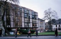
Title (German)
Bonn, Martinsplatz
Caption
Photographer keyword: new building
Caption (German)
Schlagwort Bestandsbildner: Neubau
Record Name
Dia_287-32266

Title (German)
Bonn, Martinsplatz, Kaiserpassage
Caption
Photographer keyword: old and new
Caption (German)
Schlagwort Bestandsbildner: alt und neu
Record Name
Dia_287-32267

Title (German)
Bonn, Martinsplatz, Münsterapsis und Kaiserpassage
Caption
Photographer keyword: old and new
Caption (German)
Schlagwort Bestandsbildner: alt und neu
Record Name
Dia_287-32268

Title (German)
Bonn, Kaufhof, Werbung
Caption
Photographer keyword: new building
Caption (German)
Schlagwort Bestandsbildner: Neubau
Record Name
Dia_287-32269

Title (German)
Bonn, Kaufhof
Caption
Photographer keyword: new building
Caption (German)
Schlagwort Bestandsbildner: Neubau
Record Name
Dia_287-32270

Title (German)
Bonn, Neue Fassade, Leffers von Lohm
Caption
Photographer keyword: old and new
Caption (German)
Schlagwort Bestandsbildner: alt und neu
Record Name
Dia_287-32271

Title (German)
Bonn, Neue Fassade, Leffers von Lohm
Caption
Photographer keyword: old and new
Caption (German)
Schlagwort Bestandsbildner: alt und neu
Record Name
Dia_287-32272

Title (German)
Bonn, Neue Fassade, Leffers von Lohm
Caption
Photographer keyword: old and new
Caption (German)
Schlagwort Bestandsbildner: alt und neu
Record Name
Dia_287-32273

Title (German)
Bonn, Neue Fassade, Leffers von Lohm
Caption
Photographer keyword: old and new
Caption (German)
Schlagwort Bestandsbildner: alt und neu
Record Name
Dia_287-32274

Title (German)
Bonn, Markt, Rathaus
Caption
Photographer keyword: old and new
Caption (German)
Schlagwort Bestandsbildner: alt und neu
Record Name
Dia_287-32275
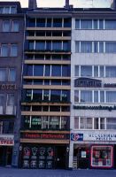
Title (German)
Bonn, Markt, Massstäbe
Caption
Photographer keyword: old and new
Caption (German)
Schlagwort Bestandsbildner: alt und neu
Record Name
Dia_287-32276

Title (German)
Bonn, Münsterplatz
Caption
Photographer keyword: old and new
Caption (German)
Schlagwort Bestandsbildner: alt und neu
Record Name
Dia_287-32277

Title (German)
Bonn, Münsterplatz
Caption
Photographer keyword: old and new
Caption (German)
Schlagwort Bestandsbildner: alt und neu. Unscharfe Aufnahme
Record Name
Dia_287-32278

Title (German)
Bonn, Münsterplatz
Caption
Photographer keyword: old and new
Caption (German)
Schlagwort Bestandsbildner: alt und neu
Record Name
Dia_287-32279

Title (German)
Bonn, Münsterplatz mit Umbau Dresdner Bank
Caption
Photographer keyword: old and new
Caption (German)
Schlagwort Bestandsbildner: alt und neu
Record Name
Dia_287-32280

Title (German)
Bonn, Münsterplatz, Dresdner Bank
Caption
Photographer keyword: old and new
Caption (German)
Schlagwort Bestandsbildner: alt und neu
Record Name
Dia_287-32281

Title (German)
Bonn, Münsterplatz, Dresdner Bank
Caption
Photographer keyword: old and new
Caption (German)
Schlagwort Bestandsbildner: alt und neu
Record Name
Dia_287-32282

Title (German)
Bonn, Münsterplatz, Kaufhof
Caption
Photographer keyword: new building
Caption (German)
Schlagwort Bestandsbildner: Neubau
Record Name
Dia_287-32283

Title (German)
Bonn, Münsterplatz, Kaufhof, Kammerer und Belz Architekt
Caption
Photographer keyword: new building
Caption (German)
Schlagwort Bestandsbildner: Neubau
Record Name
Dia_287-32284

Title (German)
Bonn, Münsterplatz, Kaufhof
Caption
Photographer keyword: new building
Caption (German)
Schlagwort Bestandsbildner: Neubau
Record Name
Dia_287-32285

Title (German)
Bonn, Münsterplatz, Kaufhof
Caption
Photographer keyword: old and new
Caption (German)
Schlagwort Bestandsbildner: alt und neu
Record Name
Dia_287-32286

Title (German)
Bonn, Kaufhof
Caption
Photographer keyword: new building
Caption (German)
Schlagwort Bestandsbildner: Neubau
Record Name
Dia_287-32287

Title (German)
Bonn, Münsterplatz, Kaufhof, Neubauten, Historismus
Caption
Photographer keyword: old and new
Caption (German)
Schlagwort Bestandsbildner: alt und neu
Record Name
Dia_287-32288

Title (German)
Bonn, Münsterplatz, Kaufhof
Caption
Photographer keyword: new building
Caption (German)
Schlagwort Bestandsbildner: Neubau
Record Name
Dia_287-32289

Title (German)
Bonn, Poppelsdorfer Allee, Staatshochbauamt
Caption
Photographer keyword: old and new
Caption (German)
Schlagwort Bestandsbildner: alt und neu
Record Name
Dia_287-32290

Title (German)
Bonn, Poppelsdorfer Allee, Staatshochbauamt
Caption
Photographer keyword: old and new
Caption (German)
Schlagwort Bestandsbildner: alt und neu
Record Name
Dia_287-32291

Title (German)
Bonn, Poppelsdorfer Allee, Staatshochbauamt
Caption
Photographer keyword: old and new
Caption (German)
Schlagwort Bestandsbildner: alt und neu
Record Name
Dia_287-32292

Title (German)
Bonn, Poppelsdorfer Allee, Staatshochbauamt
Caption
Photographer keyword: old and new
Caption (German)
Schlagwort Bestandsbildner: alt und neu
Record Name
Dia_287-32293

Title (German)
Bonn, Poppelsdorfer Allee, Herold-Neubau
Caption
Photographer keyword: new building
Caption (German)
Schlagwort Bestandsbildner: Neubau
Record Name
Dia_287-32294

Title (German)
Bonn, Poststrsse, Anschluss an Cassius-Bastei
Caption
Photographer keyword: old and new
Caption (German)
Schlagwort Bestandsbildner: alt und neu
Record Name
Dia_287-32295

Title (German)
Bonn, Poststrsse, Anschluss an Cassius-Bastei
Caption
Photographer keyword: old and new
Caption (German)
Schlagwort Bestandsbildner: alt und neu
Record Name
Dia_287-32296

Title (German)
Bonn, Poststrsse, Anschluss an Cassius-Bastei
Caption
Photographer keyword: old and new
Caption (German)
Schlagwort Bestandsbildner: alt und neu
Record Name
Dia_287-32297

Title (German)
Bonn, Poststrasse mit Haus Hilgers
Caption
Photographer keyword: old and new
Caption (German)
Schlagwort Bestandsbildner: alt und neu
Record Name
Dia_287-32298

Title (German)
Bonn, Poststrasse, Haus Hilgers und Lückenfüllung
Caption
Photographer keyword: old and new
Caption (German)
Schlagwort Bestandsbildner: alt und neu
Record Name
Dia_287-32299

Title (German)
Bonn, Poststrasse, Haus Hilgers und Lückenfüllung
Caption
Photographer keyword: old and new
Caption (German)
Schlagwort Bestandsbildner: alt und neu
Record Name
Dia_287-32300

Title (German)
Bonn, Poststrasse, Haus Hilgers und Lückenfüllung
Caption
Photographer keyword: old and new
Caption (German)
Schlagwort Bestandsbildner: alt und neu
Record Name
Dia_287-32301

Title (German)
Bonn, Poststrasse, Haus Hilgers und Lückenfüllung
Caption
Photographer keyword: old and new
Caption (German)
Schlagwort Bestandsbildner: alt und neu
Record Name
Dia_287-32302

Title (German)
Bonn, Stadthaus
Caption
Photographer keyword: old and new
Caption (German)
Schlagwort Bestandsbildner: alt und neu
Record Name
Dia_287-32303

Title (German)
Bonn, Stadthaus
Caption
Photographer keyword: old and new
Caption (German)
Schlagwort Bestandsbildner: alt und neu
Record Name
Dia_287-32304

Title (German)
Bonn, Sterustrasse
Caption
Photographer keyword: new building
Caption (German)
Schlagwort Bestandsbildner: Neubau
Record Name
Dia_287-32305
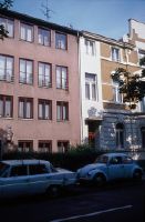
Title (German)
Bonn, Südstadt
Caption
Photographer keyword: old and new
Caption (German)
Schlagwort Bestandsbildner: alt und neu
Record Name
Dia_287-32306

Title (German)
Bonn, Thomas Mann-Strasse, Stadtwerkebau
Caption
Photographer keyword: old and new
Caption (German)
Schlagwort Bestandsbildner: alt und neu
Record Name
Dia_287-32307

Title (German)
Bonn, Thomas Mann-Strasse, Stadtwerkebau
Caption
Photographer keyword: old and new
Caption (German)
Schlagwort Bestandsbildner: alt und neu
Record Name
Dia_287-32308

Title (German)
Bonn, Uni, U-Bahneingang
Caption
Photographer keyword: old and new
Caption (German)
Schlagwort Bestandsbildner: alt und neu
Record Name
Dia_287-32309

Title (German)
Bonn, Uni und W-Bahnpavillon
Caption
Photographer keyword: old and new
Caption (German)
Schlagwort Bestandsbildner: alt und neu
Record Name
Dia_287-32310

Title (German)
Bonn, Mehlem, Südafrikanische Botschaft
Caption
Photographer keyword: new building
Caption (German)
Schlagwort Bestandsbildner: Neubau
Record Name
Dia_287-32311

Title (German)
Bonn, Mehlem, Südafrikanische Botschaft
Caption
Photographer keyword: new building
Caption (German)
Schlagwort Bestandsbildner: Neubau
Record Name
Dia_287-32312

Title (German)
Bonn, Mehlem, Südafrikanische Botschaft
Caption
Photographer keyword: new building
Caption (German)
Schlagwort Bestandsbildner: Neubau
Record Name
Dia_287-32313

Title (German)
Bonn, Mehlem, Südafrikanische Botschaft
Caption
Photographer keyword: new building
Caption (German)
Schlagwort Bestandsbildner: Neubau
Record Name
Dia_287-32314

Title (German)
Bonn, Schaufenster, aufgeklebte Sprossen
Caption
Photographer keyword: old and new
Caption (German)
Schlagwort Bestandsbildner: alt und neu
Record Name
Dia_287-32315

Title (German)
Bourg-en-Bresse, Rathaus
Caption
Photographer keyword: old and new
Caption (German)
Schlagwort Bestandsbildner: alt und neu
Record Name
Dia_287-32316

Title (German)
Steinfurt, Borghorst, St. Nikomedes, Paul Weigmann, Fenster neu
Caption
Photographer keyword: new building
Caption (German)
Schlagwort Bestandsbildner: Neubau
Record Name
Dia_287-32317

Title (German)
Bozen, Denkmalamt, Modell der Burg von Reinhold Messmer
Caption
Photographer keyword: old and new
Caption (German)
Schlagwort Bestandsbildner: alt und neu
Record Name
Dia_287-32318

Title (German)
Bozen, Denkmalamt, Modell der Burg von Reinhold Messmer
Caption
Photographer keyword: old and new
Caption (German)
Schlagwort Bestandsbildner: alt und neu
Record Name
Dia_287-32319

Title (German)
Bozen, Denkmalamt, Modell der Burg von Reinhold Messmer
Caption
Photographer keyword: old and new
Caption (German)
Schlagwort Bestandsbildner: alt und neu
Record Name
Dia_287-32320

Title (German)
Bozen, Hoterl laurin, Umbau Podrecca
Caption
Photographer keyword: old and new
Caption (German)
Schlagwort Bestandsbildner: alt und neu
Record Name
Dia_287-32321

Title (German)
Bozen, Museum
Caption
Photographer keyword: old and new
Caption (German)
Schlagwort Bestandsbildner: alt und neu
Record Name
Dia_287-32322

Title (German)
Bozen, Walterplatz
Caption
Photographer keyword: old and new
Caption (German)
Schlagwort Bestandsbildner: alt und neu
Record Name
Dia_287-32323

Title (German)
Bozen, Walterplatz
Caption
Photographer keyword: old and new
Caption (German)
Schlagwort Bestandsbildner: alt und neu
Record Name
Dia_287-32324

Title (German)
Braunwald, Chalets
Caption
Photographer keyword: new building
Caption (German)
Schlagwort Bestandsbildner: Neubau
Record Name
Dia_287-32325

Title (German)
Braunwald, Wasserzinne
Caption
Photographer keyword: old and new
Caption (German)
Schlagwort Bestandsbildner: alt und neu
Record Name
Dia_287-32326

Title (German)
Braunwald, Wasserzinne
Caption
Photographer keyword: old and new
Caption (German)
Schlagwort Bestandsbildner: alt und neu
Record Name
Dia_287-32327

Title (German)
Bregenz, Berufsschule, neuer Teil: Ebarle
Caption
Photographer keyword: old and new
Caption (German)
Schlagwort Bestandsbildner: alt und neu
Record Name
Dia_287-32328

Title (German)
Bregenz, Berufsschule, neuer Teil: Ebarle
Caption
Photographer keyword: old and new
Caption (German)
Schlagwort Bestandsbildner: alt und neu
Record Name
Dia_287-32329

Title (German)
Bregenz, Berufsschule, neuer Teil: Ebarle
Caption
Photographer keyword: old and new
Caption (German)
Schlagwort Bestandsbildner: alt und neu
Record Name
Dia_287-32330

Title (German)
Bregenz, Berufsschule, neuer Teil: Ebarle
Caption
Photographer keyword: old and new
Caption (German)
Schlagwort Bestandsbildner: alt und neu
Record Name
Dia_287-32331

Title (German)
Bregenz, Berufsschule, neuer Teil: Ebarle
Caption
Photographer keyword: old and new
Caption (German)
Schlagwort Bestandsbildner: alt und neu
Record Name
Dia_287-32332

Title (German)
Bregenz, Berufsschule, neuer Teil: Ebarle
Caption
Photographer keyword: old and new
Caption (German)
Schlagwort Bestandsbildner: alt und neu
Record Name
Dia_287-32333