 E-PICS - ETHBIB.Bildarchiv


The images presented on this page are part of E-Pics, a service provided by the ETH-Bibliothek of ETH Zurich. You find here static medium resolution images published under the creative commons
CC-BY-SA license or with the Public Domain Mark. This means that you are free to share, copy and redistribute the material in any medium or format; that you are free to remix, transform, and build upon the material for any purpose, even commercially, under the following conditions: You must give appropriate credit, provide a link to the license, and indicate if changes were made.
- More information about E-Pics is available at https://www.e-pics.ethz.ch
- This catalog can also be accessed at https://ba.e-pics.ethz.ch/ . There you can download the image in a higher resolution.

Title (German)
Basis, Basen; Taf. 300
Caption
Keyword Photographer: Floor plan. Title tab: Base
Caption (German)
Schlagwort Bestandsbildner: Grundriss. Titel Reiter: Basis
Record Name
Dia_287-22783

Title (German)
Basis, Basen; Taf. 300
Caption
Keyword Photographer: Floor plan. Title tab: Base
Caption (German)
Schlagwort Bestandsbildner: Grundriss. Titel Reiter: Basis
Record Name
Dia_287-22784

Title (German)
Basis, Basen; Taf. 301, 1-11
Caption
Keyword Photographer: Floor plan. Title tab: Base
Caption (German)
Schlagwort Bestandsbildner: Grundriss. Titel Reiter: Basis
Record Name
Dia_287-22785

Title (German)
Basis, Basen; Taf. 301, 12-18
Caption
Keyword Photographer: Floor plan. Title tab: Base
Caption (German)
Schlagwort Bestandsbildner: Grundriss. Titel Reiter: Basis
Record Name
Dia_287-22786

Title (German)
Basis, Basen; Taf. 301, 12-18
Caption
Keyword Photographer: Floor plan. Title tab: Base
Caption (German)
Schlagwort Bestandsbildner: Grundriss. Titel Reiter: Basis
Record Name
Dia_287-22787

Title (German)
Basis, Basen; Taf. 302, 1-7
Caption
Keyword Photographer: Floor plan. Title tab: Base
Caption (German)
Schlagwort Bestandsbildner: Grundriss. Titel Reiter: Basis
Record Name
Dia_287-22788

Title (German)
Basis, Basen; Taf. 302, 8-13
Caption
Keyword Photographer: Floor plan. Title tab: Base
Caption (German)
Schlagwort Bestandsbildner: Grundriss. Titel Reiter: Basis
Record Name
Dia_287-22789

Title (German)
Basly
Caption
Keyword photographer: floor plan. Title rider: Basly
Caption (German)
Schlagwort Bestandsbildner: Grundriss. Titel Reiter: Basly
Record Name
Dia_287-22790

Title (German)
Bassac, Saec. 12
Caption
Keyword photographer: Floor plan. Title rider: Bassac
Caption (German)
Schlagwort Bestandsbildner: Grundriss. Titel Reiter: Bassac
Record Name
Dia_287-22791

Title (German)
Batalha, Klosterkirche
Caption
Keyword photographer: Floor plan. Title rider: Batalha
Caption (German)
Schlagwort Bestandsbildner: Grundriss. Titel Reiter: Batalha
Record Name
Dia_287-22792

Title (German)
Batalha, Batalha
Caption
Keyword photographer: Floor plan. Title rider: Batalha
Caption (German)
Schlagwort Bestandsbildner: Grundriss. Titel Reiter: Batalha
Record Name
Dia_287-22793

Title (German)
Batalha, Klosterkirche
Caption
Keyword photographer: Floor plan. Title rider: Batalha
Caption (German)
Schlagwort Bestandsbildner: Grundriss. Titel Reiter: Batalha
Record Name
Dia_287-22794

Title (German)
Bath, Abbey
Caption
Title rider: Bath
Caption (German)
Titel Reiter: Bath
Record Name
Dia_287-22795
Title (German)
Bath, Abbey
Caption
Title rider: Bath
Caption (German)
Titel Reiter: Bath
Record Name
Dia_287-22796

Title (German)
Bath, Abbey
Caption
Title rider: Bath
Caption (German)
Titel Reiter: Bath
Record Name
Dia_287-22797

Title (German)
Bath, Abbey
Caption
Title rider: Bath
Caption (German)
Titel Reiter: Bath
Record Name
Dia_287-22798

Title (German)
Bath, Battenfeld
Caption
Keyword photographer: floor plan. Title rider: Bath; Battenfeld
Caption (German)
Schlagwort Bestandsbildner: Grundriss. Titel Reiter: Bath; Battenfeld
Record Name
Dia_287-22799

Title (German)
Bath, Battenfeld
Caption
Keyword photographer: floor plan. Title rider: Bath; Battenfeld
Caption (German)
Schlagwort Bestandsbildner: Grundriss. Titel Reiter: Bath; Battenfeld
Record Name
Dia_287-22800

Title (German)
Grossbritannien, Bau, Mittelschiffgewölbe; Repro Hirmer 41
Caption
Keyword photographer: floor plan. Title tab: construction
Caption (German)
Schlagwort Bestandsbildner: Grundriss. Titel Reiter: Bau
Record Name
Dia_287-22801

Title (German)
Grossbritannien, Baudetail, Repro Hirmer 41
Caption
Photographer keyword: floor plan. Title tab: building detail
Caption (German)
Schlagwort Bestandsbildner: Grundriss. Titel Reiter: Baudetail
Record Name
Dia_287-22802

Title (German)
Bayeux, Kathedrale, Chor A. saec. 13
Caption
Keyword photographer: Floor plan. Title tab: Bayeux; Cathedral
Caption (German)
Schlagwort Bestandsbildner: Grundriss. Titel Reiter: Bayeux; Kathedrale
Record Name
Dia_287-22803

Title (German)
Bayeux, Kathedrale, A. saec. 13
Caption
Keyword photographer: Floor plan. Title tab: Bayeux; Cathedral
Caption (German)
Schlagwort Bestandsbildner: Grundriss. Titel Reiter: Bayeux; Kathedrale
Record Name
Dia_287-22804

Title (German)
Bayeux, Kathedrale, Nach 1159
Caption
Keyword photographer: Floor plan. Title tab: Bayeux; Cathedral
Caption (German)
Schlagwort Bestandsbildner: Grundriss. Titel Reiter: Bayeux; Kathedrale
Record Name
Dia_287-22805

Title (German)
Bayeux, Kathedrale, Ansicht von Südosten
Caption
Title tab: Bayeux; Cathedral
Caption (German)
Titel Reiter: Bayeux; Kathedrale
Record Name
Dia_287-22806

Title (German)
Bayeux, Kathedrale, Ansicht von Südosten
Caption
Title tab: Bayeux; Cathedral
Caption (German)
Titel Reiter: Bayeux; Kathedrale
Record Name
Dia_287-22807

Title (German)
Bayeux, Kathedrale, Südliche Langhauswand
Caption
Title tab: Bayeux; Cathedral
Caption (German)
Titel Reiter: Bayeux; Kathedrale
Record Name
Dia_287-22808

Title (German)
Bayeux, Kathedrale, Südliche Langhauswand
Caption
Title tab: Bayeux; Cathedral
Caption (German)
Titel Reiter: Bayeux; Kathedrale
Record Name
Dia_287-22809

Title (German)
Bayeux, Kathedrale, Südliche Arkade, Langhauswand
Caption
Title tab: Bayeux; Cathedral
Caption (German)
Titel Reiter: Bayeux; Kathedrale
Record Name
Dia_287-22810

Title (German)
Bayeux, Kathedrale, Detail südliche Langhauswand
Caption
Title tab: Bayeux; Cathedral
Caption (German)
Titel Reiter: Bayeux; Kathedrale
Record Name
Dia_287-22811

Title (German)
Bayeux, Kathedrale, Hallenkrypta
Caption
Title tab: Bayeux; Cathedral
Caption (German)
Titel Reiter: Bayeux; Kathedrale
Record Name
Dia_287-22812

Title (German)
Bayeux, Kathedrale, Hallenkrypta
Caption
Title tab: Bayeux; Cathedral
Caption (German)
Titel Reiter: Bayeux; Kathedrale
Record Name
Dia_287-22813

Title (German)
Bayeux, Kathedrale, Hallenkrypta
Caption
Title tab: Bayeux; Cathedral
Caption (German)
Titel Reiter: Bayeux; Kathedrale
Record Name
Dia_287-22814

Title (German)
Bayeux, Kathedrale, Nördliches Turmerdgeschoss
Caption
Title tab: Bayeux; Cathedral
Caption (German)
Titel Reiter: Bayeux; Kathedrale
Record Name
Dia_287-22815

Title (German)
Bayeux, Kathedrale, Nördliches Turmerdgeschoss
Caption
Title tab: Bayeux; Cathedral
Caption (German)
Titel Reiter: Bayeux; Kathedrale
Record Name
Dia_287-22816

Title (German)
Beaucaire, Dreieckiger Eckturm
Caption
Title rider: Beaucaire
Caption (German)
Titel Reiter: Beaucaire
Record Name
Dia_287-22817

Title (German)
Beaugency, Notre Dame, 2. H. saec. 11
Caption
Keyword photographer: Floor plan. Title tab: Beaugency
Caption (German)
Schlagwort Bestandsbildner: Grundriss. Titel Reiter: Beaugency
Record Name
Dia_287-22818

Title (German)
Beaulieu-sur-Dordogne, Corrèze
Caption
Keyword photographer: floor plan. Title rider: Beaulieu-sur-Dordogne
Caption (German)
Schlagwort Bestandsbildner: Grundriss. Titel Reiter: Beaulieu-sur-Dordogne
Record Name
Dia_287-22819

Title (German)
Beaulieu-les-Loches, Seitenturm, 1. V. saec. 12
Caption
Keyword photographer: floor plan. Title rider: Beaulieu-les-Loches
Caption (German)
Schlagwort Bestandsbildner: Grundriss. Titel Reiter: Beaulieu-les-Loches
Record Name
Dia_287-22820

Title (German)
Beaune, Kollegiatskirche Notre Dame, Notre Dame
Caption
Keyword photographer: floor plan. Title rider: Beaune; collegiate church Notre Dame
Caption (German)
Schlagwort Bestandsbildner: Grundriss. Titel Reiter: Beaune; Kollegiatskirche Notre Dame
Record Name
Dia_287-22821

Title (German)
Beaune, Kollegiatskirche Notre Dame, Notre Dame
Caption
Keyword photographer: floor plan. Title rider: Beaune; collegiate church Notre Dame
Caption (German)
Schlagwort Bestandsbildner: Grundriss. Titel Reiter: Beaune; Kollegiatskirche Notre Dame
Record Name
Dia_287-22822

Title (German)
Beaune, Kollegiatskirche Notre Dame, Notre Dame
Caption
Keyword photographer: floor plan. Title rider: Beaune; collegiate church Notre Dame
Caption (German)
Schlagwort Bestandsbildner: Grundriss. Titel Reiter: Beaune; Kollegiatskirche Notre Dame
Record Name
Dia_287-22823

Title (German)
Beaune, Kollegiatskirche Notre Dame, Kollegiatskirche, Strebepfeiler und -bögen
Caption
Title tab: Beaune; collegiate church Notre Dame
Caption (German)
Titel Reiter: Beaune; Kollegiatskirche Notre Dame
Record Name
Dia_287-22824
Title (German)
Beaune, Kollegiatskirche Notre Dame, Kollegiatskirche, Strebepfeiler und -bögen
Caption
Title tab: Beaune; collegiate church Notre Dame
Caption (German)
Titel Reiter: Beaune; Kollegiatskirche Notre Dame
Record Name
Dia_287-22825

Title (German)
Beaune, Kollegiatskirche Notre Dame, Kollegiatskirche, Strebepfeiler und -bögen
Caption
Title tab: Beaune; collegiate church Notre Dame
Caption (German)
Titel Reiter: Beaune; Kollegiatskirche Notre Dame
Record Name
Dia_287-22826

Title (German)
Beaune, Hôtel-Dieu, Ehrenhof
Caption
Title rider: Beaune; Hôtel-Dieu
Caption (German)
Titel Reiter: Beaune; Hôtel-Dieu
Record Name
Dia_287-22827

Title (German)
Beauvais, Kathedrale
Caption
Keyword photographer: Floor plan. Title rider: Beauvais; Cathedral
Caption (German)
Schlagwort Bestandsbildner: Grundriss. Titel Reiter: Beauvais; Kathedrale
Record Name
Dia_287-22828

Title (German)
Beauvais, Kathedrale, Chor 1225-72
Caption
Keyword photographer: Floor plan. Title rider: Beauvais; Cathedral
Caption (German)
Schlagwort Bestandsbildner: Grundriss. Titel Reiter: Beauvais; Kathedrale
Record Name
Dia_287-22829

Title (German)
Beauvais, Kathedrale
Caption
Keyword photographer: Floor plan. Title rider: Beauvais; Cathedral
Caption (German)
Schlagwort Bestandsbildner: Grundriss. Titel Reiter: Beauvais; Kathedrale
Record Name
Dia_287-22830

Title (German)
Beauvais, Kathedrale, Chor von aussen
Caption
Title rider: Beauvais; Cathedral
Caption (German)
Titel Reiter: Beauvais; Kathedrale
Record Name
Dia_287-22831

Title (German)
Beauvais, Kathedrale, Chor von aussen
Caption
Title rider: Beauvais; Cathedral
Caption (German)
Titel Reiter: Beauvais; Kathedrale
Record Name
Dia_287-22832
Title (German)
Beauvais, Kathedrale, Chor, Strebewerk
Caption
Title rider: Beauvais; Cathedral
Caption (German)
Titel Reiter: Beauvais; Kathedrale
Record Name
Dia_287-22833

Title (German)
Beauvais, Kathedrale, Chor, Strebewerk
Caption
Title rider: Beauvais; Cathedral
Caption (German)
Titel Reiter: Beauvais; Kathedrale
Record Name
Dia_287-22834

Title (German)
Beauvais, Kathedrale, Chor
Caption
Title rider: Beauvais; Cathedral
Caption (German)
Titel Reiter: Beauvais; Kathedrale
Record Name
Dia_287-22835

Title (German)
Beauvais, Kathedrale, Chor
Caption
Title rider: Beauvais; Cathedral
Caption (German)
Titel Reiter: Beauvais; Kathedrale
Record Name
Dia_287-22836

Title (German)
Beauvais, Kathedrale, Chor
Caption
Title rider: Beauvais; Cathedral
Caption (German)
Titel Reiter: Beauvais; Kathedrale
Record Name
Dia_287-22837

Title (German)
Beauvais, Kathedrale, Chor
Caption
Title rider: Beauvais; Cathedral
Caption (German)
Titel Reiter: Beauvais; Kathedrale
Record Name
Dia_287-22838
Title (German)
Beauvais, Kathedrale, Chor
Caption
Title rider: Beauvais; Cathedral
Caption (German)
Titel Reiter: Beauvais; Kathedrale
Record Name
Dia_287-22839

Title (German)
Beauvais, Kathedrale, Chor
Caption
Title rider: Beauvais; Cathedral
Caption (German)
Titel Reiter: Beauvais; Kathedrale
Record Name
Dia_287-22840

Title (German)
Beauvais, Kathedrale, Chor
Caption
Title rider: Beauvais; Cathedral
Caption (German)
Titel Reiter: Beauvais; Kathedrale
Record Name
Dia_287-22841

Title (German)
Beauvais, Kathedrale, Chor
Caption
Title rider: Beauvais; Cathedral
Caption (German)
Titel Reiter: Beauvais; Kathedrale
Record Name
Dia_287-22842

Title (German)
Beauvais, Kathedrale, Chor
Caption
Title rider: Beauvais; Cathedral
Caption (German)
Titel Reiter: Beauvais; Kathedrale
Record Name
Dia_287-22843

Title (German)
Beauvais, Kathedrale, Chor, Gewölbe
Caption
Title rider: Beauvais; Cathedral
Caption (German)
Titel Reiter: Beauvais; Kathedrale
Record Name
Dia_287-22844

Title (German)
Beauvais, Kathedrale, Chor, Gewölbe
Caption
Title rider: Beauvais; Cathedral
Caption (German)
Titel Reiter: Beauvais; Kathedrale
Record Name
Dia_287-22845
Title (German)
Beauvais, Kathedrale, Chor, Gewölbe
Caption
Title rider: Beauvais; Cathedral
Caption (German)
Titel Reiter: Beauvais; Kathedrale
Record Name
Dia_287-22846

Title (German)
Beauvais, Kathedrale, Chor, Gewölbe
Caption
Title rider: Beauvais; Cathedral
Caption (German)
Titel Reiter: Beauvais; Kathedrale
Record Name
Dia_287-22847

Title (German)
Beauvais, Kathedrale, Chor, Gewölbe
Caption
Title rider: Beauvais; Cathedral
Caption (German)
Titel Reiter: Beauvais; Kathedrale
Record Name
Dia_287-22848

Title (German)
Beauvais, Kathedrale, Chor, Gewölbe
Caption
Title rider: Beauvais; Cathedral
Caption (German)
Titel Reiter: Beauvais; Kathedrale
Record Name
Dia_287-22849

Title (German)
Beauvais, Kathedrale, Chorgewölbe, 6-teilig durch Umbau
Caption
Title rider: Beauvais; Cathedral
Caption (German)
Titel Reiter: Beauvais; Kathedrale
Record Name
Dia_287-22850

Title (German)
Beauvais, Kathedrale, Chor, neue Stützen
Caption
Title rider: Beauvais; Cathedral
Caption (German)
Titel Reiter: Beauvais; Kathedrale
Record Name
Dia_287-22851

Title (German)
Beauvais, Kathedrale, südlicher Chorumgang
Caption
Title rider: Beauvais; Cathedral
Caption (German)
Titel Reiter: Beauvais; Kathedrale
Record Name
Dia_287-22852

Title (German)
Beauvais, St-Étienne
Caption
Keyword photographer: floor plan. Title rider: Beauvais; St. Etienne
Caption (German)
Schlagwort Bestandsbildner: Grundriss. Titel Reiter: Beauvais; St. Etienne
Record Name
Dia_287-22853

Title (German)
Beauvais, St-Étienne
Caption
Keyword photographer: floor plan. Title rider: Beauvais; St. Etienne
Caption (German)
Schlagwort Bestandsbildner: Grundriss. Titel Reiter: Beauvais; St. Etienne
Record Name
Dia_287-22854

Title (German)
Beauvais, St-Étienne
Caption
Keyword photographer: floor plan. Title rider: Beauvais; St. Etienne
Caption (German)
Schlagwort Bestandsbildner: Grundriss. Titel Reiter: Beauvais; St. Etienne
Record Name
Dia_287-22855

Title (German)
Beauvais, St-Étienne, Lessay, Pfeilergrundriss, Bony Fig. 32
Caption
Keyword photographer: floor plan. Title rider: Beauvais; St. Etienne
Caption (German)
Schlagwort Bestandsbildner: Grundriss. Titel Reiter: Beauvais; St. Etienne
Record Name
Dia_287-22856

Title (German)
Beauvais, Basse-Oeuvre, E. saec. 10
Caption
Keyword photographer: floor plan. Title rider: Beauvais; Basse oeuvre
Caption (German)
Schlagwort Bestandsbildner: Grundriss. Titel Reiter: Beauvais; Basse-Oeuvre
Record Name
Dia_287-22857

Title (German)
Beauvais, Basse-Oeuvre, Saec. 10
Caption
Keyword photographer: floor plan. Title rider: Beauvais; Basse oeuvre
Caption (German)
Schlagwort Bestandsbildner: Grundriss. Titel Reiter: Beauvais; Basse-Oeuvre
Record Name
Dia_287-22858

Title (German)
Beauvais, Basse-Oeuvre, Saec. 10
Caption
Keyword photographer: floor plan. Title rider: Beauvais; Basse oeuvre
Caption (German)
Schlagwort Bestandsbildner: Grundriss. Titel Reiter: Beauvais; Basse-Oeuvre
Record Name
Dia_287-22859

Title (German)
Bechyne, Bechin
Caption
Keyword photographer: Floor plan. Title rider: Bechin
Caption (German)
Schlagwort Bestandsbildner: Grundriss. Titel Reiter: Bechin
Record Name
Dia_287-22860

Title (German)
Beeskow
Caption
Keyword photographer: floor plan. Title rider: Beeskow
Caption (German)
Schlagwort Bestandsbildner: Grundriss. Titel Reiter: Beeskow
Record Name
Dia_287-22861

Title (German)
Belem, Klosterkirche
Caption
Keyword Photographer: Floor plan. Title tab: Belem
Caption (German)
Schlagwort Bestandsbildner: Grundriss. Titel Reiter: Belem
Record Name
Dia_287-22862

Title (German)
Belluno, Sto. Stefano
Caption
Keyword photographer: floor plan. Title rider: Belluno
Caption (German)
Schlagwort Bestandsbildner: Grundriss. Titel Reiter: Belluno
Record Name
Dia_287-22863

Title (German)
Bénévent-l’Abbaye, Bénévent, L'Abbaye (Dèp. Creuse), Saec. 12
Caption
Keyword photographer: Floor plan. Title rider: Bénévent; L'Abbaye (Dèp. Creuse)
Caption (German)
Schlagwort Bestandsbildner: Grundriss. Titel Reiter: Bénévent; L'Abbaye (Dèp. Creuse)
Record Name
Dia_287-22864

Title (German)
Bénévent-l’Abbaye, Bénévent, L'Abbaye (Dèp. Creuse), Saec. 12
Caption
Keyword photographer: Floor plan. Title rider: Bénévent; L'Abbaye (Dèp. Creuse)
Caption (German)
Schlagwort Bestandsbildner: Grundriss. Titel Reiter: Bénévent; L'Abbaye (Dèp. Creuse)
Record Name
Dia_287-22865

Title (German)
Benevento, Sta. Sofia
Caption
Keyword photographer: Floor plan. Title rider: Benevento; Sta. Sofia
Caption (German)
Schlagwort Bestandsbildner: Grundriss. Titel Reiter: Benevento; Sta. Sofia
Record Name
Dia_287-22866

Title (German)
Berchtesgaden, Stiftskirche
Caption
Keyword photographer: ground plan. Title rider: Berchtesgaden; collegiate church
Caption (German)
Schlagwort Bestandsbildner: Grundriss. Titel Reiter: Berchtesgaden; Stiftskirche
Record Name
Dia_287-22867

Title (German)
Berchtesgaden, Stiftskirche
Caption
Keyword photographer: ground plan. Title rider: Berchtesgaden; collegiate church
Caption (German)
Schlagwort Bestandsbildner: Grundriss. Titel Reiter: Berchtesgaden; Stiftskirche
Record Name
Dia_287-22868

Title (German)
Berchtesgaden, Frauenkirche, Frauenkirche am Anger
Caption
Keyword photographer: ground plan. Title rider: Berchtesgaden; Church of Our Lady
Caption (German)
Schlagwort Bestandsbildner: Grundriss. Titel Reiter: Berchtesgaden; Frauenkirche
Record Name
Dia_287-22869

Title (German)
Berchtesgaden, Frauenkirche, Franziskanerkirche; Frazebjurcge an Anger
Caption
Keyword photographer: ground plan. Title rider: Berchtesgaden; Church of Our Lady
Caption (German)
Schlagwort Bestandsbildner: Grundriss. Titel Reiter: Berchtesgaden; Frauenkirche
Record Name
Dia_287-22870

Title (German)
Bergamo, Baptisterium, Baptistarium (1370), u. Cap. Colleoni (1470 - 76)
Caption
Title rider: Bergamo; Baptistery
Caption (German)
Titel Reiter: Bergamo; Baptisterium
Record Name
Dia_287-22871

Title (German)
Bergamo, Baptisterium, Baptistarium (1340)
Caption
Title rider: Bergamo; Baptistery
Caption (German)
Titel Reiter: Bergamo; Baptisterium
Record Name
Dia_287-22872

Title (German)
Bergamo, Sta. Croce, S. Croce, 11. Jh.
Caption
Title rider: Bergamo; Sta. Croce
Caption (German)
Titel Reiter: Bergamo; Sta. Croce
Record Name
Dia_287-22873

Title (German)
Bergamo, Santa Maria Maggiore, Portallöwe
Caption
Title rider: Bergamo; S. M. Maggiore
Caption (German)
Titel Reiter: Bergamo; S. M. Maggiore
Record Name
Dia_287-22874

Title (German)
Bergamo, Santa Maria Maggiore, Portal
Caption
Title rider: Bergamo; S. M. Maggiore
Caption (German)
Titel Reiter: Bergamo; S. M. Maggiore
Record Name
Dia_287-22875

Title (German)
Bergamo, Santa Maria Maggiore, Hauptapsis
Caption
Title rider: Bergamo; S. M. Maggiore
Caption (German)
Titel Reiter: Bergamo; S. M. Maggiore
Record Name
Dia_287-22876

Title (German)
Bergamo, Santa Maria Maggiore, Hauptapsis
Caption
Title rider: Bergamo; S. M. Maggiore
Caption (German)
Titel Reiter: Bergamo; S. M. Maggiore
Record Name
Dia_287-22877

Title (German)
Bergamo, Santa Maria Maggiore, Hauptapsis
Caption
Title rider: Bergamo; S. M. Maggiore
Caption (German)
Titel Reiter: Bergamo; S. M. Maggiore
Record Name
Dia_287-22878

Title (German)
Bergamo, Santa Maria Maggiore, Seitenapsis
Caption
Title rider: Bergamo; S. M. Maggiore
Caption (German)
Titel Reiter: Bergamo; S. M. Maggiore
Record Name
Dia_287-22879

Title (German)
Bergamo, Santa Maria Maggiore, Seitenapsis
Caption
Title rider: Bergamo; S. M. Maggiore
Caption (German)
Titel Reiter: Bergamo; S. M. Maggiore
Record Name
Dia_287-22880

Title (German)
Bergamo, Santa Maria Maggiore, Seitenapsis
Caption
Title rider: Bergamo; S. M. Maggiore
Caption (German)
Titel Reiter: Bergamo; S. M. Maggiore
Record Name
Dia_287-22881

Title (German)
Bergamo, Santa Maria Maggiore, Seitenapsis
Caption
Title rider: Bergamo; S. M. Maggiore
Caption (German)
Titel Reiter: Bergamo; S. M. Maggiore
Record Name
Dia_287-22882

Title (German)
Bergamo, Santa Maria Maggiore, Seitenapsis
Caption
Title rider: Bergamo; S. M. Maggiore
Caption (German)
Titel Reiter: Bergamo; S. M. Maggiore
Record Name
Dia_287-22883

Title (German)
Bergamo, Santa Maria Maggiore, Zwerggalerie
Caption
Title rider: Bergamo; S. M. Maggiore
Caption (German)
Titel Reiter: Bergamo; S. M. Maggiore
Record Name
Dia_287-22884

Title (German)
Bergamo, Santa Maria Maggiore, Zwerggalerie
Caption
Title rider: Bergamo; S. M. Maggiore
Caption (German)
Titel Reiter: Bergamo; S. M. Maggiore
Record Name
Dia_287-22885

Title (German)
Bergamo, Santa Maria Maggiore, Zwerggalerie
Caption
Title rider: Bergamo; S. M. Maggiore
Caption (German)
Titel Reiter: Bergamo; S. M. Maggiore
Record Name
Dia_287-22886

Title (German)
Bergamo, Santa Maria Maggiore, Zwerggalerie
Caption
Title rider: Bergamo; S. M. Maggiore
Caption (German)
Titel Reiter: Bergamo; S. M. Maggiore
Record Name
Dia_287-22887

Title (German)
Bergamo, Santa Maria Maggiore, Cap. Colleoni 1470 - 76
Caption
Title rider: Bergamo; S. M. Maggiore
Caption (German)
Titel Reiter: Bergamo; S. M. Maggiore
Record Name
Dia_287-22888

Title (German)
Bergamo, Santa Maria Maggiore, Cap. Colleoni 1470 - 76
Caption
Title rider: Bergamo; S. M. Maggiore
Caption (German)
Titel Reiter: Bergamo; S. M. Maggiore
Record Name
Dia_287-22889

Title (German)
Bergamo, Santa Maria Maggiore, Cap. Colleoni 1470 - 76
Caption
Title rider: Bergamo; S. M. Maggiore
Caption (German)
Titel Reiter: Bergamo; S. M. Maggiore
Record Name
Dia_287-22890

Title (German)
Bergholzzell, A. 1006 ff.
Caption
Keyword photographer: floor plan. Title rider: Bergholzzell
Caption (German)
Schlagwort Bestandsbildner: Grundriss. Titel Reiter: Bergholzzell
Record Name
Dia_287-22891

Title (German)
Berlin, Weberwiese
Caption
Title rider: Berlin; Weberwiese
Caption (German)
Titel Reiter: Berlin; Weberwiese
Record Name
Dia_287-22892

Title (German)
Berlin, Weberwiese
Caption
Title rider: Berlin; Weberwiese
Caption (German)
Titel Reiter: Berlin; Weberwiese
Record Name
Dia_287-22893

Title (German)
Berlin, Weberwiese
Caption
Title rider: Berlin; Weberwiese
Caption (German)
Titel Reiter: Berlin; Weberwiese
Record Name
Dia_287-22894

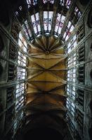
Title (German)
Berlin, Bern, Münster
Caption
Keyword photographer: floor plan. Title rider: Bern; Minster
Caption (German)
Schlagwort Bestandsbildner: Grundriss. Titel Reiter: Bern; Münster
Record Name
Dia_287-22895

Title (German)
Berlin, Bern, Münster
Caption
Keyword photographer: floor plan. Title rider: Bern; Minster
Caption (German)
Schlagwort Bestandsbildner: Grundriss. Titel Reiter: Bern; Münster
Record Name
Dia_287-22896

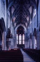
Title (German)
Berlin, Bern, Münster, Langhaus nach Osten
Caption
Title rider: Bern; Minster
Caption (German)
Titel Reiter: Bern; Münster
Record Name
Dia_287-22897
Title (German)
Berlin, Bern, Münster, Münster nach Osten
Caption
Title rider: Bern; Minster
Caption (German)
Titel Reiter: Bern; Münster
Record Name
Dia_287-22898

Title (German)
Berlin, Bern, Münster, Langhausgewölbe
Caption
Title rider: Bern; Minster
Caption (German)
Titel Reiter: Bern; Münster
Record Name
Dia_287-22899

Title (German)
Berlin, Bern, Münster, Langhaus nach Osten
Caption
Title rider: Bern; Minster
Caption (German)
Titel Reiter: Bern; Münster
Record Name
Dia_287-22900

Title (German)
Berlin, Bern, Münster, Langaus nach Westen
Caption
Title rider: Bern; Minster
Caption (German)
Titel Reiter: Bern; Münster
Record Name
Dia_287-22901

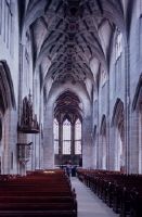
Title (German)
Berlin, Bern, Münster, Langhaus
Caption
Title rider: Bern; Minster
Caption (German)
Titel Reiter: Bern; Münster
Record Name
Dia_287-22902
Title (German)
Berlin, Bern, Münster, Langhaus nach Osten
Caption
Title rider: Bern; Minster
Caption (German)
Titel Reiter: Bern; Münster
Record Name
Dia_287-22903

Title (German)
Berlin, Bern, Dominkanerkirche, Dominikanerkirche nach Osten
Caption
Title rider: Bern; Dominkanerkirche
Caption (German)
Titel Reiter: Bern; Dominkanerkirche
Record Name
Dia_287-22904

Title (German)
Bernay, Abteikirche, Um 1024
Caption
Keyword photographer: Floor plan. Title rider: Bernay; abbey church
Caption (German)
Schlagwort Bestandsbildner: Grundriss. Titel Reiter: Bernay; Abteikirche
Record Name
Dia_287-22905

Title (German)
Bernay, Abteikirche, Bernay
Caption
Keyword photographer: Floor plan. Title rider: Bernay; abbey church
Caption (German)
Schlagwort Bestandsbildner: Grundriss. Titel Reiter: Bernay; Abteikirche
Record Name
Dia_287-22906

Title (German)
Bernay, Abteikirche, Ca. 1024
Caption
Keyword photographer: Floor plan. Title rider: Bernay; abbey church
Caption (German)
Schlagwort Bestandsbildner: Grundriss. Titel Reiter: Bernay; Abteikirche
Record Name
Dia_287-22907

Title (German)
Bernay, Abteikirche, Mittelschiff nach Osten
Caption
Title rider: Bernay; abbey church
Caption (German)
Titel Reiter: Bernay; Abteikirche
Record Name
Dia_287-22908

Title (German)
Bernay, Abteikirche, Mittelschiff nach Osten
Caption
Title rider: Bernay; abbey church
Caption (German)
Titel Reiter: Bernay; Abteikirche
Record Name
Dia_287-22909

Title (German)
Bernay, Abteikirche, Mittelschiffwand
Caption
Title rider: Bernay; abbey church
Caption (German)
Titel Reiter: Bernay; Abteikirche
Record Name
Dia_287-22910

Title (German)
Bernay, Abteikirche, Mittelschiffwand
Caption
Title rider: Bernay; abbey church
Caption (German)
Titel Reiter: Bernay; Abteikirche
Record Name
Dia_287-22911

Title (German)
Bernay, Abteikirche, Mittelschiffwand
Caption
Title rider: Bernay; abbey church
Caption (German)
Titel Reiter: Bernay; Abteikirche
Record Name
Dia_287-22912

Title (German)
Bernay, Abteikirche, Mittelschiff, Südwand von Nordwesten
Caption
Title rider: Bernay; abbey church
Caption (German)
Titel Reiter: Bernay; Abteikirche
Record Name
Dia_287-22913

Title (German)
Bernay, Abteikirche, Mittelschiff, Südwand von Westen
Caption
Title rider: Bernay; abbey church
Caption (German)
Titel Reiter: Bernay; Abteikirche
Record Name
Dia_287-22914

Title (German)
Bernay, Abteikirche, Südliche Mittelschifwand von Nordwesten
Caption
Title rider: Bernay; abbey church
Caption (German)
Titel Reiter: Bernay; Abteikirche
Record Name
Dia_287-22915

Title (German)
Bernay, Abteikirche, Nische im Mittelschiff
Caption
Title rider: Bernay; abbey church
Caption (German)
Titel Reiter: Bernay; Abteikirche
Record Name
Dia_287-22916

Title (German)
Bernay, Abteikirche, Südliches Seitenschiff
Caption
Title rider: Bernay; abbey church
Caption (German)
Titel Reiter: Bernay; Abteikirche
Record Name
Dia_287-22917.tif

Title (German)
Bernay, Abteikirche, Südliches Seitenschiff
Caption
Title rider: Bernay; abbey church
Caption (German)
Titel Reiter: Bernay; Abteikirche
Record Name
Dia_287-22918

Title (German)
Bernay, Abteikirche, Südliches Querhaus, Ostwand
Caption
Title rider: Bernay; abbey church
Caption (German)
Titel Reiter: Bernay; Abteikirche
Record Name
Dia_287-22919

Title (German)
Bernay, Abteikirche, Südliches Querschiff, Ostwand
Caption
Title rider: Bernay; abbey church
Caption (German)
Titel Reiter: Bernay; Abteikirche
Record Name
Dia_287-22920

Title (German)
Bernay, Abteikirche, Bifore im Mittelschiff
Caption
Title rider: Bernay; abbey church
Caption (German)
Titel Reiter: Bernay; Abteikirche
Record Name
Dia_287-22921

Title (German)
Bernay, Abteikirche, Querhaus, Ostwand
Caption
Title rider: Bernay; abbey church
Caption (German)
Titel Reiter: Bernay; Abteikirche
Record Name
Dia_287-22922
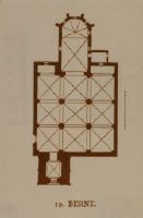
Title (German)
Berne, Berne
Caption
Keyword photographer: floor plan. Title rider: Berne
Caption (German)
Schlagwort Bestandsbildner: Grundriss. Titel Reiter: Berne
Record Name
Dia_287-22923

Title (German)
Berne, Berne
Caption
Keyword photographer: floor plan. Title rider: Berne
Caption (German)
Schlagwort Bestandsbildner: Grundriss. Titel Reiter: Berne
Record Name
Dia_287-22924

Title (German)
Berschis, St. Georg
Caption
Photographer keyword: floor plan. Title rider: Berschis
Caption (German)
Schlagwort Bestandsbildner: Grundriss. Titel Reiter: Berschis
Record Name
Dia_287-22925

Title (German)
Berzé-la-Ville, Wandmalerei, 12. Jh., Martyrium des Hl. Blasius
Caption
Title rider: Berzé-la-Ville
Caption (German)
Titel Reiter: Berzé-la-Ville
Record Name
Dia_287-22926

Title (German)
Berzé-la-Ville, Wandmalerei, 12. Jh., Martyrium des Hl. Blasius
Caption
Title rider: Berzé-la-Ville
Caption (German)
Titel Reiter: Berzé-la-Ville
Record Name
Dia_287-22927

Title (German)
Berzé-la-Ville, Apsisgewölbe, Wandmalerei, 12. Jh., Christus
Caption
Title rider: Berzé-la-Ville
Caption (German)
Titel Reiter: Berzé-la-Ville
Record Name
Dia_287-22928

Title (German)
Berzé-la-Ville, Apsisgewölbe, Wandmalerei, 12. Jh., Martyrium des Hl. Laurenzius
Caption
Title rider: Berzé-la-Ville
Caption (German)
Titel Reiter: Berzé-la-Ville
Record Name
Dia_287-22929

Title (German)
Berzé-la-Ville, Apsisgewölbe, Wandmalerei, 12. Jh., Christus und Apostel
Caption
Title rider: Berzé-la-Ville
Caption (German)
Titel Reiter: Berzé-la-Ville
Record Name
Dia_287-22930

Title (German)
Berzé-la-Ville, Apsisgewölbe, Wandmalerei, 12. Jh., Heilige
Caption
Title rider: Berzé-la-Ville
Caption (German)
Titel Reiter: Berzé-la-Ville
Record Name
Dia_287-22931

Title (German)
Besançon, Kathedrale, Altar "hoc signum praestat populis caelestia regna"
Caption
Title tab: Besançon; Cathedral
Caption (German)
Titel Reiter: Besançon; Kathedrale
Record Name
Dia_287-22932

Title (German)
Bethlehem, Marienkirche, Saec. 4
Caption
Keyword photographer: Floor plan. Title rider: Bethlehem; St. Mary's Church
Caption (German)
Schlagwort Bestandsbildner: Grundriss. Titel Reiter: Bethlehem; Marienkirche
Record Name
Dia_287-22933

Title (German)
Bethlehem, Marienkirche
Caption
Keyword photographer: floor plan. Title rider: Bethlehem; St. Mary's Church
Caption (German)
Schlagwort Bestandsbildner: Grundriss. Titel Reiter: Bethlehem; Marienkirche
Record Name
Dia_287-22934

Title (German)
Beverley, St Mary's Church
Caption
Keyword photographer: floor plan. Title rider: Beverly
Caption (German)
Schlagwort Bestandsbildner: Grundriss. Titel Reiter: Beverly
Record Name
Dia_287-22935

Title (German)
Beverley, St. Mary
Caption
Keyword photographer: floor plan. Title rider: Beverly
Caption (German)
Schlagwort Bestandsbildner: Grundriss. Titel Reiter: Beverly
Record Name
Dia_287-22936

Title (German)
Beverley, Querschiff
Caption
Keyword photographer: floor plan. Title rider: Beverly
Caption (German)
Schlagwort Bestandsbildner: Grundriss. Titel Reiter: Beverly
Record Name
Dia_287-22937

Title (German)
Beverley, Querschiff
Caption
Keyword photographer: floor plan. Title rider: Beverly
Caption (German)
Schlagwort Bestandsbildner: Grundriss. Titel Reiter: Beverly
Record Name
Dia_287-22938

Title (German)
Béziers, St. Aphrodise, Saec. 10
Caption
Keyword photographer: Floor plan. Title rider: Béziers; St. Aphrodise
Caption (German)
Schlagwort Bestandsbildner: Grundriss. Titel Reiter: Béziers; St. Aphrodise
Record Name
Dia_287-22939

Title (German)
Béziers, St. Aphrodise, S. Aphrodise
Caption
Keyword photographer: Floor plan. Title rider: Béziers; St. Aphrodise
Caption (German)
Schlagwort Bestandsbildner: Grundriss. Titel Reiter: Béziers; St. Aphrodise
Record Name
Dia_287-22940

Title (German)
Béziers, St. Aphrodise, Etwa 1. H. saec. 11
Caption
Keyword photographer: Floor plan. Title rider: Béziers; St. Aphrodise
Caption (German)
Schlagwort Bestandsbildner: Grundriss. Titel Reiter: Béziers; St. Aphrodise
Record Name
Dia_287-22941

Title (German)
Béziers, St. Jacques, Saec. 11 - 12
Caption
Keyword photographer: floor plan. Title rider: Béziers; St. Jacques
Caption (German)
Schlagwort Bestandsbildner: Grundriss. Titel Reiter: Béziers; St. Jacques
Record Name
Dia_287-22942

Title (German)
Biéville, Fassade, 1. H. saec. 12
Caption
Keyword photographer: floor plan. Title rider: Biéville
Caption (German)
Schlagwort Bestandsbildner: Grundriss. Titel Reiter: Biéville
Record Name
Dia_287-22943

Title (German)
Billerbeck, Propsteikirche St. Ludgerus
Caption
Keyword photographer: floor plan. Title rider: Billerbeck
Caption (German)
Schlagwort Bestandsbildner: Grundriss. Titel Reiter: Billerbeck
Record Name
Dia_287-22944

Title (German)
Billerbeck, Propsteikirche St. Ludgerus
Caption
Keyword photographer: floor plan. Title rider: Billerbeck
Caption (German)
Schlagwort Bestandsbildner: Grundriss. Titel Reiter: Billerbeck
Record Name
Dia_287-22945

Title (German)
Billerbeck, Propsteikirche St. Ludgerus
Caption
Keyword photographer: floor plan. Title rider: Billerbeck
Caption (German)
Schlagwort Bestandsbildner: Grundriss. Titel Reiter: Billerbeck
Record Name
Dia_287-22946

Title (German)
Bitetto, Kathedrale
Caption
Keyword photographer: Floor plan. Title tab: Bitetto
Caption (German)
Schlagwort Bestandsbildner: Grundriss. Titel Reiter: Bitetto
Record Name
Dia_287-22947

Title (German)
Blattwerk, Taf. 585
Caption
Keyword Photographer: Floor plan. Title tab: foliage
Caption (German)
Schlagwort Bestandsbildner: Grundriss. Titel Reiter: Blattwerk
Record Name
Dia_287-22948

Title (German)
Blattwerk, Taf. 586
Caption
Keyword Photographer: Floor plan. Title tab: foliage
Caption (German)
Schlagwort Bestandsbildner: Grundriss. Titel Reiter: Blattwerk
Record Name
Dia_287-22949

Title (German)
Blattwerk, Taf. 587
Caption
Keyword Photographer: Floor plan. Title tab: foliage
Caption (German)
Schlagwort Bestandsbildner: Grundriss. Titel Reiter: Blattwerk
Record Name
Dia_287-22950
Title (German)
Blattwerk, Taf. 588
Caption
Keyword Photographer: Floor plan. Title tab: foliage
Caption (German)
Schlagwort Bestandsbildner: Grundriss. Titel Reiter: Blattwerk
Record Name
Dia_287-22951

Title (German)
Blattwerk, Taf. 589
Caption
Keyword Photographer: Floor plan. Title tab: foliage
Caption (German)
Schlagwort Bestandsbildner: Grundriss. Titel Reiter: Blattwerk
Record Name
Dia_287-22952

Title (German)
Blattwerk, Taf. 590
Caption
Keyword Photographer: Floor plan. Title tab: foliage
Caption (German)
Schlagwort Bestandsbildner: Grundriss. Titel Reiter: Blattwerk
Record Name
Dia_287-22953

Title (German)
Blattwerk, Taf. 591
Caption
Keyword Photographer: Floor plan. Title tab: foliage
Caption (German)
Schlagwort Bestandsbildner: Grundriss. Titel Reiter: Blattwerk
Record Name
Dia_287-22954

Title (German)
Blattwerk, Taf. 592
Caption
Keyword Photographer: Floor plan. Title tab: foliage
Caption (German)
Schlagwort Bestandsbildner: Grundriss. Titel Reiter: Blattwerk
Record Name
Dia_287-22955

Title (German)
Blattwerk, Taf. 593
Caption
Keyword Photographer: Floor plan. Title tab: foliage
Caption (German)
Schlagwort Bestandsbildner: Grundriss. Titel Reiter: Blattwerk
Record Name
Dia_287-22956

Title (German)
Bocke
Caption
Keyword photographer: Floor plan. Title rider: trestle
Caption (German)
Schlagwort Bestandsbildner: Grundriss. Titel Reiter: Bocke
Record Name
Dia_287-22957

Title (German)
Bogen- und Rippenprofile, Taf. 570
Caption
Keyword photographer: floor plan. Title tab: arch and rib profiles
Caption (German)
Schlagwort Bestandsbildner: Grundriss. Titel Reiter: Bogen- und Rippenprofile
Record Name
Dia_287-22958

Title (German)
Bogen- und Rippenprofile, Taf. 571
Caption
Keyword photographer: floor plan. Title tab: arch and rib profiles
Caption (German)
Schlagwort Bestandsbildner: Grundriss. Titel Reiter: Bogen- und Rippenprofile
Record Name
Dia_287-22959

Title (German)
Bogen- und Rippenprofile, Taf. 572
Caption
Keyword photographer: floor plan. Title tab: arch and rib profiles
Caption (German)
Schlagwort Bestandsbildner: Grundriss. Titel Reiter: Bogen- und Rippenprofile
Record Name
Dia_287-22960

Title (German)
Bogen- und Rippenprofile, Taf. 573
Caption
Keyword photographer: floor plan. Title tab: arch and rib profiles
Caption (German)
Schlagwort Bestandsbildner: Grundriss. Titel Reiter: Bogen- und Rippenprofile
Record Name
Dia_287-22961

Title (German)
Bogen- und Rippenprofile, Taf. 574
Caption
Keyword photographer: floor plan. Title tab: arch and rib profiles
Caption (German)
Schlagwort Bestandsbildner: Grundriss. Titel Reiter: Bogen- und Rippenprofile
Record Name
Dia_287-22962

Title (German)
Bogen- und Rippenprofile, Taf. 575
Caption
Keyword photographer: floor plan. Title tab: arch and rib profiles
Caption (German)
Schlagwort Bestandsbildner: Grundriss. Titel Reiter: Bogen- und Rippenprofile
Record Name
Dia_287-22963

Title (German)
Bois, Sainte Marie
Caption
Keyword photographer: Floor plan. Title rider: Bois; St. Marie
Caption (German)
Schlagwort Bestandsbildner: Grundriss. Titel Reiter: Bois; St. Marie
Record Name
Dia_287-22964

Title (German)
Bois, Sainte Marie
Caption
Keyword photographer: Floor plan. Title rider: Bois; St. Marie
Caption (German)
Schlagwort Bestandsbildner: Grundriss. Titel Reiter: Bois; St. Marie
Record Name
Dia_287-22965

Title (German)
Bois, Sainte Marie
Caption
Keyword photographer: Floor plan. Title rider: Bois; St. Marie
Caption (German)
Schlagwort Bestandsbildner: Grundriss. Titel Reiter: Bois; St. Marie
Record Name
Dia_287-22966

Title (German)
Bois, St. Marie, Fassade
Caption
Title rider: Bois; St. Marie
Caption (German)
Titel Reiter: Bois; St. Marie
Record Name
Dia_287-22967

Title (German)
Bois, St. Marie, Südseite
Caption
Title rider: Bois; St. Marie
Caption (German)
Titel Reiter: Bois; St. Marie
Record Name
Dia_287-22968

Title (German)
Bois, St. Marie, Nördliche Langhauswand, innen
Caption
Title rider: Bois; St. Marie; inside
Caption (German)
Titel Reiter: Bois; St. Marie; innen
Record Name
Dia_287-22969

Title (German)
Bois, St. Marie, Langhaus von Südosten, innen
Caption
Title rider: Bois; St. Marie; inside
Caption (German)
Titel Reiter: Bois; St. Marie; innen
Record Name
Dia_287-22970

Title (German)
Bois, St. Marie, Langhaus von Osten, innen
Caption
Title rider: Bois; St. Marie; inside
Caption (German)
Titel Reiter: Bois; St. Marie; innen
Record Name
Dia_287-22971

Title (German)
Bois, St. Marie, Südliche Langhauswand, innen
Caption
Title rider: Bois; St. Marie; inside
Caption (German)
Titel Reiter: Bois; St. Marie; innen
Record Name
Dia_287-22972

Title (German)
Bois, St. Marie, Schiff, innen
Caption
Title rider: Bois; St. Marie; inside
Caption (German)
Titel Reiter: Bois; St. Marie; innen
Record Name
Dia_287-22973

Title (German)
Bois, St. Marie, Chor, innen
Caption
Title rider: Bois; St. Marie; inside
Caption (German)
Titel Reiter: Bois; St. Marie; innen
Record Name
Dia_287-22974

Title (German)
Bois, St. Marie, Chor, innen
Caption
Title rider: Bois; St. Marie; inside
Caption (German)
Titel Reiter: Bois; St. Marie; innen
Record Name
Dia_287-22975

Title (German)
Bois, St. Marie, Chorumgang, innen
Caption
Title rider: Bois; St. Marie; inside
Caption (German)
Titel Reiter: Bois; St. Marie; innen
Record Name
Dia_287-22976

Title (German)
Bologna, St. Petronio
Caption
Keyword photographer: Floor plan. Title rider: Bologna; St. Petronio
Caption (German)
Schlagwort Bestandsbildner: Grundriss. Titel Reiter: Bologna; St. Petronio
Record Name
Dia_287-22977

Title (German)
Bologna, St. Petronio
Caption
Keyword photographer: Floor plan. Title rider: Bologna; St. Petronio
Caption (German)
Schlagwort Bestandsbildner: Grundriss. Titel Reiter: Bologna; St. Petronio
Record Name
Dia_287-22978

Title (German)
Bologna, St. Petronio
Caption
Keyword photographer: Floor plan. Title rider: Bologna; St. Petronio
Caption (German)
Schlagwort Bestandsbildner: Grundriss. Titel Reiter: Bologna; St. Petronio
Record Name
Dia_287-22979

Title (German)
Bologna, St. Petronio
Caption
Title rider: Bologna; St. Petronio
Caption (German)
Titel Reiter: Bologna; St. Petronio
Record Name
Dia_287-22980

Title (German)
Bologna, St. Petronio
Caption
Title rider: Bologna; St. Petronio
Caption (German)
Titel Reiter: Bologna; St. Petronio
Record Name
Dia_287-22981

Title (German)
Bologna, St. Petronio
Caption
Title rider: Bologna; St. Petronio
Caption (German)
Titel Reiter: Bologna; St. Petronio
Record Name
Dia_287-22982

Title (German)
Bologna, St. Petronio, Nach Osten
Caption
Title rider: Bologna; St. Petronio
Caption (German)
Titel Reiter: Bologna; St. Petronio
Record Name
Dia_287-22983

Title (German)
Bologna, St. Petronio, Hauptportal, Genesis Jacopo della Quercia
Caption
Title rider: Bologna; St. Petronio
Caption (German)
Titel Reiter: Bologna; St. Petronio
Record Name
Dia_287-22984

Title (German)
Bologna, St. Petronio, Sockel
Caption
Title rider: Bologna; St. Petronio
Caption (German)
Titel Reiter: Bologna; St. Petronio
Record Name
Dia_287-22985

Title (German)
Bologna, St. Petronio, Sockel
Caption
Title rider: Bologna; St. Petronio
Caption (German)
Titel Reiter: Bologna; St. Petronio
Record Name
Dia_287-22986

Title (German)
Bologna, St. Giovanni in Monte, Fassade
Caption
Title rider: Bologna; St. Giovanni in Monte
Caption (German)
Titel Reiter: Bologna; St. Giovanni in Monte
Record Name
Dia_287-22987

Title (German)
Bologna, S. M. dei Servi, Atrium
Caption
Title rider: Bologna; S. M. dei Servi
Caption (German)
Titel Reiter: Bologna; S. M. dei Servi
Record Name
Dia_287-22988

Title (German)
Bologna, S. M. dei Servi, Bogengang
Caption
Title rider: Bologna; S. M. dei Servi
Caption (German)
Titel Reiter: Bologna; S. M. dei Servi
Record Name
Dia_287-22989

Title (German)
Bologna, SS. Pietro e Paolo
Caption
Keyword photographer: floor plan. Title rider: Bologna; SS. Pietro e Paolo
Caption (German)
Schlagwort Bestandsbildner: Grundriss. Titel Reiter: Bologna; SS. Pietro e Paolo
Record Name
Dia_287-22990

Title (German)
Bologna, SS. Pietro e Paolo
Caption
Keyword photographer: floor plan. Title rider: Bologna; SS. Pietro e Paolo
Caption (German)
Schlagwort Bestandsbildner: Grundriss. Titel Reiter: Bologna; SS. Pietro e Paolo
Record Name
Dia_287-22991

Title (German)
Bologna, SS. Pietro e Paolo
Caption
Keyword photographer: floor plan. Title rider: Bologna; SS. Pietro e Paolo
Caption (German)
Schlagwort Bestandsbildner: Grundriss. Titel Reiter: Bologna; SS. Pietro e Paolo
Record Name
Dia_287-22992

Title (German)
Bologna, S. Sepolcro, Saec. 12
Caption
Keyword photographer: floor plan. Title rider: Bologna; S. Sepolcro
Caption (German)
Schlagwort Bestandsbildner: Grundriss. Titel Reiter: Bologna; S. Sepolcro
Record Name
Dia_287-22993

Title (German)
Bologna, S. Sepolcro, Saec. 12
Caption
Keyword photographer: floor plan. Title rider: Bologna; S. Sepolcro
Caption (German)
Schlagwort Bestandsbildner: Grundriss. Titel Reiter: Bologna; S. Sepolcro
Record Name
Dia_287-22994

Title (German)
Bologna, S. Sepolcro
Caption
Title rider: Bologna; S. Sepolcro
Caption (German)
Titel Reiter: Bologna; S. Sepolcro
Record Name
Dia_287-22995

Title (German)
Bologna, S. Stefano, Kreuzgang
Caption
Title rider: S. Stefano
Caption (German)
Titel Reiter: S. Stefano
Record Name
Dia_287-22996

Title (German)
Bologna, S. Stefano, Kreuzgang
Caption
Title rider: S. Stefano
Caption (German)
Titel Reiter: S. Stefano
Record Name
Dia_287-22997

Title (German)
Bologna, S. Stefano, Kreuzgang
Caption
Title rider: S. Stefano
Caption (German)
Titel Reiter: S. Stefano
Record Name
Dia_287-22998

Title (German)
Bologna, S. Stefano, Kreuzgang
Caption
Title rider: S. Stefano
Caption (German)
Titel Reiter: S. Stefano
Record Name
Dia_287-22999

Title (German)
Bonmont, Dimier, Tf. 42
Caption
Keyword photographer: floor plan. Title rider: Bonmont
Caption (German)
Schlagwort Bestandsbildner: Grundriss. Titel Reiter: Bonmont
Record Name
Dia_287-23000

Title (German)
Bonmont, Saec. 12
Caption
Keyword photographer: floor plan. Title rider: Bonmont
Caption (German)
Schlagwort Bestandsbildner: Grundriss. Titel Reiter: Bonmont
Record Name
Dia_287-23001

Title (German)
Bonmont, Zisterz. Kirche
Caption
Title rider: Bonmont
Caption (German)
Titel Reiter: Bonmont
Record Name
Dia_287-23002

Title (German)
Bonn, Münster
Caption
Keyword photographer: floor plan. Title rider: Bonn; Minster
Caption (German)
Schlagwort Bestandsbildner: Grundriss. Titel Reiter: Bonn; Münster
Record Name
Dia_287-23003

Title (German)
Bonn, Münster, Münsterkirche
Caption
Keyword photographer: floor plan. Title rider: Bonn; Minster
Caption (German)
Schlagwort Bestandsbildner: Grundriss. Titel Reiter: Bonn; Münster
Record Name
Dia_287-23004

Title (German)
Bonn, Münster
Caption
Keyword photographer: floor plan. Title rider: Bonn; Minster
Caption (German)
Schlagwort Bestandsbildner: Grundriss. Titel Reiter: Bonn; Münster
Record Name
Dia_287-23005

Title (German)
Bonn, Münster
Caption
Keyword photographer: floor plan. Title rider: Bonn; Minster
Caption (German)
Schlagwort Bestandsbildner: Grundriss. Titel Reiter: Bonn; Münster
Record Name
Dia_287-23006

Title (German)
Bonn, Münster, A. saec. 13
Caption
Keyword photographer: floor plan. Title rider: Bonn; Minster
Caption (German)
Schlagwort Bestandsbildner: Grundriss. Titel Reiter: Bonn; Münster
Record Name
Dia_287-23007

Title (German)
Bonn, Münster, Kreuzgang am Münster, um 1150
Caption
Keyword photographer: floor plan. Title rider: Bonn; Minster
Caption (German)
Schlagwort Bestandsbildner: Grundriss. Titel Reiter: Bonn; Münster
Record Name
Dia_287-23008

Title (German)
Bonn, Münster, Kreuzgang um 1150
Caption
Keyword photographer: floor plan. Title rider: Bonn; Minster
Caption (German)
Schlagwort Bestandsbildner: Grundriss. Titel Reiter: Bonn; Münster
Record Name
Dia_287-23009

Title (German)
Bonn, Münster
Caption
Title rider: Bonn; Münster
Caption (German)
Titel Reiter: Bonn; Münster
Record Name
Dia_287-23010

Title (German)
Bonn, Münster
Caption
Title rider: Bonn; Münster
Caption (German)
Titel Reiter: Bonn; Münster
Record Name
Dia_287-23011

Title (German)
Bonn, Münster, Langhaus
Caption
Title rider: Bonn; Münster
Caption (German)
Titel Reiter: Bonn; Münster
Record Name
Dia_287-23012

Title (German)
Bonn, Münster
Caption
Title rider: Bonn; Münster
Caption (German)
Titel Reiter: Bonn; Münster
Record Name
Dia_287-23013

Title (German)
Bonn, Münster, 1922
Caption
Title rider: Bonn; Münster
Caption (German)
Titel Reiter: Bonn; Münster
Record Name
Dia_287-23014

Title (German)
Bonn, Münster, Apsis
Caption
Title rider: Bonn; Münster
Caption (German)
Titel Reiter: Bonn; Münster
Record Name
Dia_287-23015

Title (German)
Bonn, Münster, Ostbau
Caption
Title rider: Bonn; Münster
Caption (German)
Titel Reiter: Bonn; Münster
Record Name
Dia_287-23016

Title (German)
Bonn, Münster
Caption
Title rider: Bonn; Münster
Caption (German)
Titel Reiter: Bonn; Münster
Record Name
Dia_287-23017

Title (German)
Bonn, Münster, Südquerschiff
Caption
Title rider: Bonn; Münster
Caption (German)
Titel Reiter: Bonn; Münster
Record Name
Dia_287-23018

Title (German)
Bonn, Münster, Südquerhaus
Caption
Title rider: Bonn; Münster
Caption (German)
Titel Reiter: Bonn; Münster
Record Name
Dia_287-23019

Title (German)
Bonn, Münster, 1953
Caption
Title rider: Bonn; Münster
Caption (German)
Titel Reiter: Bonn; Münster
Record Name
Dia_287-23021

Title (German)
Bonn, Münster, Langhaus
Caption
Title rider: Bonn; Münster
Caption (German)
Titel Reiter: Bonn; Münster
Record Name
Dia_287-23022

Title (German)
Bonn, Münster, Langhaus
Caption
Title rider: Bonn; Münster
Caption (German)
Titel Reiter: Bonn; Münster
Record Name
Dia_287-23023

Title (German)
Bonn, Münster, Langhaus
Caption
Title rider: Bonn; Münster
Caption (German)
Titel Reiter: Bonn; Münster
Record Name
Dia_287-23024

Title (German)
Bonn, Münster, Krypta nach Nordosten
Caption
Title rider: Bonn; Münster
Caption (German)
Titel Reiter: Bonn; Münster
Record Name
Dia_287-23025

Title (German)
Bonn, Friedhofkapelle, Ehem. Ramersdorf
Caption
Title rider: Bonn; cemetery chapel
Caption (German)
Titel Reiter: Bonn; Friedhofkapelle
Record Name
Dia_287-23026

Title (German)
Bonn, Minoritenkirche
Caption
Keyword photographer: ground plan. Title tab: Bonn; Minoritenkirche church
Caption (German)
Schlagwort Bestandsbildner: Grundriss. Titel Reiter: Bonn; Minoritenkirche
Record Name
Dia_287-23027

Title (German)
Bonn, St. Martin
Caption
Title rider: Bonn; St. Martin
Caption (German)
Titel Reiter: Bonn; St. Martin
Record Name
Dia_287-23028

Title (German)
Bonn, St. Martin
Caption
Title rider: Bonn; St. Martin
Caption (German)
Titel Reiter: Bonn; St. Martin
Record Name
Dia_287-23029

Title (German)
Bordeaux, Kath. St. André, Kathedrale
Caption
Keyword photographer: floor plan. Title rider: Bordeaux; Cath St. André
Caption (German)
Schlagwort Bestandsbildner: Grundriss. Titel Reiter: Bordeaux; Kath. St. André
Record Name
Dia_287-23030

Title (German)
Bordeaux, Kath. St. André, Kathedrale
Caption
Keyword photographer: floor plan. Title rider: Bordeaux; Cath St. André
Caption (German)
Schlagwort Bestandsbildner: Grundriss. Titel Reiter: Bordeaux; Kath. St. André
Record Name
Dia_287-23031

Title (German)
Bordeaux, St. Seurin, S. Seurin
Caption
Keyword photographer: floor plan. Title rider: Bordeaux; St. Seurin
Caption (German)
Schlagwort Bestandsbildner: Grundriss. Titel Reiter: Bordeaux; St. Seurin
Record Name
Dia_287-23032

Title (German)
Fidenza, Borgo-San-Donnino, Borgo-San-Donnino
Caption
Keyword photographer: floor plan. Title rider: Borgo-San-Donnino
Caption (German)
Schlagwort Bestandsbildner: Grundriss. Titel Reiter: Borgo-San-Donnino
Record Name
Dia_287-23033

Title (German)
Bosch, Hiernoymus Bosch, Laatste Oordeel Detail
Caption
Title rider: Bosch
Caption (German)
Titel Reiter: Bosch
Record Name
Dia_287-23034

Title (German)
Bosch, Hiernoymus Bosch, Laatste Oordeel
Caption
Title rider: Bosch
Caption (German)
Titel Reiter: Bosch
Record Name
Dia_287-23035

Title (German)
Saint-Martin-de-Boscherville, Saint-Georges, Beg. A. 1050 (?)
Caption
Keyword photographer: floor plan. Title rider: Boscherville
Caption (German)
Schlagwort Bestandsbildner: Grundriss. Titel Reiter: Boscherville
Record Name
Dia_287-23036

Title (German)
Saint-Martin-de-Boscherville, Saint-Georges, 1. H. saec. 12
Caption
Keyword photographer: floor plan. Title rider: Boscherville
Caption (German)
Schlagwort Bestandsbildner: Grundriss. Titel Reiter: Boscherville
Record Name
Dia_287-23037

Title (German)
Saint-Martin-de-Boscherville, Saint-Georges
Caption
Keyword photographer: floor plan. Title rider: Boscherville
Caption (German)
Schlagwort Bestandsbildner: Grundriss. Titel Reiter: Boscherville
Record Name
Dia_287-23038

Title (German)
Saint-Martin-de-Boscherville, Saint-Georges, saec. 11
Caption
Keyword photographer: floor plan. Title rider: Boscherville
Caption (German)
Schlagwort Bestandsbildner: Grundriss. Titel Reiter: Boscherville
Record Name
Dia_287-23039

Title (German)
Boston, Tower
Caption
Keyword photographer: floor plan. Title tab: Boston
Caption (German)
Schlagwort Bestandsbildner: Grundriss. Titel Reiter: Boston
Record Name
Dia_287-23040

Title (German)
Boston, Bourg. en. Bresse, N. D., Mittelschiff von Westen
Caption
Title rider: Boston
Caption (German)
Titel Reiter: Boston
Record Name
Dia_287-23041

Title (German)
Boston, Bourg. En. Bresse, N. D., Chorgewölbe
Caption
Title rider: Boston
Caption (German)
Titel Reiter: Boston
Record Name
Dia_287-23042

Title (German)
Charente, Bourg sur Charente, Saec. 12
Caption
Keyword photographer: Floor plan. Title rider: Bourg sur Charente
Caption (German)
Schlagwort Bestandsbildner: Grundriss. Titel Reiter: Bourg sur Charente
Record Name
Dia_287-23043

Title (German)
Bourges, Kath. St. Etienne, Projektiert 1172, beg. Saec. 13
Caption
Keyword photographer: Floor plan. Title rider: Bourges; St. Etienne Cathedral
Caption (German)
Schlagwort Bestandsbildner: Grundriss. Titel Reiter: Bourges; Kath. St. Etienne
Record Name
Dia_287-23044

Title (German)
Bourges, Kath. St. Etienne, Anf. 13. Jh., Viollet-le-Duc, d'arch. IX, s. 252
Caption
Keyword photographer: Floor plan. Title rider: Bourges; St. Etienne Cathedral
Caption (German)
Schlagwort Bestandsbildner: Grundriss. Titel Reiter: Bourges; Kath. St. Etienne
Record Name
Dia_287-23045
Title (German)
Bourges, Kath. St. Etienne, 1. H. saec. 13
Caption
Keyword photographer: Floor plan. Title rider: Bourges; St. Etienne Cathedral
Caption (German)
Schlagwort Bestandsbildner: Grundriss. Titel Reiter: Bourges; Kath. St. Etienne
Record Name
Dia_287-23046

Title (German)
Bourges, Kath. St. Etienne, Dachstuhl; Repro Hirmer 305
Caption
Title rider: Bourges; Cath. St. Etienne
Caption (German)
Titel Reiter: Bourges; Kath. St. Etienne
Record Name
Dia_287-23047

Title (German)
Braine, St. Yved, Beg. C. 1200
Caption
Keyword photographer: floor plan. Title rider: Braine; St. Yved
Caption (German)
Schlagwort Bestandsbildner: Grundriss. Titel Reiter: Braine; St. Yved
Record Name
Dia_287-23048

Title (German)
Braine, St. Yved, A. saec. 13
Caption
Keyword photographer: floor plan. Title rider: Braine; St. Yved
Caption (German)
Schlagwort Bestandsbildner: Grundriss. Titel Reiter: Braine; St. Yved
Record Name
Dia_287-23049

Title (German)
Braine, St. Yved, A. saec. 13
Caption
Keyword photographer: floor plan. Title rider: Braine; St. Yved
Caption (German)
Schlagwort Bestandsbildner: Grundriss. Titel Reiter: Braine; St. Yved
Record Name
Dia_287-23050

Title (German)
Braine, St. Yved
Caption
Keyword photographer: floor plan. Title rider: Braine; St. Yved
Caption (German)
Schlagwort Bestandsbildner: Grundriss. Titel Reiter: Braine; St. Yved
Record Name
Dia_287-23051

Title (German)
Braine, St. Yved, A. saec. 13
Caption
Keyword photographer: floor plan. Title rider: Braine; St. Yved
Caption (German)
Schlagwort Bestandsbildner: Grundriss. Titel Reiter: Braine; St. Yved
Record Name
Dia_287-23052
Title (German)
Braine, St. Yved, Collégiale, Chor
Caption
Title rider: Braine; St. Yved
Caption (German)
Titel Reiter: Braine; St. Yved
Record Name
Dia_287-23053

Title (German)
Braine, St. Yved, Collégiale, Chor
Caption
Title rider: Braine; St. Yved
Caption (German)
Titel Reiter: Braine; St. Yved
Record Name
Dia_287-23054

Title (German)
Braine, St. Yved
Caption
Title rider: Braine; St. Yved
Caption (German)
Titel Reiter: Braine; St. Yved
Record Name
Dia_287-23055

Title (German)
Braine, St. Yved
Caption
Title rider: Braine; St. Yved
Caption (German)
Titel Reiter: Braine; St. Yved
Record Name
Dia_287-23056

Title (German)
Braine, St. Yved
Caption
Title rider: Braine; St. Yved
Caption (German)
Titel Reiter: Braine; St. Yved
Record Name
Dia_287-23057
Title (German)
Braine, St. Yved, Collégiale, nördliches Querhaus
Caption
Title rider: Braine; St. Yved
Caption (German)
Titel Reiter: Braine; St. Yved
Record Name
Dia_287-23058

Title (German)
Braine, St. Yved
Caption
Title rider: Braine; St. Yved
Caption (German)
Titel Reiter: Braine; St. Yved
Record Name
Dia_287-23059

Title (German)
Braine, St. Yved
Caption
Title rider: Braine; St. Yved
Caption (German)
Titel Reiter: Braine; St. Yved
Record Name
Dia_287-23060

Title (German)
Braine, St. Yved
Caption
Title rider: Braine; St. Yved
Caption (German)
Titel Reiter: Braine; St. Yved
Record Name
Dia_287-23061

Title (German)
Braine, St. Yved
Caption
Title rider: Braine; St. Yved
Caption (German)
Titel Reiter: Braine; St. Yved
Record Name
Dia_287-23062

Title (German)
Braine, St. Yved
Caption
Title rider: Braine; St. Yved
Caption (German)
Titel Reiter: Braine; St. Yved
Record Name
Dia_287-23063

Title (German)
Braine, St. Yved
Caption
Title rider: Braine; St. Yved
Caption (German)
Titel Reiter: Braine; St. Yved
Record Name
Dia_287-23064

Title (German)
Braine, St. Yved
Caption
Title rider: Braine; St. Yved
Caption (German)
Titel Reiter: Braine; St. Yved
Record Name
Dia_287-23065

Title (German)
Brancion, Staffelchor
Caption
Title rider: Brancion
Caption (German)
Titel Reiter: Brancion
Record Name
Dia_287-23066

Title (German)
Brancion, Staffelchor
Caption
Title rider: Brancion
Caption (German)
Titel Reiter: Brancion
Record Name
Dia_287-23067

Title (German)
Brancion, Südseite
Caption
Title rider: Brancion
Caption (German)
Titel Reiter: Brancion
Record Name
Dia_287-23068

Title (German)
Brancion, Westfassade
Caption
Title rider: Brancion
Caption (German)
Titel Reiter: Brancion
Record Name
Dia_287-23069

Title (German)
Brancion, Mittelschiff nach Osten
Caption
Title rider: Brancion
Caption (German)
Titel Reiter: Brancion
Record Name
Dia_287-23070

Title (German)
Brancion, Nördliche Mittelschiffwand nach Nordwesten
Caption
Title rider: Brancion
Caption (German)
Titel Reiter: Brancion
Record Name
Dia_287-23071

Title (German)
Brancion, Nördliche Mittelschiffwand nach Nordwesten
Caption
Title rider: Brancion
Caption (German)
Titel Reiter: Brancion
Record Name
Dia_287-23072

Title (German)
Brancion, Nördliche Mittelschiffwand nach Nordwesten
Caption
Title rider: Brancion
Caption (German)
Titel Reiter: Brancion
Record Name
Dia_287-23073

Title (German)
Brancion, Nördliche Mittelschiffwand nach Osten
Caption
Title rider: Brancion
Caption (German)
Titel Reiter: Brancion
Record Name
Dia_287-23074

Title (German)
Brancion, Mittelschiffsystem
Caption
Title rider: Brancion
Caption (German)
Titel Reiter: Brancion
Record Name
Dia_287-23075

Title (German)
Brancion, Seitenschiff mit Vierteltonne
Caption
Title rider: Brancion
Caption (German)
Titel Reiter: Brancion
Record Name
Dia_287-23076

Title (German)
Brancion, Seitenschiff mit Vierteltonne
Caption
Title rider: Brancion
Caption (German)
Titel Reiter: Brancion
Record Name
Dia_287-23077

Title (German)
Brancion, Seitenschiff mit Vierteltonne
Caption
Title rider: Brancion
Caption (German)
Titel Reiter: Brancion
Record Name
Dia_287-23078

Title (German)
Brancion, Seitenschiff mit Vierteltonne
Caption
Title rider: Brancion
Caption (German)
Titel Reiter: Brancion
Record Name
Dia_287-23079

Title (German)
Brancion, Tannengewölbe von unten
Caption
Title rider: Brancion
Caption (German)
Titel Reiter: Brancion
Record Name
Dia_287-23080

Title (German)
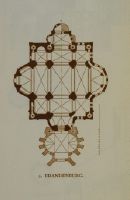
Brandenburg, Brandenburg
Caption
Keyword photographer: floor plan. Title rider: Brandenburg
Caption (German)
Schlagwort Bestandsbildner: Grundriss. Titel Reiter: Brandenburg
Record Name
Dia_287-23081

Title (German)
Brandenburg, Katharinenkirche
Caption
Keyword photographer: floor plan. Title rider: Brandenburg
Caption (German)
Schlagwort Bestandsbildner: Grundriss. Titel Reiter: Brandenburg
Record Name
Dia_287-23082

Title (German)
Brandenburg, Fronleichnamskapelle an der Katharinenkirche
Caption
Keyword photographer: floor plan. Title rider: Brandenburg
Caption (German)
Schlagwort Bestandsbildner: Grundriss. Titel Reiter: Brandenburg
Record Name
Dia_287-23083
Title (German)
Brandenburg, Harlungerbergkirche, A. saec. 13
Caption
Keyword photographer: floor plan. Title rider: Brandenburg
Caption (German)
Schlagwort Bestandsbildner: Grundriss. Titel Reiter: Brandenburg
Record Name
Dia_287-23084

Title (German)
Brandenburg, Kirche auf dem Harlungerberg, A. saec. 13
Caption
Keyword photographer: floor plan. Title rider: Brandenburg
Caption (German)
Schlagwort Bestandsbildner: Grundriss. Titel Reiter: Brandenburg
Record Name
Dia_287-23085

Title (German)
Braunau, Stadtpfarrkirche, Westgiebel
Caption
Title rider: Braunau; city parish church
Caption (German)
Titel Reiter: Braunau; Stadtpfarrkirche
Record Name
Dia_287-23086

Title (German)
Braunau, Stadtpfarrkirche, Linke Flanke
Caption
Title rider: Braunau; city parish church
Caption (German)
Titel Reiter: Braunau; Stadtpfarrkirche
Record Name
Dia_287-23087

Title (German)
Braunau, Stadtpfarrkirche, Westgiebel
Caption
Title rider: Braunau; city parish church
Caption (German)
Titel Reiter: Braunau; Stadtpfarrkirche
Record Name
Dia_287-23088

Title (German)
Braunau, Stadtpfarrkirche, Langhaus
Caption
Title rider: Braunau; city parish church
Caption (German)
Titel Reiter: Braunau; Stadtpfarrkirche
Record Name
Dia_287-23089

Title (German)
Braunau, Stadtpfarrkirche, Langhaus
Caption
Title rider: Braunau; city parish church
Caption (German)
Titel Reiter: Braunau; Stadtpfarrkirche
Record Name
Dia_287-23090

Title (German)
Braunau, Stadtpfarrkirche, Langhaus
Caption
Title rider: Braunau; city parish church
Caption (German)
Titel Reiter: Braunau; Stadtpfarrkirche
Record Name
Dia_287-23091

Title (German)
Braunau, Stadtpfarrkirche, Langhaus
Caption
Title rider: Braunau; city parish church
Caption (German)
Titel Reiter: Braunau; Stadtpfarrkirche
Record Name
Dia_287-23092

Title (German)
Braunau, Stadtpfarrkirche, Langhaus
Caption
Title rider: Braunau; city parish church
Caption (German)
Titel Reiter: Braunau; Stadtpfarrkirche
Record Name
Dia_287-23093

Title (German)
Braunau, Stadtpfarrkirche, Langhaus
Caption
Title rider: Braunau; city parish church
Caption (German)
Titel Reiter: Braunau; Stadtpfarrkirche
Record Name
Dia_287-23094

Title (German)
Braunau, Stadtpfarrkirche, Langhaus
Caption
Title rider: Braunau; city parish church
Caption (German)
Titel Reiter: Braunau; Stadtpfarrkirche
Record Name
Dia_287-23095

Title (German)
Braunau, Stadtpfarrkirche, Langhaus
Caption
Title rider: Braunau; city parish church
Caption (German)
Titel Reiter: Braunau; Stadtpfarrkirche
Record Name
Dia_287-23096

Title (German)
Braunau, Spitalkirche, Bürgerspitalkirche
Caption
Keyword photographer: ground plan. Title rider: Braunau; hospital church
Caption (German)
Schlagwort Bestandsbildner: Grundriss. Titel Reiter: Braunau; Spitalkirche
Record Name
Dia_287-23097

Title (German)
Braunau, Spitalkirche, Westbau
Caption
Title rider: Braunau; hospital church
Caption (German)
Titel Reiter: Braunau; Spitalkirche
Record Name
Dia_287-23098

Title (German)
Braunau, Spitalkirche, Westbau
Caption
Title rider: Braunau; hospital church
Caption (German)
Titel Reiter: Braunau; Spitalkirche
Record Name
Dia_287-23099

Title (German)
Braunau, Spitalkirche
Caption
Title rider: Braunau; hospital church
Caption (German)
Titel Reiter: Braunau; Spitalkirche
Record Name
Dia_287-23100

Title (German)
Braunau, Spitalkirche
Caption
Title rider: Braunau; hospital church
Caption (German)
Titel Reiter: Braunau; Spitalkirche
Record Name
Dia_287-23101

Title (German)
Braunau, Spitalkirche
Caption
Title rider: Braunau; hospital church
Caption (German)
Titel Reiter: Braunau; Spitalkirche
Record Name
Dia_287-23102

Title (German)
Braunau, Spitalkirche, Innen
Caption
Title rider: Braunau; hospital church
Caption (German)
Titel Reiter: Braunau; Spitalkirche
Record Name
Dia_287-23103

Title (German)
Braunau, Spitalkirche
Caption
Title rider: Braunau; hospital church
Caption (German)
Titel Reiter: Braunau; Spitalkirche
Record Name
Dia_287-23104

Title (German)
Braunau, Spitalkirche
Caption
Title rider: Braunau; hospital church
Caption (German)
Titel Reiter: Braunau; Spitalkirche
Record Name
Dia_287-23105

Title (German)
Braunau, Spitalkirche
Caption
Title rider: Braunau; hospital church
Caption (German)
Titel Reiter: Braunau; Spitalkirche
Record Name
Dia_287-23106

Title (German)
Braunau, Spitalkirche
Caption
Title rider: Braunau; hospital church
Caption (German)
Titel Reiter: Braunau; Spitalkirche
Record Name
Dia_287-23107

Title (German)
Braunau, Spitalkirche
Caption
Title rider: Braunau; hospital church
Caption (German)
Titel Reiter: Braunau; Spitalkirche
Record Name
Dia_287-23108

Title (German)
Braunau, Spitalkirche
Caption
Title rider: Braunau; hospital church
Caption (German)
Titel Reiter: Braunau; Spitalkirche
Record Name
Dia_287-23109

Title (German)
Braunau, Spitalkirche
Caption
Title rider: Braunau; hospital church
Caption (German)
Titel Reiter: Braunau; Spitalkirche
Record Name
Dia_287-23110

Title (German)
Braunau, Spitalkirche
Caption
Title rider: Braunau; hospital church
Caption (German)
Titel Reiter: Braunau; Spitalkirche
Record Name
Dia_287-23111

Title (German)
Braunau, Spitalkirche, Ansatzpunkt der ehemaligen Mittelstütze
Caption
Title rider: Braunau; hospital church
Caption (German)
Titel Reiter: Braunau; Spitalkirche
Record Name
Dia_287-23112

Title (German)
Braunau, Spitalkirche
Caption
Title rider: Braunau; hospital church
Caption (German)
Titel Reiter: Braunau; Spitalkirche
Record Name
Dia_287-23113

Title (German)
Braunau, Spitalkirche
Caption
Title rider: Braunau; hospital church
Caption (German)
Titel Reiter: Braunau; Spitalkirche
Record Name
Dia_287-23114

Title (German)
Braunschweig, Dom
Caption
Keyword photographer: floor plan. Title tab: Brunswick; Cathedral
Caption (German)
Schlagwort Bestandsbildner: Grundriss. Titel Reiter: Braunschweig; Dom
Record Name
Dia_287-23115

Title (German)
Braunschweig, Dom
Caption
Keyword photographer: floor plan. Title tab: Brunswick; Cathedral
Caption (German)
Schlagwort Bestandsbildner: Grundriss. Titel Reiter: Braunschweig; Dom
Record Name
Dia_287-23116

Title (German)
Braunschweig, Dom, E. saec. 12 u. A. saec. 13
Caption
Keyword photographer: floor plan. Title tab: Brunswick; Cathedral
Caption (German)
Schlagwort Bestandsbildner: Grundriss. Titel Reiter: Braunschweig; Dom
Record Name
Dia_287-23117

Title (German)
Braunschweig, St. Martin
Caption
Keyword photographer: floor plan. Title rider: Brunswick; St. Martin
Caption (German)
Schlagwort Bestandsbildner: Grundriss. Titel Reiter: Braunschweig; St. Martin
Record Name
Dia_287-23118

Title (German)
Braunschweig, Rathaus
Caption
Title tab: Brunswick; city hall
Caption (German)
Titel Reiter: Braunschweig; Rathaus
Record Name
Dia_287-23119

Title (German)
Braunweiler, Braunschweig, Rathaus, Braunweiler
Caption
Keyword photographer: floor plan. Title tab: Brunswick; city hall
Caption (German)
Schlagwort Bestandsbildner: Grundriss. Titel Reiter: Braunschweig; Rathaus
Record Name
Dia_287-23120

Title (German)
Braunweiler, Von Nordwesten, ca. 1889
Caption
Title rider: Braunweiler
Caption (German)
Titel Reiter: Braunweiler
Record Name
Dia_287-23121

Title (German)
Breda, Groote Kerk
Caption
Keyword photographer: floor plan. Title rider: Breda; Groote Kerk
Caption (German)
Schlagwort Bestandsbildner: Grundriss. Titel Reiter: Breda; Groote Kerk
Record Name
Dia_287-23122

Title (German)
Breda, Groote Kerk
Caption
Keyword photographer: floor plan. Title rider: Breda; Groote Kerk
Caption (German)
Schlagwort Bestandsbildner: Grundriss. Titel Reiter: Breda; Groote Kerk
Record Name
Dia_287-23123

Title (German)
Breitenau, Voll. A. 1142
Caption
Keyword photographer: floor plan. Title rider: Breitenau
Caption (German)
Schlagwort Bestandsbildner: Grundriss. Titel Reiter: Breitenau
Record Name
Dia_287-23124

Title (German)
Bremen bei Werl, Bremen bei Werl
Caption
Keyword photographer: floor plan. Title rider: Bremen near Werl
Caption (German)
Schlagwort Bestandsbildner: Grundriss. Titel Reiter: Bremen bei Werl
Record Name
Dia_287-23125

Title (German)
Brenig/Bornheim, Katholische Kirche
Caption
Title rider: Brenig/Bornheim
Caption (German)
Titel Reiter: Brenig/Bornheim
Record Name
Dia_287-23126

Title (German)
Brenig/Bornheim, Katholische Kirche
Caption
Title rider: Brenig/Bornheim
Caption (German)
Titel Reiter: Brenig/Bornheim
Record Name
Dia_287-23127

Title (German)
Brescia, Alter Dom/La Rotonda, La Rotonda, saec. 7
Caption
Keyword photographer: Floor plan. Title rider: Brescia; Old Cathedral/La Rotonda
Caption (German)
Schlagwort Bestandsbildner: Grundriss. Titel Reiter: Brescia; Alter Dom/La Rotonda
Record Name
Dia_287-23128

Title (German)
Brescia, Alter Dom/La Rotonda, Crpita. S. Filostrato
Caption
Keyword photographer: Floor plan. Title rider: Brescia; Old Cathedral/La Rotonda
Caption (German)
Schlagwort Bestandsbildner: Grundriss. Titel Reiter: Brescia; Alter Dom/La Rotonda
Record Name
Dia_287-23129

Title (German)
Brescia, Alter Dom/La Rotonda, Alter Dom
Caption
Title rider: Brescia; Old Cathedral/La Rotonda
Caption (German)
Titel Reiter: Brescia; Alter Dom/La Rotonda
Record Name
Dia_287-23130
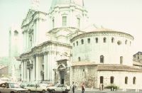
Title (German)
Brescia, Alter Dom/La Rotonda, Alter und neuer Dom
Caption
Title rider: Brescia; Old Cathedral/La Rotonda
Caption (German)
Titel Reiter: Brescia; Alter Dom/La Rotonda
Record Name
Dia_287-23131

Title (German)
Breslau, Heiliges Kreuz
Caption
Keyword photographer: floor plan. Title rider: Wroclaw
Caption (German)
Schlagwort Bestandsbildner: Grundriss. Titel Reiter: Breslau
Record Name
Dia_287-23132

Title (German)
Bresles, Saec. 11 (?)
Caption
Keyword photographer: Floor plan. Title rider: Bresles
Caption (German)
Schlagwort Bestandsbildner: Grundriss. Titel Reiter: Bresles
Record Name
Dia_287-23133

Title (German)
Brioude, S. Julien
Caption
Keyword photographer: Floor plan. Title rider: Brioude
Caption (German)
Schlagwort Bestandsbildner: Grundriss. Titel Reiter: Brioude
Record Name
Dia_287-23134

Title (German)
Brioude, S. Julien
Caption
Keyword photographer: Floor plan. Title rider: Brioude
Caption (German)
Schlagwort Bestandsbildner: Grundriss. Titel Reiter: Brioude
Record Name
Dia_287-23135
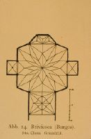
Title (German)
Briviesca, (Burgos) Sta. Clara
Caption
Keyword photographer: Floor plan. Title rider: Briviesca
Caption (German)
Schlagwort Bestandsbildner: Grundriss. Titel Reiter: Briviesca
Record Name
Dia_287-23136

Title (German)
Briviesca, (Burgos) Sta. Clara Gewölbe Hauptraum
Caption
Keyword photographer: Floor plan. Title rider: Briviesca
Caption (German)
Schlagwort Bestandsbildner: Grundriss. Titel Reiter: Briviesca
Record Name
Dia_287-23137

Title (German)
Briviesca, (Burgos) Sta. Clara von Westen
Caption
Keyword photographer: Floor plan. Title rider: Briviesca
Caption (German)
Schlagwort Bestandsbildner: Grundriss. Titel Reiter: Briviesca
Record Name
Dia_287-23138

Title (German)
Brixworth, Saec. 10 (?)
Caption
Keyword photographer: floor plan. Title rider: Brixworth
Caption (German)
Schlagwort Bestandsbildner: Grundriss. Titel Reiter: Brixworth
Record Name
Dia_287-23139
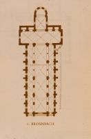
Title (German)
Wertheim, Bronnbach
Caption
Keyword photographer: floor plan. Title rider: Bronnbach
Caption (German)
Schlagwort Bestandsbildner: Grundriss. Titel Reiter: Bronnbach
Record Name
Dia_287-23140

Title (German)
Wertheim, Bronnbach
Caption
Keyword photographer: floor plan. Title rider: Bronnbach
Caption (German)
Schlagwort Bestandsbildner: Grundriss. Titel Reiter: Bronnbach
Record Name
Dia_287-23141

Title (German)
Wertheim, Bronnbach
Caption
Keyword photographer: floor plan. Title rider: Bronnbach
Caption (German)
Schlagwort Bestandsbildner: Grundriss. Titel Reiter: Bronnbach
Record Name
Dia_287-23142

Title (German)
Afrika, Bronze-Lampe, Bronzelampe aus Afrika
Caption
Keyword photographer: floor plan. Title rider: bronze lamp
Caption (German)
Schlagwort Bestandsbildner: Grundriss. Titel Reiter: Bronze-Lampe
Record Name
Dia_287-23143

Title (German)
Kloster Brou, Klosterkirche, Westfassade, Mittelteil
Caption
Title rider: Bron
Caption (German)
Titel Reiter: Bron
Record Name
Dia_287-23144

Title (German)
Kloster Brou, Kloster, Westfassade der Kirche
Caption
Title rider: Bron
Caption (German)
Titel Reiter: Bron
Record Name
Dia_287-23145

Title (German)
Kloster Brou, Klosterkirche, Mitelschiffpfeiler, Basis
Caption
Title rider: Bron
Caption (German)
Titel Reiter: Bron
Record Name
Dia_287-23146

Title (German)
Kloster Brou, Klosterkirche, Lettner
Caption
Title rider: Bron
Caption (German)
Titel Reiter: Bron
Record Name
Dia_287-23147

Title (German)
Kloster Brou, Klosterkirche, Chor mit Ausstattung
Caption
Title rider: Bron
Caption (German)
Titel Reiter: Bron
Record Name
Dia_287-23148

Title (German)
Kloster Brou, Klosterkirche, Chor mit Ausstattung
Caption
Title rider: Bron
Caption (German)
Titel Reiter: Bron
Record Name
Dia_287-23149

Title (German)
Kloster Brou, Klosterkirche, Chor mit Lettner und Grabmälern
Caption
Title rider: Bron
Caption (German)
Titel Reiter: Bron
Record Name
Dia_287-23150

Title (German)
Brügge, St. Saveur, Saint-Saveur
Caption
Keyword photographer: floor plan. Title rider: Bruges; St. Saveur
Caption (German)
Schlagwort Bestandsbildner: Grundriss. Titel Reiter: Brügge; St. Saveur
Record Name
Dia_287-23151

Title (German)
Brügge, St. Saveur, Saec. 13
Caption
Keyword photographer: floor plan. Title rider: Bruges; St. Saveur
Caption (German)
Schlagwort Bestandsbildner: Grundriss. Titel Reiter: Brügge; St. Saveur
Record Name
Dia_287-23152

Title (German)
Brügge, St. Saveur, Wessturm
Caption
Keyword photographer: floor plan. Title rider: Bruges; St. Saveur
Caption (German)
Schlagwort Bestandsbildner: Grundriss. Titel Reiter: Brügge; St. Saveur
Record Name
Dia_287-23153

Title (German)
Brügge, Museum, Groeninge, Museum, Kreuzigung, Meister der Strausskreuzigung
Caption
Title rider: Bruges; Museum
Caption (German)
Titel Reiter: Brügge; Museum
Record Name
Dia_287-23154

Title (German)
Brügge, Museum, Groeninge, Museum, Rogier van der Weyden, Lukas malt die Madonna
Caption
Title rider: Bruges; Museum
Caption (German)
Titel Reiter: Brügge; Museum
Record Name
Dia_287-23155

Title (German)
Brügge, Museum, Groeninge, Museum, Jan van Byck, Madonna des Kanonikus van der Paele
Caption
Title rider: Bruges; Museum
Caption (German)
Titel Reiter: Brügge; Museum
Record Name
Dia_287-23156

Title (German)
Brügge, Dijver, Bauplatz
Caption
Title rider: Bruges; Dijver
Caption (German)
Titel Reiter: Brügge; Dijver
Record Name
Dia_287-23157

Title (German)
Brüssel, Sainte Gudule, beg. 1226
Caption
Keyword photographer: floor plan. Title tab: Brussels; Ste-Gudule
Caption (German)
Schlagwort Bestandsbildner: Grundriss. Titel Reiter: Brüssel; Ste-Gudule
Record Name
Dia_287-23158

Title (German)
Brüssel, Sainte Gudule
Caption
Keyword photographer: floor plan. Title tab: Brussels; Ste-Gudule
Caption (German)
Schlagwort Bestandsbildner: Grundriss. Titel Reiter: Brüssel; Ste-Gudule
Record Name
Dia_287-23159

Title (German)
Brüssel, Sainte Gudule, saec. 13
Caption
Keyword photographer: floor plan. Title tab: Brussels; Ste-Gudule
Caption (German)
Schlagwort Bestandsbildner: Grundriss. Titel Reiter: Brüssel; Ste-Gudule
Record Name
Dia_287-23160

Title (German)
Brüssel, Ste-Gudule, Gewölbe
Caption
Title rider: Brussels; Ste-Gudule
Caption (German)
Titel Reiter: Brüssel; Ste-Gudule
Record Name
Dia_287-23161

Title (German)
Brüssel, Ste-Gudule, Chorwand mit Umgang von Süden
Caption
Title rider: Brussels; Ste-Gudule
Caption (German)
Titel Reiter: Brüssel; Ste-Gudule
Record Name
Dia_287-23162

Title (German)
Brüssel, Ste-Gudule, Mittelschiff und Chor
Caption
Title rider: Brussels; Ste-Gudule
Caption (German)
Titel Reiter: Brüssel; Ste-Gudule
Record Name
Dia_287-23163

Title (German)
Brugg, Aarenbrücke
Caption
Title rider: Brugg
Caption (German)
Titel Reiter: Brugg
Record Name
Dia_287-23164

Title (German)
Brugg, Aarenbrücke
Caption
Title rider: Brugg
Caption (German)
Titel Reiter: Brugg
Record Name
Dia_287-23165

Title (German)
Wien, Buchmalerei, Dagulfpsalter, Initialseite; E. 8. Jh., österreichische Nationalbibliothek
Caption
Title rider: book painting
Caption (German)
Titel Reiter: Buchmalerei
Record Name
Dia_287-23166

Title (German)
Paris, Buchmalerei, Elfenbeintafel des Dagulfpsalters; E. 8. Jh., Paris, Louvre
Caption
Title rider: book painting
Caption (German)
Titel Reiter: Buchmalerei
Record Name
Dia_287-23167

Title (German)
Köln, Buchmalerei, Kanonsammlung, Initialseite; M. 8. Jh., Köln, Dombibliothek
Caption
Title rider: book painting
Caption (German)
Titel Reiter: Buchmalerei
Record Name
Dia_287-23168

Title (German)
Aachen, Buchmalerei, Karolingisches Evangeliar; A. 9. Jh., Aachen Domschatz
Caption
Title rider: book painting
Caption (German)
Titel Reiter: Buchmalerei
Record Name
Dia_287-23169

Title (German)
Burgos, Kathedrale
Caption
Keyword photographer: floor plan. Title tab: Burgos; Cathedral
Caption (German)
Schlagwort Bestandsbildner: Grundriss. Titel Reiter: Burgos; Kathedrale
Record Name
Dia_287-23170

Title (German)
Burgos, Kathedrale, Südliche Querschifffassade
Caption
Keyword photographer: floor plan. Title tab: Burgos; Cathedral
Caption (German)
Schlagwort Bestandsbildner: Grundriss. Titel Reiter: Burgos; Kathedrale
Record Name
Dia_287-23171

Title (German)
Burgos, Kathedrale, Gewölbe der Capilla de la Prestenación
Caption
Keyword photographer: floor plan. Title tab: Burgos; Cathedral
Caption (German)
Schlagwort Bestandsbildner: Grundriss. Titel Reiter: Burgos; Kathedrale
Record Name
Dia_287-23172

Title (German)
Bury, Bury
Caption
Keyword photographer: floor plan. Title rider: Bury
Caption (German)
Schlagwort Bestandsbildner: Grundriss. Titel Reiter: Bury
Record Name
Dia_287-23173

Title (German)
Bury, Bury
Caption
Keyword photographer: floor plan. Title rider: Bury
Caption (German)
Schlagwort Bestandsbildner: Grundriss. Titel Reiter: Bury
Record Name
Dia_287-23174

Title (German)
Bury, Bury
Caption
Keyword photographer: floor plan. Title rider: Bury
Caption (German)
Schlagwort Bestandsbildner: Grundriss. Titel Reiter: Bury
Record Name
Dia_287-23175

Title (German)
Yorkshire, Byland
Caption
Keyword photographer: Floor plan. Title rider: Byland
Caption (German)
Schlagwort Bestandsbildner: Grundriss. Titel Reiter: Byland
Record Name
Dia_287-23176

Title (German)
Yorkshire, Byland
Caption
Keyword photographer: Floor plan. Title rider: Byland
Caption (German)
Schlagwort Bestandsbildner: Grundriss. Titel Reiter: Byland
Record Name
Dia_287-23177

Title (German)
Caen, St-Etienne, Beg. A. 1063
Caption
Keyword photographer: floor plan. Title rider: Caen; St-Etienne
Caption (German)
Schlagwort Bestandsbildner: Grundriss. Titel Reiter: Caen; St-Etienne
Record Name
Dia_287-23178

Title (German)
Caen, St-Etienne, St. Etienne
Caption
Keyword photographer: floor plan. Title rider: Caen; St-Etienne
Caption (German)
Schlagwort Bestandsbildner: Grundriss. Titel Reiter: Caen; St-Etienne
Record Name
Dia_287-23179

Title (German)
Caen, St-Etienne, St. Etienne
Caption
Keyword photographer: floor plan. Title rider: Caen; St-Etienne
Caption (German)
Schlagwort Bestandsbildner: Grundriss. Titel Reiter: Caen; St-Etienne
Record Name
Dia_287-23180

Title (German)
Caen, St-Etienne, L. V. saec. 11
Caption
Keyword photographer: floor plan. Title rider: Caen; St-Etienne
Caption (German)
Schlagwort Bestandsbildner: Grundriss. Titel Reiter: Caen; St-Etienne
Record Name
Dia_287-23181

Title (German)
Caen, St-Etienne, Nach 1063
Caption
Keyword photographer: floor plan. Title rider: Caen; St-Etienne
Caption (German)
Schlagwort Bestandsbildner: Grundriss. Titel Reiter: Caen; St-Etienne
Record Name
Dia_287-23182

Title (German)
Caen, St-Etienne, Rekonstruktion
Caption
Keyword photographer: floor plan. Title rider: Caen; St-Etienne
Caption (German)
Schlagwort Bestandsbildner: Grundriss. Titel Reiter: Caen; St-Etienne
Record Name
Dia_287-23183

Title (German)
Caen, St-Etienne, Chor, Frühzeit s. 13
Caption
Keyword photographer: floor plan. Title rider: Caen; St-Etienne
Caption (German)
Schlagwort Bestandsbildner: Grundriss. Titel Reiter: Caen; St-Etienne
Record Name
Dia_287-23184

Title (German)
Caen, St-Etienne, St. Etienne
Caption
Keyword photographer: floor plan. Title rider: Caen; St-Etienne
Caption (German)
Schlagwort Bestandsbildner: Grundriss. Titel Reiter: Caen; St-Etienne
Record Name
Dia_287-23185

Title (German)
Caen, St-Etienne, Saint Etienne
Caption
Keyword photographer: floor plan. Title rider: Caen; St-Etienne
Caption (German)
Schlagwort Bestandsbildner: Grundriss. Titel Reiter: Caen; St-Etienne
Record Name
Dia_287-23186

Title (German)
Caen, St-Etienne, Chor, Frühzeit saec. 13
Caption
Keyword photographer: floor plan. Title rider: Caen; St-Etienne
Caption (German)
Schlagwort Bestandsbildner: Grundriss. Titel Reiter: Caen; St-Etienne
Record Name
Dia_287-23187

Title (German)
Caen, St-Etienne, St. Etienne
Caption
Keyword photographer: floor plan. Title rider: Caen; St-Etienne
Caption (German)
Schlagwort Bestandsbildner: Grundriss. Titel Reiter: Caen; St-Etienne
Record Name
Dia_287-23188

Title (German)
Caen, St-Etienne, System Langhaus
Caption
Keyword photographer: floor plan. Title rider: Caen; St-Etienne
Caption (German)
Schlagwort Bestandsbildner: Grundriss. Titel Reiter: Caen; St-Etienne
Record Name
Dia_287-23189

Title (German)
Caen, St-Etienne, Westtürme
Caption
Title rider: Caen; St-Etienne
Caption (German)
Titel Reiter: Caen; St-Etienne
Record Name
Dia_287-23190

Title (German)
Caen, St-Etienne, Westfassade
Caption
Title rider: Caen; St-Etienne
Caption (German)
Titel Reiter: Caen; St-Etienne
Record Name
Dia_287-23191

Title (German)
Caen, St-Etienne, Westfassade
Caption
Title rider: Caen; St-Etienne
Caption (German)
Titel Reiter: Caen; St-Etienne
Record Name
Dia_287-23192

Title (German)
Caen, St-Etienne, Westfassade
Caption
Title rider: Caen; St-Etienne
Caption (German)
Titel Reiter: Caen; St-Etienne
Record Name
Dia_287-23193

Title (German)
Caen, St-Etienne, Westtürme von Südosten
Caption
Title rider: Caen; St-Etienne
Caption (German)
Titel Reiter: Caen; St-Etienne
Record Name
Dia_287-23194

Title (German)
Caen, St-Etienne, Mittelschiff von Westen
Caption
Title rider: Caen; St-Etienne
Caption (German)
Titel Reiter: Caen; St-Etienne
Record Name
Dia_287-23195

Title (German)
Caen, St-Etienne, Nördliche Mittelschiffwand
Caption
Title rider: Caen; St-Etienne
Caption (German)
Titel Reiter: Caen; St-Etienne
Record Name
Dia_287-23196

Title (German)
Caen, St-Etienne, Nördliche Mittelschiffwand
Caption
Title rider: Caen; St-Etienne
Caption (German)
Titel Reiter: Caen; St-Etienne
Record Name
Dia_287-23197

Title (German)
Caen, St-Etienne, Nördliche Mittelschiffwand
Caption
Title rider: Caen; St-Etienne
Caption (German)
Titel Reiter: Caen; St-Etienne
Record Name
Dia_287-23198

Title (German)
Caen, St-Etienne, Nördliche Mittelschiffwand
Caption
Title rider: Caen; St-Etienne
Caption (German)
Titel Reiter: Caen; St-Etienne
Record Name
Dia_287-23199

Title (German)
Caen, St-Etienne, Nördliche Vierungsecke
Caption
Title rider: Caen; St-Etienne
Caption (German)
Titel Reiter: Caen; St-Etienne
Record Name
Dia_287-23200

Title (German)
Caen, St-Etienne, Nördliche Vierungsecke
Caption
Title rider: Caen; St-Etienne
Caption (German)
Titel Reiter: Caen; St-Etienne
Record Name
Dia_287-23201

Title (German)
Caen, St-Etienne, Querhausstirn
Caption
Title rider: Caen; St-Etienne
Caption (German)
Titel Reiter: Caen; St-Etienne
Record Name
Dia_287-23202

Title (German)
Caen, St-Etienne, Östliche Wand des Nordquerhauses
Caption
Title rider: Caen; St-Etienne
Caption (German)
Titel Reiter: Caen; St-Etienne
Record Name
Dia_287-23203

Title (German)
Caen, St-Etienne, Detail Obergaden
Caption
Title rider: Caen; St-Etienne
Caption (German)
Titel Reiter: Caen; St-Etienne
Record Name
Dia_287-23204

Title (German)
Caen, St-Etienne, Detail Obergaden
Caption
Title rider: Caen; St-Etienne
Caption (German)
Titel Reiter: Caen; St-Etienne
Record Name
Dia_287-23205

Title (German)
Caen, St-Nicolas
Caption
Keyword photographer: floor plan. Title rider: Caen; St-Nicolas
Caption (German)
Schlagwort Bestandsbildner: Grundriss. Titel Reiter: Caen; St-Nicolas
Record Name
Dia_287-23206

Title (German)
Caen, St. Pierre
Caption
Keyword photographer: floor plan. Title rider: Caen; St. Pierre
Caption (German)
Schlagwort Bestandsbildner: Grundriss. Titel Reiter: Caen; St. Pierre
Record Name
Dia_287-23207

Title (German)
Caen, Ste-Trinité
Caption
Keyword photographer: Floor plan. Title rider: Caen; Ste-Trinité
Caption (German)
Schlagwort Bestandsbildner: Grundriss. Titel Reiter: Caen; Ste-Trinité
Record Name
Dia_287-23208

Title (German)
Caen, Ste-Trinité, L. V. saec. 11
Caption
Keyword photographer: floor plan. Title rider: Caen; Ste-Trinité
Caption (German)
Schlagwort Bestandsbildner: Grundriss. Titel Reiter: Caen; Ste-Trinité
Record Name
Dia_287-23209

Title (German)
Caen, Ste-Trinité, E. saec. 11. und 1. H. saec. 12
Caption
Keyword photographer: floor plan. Title rider: Caen; Ste-Trinité
Caption (German)
Schlagwort Bestandsbildner: Grundriss. Titel Reiter: Caen; Ste-Trinité
Record Name
Dia_287-23210

Title (German)
Caen, Ste-Trinité, Schiff und Querschiff
Caption
Keyword photographer: floor plan. Title rider: Caen; Ste-Trinité
Caption (German)
Schlagwort Bestandsbildner: Grundriss. Titel Reiter: Caen; Ste-Trinité
Record Name
Dia_287-23211

Title (German)
Caen, Ste-Trinité
Caption
Keyword photographer: floor plan. Title rider: Caen; Ste-Trinité
Caption (German)
Schlagwort Bestandsbildner: Grundriss. Titel Reiter: Caen; Ste-Trinité
Record Name
Dia_287-23212

Title (German)
Caen, Ste-Trinité
Caption
Keyword photographer: floor plan. Title rider: Caen; Ste-Trinité
Caption (German)
Schlagwort Bestandsbildner: Grundriss. Titel Reiter: Caen; Ste-Trinité
Record Name
Dia_287-23213

Title (German)
Caen, Ste-Trinité, Langhaus von Westen
Caption
Title rider: Caen; Ste-Trinité
Caption (German)
Titel Reiter: Caen; Ste-Trinité
Record Name
Dia_287-23214

Title (German)
Caen, Ste-Trinité, Westfassade
Caption
Title rider: Caen; Ste-Trinité
Caption (German)
Titel Reiter: Caen; Ste-Trinité
Record Name
Dia_287-23215

Title (German)
Caen, Ste-Trinité, Westfassade
Caption
Title rider: Caen; Ste-Trinité
Caption (German)
Titel Reiter: Caen; Ste-Trinité
Record Name
Dia_287-23216

Title (German)
Caen, Ste-Trinité, Südflanke
Caption
Title rider: Caen; Ste-Trinité
Caption (German)
Titel Reiter: Caen; Ste-Trinité
Record Name
Dia_287-23217

Title (German)
Caen, Ste-Trinité, S. Trinité
Caption
Title rider: Caen; Ste-Trinité
Caption (German)
Titel Reiter: Caen; Ste-Trinité
Record Name
Dia_287-23218

Title (German)
Caen, Ste-Trinité, Blick ins Mittelschiff von Nordosten
Caption
Title rider: Caen; Ste-Trinité
Caption (German)
Titel Reiter: Caen; Ste-Trinité
Record Name
Dia_287-23219
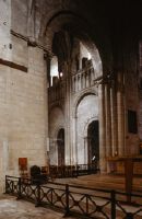
Title (German)
Caen, Ste-Trinité, Blick ins nördliche Querhaus von Südwesten
Caption
Title rider: Caen; Ste-Trinité
Caption (German)
Titel Reiter: Caen; Ste-Trinité
Record Name
Dia_287-23220

Title (German)
Caen, Ste-Trinité, Nördliche Langhauswand
Caption
Title rider: Caen; Ste-Trinité
Caption (German)
Titel Reiter: Caen; Ste-Trinité
Record Name
Dia_287-23221

Title (German)
Caen, Ste-Trinité, Nördliche Langhauswand
Caption
Title rider: Caen; Ste-Trinité
Caption (German)
Titel Reiter: Caen; Ste-Trinité
Record Name
Dia_287-23222

Title (German)
Caen, Ste-Trinité, Nördliche Langhauswand
Caption
Title rider: Caen; Ste-Trinité
Caption (German)
Titel Reiter: Caen; Ste-Trinité
Record Name
Dia_287-23223

Title (German)
Caen, Ste-Trinité, Nördliche Langhauswand
Caption
Title rider: Caen; Ste-Trinité
Caption (German)
Titel Reiter: Caen; Ste-Trinité
Record Name
Dia_287-23224

Title (German)
Caen, Ste-Trinité, Nördlicher Obergaden
Caption
Title rider: Caen; Ste-Trinité
Caption (German)
Titel Reiter: Caen; Ste-Trinité
Record Name
Dia_287-23225

Title (German)
Caen, Ste-Trinité, Nördlicher Obergaden
Caption
Title rider: Caen; Ste-Trinité
Caption (German)
Titel Reiter: Caen; Ste-Trinité
Record Name
Dia_287-23226

Title (German)
Caen, Ste-Trinité, Nördlicher Obergaden
Caption
Title rider: Caen; Ste-Trinité
Caption (German)
Titel Reiter: Caen; Ste-Trinité
Record Name
Dia_287-23227

Title (German)
Caen, Ste-Trinité, Nördliche Querhausstirnwand
Caption
Title rider: Caen; Ste-Trinité
Caption (German)
Titel Reiter: Caen; Ste-Trinité
Record Name
Dia_287-23228

Title (German)
Caen, Ste-Trinité, Östliche Kapelle am südlichen Querhaus
Caption
Title rider: Caen; Ste-Trinité
Caption (German)
Titel Reiter: Caen; Ste-Trinité
Record Name
Dia_287-23229

Title (German)
Caen, Ste-Trinité, Südliches Seitenschiff, Gewölbe
Caption
Title rider: Caen; Ste-Trinité
Caption (German)
Titel Reiter: Caen; Ste-Trinité
Record Name
Dia_287-23230

Title (German)
Caen, Ste-Trinité, Chorhaupt
Caption
Title rider: Caen; Ste-Trinité
Caption (German)
Titel Reiter: Caen; Ste-Trinité
Record Name
Dia_287-23231

Title (German)
Caen, Ste-Trinité, Chorhaupt
Caption
Title rider: Caen; Ste-Trinité
Caption (German)
Titel Reiter: Caen; Ste-Trinité
Record Name
Dia_287-23232

Title (German)
Caen, Ste-Trinité, Chorhaupt
Caption
Title rider: Caen; Ste-Trinité
Caption (German)
Titel Reiter: Caen; Ste-Trinité
Record Name
Dia_287-23233

Title (German)
Caen, Ste-Trinité, Hallenkrypta
Caption
Title rider: Caen; Ste-Trinité
Caption (German)
Titel Reiter: Caen; Ste-Trinité
Record Name
Dia_287-23234

Title (German)
Caen, Ste-Trinité, Hallenkrypta
Caption
Title rider: Caen; Ste-Trinité
Caption (German)
Titel Reiter: Caen; Ste-Trinité
Record Name
Dia_287-23235

Title (German)
Caen, Ste-Trinité, Hallenkrypta
Caption
Title rider: Caen; Ste-Trinité
Caption (German)
Titel Reiter: Caen; Ste-Trinité
Record Name
Dia_287-23236

Title (German)
Caen, Ste-Trinité, Krypta
Caption
Title rider: Caen; Ste-Trinité
Caption (German)
Titel Reiter: Caen; Ste-Trinité
Record Name
Dia_287-23237

Title (German)
Cahors, Kath. St. Etienne, Ca. 1110
Caption
Keyword photographer: floor plan. Title rider: Cahors; Cath. St. Etienne
Caption (German)
Schlagwort Bestandsbildner: Grundriss. Titel Reiter: Cahors; Kath. St. Etienne
Record Name
Dia_287-23238

Title (German)
Cahors, Kath. St. Etienne, Kathedrale
Caption
Keyword photographer: floor plan. Title rider: Cahors; Cath. St. Etienne
Caption (German)
Schlagwort Bestandsbildner: Grundriss. Titel Reiter: Cahors; Kath. St. Etienne
Record Name
Dia_287-23239

Title (German)
Cahors, Kath. St. Etienne, Kathedrale
Caption
Keyword photographer: floor plan. Title rider: Cahors; Cath. St. Etienne
Caption (German)
Schlagwort Bestandsbildner: Grundriss. Titel Reiter: Cahors; Kath. St. Etienne
Record Name
Dia_287-23240

Title (German)
Cahors, Kath. St. Etienne, Innen von Westen
Caption
Title rider: Cahors; Cath. St. Etienne
Caption (German)
Titel Reiter: Cahors; Kath. St. Etienne
Record Name
Dia_287-23241

Title (German)
Cahors, Kath. St. Etienne, Innen von Osten
Caption
Title rider: Cahors; Cath. St. Etienne
Caption (German)
Titel Reiter: Cahors; Kath. St. Etienne
Record Name
Dia_287-23242

Title (German)
Cahors, Kath. St. Etienne, Südwand
Caption
Title rider: Cahors; Cath. St. Etienne
Caption (German)
Titel Reiter: Cahors; Kath. St. Etienne
Record Name
Dia_287-23243

Title (German)
Cahors, Kath. St. Etienne, Nordwand von Südwesten
Caption
Title rider: Cahors; Cath. St. Etienne
Caption (German)
Titel Reiter: Cahors; Kath. St. Etienne
Record Name
Dia_287-23244

Title (German)
Cahors, Kath. St. Etienne, Nordwand von Osten
Caption
Title rider: Cahors; Cath. St. Etienne
Caption (German)
Titel Reiter: Cahors; Kath. St. Etienne
Record Name
Dia_287-23245

Title (German)
Cahors, Kath. St. Etienne, Nordwand der Ostkuppel
Caption
Title rider: Cahors; Cath. St. Etienne
Caption (German)
Titel Reiter: Cahors; Kath. St. Etienne
Record Name
Dia_287-23246

Title (German)
Cahors, Kath. St. Etienne, Kuppel von Westen
Caption
Title rider: Cahors; Cath. St. Etienne
Caption (German)
Titel Reiter: Cahors; Kath. St. Etienne
Record Name
Dia_287-23247

Title (German)
Cahors, Kath. St. Etienne, Ostkuppel
Caption
Title rider: Cahors; Cath. St. Etienne
Caption (German)
Titel Reiter: Cahors; Kath. St. Etienne
Record Name
Dia_287-23248

Title (German)
Cahors, Kath. St. Etienne, Westkuppel
Caption
Title rider: Cahors; Cath. St. Etienne
Caption (German)
Titel Reiter: Cahors; Kath. St. Etienne
Record Name
Dia_287-23249

Title (German)
Cambrai, Kathedrale, Langhaus und Querschiff 1150 - 80, Chor 1230
Caption
Keyword photographer: floor plan. Title rider: Cambrai
Caption (German)
Schlagwort Bestandsbildner: Grundriss. Titel Reiter: Cambrai
Record Name
Dia_287-23250

Title (German)
Cambridge, King's College
Caption
Keyword photographer: floor plan. Title tab: Cambridge
Caption (German)
Schlagwort Bestandsbildner: Grundriss. Titel Reiter: Cambridge
Record Name
Dia_287-23251

Title (German)
Cambridge, King's College, Chapel, Jantzen 1962
Caption
Keyword photographer: floor plan. Title tab: Cambridge
Caption (German)
Schlagwort Bestandsbildner: Grundriss. Titel Reiter: Cambridge
Record Name
Dia_287-23252

Title (German)
Cambridge, King's College
Caption
Keyword photographer: floor plan. Title tab: Cambridge
Caption (German)
Schlagwort Bestandsbildner: Grundriss. Titel Reiter: Cambridge
Record Name
Dia_287-23253

Title (German)
Cambridge, King's College
Caption
Keyword photographer: floor plan. Title tab: Cambridge
Caption (German)
Schlagwort Bestandsbildner: Grundriss. Titel Reiter: Cambridge
Record Name
Dia_287-23254

Title (German)
Cambridge, King's Chapel, Westfront
Caption
Title rider: Cambridge
Caption (German)
Titel Reiter: Cambridge
Record Name
Dia_287-23255

Title (German)
Cambridge, King's Chapel, Westfront
Caption
Title rider: Cambridge
Caption (German)
Titel Reiter: Cambridge
Record Name
Dia_287-23256

Title (German)
Cambridge, King's College, aussen
Caption
Title rider: Cambridge
Caption (German)
Titel Reiter: Cambridge
Record Name
Dia_287-23257

Title (German)
Cambridge, King's College, aussen
Caption
Title rider: Cambridge
Caption (German)
Titel Reiter: Cambridge
Record Name
Dia_287-23258

Title (German)
Cambridge, King's College, Fensterwand
Caption
Title rider: Cambridge
Caption (German)
Titel Reiter: Cambridge
Record Name
Dia_287-23259

Title (German)
Cambridge, King's Chapel, Chor
Caption
Title rider: Cambridge
Caption (German)
Titel Reiter: Cambridge
Record Name
Dia_287-23260

Title (German)
Cambridge, King's College, Chapel, Chor
Caption
Title rider: Cambridge
Caption (German)
Titel Reiter: Cambridge
Record Name
Dia_287-23261

Title (German)
Cambridge, King's College, Chor
Caption
Title rider: Cambridge
Caption (German)
Titel Reiter: Cambridge
Record Name
Dia_287-23262

Title (German)
Cambridge, King's Chapel, Langhaus
Caption
Title rider: Cambridge
Caption (German)
Titel Reiter: Cambridge
Record Name
Dia_287-23263

Title (German)
Cambridge, King's Chapel
Caption
Title rider: Cambridge
Caption (German)
Titel Reiter: Cambridge
Record Name
Dia_287-23264

Title (German)
Cambridge, King's Chapel
Caption
Title rider: Cambridge
Caption (German)
Titel Reiter: Cambridge
Record Name
Dia_287-23265

Title (German)
Cambridge, King's Chapel, Fensterwand
Caption
Title rider: Cambridge
Caption (German)
Titel Reiter: Cambridge
Record Name
Dia_287-23266

Title (German)
Cambridge, King's Chapel
Caption
Title rider: Cambridge
Caption (German)
Titel Reiter: Cambridge
Record Name
Dia_287-23267

Title (German)
Cambridge, King's Chapel
Caption
Title rider: Cambridge
Caption (German)
Titel Reiter: Cambridge
Record Name
Dia_287-23268

Title (German)
Cambridge, King's Chapel, Fensterwand
Caption
Title rider: Cambridge
Caption (German)
Titel Reiter: Cambridge
Record Name
Dia_287-23269

Title (German)
Cambridge, King's Chapel
Caption
Title rider: Cambridge
Caption (German)
Titel Reiter: Cambridge
Record Name
Dia_287-23270

Title (German)
Cambridge, King's Chapel, Lettner
Caption
Title rider: Cambridge
Caption (German)
Titel Reiter: Cambridge
Record Name
Dia_287-23271

Title (German)
Cambridge, King's Chapel, Gewölbe
Caption
Title rider: Cambridge
Caption (German)
Titel Reiter: Cambridge
Record Name
Dia_287-23272

Title (German)
Cambridge, King's Chapel, Gewölbe
Caption
Title rider: Cambridge
Caption (German)
Titel Reiter: Cambridge
Record Name
Dia_287-23273

Title (German)
Cambridge, King's Chapel, Gewölbe
Caption
Title rider: Cambridge
Caption (German)
Titel Reiter: Cambridge
Record Name
Dia_287-23274

Title (German)
Cambridge, King's Chapel, Gewölbe
Caption
Title rider: Cambridge
Caption (German)
Titel Reiter: Cambridge
Record Name
Dia_287-23275

Title (German)
Cambridge, King's Chapel, Gewölbe
Caption
Title rider: Cambridge
Caption (German)
Titel Reiter: Cambridge
Record Name
Dia_287-23276

Title (German)
Paris, Cambronne
Caption
Keyword photographer: floor plan. Title rider: Cambronne
Caption (German)
Schlagwort Bestandsbildner: Grundriss. Titel Reiter: Cambronne
Record Name
Dia_287-23277

Title (German)
Camprodon, Saec. 12
Caption
Keyword photographer: Floor plan. Title tab: Camprodon
Caption (German)
Schlagwort Bestandsbildner: Grundriss. Titel Reiter: Camprodon
Record Name
Dia_287-23278

Title (German)
Camprodon, Camprodon
Caption
Keyword photographer: Floor plan. Title tab: Camprodon
Caption (German)
Schlagwort Bestandsbildner: Grundriss. Titel Reiter: Camprodon
Record Name
Dia_287-23279

Title (German)
Camprodon, Camprodon
Caption
Keyword photographer: Floor plan. Title tab: Camprodon
Caption (German)
Schlagwort Bestandsbildner: Grundriss. Titel Reiter: Camprodon
Record Name
Dia_287-23280

Title (German)
Canterbury, Kathedrale
Caption
Keyword photographer: floor plan. Title rider: Canterbury; Cath.
Caption (German)
Schlagwort Bestandsbildner: Grundriss. Titel Reiter: Canterbury; Kath.
Record Name
Dia_287-23281

Title (German)
Canterbury, Kathedrale, E. saec. 11. und 1. H. saec. 12
Caption
Keyword photographer: floor plan. Title rider: Canterbury; Cath.
Caption (German)
Schlagwort Bestandsbildner: Grundriss. Titel Reiter: Canterbury; Kath.
Record Name
Dia_287-23282

Title (German)
Canterbury, Kathedrale, Chor 1175-85
Caption
Keyword photographer: floor plan. Title rider: Canterbury; Cath.
Caption (German)
Schlagwort Bestandsbildner: Grundriss. Titel Reiter: Canterbury; Kath.
Record Name
Dia_287-23283