 E-PICS - ETHBIB.Bildarchiv


The images presented on this page are part of E-Pics, a service provided by the ETH-Bibliothek of ETH Zurich. You find here static medium resolution images published under the creative commons
CC-BY-SA license or with the Public Domain Mark. This means that you are free to share, copy and redistribute the material in any medium or format; that you are free to remix, transform, and build upon the material for any purpose, even commercially, under the following conditions: You must give appropriate credit, provide a link to the license, and indicate if changes were made.
- More information about E-Pics is available at https://www.e-pics.ethz.ch
- This catalog can also be accessed at https://ba.e-pics.ethz.ch/ . There you can download the image in a higher resolution.

Title (German)
Solothurn, Rüttenen, Steingruben, obere Steingrubenstrasse, Grüneggweg, Blick nach Süden (S)
Record Name
Com_F69-15994

Title (German)
Grandson VD, Schloss und Teilansichten
Caption
Caption (German)
Record Name
Com_F69-15995

Title (German)
Grandson VD, Schloss und Teilansichten
Caption
Caption (German)
Record Name
Com_F69-15996

Title (German)
Grandson VD, Schloss und Teilansichten
Caption
Caption (German)
Record Name
Com_F69-15997


Title (German)
Grandson VD, Schloss und Teilansichten
Caption
Caption (German)
Record Name
Com_F69-15999

Title (German)
Grandson VD, Schloss und Teilansichten
Caption
Caption (German)
Record Name
Com_F69-16000


Title (German)
Ritex AG, Kleiderfabrik, Zofingen AG
Caption
Caption (German)
Record Name
Com_F69-16003

Title (German)
Ritex AG, Kleiderfabrik, Zofingen AG
Caption
Caption (German)
Record Name
Com_F69-16004

Title (German)
Ritex AG, Kleiderfabrik, Zofingen AG
Caption
Caption (German)
Record Name
Com_F69-16005

Title (German)
Ritex AG, Kleiderfabrik, Zofingen AG
Caption
Caption (German)
Record Name
Com_F69-16006

Title (German)
Ritex AG, Kleiderfabrik, Zofingen AG
Caption
Caption (German)
Record Name
Com_F69-16007

Title (German)
Hauser, J. AG, Carrosseriewerke, Zofingen
Caption
Caption (German)
Record Name
Com_F69-16008


Title (German)
Grapha, Maschinenfabrik, Zofingen
Caption
Caption (German)
Record Name
Com_F69-16013

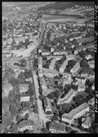
Title (German)
Zofingen, neues Wohnquartier
Record Name
Com_F69-16014

Title (German)
Zofingen, neues Wohnquartier
Record Name
Com_F69-16015

Title (German)
Bau- und Holz AG, Zofingen
Caption
Caption (German)
Record Name
Com_F69-16016


Title (German)
Zofingen, Bleiche AG, Kammgarnweberei
Record Name
Com_F69-16021

Title (German)
Zofingen, Bleiche AG, Kammgarnweberei
Record Name
Com_F69-16022

Title (German)
Zofingen, Bleiche AG, Kammgarnweberei
Record Name
Com_F69-16023

Title (German)
Zofingen, Bleiche AG, Kammgarnweberei
Record Name
Com_F69-16024

Title (German)
Rapperswil (Sankt Gallen)
Caption
Caption (German)
Record Name
Com_F69-16025

Title (German)
Rapperswil (Sankt Gallen)
Caption
Caption (German)
Record Name
Com_F69-16026

Title (German)
Rapperswil (Sankt Gallen)
Caption
Caption (German)
Record Name
Com_F69-16027

Title (German)
Rapperswil mit Seedamm
Caption
Caption (German)
Record Name
Com_F69-16028

Title (German)
Rapperswil (Sankt Gallen) (auch Kinderzoo)
Caption
Caption (German)
Record Name
Com_F69-16029

Title (German)
Rapperswil (Sankt Gallen)
Caption
Caption (German)
Record Name
Com_F69-16030

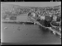
Title (German)
Seepolizei Zürich, Bootshäuser der Seepolizei, Wollishofen
Caption
Caption (German)
Record Name
Com_F69-16031

Title (German)
Seepolizei Zürich, Bootshäuser der Seepolizei, Wollishofen
Caption
Caption (German)
Record Name
Com_F69-16032

Title (German)
Seepolizei Zürich, Bootshäuser der Seepolizei, Wollishofen
Caption
Caption (German)
Record Name
Com_F69-16033

Title (German)
Zürich, Enge, Schifflände bei Löwenplastik
Caption
Caption (German)
Record Name
Com_F69-16034
Title (German)
Nationalstrasse N3/Autobahn A3, Walenseestrasse, Restaurant bei Mühlehorn
Caption
Caption (German)
Record Name
Com_F69-16035

Title (German)
Nationalstrasse N3/Autobahn A3, Walenseestrasse, Restaurant bei Mühlehorn
Caption
Caption (German)
Record Name
Com_F69-16036

Title (German)
Zürich, Strandbad Tiefenbrunnen
Caption
Caption (German)
Record Name
Com_F69-16037

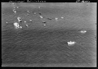
Title (German)
Zürich, Marathonschwimmen von Rapperswil nach Zürich, Begleitschiffe im Zürcher Seebecken
Record Name
Com_F69-16038

Title (German)
Zürich, Marathonschwimmen von Rapperswil nach Zürich, Begleitschiffe im Zürcher Seebecken
Record Name
Com_F69-16039

Title (German)
Zürich, Marathonschwimmen von Rapperswil nach Zürich, Begleitschiffe im Zürcher Seebecken
Record Name
Com_F69-16040
Title (German)
Zürich, Marathonschwimmen von Rapperswil nach Zürich, Begleitschiffe im Zürcher Seebecken
Record Name
Com_F69-16041

Title (German)
Zürich, Marathonschwimmen von Rapperswil nach Zürich, Begleitschiffe im Zürcher Seebecken
Record Name
Com_F69-16042

Title (German)
Zürich, Marathonschwimmen von Rapperswil nach Zürich, Begleitschiffe im Zürcher Seebecken
Caption
Caption (German)
Record Name
Com_F69-16043
Title (German)
Zürich, Marathonschwimmen von Rapperswil nach Zürich, Begleitschiffe im Zürcher Seebecken
Caption
Caption (German)
Record Name
Com_F69-16044

Title (German)
Zürich, Strandbad Tiefenbrunnen
Caption
Caption (German)
Record Name
Com_F69-16045

Title (German)
Zürich, Marathonschwimmen von Rapperswil nach Zürich, Begleitschiffe im Zürcher Seebecken
Caption
Caption (German)
Record Name
Com_F69-16046

Title (German)
Arosa, Schwimmbad, Hotels, etcetera
Caption
Caption (German)
Record Name
Com_F69-16047

Title (German)
Arosa, Schwimmbad, Hotels, etcetera
Caption
Caption (German)
Record Name
Com_F69-16048

Title (German)
Arosa, Schwimmbad, Hotels, etcetera
Caption
Caption (German)
Record Name
Com_F69-16049

Title (German)
Arosa, Schwimmbad, Hotels, etcetera
Caption
Caption (German)
Record Name
Com_F69-16050

Title (German)
Arosa, Schwimmbad, Hotels, etcetera
Caption
Caption (German)
Record Name
Com_F69-16051

Title (German)
Arosa, Schwimmbad, Hotels, etcetera
Caption
Caption (German)
Record Name
Com_F69-16052

Title (German)
Arosa, Schwimmbad, Hotels, etcetera
Caption
Caption (German)
Record Name
Com_F69-16053

Title (German)
Arosa, Schwimmbad, Hotels, etcetera
Caption
Caption (German)
Record Name
Com_F69-16054

Title (German)
Arosa, Schwimmbad, Hotels, etcetera
Caption
Caption (German)
Record Name
Com_F69-16055


Title (German)
Davos, Schatzalp, Hotel Schatzalp
Caption
Caption (German)
Record Name
Com_F69-16059


Title (German)
Chur, Bahnhof, Hauptpost
Caption
Caption (German)
Record Name
Com_F69-16068

Title (German)
Chur, Neubau Kantonsschule
Caption
Caption (German)
Record Name
Com_F69-16069

Title (German)
Chur, Neubau Gewerbeschule
Caption
Caption (German)
Record Name
Com_F69-16070

Title (German)
Chur, Kantonale Verwaltung
Caption
Caption (German)
Record Name
Com_F69-16071

Title (German)
Chur, Neubau Gewerbeschule
Caption
Caption (German)
Record Name
Com_F69-16072

Title (German)
Chur, Wohnhäuser Rosenhügel
Caption
Caption (German)
Record Name
Com_F69-16073

Title (German)
Chur, Masanserstrasse, Heiligkreuz Kirche
Caption
Caption (German)
Record Name
Com_F69-16074

Title (German)
Nationalstrasse N13/Autobahn A13 vor Chur, mit Rhein (Sandbänke)
Caption
With Mastrilser floodplain
Caption (German)
Mit Mastrilser Auenlandschaft
Record Name
Com_F69-16075

Title (German)
Chur, Masanserstrasse und Giacomettistrasse, Heiligkreuz Kirche
Caption
Caption (German)
Record Name
Com_F69-16076

Title (German)
Chur, Wohnbauten im Gebiet Scalettastrasse und Austrasse
Caption
In the background: national road N13
Caption (German)
Im Hintergrund: Nationalstrasse N13
Record Name
Com_F69-16077

Title (German)
Chur, Geschäftshäuser Alexanderstrasse und Quaderstrasse
Caption
Right: RhB administration building
Caption (German)
Rechts: Verwaltungsgebäude der RhB
Record Name
Com_F69-16078


Title (German)
Chur, Wohnsiedlung "Lacuna"
Caption
Caption (German)
Record Name
Com_F69-16080

Title (German)
Chur, Bahnhof, Hauptpost
Caption
Caption (German)
Record Name
Com_F69-16081

Title (German)
Chur, Wohnsiedlung "Lacuna"
Caption
Caption (German)
Record Name
Com_F69-16082

Title (German)
Chur, Wohnsiedlung "Lacuna"
Caption
Caption (German)
Record Name
Com_F69-16083

Title (German)
Chur, Wohnsiedlung "Lacuna"
Caption
Caption (German)
Record Name
Com_F69-16084


Title (German)
Zürich-Höngg, Regensdorferstrasse nahe Rütihof, Univac
Caption
Caption (German)
Record Name
Com_F69-16086

Title (German)
Zürich-Höngg, Regensdorferstrasse nahe Rütihof, Univac
Caption
Caption (German)
Record Name
Com_F69-16087

Title (German)
Zürich-Höngg, Regensdorferstrasse nahe Rütihof, Univac
Caption
Caption (German)
Record Name
Com_F69-16088

Title (German)
Zürich-Höngg, Regensdorferstrasse nahe Rütihof, Univac
Caption
Caption (German)
Record Name
Com_F69-16089

Title (German)
Zürich-Höngg, Regensdorferstrasse nahe Rütihof, Univac
Caption
Caption (German)
Record Name
Com_F69-16090

Title (German)
Neeracher Ried, Strassenführung, Rondell
Caption
Caption (German)
Record Name
Com_F69-16091

Title (German)
Neeracher Ried, Strassenführung, Rondell
Caption
Caption (German)
Record Name
Com_F69-16092

Title (German)
Neeracher Ried, Strassenführung, Rondell
Caption
Caption (German)
Record Name
Com_F69-16093

Title (German)
Neeracher Ried, Strassenführung, Rondell
Caption
Caption (German)
Record Name
Com_F69-16094

Title (German)
Neeracher Ried, Strassenführung, Rondell
Caption
Caption (German)
Record Name
Com_F69-16095

Title (German)
Regensdorf, Watt, neue Strassenführung
Caption
Caption (German)
Record Name
Com_F69-16096

Title (German)
Regensdorf, Watt, neue Strassenführung
Caption
Caption (German)
Record Name
Com_F69-16097

Title (German)
Züspa (Zürcher Spezialitätenausstellung) (auch offene Rennbahn, Hallenstadion Zürich)
Caption
Caption (German)
Record Name
Com_F69-16098

Title (German)
Züspa (Zürcher Spezialitätenausstellung) (auch offene Rennbahn, Hallenstadion Zürich)
Caption
Caption (German)
Record Name
Com_F69-16099

Title (German)
Züspa (Zürcher Spezialitätenausstellung) (auch offene Rennbahn, Hallenstadion Zürich)
Caption
Caption (German)
Record Name
Com_F69-16100

Title (German)
Züspa (Zürcher Spezialitätenausstellung) (auch offene Rennbahn, Hallenstadion Zürich)
Caption
Caption (German)
Record Name
Com_F69-16101

Title (German)
Zürich, Oerlikon, Neubau eines Hotels beim Bahnhof, Hotel International
Caption
Caption (German)
Record Name
Com_F69-16102

Title (German)
Zürich, Radiostudio
Caption
Caption (German)
Record Name
Com_F69-16103

Title (German)
Zürich, Radiostudio
Caption
Caption (German)
Record Name
Com_F69-16104

Title (German)
Zürich, Radiostudio
Caption
Caption (German)
Record Name
Com_F69-16105

Title (German)
Zürich-Tiefenbrunnen, Bau Strassenüberführung
Caption
Caption (German)
Record Name
Com_F69-16106

Title (German)
Zürich-Tiefenbrunnen, Bau Strassenüberführung
Caption
Caption (German)
Record Name
Com_F69-16107

Title (German)
Zürich-Tiefenbrunnen, Bau Strassenüberführung
Caption
Caption (German)
Record Name
Com_F69-16108

Title (German)
Zürich-Tiefenbrunnen, Bau Strassenüberführung
Caption
Caption (German)
Record Name
Com_F69-16109


Title (German)
Spreitenbach, Einkaufszentrum
Record Name
Com_F69-16113

Title (German)
Spreitenbach, Einkaufszentrum
Record Name
Com_F69-16114

Title (German)
Spreitenbach, Einkaufszentrum
Record Name
Com_F69-16115

Title (German)
Spreitenbach, Einkaufszentrum
Record Name
Com_F69-16116

Title (German)
Spreitenbach, Einkaufszentrum
Record Name
Com_F69-16117

Title (German)
Spreitenbach, Einkaufszentrum
Record Name
Com_F69-16118

Title (German)
Spreitenbach, Dietikon, Nationalstrasse N1/Autobahn A1 im Bau, Blick nach Ostsüdosten (ESE)
Caption
Center: Construction site connection 58 Dietikon
Caption (German)
Mitte: Baustelle Anschluss 58 Dietikon
Record Name
Com_F69-16119

Title (German)
Weiningen, Geroldswil, Nationalstrasse N1/Autobahn A1 im Bau, Blick nach Nordwesten (NW)
Caption
Below: Gravel extraction and location of the future 59 Limmattal interchange.
Caption (German)
Unten: Kiesgewinnung und Standort des künftigen Autobahnkreuzes 59 Limmattal
Record Name
Com_F69-16120

Title (German)
Bassersdorf (auch Wohnquartier mit Hochhäusern)
Record Name
Com_F69-16121

Title (German)
Bassersdorf (auch Wohnquartier mit Hochhäusern)
Record Name
Com_F69-16122

Title (German)
Bassersdorf (auch Wohnquartier mit Hochhäusern)
Record Name
Com_F69-16123

Title (German)
Kloten, Nationalstrasse N1b/Autobahn A1b mit Swissair-Verwaltungsgebäude
Caption
National roads, N1b and expressway Unterland, 1.
Caption (German)
Nationalstrassen, N1b und Expressstrasse Unterland, 1.
Record Name
Com_F69-16124

Title (German)
Zürich-Hottingen, Heuelstrasse 7-21, Trigondorf
Caption
Years of construction: 1968-1969, Architect: Justus Dahinden
Caption (German)
Baujahre: 1968-1969, Architekt: Justus Dahinden
Record Name
Com_F69-16125

Title (German)
Zürich-Hottingen, Heuelstrasse 7-21, Trigondorf
Caption
Years of construction: 1968-1969, Architect: Justus Dahinden
Caption (German)
Baujahre: 1968-1969, Architekt: Justus Dahinden
Record Name
Com_F69-16126

Title (German)
Zürich-Hottingen, Heuelstrasse 7-21, Trigondorf
Caption
Years of construction: 1968-1969, Architect: Justus Dahinden
Caption (German)
Baujahre: 1968-1969, Architekt: Justus Dahinden
Record Name
Com_F69-16127

Title (German)
Zürich-Hottingen, Heuelstrasse 7-21, Trigondorf
Caption
Years of construction: 1968-1969, Architect: Justus Dahinden
Caption (German)
Baujahre: 1968-1969, Architekt: Justus Dahinden
Record Name
Com_F69-16128

Title (German)
Züspa (Zürcher Spezialitätenausstellung) (auch offene Rennbahn, Hallenstadion Zürich)
Record Name
Com_F69-16129

Title (German)
Züspa (Zürcher Spezialitätenausstellung) (auch offene Rennbahn, Hallenstadion Zürich)
Record Name
Com_F69-16130


Title (German)
Zürich, ETH Zürich, Umbau alte ETH
Record Name
Com_F69-16132

Title (German)
Zürich, ETH Zürich, Umbau alte ETH
Record Name
Com_F69-16133

Title (German)
Zürich, ETH Zürich, Umbau alte ETH
Record Name
Com_F69-16134


Title (German)
Zürich, Stadelhofenplatz mit altem Baumbestand
Record Name
Com_F69-16136

Title (German)
Zürich, Stadelhofenplatz mit altem Baumbestand
Record Name
Com_F69-16137

Title (German)
Zürich, Alpenquai, Mythenquai
Record Name
Com_F69-16138

Title (German)
Zürich, Tiefenbrunnen, Villa am See
Record Name
Com_F69-16139


Title (German)
Zürich, Schaffhauserplatz Umbau
Record Name
Com_F69-16141


Title (German)
Walter, J. AG, Pneumatik, Balterswil (Thurgau)
Record Name
Com_F69-16150

Title (German)
Walter, J. AG, Pneumatik, Balterswil (Thurgau)
Record Name
Com_F69-16151

Title (German)
Walter, J. AG, Pneumatik, Balterswil (Thurgau)
Record Name
Com_F69-16152

Title (German)
Walter, J. AG, Pneumatik, Balterswil (Thurgau)
Record Name
Com_F69-16153

Title (German)
Wängi (TG), Wilen, Nationalstrasse N1/Autobahn A1 im Bau, Blick nach Südosten (SE)
Caption
Below: Provisional entrance and exit of the operational section to and from St. Gallen before completion.
Caption (German)
Unten: Provisorische Ein- und Ausfahrt des betriebsbereiten Teilstücks von und nach St. Gallen vor der Fertigstellung
Record Name
Com_F69-16154

Title (German)
Wängi (TG), Wilen, Nationalstrasse N1/Autobahn A1 im Bau, Blick nach Südosten (SE)
Caption
Bottom left: Provisional entrance and exit of the operational section to and from St. Gallen before completion.
Caption (German)
Unten links: Provisorische Ein- und Ausfahrt des betriebsbereiten Teilstücks von und nach St. Gallen vor der Fertigstellung
Record Name
Com_F69-16155

Title (German)
Wil SG, Nationalstrasse N1/Autobahn A1 bei Wil SG, Übersicht
Caption
N1, Genève, Bern, Zurich, St. Gallen, St. Margrethen, roads, road construction, 19, 16.
Caption (German)
N1, Genève, Bern, Zürich, St. Gallen, St. Margrethen, Strassen, Strassenbau, 19, 16.
Record Name
Com_F69-16156

Title (German)
Wil SG, Nationalstrasse N1/Autobahn A1 bei Wil SG, Übersicht
Caption
N1, Genève, Bern, Zurich, St. Gallen, St. Margrethen, roads, road construction, 19, 16.
Caption (German)
N1, Genève, Bern, Zürich, St. Gallen, St. Margrethen, Strassen, Strassenbau, 19, 16.
Record Name
Com_F69-16157


Title (German)
Winterthur, Teilansichten, Gutschick
Record Name
Com_F69-16162

Title (German)
Winterthur, Teilansichten, Hochhaus Sulzer
Record Name
Com_F69-16163

Title (German)
Kloten, Ansicht des Dorfes mit Flughafenstrasse und Butzenbühl
Record Name
Com_F69-16164

Title (German)
Zürich-Kloten, Comet der MEA, Middle East Airlines, auf Tarmac
Record Name
Com_F69-16165

Title (German)
Grosser Mythen, Gipfelpartie SZ
Record Name
Com_F69-16166

Title (German)
Kresse AR, Villa Seeheim, Seestrasse 111, Herrliberg ZH
Record Name
Com_F69-16167

Title (German)
Kresse AR, Villa Seeheim, Seestrasse 111, Herrliberg ZH
Record Name
Com_F69-16168

Title (German)
Zürich-Kloten, Flughafenkopf und Tarmac
Record Name
Com_F69-16169

Title (German)
Vorderrheintal GR, Tavetsch Höhe Tschamut-Selva, Blick Richtung Disentis
Record Name
Com_F69-16170

Title (German)
Robiei TI, Kraftwerk, Lage nördlich Campo Val Bavona
Record Name
Com_F69-16171

Title (German)
Robiei TI, Kraftwerk, Lage nördlich Campo Val Bavona
Record Name
Com_F69-16172

Title (German)
Val Bedretto, Vordergrund, Airolo und Gotthardstrasse
Record Name
Com_F69-16173

Title (German)
Val Bedretto, Vordergrund, Airolo und Gotthardstrasse
Record Name
Com_F69-16174

Title (German)
Valle Leventina, Airolo, Ambri-Piotta
Record Name
Com_F69-16175

Title (German)
Cari, mit Campello, Molare, Croce
Caption
Location northeast Faido
Caption (German)
Lage nordöstlich Faido
Record Name
Com_F69-16176

Title (German)
Cari, mit Campello, Molare, Croce
Caption
Location northeast Faido
Caption (German)
Lage nordöstlich Faido
Record Name
Com_F69-16177

Title (German)
Cari, mit Campello, Molare, Croce
Caption
Location northeast Faido
Caption (German)
Lage nordöstlich Faido
Record Name
Com_F69-16178

Title (German)
Cari, mit Campello, Molare, Croce
Caption
Location northeast Faido
Caption (German)
Lage nordöstlich Faido
Record Name
Com_F69-16179

Title (German)
Cari, mit Campello, Molare, Croce
Caption
Location northeast Faido
Caption (German)
Lage nordöstlich Faido
Record Name
Com_F69-16180

Title (German)
Cari, mit Campello, Molare, Croce
Caption
Location northeast Faido
Caption (German)
Lage nordöstlich Faido
Record Name
Com_F69-16181

Title (German)
Cari, mit Campello, Molare, Croce
Caption
Location northeast Faido
Caption (German)
Lage nordöstlich Faido
Record Name
Com_F69-16182

Title (German)
Cari, mit Campello, Molare, Croce
Caption
Location northeast Faido
Caption (German)
Lage nordöstlich Faido
Record Name
Com_F69-16183

Title (German)
Cari, mit Campello, Molare, Croce
Caption
Location northeast Faido
Caption (German)
Lage nordöstlich Faido
Record Name
Com_F69-16184

Title (German)
Cari, mit Campello, Molare, Croce
Caption
Location northeast Faido
Caption (German)
Lage nordöstlich Faido
Record Name
Com_F69-16185

Title (German)
Cari, mit Campello, Molare, Croce
Caption
Location northeast Faido
Caption (German)
Lage nordöstlich Faido
Record Name
Com_F69-16186

Title (German)
Cari, mit Campello, Molare, Croce
Caption
Location northeast Faido
Caption (German)
Lage nordöstlich Faido
Record Name
Com_F69-16187

Title (German)
Cari, mit Campello, Molare, Croce
Caption
Location northeast Faido
Caption (German)
Lage nordöstlich Faido
Record Name
Com_F69-16188

Title (German)
Cari, mit Campello, Molare, Croce
Caption
Location northeast Faido
Caption (German)
Lage nordöstlich Faido
Record Name
Com_F69-16189

Title (German)
Cari, mit Campello, Molare, Croce
Caption
Location northeast Faido
Caption (German)
Lage nordöstlich Faido
Record Name
Com_F69-16190

Title (German)
Cari, mit Campello, Molare, Croce
Caption
Location northeast Faido
Caption (German)
Lage nordöstlich Faido
Record Name
Com_F69-16191

Title (German)
Cari, mit Campello, Molare, Croce
Caption
Location northeast Faido
Caption (German)
Lage nordöstlich Faido
Record Name
Com_F69-16192

Title (German)
Cari, mit Campello, Molare, Croce
Caption
Location northeast Faido
Caption (German)
Lage nordöstlich Faido
Record Name
Com_F69-16193

Title (German)
Cari, mit Campello, Molare, Croce
Caption
Location northeast Faido
Caption (German)
Lage nordöstlich Faido
Record Name
Com_F69-16194

Title (German)
Cari, mit Campello, Molare, Croce
Caption
Location northeast Faido
Caption (German)
Lage nordöstlich Faido
Record Name
Com_F69-16195

Title (German)
Cari, mit Campello, Molare, Croce
Caption
Location northeast Faido
Caption (German)
Lage nordöstlich Faido
Record Name
Com_F69-16196

Title (German)
Cari, mit Campello, Molare, Croce
Caption
Location northeast Faido
Caption (German)
Lage nordöstlich Faido
Record Name
Com_F69-16197

Title (German)
Cari, mit Campello, Molare, Croce
Caption
Location northeast Faido
Caption (German)
Lage nordöstlich Faido
Record Name
Com_F69-16198

Title (German)
Nationalstrasse N2/Autobahn A2 oberhalb Airolo, Gotthardstrasse mit Wendeplatte, Übersicht
Caption
N2, Basel, Lucerne, Gotthard, Chiasso, 19, roads, road construction, 9.
Caption (German)
N2, Basel, Luzern, Gotthard, Chiasso, 19, Strassen, Strassenbau, 9.
Record Name
Com_F69-16199

Title (German)
Nationalstrasse N2/Autobahn A2 oberhalb Airolo, Gotthardstrasse mit Wendeplatte, Übersicht
Caption
N2, Basel, Lucerne, Gotthard, Chiasso, 19, roads, road construction, 9.
Caption (German)
N2, Basel, Luzern, Gotthard, Chiasso, 19, Strassen, Strassenbau, 9.
Record Name
Com_F69-16200

Title (German)
Nationalstrasse N2/Autobahn A2 oberhalb Airolo, Gotthardstrasse mit Wendeplatte, Übersicht
Caption
N2, Basel, Lucerne, Gotthard, Chiasso, 19, roads, road construction, 9.
Caption (German)
N2, Basel, Luzern, Gotthard, Chiasso, 19, Strassen, Strassenbau, 9.
Record Name
Com_F69-16201

Title (German)
Kleiner und Grosser Mythen SZ, mit Nebelmeer und Glarneralpen
Record Name
Com_F69-16202

Title (German)
Kleiner und Grosser Mythen SZ, mit Nebelmeer und Glarneralpen
Record Name
Com_F69-16203

Title (German)
Kleiner und Grosser Mythen SZ, mit Nebelmeer und Glarneralpen
Record Name
Com_F69-16204

Title (German)
Kleiner und Grosser Mythen SZ, mit Nebelmeer und Glarneralpen
Record Name
Com_F69-16205

Title (German)
Kleiner und Grosser Mythen SZ, mit Nebelmeer und Glarneralpen
Record Name
Com_F69-16206

Title (German)
Kleiner und Grosser Mythen SZ, mit Nebelmeer und Glarneralpen
Record Name
Com_F69-16207

Title (German)
Kleiner und Grosser Mythen SZ, mit Nebelmeer und Glarneralpen
Record Name
Com_F69-16208


Title (German)
Oberalppass GR, Blick gegen Disentis
Record Name
Com_F69-16215


Title (German)
Oberalpstock, Blick nach Ostnordosten (ENE)
Caption
Center: Oberalpstock, center left: Düssistocks, in front from left to right: Bristenstock, Klüserlücke, Pörtliruchen (Felliruchen), in the background left: Tödi and the wide firn field of Hüfifirn; photo location: above Fellital near Treschhütte SAC, about 2000 m a.s.l.
Caption (German)
Mitte: Oberalpstock, Mitte links: Düssistocks, vorne v.l.n.r.: Bristenstock, Klüserlücke, Pörtliruchen (Felliruchen), im Hintergrund links: Tödi und das weite Firnfeld des Hüfifirns; Aufnahmestandort: über Fellital Nähe Treschhütte SAC, rund 2000 m über Grund
Record Name
Com_F69-16219

Title (German)
Schottensee am Flüelapass (Passhöhe)
Record Name
Com_F69-16220


Title (German)
Schächental, Blick nach Osten (E)
Caption
Deep view into the Schächental (Klausen west ramp), in the foreground: Wängihorn, in the background left: Glärnischmassiv, followed by Höch Turm and Ortstock with the Schächentaler Windgällen in front and flat karst plateau of Glatten above the Klausen pass, far right: Gemsfayrenstock with the Kleine Teufelstöcken, on the horizon to the right: the pair of peaks Piz Sardona/Piz Segnes in the distance; photo location: above Riedertal behind Bürglen, about 1200 m above ground level
Caption (German)
Tiefblick ins Schächental (Klausen-Westrampe), im Vordergrund: Wängihorn, im Hintergrund links: Glärnischmassiv, gefolgt von Höch Turm und Ortstock mit den vorgelagerten Schächentaler Windgällen und flachen Karstplateau des Glatten über der Klausen-Passhöhe, ganz rechts: Gemsfayrenstock mit den Kleinen Teufelstöcken, am Horizont rechts: der Ferne das Gipfelpaar Piz Sardona/Piz Segnes; Aufnahmestandort: über Riedertal hinter Bürglen, rund 1200 m über Grund
Record Name
Com_F69-16224


Title (German)
Bristenstock UR, Düssistock, Tödi
Record Name
Com_F69-16226

Title (German)
Gross und Klein Windgällen, mit Seewlisee UR
Record Name
Com_F69-16227

Title (German)
Gross und Klein Windgällen, mit Seewlisee UR
Record Name
Com_F69-16228

Title (German)
Sunnig Wichel, Oberalpstock, links, Tödi UR
Record Name
Com_F69-16229

Title (German)
Bedrettotal mit Nufenenstrasse
Record Name
Com_F69-16230

Title (German)
Bedrettotal mit Nufenenstrasse
Record Name
Com_F69-16231

Title (German)
Maderanertal UR, mit Hüfifirn und Tödi
Record Name
Com_F69-16232


Title (German)
Lukmanier GR, Stausee und Staumauer
Record Name
Com_F69-16234

Title (German)
Lukmanier, Stausee Lai da Sontga Maria, Blick nach Norden (N)
Caption
Lukmanier pass summit with reservoir and Sontga Maria arch dam of the Vorderrhein power plants (1968), left: Guy pole of the Lukmanier line (380 kV three-phase high-voltage line) in the reservoir, on the horizon left: Piz Gannaretsch; photo location: above the Foppe di Pertusio in the Alpe di Croce area in the Valle Santa Maria on the Lukmanier southeast ramp, about 800 m above sea level.
Caption (German)
Lukmanier-Passhöhe mit Stausee und Bogenstaumauer Sontga Maria der Kraftwerke Vorderrhein (1968), links: Abspannmast der Lukmanierleitung (380-kV-Drehstrom-Hochspannungsleitung) im Stausee, am Horizont links: Piz Gannaretsch; Aufnahmestandort: über den Foppe di Pertusio im Gebiet Alpe di Croce im Valle Santa Maria an der Lukmanier-Südostrampe, rund 800 m über Grund
Record Name
Com_F69-16235

Title (German)
Lukmanier, Stausee Lai da Sontga Maria, Blick nach Norden (N)
Caption
Lukmanier pass summit with reservoir and Sontga Maria arch dam of the Vorderrhein power plants (1968), on the horizon left: Piz Gannaretsch; photo location: above Torói in the Piano dei Canali area in the Valle Santa Maria on the Lukmanier southeast ramp, about 500 m above sea level.
Caption (German)
Lukmanier-Passhöhe mit Stausee und Bogenstaumauer Sontga Maria der Kraftwerke Vorderrhein (1968), am Horizont links: Piz Gannaretsch; Aufnahmestandort: über Torói im Gebiet Piano dei Canali im Valle Santa Maria an der Lukmanier-Südostrampe, rund 500 m über Grund
Record Name
Com_F69-16236

Title (German)
Curnera Stausee GR, Tavetsch
Record Name
Com_F69-16237

Title (German)
Stausee Sambuco TI, Lage nördlich Fusio
Record Name
Com_F69-16239

Title (German)
Curnera Stausee GR, Tavetsch
Record Name
Com_F69-16240

Title (German)
Curnera Stausee GR, Tavetsch
Record Name
Com_F69-16241

Title (German)
Oberalp mit Blick gegen Val Curnera und Val Maighels GR
Record Name
Com_F69-16242

Title (German)
Oberalp mit Blick gegen Val Curnera und Val Maighels GR
Record Name
Com_F69-16243

Title (German)
Schwyzer Berge, Blüemberg, Kaiserstock, Sicht gegen Glärnisch
Record Name
Com_F69-16244

Title (German)
Schwyzer Berge, Blüemberg, Kaiserstock, Sicht gegen Glärnisch
Record Name
Com_F69-16245

Title (German)
Bündnerberge mit Piz Kesch und Berninagruppe
Record Name
Com_F69-16246

Title (German)
Glarner, Schwyzer Berge, Clariden, Scherhorn, Tödi, Klausen
Record Name
Com_F69-16247

Title (German)
Glarner, Schwyzer Berge, Clariden, Scherhorn, Tödi, Klausen, mit Nebelmeer im Vordergrund
Record Name
Com_F69-16248

Title (German)
Blick gegen Glarner Alpen, Tödi, Clariden, Scherhorn, mit Nebelmeer im Vordergrund
Record Name
Com_F69-16249

Title (German)
Blick gegen Säntis und Altmann, mit Nebelmeer im Vordergrund
Record Name
Com_F69-16250

Title (German)
Blick gegen Glarner Alpen, Tödi, Clariden, Scherhorn, mit Nebelmeer im Vordergrund
Record Name
Com_F69-16251

Title (German)
Blick gegen Glarner Alpen, Tödi, Clariden, Scherhorn, mit Nebelmeer im Vordergrund
Record Name
Com_F69-16252

Title (German)
Blick von Schwyzer Bergen gegen Säntis, bei Föhnstimmung
Record Name
Com_F69-16253

Title (German)
Blick von Schwyzer Bergen gegen Säntis
Record Name
Com_F69-16254

Title (German)
Maderanertal UR, mit Hüfifirn und Tödi
Record Name
Com_F69-16255

Title (German)
Schwyzer Berge, Blüemberg, Kaiserstock, Richtung Tödi
Record Name
Com_F69-16256

Title (German)
Urner Berge, Gross und Klein Windgällen, Oberalpstock, Fellital UR
Record Name
Com_F69-16258

Title (German)
Davos, Parsenngebiet, Blick nach Nordwesten (NW)
Caption
Left: Davos-Platz, center: Davos-Dorf, right: Davosersee, in the background: the Parsenn with the Weissfluh as culmination, left: the extensive avalanche obstructions on the Schiahorn; photo location: above lower Dischmatal, about 1200 m a.s.l.
Caption (German)
Links: Davos-Platz, Mitte: Davos-Dorf, rechts: Davosersee, im Hintergrund: die Parsenn mit der Weissfluh als Kulminationspunkt, links: die ausgedehnten Lawinenverbauungen am Schiahorn; Aufnahmestandort: über unteren Dischmatal, rund 1200 m über Grund
Record Name
Com_F69-16259

Title (German)
Nationalstrasse N13/Autobahn A13 mit Reichenau (Graubünden), Tamins und bei Reichenau
Record Name
Com_F69-16261

Title (German)
Nationalstrasse N13/Autobahn A13 mit Reichenau (Graubünden), Tamins und bei Reichenau
Record Name
Com_F69-16262

Title (German)
Nationalstrasse N13/Autobahn A13 mit Reichenau (Graubünden), Tamins und bei Reichenau
Record Name
Com_F69-16263

Title (German)
Vorderrheinschlucht, Versamer Tobel
Record Name
Com_F69-16264

Title (German)
Vorderrheinschlucht, Versamer Tobel
Record Name
Com_F69-16265

Title (German)
Vorderrheinschlucht, Versamer Tobel
Record Name
Com_F69-16266

Title (German)
Vorderrheinschlucht, Versamer Tobel
Record Name
Com_F69-16267

Title (German)
Vorderrheinschlucht, Versamer Tobel
Record Name
Com_F69-16268

Title (German)
Ebnat-Kappel, Umfahrung von Ebnat-Kappel
Record Name
Com_F69-16269

Title (German)
Rhein bei Chur (Gegenlichtaufnahme)
Record Name
Com_F69-16270

Title (German)
Rhein bei Chur (Gegenlichtaufnahme)
Record Name
Com_F69-16271

Title (German)
Flüela, Passhöhe, Blick nach Süden (S)
Caption
Flüela pass summit with Schottensee, overlooked by the Flüela-Schwarzhorn; photo location: above the western flank of the Flüela-Weisshorn on the ascent to the Winterlücke, about 800 m above sea level
Caption (German)
Flüela-Passhöhe mit Schottensee, überragt vom Flüela-Schwarzhorn; Aufnahmestandort: über der Westflanke des Flüela-Weisshorn am Aufstieg zur Winterlücke, rund 800 m über Grund
Record Name
Com_F69-16272

Title (German)
Flüela, Passhöhe, Blick nach Süden (S)
Caption
Flüela pass summit with Schottensee, overlooked by Flüela-Schwarzhorn, on the horizon in the distance left: Bernina group with Piz Palü, Piz Bernina and Piz Roseg, center: Piz d'Es-cha (Piz Kesch); photo location: above the western flank of the Flüela-Weisshorn on the ascent to the Winterlücke, about 800 m above sea level
Caption (German)
Flüela-Passhöhe mit Schottensee, überragt vom Flüela-Schwarzhorn, am Horizont in der Ferne links: Berninagruppe mit Piz Palü, Piz Bernina und Piz Roseg, Mitte: Piz d'Es-cha (Piz Kesch); Aufnahmestandort: über der Westflanke des Flüela-Weisshorn am Aufstieg zur Winterlücke, rund 800 m über Grund
Record Name
Com_F69-16273

Title (German)
Niederurnertal, Blick nach Süden (S)
Caption
In the foreground right: Köpfenberg, in the middle ground: the "horseshoe" around Ahornenalp, counterclockwise from front to back: Tierberg, Bockmattlistock with Gross Bockmattli Tower in front to the north, Schiberg and Plattenberg, followed to the rear by Brünnelistock, on the horizon to the left: Central Swiss and Bernese High Alps, right: Grosse Mythen, Pilatus, Rigi-Kulm, bottom right: Hirzli and Plankenstock; photo location: above Platten above Bilten, about 1200 m above sea level.
Caption (German)
Im Vordergrund rechts: Köpfenberg, im Mittelgrund: das "Hufeisen" um die Ahornenalp, im Gegenuhrzeigersinn von vorne nach hinten: Tierberg, Bockmattlistock mit nördlich vorgelagerten Gross Bockmattliturm, Schiberg und Plattenberg, nach hinten gefolgt vom Brünnelistock, am Horizont links: Zentralschweizer und Berner Hochalpen, rechts: Grosse Mythen, Pilatus, Rigi-Kulm, unten rechts: Hirzli und Plankenstock; Aufnahmestandort: über Platten oberhalb Bilten, rund 1200 m über Grund
Record Name
Com_F69-16274

Title (German)
Niederurnertal, Blick nach Süden (S)
Caption
In the foreground right: Köpfenberg, in the middle ground the "horseshoe" around Ahornenalp, counterclockwise from front to back: Tierberg, Bockmattlistock with Gross Bockmattli Tower in front to the north, Schiberg and Plattenberg, followed to the back by Brünnelistock, on the horizon in the middle left: Central Swiss and Bernese High Alps, right: Grosse Mythen, bottom right: Hirzli and Plankenstock; photo location: above Platten above Bilten, about 1200 m a.s.l.
Caption (German)
Im Vordergrund rechts: Köpfenberg, im Mittelgrund das "Hufeisen" um die Ahornenalp, im Gegenuhrzeigersinn von vorne nach hinten: Tierberg, Bockmattlistock mit nördlich vorgelagerten Gross Bockmattliturm, Schiberg und Plattenberg, nach hinten gefolgt vom Brünnelistock, am Horizont Mitte links: Zentralschweizer und Berner Hochalpen, rechts: Grosse Mythen, unten rechts: Hirzli und Plankenstock; Aufnahmestandort: über Platten oberhalb Bilten, rund 1200 m über Grund
Record Name
Com_F69-16275

Title (German)
Glarner Alpen, Blick nach Südsüdosten (SSE)
Caption
In the foreground left: Hirzli, right: Plankenstock, behind: Niederurnertal, in the middle foreground: Rautispitz and Wiggis, in the background right: Glärnisch with from left to right Vrenelisgärtli, Ruchenglärnisch and Bächistock, on the horizon from left to right: Ringelspitz, Piz Sardona, Piz Segnes, Tschingelhörner, Vorab and Kärpf; photo location: above the Hirzegg area above Reichenburg, about 1200 m above sea level.
Caption (German)
Im Vordergrund links: Hirzli, rechts: Plankenstock, dahinter: Niederurnertal, im Mittelgrund Mitte: Rautispitz und Wiggis, im Hintergrund rechts: Glärnisch mit v.l.n.r. Vrenelisgärtli, Ruchenglärnisch und Bächistock, am Horizont v.l.n.r.: Ringelspitz, Piz Sardona, Piz Segnes, Tschingelhörner, Vorab und Kärpf; Aufnahmestandort: über Gebiet Hirzegg oberhalb Reichenburg, rund 1200 m über Grund
Record Name
Com_F69-16276

Title (German)
Glarner Alpen, Blick nach Südsüdosten (SSE)
Caption
In the foreground left: Hirzli and Plankenstock, behind: Niederurnertal, in the middle foreground: Rautispitz and Wiggis, in the background on the right: Glärnisch with from left to right Vrenelisgärtli, Ruchenglärnisch and Bächistock, on the horizon from left to right: Ringelspitz, Piz Sardona, Piz Segnes, Tschingelhörner, Vorab and Kärpf; photo location: above the Linth plain near Siebnen, about 1500 m above sea level.
Caption (German)
Im Vordergrund links: Hirzli und Plankenstock, dahinter: Niederurnertal, im Mittelgrund Mitte: Rautispitz und Wiggis, im Hintergrund rechts: Glärnisch mit v.l.n.r. Vrenelisgärtli, Ruchenglärnisch und Bächistock, am Horizont v.l.n.r.: Ringelspitz, Piz Sardona, Piz Segnes, Tschingelhörner, Vorab und Kärpf; Aufnahmestandort: über der Linthebene bei Siebnen, rund 1500 m über Grund
Record Name
Com_F69-16277

Title (German)
Niederurnertal, Blick nach Süden (S)
Caption
In the foreground the Köpfenberg, in the middle ground: "horseshoe" around the Ahornenalp, counterclockwise from front to back: Tierberg, Bockmattlistock, Schiberg and Plattenberg, followed in the back by Brünnelistock, on the horizon center left: Central Swiss and Bernese High Alps; photo location: above Niderenwald above Bilten, about 1200 m a.s.l.
Caption (German)
Im Vordergrund der Köpfenberg, im Mittelgrund: "Hufeisen" um die Ahornenalp, im Gegenuhrzeigersinn von vorne nach hinten: Tierberg, Bockmattlistock, Schiberg und Plattenberg, nach hinten gefolgt vom Brünnelistock, am Horizont Mitte links: Zentralschweizer und Berner Hochalpen; Aufnahmestandort: über Niderenwald oberhalb Bilten, rund 1200 m über Grund
Record Name
Com_F69-16278

Title (German)
Glarner Alpen, bei Föhnstimmung
Record Name
Com_F69-16279

Title (German)
Glarner Alpen, Blick nach Westsüdwesten (WSW)
Caption
Center right: the small rock ruin of the Guilder tower, in the background right: Glärnisch south face with Bächistock left and Vrenelisgärtli right, on the horizon left: Central Swiss High Alps with Gross Spannort; photo location: above the area of the Riseten Pass in the rear Weisstannental, about 800 m above sea level
Caption (German)
Mitte rechts: die kleine Felsruine des Gulderturms, im Hintergrund rechts: Glärnisch-Südwand mit Bächistock links und Vrenelisgärtli rechts, am Horizont links: Zentralschweizer Hochalpen mit Gross Spannort; Aufnahmestandort: über der Gegend des Risetenpasses im hinteren Weisstannental, rund 800 m über Grund
Record Name
Com_F69-16280

Title (German)
Glarner Alpen, Blick nach Südsüdosten (SSE)
Caption
In the foreground left: Hirzli and Plankenstock, behind: Niederurnertal, in the middle ground far left: Rautispitz and Wiggis, in the middle background: Glärnisch with from left to right Vrenelisgärtli, Ruchenglärnisch and Bächistock, on the horizon left: Vorab and Kärpf; photo location: above the Linth plain near Reichenburg, about 1500 m above sea level.
Caption (German)
Im Vordergrund links: Hirzli und Plankenstock, dahinter: Niederurnertal, im Mittelgrund ganz links: Rautispitz und Wiggis, im Hintergrund Mitte: Glärnisch mit v.l.n.r. Vrenelisgärtli, Ruchenglärnisch und Bächistock, am Horizont links: Vorab und Kärpf; Aufnahmestandort: über der Linthebene bei Reichenburg, rund 1500 m über Grund
Record Name
Com_F69-16281

Title (German)
Klosters-Platz
Caption
Behind: Klosters village
Caption (German)
Hinten: Klosters-Dorf
Record Name
Com_F69-16282

Title (German)
Küblis mit Maschinenhaus des Kraftwerks Küblis
Record Name
Com_F69-16283


Title (German)
Crap Sogn Gion oberhalb Laax GR, Bergstation
Record Name
Com_F69-16285

Title (German)
Crap Sogn Gion oberhalb Laax GR, Bergstation
Record Name
Com_F69-16286

Title (German)
Crap Sogn Gion oberhalb Laax GR, Bergstation
Record Name
Com_F69-16287

Title (German)
Davos, Parsenngebiet, Blick nach Nordwesten (NW)
Caption
Left: Davos-Platz, center: Davos-Dorf, right: Davosersee, in the background: the Parsenn with the Weissfluh as culmination and on the left the extensive avalanche obstructions on the Schiahorn, far left: Küpfenfluh with its fore summit Strela, on the horizon left: Ringelspitz; photo location: above ridge of Büelenberg between Dischmatal and Flüela valley, about 300 m above ground level.
Caption (German)
Links: Davos-Platz, Mitte: Davos-Dorf, rechts: Davosersee, im Hintergrund: die Parsenn mit der Weissfluh als Kulminationspunkt und links die ausgedehnten Lawinenverbauungen am Schiahorn, ganz links: Küpfenfluh mit ihrem Vorgipfel Strela, am Horizont links: Ringelspitz; Aufnahmestandort: über Grat des Büelenbergs zwischen Dischmatal und Flüelatal, rund 300 m über Grund
Record Name
Com_F69-16288

Title (German)
Bergstation Jakobshorn oberhalb Davos GR
Record Name
Com_F69-16289

Title (German)
Bergstation Jakobshorn oberhalb Davos GR
Record Name
Com_F69-16290


Title (German)
Lawinenniedergang bei Wolfgang, Davos GR, Aufräumungsarbeiten
Record Name
Com_F69-16292

Title (German)
Crap Sogn Gion oberhalb Laax GR, Bergstation und Laax
Record Name
Com_F69-16293

Title (German)
Crap Sogn Gion oberhalb Laax GR, Bergstation und Laax
Record Name
Com_F69-16294

Title (German)
Crap Sogn Gion oberhalb Laax GR, Bergstation und Laax
Record Name
Com_F69-16295

Title (German)
Crap Sogn Gion oberhalb Laax GR, Bergstation und Laax
Record Name
Com_F69-16296
Title (German)
Glarner Alpen, Blick nach Westsüdwesten (WSW)
Caption
In the foreground left: Weissgandstöckli, in the middle foreground left: the small rock ruin of the Guilder tower, in the background right: Glärnisch south face with Bächistock on the left and Vrenelisgärtli on the right; photo location: above the area of Oberlaui in the rear Weisstannental, about 800 m above ground level
Caption (German)
Im Vordergrund links: Weissgandstöckli, im Mittelgrund Mitte links: die kleine Felsruine des Gulderturms, im Hintergrund rechts: Glärnisch-Südwand mit Bächistock links und Vrenelisgärtli rechts; Aufnahmestandort: über der Gegend von Oberlaui im hinteren Weisstannental, rund 800 m über Grund
Record Name
Com_F69-16297

Title (German)
Flims, Laax, mit Flimserstein
Record Name
Com_F69-16298

Title (German)
Oberhalbstein bei Bivio GR, rechts Weg nach dem Septimerpass, links Strasse über Julier
Record Name
Com_F69-16299

Title (German)
Marmorera Stausee GR, Lage Oberhalbstein, Julier
Record Name
Com_F69-16300

Title (German)
Lago di Lei, Blick nach Westsüdwesten (WSW)
Caption
Valle di Lei with reservoir and arch dam Lago di Lei of the Hinterrhein power plants (1962), lower left: Road over the Passo del Scengio (Furgga); photo location: above Passo del Scengio, about 500 m above ground level
Caption (German)
Valle di Lei mit Stausee und Bogenstaumauer Lago di Lei der Kraftwerke Hinterrhein (1962), unten links: Fahrweg über den Passo del Scengio (Furgga); Aufnahmestandort: über Passo del Scengio, rund 500 m über Grund
Record Name
Com_F69-16301

Title (German)
Lago di Lei, Blick nach Süden (S)
Caption
Valle di Lei with reservoir and arch dam Lago di Lei of the Hinterrhein power plant (1962), at the end of the valley: Pizzo Stella, lower left: Road over the Passo del Scengio (Furgga); photo location: above the Reno di Lei gorge, about 1500 m above sea level.
Caption (German)
Valle di Lei mit Stausee und Bogenstaumauer Lago di Lei der Kraftwerke Hinterrhein (1962), im Talabschluss: Pizzo Stella, unten links: Fahrweg über den Passo del Scengio (Furgga); Aufnahmestandort: über der Schlucht des Reno di Lei, rund 1500 m über Grund
Record Name
Com_F69-16302

Title (German)
Lago di Lei, Blick nach Südsüdosten (SSE)
Caption
Valle di Lei with reservoir and arch dam Lago di Lei of the Hinterrhein power plant (1962), at the end of the valley: Pizzo Stella, lower left: Road over the Passo del Scengio (Furgga); photo location: above the Reno di Lei gorge, about 1500 m above sea level.
Caption (German)
Valle di Lei mit Stausee und Bogenstaumauer Lago di Lei der Kraftwerke Hinterrhein (1962), im Talabschluss: Pizzo Stella, unten links: Fahrweg über den Passo del Scengio (Furgga); Aufnahmestandort: über der Schlucht des Reno di Lei, rund 1500 m über Grund
Record Name
Com_F69-16303

Title (German)
Berninapass, Passhöhe, Lagi Bianco, Blick nach Südosten (SE)
Caption
Bernina Pass summit with Lago Bianco reservoir, in front of it the two natural lakes Lej Nair (Lago Nero) and Lej Pitschen, left: near the hospice the Lagh de la Cruseta, the third natural lake on the Bernina Pass summit, above left: shaded pyramid of Piz Campasc, right: from the terrain threshold to the Puschlav the Sassal Mason, far left: beyond the valley depression of the Puschlav the sharp horn of Piz dal Teo; photo location: above Arlas area on the Bernina northwest ramp, about 1200 m above ground level.
Caption (German)
Bernina-Passhöhe mit Stausee Lago Bianco, diesem vorgelagert die beiden natürlichen Seen Lej Nair (Lago Nero) und Lej Pitschen, links: beim Hospiz der Lagh de la Cruseta, der dritte natürliche See auf der Bernina-Passhöhe, darüber links: beschattete Pyramide des Piz Campasc, rechts: von der Geländeschwelle zum Puschlav der Sassal Mason, ganz links: jenseits der Talsenke des Puschlav das scharfe Horn des Piz dal Teo; Aufnahmestandort: über Gebiet Arlas an der Bernina-Nordwestrampe, rund 1200 m über Grund
Record Name
Com_F69-16304

Title (German)
Berninapass, Passhöhe, Blick nach Ostsüdosten (ESE)
Caption
Bernina Pass summit with center left: Piz Lagalb with cable car station at the summit, far right: Bernina pass summit with reservoir Lago Bianco, in front of it the two natural lakes Lej Nair (Lago Nero) and Lej Pitschen and at the hospice the Lagh de la Cruseta, the third natural lake on the Bernina pass summit; photo location: above area Bernina Suot near valley entrance to Val da Fain on the Bernina northwest ramp, about 1200 m above ground level
Caption (German)
Bernina-Passhöhe mit Mitte links: Piz Lagalb mit Luftseilbahnstation am Gipfel, ganz rechts: Bernina Passhöhe mit Stausee Lago Bianco, diesem vorgelagert die beiden natürlichen Seen Lej Nair (Lago Nero) und Lej Pitschen und beim Hospiz der Lagh de la Cruseta, der dritte natürliche See auf der Bernina-Passhöhe; Aufnahmestandort: über Gebiet Bernina Suot Nähe Taleingang zum Val da Fain an der Bernina-Nordwestrampe, rund 1200 m über Grund
Record Name
Com_F69-16305


Title (German)
Rofflaschlucht, südlich Andeer
Record Name
Com_F69-16314

Title (German)
Rofflaschlucht, südlich Andeer
Record Name
Com_F69-16315


Title (German)
Glarner Alpen, Fronalpstock, Blick nach Südsüdwesten (SSW)
Caption
In the foreground right: the striking pyramid of the Glarus Fronalpstock, in the middle ground: the flat summit of the Schilt with the three summit points Siwellen, Schilt and Tristli, in the background right: Glärnisch with Vrenelisgärtli and the beehive-shaped Vorderglärnisch in front, on the horizon from left to right: Hausstock, Bifertenstock, Tödi, Claridenstock, Scherhorn and Gross Ruchen; photo location: above Schijenstock, about 800 m above ground level.
Caption (German)
Im Vordergrund rechts: die markante Pyramide des Glarner Fronalpstocks, im Mittelgrund: die flache Gipfelkuppe des Schilt mit den drei Gipfelpunkten Siwellen, Schilt und Tristli, im Hintergrund rechts: Glärnisch mit Vrenelisgärtli und vorgelagerten bienenkorbförmigen Vorderglärnisch, am Horizont v.l.n.r.: Hausstock, Bifertenstock, Tödi, Claridenstock, Scherhorn und Gross Ruchen; Aufnahmestandort: über Schijenstock, rund 800 m über Grund
Record Name
Com_F69-16318

Title (German)
Glarner Alpen, Mürtschenstock, Blick nach Südwesten (SW)
Caption
In the foreground: the three-peaked Mürtschenstock with the peaks f.l.t.r. Ruchen, Faulen and Stock, in the middle right: the striking pyramid of the Glarus Fronalpstock, center left;: the flat summit peak of the Schilt with the three summit points Siwellen, Schilt and Tristli, in the background right: Glärnisch with Vrenelisgärtli and Ruchenglärnisch and the beehive-shaped Vorderglärnisch in front, on the horizon f.l.t.r.: Bifertenstock.l.t.r.: Bifertenstock, Tödi, Claridenstock, Scherhorn, Gross Ruchen and Gross Windgällen, on the right in the far distance: Bernese Alps; photo location: above Meerenboden, about 1200 m a.s.l.
Caption (German)
Im Vordergrund: der dreigipflige Mürtschenstock mit den Gipfeln v.l.n.r. Ruchen, Faulen und Stock, im Mittelgrund rechts: die markante Pyramide des Glarner Fronalpstocks, Mitte links;: die flache Gipfelkuppe des Schilt mit den drei Gipfelpunkten Siwellen, Schilt und Tristli, im Hintergrund rechts: Glärnisch mit Vrenelisgärtli und Ruchenglärnisch und vorgelagerten bienenkorbförmigen Vorderglärnisch, am Horizont v.l.n.r.: Bifertenstock, Tödi, Claridenstock, Scherhorn, Gross Ruchen und Gross Windgällen, rechts ganz in der Ferne: Berner Alpen; Aufnahmestandort: über Meerenboden, rund 1200 m über Grund
Record Name
Com_F69-16319

Title (German)
Weisstannental, Piz Sardona, Blick nach Westsüdwesten (WSW)
Caption
In the foreground: Hangsackgrat-Fahnenstock chain, behind in the center: Piz Sardona with Piz Segnes adjoining on the left, on the horizon on the right: Tödi and the Hausstock; photo location: above Heidelpass area, about 800 m above sea level
Caption (German)
Im Vordergrund: Hangsackgrat-Fahnenstock-Kette, dahinter in der Mitte: Piz Sardona mit links anschliesenden Piz Segnes, am Horizont rechts: Tödi und der Hausstock; Aufnahmestandort: über Gebiet Heidelpass, rund 800 m über Grund
Record Name
Com_F69-16320

Title (German)
Weisstannental, Piz Sardona, Blick nach Westsüdwesten (WSW)
Caption
In the foreground: Hangsackgrat-Fahnenstock chain, behind it on the left: Piz Sardona with adjacent Piz Segnes on the left, on the horizon center left: Tödi and the Hausstock; photo location: above Heidelpass area, about 800 m above ground level
Caption (German)
Im Vordergrund: Hangsackgrat-Fahnenstock-Kette, dahinter links: Piz Sardona mit links anschliesenden Piz Segnes, am Horizont Mitte links: Tödi und der Hausstock; Aufnahmestandort: über Gebiet Heidelpass, rund 800 m über Grund
Record Name
Com_F69-16321

Title (German)
Calfeisental, Piz Sardona, Blick nach Westen (W)
Caption
In the foreground right: Sazmartinhorn, in the background center: end of the Calfeisen valley with Piz Sardona, adjoining left: Piz Segnes, on the horizon left: Tödi; photo location: above the Zanaihorns, about 800 m above ground level
Caption (German)
Im Vordergrund rechts: Sazmartinhorn, im Hintergrund Mitte: Talabschluss des Calfeisentals mit Piz Sardona, links anschliesenden: Piz Segnes, am Horizont links: Tödi; Aufnahmestandort: über den Zanaihörnern, rund 800 m über Grund
Record Name
Com_F69-16322

Title (German)
Calfeisental, Piz Sardona, Blick nach Westen (W)
Caption
In the foreground right: Sazmartinhorn, in the background center: end of the Calfeisen valley with Piz Sardona, adjoining left: Piz Segnes, on the horizon left: Tödi; photo location: above the Zanaihorns, about 800 m above ground level
Caption (German)
Im Vordergrund rechts: Sazmartinhorn, im Hintergrund Mitte: Talabschluss des Calfeisentals mit Piz Sardona, links anschliesenden: Piz Segnes, am Horizont links: Tödi; Aufnahmestandort: über den Zanaihörnern, rund 800 m über Grund
Record Name
Com_F69-16323


Title (German)
Ofenpass GR mit Nationalpark
Record Name
Com_F69-16325

Title (German)
Weisstannental, Foostock, Blick nach Westsüdwesten (WSW)
Caption
In the foreground: bottom of the Weisstannental valley near Vorsiez, behind: Valley end of the Weisstannental with the broad crest of the Foostock, right: Risetenhörner, on the horizon center left the Tödi and in front of it the Hausstock; photo location: above middle Weisstannental near Weisstannen, about 800 m above ground level
Caption (German)
Im Vordergrund: Talgrund des Weisstannentals bei Vorsiez, dahinter: Talabschluss des Weisstannentals mit der breiten Kuppe des Foostocks, rechts: Risetenhörner, am Horizont Mitte links der Tödi und davor der Hausstock; Aufnahmestandort: über mittleren Weisstannental bei Weisstannen, rund 800 m über Grund
Record Name
Com_F69-16326


Title (German)
Weisstannental, Foostock, Blick nach Westsüdwesten (WSW)
Caption
In the foreground left: Bottom of the Weisstannental valley near Gletti, behind: Valley end of the Weisstannental with the broad crest of the Foostock, right: Risetenhörner, on the horizon left: Vorab, center: Tödi, in front: Hausstock; photo location: above the southern flank of Rotrüfner in the middle Weisstannental, about 800 m above sea level
Caption (German)
Im Vordergrund links: Talgrund des Weisstannentals bei Gletti, dahinter: Talabschluss des Weisstannentals mit der breiten Kuppe des Foostocks, rechts: Risetenhörner, am Horizont links: Vorab, Mitte: Tödi, davor: Hausstock; Aufnahmestandort: über der Südflanke des Rotrüfner im mittleren Weisstannental, rund 800 m über Grund
Record Name
Com_F69-16329

Title (German)
Glarner Alpen, Mürtschenstock, Blick nach Westsüdwesten (WSW)
Caption
In the foreground: three three-pointed Mürtschenstock with the peaks f.l.t.r. Ruchen, Faulen and Stock, in the middle ground center right: the prominent pyramid of the Glarus Fronalpstock, left: the flat summit top of the Schilt with the three summit points Siwellen, Schilt and Tristli, in the background left: Glärnisch with Vrenelisgärtli and Ruchenglärnisch and the beehive-shaped Vorderglärnisch in front, far right: Wiggis/Rautispitz, on the horizon left: Grosse Windgällen; photo location: above Meerenboden, about 1200 m a.s.l.
Caption (German)
Im Vordergrund: drei dreigipflige Mürtschenstock mit den Gipfeln v.l.n.r. Ruchen, Faulen und Stock, im Mittelgrund Mitte rechts: die markante Pyramide des Glarner Fronalpstocks, links: die flache Gipfelkuppe des Schilt mit den drei Gipfelpunkten Siwellen, Schilt und Tristli, im Hintergrund links: Glärnisch mit Vrenelisgärtli und Ruchenglärnisch und vorgelagerten bienenkorbförmigen Vorderglärnisch, ganz rechts: Wiggis/Rautispitz, am Horizont links: Grosse Windgällen; Aufnahmestandort: über Meerenboden, rund 1200 m über Grund
Record Name
Com_F69-16330

Title (German)
Glarner Alpen, Mürtschenstock, Blick nach Westsüdwesten (WSW)
Caption
In the foreground: the three-peaked Mürtschenstock with the peaks f.l.t.r. Ruchen, Faulen and Stock, in the middle ground center: the striking pyramid of the Glarus Fronalpstock,. far left: the flat summit top of the Schilt with the three summit points Siwellen, Schilt and Tristli, in the background left: Glärnisch with Vrenelisgärtli and Ruchenglärnisch and preceding beehive-shaped Vorderglärnisch, right: Wiggis/Rautispitz, far right further back: Oberseetal flank of the three Wägital mountains Zindelspitz, Rossalpelispitz and Brünnelistock, on the horizon to the right: Pilatus, Rigi-Kulm; photo location: above the alp Bigligen, about 1200 m above sea level.
Caption (German)
Im Vordergrund: der dreigipflige Mürtschenstock mit den Gipfeln v.l.n.r. Ruchen, Faulen und Stock, im Mittelgrund Mitte: die markante Pyramide des Glarner Fronalpstocks,. ganz links: die flache Gipfelkuppe des Schilt mit den drei Gipfelpunkten Siwellen, Schilt und Tristli, im Hintergrund links: Glärnisch mit Vrenelisgärtli und Ruchenglärnisch und vorgelagerten bienenkorbförmigen Vorderglärnisch, rechts: Wiggis/Rautispitz, ganz rechts weiter hinten: Oberseetalflanke der drei Wägitaler Berge Zindelspitz, Rossalpelispitz und Brünnelistock, am Horizont rechts: Pilatus, Rigi-Kulm; Aufnahmestandort: über der Alp Bigligen, rund 1200 m über Grund
Record Name
Com_F69-16331

Title (German)
Rheinwald zwischen Splügen und Hinterrhein, Übersicht, Nationalstrasse N13/Autostrasse A13, Blick nach Südwesten (SW)
Caption
N13, Sankt Margrethen, Sargans, Chur, Bernardino, Castione, 19, roads, road construction, 2.
Caption (German)
N13, Sankt Margrethen, Sargans, Chur, Bernardino, Castione, 19, Strassen, Strassenbau, 2.
Record Name
Com_F69-16332

Title (German)
Morteratschgletscher, Blick nach Süden (S)
Caption
Left: Confluence of Pers and Morteratsch glaciers at the rocky island of Isla Persa, in the background: witness area of the Morteratsch glacier between Piz Palü on the left and the Piz Bernina northeast flank on the right, at its base the black rock bastion of Sass dal Pos with its characteristic diagonally running ice couloir La Gula; photo location: above the glacier front of the Morteratsch glacier near Morteratsch, about 1800 m above sea level.
Caption (German)
Links: Zusammenfluss von Pers- und Morteratschgletscher bei der Felsinsel der Isla Persa, im Hintergrund: Zehrgebiet des Morteratschgletschers zwischen Piz Palü links und der Piz Bernina Nordostflanke rechts, an dessen Sockel die schwarze Felsbastion des Sass dal Pos mit seinem charakteristischen diagonal verlaufenden Eiscouloir La Gula; Aufnahmestandort: über der Gletscherstirn des Morteratschgletschers bei Morteratsch, rund 1800 m über Grund
Record Name
Com_F69-16333

Title (German)
Sihlsee in Dunst, Einsiedeln, Blick nach Südsüdwesten (SSW)
Caption
Sihlsee with Willerzeller viaduct Birchli-Willerzell, on the right: Einsiedeln, in the middle ground center: Grosse Mythen and Kleine Mythen, on the horizon middle: Central Swiss High Alps with Titlis, right: Bernese Alps with Finsteraarhorn, Schreckhorn, Mönch, Jungfrau and Eiger; photo location: above area Mittlisberg/Höhgaden above Altendorf, about 1500 m above ground level
Caption (German)
Sihlsee mit Willerzeller-Viadukt Birchli-Willerzell, rechts: Einsiedeln, im Mittelgrund Mitte: Grosse Mythen und Kleine Mythen, am Horizont Mitte: Zentralschweizer Hochalpen mit Titlis, rechts: Berner Alpen mit Finsteraarhorn, Schreckhorn, Mönch, Jungfrau und Eiger; Aufnahmestandort: über Gebiet Mittlisberg/Höhgaden oberhalb Altendorf, rund 1500 m über Grund
Record Name
Com_F69-16334

Title (German)
Silvaplana, Blick nach Südsüdosten (SSE)
Caption
Vore right: Silvaplana village center in the delta of the Ova dal Vallun, behind left: Silvaplana-Surlej district with the valley station of the Corvatsch aerial cableway beyond the lake narrows, left: Lake Champfèr with Penisla dal Piz, right: Lake Silvaplana; photo location: above Tschüchas area on the southeast slope of Piz Albana, about 800 m above ground
Caption (German)
Vore rechts: Silvaplana-Dorfmitte im Delta der Ova dal Vallun, hinten links: Ortsteil Silvaplana-Surlej mit der Talstation der Corvatsch-Luftseilbahn jenseits der See-Enge, links: Champfèrersee mit Penisla dal Piz, rechts: Silvaplanersee; Aufnahmestandort: über Gebiet Tschüchas am Südosthang des Piz Albana, rund 800 m über Grund
Record Name
Com_F69-16335

Title (German)
Surlej, Berninagruppe, Blick nach Südosten (SE)
Caption
Bernina group with the core group Piz Morteratsch, Piz Bernina and Piz Roseg, on the right: Piz Corvatsch in front, in the valley bottom: Lake Silvaplana with Silvaplana-Surlej; photo location: above the Muot dal Sablun area on the Julier pass road, about 800 m above ground level
Caption (German)
Berninagruppe mit der Kerngruppe Piz Morteratsch, Piz Bernina und Piz Roseg, rechts: vorgelagert der Piz Corvatsch, im Talgrund: Silvaplanersee mit Silvaplana-Surlej; Aufnahmestandort: über Gebiet Muot dal Sablun an der Julier-Passstrasse, rund 800 m über Grund
Record Name
Com_F69-16336

Title (German)
Flims, Laax, mit Flimserstein
Record Name
Com_F69-16337

Title (German)
Flims, Laax, mit Flimserstein
Record Name
Com_F69-16338

Title (German)
Crap Sogn Gion oberhalb Laax GR, Bergstation und Laax
Record Name
Com_F69-16339

Title (German)
Crap Sogn Gion oberhalb Laax GR, Bergstation und Laax
Record Name
Com_F69-16340

Title (German)
Crap Sogn Gion oberhalb Laax GR, Bergstation und Laax
Record Name
Com_F69-16341

Title (German)
Crap Sogn Gion oberhalb Laax GR, Bergstation und Laax
Record Name
Com_F69-16342

Title (German)
Piz Languard, Lage, östlich Pontresina
Record Name
Com_F69-16343

Title (German)
Bergell, Bondascagruppe, Blick nach Süden (S)
Caption
Bondasca summit pair Pizzo Cengalo, far right: Pizzo Badile, on the horizon left: Monte Disgrazia ennet der Landesgrenze im Veltlin; photo location: above the area of Bivio on the Julier north ramp, about 800 m above ground level
Caption (German)
Bondasca-Gipfelpaar Pizzo Cengalo, ganz rechts: Pizzo Badile, am Horizont links: Monte Disgrazia ennet der Landesgrenze im Veltlin; Aufnahmestandort: über Gebiet von Bivio an der Julier-Nordrampe, rund 800 m über Grund
Record Name
Com_F69-16344

Title (German)
Sihlsee mit Dunst, mit Bergpanorama
Record Name
Com_F69-16345

Title (German)
Suferser See, Teilansicht mit Sufers und Nationalstrasse N13/Autobahn A13
Record Name
Com_F69-16346

Title (German)
Marmorera Stausee GR, Lage Oberhalbstein, Julier
Record Name
Com_F69-16347

Title (German)
Marmorera Stausee GR, Lage Oberhalbstein, Julier
Record Name
Com_F69-16348

Title (German)
Rosegtal, Blick nach Südwesten (SW)
Caption
Roseg valley with the Sella group above Vadret da Roseg at the end of the valley from left to right: double peaks La Sella, Piz Glüschaint, La Muongia and Il Chapütschin, far right: Piz Corvatsch (Piz Murtèl); photo location: above Margun da l'Alp Prüma area on the western flank of Chalchagn Pitschen, about 800 m above sea level
Caption (German)
Rosegtal mit der Sellagruppe über Vadret da Roseg im Talabschluss v.l.n.r.: Doppelgipfel La Sella, Piz Glüschaint, La Muongia und Il Chapütschin, ganz rechts: Piz Corvatsch (Piz Murtèl); Aufnahmestandort: über Gebiet Margun da l'Alp Prüma an der Westflanke des Chalchagn Pitschen, rund 800 m über Grund
Record Name
Com_F69-16349

Title (German)
Spöl Stausee GR, Italien, Lage südlich Zernez im Nationalpark, Grenze Schweiz, Italien
Record Name
Com_F69-16350

Title (German)
Spöl Stausee GR, Italien, Lage südlich Zernez im Nationalpark, Grenze Schweiz, Italien
Record Name
Com_F69-16351

Title (German)
Spöl Stausee GR, Italien, Lage südlich Zernez im Nationalpark, Grenze Schweiz, Italien
Record Name
Com_F69-16352

Title (German)
Nationalstrasse N13/Autobahn A13 bei Splügen, Übersicht
Record Name
Com_F69-16353


Title (German)
Marmorera Stausee GR, Lage Oberhalbstein, Julier
Record Name
Com_F69-16355

Title (German)
Nationalstrasse N13/Autobahn A13 bei Splügen, Übersicht
Record Name
Com_F69-16356

Title (German)
Surlej, Berninagruppe, Blick nach Südosten (SE)
Caption
Bernina Group with the core group Piz Morteratsch, Piz Bernina and Piz Roseg, in the valley bottom: Lake Silvaplana with Silvaplana-Surlej; photo location: above the Muot dal Sablun area on the Julier pass road, about 800 m above ground level
Caption (German)
Berninagruppe mit der Kerngruppe Piz Morteratsch, Piz Bernina und Piz Roseg, im Talgrund: Silvaplanersee mit Silvaplana-Surlej; Aufnahmestandort: über Gebiet Muot dal Sablun an der Julier-Passstrasse, rund 800 m über Grund
Record Name
Com_F69-16357

Title (German)
Zernez (auch Teil Nationalpark)
Record Name
Com_F69-16358

Title (German)
Zernez (auch Teil Nationalpark)
Record Name
Com_F69-16359


Title (German)
Septimerpass, Lage, Casaccia, Bergell, Bivio, Oberhalbstein, Julier
Record Name
Com_F69-16362

Title (German)
Marmorera Stausee GR, Lage Oberhalbstein, Julier
Record Name
Com_F69-16363


Title (German)
Spöl Stausee GR, Italien, Lage südlich Zernez im Nationalpark, Grenze Schweiz, Italien
Record Name
Com_F69-16365


Title (German)
Zernez, Blick nach Nordnordwesten (NNW)
Caption
At the bottom of the valley on the left: Zernez, the gateway to the Swiss National Park, bottom right: Val dal Spöl, on the horizon: Silvretta ridge with the pointed pyramid of Piz Linard right of center (highest peak of the Silvretta) and chunky Piz Buin Grond far right; photo location: above northwest ridge of Piz Terza in the National Park, about 600 m above ground level.
Caption (German)
Im Talgrund links unten: Zernez, das Tor zum Schweizerischen Nationalpark, rechts unten: Val dal Spöl, am Horizont: Silvrettagrupe mit der spitzen Pyramide des Piz Linard rechts der Mitte (höchster Gipfel der Silvretta) und klotzigen Piz Buin Grond ganz rechts; Aufnahmestandort: über Nordwestgrat des Piz Terza im Nationalpark, rund 600 m über Grund
Record Name
Com_F69-16368

Title (German)
Zernez, Blick nach Südosten (SE)
Caption
At the bottom of the valley on the left: Zernez, the gateway to the Swiss National Park, behind it: Val dal Spöl and the core area of the National Park, on the horizon left: Firnklotz of the Ortler and the white reef of the Königsspitze in South Tyrol; photo location: above God Munt on the northeast flank of Piz d'Urezza, about 600 m above sea level
Caption (German)
Im Talgrund links unten: Zernez, das Tor zum Schweizerischen Nationalpark, dahinter: Val dal Spöl und das Kerngebiet des Nationalparks, am Horizont links: Firnklotz des Ortlers und das weisse Riff der Königsspitze im Südtirol; Aufnahmestandort: über God Munt an der Nordostflanke des Piz d'Urezza, rund 600 m über Grund
Record Name
Com_F69-16369

Title (German)
Celerina, auch Teil Nationalpark
Record Name
Com_F69-16370

Title (German)
Zernez, Blick nach Nordnordwesten (NNW)
Caption
At the bottom of the valley on the left: Zernez, the gateway to the Swiss National Park, below: Val dal Spöl, on the horizon: Silvretta ridge with the pointed pyramid of Piz Linard left of center (highest peak of the Silvretta) and chunky Piz Buin Grond on the right; photo location: above northwest ridge of Piz Terza in the National Park, about 600 m above ground level.
Caption (German)
Im Talgrund links unten: Zernez, das Tor zum Schweizerischen Nationalpark, unten: Val dal Spöl, am Horizont: Silvrettagrupe mit der spitzen Pyramide des Piz Linard links der Mitte (höchster Gipfel der Silvretta) und klotzigen Piz Buin Grond rechts; Aufnahmestandort: über Nordwestgrat des Piz Terza im Nationalpark, rund 600 m über Grund
Record Name
Com_F69-16371

Title (German)
Berninagruppe, Morteratschgletscher, Blick nach Südsüdosten (SSE)
Caption
Bernina Group with the core group from left to right: Piz Cambrena, Piz Palü, Bellavista, Piz Argient, Crast'Agüzza, Piz Bernina and Piz Scerscen, center;: Confluence of Pers Glacier on the left with Morteratsch Glacier at the rocky island Isla Persa, in the middle ground on the left: Munt Pers; photo location: above the eastern flank of Piz Chalchagn, about 600 m above ground level
Caption (German)
Berninagruppe mit der Kerngruppe v.l.n.r.: Piz Cambrena, Piz Palü, Bellavista, Piz Argient, Crast'Agüzza, Piz Bernina und Piz Scerscen, Mitte;: Zusammenfluss des Persgletschers links mit Morteratschgletscher bei der Felsinsel Isla Persa, im Mittelgrund links: Munt Pers; Aufnahmestandort: über der Ostflanke des Piz Chalchagn, rund 600 m über Grund
Record Name
Com_F69-16372

Title (German)
Zernez (auch Teil Nationalpark)
Record Name
Com_F69-16373

Title (German)
Berninagruppe, Morteratschgletscher, Blick nach Südsüdosten (SSE)
Caption
Bernina Group with the core group from left to right: Piz Palü, Bellavista, Piz Argient, Crast'Agüzza, Piz Bernina and Piz Scerscen, center left: Confluence of Persgletscher on the left with Morteratschgletscher at the rocky island Isla Persa; photo location: above the eastern flank of Piz Chalchagn, about 600 m above ground
Caption (German)
Berninagruppe mit der Kerngruppe v.l.n.r.: Piz Palü, Bellavista, Piz Argient, Crast'Agüzza, Piz Bernina und Piz Scerscen, Mitte links: Zusammenfluss des Persgletschers links mit Morteratschgletscher bei der Felsinsel Isla Persa; Aufnahmestandort: über der Ostflanke des Piz Chalchagn, rund 600 m über Grund
Record Name
Com_F69-16375

Title (German)
Morteratschgletscher, Blick nach Süden (S)
Caption
Back left:; confluence of the Pers glacier on the left with Morteratsch glacier at the rocky island Isla Persa; photo location: via hut path to Bovalhütte SAC on the western lateral moraine of Morteratsch glacier, about 1500 m above sea level
Caption (German)
Hinten links:; Zusammenfluss des Persgletschers links mit Morteratschgletscher bei der Felsinsel Isla Persa; Aufnahmestandort: über Hüttenweg zur Bovalhütte SAC auf der westlichen Seitenmoräne des Morteratschgletschers, rund 1500 m über Grund
Record Name
Com_F69-16376


Title (German)
Silvaplana, Oberengadiner Seenplatte, Blick nach Süden (S)
Caption
Lake Champfèr with in front: Penisla dal Piz in front, behind: Lake Silvaplana, in between: Delta of the Ova dal Vallun with village center of Silvaplana and beyond the lake narrows between the two lakes the district Silvaplana-Surlej with the valley station of the Corvatsch cable car, in the background left: Piz Corvatsch, on the horizon left: Sella group (double peak La Sella and Piz Glüschaint) in the western Bernina; photo location: above Albana area on the eastern flank of Piz Albana Pitschen above Champfèr, about 800 m above sea level
Caption (German)
Champfèrersee mit vorne: Penisla dal Piz vorne, hinten: Silvaplanersee, dazwischen: Delta der Ova dal Vallun mit Ortskern von Silvaplana und jenseits der See-Enge zwischen den beiden Seen der Ortsteil Silvaplana-Surlej mit der Talstation der Corvatsch-Luftseilbahn, im Hintergrund links: Piz Corvatsch, am Horizont links: Sellagruppe (Doppelgipfel La Sella und Piz Glüschaint) in der westlichen Bernina; Aufnahmestandort: über Gebiet Albana an der Ostflanke des Piz Albana Pitschen oberhalb Champfèr, rund 800 m über Grund
Record Name
Com_F69-16378


Title (German)
Pontresina, Blick nach Südosten (SE)
Caption
Bottom right: extensive forest area of La Crasta, top left: the slender cone of Piz Languard, center: above the center of Pontresina the pyramid of Piz Albris, top right: Munt Pers in the Diavolezza area, at the end of the valley: Bernina pass summit and Piz Campasc shaded on the left; photo location: above God da Spuondas near Celerina, about 800 m above ground level
Caption (German)
Unten rechts: ausgedehnte Waldgebiet von La Crasta, oben links: der schlanke Kegel des Piz Languard, Mitte: über der Ortsmitte Pontresina die Pyramide des Piz Albris, oben rechts: Munt Pers im Diavolezzagebiet, im Talabschluss: Bernina-Passhöhe und der links beschattete Piz Campasc; Aufnahmestandort: über God da Spuondas bei Celerina, rund 800 m über Grund
Record Name
Com_F69-16380

Title (German)
Pontresina, Celerina, Samedan, Blick nach Nordwesten (NW)
Caption
Center: Pontresina, left: Celerina, right: Samedan, overlooked by the crooked cone of Piz Ot, behind it in the distance: the striking three Bergünerstöcke in the Oberhalbstein from right to left: Piz Ela, Tinzenhorn/Corn da Tinizong and Piz Mitgel, right: the pale blunt mound of Piz Üertsch, far right (cut): Piz Kesch (Piz d'Es-cha), front right: above valley exit the Schafberg (Munt da la Bês-cha) with the Segantini hut, far right: "Dicke Schwester" (Las Sours west summit); photo location: above Morteratsch, about 800 m above ground level.
Caption (German)
Mitte: Pontresina, links: Celerina, rechts: Samedan, überragt vom schiefen Kegel des Piz Ot, hinter diesem in der Ferne: die markanten drei Bergünerstöcke im Oberhalbstein v.r.n.l. Piz Ela, Tinzenhorn/Corn da Tinizong und Piz Mitgel, rechts: der bleiche stumpfe Mugel des Piz Üertsch, ganz rechts (angeschnitten): Piz Kesch (Piz d'Es-cha), vorne rechts: über Talausgang der Schafberg (Munt da la Bês-cha) mit der Segantinihütte, ganz rechts: "Dicke Schwester" (Las Sours Westgipfel); Aufnahmestandort: über Morteratsch, rund 800 m über Grund
Record Name
Com_F69-16381

Title (German)
Oberengadin, St. Moritz mit St. Moritzersee, Blick nach Westen (W)
Caption
Left: St. Moritz-Bad, center: St. Moritz-Dorf, in the foreground: Stazersee with forest area of La Crasta, in the background left: Double peak Piz Julier and Piz Albana, right: Corviglia skiing area with Piz Nair; photo location: above the entrance to the Roseg valley near Pontresina, about 800 m above sea level.
Caption (German)
Links: St. Moritz-Bad, Mitte: St. Moritz-Dorf, im Vordergrund: Stazersee mit Waldgebiet von La Crasta, im Hintergrund links: Doppelgipfel Piz Julier und Piz Albana, rechts: Skigebiet Corviglia mit dem Piz Nair; Aufnahmestandort: über dem Eingang zum Rosegtal bei Pontresina, rund 800 m über Grund
Record Name
Com_F69-16382

Title (German)
St. Moritz, St. Moritzersee, Blick nach Osten (E)
Caption
Left: St. Moritz village, right: St. Moritz spa, in the background: the extensive forest area of La Crasta with Stazersee, left: Celerina, top right: Pontresina, bottom left: St. Moritz ski area of Corviglia; photo location: above Alp Giop on Corviglia, about 800 m above ground level
Caption (German)
Links: St. Moritz-Dorf, rechts: St. Moritz-Bad, im Hintergrund: das ausgedehnte Waldgebiet von La Crasta mit Stazersee, links: Celerina, oben rechts: Pontresina, unten links: St. Moritzer-Skigebiet der Corviglia; Aufnahmestandort: über der Alp Giop auf der Corviglia, rund 800 m über Grund
Record Name
Com_F69-16383

Title (German)
St. Moritz, Blick nach Südosten (SE)
Caption
In front: St. Moritz village, on the right: St. Moritz spa, in the background; God Giand'Alva, the wooded southern shore of the lake; photo location: above Salastrains area on Alp Giop on the Corviglia, about 500 m above ground level
Caption (German)
Vorne: St. Moritz-Dorf, rechts: St. Moritz-Bad, im Hintergrund; God Giand'Alva, das bewaldete Südufer des Sees; Aufnahmestandort: über Gebiet Salastrains auf der Alp Giop auf der Corviglia, rund 500 m über Grund
Record Name
Com_F69-16384

Title (German)
St. Moritz, Blick nach Südwesten (SW)
Caption
Upper Engadine lake district, from front to back: Lake St. Moritz, Lake Champfèr, Lake Silvaplana and Lake Sils, center right: St. Moritz village, center left: St. Moritz-Bad, below cut: Stazersee with extensive forest area of Fullun/God da Spuondas, in the background left: Maloja, center: Piz Polaschin, right: the prominent double peak Piz Julier and Piz Albana, on the horizon far left;: Bergell mountains (Pizzo Cengalo and Piz Badile); photo location: above God da Spuondas, about 800 m above ground level.
Caption (German)
Oberengadiner Seenplatte, von vorn nach hinten: St. Moritzersee, Champfèrersee, Silvaplanersee und Silsersee, Mitte rechts: St. Moritz-Dorf, Mitte links: St. Moritz-Bad, unten angeschnitten: Stazersee mit ausgedehnten Waldgebiet von Fullun/God da Spuondas, im Hintergrund links: Maloja, Mitte: Piz Polaschin, rechts: der markante Doppelgipfel Piz Julier und Piz Albana, am Horizont ganz links;: Bergellerberge (Pizzo Cengalo und Piz Badile); Aufnahmestandort: über God da Spuondas, rund 800 m über Grund
Record Name
Com_F69-16385

Title (German)
St. Moritz, Blick nach Westsüdwesten (WSW)
Caption
Right: St. Moritz village, left: St. Moritz-Bad, in the foreground: Stazersee with extensive forest area of La Crasta, in the background left: the black cone of Piz Polaschin, center: the prominent double peak Piz Julier and Piz Albana, right: St. Moritz ski area of Corviglia with culmination Piz Nair; photo location: above Val Bernina near Muragls (northwestern district of Pontresina), about 800 m above sea level
Caption (German)
Rechts: St. Moritz-Dorf, links: St. Moritz-Bad, im Vordergrund: Stazersee mit ausgedehnten Waldgebiet von La Crasta, im Hintergrund links: der schwarze Kegel des Piz Polaschin, Mitte: der markante Doppelgipfel Piz Julier und Piz Albana, rechts: St. Moritzer-Skigebiet der Corviglia mit Kulminationspunkt Piz Nair; Aufnahmestandort: über Val Bernina Nähe Muragls (nordwestlicher Ortsteil von Pontresina), rund 800 m über Grund
Record Name
Com_F69-16386

Title (German)
St. Moritz, Blick nach Südwesten (SW)
Caption
Upper Engadine lake district, from front to back: Lake St. Moritz, Lake Champfèr, Lake Silvaplana and Lake Sils, right: St. Moritz village, left: St. Moritz-Bad, below: Stazersee with extensive forest area of Fullun/God da Spuondas, in the background left Maloja, center: Piz Polaschin, right;: the prominent double peak Piz Julier and Piz Albana, on the horizon far left: Bergeller mountains (Pizzo Cengalo and Piz Badile); photo location: above Val Bernina near Muragls (northwestern district of Pontresina), about 800 m above sea level.
Caption (German)
Oberengadiner Seenplatte, von vorne nach hinten: St. Moritzersee, Champfèrersee, Silvaplanersee und Silsersee, rechts: St. Moritz-Dorf, links: St. Moritz-Bad, unten: Stazersee mit ausgedehnten Waldgebiet von Fullun/God da Spuondas, im Hintergrund links Maloja, Mitte: Piz Polaschin, rechts;: der markante Doppelgipfel Piz Julier und Piz Albana, am Horizont ganz links: Bergellerberge (Pizzo Cengalo und Piz Badile); Aufnahmestandort: über Val Bernina Nähe Muragls (nordwestlicher Ortsteil von Pontresina), rund 800 m über Grund
Record Name
Com_F69-16387

Title (German)
St. Moritz, Blick nach Südosten (SE)
Caption
In front left: St. Moritz village, right: St. Moritz spa, in the background: God Giand'Alva, the wooded southern shore of the lake; shooting location: above Signal area on Alp Giop on Corviglia, about 500 m above ground level.
Caption (German)
Vorne links: St. Moritz-Dorf, rechts: St. Moritz-Bad, im Hintergrund: God Giand'Alva, das bewaldete Südufer des Sees; Aufnahmestandort: über Gebiet Signal auf der Alp Giop auf der Corviglia, rund 500 m über Grund
Record Name
Com_F69-16388

Title (German)
Zürich, Bauplatz Milchbuck, Westtangente
Record Name
Com_F69-16389

Title (German)
Zürich-Kloten, Flughafenkopf und Tarmac
Record Name
Com_F69-16390

Title (German)
Zürich, Schaffhauserplatz Umbau
Record Name
Com_F69-16391

Title (German)
Zürich, Neubau des Hotels Zürich
Record Name
Com_F69-16392

Title (German)
Zürich, Neubau des Hotels Zürich
Record Name
Com_F69-16393

Title (German)
Zürich-Industriequartier, Duttweilerbrücke im Bau,
Caption
Above: Hardturm viaduct of the SBB, center left: Building Hohlstrasse 370, top left: Pfingstweidstrasse 101, 103, Migros Herder
Caption (German)
Oben: Hardturm-Viadukt der SBB, Mitte links: Gebäude Hohlstrasse 370, links oben: Pfingstweidstrasse 101, 103, Migros Herdern
Record Name
Com_F69-16394

Title (German)
Zürich, Hauptbahnhof, Bahnhofplatz
Record Name
Com_F69-16395

Title (German)
Zürich, Hauptbahnhof, Bahnhofplatz
Record Name
Com_F69-16396


Title (German)
Züspa (Zürcher Spezialitätenausstellung) (auch offene Rennbahn, Hallenstadion Zürich)
Record Name
Com_F69-16399

Title (German)
Zürich, Oerlikon, Neubau Hotel International
Record Name
Com_F69-16400

Title (German)
Zürich, ETH Zürich, Aussenstation Hönggerberg
Record Name
Com_F69-16401

Title (German)
Zürich, ETH Zürich, Aussenstation Hönggerberg
Record Name
Com_F69-16402

Title (German)
Zürich-Kloten, Convair CV-990 Coronado der SPANTAX vor der Schalldämpferanlage
Record Name
Com_F69-16403

Title (German)
Zürich-Kloten, Convair CV-990 Coronado der SPANTAX vor der Schalldämpferanlage
Record Name
Com_F69-16404

Title (German)
Kloten, Umfahrungsstrasse (Nationalstrasse N1b/Autobahn A1b), Dorf Kloten
Caption
National roads, N1b and expressway Unterland, 1.
Caption (German)
Nationalstrassen, N1b und Expressstrasse Unterland, 1.
Record Name
Com_F69-16405

Title (German)
Kloten, Umfahrungsstrasse (Nationalstrasse N1b/Autobahn A1b), Dorf Kloten
Caption
National roads, N1b and expressway Unterland, 1.
Caption (German)
Nationalstrassen, N1b und Expressstrasse Unterland, 1.
Record Name
Com_F69-16406

Title (German)
Kloten, Umfahrungsstrasse (Nationalstrasse N1b/Autobahn A1b), Dorf Kloten
Caption
National roads, N1b and expressway Unterland, 1.
Caption (German)
Nationalstrassen, N1b und Expressstrasse Unterland, 1.
Record Name
Com_F69-16407

Title (German)
Kloten, Umfahrungsstrasse (Nationalstrasse N1b/Autobahn A1b), Dorf Kloten
Caption
National roads, N1b and expressway Unterland, 1.
Caption (German)
Nationalstrassen, N1b und Expressstrasse Unterland, 1.
Record Name
Com_F69-16408

Title (German)
Kloten, Umfahrungsstrasse (Nationalstrasse N1b/Autobahn A1b), Dorf Kloten
Caption
National roads, N1b and expressway Unterland, 1.
Caption (German)
Nationalstrassen, N1b und Expressstrasse Unterland, 1.
Record Name
Com_F69-16409

Title (German)
Mägenwil, Lindholz, Nationalstrasse N1/Autobahn A1 im Bau, Blick nach Nordosten (NE)
Caption
Installation of the concrete pavement on the roadway in the direction of Bern, clearing area for connection 52 Mägenwil
Caption (German)
Einbau des Betonbelags auf der Fahrbahn Richtung Bern, Rodungsflache für den Anschluss 52 Mägenwil
Record Name
Com_F69-16410

Title (German)
Dättwil, Zufahrtsrampe zum Südportal Bareggtunnel Nationalstrasse N1/Autobahn A1
Record Name
Com_F69-16411

Title (German)
Stilli, Aarebrücke und Dorf
Record Name
Com_F69-16412

Title (German)
Stilli, Aarebrücke und Dorf
Record Name
Com_F69-16413

Title (German)
Würenlingen AG, Hintergrund Beznau AG
Record Name
Com_F69-16414

Title (German)
Würenlingen AG, Hintergrund Beznau AG
Record Name
Com_F69-16415

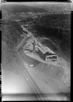
Title (German)
Mellingen, Tunnel der Schweizerischen Bundesbahnen (SBB) (Heitersberg-Tunnel)
Record Name
Com_F69-16417

Title (German)
Mellingen, Tunnel der Schweizerischen Bundesbahnen (SBB) (Heitersberg-Tunnel)
Record Name
Com_F69-16418

Title (German)
Mellingen, Tunnel der Schweizerischen Bundesbahnen (SBB) (Heitersberg-Tunnel)
Record Name
Com_F69-16419
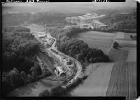
Title (German)
Mellingen, Tunnel der Schweizerischen Bundesbahnen (SBB) (Heitersberg-Tunnel)
Record Name
Com_F69-16420


Title (German)
WARO, Supermarkt, Hegnau, Volketswil
Record Name
Com_F69-16431

Title (German)
WARO, Supermarkt, Hegnau, Volketswil
Record Name
Com_F69-16432

Title (German)
WARO, Supermarkt, Hegnau, Volketswil
Record Name
Com_F69-16433

Title (German)
WARO, Supermarkt, Hegnau, Volketswil
Record Name
Com_F69-16434
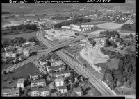
Title (German)
Kloten, Nationalstrasse N1b/Autobahn A1b mit Swissair-Verwaltung und Hilton Hotel
Record Name
Com_F69-16435

Title (German)
Kloten, Nationalstrasse N1b/Autobahn A1b mit Swissair-Verwaltung und Hilton Hotel
Record Name
Com_F69-16436


Title (German)
Reiff Erben, Ed. F., Effretikon, Bauten in Effretikon
Record Name
Com_F69-16439

Title (German)
Effretikon ZH, neue Wohnquartiere
Record Name
Com_F69-16440

Title (German)
Reiff Erben, Ed. F., Effretikon, Bauten in Effretikon
Record Name
Com_F69-16441

Title (German)
Steiner, Karl, Firma, Steiner-Bauten, Effretikon
Record Name
Com_F69-16442


Title (German)
Steiner, Karl, Firma, Steiner-Bauten, Effretikon
Record Name
Com_F69-16444

Title (German)
Effretikon ZH, neue Wohnquartiere
Record Name
Com_F69-16445

Title (German)
Effretikon ZH, neue Wohnquartiere
Record Name
Com_F69-16446


Title (German)
Effretikon ZH, neue Wohnquartiere
Record Name
Com_F69-16448

Title (German)
Schulungszentrum der Spengler und Installateure, Obfelden
Record Name
Com_F69-16449

Title (German)
Schulungszentrum der Spengler und Installateure, Obfelden
Record Name
Com_F69-16450

Title (German)
Schulungszentrum der Spengler und Installateure, Obfelden
Record Name
Com_F69-16451

Title (German)
Schulungszentrum der Spengler und Installateure, Obfelden
Record Name
Com_F69-16452

Title (German)
Schulungszentrum der Spengler und Installateure, Obfelden
Record Name
Com_F69-16453

Title (German)
Schulungszentrum der Spengler und Installateure, Obfelden
Record Name
Com_F69-16454

Title (German)
Schulungszentrum der Spengler und Installateure, Obfelden
Record Name
Com_F69-16455

Title (German)
Schulungszentrum der Spengler und Installateure, Obfelden
Record Name
Com_F69-16456

Title (German)
Schulungszentrum der Spengler und Installateure, Obfelden
Record Name
Com_F69-16457

Title (German)
Zürich-Kloten, Balair Cargo DC-4, HB-ILD, Tarmac Verbreiterung
Record Name
Com_F69-16458

Title (German)
Misox, Lumino, San Vittore, Nationalstrasse N13/Autostrasse A13 im Bau, Blick nach Ostnordosten (ENE)
Caption
N13, Sankt Margrethen, Sargans, Chur, Bernardino, Castione, 19, roads, road construction, 2.
Caption (German)
N13, Sankt Margrethen, Sargans, Chur, Bernardino, Castione, 19, Strassen, Strassenbau, 2.
Record Name
Com_F69-16459


Title (German)
Contone, Firma Möbel Pfister AG
Record Name
Com_F69-16461

Title (German)
Contone, Industrielager, Stisa, Bell, MMM
Record Name
Com_F69-16462

Title (German)
Misox, San Vittore, Roveredo, Nationalstrasse N13/Autostrasse A13 im Bau, Blick nach Osten (E)
Caption
Top: Roveredo
Caption (German)
Oben: Roveredo
Record Name
Com_F69-16463

Title (German)
Arbedo, Grossbaustelle Nationalstrassen N13/Autobahnen A13 und N2/A2
Caption
N2, Basel, Lucerne, Gotthard, Chiasso, 19, roads, road construction, 9.
Caption (German)
N2, Basel, Luzern, Gotthard, Chiasso, 19, Strassen, Strassenbau, 9.
Record Name
Com_F69-16464

Title (German)
Arbedo, Grossbaustelle Nationalstrassen N13/Autobahnen A13 und N2/A2
Caption
N2, Basel, Lucerne, Gotthard, Chiasso, 19, roads, road construction, 9.
Caption (German)
N2, Basel, Luzern, Gotthard, Chiasso, 19, Strassen, Strassenbau, 9.
Record Name
Com_F69-16465

Title (German)
Arbedo, Grossbaustelle Nationalstrassen N13/Autobahnen A13 und N2/A2
Caption
N2, Basel, Lucerne, Gotthard, Chiasso, 19, roads, road construction, 9.
Caption (German)
N2, Basel, Luzern, Gotthard, Chiasso, 19, Strassen, Strassenbau, 9.
Record Name
Com_F69-16467

Title (German)
Arbedo, Grossbaustelle Nationalstrassen N13/Autobahnen A13 und N2/A2
Caption
N2, Basel, Lucerne, Gotthard, Chiasso, 19, roads, road construction, 9.
Caption (German)
N2, Basel, Luzern, Gotthard, Chiasso, 19, Strassen, Strassenbau, 9.
Record Name
Com_F69-16468

Title (German)
Arbedo, Grossbaustelle Nationalstrassen N13/Autobahnen A13 und N2/A2
Caption
N2, Basel, Lucerne, Gotthard, Chiasso, 19, roads, road construction, 9.
Caption (German)
N2, Basel, Luzern, Gotthard, Chiasso, 19, Strassen, Strassenbau, 9.
Record Name
Com_F69-16469

Title (German)
Arbedo, Grossbaustelle Nationalstrassen N13/Autobahnen A13 und N2/A2
Caption
N2, Basel, Lucerne, Gotthard, Chiasso, 19, roads, road construction, 9.
Caption (German)
N2, Basel, Luzern, Gotthard, Chiasso, 19, Strassen, Strassenbau, 9.
Record Name
Com_F69-16470
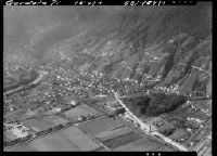


Title (German)
Ascona TI, Villenquartier, auch Villa Helmut Zacharias
Caption
Architecture, modern buildings, 10, 4.
Record Name
Com_F69-16474

Title (German)
Ascona TI, Villenquartier, auch Villa Helmut Zacharias
Caption
Architecture, modern buildings, 10, 4.
Record Name
Com_F69-16475


Title (German)
Ascona TI, Villenquartier, auch Villa Helmut Zacharias
Caption
Architecture, modern buildings, 10, 4.
Record Name
Com_F69-16477


Title (German)
Ascona, Agiebauten bei Ascona, Losone
Record Name
Com_F69-16479

Title (German)
Ronco sopra Ascona TI, Maggia Werk
Record Name
Com_F69-16480


Title (German)
Ronco sopra Ascona TI, Villa mit Lift zu Angestelltenhaus und Herrschaftsvilla
Record Name
Com_F69-16485


Title (German)
Ronco sopra Ascona TI, Villa mit Lift zu Angestelltenhaus und Herrschaftsvilla
Record Name
Com_F69-16487


Title (German)
Brissago, Isole di Brissago, Blick nach Osten (E)
Caption
Isola di San Pancrazio (Isola Grande) with Giardino bottanico del Canton Ticino and Villa Emden; photo location: over lake area about halfway between Crodolo (Porto Ronco) and Isola Grande, about 200 m above lake level
Caption (German)
Isola di San Pancrazio (Isola Grande) mit Giardino bottanico del Canton Ticino und der Villa Emden; Aufnahmestandort: über Seegebiet etwa auf halbem Wege zwischen Crodolo (Porto Ronco) und der Isola Grande, rund 200 m über Seespiegel
Record Name
Com_F69-16491

Title (German)
Fabbrica di Tabacchi, Brissago
Caption
14, companies, F, 2.
Record Name
Com_F69-16492


Title (German)
Roveredo, Nationalstrasse N13/Autostrasse A13 im Bau, Anschluss 38 Roveredo, Blick nach Osten (E)
Caption
N13, Sankt Margrethen, Sargans, Chur, Bernardino, Castione, 19, roads, road construction, 2.
Caption (German)
N13, Sankt Margrethen, Sargans, Chur, Bernardino, Castione, 19, Strassen, Strassenbau, 2.
Record Name
Com_F69-16495

Title (German)
Roveredo, Nationalstrasse N13/Autostrasse A13 im Bau, Führung durch das Dorf Roveredo, Blick nach Osten (E)
Caption
N13, Sankt Margrethen, Sargans, Chur, Bernardino, Castione, 19, roads, road construction, 2.
Caption (German)
N13, Sankt Margrethen, Sargans, Chur, Bernardino, Castione, 19, Strassen, Strassenbau, 2.
Record Name
Com_F69-16496