Dia_303-06686
DE: Reutigen BE, Spiez BE, Ufer und Flussbett der Kander bei km 3.70 in der Augand
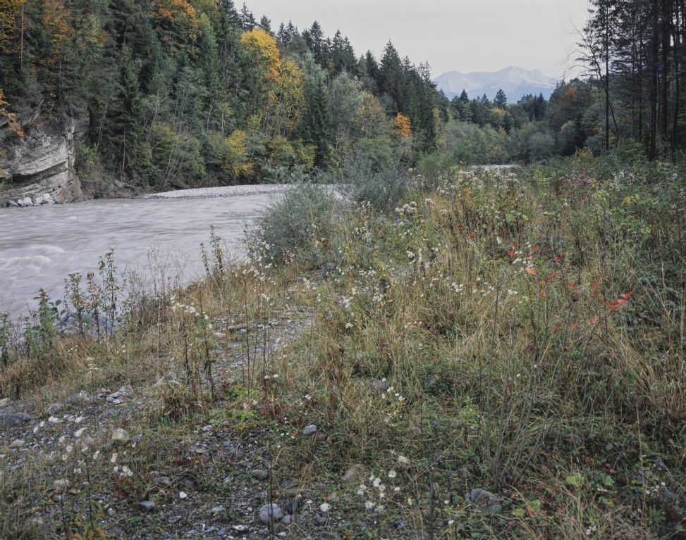
EN: Reutigen BE, Spiez BE, bank and riverbed of the Kander at km 3.70 in the Augand
| Record Name | Dia_303-06686 |
|---|---|
| Photographer | Huber, Roger; Kobi, Hans |
| Dating | 04.10.2007 |
| Caption | Northwest view from left bank with roadway at km 3.70 upstream on riverbed and both banks of the Kander with riparian forestation, 2nd follow-up photograph renaturation Augand (2007), general view; coordinates (LV03) of camera location: 171154/614800; keywords Documenta Natura: river renaturation, riparian forest, river, foothills of the Alps, landscape change |
| Caption (German) | Nordwestansicht vom linken Ufer mit Fahrweg bei km 3.70 flussaufwärts auf Flussbett und beide Ufer der Kander mit Uferbewaldung, 2. Folgeaufnahme Renaturierung Augand (2007), Gesamtansicht; Koordinaten (LV03) des Kamerastandorts: 171154/614800; Schlagworte Documenta Natura: Flussrenaturierung, Auenwald, Fluss, Voralpen, Landschaftswandel |
| Physical description | Fotografie : Diapositiv |
| Format | 10 x 12 cm (4 x 5'') |
| Colour | farbig |
| Orientation | Querformat |
| Categories |
|
| License | Creative Commons BY-SA 4.0 |
| Copyright notice | ETH-Bibliothek Zürich, Bildarchiv / Fotograf: Huber, Roger; Kobi, Hans / Dia_303-06686 / CC BY-SA 4.0 |

 .
.
The image presented on this page is part of E-Pics, a service provided by the ETH-Bibliothek of ETH Zurich. This medium resolution copy is published under the license indicated above.
Please respect terms of the respective license ( CC BY-SA or Public Domain Mark , indicated above under License) when using this image.