Com_FC09-7503-003
DE: Samaden/Samedan, Flugplatz, Blick nach Nordwesten (NW)
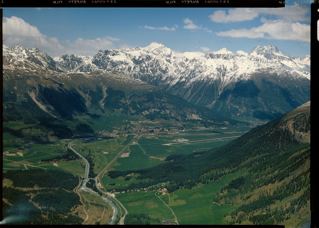
EN: Samaden/Samedan, airfield, view to northwest (NW)
| Record Name | Com_FC09-7503-003 |
|---|---|
| Photographer | Comet Photo AG (Zürich) |
| Dating | 6/1979 |
| Caption | Center: Airport area of Samedan airfield (Engadin Airport), right down the valley: Bever, left: Flazbach on municipality ground Celerina/Schlarigna, church hill of San Gian with the church ruins of the same name, the landmark of the region Obengadin, at the very bottom on the eastern bank of the Flazbach: Punt Muragl with the valley station of the funicular to Muottas Muragl, on the horizon center: Piz Üertsch, followed to the right by the white cone of Piz Blaisun, on the far right: prominent chunk of Piz Kesch (Piz d'Es-cha); photo location: above the Muragl district of the neighboring municipality of Pontresina/Puntraschigna about 600 m above sea level |
| Caption (German) | Mitte: Flughafengelände des Flugplatzes Samedan (Engadin Airport), rechts talabwärts: Bever, links: Flazbachs auf Gemeindeboden Celerina/Schlarigna, Kirchhügel von San Gian mit der gleichnamigen Kirchenruine, dem Wahrzeichen der Region Obengadin, ganz unten am Ostufer des Flazbachs: Punt Muragl mit der Talstation der Standseilbahn nach Muottas Muragl, am Horizont Mitte: Piz Üertsch, nach rechts gefolgt vom weissen Kegel des Piz Blaisun, ganz rechts: markante Klotz des Piz Kesch (Piz d'Es-cha); Aufnahmestandort: über dem Ortsteil Muragls der Nachbargemeinde Pontresina/Puntraschigna rund 600 m über Grund |
| Physical description | Fotografie : Diapositiv |
| Format | 13 x 18 cm |
| Colour | farbig |
| Orientation | Querformat |
| Categories |
|
| License | Creative Commons BY-SA 4.0 |
| Copyright notice | ETH-Bibliothek Zürich, Bildarchiv / Fotograf: Comet Photo AG (Zürich) / Com_FC09-7503-003 / CC BY-SA 4.0 |

 .
.
The image presented on this page is part of E-Pics, a service provided by the ETH-Bibliothek of ETH Zurich. This medium resolution copy is published under the license indicated above.
Please respect terms of the respective license ( CC BY-SA or Public Domain Mark , indicated above under License) when using this image.