AIC_02-0W-433020-006
DE: Riggisberg, Blick Nordnordwesten (NNW)
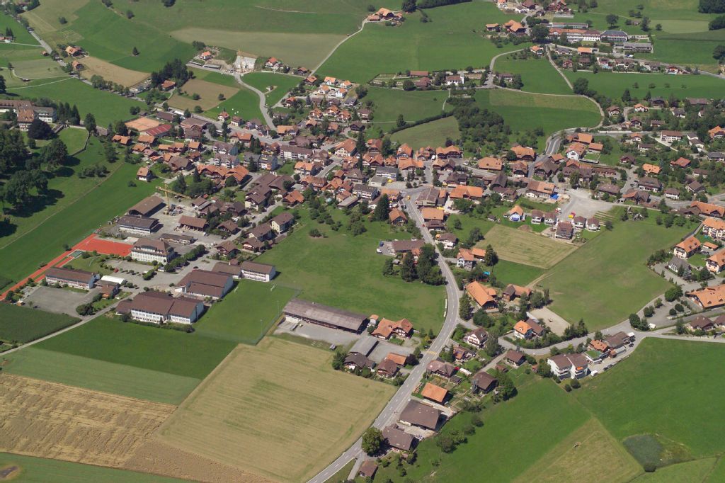
EN: Riggisberg, view north northwest (NNW)
| Record Name | AIC_02-0W-433020-006 |
|---|---|
| Photographer | Ziebold, Richard |
| Dating | 09.08.2005 |
| Caption | In the foreground left: Schoolhouse area at Lindengässli, in the foreground center: Gurnigelstrasse with branch Halbbachweg to the right; center from left to right: castle, castle garden, from top left: Schwarzenburgstrasse, settlement around Mühleweg, above it rising Zelgweg/Hirzbodenweg, Hintere Gasse, above it rising: Kirchweg to the church and cemetery, center half-right: Längenbergstrasse as serpentine upward, tangent to housing estates Büele/Bühlen, Oberer Bühl, Spital, Studigasse/Staudengasse. |
| Caption (German) | Im Vordergrund links: Schulhäuserareal am Lindengässli, im Vordergrund Mitte: Gurnigelstrasse mit Abzweig Halbbachweg n.r.; Mitte v.l.n.r.: Schloss, Schlossgarten, von oben links: Schwarzenburgstrasse, Siedlung um Mühleweg, darüber ansteigender Zelgweg/Hirzbodenweg, Hintere Gasse, darüber ansteigender: Kirchweg zur Kirche und Friedhof, Mitte halbrechts: Längenbergstrasse als Serpentine nach oben, tangiert Wohnsiedlungen Büele/Bühlen, Oberer Bühl, Spital, Studigasse/Staudengasse |
| Physical description | Digitale Fotografie : Datei |
| Colour | farbig |
| Orientation | Querformat |
| Categories |
|
| License | Creative Commons BY-SA 4.0 |
| Copyright notice | ETH-Bibliothek Zürich, Bildarchiv / Fotograf: Ziebold, Richard / AIC_02-0W-433020-006 / CC BY-SA 4.0 |

 .
.
The image presented on this page is part of E-Pics, a service provided by the ETH-Bibliothek of ETH Zurich. This medium resolution copy is published under the license indicated above.
Please respect terms of the respective license ( CC BY-SA or Public Domain Mark , indicated above under License) when using this image.