WIH_FLv15-0562
DE: Silsersee (Lej da Segl) aus 2200 müG
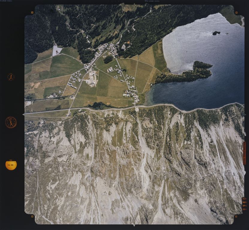
EN: Lake Sils (Lej da Segl) from 2200 m above sea level
| Record Name | WIH_FLv15-0562 |
|---|---|
| Photographer | Bock, Franz |
| Dating | 31.08.1979 |
| Caption | 15/4 UAG 13002, f=153.27, image scale 1:14500. Eastern end of the lake with the peninsula of Chastè and the island of Chaviolas; in the plain at the base of the peninsula of Chastè the three villages of the municipality of Sils/Segl arranged in a triangle: Sils Maria (at the top of the entrance to the Fex Valley), Sils Baselgia (on the opposite side of the plain, at the lower right corner point of the triangle), Seglias (in the plain, at the lower left corner point of the triangle); north arrow pointing to 7 o'clock; photo location: above the Pignoulas quarry near Sils Baselgia at flight altitude: 2200 m above ground level (7215 feet above ground level) |
| Caption (German) | 15/4 UAG 13002, f=153.27, Bildmassstab 1:14500. Östliches See-Ende mit der Halbinsel Chastè und der Insel Chaviolas; in der Ebene an der Basis der Halbinsel Chastè die im Dreieck angeordneten drei Ortstelle der Gemeinde Sils/Segl: Sils Maria (oben am Eingang zum Fextal), Sils Baselgia (auf der gegenüberliegenden Seite der Ebene, am unteren rechten Eckpunkt des Dreiecks), Seglias (in der Ebene, am unteren linken Eckpunkt des Dreiecks); Nordpfeil gerichtet nach 7 Uhr; Aufnahmestandort: über dem Steinbruch Pignoulas bei Sils Baselgia auf Flughöhe: 2200 m über Grund (7215 feet above ground level) |
| Physical description | Fotografie : Diapositiv |
| Format | 23 x 23 cm |
| Colour | farbig |
| Orientation | Quadrat |
| Categories |
|
| License | Creative Commons BY-SA 4.0 |
| Copyright notice | ETH-Bibliothek Zürich, Bildarchiv / Fotograf: Bock, Franz / WIH_FLv15-0562 / CC BY-SA 4.0 |

 .
.
The image presented on this page is part of E-Pics, a service provided by the ETH-Bibliothek of ETH Zurich. This medium resolution copy is published under the license indicated above.
Please respect terms of the respective license ( CC BY-SA or Public Domain Mark , indicated above under License) when using this image.